
Adobetown WSA
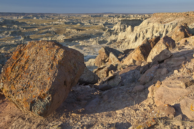
At 85,710 acres in size, Adobetown WSA is the largest in Wyoming. Within the WSA, you'll find Skull Creek Rim and Monument Valley - names that conjure up images of colorful badlands, buttes and spires created by thousands of years of erosion. Located 80 miles southwest of Rawlins, outstanding opportunities for solitude and primitive and unconfined recreation exist in the WSA.
Almost 11,000 acres of this WSA were recommended as suitable for wilderness status in the 1992 report to Congress. The majority of the WSA provides opportunities for unconfined freedom of movement due to the open rolling hills and numerous drainages. Opportunities for hiking, backpacking, sightseeing, horseback riding, hunting, nature study, scientific study and photography are available to the visitor. The outstanding scenic quality of this WSA enhances the recreational values.
The area is predominantly natural with some human imprints. Skull Creek Rim, in the core of the recommended area, is a very colorful and rugged badland area which consists of a series of highly eroded drainages and colorful badland rims. To the north of Skull Creek Rim is Monument Valley and Adobe Town Rim. These areas also contain badlands and formations similar to Skull Creek, but are more dispersed. To the east (the majority of the non-suitable area) is a broad, relatively undisturbed plain that is covered with stabilized sand dunes and alluvium. Use of a high clearance vehicle is recommended.

ADOBETOWN WSA PHOTOS
BLM WYOMING KNOW BEFORE YOU GO
Phone
Geographic Coordinates
41.251535, -108.285593
Directions
From the southeast - From Rock Springs take I-80 east 29 miles to The Bitter Creek Road exit 134. Go south 24 miles and turn east on The Manual Gap road (BLM 4409). Turn east onto the Manual Gap road 13 miles to the WSA north boundary.