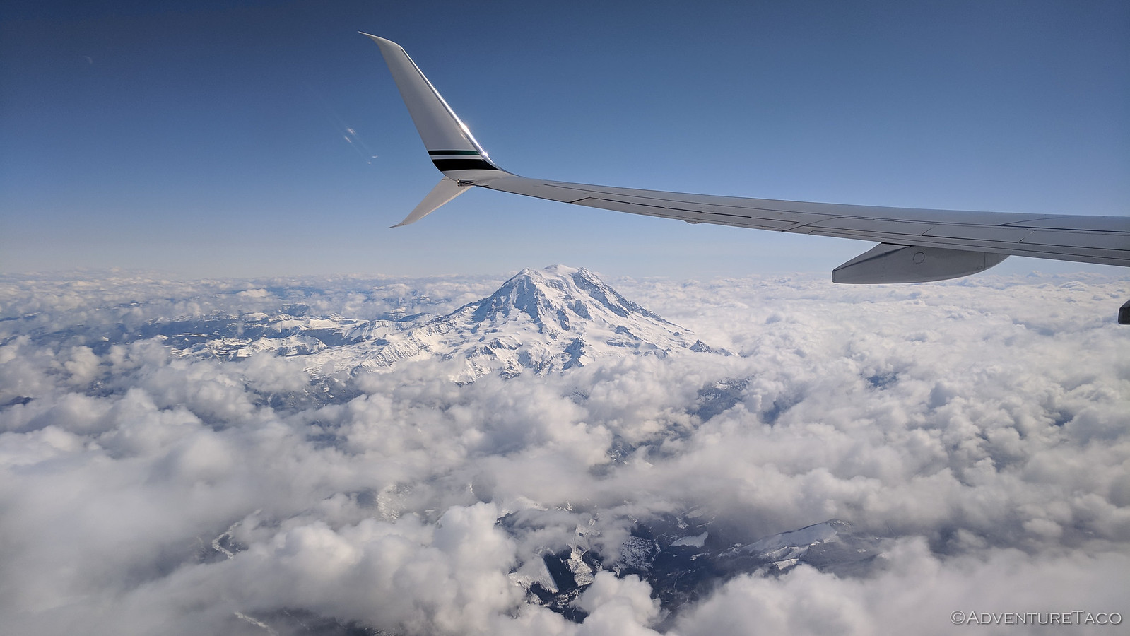
For 10 days, we lived our normal lives. As it were, a cold existence in the Pacific Northwest. We'd left with snow on the ground, and we returned to a few small patches remaining. And then it snowed the first night we were home. Needless to say, we missed the southern California weather!
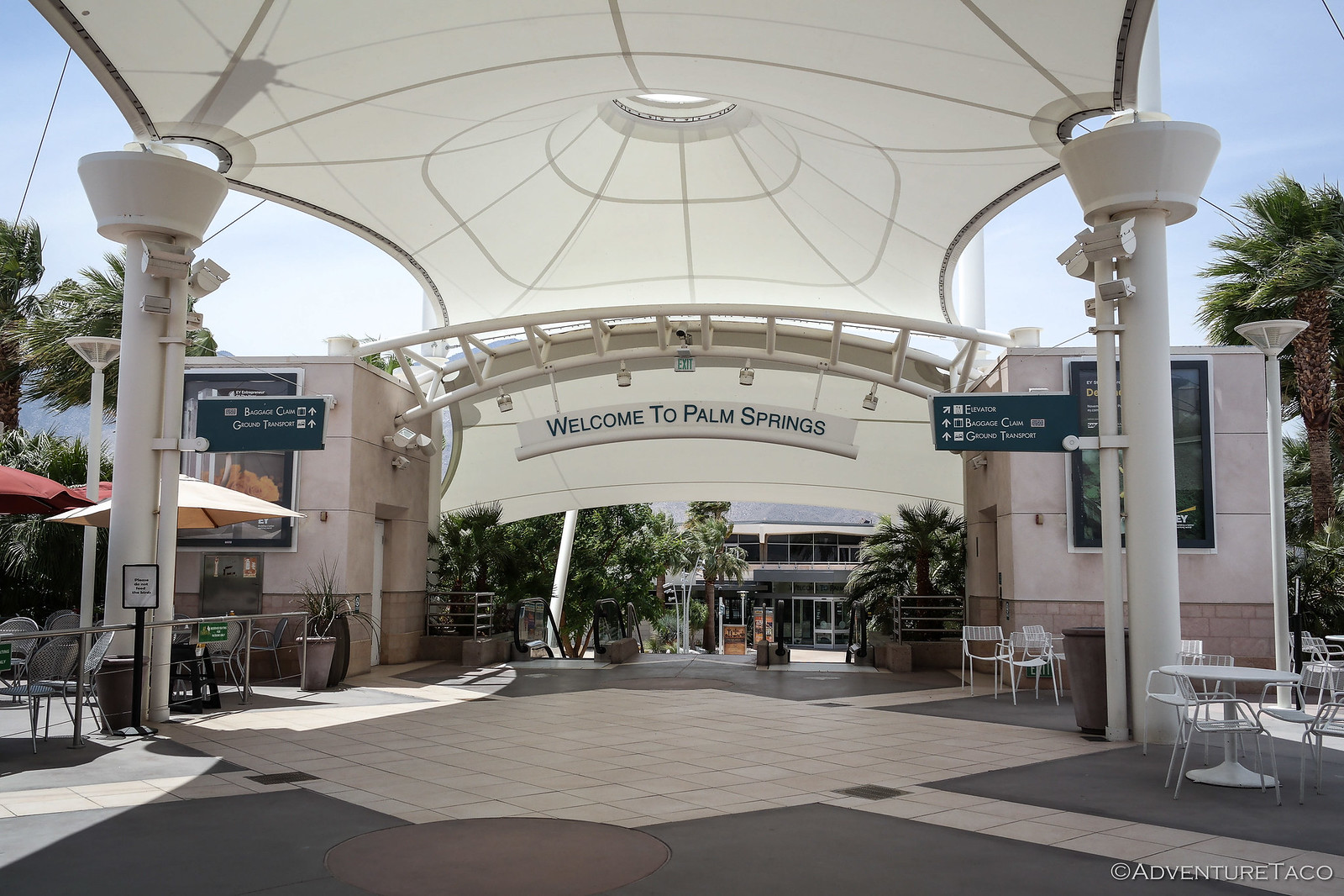
But, extremely happy with our decision to double-up on the adventure, we knew that it wouldn't be long before we hopped back on a plane that would take us away from the clouds and back to the "weather's-so-nice-our-airport-doesn't-need-a-roof" Palm Springs airport.
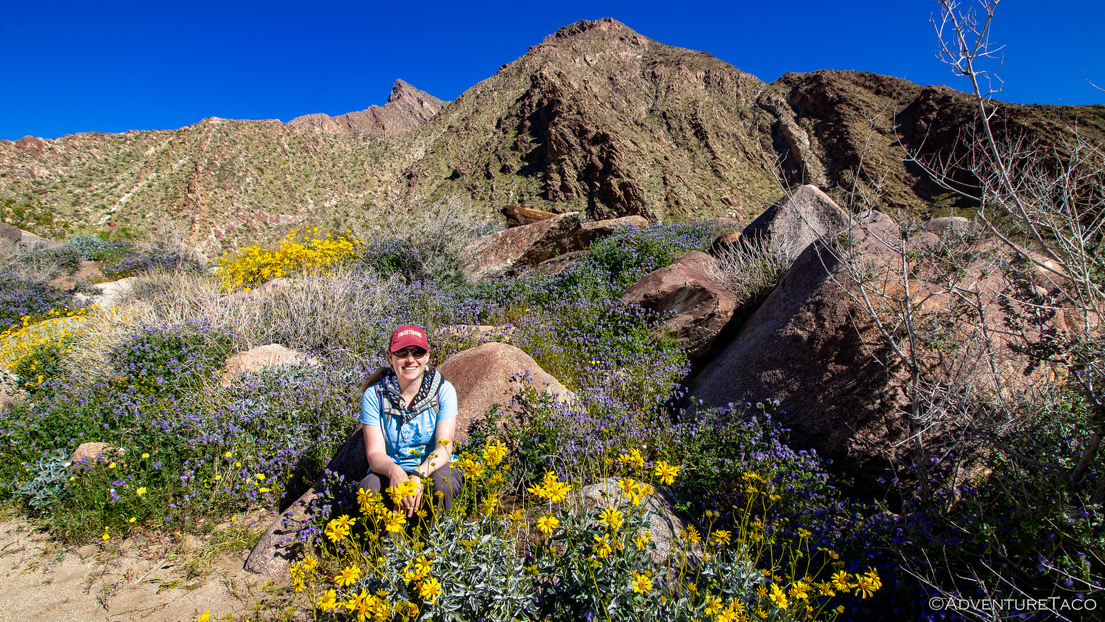
As we drove back to Anza-Borrego, it hit us that it was even more green than it'd been when we left. A day of rain, and now mid-70ºF temps meant that the super bloom was in full swing - a fact that we'd take full advantage of in the coming days. Today though, we'd restock and repack the Tacoma, and have a nice dinner in town with Pops and my step mother.
- - - - -
March 14, 2019.
The next morning, we all decided it'd be the perfect time to hike Palm Canyon. This is a reasonably popular hike right by the visitor center, so we knew that it would be more crowded than other places - but it's a beautiful hike and one of the only places to see running water in the park (at least that we found) so we decided to give it a shot.
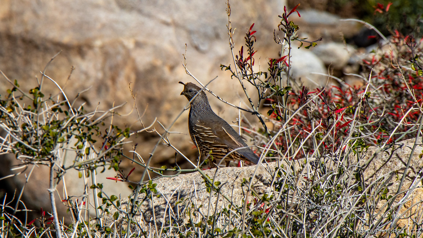
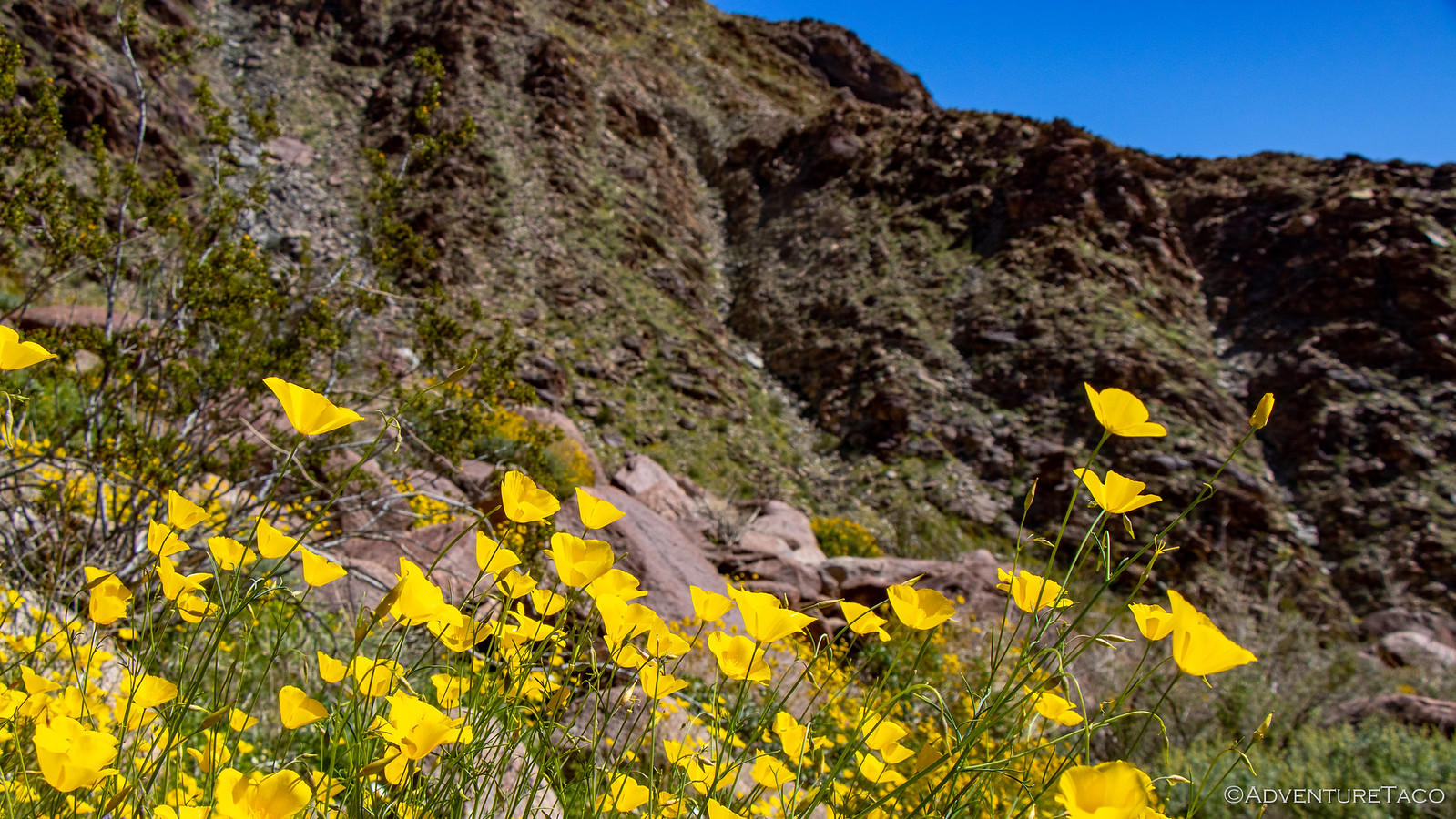
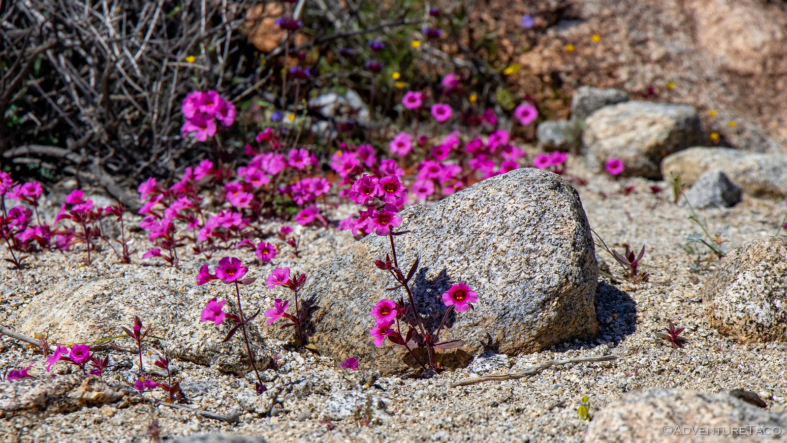
As we headed up the canyon, the wildflowers were amazing.
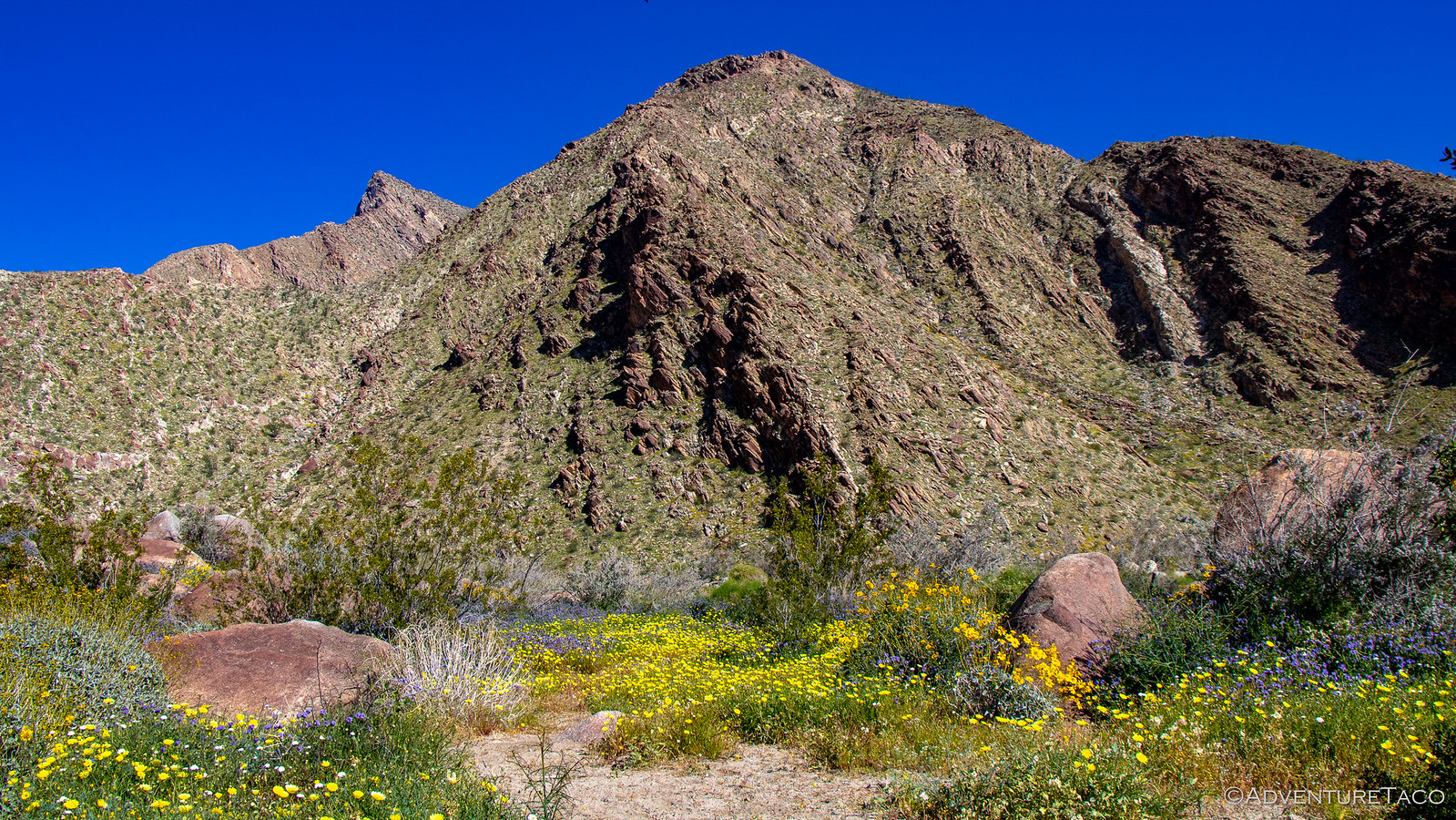
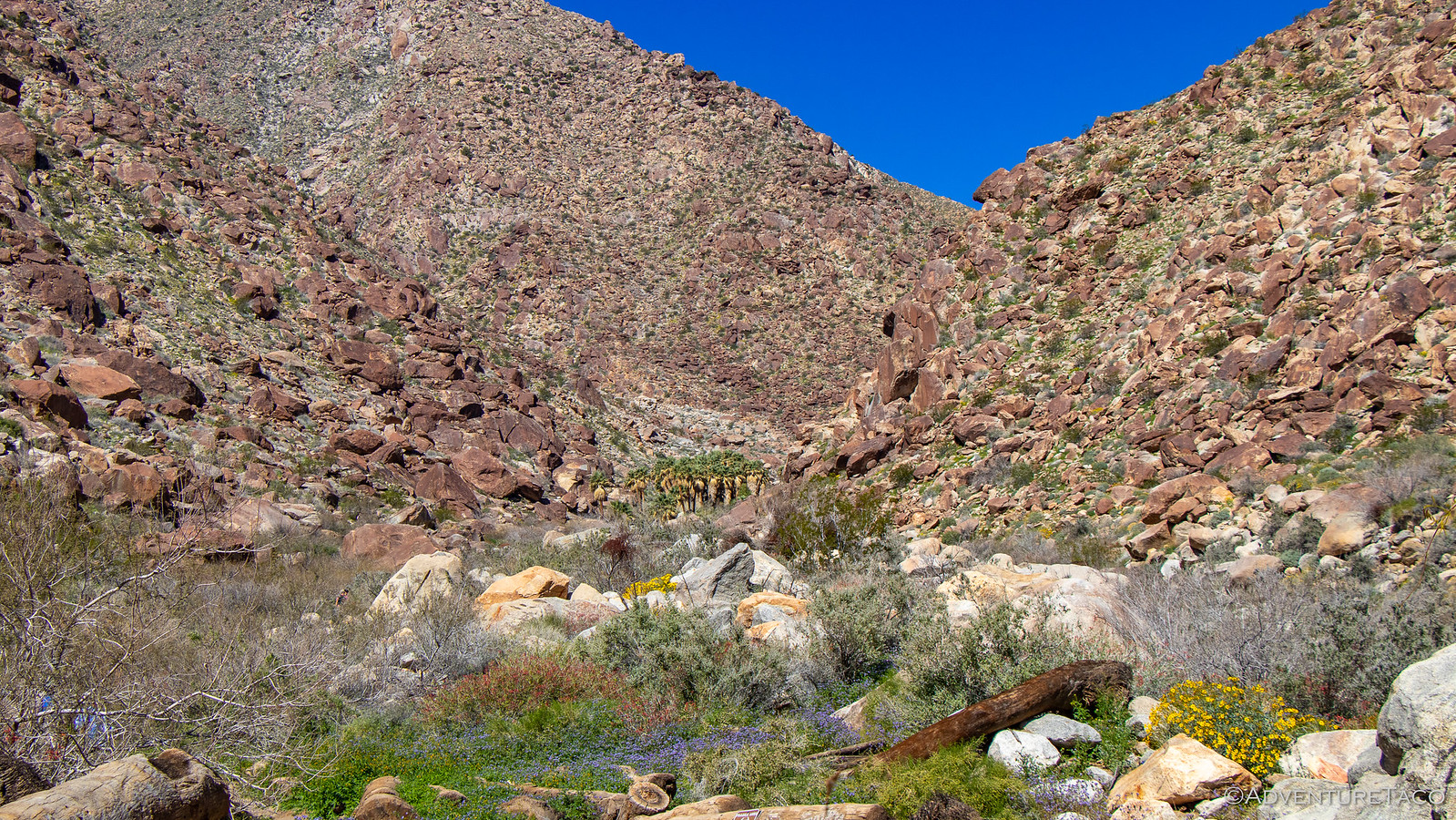
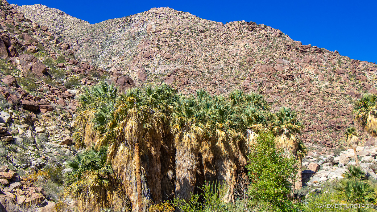
It was as though we weren't even in the desert - the ground so green, the flowers vibrant yellows, purples, pinks, and white. Birds flitting and hikers ogling the entire way up the trail. Eventually - perhaps a mile up trail - we spotted the grove of Fan Palms from which the canyon gets its name.
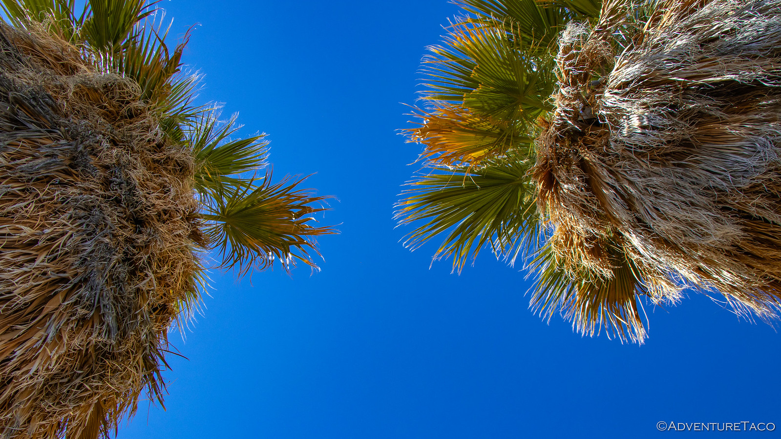
As we got closer, more and more palms came into view - and unlike 5 Palms or even 17 Palms that we'd visited on our first leg of this adventure, this truly was an oasis - the water streaming down the wash next to us.
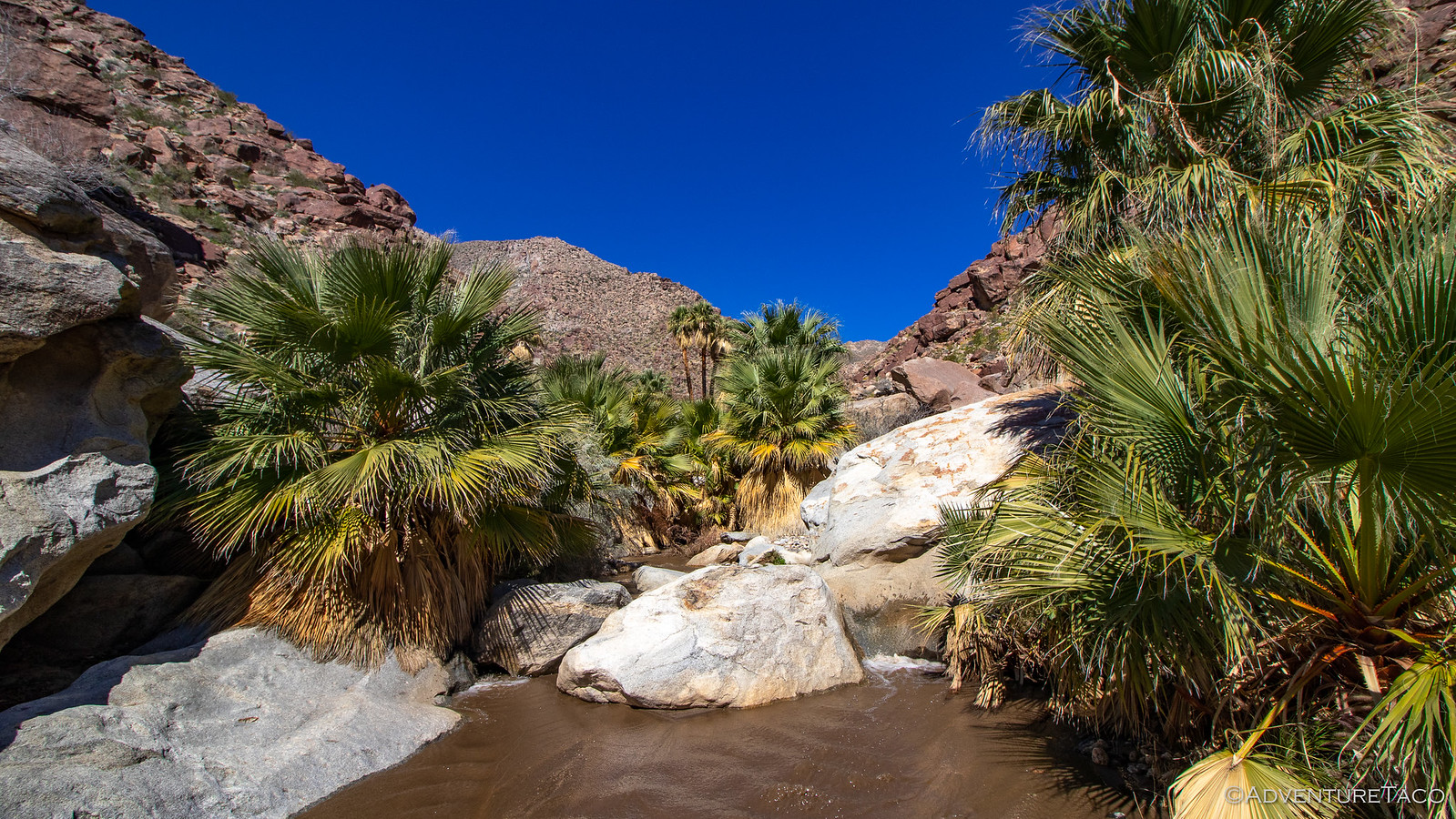
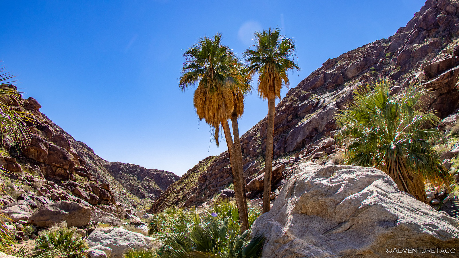
We explored the trail as far as we could go - it turns out that the upper portion of the hike beyond the palm oasis was closed due to the recent rains - before turning around and heading back down via an alternate path on the opposite side of the canyon. The path was a bit longer, but given the surroundings, that was fine by us - the sights here just as breathtaking as those we'd experienced on the way up.
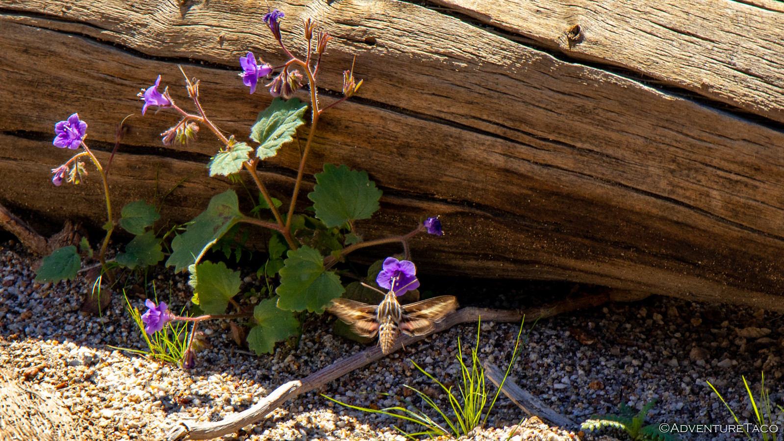
We even saw a White-lined Sphinx Moth (also called a Hummingbird-moth) doing it's thing - initially mistaking it for an actual humming bird! In fact, unbeknownst to us, this would be far from the last that we'd see of this moth on the trip - apparently they are somewhat of a pest in the area!
Back at the trailhead, Pops quickly became the most popular guy around by pulling out his birding scope and training it on a couple Bighorn Sheep that were grazing on a nearby mountain. I'll tell you what - as soon as that happened, it was like the entire parking lot descended on his scope to get a look. Because, well, if you can see wildlife from the parking lot...then you can just get right back in your car! 
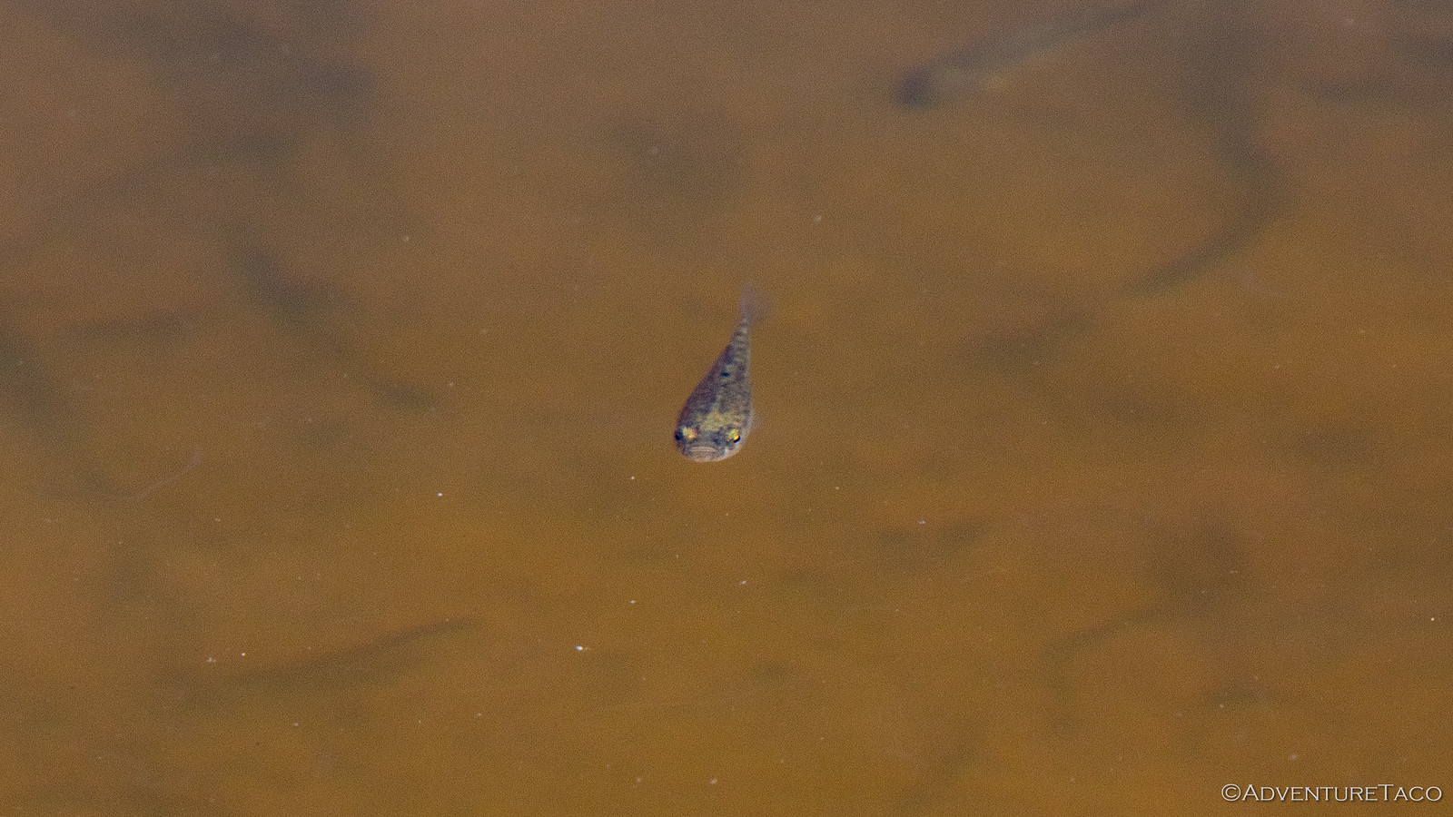
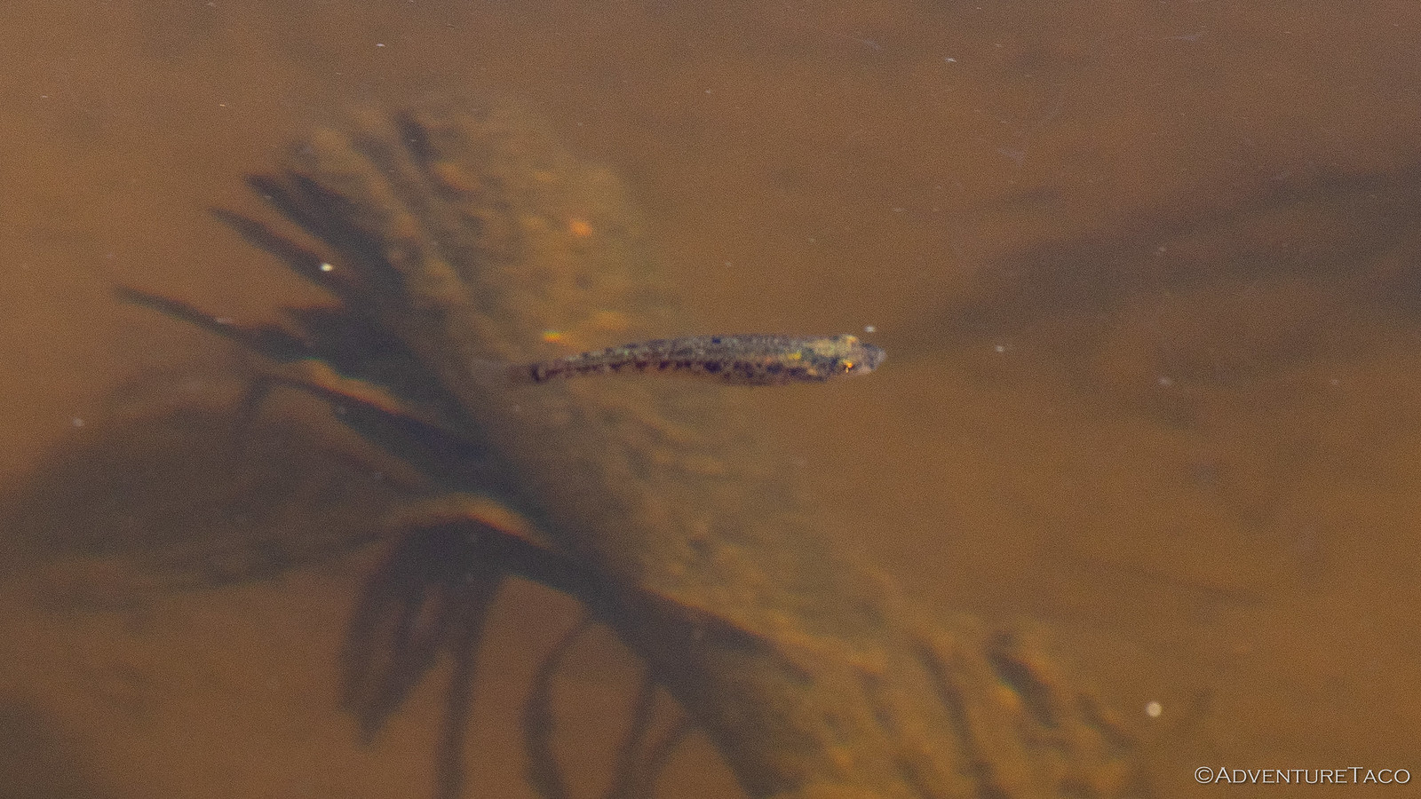
While that was going on, we also noticed that a small concrete pool contained a bunch of 1-2" long fish - pupfish I was told, which I initially thought was a bunch of baloney. After-all, how would pupfish get into this man-made pool? Sure enough however, that's exactly what they were - Desert Pupfish that live only here in Anza-Borrego. And, so near the parking lot...and yet still unnoticed by the vast majority of folks!
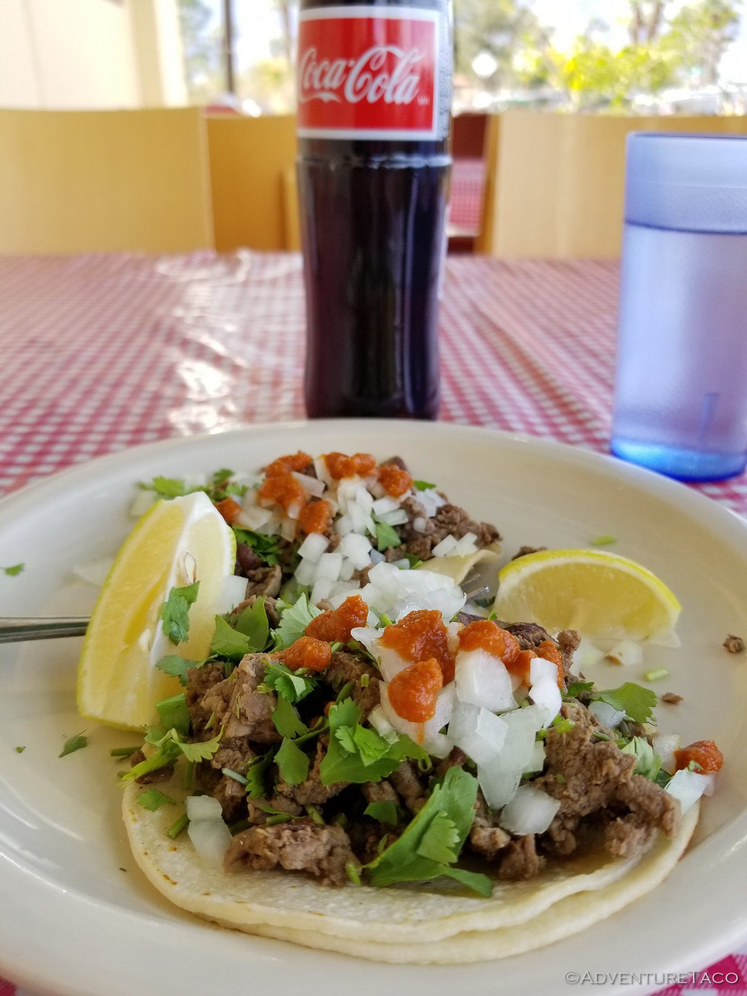
Eventually Pops had to wrench his scope out of the ever-growing throng of tourists because we'd decided it was time for lunch - the famous shrimp tacos at El Borrego, a local favorite, calling to us before we headed out of town to enjoy a bit more seclusion than the trip had afforded so far. Oh, and it turns out the carnitas tacos are amazing as well.
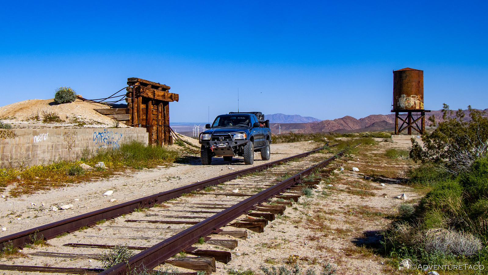
Lunch wrapped up and our bellies stuffed, we bid farewell to our gracious hosts and headed south, our destination - Mortero Wash near Indian Hills - meant to be a great place to kick off an 8-mile, early morning, hike to the Goat Canyon Trestle Bridge the next day.
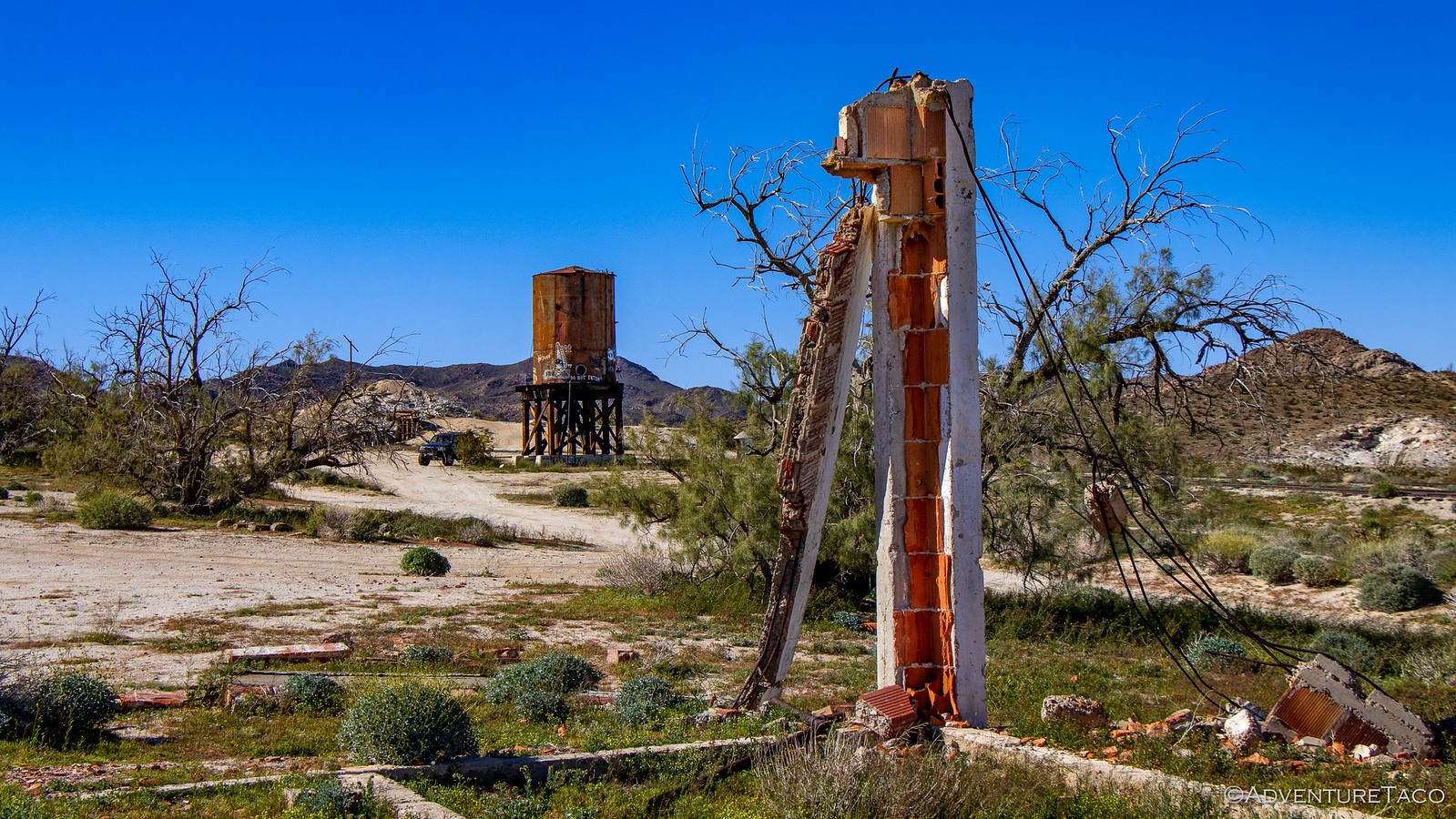
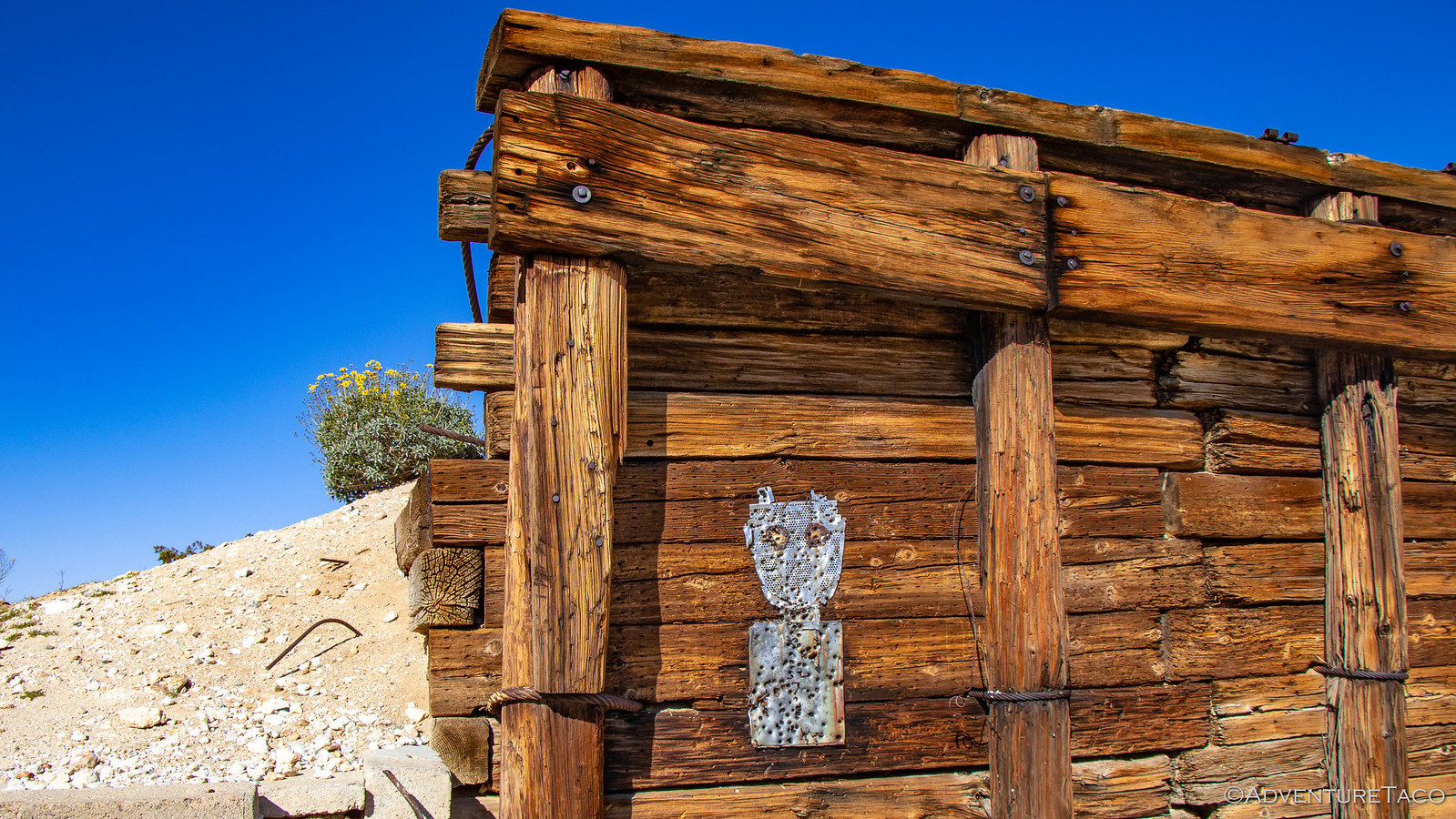
Along our way, the road passed through the old Dos Cabezas railway station. There's not much here anymore - it was decommissioned in 1958, only an old water tower and a few small ruins left at this point - but this station was once part of the El Centro to San Diego train line. Known as the "impossible railroad" during construction, the line through deep rocky canyons and hillsides was completed in 1919; the Dos Cabezas station a watering stop for steam engines and a place for nearby miners to access the rail.
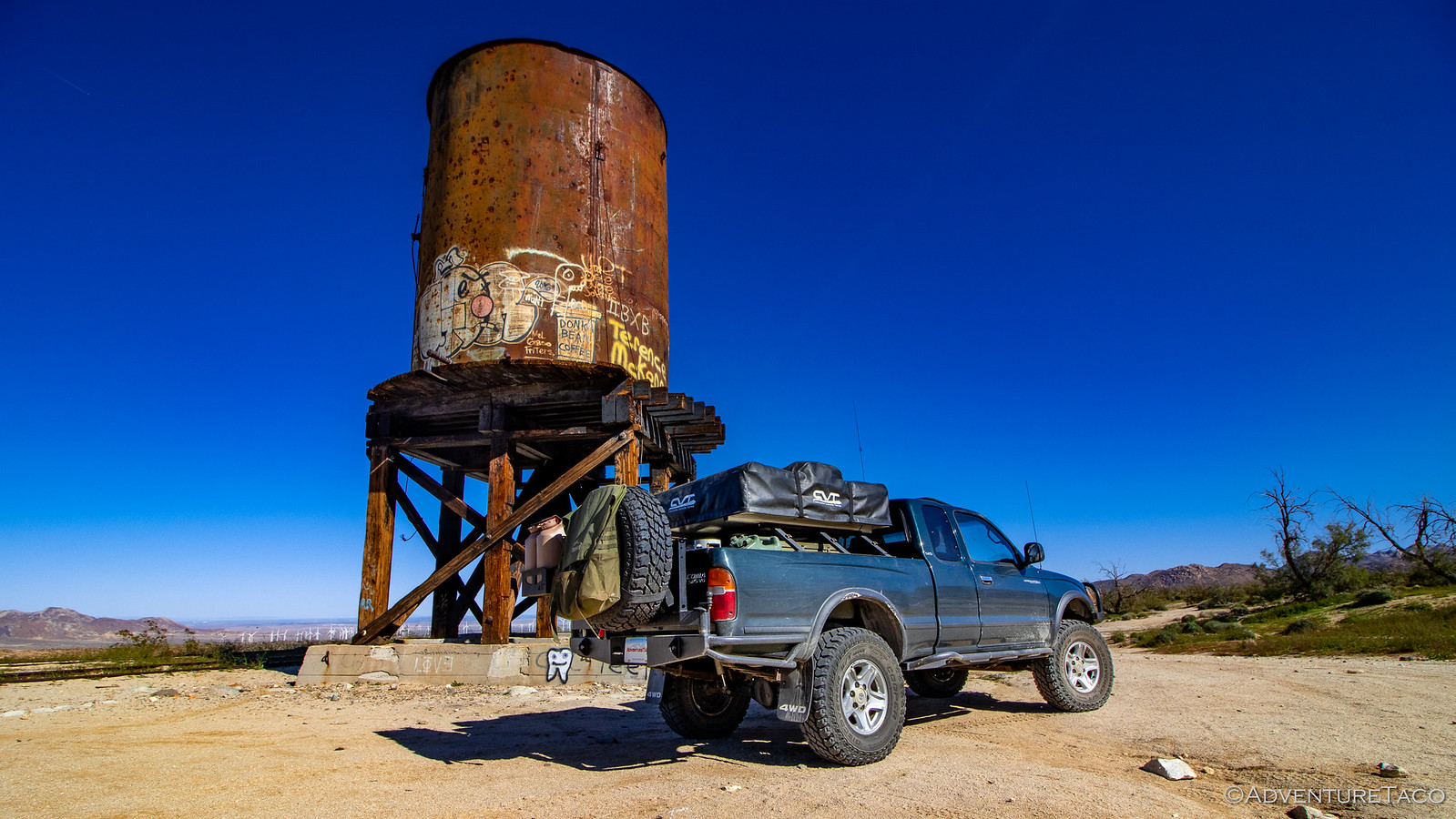
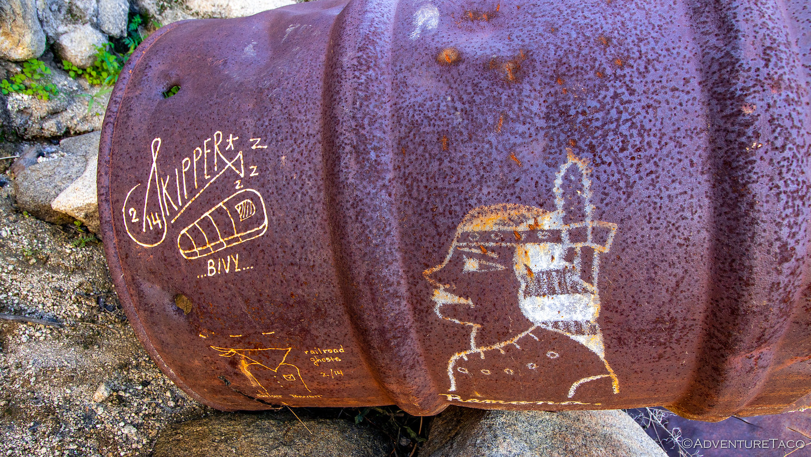
Today, the few structures still standing are covered in graffiti and gunshots, a distinct "alien" vibe present in much of the art.
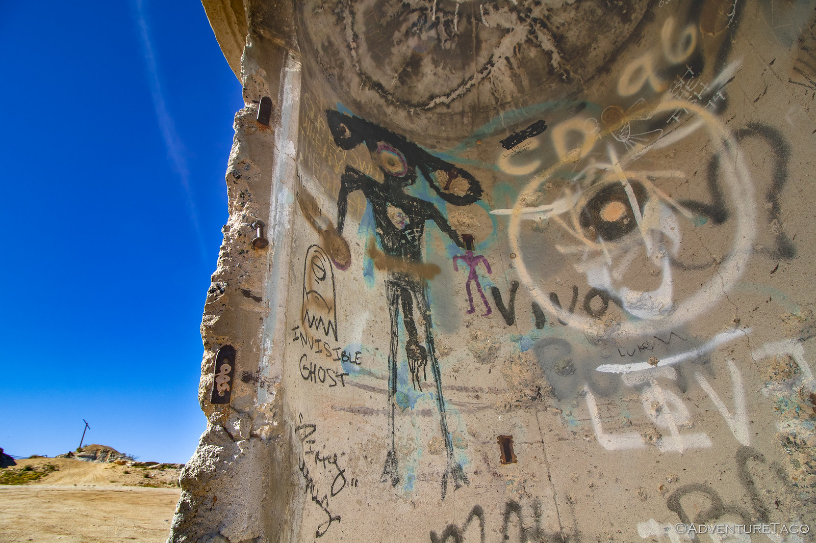
In the distance and through the rubble, a stark contrast to the dilapidated station.
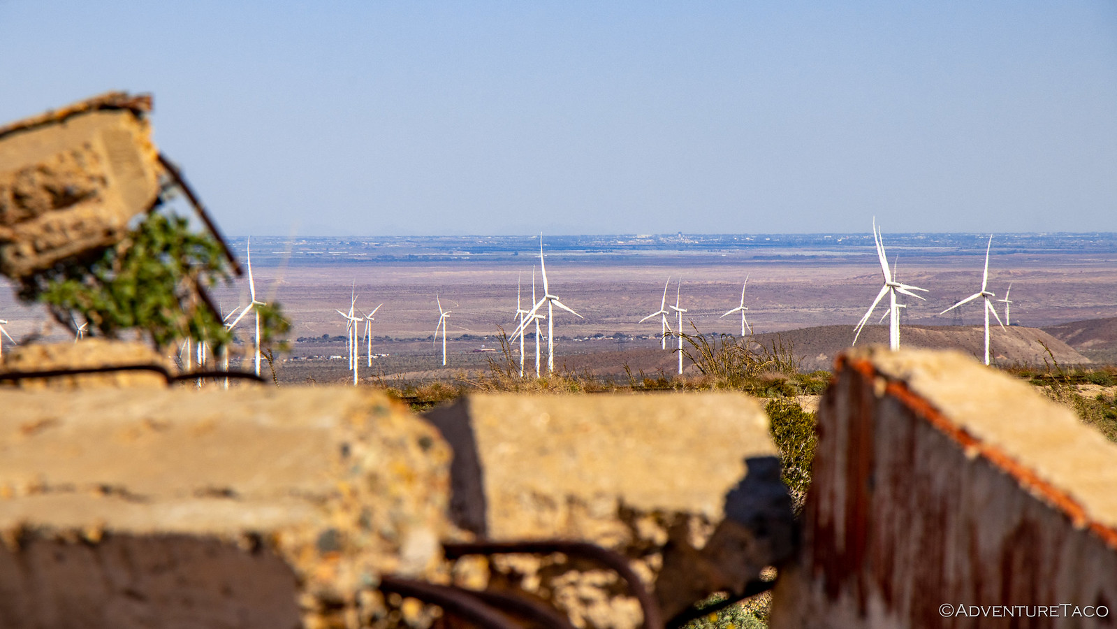
This contrast is something that we noticed throughout our time (both trips) in Anza-Borrego. This park, while extremely beautiful, is much less remote than most of the places we visit. There were more people here, more civilization encroaching along - and within - the park, and a feeling of being not very far away, no matter where you are. Unexpected, it was something we discussed several times over the course of the trip - wondering why it was. Free State Park vs. paid National Park? Proximity to the overwhelming population of southern California? Something else entirely? In the end of course, we never figured it - opting to spend our time searching for the more beautiful, remote areas instead.
For now, that meant leaving Dos Cabezas and continuing along an unnamed road into the back country, a steep, mogul-y road acting as a welcome gatekeeper for most other vehicles.
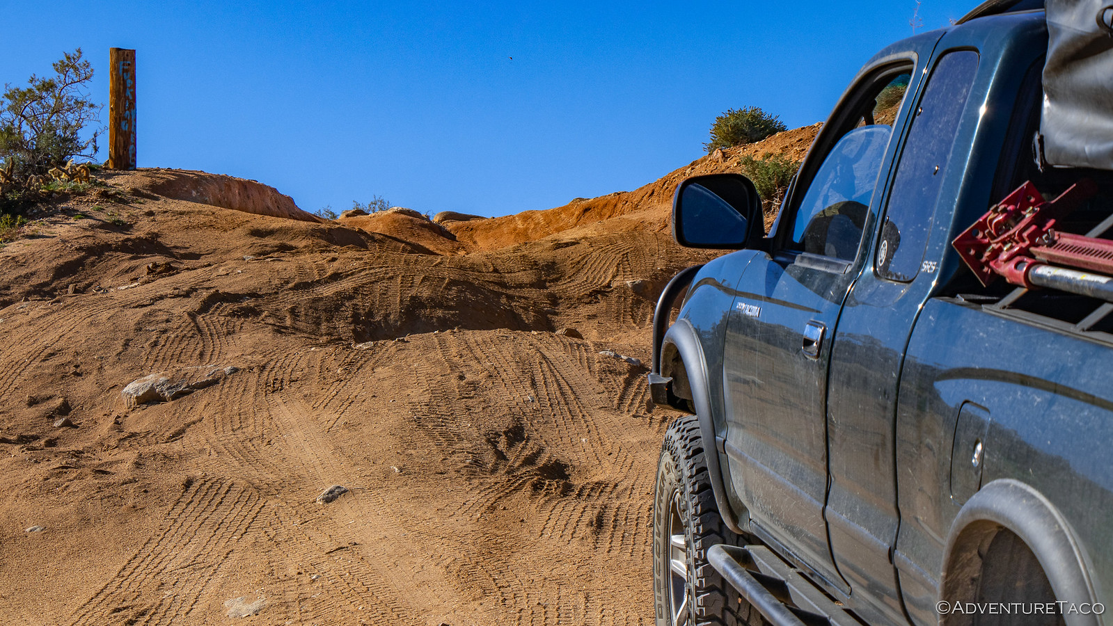
As we continued along the road, the landscape evolved from a sandy desert to a much rockier, mountainous terrain. These decomposing granite boulders were spectacular, the nooks and crannies they created beckoning people to explore (and live) for thousands of years.
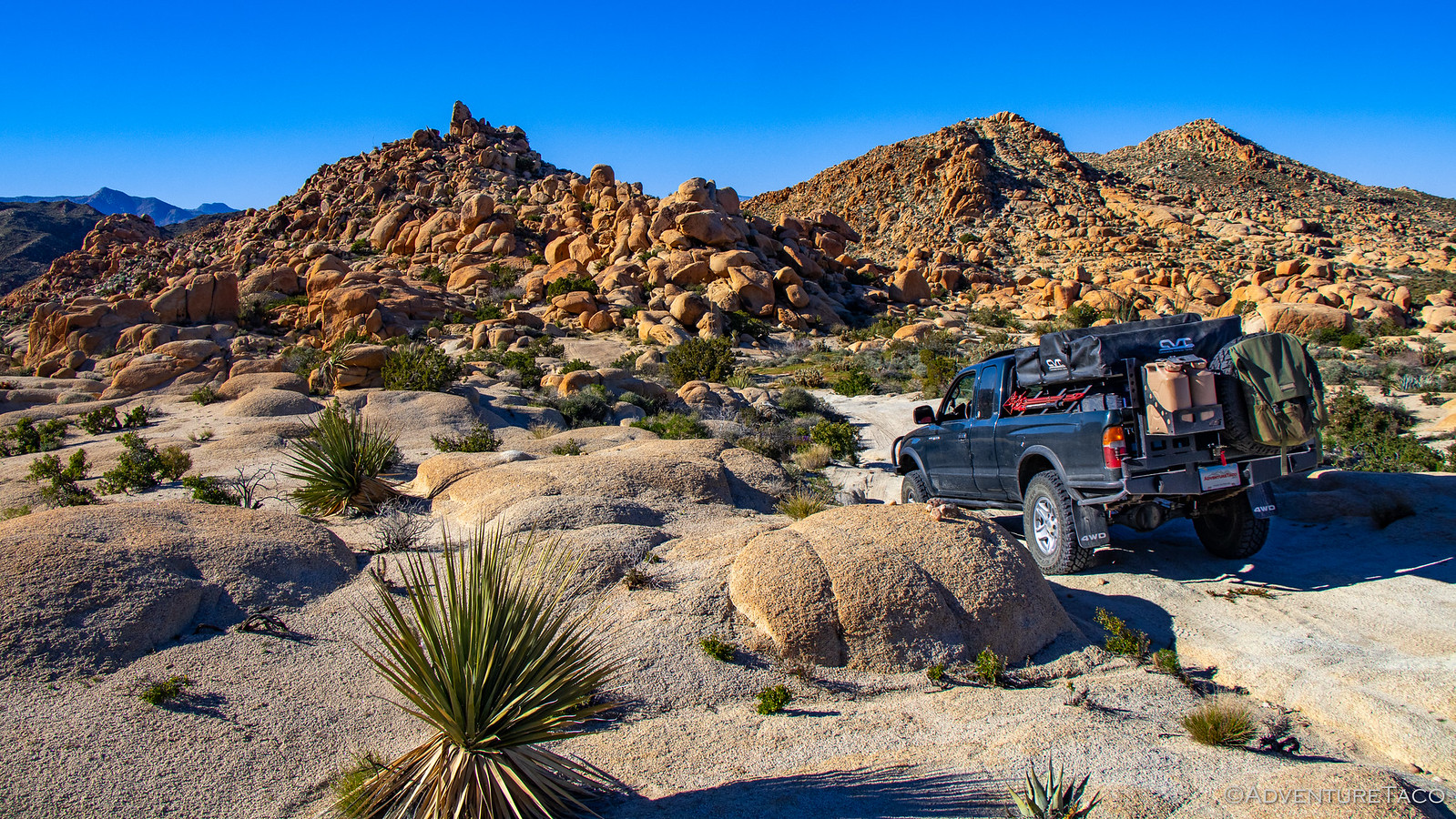
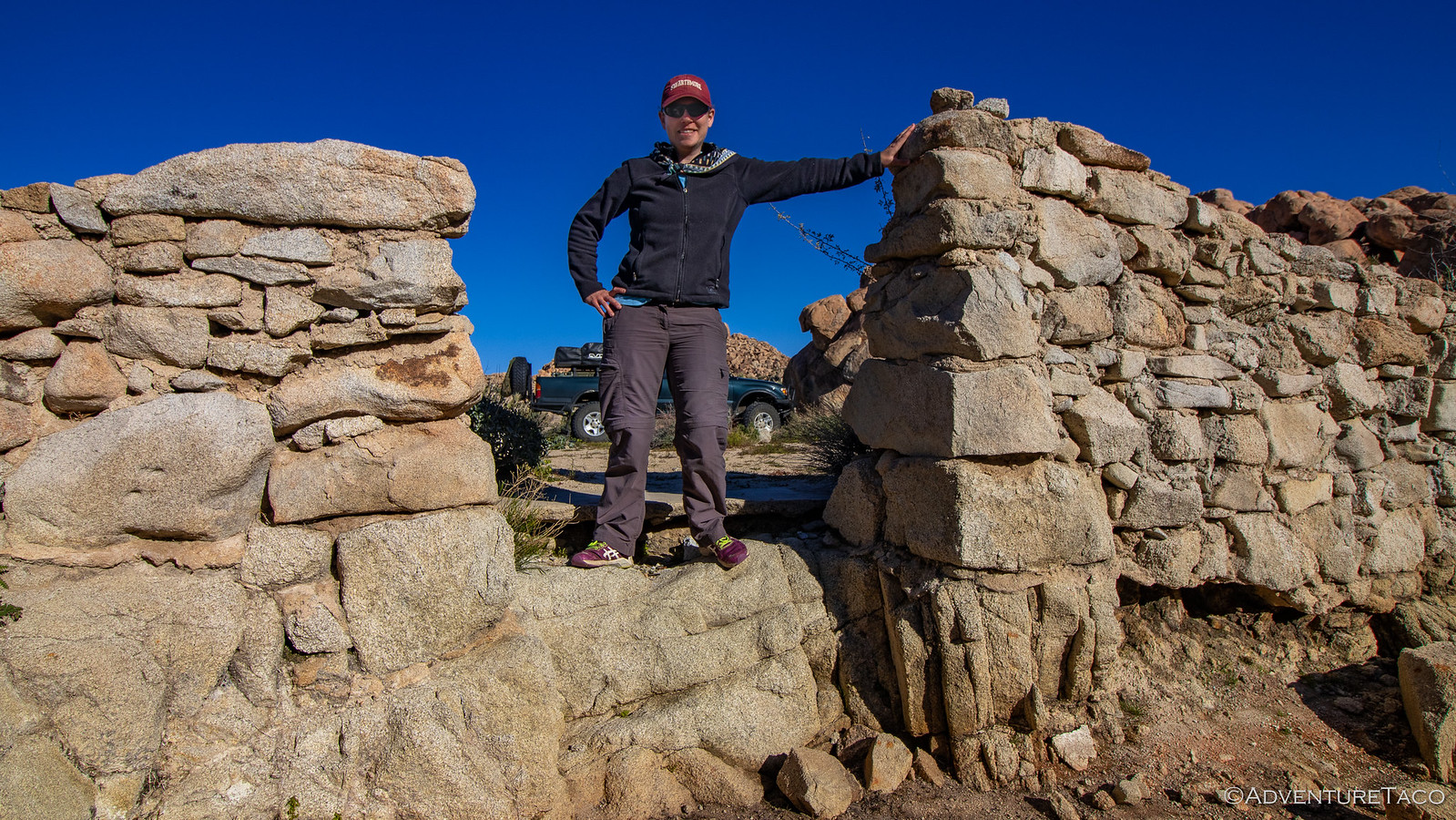
Eventually of course, we reached the end of the road. It'd gone much further than we'd expected - nearly to the train tracks that would lead us to the trestle the next morning - and left us with an interesting dilemma: since we'd be cutting a couple miles and 1,000 vertical feet off of the hike, should we do it now?
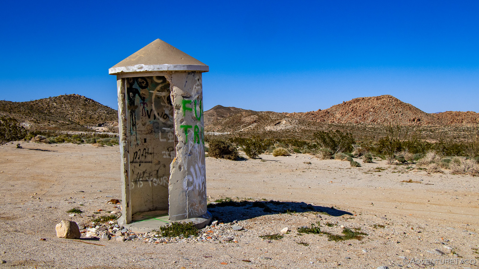
We pondered that question for a few minutes while exploring some ruins at the end of the road.

In the end - what with it being 5:00pm already - the smart thing to do was to stick around camp.
So, as one does, we decided to give the hike a shot! If we could complete it, we'd buy ourselves nearly 4 more hours of exploring the next day, and of course once we were walking along the tracks, we were going to complete it. 
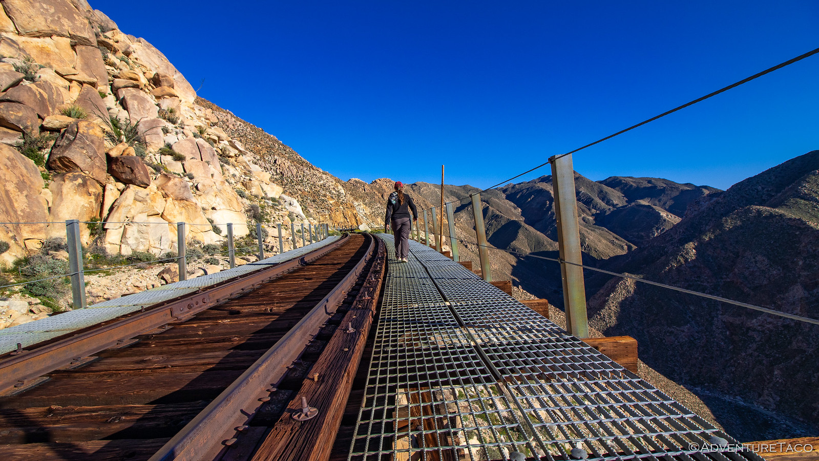
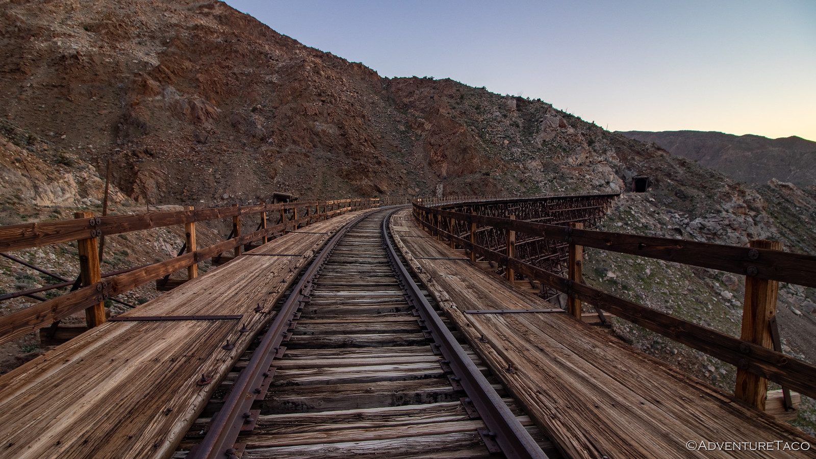
Let me tell you - the hike along the tracks in the warm glow of the evening sun was really quite special. A breeze kept us cool while the sun kept us warm, and the colors - orange rocks, blue skies, and spring green vegetation - made for one of the most enjoyable hikes I've been on in a long time.
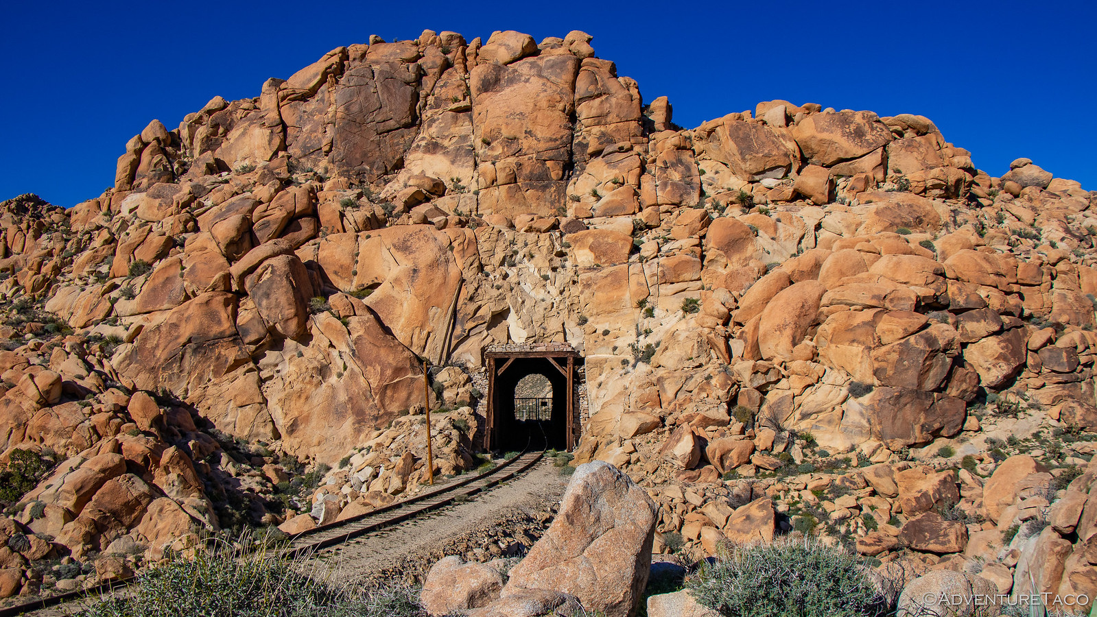
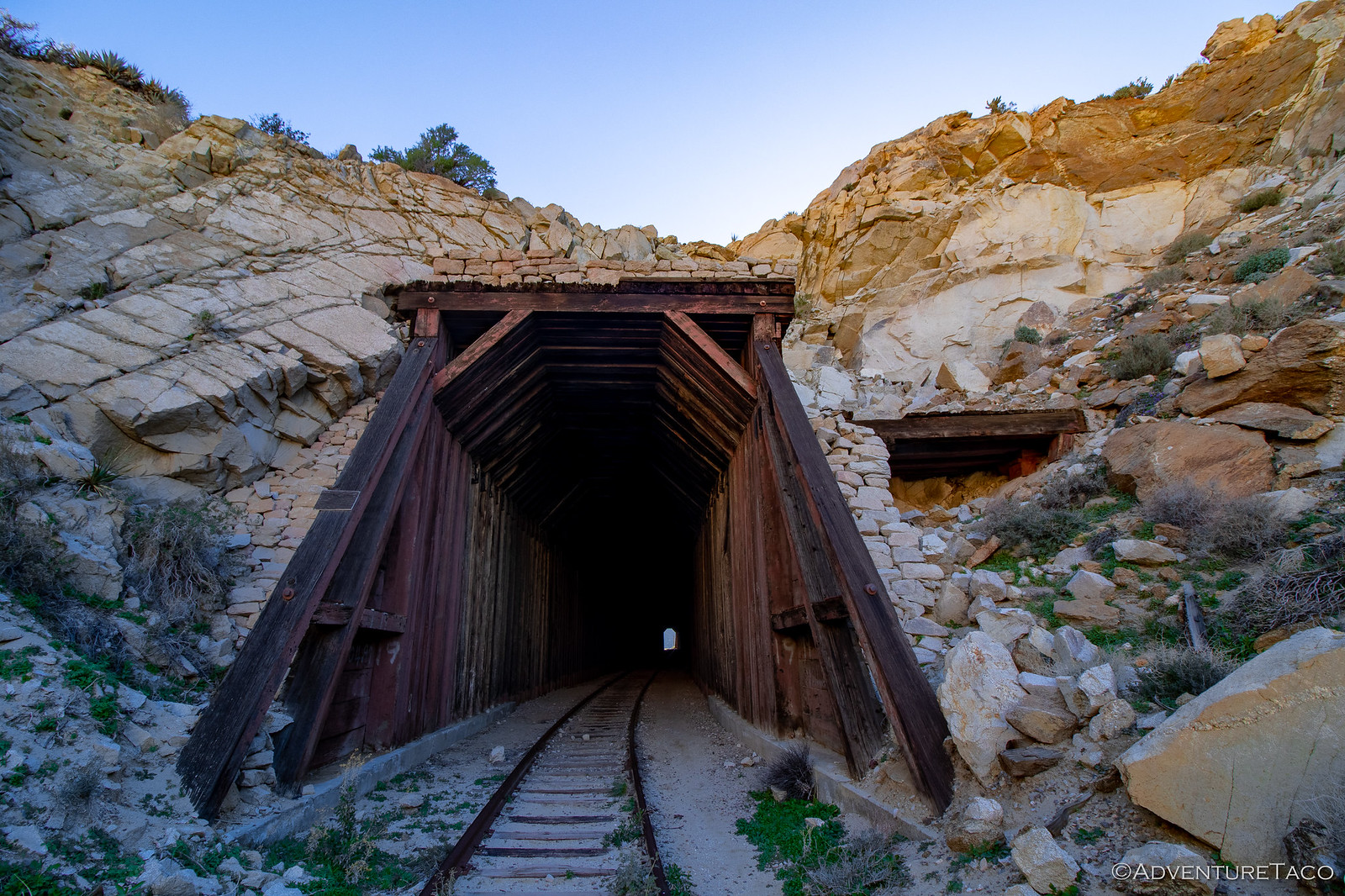
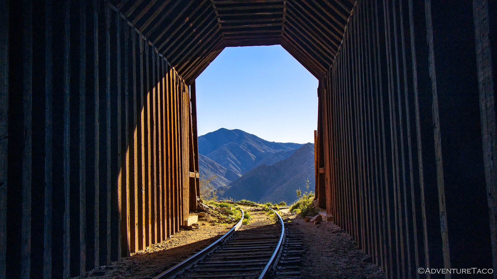
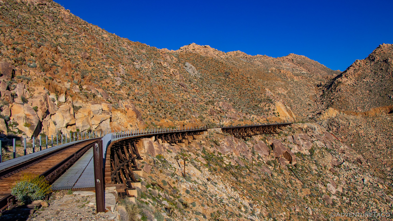
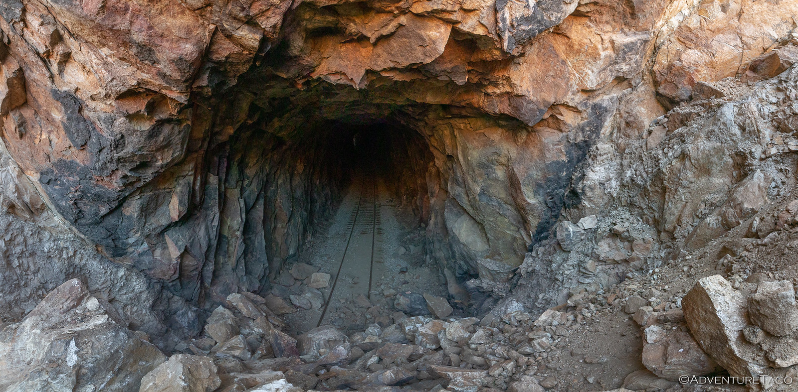
As we hiked along, the track took us through tunnels and over trestles as we wound our way towards Goat Canyon, and the longest (600 feet), tallest (200 feet), wooden trestle in the world.
Initially, the train line passed through a tunnel and along the mountainside where the trestle stands today, but in 1932 the tunnel collapsed and it was deemed both easier and safer to build the trestle in its place. I guess everything's relative.
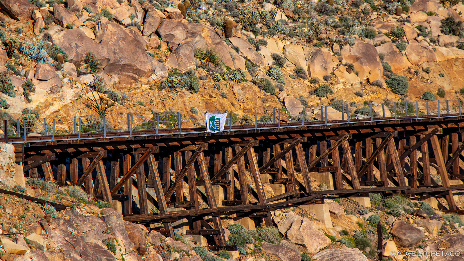
Along the way, along one of the longer trestles we'd come to, it seemed like a good place to start a new tradition, and we unfurled an enormous Excel flag. Amazing how tiny it looks here.
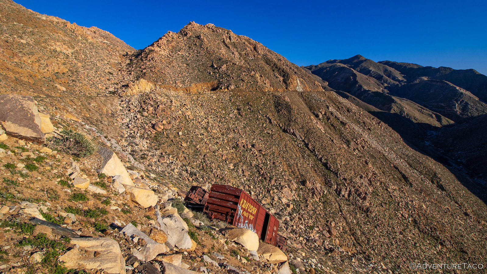
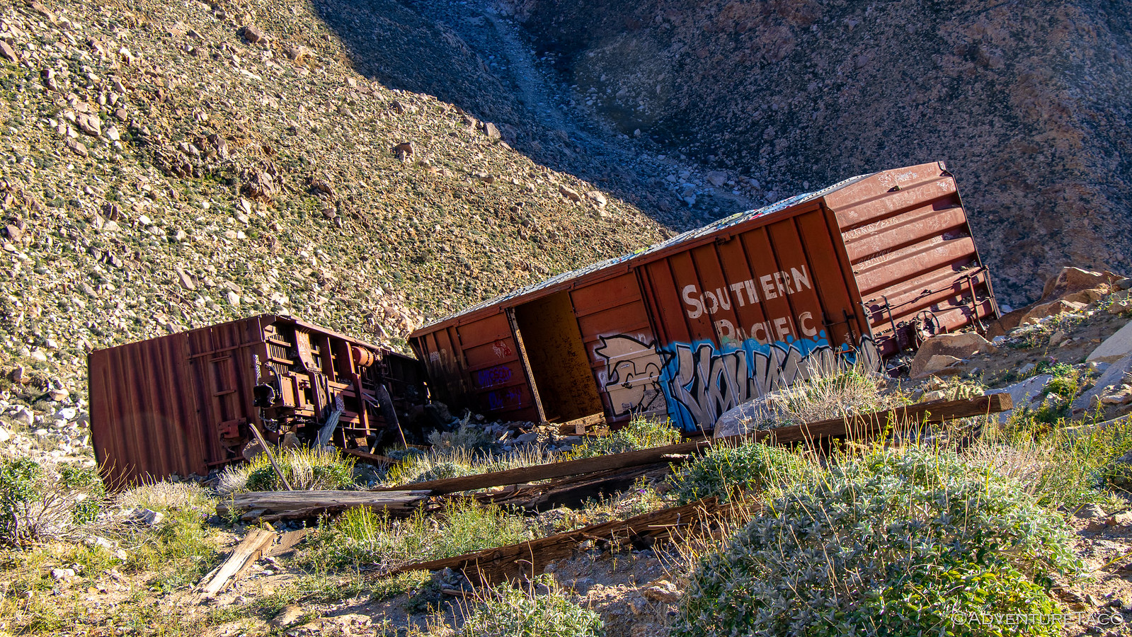
Cognizant of the time, and @mrs.turbodb now realizing that she didn't bring any water (which was fine - we weren't going to get lost on the tracks), we pushed on - trying to pick up the pace a little bit. Until, a little further up the track - two box cars over the side! A required stop if there ever was one.
By this time, I think we were both starting to wonder where we were in the overall hike - I mean, we knew we had ~3-4 miles to reach the trestle, but how many more tunnels would we pass through, and other trestles would we pass over, before we reached the turn around point?
We weren't wondering from a time perspective so much - as I mentioned, it's hard to get lost on the tracks - rather, we were a little worried about something else entirely: the longer we were on the tracks, the more likely we were to encounter a representative from the railroad. Rumor has it that this rail line is now used by migrants trying to enter the USA from Mexico, and so is randomly patrolled. And, as a narrow swath of private land running through Anza-Borrego, the rail company has apparently decided that the best way to reduce liability is to keep everyone off the tracks - by issuing hefty tickets to anyone they find along the line.
Whether that was true or not, we didn't really want to find out. Plus, we were having a great time.
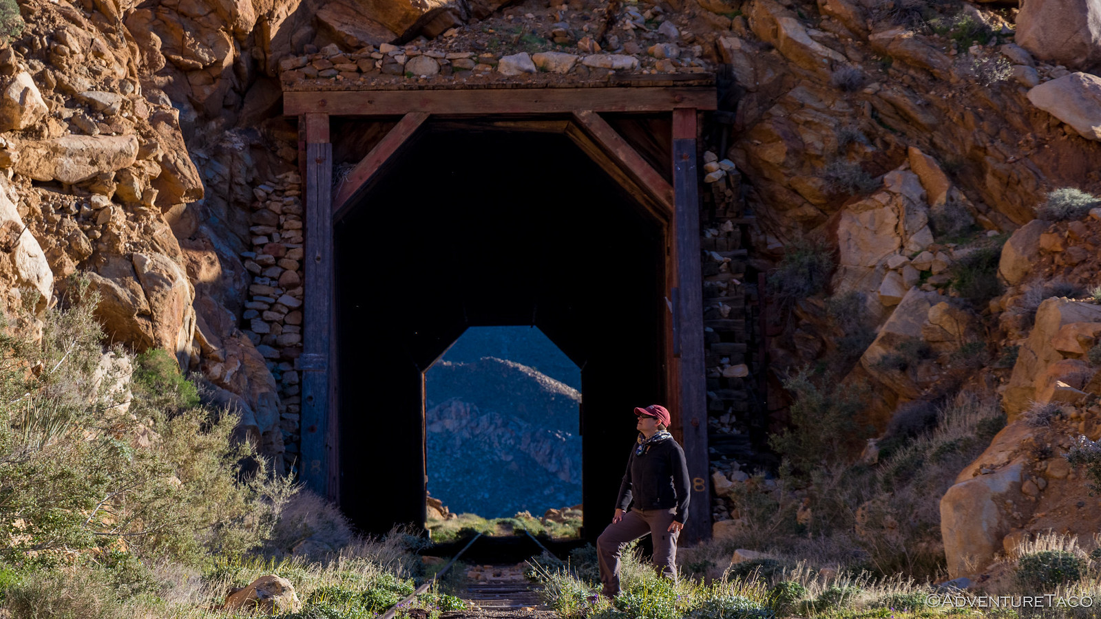
And then, a bit of excitement. In the distance, around a bend, we caught our first glimpse of part of the trestle. We were close. It looked like maybe another half mile of track and one more tunnel before we'd arrive. But nothing is ever that easy; as we approached the last tunnel - a plot twist.
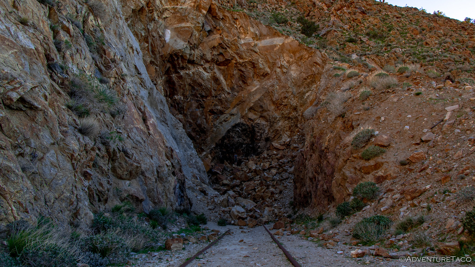
At some point, the mountain at the north end of the tunnel (we were heading south) had collapsed, making it impassable for trains and questionably safe for hikers. Actually, the collapse wasn't what had us worried - rather, it was the fact that unlike all the other tunnels, this one had no wooden frame inside - as though it'd been put into service before being finished, and then was left undone by its creators.
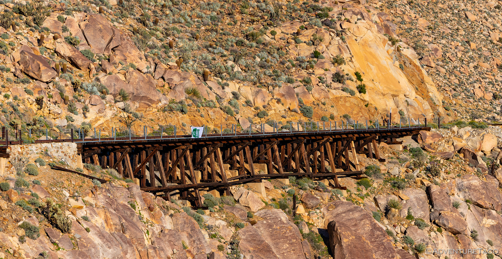
We decided to go around - there was a trail around the mountain - rather than through and as we crested the ridge line, there was the Goat Canyon Trestle.
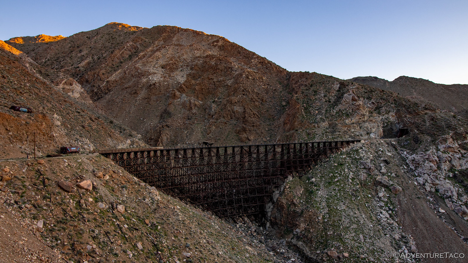
I'm not sure either of us was really ready for the enormity of this trestle. Even the photos don't do it justice, it's just so big. The bridge, built without nails, was designed with a 14-degree curve to withstand the strong winds that whip through the canyon; each level of the structure is 20-feet tall and made of 18" x 18" Redwood beams. Just getting those to the location had to be a daunting task, much less getting them assembled. How it was started in 1932 and completed in 1933 is beyond me!

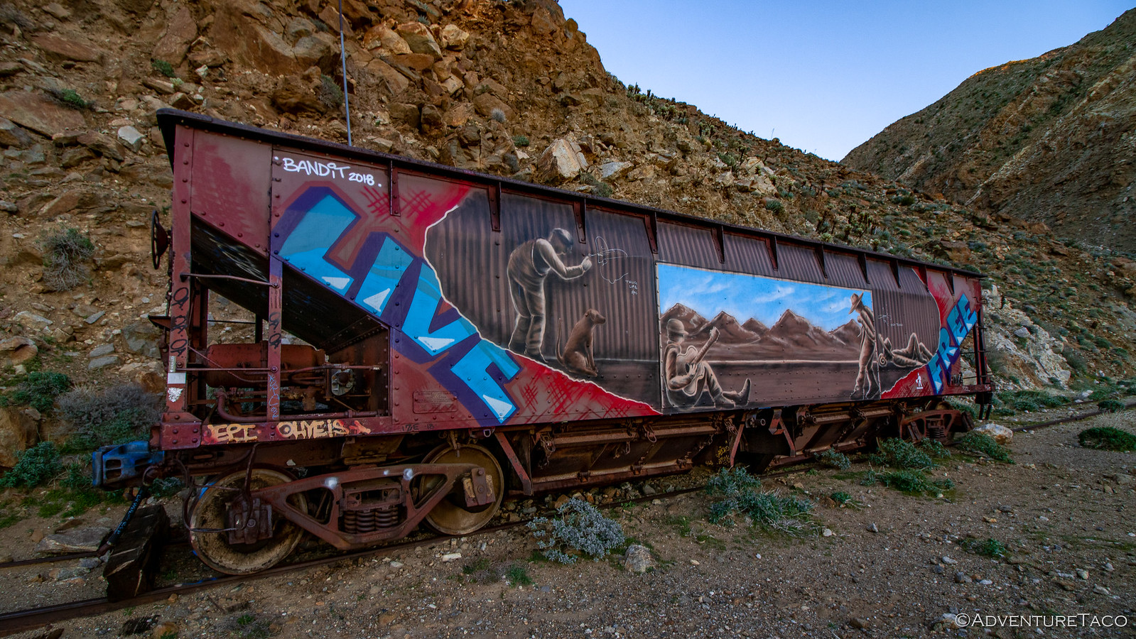
Near the trestle were two more abandoned rail cars - one, a tanker - had been lifted up the mountainside and was always kept full of water - a safety precaution should the bridge ever catch fire. The other - a hopper abandoned along a side track for an unknown reason - now the canvas for a really nice mural that someone spray painted along it's side in 2018.
We admired it all for a while before deciding that it was time to get going back. We'd dillied and dallied enough on our way as we explored the tracks that it'd taken us a good couple hours and used up our remaining sunlight.
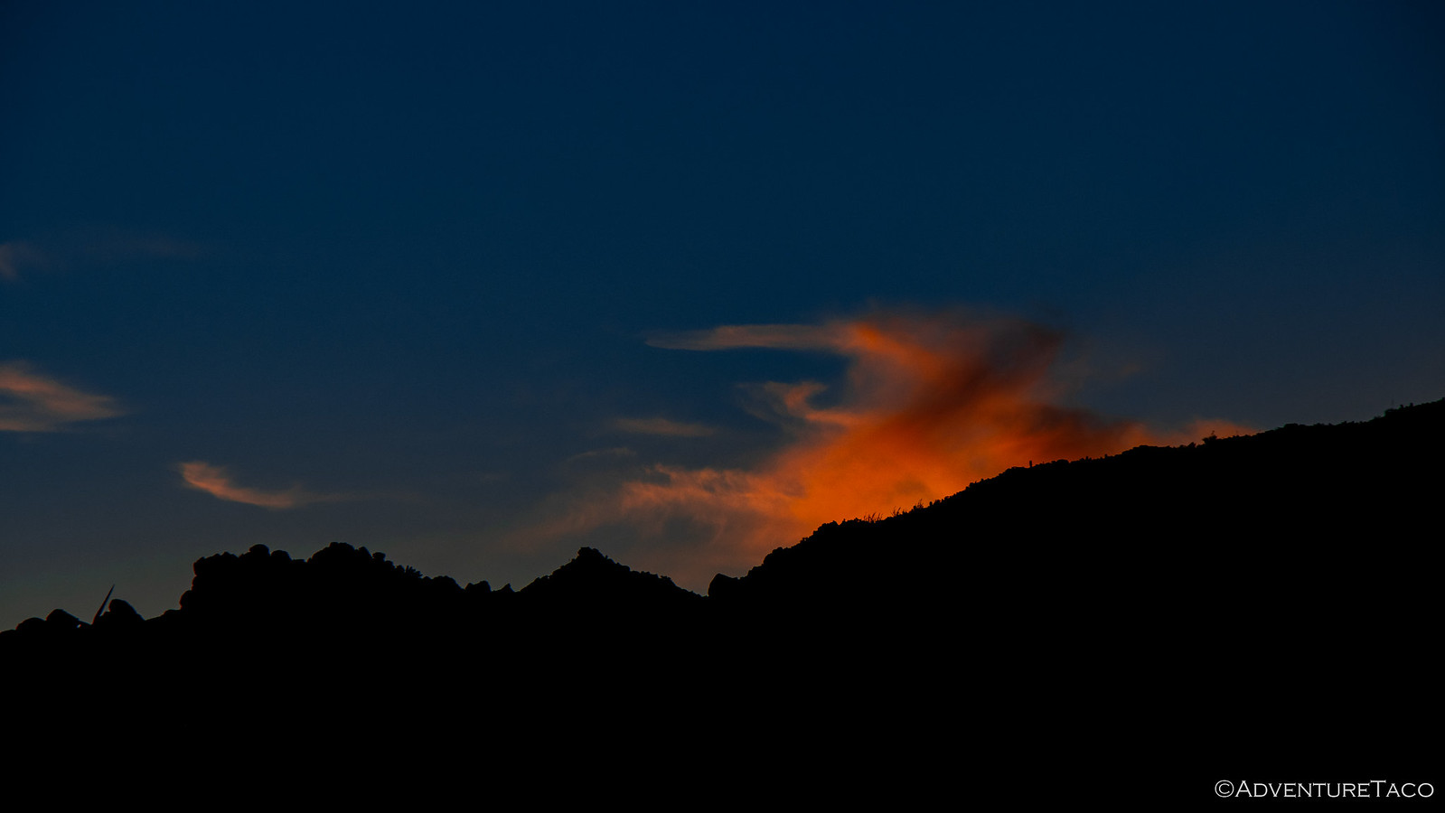
Of course, that meant that we got to take in a nice sunset as we made our way north, back along the tracks. Shucks.
And then, a special surprise - a nearly full moon meant that even as the sunlight faded, we didn't have any problem making our way back over the trestles and through the tunnels as we got closer and closer to the trailhead.
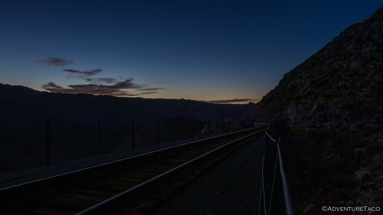
Ultimately we got back about 3.5-hours after we'd left - a super fun, and unexpected adventure to end the day. Our parking spot at the end of the road a nice, flat concrete pad in one of the most secluded spots in the park, we decided that this would make the perfect camp.
We also decided that after our amazing lunch, neither of us was all that hungry - so we setup the tent, brushed our teeth, and did a bit of stargazing before climbing up the ladder to cozy up and read our books before nodding off to the sound of crickets and a calm desert breeze.
It was wonderful. And it was just the beginning of our second adventure through Anza-Borrego.


There are some impressive railroad trestles in N. Idaho between Grangeville and Lewiston. You should check them out some time. I bet they compare favorably to this big one in AB..
I'll have to do a bit of research! Have any further pointers (trestle names or rail lines they are on) that would help out? It's always cool to see big structures like this. There were a few I remember from growing up where they even had switches on the trestle itself. Cool stuff.
great stuff. thanks for sharing!
Sure thing, glad you are enjoying!