
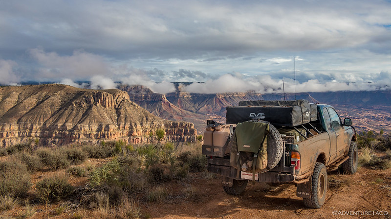
There's almost nowhere I like to camp more than on the edge of a cliff or on the top of a mountain. The expansive views and feeling of being on the edge - literally, I suppose - are the reason I love to explore. So, it was with a good dose of hesitation that I made the decision to leave my campsite on the North Rim of the Grand Canyon less than two hours before sunset, opting instead to camp at a trailhead parking area. At least it would allow me to get an early start on the following day's hike.

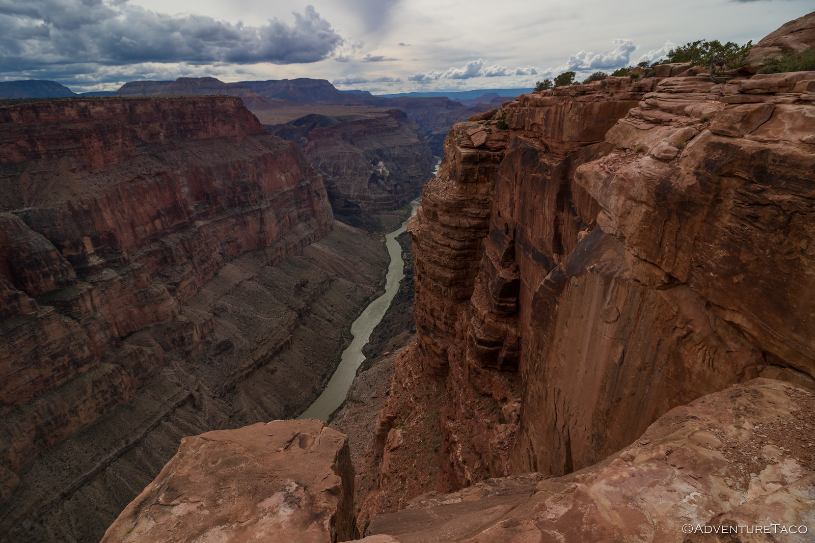
Away from the edge.

The Vermillion Cliffs and Moccasin Mountains gleamed in the distance.
My destination - Snake Gulch, in the Kanab Creek Wilderness - was one that had been recommended to me by Randy, perhaps the most avid, rock-art-loving hiker I know. Frankly, I don't really know him, except for being jealous of every photo and trip report he's ever posted, and a few emails, to which he's been kind enough to respond. One day, I hope, that will change, since he seems like a really nice guy.
Unsurprisingly, I arrived in the dark. Though my elevation was approximately the same as it'd been the night before - right around 6,000 feet - it was significantly colder. "Yay!" I thought to myself, "No view and I get to freeze to death." No matter, I pulled the truck into the corner of the parking area and unfolded the tent as quickly as my numb fingers could muster. Then, hoping I could keep warm in my comforter cocoon, I pulled on my electric socks and crossed my fingers. It was 7:23pm.
The following morning...
Something that anyone who likes photographing rock art quickly learns is that direct sun and shadows are the enemy. For this reason, I'd decided I would try to get the "out" portion of my out-and-back hike through Snake Gulch mostly - if not entirely - accomplished before the sun rose too far above the horizon. This, I hoped, would allow me to photograph most of the pictographs in indirect - or even better, reflected - light at the bottom of the gulch.
My miscalculation began long before I ever made the decision to climb out of the tent at 5:45am - in 8°F temperatures, and 90 minutes before sunrise. It began - I'd realize about four hours into my hike - before I'd ever left home.
You see, after being presented with the suggestion of hiking Snake Gulch, I'd set about doing a bit of research. This, I've learned over the years, allows me to know - to an extent - what to expect when I'm out in the middle of nowhere. At the very least, I can read trip reports from others and get a sense of landmarks; sometimes, I'm lucky enough to find a GPS track with waypoints that mark some of the interesting highlights. Such had been the case with Snake Gulch. After reading several trip reports - and getting excited for some of the pictographs I'd see - I stumbled on a trip report with a 7-mile roundtrip GPS track and more than a dozen points marking the pictographs along the way. "Jackpot!" I'd thought, before saving the data to my tablet and moving on to researching the next part of my trip. What hadn't even dawned on me at the time - but would have been obvious had I looked at the maps just a little more carefully - was that the track and points I'd found, covered by a small portion of Snake Gulch.
Still, I was blissfully unaware of my impeding misery as I fumbled around in the dark. Rather, I was dealing with the more immediate misery of pulling on every bit of clothing I'd brought along and trying to warm my fingers after I shoved my too-cold-to-touch camera gear into my bag. In fact, I even remember thinking to myself:
Thank goodness this is going to be a short hike. I can just wait until I get back to eat breakfast and I won't even bring any water...it'll still be ice by the time I'm done, anyway.
So yeah, you can see where this trainwreck is headed.

Half a mile into the hike, I was shivering as first light began pushing away the dark.
(4 sec exposure @ f2.8)

An old homestead at the head of Snake Gulch that I decided to check out more closely on my way back.
(Or not, it would turn out.)

Toothpick Ridge gleamed, 45 minutes before sunrise.
Keeping a reasonably speedy pace in order to generate not-quite-enough-warmth-to-counter-a-freezing-camera, I reveled in the soft pre-dawn glow, and commended myself for the perfect plan to explore Snake Gulch.

Magic light.
As is often the case when I'm hiking, I was making good time while I was moving, but terrible time overall. Though I wasn't stopping for a ton of pictures, the lack of light meant that each stop was longer than usual - to find somewhere to brace the camera, to click off several exposures at various ISOs and apertures, and of course, to spend a bunch of time trying to coax my fingers back from the brink of frozen fish stick land. Eventually I realized that I was eating up all the pre-sunrise light, and I turned on the afterburners, the majority of the pictographs I had marked, beginning at the 2-mile mark.
When visiting rock art and ruin sites, be respectful.
This is most easily done by following the Leave No Trace principles; leaving the place exactly as you found it and taking with you only photographs and memories. In case that is not clear enough for some reason, here are examples of respectful behaviors:

The first set of pictographs were actually petroglyphs!

Nearby, this red bighorn sheep was more like what I was expecting.

Racing the light streaming into the gulch behind me.
Soon, I was in the thick of the points that the map I'd found online suggested I would find more interesting than the trail itself.

Lone soldier.

Faded faces.

Across the deep wash, this rock formation reminded me of a crumbling apartment façade for some reason.

On the one hand, I longed for the warmth the sun would provide, on the other, I knew it would bring shadows and contrast.
Most of the artwork in Snake Gulch was likely the work of the Basketmaker culture - pre-Ancestral Puebloans that began about 1500 BC and continued until about AD 750. People of the Early Basketmaker lived a semi-nomadic, hunter-gatherer lifestyle. The eventual cultivation of corn led to a more settled, agrarian life during which they became known for basketmaking.

Family of five.


Not all of the art here was Basketmaker. These black images are probably relatively more modern and of Paiute or even Pioneer origin.
It was about the time the sun was peaking (or was it peeking?) over the rim of the canyon that I began to realize my miscalculation. Not the scope of it - that would come later - but that something wasn't quite right with my plan. I was nearly to the end of the GPS track - and points of interest - but I could see that the sandstone walls of Snake Gulch continued to stretch into the distance. Surely, there was no reason the rock art wouldn't continue as well?
And then, I came upon the best pictographs yet!

Time's up!

Yellow Man Alcove.

Yellowman.
It was 9:30am as I reached the this-is-definitely-not-the-end-of-the-trail point of GPS track I'd been using as a guide. I wasn't hungry, but I knew that if I returned now, I'd be eating breakfast at lunch time, and I remember thinking that - while I don't drink much on a hike - it sure would be nice to have a little water.
A smarter - or less hard-headed - hiker probably would have realized their miscalculation at this point, acknowledged their mistake, and headed back to camp, leaving the remainder of Snake Gulch for another time. My head, however, is like a solid rock; unlike a geode, there's no room inside for a brain. Knowing that I could push on a little further without food or water - after all, while I wouldn't have turned down a handful of nuts, I was by no means hungry - I decided to keep going.
Here, too, I also noticed that the walls on the opposite side of the gulch - across a 15-foot-deep channel with nearly vertical sides - were also decorated with drawings. And thus began a much more strenuous - I ended up crossing the channel at least ten times - portion of the hike.

Two interesting anthropomorphs.

Ghostly mask.

Big foot.
It was on one of these excursions to the other side of the gulch that I came upon what would be one of my favorite panels of the day. There, high on the wall and in perpetual shadow were six figures in a row. The remainder of the wall was empty.

Mohawk Men.
Though the trail through Snake Gulch was well traveled and easy to follow, an hour after the point at which I'd planned to turn around, I'd only made it an additional mile. Largely, this was due to the extremely slow progress I was making as I plunged through the three-foot-deep tumbleweed and clambered up and down the sandy sides of the channel to view panels on both sides of the gulch.
I began looking for a spot on my map where I'd force myself to turn around. Every step I took until then, was one I knew I'd need to retrace on my return.

Big and small.

In a corner.

Yellow twins.

Fading away.

White head in a tuxedo.

Next to a nook.

Lost his Head.
Having identified the confluence of Toothpick Canyon with Snake Gulch as my turnaround point, I either wasn't paying attention, or I was so intent on finding the next panel that I completely missed the point - more than two miles beyond the end of my marked trail - at which the two came together. While any normal person would have - after realizing that they went too far - just turned around, I decided that it was only 11:30am, that I was a little thirsty but generally felt fine, and that I might was well just continue hiking.
After all, my new turnaround - the confluence with Table Rock Canyon - was only another mile away, and I kept finding all these cool panels!

Above the fold.

Small twins.

Small twin view.

Pin stripes.

Big Yellow Man.

Washing away.

You there, back in line.

Caught, red handed.


Hairstyles. Frizzy (left) and Spiked (right).

I don't know why, but I really liked this chevron in a nook.

More to go.
With one more gentle bend in the gulch between me and Table Rock Canyon, I realized that what I'd assumed would be a quick, before-breakfast, three-and-a-half-hour hike, had turned into something much more. Now six hours in, I'd covered more than nine miles - a smidge longer and more difficult than my return trip, since I wouldn't be bushwacking back and forth across the canyon floor, but still - a hike for which I would have preferred to have a water bottle secured in my pack and breakfast in my belly.
But, ancient graffiti!

High panel.

Corner watchmen.

Spiky hair.

Pineapple People.
Unlike Toothpick Canyon, I made sure that when I overshot Table Rock Canyon - how does this keep happening to me? - that I didn't just keep going. Well, technically I kept going for a few hundred feet, but only because I spotted some crumbling walls of an old granary.

Table Rock Ruins.
And with that, it was time to head back. By now I thought I fully understood the mistake I had made but I was wrong. Though my feet were starting to get a bit tired, my belly had stopped growling nearly an hour earlier, and I could have gone for a bit of water, I was still in reasonably high spirits having seen so many cool pictographs.
This would not be the case by the time I got back to the Tacoma.

Technically, still another 15 miles of Snake Gulch to go (before it runs into Kanab Creek).
On the way back, I knew that I was pushing my endurance - by now, it'd been 24 hours since I'd last eaten in the Shamans Gallery, and I hadn't had anything to drink in nearly the same amount of time - so I did my best to keep my head down and camera stowed in order to make good time on the return trip.

Snake Gulch bread loaf.
The miles - of which I had eight or so to accomplish - ticked off slowly. The sun, which I'd initially welcomed for warmth, was now a menace. As with food and water, I'd assumed I'd be back to camp before a hat or sunscreen would be necessary - one more in a string of miscalculations - no longer the case as it neared 1:00pm in the afternoon. Sunglasses would have been nice, as well.

Radio Tower Man (and his minions).

Wish I'd spotted this deer before the sun and shadows made it harder to see.
Searching for short stretches of shade that were offered by only the highest walls of the gulch, I draped my sweatshirt over my head to shield my face from the worst of the sun. By this point, I could tell my feet were dragging - a sensation I don't often experience, even on the longest of hikes - and I was ready for a rest. Spotting a shady alcove with a rock to sit on, I wandered over.

Hey little buddy!

At first, I thought this guy had been consumed by a spider, but maybe it just shed its exoskeleton?
Ultimately, I trudged my way into camp - now in the afternoon shadow - a little more than nine hours after setting out, and just after 3:00pm. Finally, it was time for breakfast!

A prettier sight, I've never seen.
The Whole Story


Epilogue
For anyone interested, breakfast was half a box (four servings) of my favorite cereal (Wheat Chex), and just less than half a gallon of very cold (the best kind) milk. I like my Wheat Chex very crunchy, so I fill up the bowl with milk, and put a handful of cereal in at a time. Each bite is primarily (very cold) milk, with a few Chex.
If I'd had more, I'd have eaten it all!
Wow, a lot of neat rock art. That yellow artwork has held up very well, wonder what they used for pigment. Must be an interesting story about that homestead way out there, too bad you were running on fumes coming back. This trip was maybe a little TOO much adventure. That's some breakfast as I do like milk. I have learned that in the backcountry opening the Oreos and setting the gallon of milk out for an afternoon snack is a bad idea, since both were half gone when I next thought about it.
Was a fun one... mostly. Actually, if I'd just been a bit smarter in my research, I'd have easily planned for a much longer hike and day from the get-go. Could have done another 9 miles easy, since it was largely level terrain, had I just decided to bring along 20oz of water, a snack or two, and a hat/sunscreen.
Won't be making that mistake again. Instead, I'll just make a different one! 😉
I'm impressed that only half the Oreos were gone. Open a bag of those around me and you'd better get eating quickly.
Thanks for sharing another fine adventure. Something I learned in 78 years, it's always better to have too much water than not enough! Also learned that plans are always subject to change and best to go with first instinct. I think I previously mentioned the backpacking trip from Hell into the High Sierras. A friend & I (experienced) allow 2 co-workers to accompany us but they wanted to take a more difficult pass & against our better judgment we said OK. Halfway up the pass it was hike 15 minutes then wait for the other 2 to start breathing again. I had visions of packing 2 dead bodies out of the mountains (LOL). We never again let someone else, especially inexperienced, to alter our plans!
Yeah, live and learn for sure. I figured I had plenty of water (none) for a short flat hike. The problem only presented itself when I continually made poor choices, lol. Really, I was fine, even if a bit miserable at the time; even with all my poor choices, I turned around well before any real trouble could present itself.
It's always a challenge hiking with other folks you've never hiked with before. Paces, water and food consumption, etc. are all so different. I usually plan to cover about half the ground I would cover alone when I'm out with someone I haven't hiked with before.
And of course, I'm sure there are folks who would walk me into the ground. I think it'd be great to go on an adventure with them!
Lucky you went very well prepared for your short hike.😆
I mean, in the end, I had everything I needed (my camera and some shoes on, lol). Would have been nice to have been out even longer, but even I have limits. 🤣