
We headed out of Telluride just after 1:00pm, and I was worried. We'd finished the entire first stage of the Colorado Backcountry Discovery Route (COBDR) in half a day, and I knew that if we didn't slow down a bit, we'd find ourselves all the way through Stage 2 - and the Alpine Loop - before sunset. And that would be terrible, because I already knew where I wanted to camp for the night, and it wasn't past the Alpine Loop. In fact, it was only about halfway through!
Luckily, speed is something I could control. Well, that and we could always decide to stop early for the night. But we'd cross that bridge - or 12,000-foot pass as is the case in Colorado - when we came to it.
For now, we headed out of town and toward the first of many passes we'd conquer over the next 24 hours - Ophir Pass.

The approach to Ophir Pass is a long one, and it first winds its way along the South Fork of the San Miguel River for a while.
Eventually, we reached the once-ghost town of Ophir. A Post Office was first established in 1878 and remained open until 1918 when nearly 120 people called this place home. It has since closed and opened several times, as the residency of the town dwindled to two full-time residents in the 1940s and 50s. Today, the town is larger than ever, with nearly 200 folks who call this place home. It's understandable, really, once you catch a glimpse of the views!

Coming into town.

Parking, for those with less capable machines.
It was in Ophir - as a parade of Jeeps streamed past us in the opposite direction - that the reality of the COBDR really started to sink in. On other BDRs we've run, a common theme is the feeling or remoteness or solitude. That would not be something we felt in Colorado, a state where everyone seems to be enjoying outdoor activities - hiking, mountain biking, off-roading, and more - in every location, and all of the time. Not that we could blame them; we were here to do the exact same thing!

Starting up Ophir Pass.
As we began the climb up the somewhat narrow shelf road to the pass, I pointed out a crushed vehicle in the scree, and joked with @mrs.turbodb that I hoped we didn't end up in the same situation. She didn't find it all that funny.
I didn't realize at the time - as I didn't actually think there was any danger in what we were doing - but just before leaving on our adventure, I'd heard about - and shared - a tragic accident where two Canadian adventurers were exploring a spot that we'd visited last year when their truck slipped off a shelf road and tore itself to pieces as it rolled down the hill. The husband was ejected and killed immediately and the wife suffered injuries that would ultimately claim her life as well.
It was a good reminder that trouble can occur even in situations that seem "normal," and that we always need to remain alert to the dangers around us.

Working our way up, the mangled trailer a shiny mess of metal below the road.

The view looking back - with the orange San Joaquin Ridge and the greenery below - was even more dramatic.
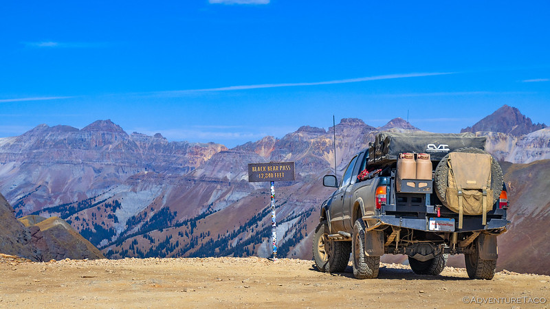
A few minutes later we made it to the pass. It was the first of many that we'd encounter throughout the San Juans - and the views at 11,796 feet were spectacular, even as indecisive clouds raced by overhead. We paused for a minute to take it all in.

Ophir Pass view of Ohio Peak (left) and Anvil Mountain (right).

We were but a spec on the road.

Heading down the other side.
Driving Ophir Pass from west to east, the descent was quick and dumped us out on the Million Dollar Highway (CO-550). Originally constructed as a toll road in the 1880s by Otto Mears - to transport ore from Silverton to the railroad in Ouray - the road is now often described as one of the most beautiful drives in the United States, with panoramic views of jagged mountains, deep gorges, and lush valleys along its entire length. The name is believed to have originated from the high costs associated with its construction and maintenance; if it'd been named for the views, "Billion" may have been a more accurate valuation.

A gaggle of vehicles on the side of the road alerted us to a moose snaking along the stream below.

This old ore bin right along the highway - and now owned by the Colorado Department of Transportation - was too photogenic to pass up.
We only spent a mile or so along CO-550, hitting dirt again as we turned onto Red Mountain Pass Road. For the next hour, we'd enjoy a whirlwind journey along a winding road passed through a half dozen of the mines - only a tiny fraction of the workings that seemed to decorate every hillside as far as the eye could see. As with the omnipresence of people, I can't recall any BDR where mines were such a constant fixture.

The Yankee Girl Mine headframe is always a fun - and dramatic - stop along this route.
As we pulled up to one of the larger workings, once the site of three historic mines - the Red Mountain Deposit Mine, the Magnolia Shaft Mine, and the Genessee Vanderbilt Mine - we spotted a couple motorcyclists enjoying their lunch on the upper level of ruins. Parking off to the side, we made our way over and after quick hellos, discovered that they too were running the COBDR, only they were doing it from north-to-south, and had linked it with the Wyoming BDR, after having run Idaho and Nevada in the same way!

These guys were hard core.

It's always fun to run into fellow BDR travelers to share real-time info on the route, and of course, to compare favorite BDRs.
After a nice conversation - you'll recall that I was looking to burn a little time given where I hoped to camp for the night - we climbed back into the Tacoma and headed for our next pass. In this case, that meant losing a bit of elevation before turning onto Corkscrew Pass Road a few miles to our north.
Of all the amazing views along the Alpine Loop, my favorite is the Corkscrew Gulch - Corkscrew Pass area. The burnt-orange scree contrasts so splendidly with the green forest, and is offset equally well against baby blue or moody gray skies. Still, as we began our ascent - with trees all around us - there was little to see on the ground.

It was our little buddy who allowed us our first glimpse at the views.

The colorful bowl we'd soon enjoy.

In the thick of the orange!
We reached Corkscrew Pass at what most would consider early evening. Now closer than ever to my target camp location, we began in earnest to figure out what we wanted to do for the night. Ultimately - and thankfully - @mrs.turbodb reminded me that we were way ahead of schedule, so slowing down and enjoying camp in a place such as this was exactly the right thing to do.
Relieved, I found myself much more relaxed than a few minutes before, as we soaked in the view all around us.

Corkscrew Pass view.
From Corkscrew Pass, it was only a few miles to Hurricane Pass. This was a spot that we'd actually visited a few years earlier - after we'd wrapped up the New Mexico BDR - and is my favorite spot in the San Juans, because it offers the best view of Corkscrew Gulch. This was where I wanted to camp for the night. Soon we found ourselves winding our way up the narrow shelf road - and picking our way out along a lightly traveled spur - to an overlook that was as dramatic as ever.

If the views weren't so good, we'd go even higher.

This is the place.
It was only 5:00pm - too early to even eat dinner - when we found a level spot for the Tacoma and deployed the tent. For the next two hours - as our chicken pesto pasta warmed to room temperature - we roamed around the high mountain meadow, knitted, transferred photos from various image-capture-devices to the laptop, and spent time getting to know the locals.


Barny and Fred lived in an old vertical shaft that'd been sealed with concrete. I asked them - politely - to stay the hell away from my wiring harnesses during the night.

Camp.
Over the next several hours, only one other vehicle found its way up the road to our overlook. They didn't linger long, and they never got closer than 100 feet to our camp, but we did overhear a bit of their conversation, "now that's a camp site," as we broke out our bowls, forks, and some home-grown tomatoes, before digging into our dinner of chicken pesto pasta as we watched the sun sneak down across the horizon. Then, it was time to brush teeth and climb into the tent; our decision to stop here one of the best we'd make all trip.
The following morning...
Even under threat of marmots munching in our engine bay, sleep came quickly. Though air conditioning was a constant fixture to fend off the near-100°F temperatures at lower elevations, it was perfectly pleasant at 12,309 feet. And so, as my alarm sounded at 5:15am, I had no problem throwing on a t-shirt and scampering down the ladder to soak in the pastel pre-sunrise light as it illuminated the peaks around us.

Good morning world!
Having stopped early the previous evening, we had a little less than half of the stage - perhaps 40 miles or so - to complete before arriving in Lake City. This would take us over two more major passes - California and Cinnamon - and through the ghost town of Animas Forks as we continued to enjoy the high elevations of the San Juan Mountains. We decided to hold off on breakfast until arriving in Animas, as it was raining when we passed through on our previous visit, and this time we hoped to poke around for a while.

Climbing up to California Pass.

California Pass view.
This section - between Hurricane Pass and Animas Forks - was one that we've run several times in the past, so in order to put a few miles behind us, I resisted the urge to get out and take photos at my usual stop-and-go-but-mostly-stop pace. Still, as we passed the ruins of the (now for sale) Bagley Mine, I couldn't help but admire the old mill and tailings pile.

Just needs a little elbow grease to be back up and running again!
A few minutes later - and another 300 feet down - we arrived in Animas Forks.
The mining community of Animas Forks at 11,200 feet in elevation experienced the ebb and flow of hard rock mining for over seven decades. The first log cabin in Animas Forks was built in 1873. The townsite was platted in 1875 and by 1876 the community had twenty-five cabins, which included a hotel, general store, meat market, saloon, blacksmith shop, assay office, restaurant, sawmill and smelter. Quite a lively place!
The town newspaper, The Animas Forks Pioneer, was published from 1882-1886. Businesses came and went with the boom and bust of mining. In 1891 a fire in the kitchen of the Kalamazoo House destroyed the Hotel and thirteen other buildings.
The first prospectors wintered in "Three Forks of the Animas" in 1873, looking for silver and gold. In 1875 the name was changed to Animas Forks to accommodate the Post Office Department, and funds were committed by the San Juan County Commissioners to build a road between Silverton and Animas Forks to connect with the trail from Lake City, now known as Cinnamon Pass. By 1885, the summer population reached 450 people. Few people braved the harsh winters when most mining activity stopped.
The town weathered the boom-and-bust cycles of the mining industry until the early 1920's when metals prices fell worldwide and it began its slow transformation into a ghost town.
BLM info sign

The multi-level ore chute and mill of the Columbus Mine.
Of all the structures in Animas Forks, the William Duncan house is by far the finest. While all are quite obviously maintained by the BLM and volunteers these days, the craftsmanship and ornate-but-understated details of this home are fantastic.

The William Duncan house.
When William W. Duncan arrived from Pennsylvania with his family at the young age of 27, he had big dreams. Duncan and his wife Mary built this house in 1879, just five years after the settlement of the Townsite. Duncan's building was designed to support a growing family including daughters Mary (6) and Sarah (5) and their infant brother Willie Grant. According to the 1880 census, Duncan was employed as a hardrock miner.
Trim detail.
Migrating from the East Coast, the Duncan's chose to include several architectural elements popular during the Victorian era, such as the finely detailed picturesque bay, with tall windows, to take advantage of the natural light and breathtaking mountain views. Although these elements are typical of the Victorian era, they were highly unusual for such a remote location at this early date. The Duncan family departed Animas Forks in 1884, leaving this magnificent and haunting statement of the optimism and confidence that a select few prospectors and their families carried deep into the San Juan.
BLM info sign

At the south end of town sat the football-field size foundations of the Gold Prince Mill. Construction began on the massive, $500,000 structure in 1905, resulting a significant boost to the town’s prosperity. The August 15, 1905 edition of The Durango Democrat reported:
Visitors to Animas Forks are surprised at the amount of work going on in that vicinity. The old houses have been repaired, new ones are being built, and the streets are numbered. Four saloons are running full blast, and 160 men, with machine drills, are at work excavating for the Gold Prince mill, a large number are employed at various other workings about the place, and all in all, Animas Forks is a regular bee hive.
At the time of its completion, the Gold Prince Mill was the largest mill in Colorado, with 100 stamps, each weighing roughly 850 lbs, a crushing capacity of 500 tons of ore per day, and an 1,800-fott long aerial tramway that hauled ore from the Sunnyside Extension portal down to the mill site.

Gold Prince Mill site.
As with many mills of the time, the Gold Prince Mill operated for only a few short years. It was closed in 1910 as gold and silver prices fell, and by1917 most of the mill's machinery was removed for a new mill in nearby Eureka.
After wandering around town for a while - as we enjoyed cereal and fresh blueberries we'd picked from our garden before heading south - we headed back to the Tacoma just as the morning crowds began to arrive. It was perfect timing really, as we had no desire to hear the unending drone of UTVs arriving for the day. After a quick clean-up of our bowls and a pit stop at the bathroom, we pointed the truck toward the road that would take us up and over Cinnamon Pass.

Looking back at Placer Valley and to California Pass.

Soon, we were 3,000 feet higher as we quickly gained elevation.

Up here, the fritillaries were out in full force, soaking in the sun and caring for their crops.
Compared to the other passes along the route, Cinnamon Pass is one of the more pedestrian. Still, as we began our descent toward Lake City, the eastern flank shown brightly in the morning sun and we stopped for a few minutes to admire the final miles of this best stage of the BDR.

Cinnamon Mountain.

The way to Lake City.
By 11:00am, we were done with the stage. Even taking it easy, this was far and away the fastest - just more than a day - that we'd ever completed the first two stages of a BDR. We quickly found ourselves wondering if this pace was indicative of the entire route, and if we'd be heading home nearly a week before we'd originally planned.
For now, though, it was even too early for lunch, so after a quick pit stop for fuel and an email check, we were on our way to Stage 3!
The Whole Story


Your photos and words provide a different insight to an area I have been to several times. The drone shots give a great perspective, that I have missed. Great moose photo, nice work. Looking forward to your next stages as I have not been on those.
Thanks! Was great to have the drone for the first time in this area. So often here, the view from the trail is so different than what you can see a little higher up, out of the trees. Loved it!
Beautiful, thank you!
Glad you enjoyed it Rick!
Beautiful! Just beautiful! As I noted in my comment in your last entry, I was just on these trails last month.
Thanks Todd!
we did these 5 passes on labor day.The weather was perfect. As you are saying , it was busy!. we were competing with the Atv on Cork Screw Pass, i think i remember the pics of the switch back, it was very steep. Could not pull over anyway.Your pictures capture the intense color of all these passes . To be at 13000 plus feet in a Tacoma is a special feeling.
Also your pictures of mines at high elevation show the ingenuity and the craziness of these miners .
Winter is coming, any desert trips coming up?
Winter is coming! The Tacoma is in Las Vegas already, and we've got a couple trips in the works. I was hoping the first would be to Death Valley, but it's looking like temps are still close to 100°F there, so we'll likely do a trip to southern Utah/Arizona Strip first, and then hit up a few spots I've got in the desert!
i am also looking forward to the next bdr co stage. i was wondering if you are planing the side trips or is it a last moment decision .Also in winter what is your heat source .
Next one is out, enjoy! Lake City to Buena Vista - Skipping the Good Stuff | COBDR Stage 3
Thanks for taking us along. Beautiful country!!
Come along any time! 👍