
We'd wrapped up the Arizona Backcountry Discovery Route (AZBDR) in record time, a full day faster than even our most ambitious estimates. On the one hand, it was nice to relax a bit, knowing that we had plenty of time to make it from the Arizona-Utah border near Kanab to our flight out of Las Vegas. On the other, now we were faced with figuring out what to do with our spare time; I hadn't researched any backup plans should a situation like this occur!
After a bit of "we could do this," and "we could go see that," we decided that we'd both enjoy a return trip to the Muddy Mountain Wilderness where - several years ago - we hiked into an amazing hidden valley to find a secret tinaja. In addition to being a beautiful spot, camping there for the night would put us only a couple hours outside Las Vegas, allowing us to take it easy on our final morning as we headed in to wash the truck and hop on our flight home.
After packing up the tent and heading west, we decided to make another quick stop - to check out some of the most unusual petroglyphs I've ever seen - before passing through St. George for lunch.

Into the mesas in search of rock art.
The last time I'd visited Canaan Gap, I was alone and doing my best to salvage a Nevada-based rock art adventure (Not the Rock Art I Was Looking For) that was turning out to be a bust on a rather important front: rock art. Even this location had required quite a bit of poking around on my part, but in the end, it was worth it - the glyphs here are so deep, unlike any we've found before or since.

You can tell something is different even from a distance, but it's hard to identify until you get up close.

While these glyphs may have started out like any others, over time, the soft sandstone has worn significantly faster than the varnished surface, creating a haunting effect to the figures.

Man and coyote.

Conjoined sheep.

Snakes, feet, and an atlatl?
Wandering below the panels, it was fun to watch my companion discover many of the same elements that I'd been wowed by on my first visit, knowing that a few minutes later she'd discover the next detail, just as energetically as I had before!

We arrived just as the sun was peaking over the panel.

While we had no idea what this depicted, we both appreciated that the artist had used the crack in the rock as part of the work.

We, as a culture, can - and must - do better. Ignoring the pockmarks, it was interesting to see that the figures here were of a similar design to those at The Maze Panel we'd recently observed.

I hadn't noticed the last time I was here, but even the layers of sediment that supported the sandstone above were fascinating.

Knowing where to look allowed us to get in and out of Canaan Gap reasonably quickly, and soon we were headed back to the Tacoma and onto the road.
It was just after noon, and as we headed towards St. George, we were both hungry for lunch. @mrs.turbodb honed in on a multi-generational Mexican place, and as she cleaned up in the ladies' room, I placed an order for two carne asada burritos that turned out to be toasted and quite delicious.
Munching away, we were perfectly happy humans until we saw an order of nachos that got delivered to a table next to us. Dang, those looked even better, and will be on our short list the next time we're passing through St. George!
Downing our last bites, and after a quick stop at Jimmy Johns to pick up dinner - a 16" Turkey Tom (#4) and chips - we pounded out the last few miles of pavement before turning off for the Muddy Mountains and the Bittersprings Backcountry Byway.

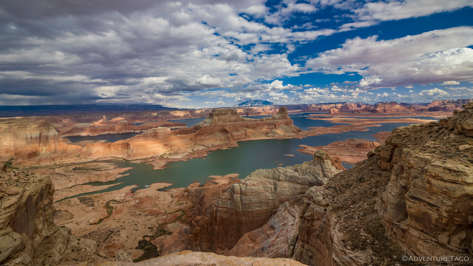
These rugged looking mountains hold secrets that few ever find.

As we aired down, spring was in the air around us. And boy, the air was a lot warmer here than it had been in Arizona!
To get to Hidden Valley, one must drive the Bittersprings Backcountry Byway through Buffington Pockets. This area - were there no other reason to visit - is an amazingly worthwhile trip, the colorful rock pockets like candy sprinkled across the dark landscape.

Ka-pow!

Inclined layers against the dark backdrop of the Muddy Mountains.

A playground of orange.

Working our way from one outcropping to the next.
Even knowing that we had a five-mile hike to complete by the time the sun fell below the horizon, we couldn't help but stop several times as we made our way to the trailhead that would also serve as our camp site. Eventually though, we reached the end of our spur at the edge of the wilderness. Normally this would have been a happy arrival, but as we looked toward the trail, we noticed that the wilderness boundary sign and - more importantly - the barricades that previously blocked the old mining road, were gone.
They were not meant to be gone, but some idiot with a sawzall apparently felt that driving their UTV (based on the track width) into the wilderness was "their right," a sense of entitlement that has become more pervasive over the last several years and completely misses the point of why these sorts of places exist.

The old posts that once blocked the road, chopped off at the ground.
Making a mental note to send an email to the BLM upon our return, we spent just under an hour “re-closing” the road, using what I like to term NPS-closure-techniques, as I’ve most often seen the technique used in Death Valley (though I’m sure BLM does it as well, ha!). It was tough work, but after much grunting and dust, we were able to move a couple dozen of the largest rocks we could carry into the road in an attempt to prevent further intrusion by vehicular traffic.

Better than nothing.

Shouldn't be necessary.
With that, it was finally time for us to enjoy the hike we'd worked so hard for. And so, we set off - up the trail we'd already poured a bit of sweat into - up the hillside, towards hidden valley.

Along the entirety of the old road, the UTV tracks would continue to irk us.
After a steep ascent through unremarkable terrain, we crested the ridge. Having witnessed this transition before, our anticipation was high as we looked down into the valley. There, the same candy colors of Buffington Pockets appeared magically sprinkled throughout the sage. Grins spread across our faces as we picked up our pace for the descent into the valley.

Valley view.

We couldn't help but to climb up some of the sandstone.

Tafoni cave.

Stripes.

On top of a wave.
After meandering our way between various pockets, we headed over to the tinaja. There, we found two trail cameras setup to capture anything that might wander this direction to check out the striated sandstone. Or - perhaps more likely - to avail themselves to a bit of water.
Easily distracted, I opened up the camera to discover that had been installed in November 2021, and had been turned off - by someone before us - in January 2024. Curious what it captured during that time, I pulled the memory card, shoved it into my camera, and started scrolling through the photos. Boy, was this ever a popular place!


Coyote.


Sheep.

Even a cat!
Our curiosity satisfied, it was finally time to capture the main attraction itself - the tinaja. It's always hard to do a place like this justice - especially when it's a place that's we've previously visited - but after a bit of balancing and positioning of my camera "just so," I finally got a few angles that I was happy with.

Colorful reflection.

Circular wave.
And with that, it was time to head back. Back through the canyon and up to the saddle through which we'd come, we said so-long, again, to the wonders of Hidden Valley.

Below, the Tacoma - and our Jimmy Johns - waiting in camp.
It'd been a great way to spend the extra day we'd had on the end of the BDR, and a valuable reminder that - even though we don't do it often - it can be nice to revisit some of the most special places we find on our adventures, a second time. In the case of the Muddy Mountains, perhaps only one of many.
The Whole Story

Why Before and After? Because this trip covers the time on either end of our adventure on the
Arizona Backcountry Discovery Route
Check it out!
Filed Under


Mighty fine rock art images, some really unusual ones.
Thanks Sherry!
I worked in OHV recreation on the San Bernardino National Forest for about eight years. We called the technique of obscuring unauthorized vehicle routes using local materials (downed logs, branches, pine needles, duff, rocks, etc.) "slashing". With some practice and time we all got pretty good at it as long as there was enough material to work with and the route wasn't completely burned in.
Nice! In this case, though quite old (decades), the old mining road is well established and easily seen both on satellite and on the ground. The only hope, really, is that people respect the road closure, though at least for the time being, they'll have to spend a few minutes moving the large rocks we distributed over the first 30 feet. As long as people bring sawzalls and chainsaws to cut out the BLM-installed barriers though, there's not much anyone will be able to do.
The idea was always to try and camouflage as best as possible. So that as much as possible it didn't catch the eye of a passing vehicle. But yes, sometimes it's nearly impossible. Just do your best to make it look EXACTLY like the surrounding terrain. It's not about barricading the road as much as obscuring it visually.
Thanks Dan!
I love the orange rock's shapes and colors. Sad to say there will always be those who have no respect for the land or the laws, sadly it is the way of the time.
On a good note, we can still enjoy the great outdoors with few restrictions. Keep traveling!