My night at Birch Creek Ranch ended as peacefully as it began - there was no wind through the night, and while outside temperatures were cold, I was as warm as could be in the tent. Of course, being near the river, there was plenty of dew, and it was frozen to both the inside and outside of the rain fly when I awoke.

Even the little mud clumps on the Tacoma were frozen.
Rather than wait for everything to dry out - I was at the bottom of the canyon after all, and waiting for the sun would have delayed me by a couple of hours - I decided my best bet would be to dry the tent when I ate lunch, and just put it away wet for the time being. So I packed everything up, had a bowl of cereal for breakfast, and took a few minutes to walk over to the Morrison Ranch, another historic ranch along this section of river.

This dwelling of the Morrison Ranch looks perfectly sized and positioned to me. I wonder if the BLM ever rents these out?
With the structures all locked up, my investigation didn't take long, and soon I was pulling out of the area, the time just a little after 7:00am. Making my way back up the gulch towards Jordan Craters as the sun rose above the horizon, the views were spectacular, if still a little shady, and I stopped several times along the way to simply turn back and admire the location from which I'd come.

Heading out.

Golden valley.
Before long, I found myself back at the turn off from Blowout Reservoir Road, and took it west towards Jordan Craters. Even now, I was unsure whether I'd visit the craters on this trip - I had, after all, been there several times already. With the roads frozen and therefore easily travelled, I only had a few minutes to make up my mind - and I found myself unable to resist turning off towards the lava field for a quick look!

The last - and largest - cone of Jordan Craters.

Less than 1,000 years old, the volcanic landscape is barren for miles and miles.
As I was pulling out and getting back underway, a fury scurry across the road caught my eye. Pretty sure I knew what it was, I stopped the truck, grabbed the camera and snuck up on the volcanic hole it'd dived into.
And I waited.

Well, hello there!

Back to sunning itself, though still wary of my presence.

Oh look, it's a family!
I ended up spending more time watching this little clan of marmots than I did exploring Jordan Craters, but it was a good reminder to me that it's always important to just go look at stuff I am passing by - to be in the moment - since the most interesting aspect may be completely unexpected!
Eventually, I made my way back up the short spur to the main road, and set off to the west - once again into a part of the Owyhee Canyonlands I'd never before visited. My destination was one I didn't know the name of at the time, but would later discover is called Hole in the Ground - perhaps because it's back down at the Owyhee River, just as the Birch Creek Ranch had been. 

Into the outback.
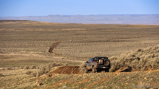
No one else for miles.
After putting several miles between myself and the craters, I came to a fork in the road that was also the site of a modern day watering trough for the cattle. No longer - it seems - do ranchers use big tanks or reservoirs to water the cows, instead it must be more cost efficient to have a fleet of water trailers that they simply haul to-and-fro, bringing out a new (full) one and hauling back the exhausted tank to refill. Smart solution, if you ask me!
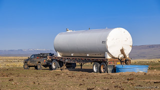
Of course the Tacoma could pull that.
And with that, I dropped down the side of the canyon towards what - even without knowing the name - I expected would be one of the highlights of my day.

Well, that looks promising, doesn't it? 

A butte on the way down.
Now, I'd added this section to the route simply because the road existed and seemed to make its way into a hard-to-access part of the canyonlands. After adding it, some satellite and internet research suggested that there were a few interesting places I might visit along the way. The one I thought I had no chance of seeing - simply because it was 1000 vertical feet from the nearest point of the road - was a series of petroglyphs down by the Owyhee River. I haven't previously seen many (any?) petroglyphs in the Owyhee's, but I can only imagine that this must have been a popular place with the Native Americans, given the river as a water source and the vast grazing lands that are home to deer, elk, and a plethora of other animals.
As I continued my descent, I was contemplating the hike down to the river to see the rock art when I noticed a faint side road leading the direction I wanted to travel. Could I be so lucky? I followed the windy road to find out. And sure enough, as I reached the end of the road, I found myself in an area near the waypoint I'd marked on my GPS; I got out to take a look around.

Clearly a petroglyph. Of something.

I was excited to find this anthropomorph.
I walked around the sandy beach looking for more glyphs, but the few I'd found already seemed to be the extent of the cache. Strange actually, given the vast numbers of dark rocks in the area, and what clearly seemed to be an ideal "camp" site. So, I climbed back in the truck and headed back the way I'd come, admiring the geology - it reminded me of Chalk Basin - as I navigated to Hole in the Ground.
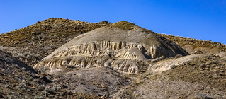
Like an enormous drip sand castle!
Having already made it most of the way down, it wasn't long before I reached the main attraction - for me - of Hole in the Ground: an old homestead, hidden between a bluff and the river. And, it was in strikingly good condition - at least on the outside...

Hole in the Ground almost looked inhabited.

The main home.

An older building; for ranch hands, perhaps.

The inside had clearly seen better days, and been ransacked over the years.

A boot. Obviously.

The rockwork on the chimney, and the keystone it contained, was clearly a labor of love when it was built.
I spent a good twenty minutes or so poking around the homestead, opening various doors and wondering how life here must have been. Great in some ways - the surroundings were lovely - but harsh in others - the surroundings were unforgiving - I'm sure.
Looking at my map, I noted that the road continued on for another couple of miles, to a place marked only as "Owyhee Rock Dam." Curious as to what that could be - as there's no way there would be a dam across the Owyhee River at this point - my curiosity got the better of me and I set out to see what it was. I didn't make it far in the Tacoma - the road got narrow and quite sloppy about a mile before the dam, so I gathered up the camera gear and headed out on foot.

Headed upstream to the rock dam.
By now, it was getting toasty out - by far the warmest day of the trip - but I still pushed myself to make good time, since I hadn't expected a hike at all, and these two miles (plus photos at the end) would add something like an hour to my itinerary. Of course, it was probably a little more than an hour, as I stopped along the way to take photos of the interesting geology along the way.

What is this green sphere embedded in the rock?

Another one, but different.
When I reached the rock dam, the name was immediately clear. A lava flow had blocked the river at this point some time in the past, creating a dam of rocks across it. Must have been quite the event when the dam failed - if it was a catastrophic failure - letting water rush down toward what is now Hole in the Ground, Birch Creek Ranch, and Lake Owyhee!
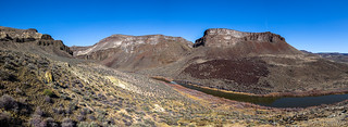
The lava rock on the far bank, remnants of the dam.
Also at this location was a bunch of man-made paraphernalia, which I initially thought was also part of the dam. I soon realized however that it was completely unrelated - it was the inlet for an irrigation system used at Hole in the Ground.

This concrete and metal system of walls and valves allowed water into an aqueduct system.
I'd noticed what looked like a canal along the side of the road as I'd walked out this direction, but couldn't imagine what it'd been for. It must have been to water the grazing and growing fields at Hole in the Ground, though even now I'm a little confused as to why they built such an elaborate system - it must have taken years - as oppossed to simply taking water from the river as it flowed by the homestead. 
Whatever the reason, my curiosity as to what lay at the end of the road had been satisfied, and I headed back to the Tacoma, ultimately making my way back up the bumpy route to the lip of the canyon. There, I was greeted with wide open tundra and a snowy Steens Mountain rising up in the distance!
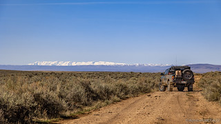
A local landmark. It's Steens Mountain.
With my early start, it was still only 11:00am a this point, but I was already hungry for lunch and started looking for a place to make a sandwich and enjoy the every-warming desert around me. I was once again on an unnamed road, as far from pavement as possible, making my way towards Miller Lane when I found the perfect overlook of the Owyhee Canyon at which to open up the ARB fridge and satisfy my stomach.

I pull up to a break in the seemingly flat tundra.

Owyhee, Oregon's Grand Canyon.
So great was the view that I decided the best course of action was to grab a bag of chips and an apple and just go sit on the edge for a bit before I set about making a sandwich. It turned out to be one of the most pleasant twenty minutes of the entire trip, the water roaring by - silently - some 2,000 feet below.
In time, I did make my sandwich, consuming it at the same overlook, another twenty minutes of magnificent silence interrupted only by a crow flying overhead.
Refueled, I got back on the trail, making my way south now - toward the town of Rome - to a few more potential overlooks I'd marked for the trip.

I've arrived at the edge, again.

The gracefulness of Steens Mountain, contrasted nicely against the badlands of Owyhee.

I was being watched, by a lifetime supply of dinner.
With one more long foray to the river's edge to investigate, I spent only a few minutes at the various overlooks, the miles of trail between them, deceiving in their pedestrian appearance.
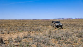
Nothing to see here; Owyhee is boring. Might as well go somewhere else.
Eventually, I reached the road I hoped would take me once again down to the water - for my final time on this trip, but to what appeared to be a glorious overlook and potentially spectacular camp site. Even the initial views from Bogus Ranch Road were promising, and I could feel myself getting excited to see what lay ahead.

"I wonder why they call it 'Bogus Ranch Road'?" I found myself wondering.

Views to Chalk Basin.
Unfortunately, my excitement was short lived. As I approached a small section of private land - through which the road passed - I spotted a gate. Usually not a problem, I pulled up to let myself through and was dismayed to find it chained and locked! Not only that, but a second access road was also blocked off in a similar fashion, the land owner clearly wanting to keep folks off their land.

Is this Bogus Ranch?

Because this feels quite bogus to me... 
There was nothing I could do but kick up a little dust in disappointment and get back in the Tacoma, so that's exactly what I did. This portion of the trip - which I'd thought might take most of the afternoon, perhaps even into the evening and an overnight camp - had suddenly been cut short. In fact, the only thing left on my itinerary was something I'd assumed I'd do the following morning, just before heading home: check out the Pillars of Rome.
So, I called an audible and headed that way - through a few outlying farms and over a cool old bridge. In fact, I'd say the bridge was the highlight of this section of the trip, the pillars themselves rather unremarkable compared to what I'd experienced even just an hour before!

Anyone crossing this bridge from the south: It's a gateway to glorious!

No need to visit the Pillars of Rome again.
And with that, my adventure was complete. With several more hours in the day, I figured the best use of my time - having seen nearly everything I'd planned and then some - was to simply head home for a hot shower and to sleep in a real bed. The trip to Owyhee's Outback had been a smashing success, and I'd discovered several additional roads along the route which looked interesting to explore.
On a future trip to this wonderful corner of Oregon!

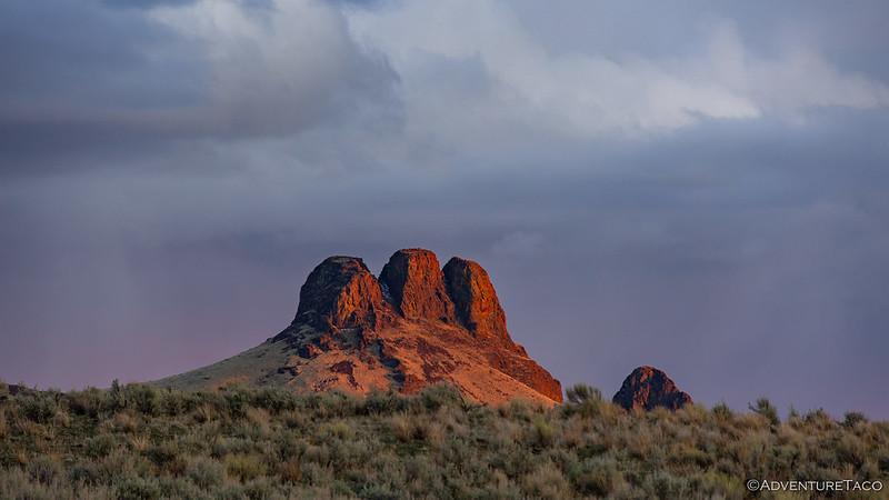

The hole in the ground is the old Morcom place the family was from Jordan Valley, Oregon. Some now live in Visalia, California owning an olive orchard farm, great family.
The white water tank was built by the company I started in the 1980's and sold in 1996.
I love this area, well for that matter all of Owyhee county and Malheur county.
The roads didn't look to muddy so that was a blessing.
Safe travels!
Thanks Kenny! Boy, I'd really love to pick your brain or have you along for a trip - your knowledge of the area would add so much to the adventure.
The roads were pretty good by this point in the trip, and I was happy for that.
I met a family when I was at the overlook where I ate lunch. I forget the father's name, but they were out checking their pipelines and reservoirs for ranching. The son's name was Talus. Very nice family.
I messaged a buddy of mine who lives in that area and the guy you met was Elias Eiguren and his son Talus. The Eiguren family are wonderful folks, I know some of them from Arock, Oregon.
I'd have been all over the pillars of rome. beautiful views and great trip. This sight-seeing on line is making me hungry for some real touch and feel geology and makes me want to pack up and goooo. I think I need a tacoma.......my camry would not like some of those rds. Thanks again for making my day more enjoyable, less boring after a year of mostly isolation. Where we going next??
Thanks Jeannie, glad you’re enjoying! We’re headed to Utah next, in search of old Native American ruins. ?
Another smashing hit...! Your photos are awesome. And you have really gotten the Tacoma pose down...! Keep it coming. Best blog on the 'net!
--Paul
Thanks Paul! This one was great fun, and I've started posting the next one - to explore some of Utah's Native American Ruins - already:
I truly enjoyed this adventure.
Thanks Verlan, it turned out differently than I expected, and yet still just as great as I'd hoped!
Man i need to get out North of Rome and explore! Ive googled earthed it to death. I was hoping you would go down Bogus to the bottom. There is a hot spring across the way and a road that comes to the opposite side of the river. I see the gate that stopped you but looks like you can go to the bluff and skirt their property?
Hey Keith, that road is gated and locked as well. Was the second one I tried in the story. ?
Could you send me coordinates of the second gate by chance?
It’s close to the point you included (and I removed ?) in your original question. Just slightly south. And here is my take on specific GPS coordinates.
Do you have a GPX for that?