The rain did seem to tail off sometime in the middle of the night, and the breeze did definitely continue on into the morning. All of this gave us hope that we'd climb out of the tent to a similar situation as the previous morning - overcast, but mostly dry.
Nope.
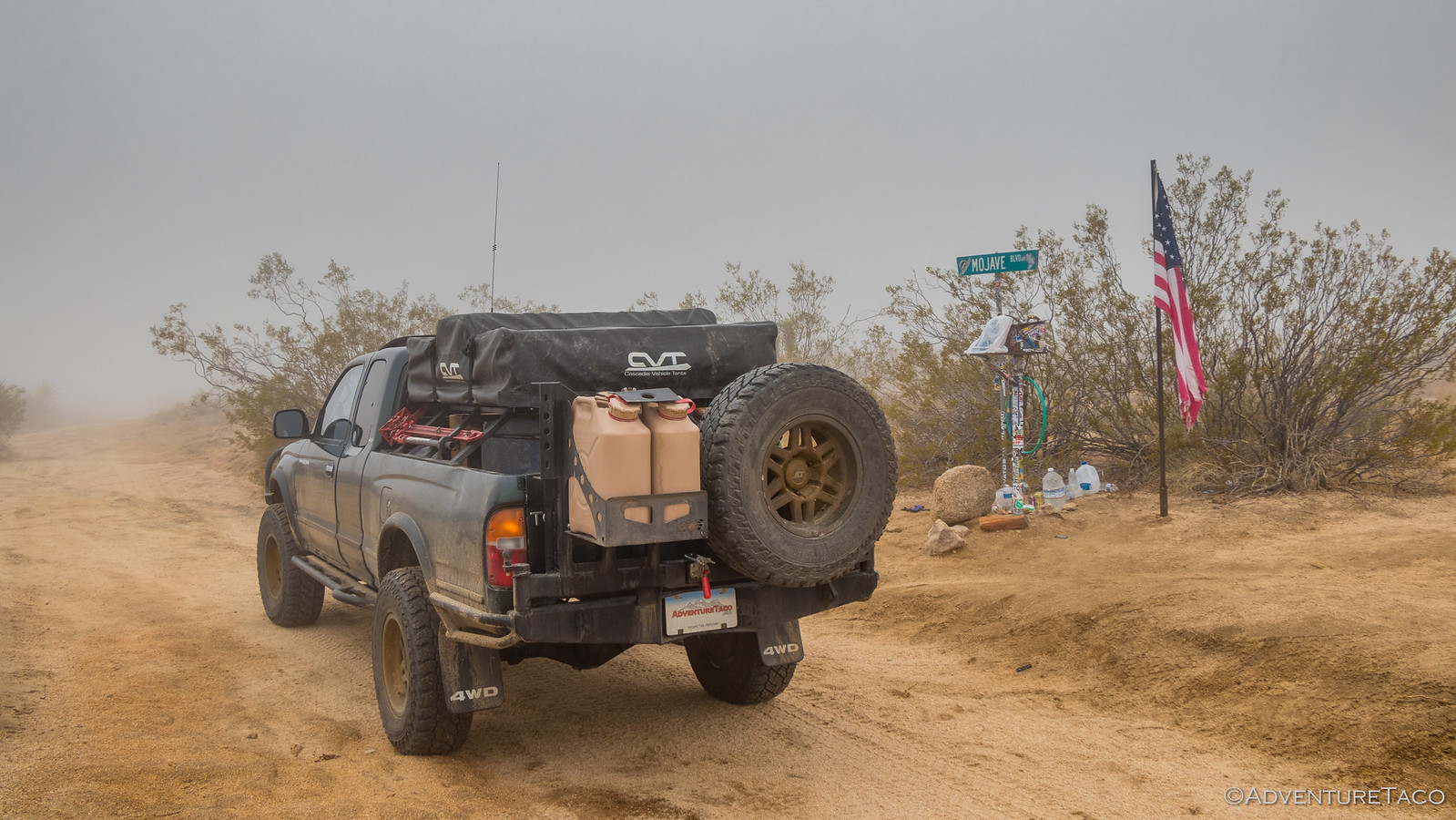
It was overcast alright, but it was also super foggy. I mean, it was a pea soup-type fog that really felt like more of a windy drizzle. The tent was soaked, and we decided that we didn't even really want to eat breakfast it was so wet out.
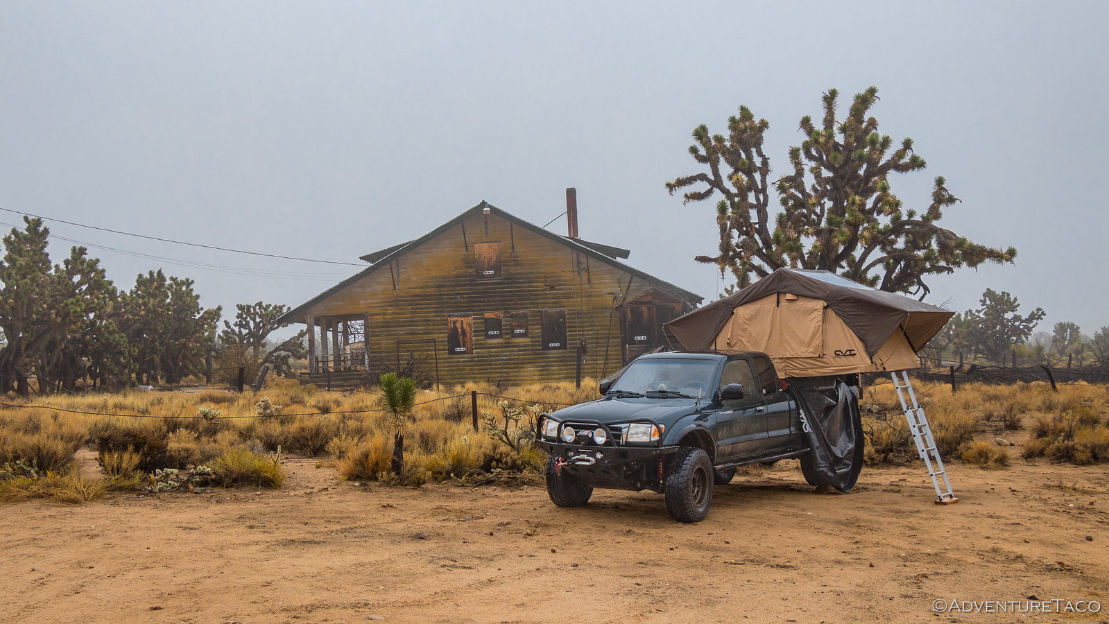
Instead, we decided to take a look around the Death Valley mine, the name alone intriguing enough to warrant a look.
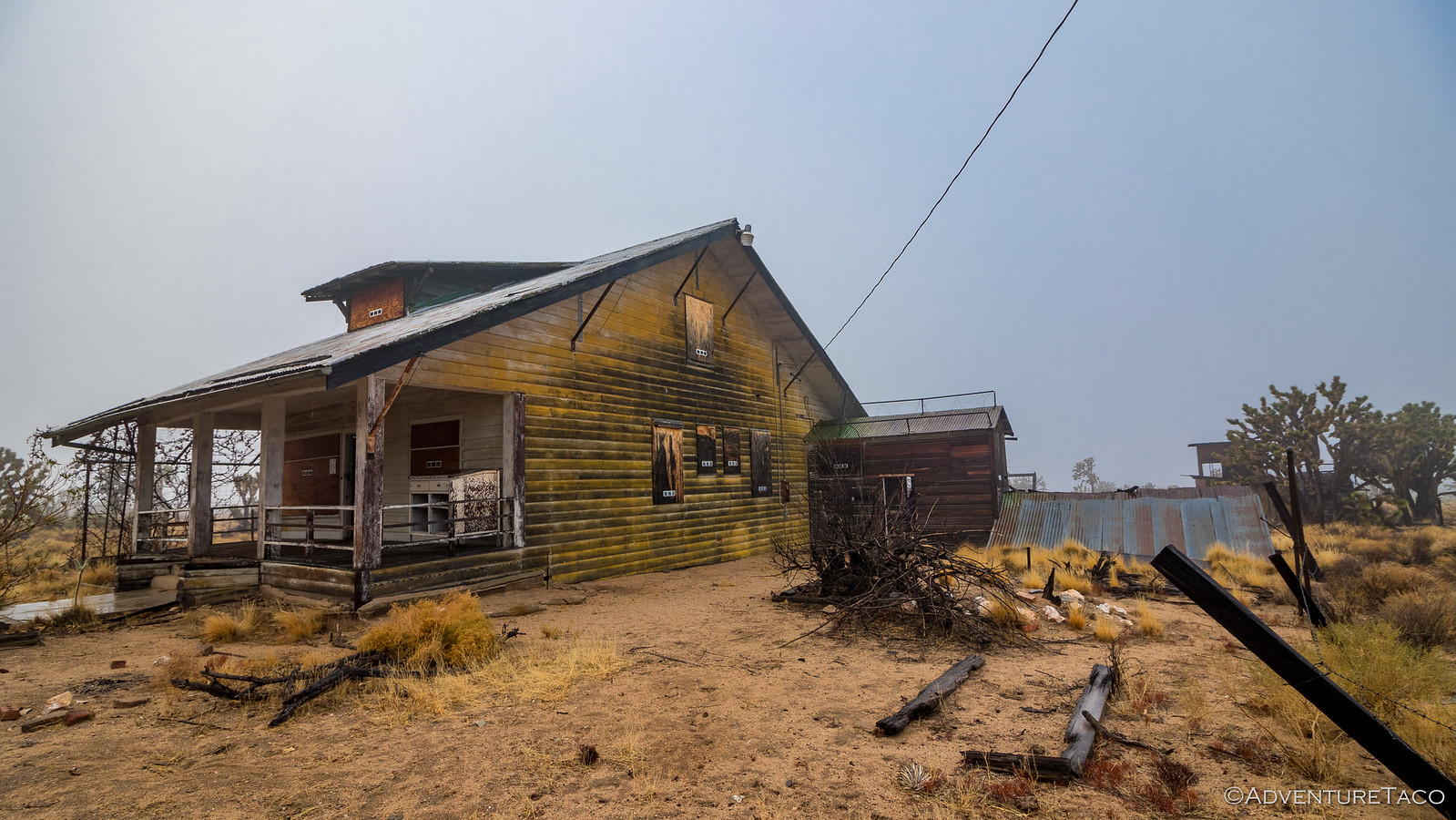
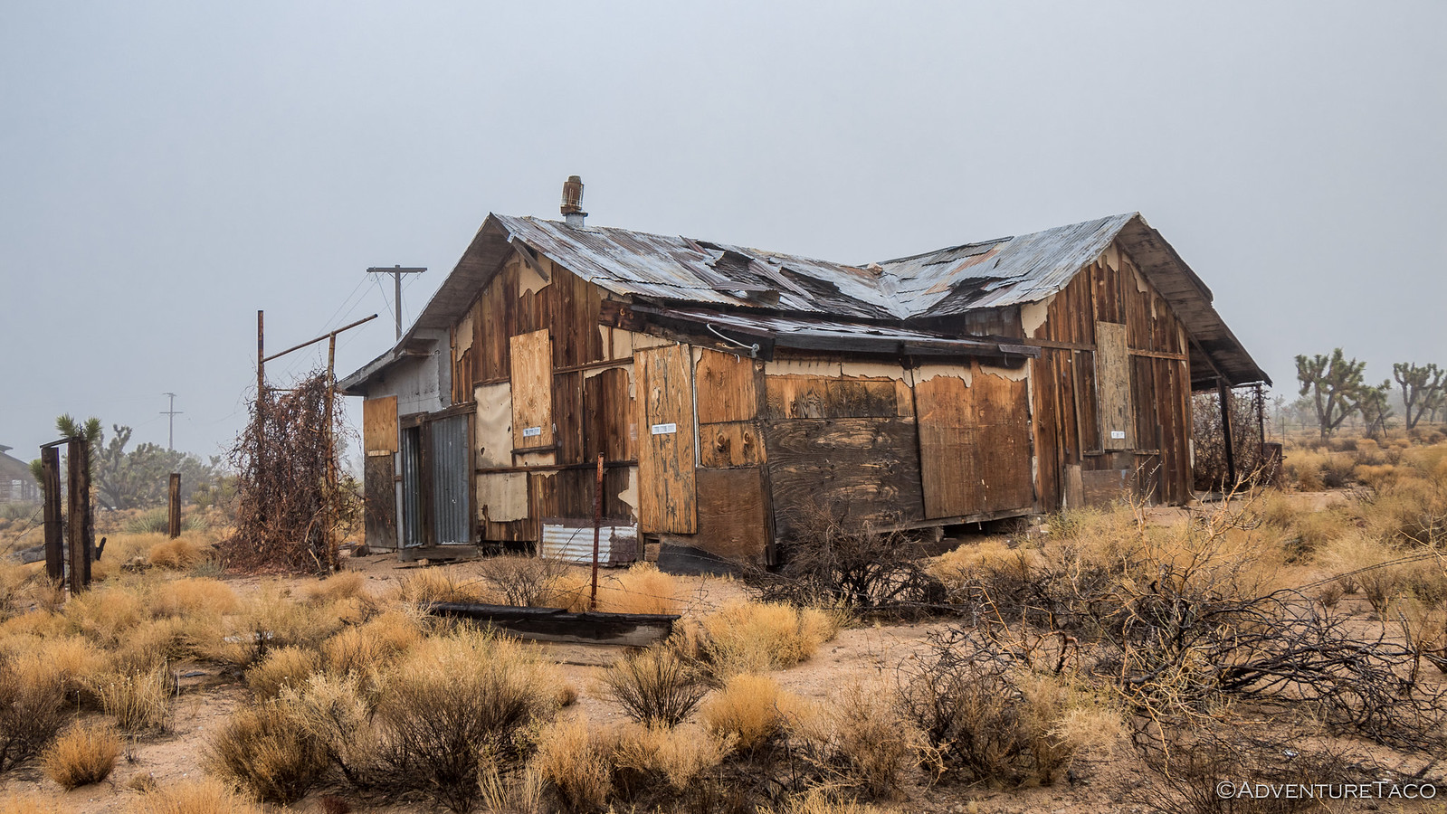
Turns out that the east Mojave Desert didn't have too many crooks, but what it lacked in numbers was made up for by Dawson. A 32-year old gold mining promoter, he started a rumor in 1905 that he'd struck it rich in Death Valley in a place he called "Hidden Hell." He ran ads across the country promoting the discovery of a mother lode and sold some 2 million shares, despite the obvious absurdity of his story. In need of an actual mining operation to keep the share price up, he purchased a mine established in 1906 by J.L. Bright, which he promptly renamed the Death Valley Mine. The fact that this mine wasn't even a gold mine didn't worry Dawson one bit - the fact that the mine was now, miraculously producing a bit of silver as well, an added benefit!
In September 1907, Dawson and his brother ran off with the proceeds of the 2 million shares, and the mine fell into disrepair. It spun up again in 1915 by the Strawn family, and run until 1921 - but produced only $38,000 of silver before shuttering once again. The mine got one more chance in the 1950's, but as much of it had already been gutted, not much more came out of it at that time.
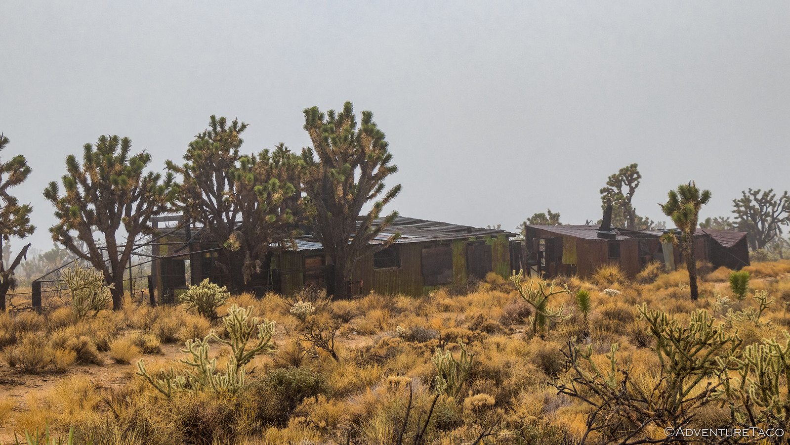
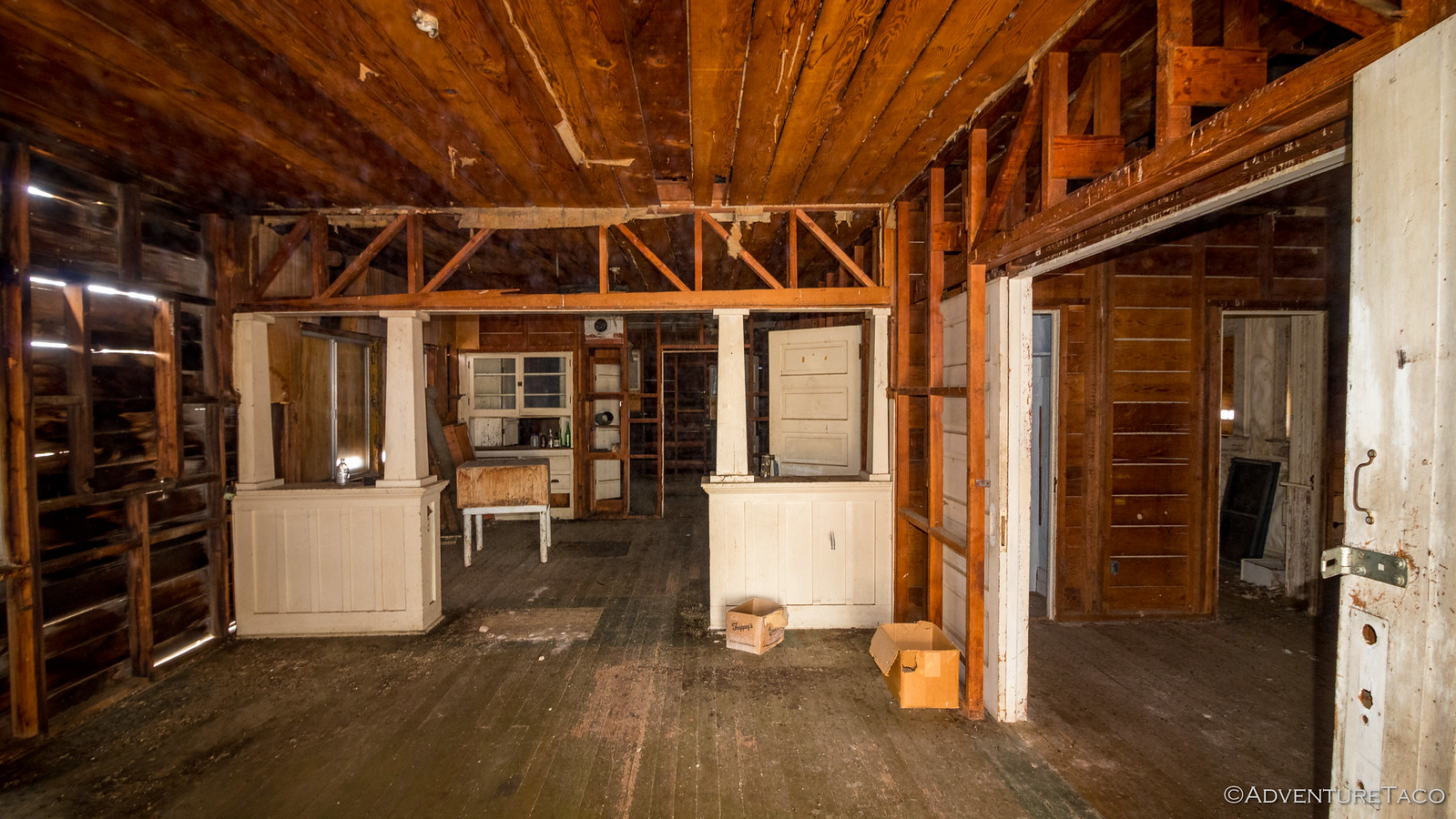
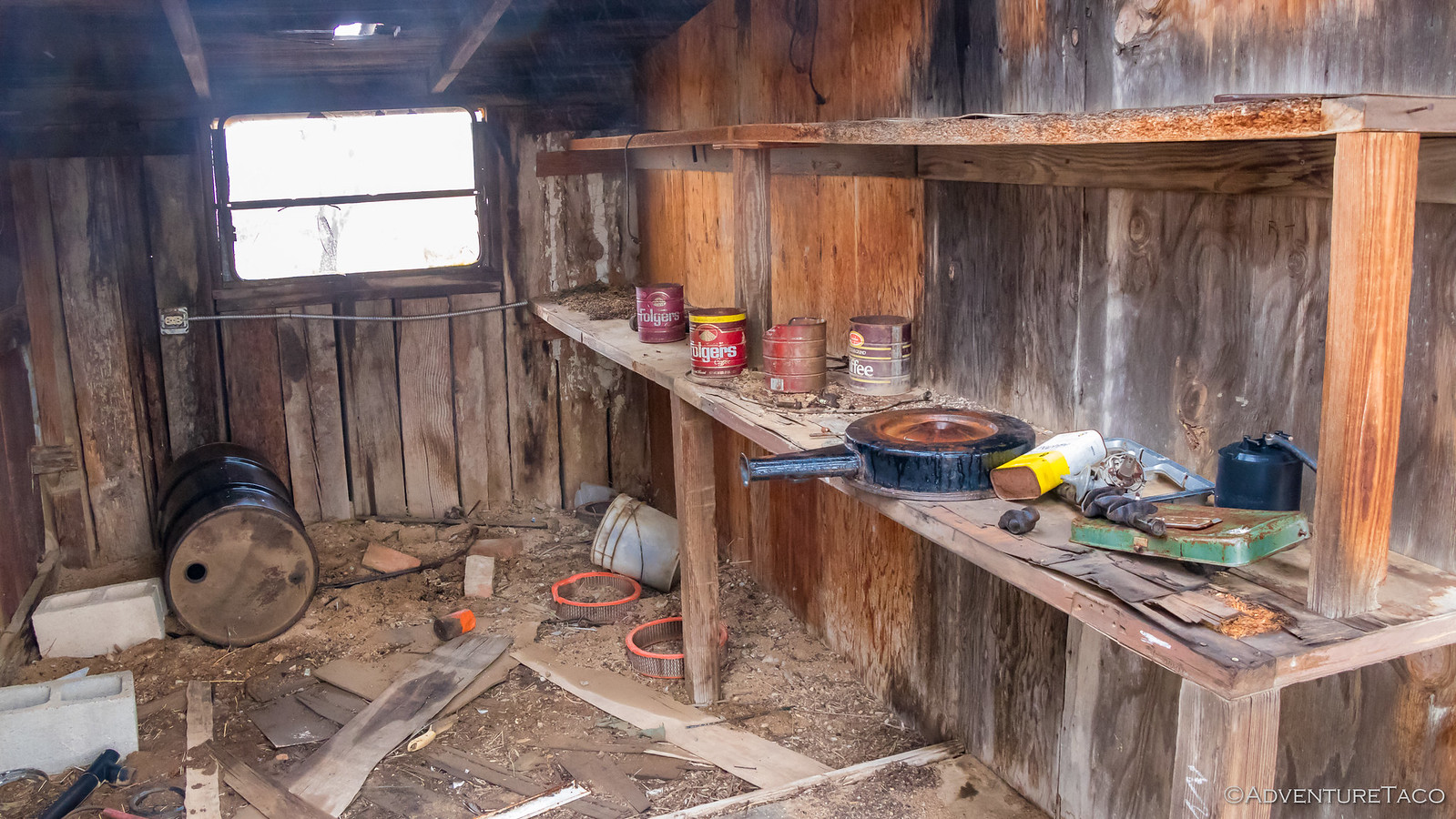
Since the mine fell into disrepair only relatively recently, many of the buildings are still in reasonable condition. The main house still sheltered from the road behind a screen of Joshua Trees; grape and melon vines growing on trellis' that covered attached porches.
The interior too was in relatively good shape - the roof still protecting the contents from the brunt of the weather.
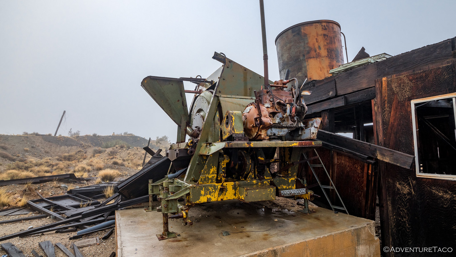
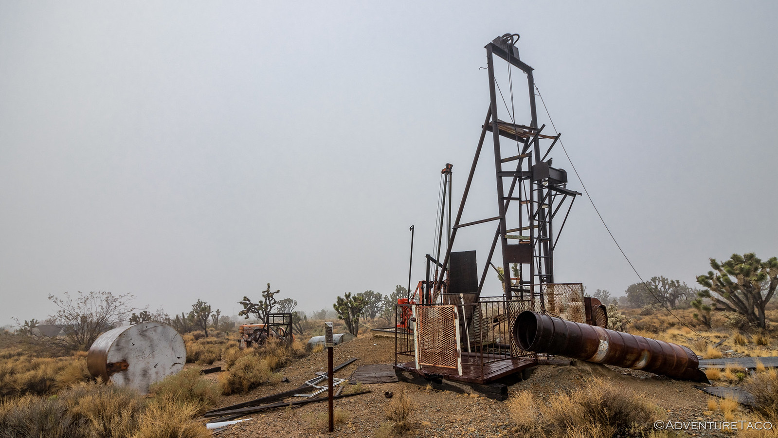
Having once employed upwards of 100 men, nearby the main house were several structures that clearly supported mining operations. The remains of an old (and barely used) 10T stamp mill, miners quarters, a workshop, and a second house were all nestled in the surrounding landscape.

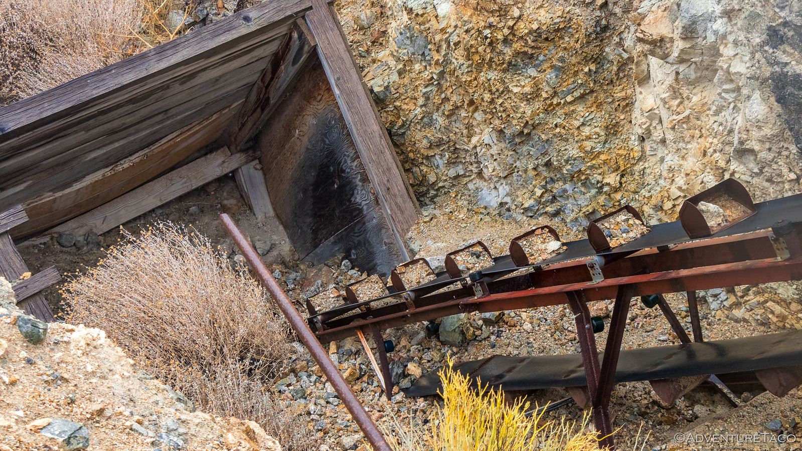
While it was clear that some minor excavation and mining had taken place around these structures, the majority of the mining clearly happened several hundred feet to the northeast where tailings surrounded both a 30T ball mill and a bucketed conveyor belt used to pull ore from deep underground.
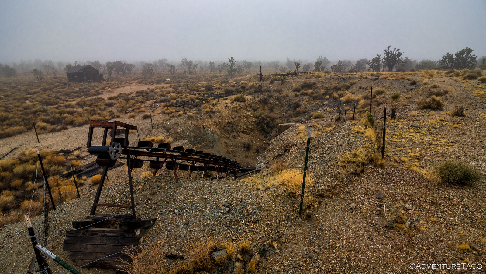
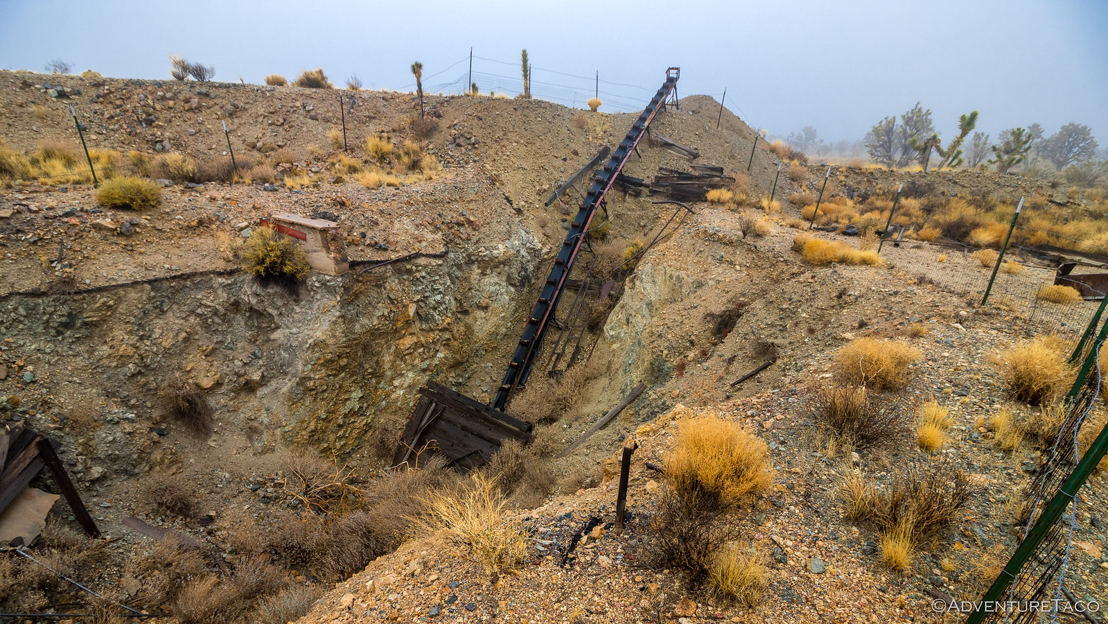
But it wasn't until the very end of our exploration that we discovered what we'd read to be the main shaft. Apparently several hundred feet deep, pumps were required to keep water out and since they've ceased operation, only the 30 feet closest to the surface are visible.

This was definitely a place that would be fun to explore again in better weather - many details likely still waiting to be discovered. For now though, it was time for us to get a move on - we had plenty to see today if it turned out to be anything like the day before!
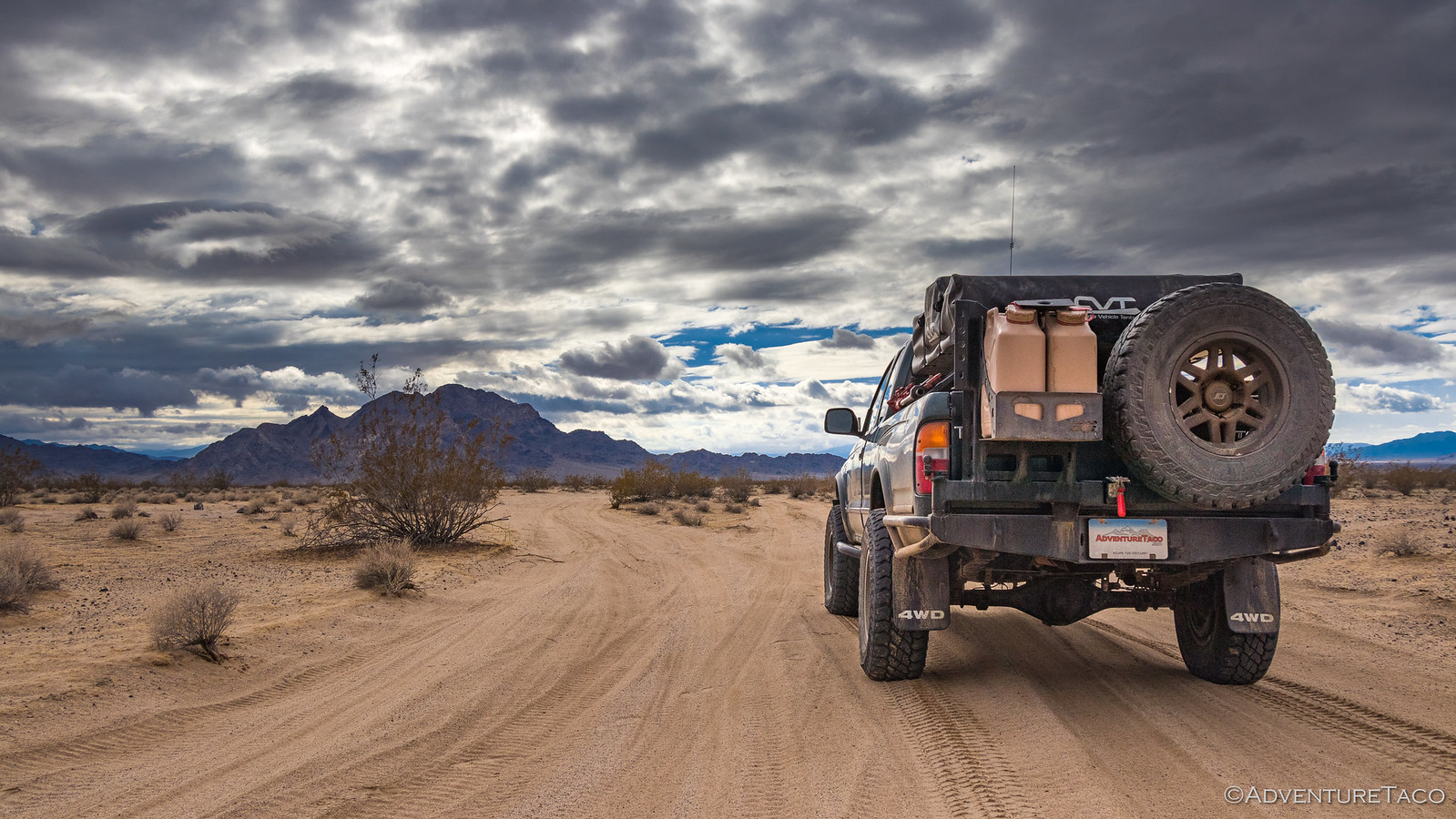
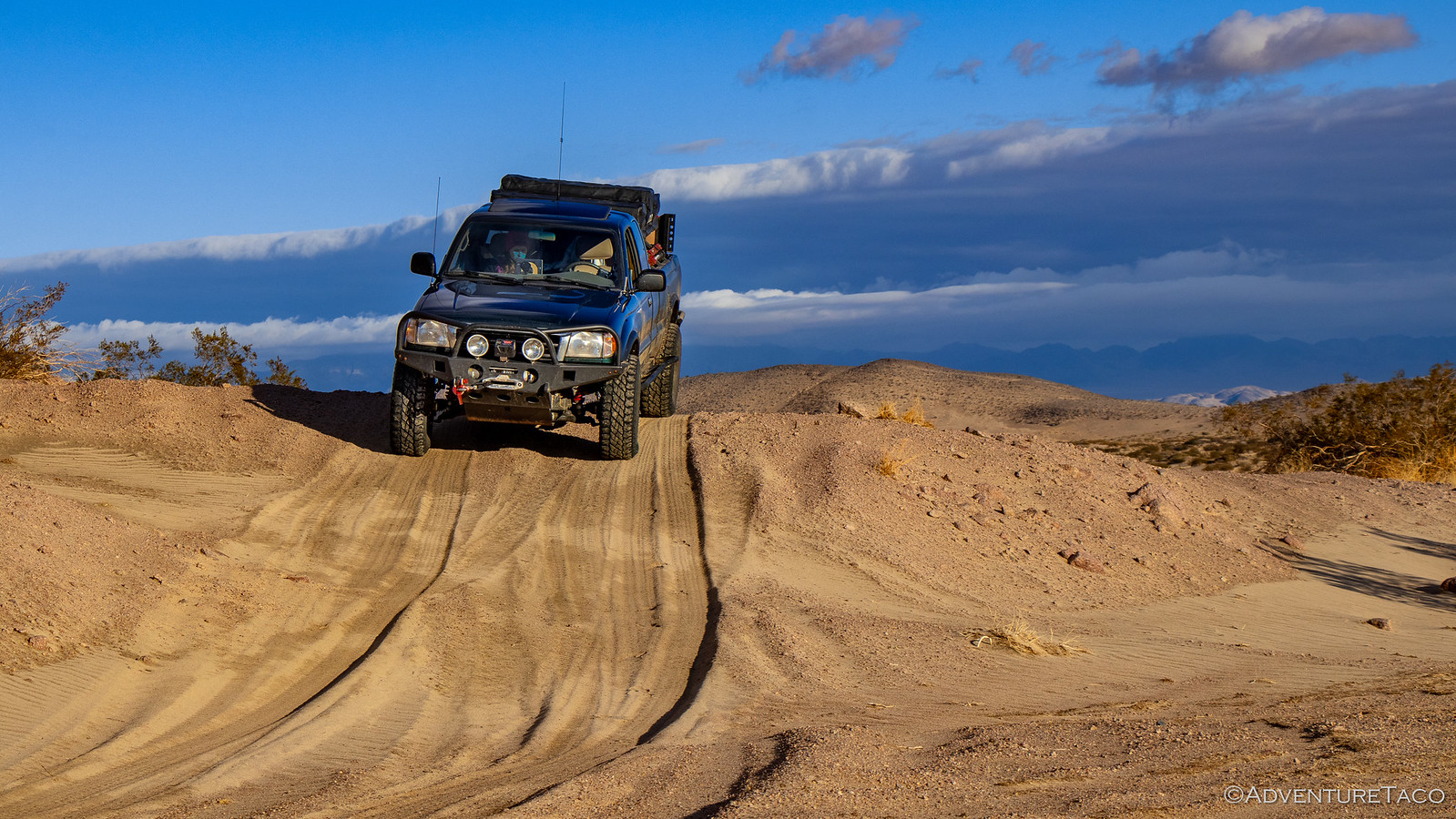
So we put away the tent wet and headed back the way we'd come the night before - only this time in daylight. To our surprise (and delight), before long the fog and clouds started to clear - or rather, we realized that it was only the area in which we'd camped where there was a thick pea soup. Lucky us.
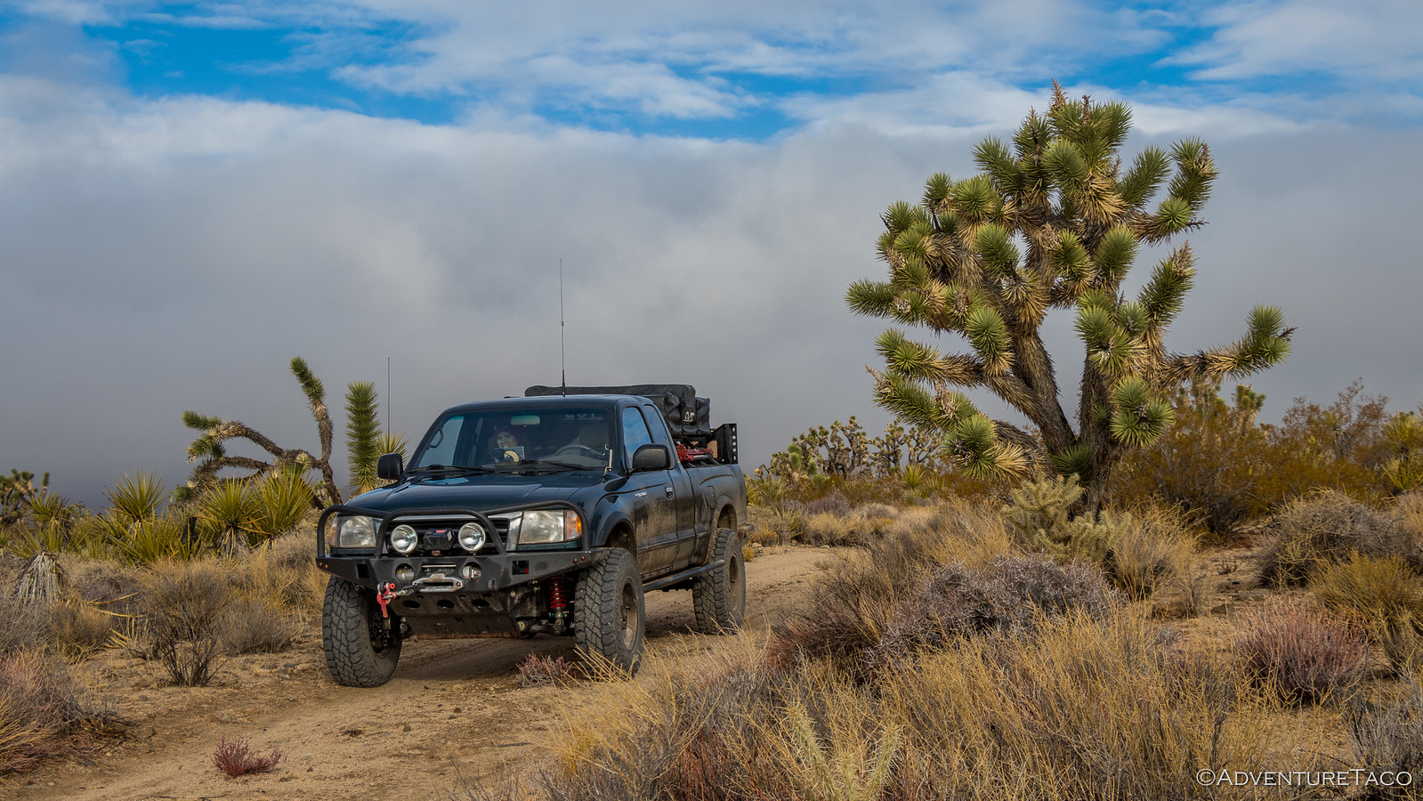
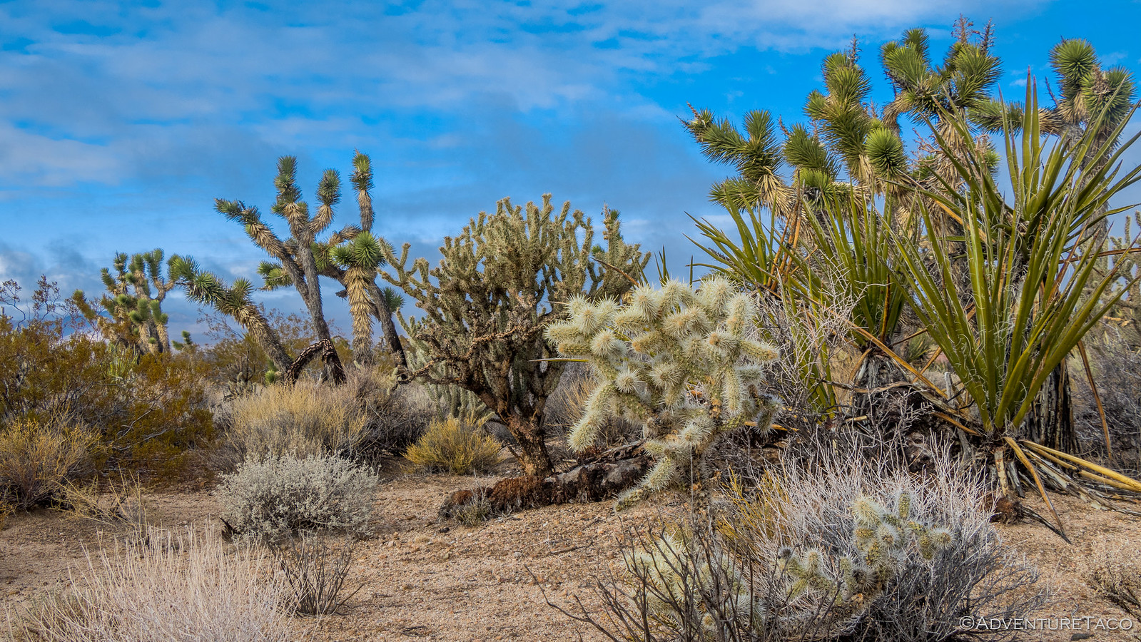
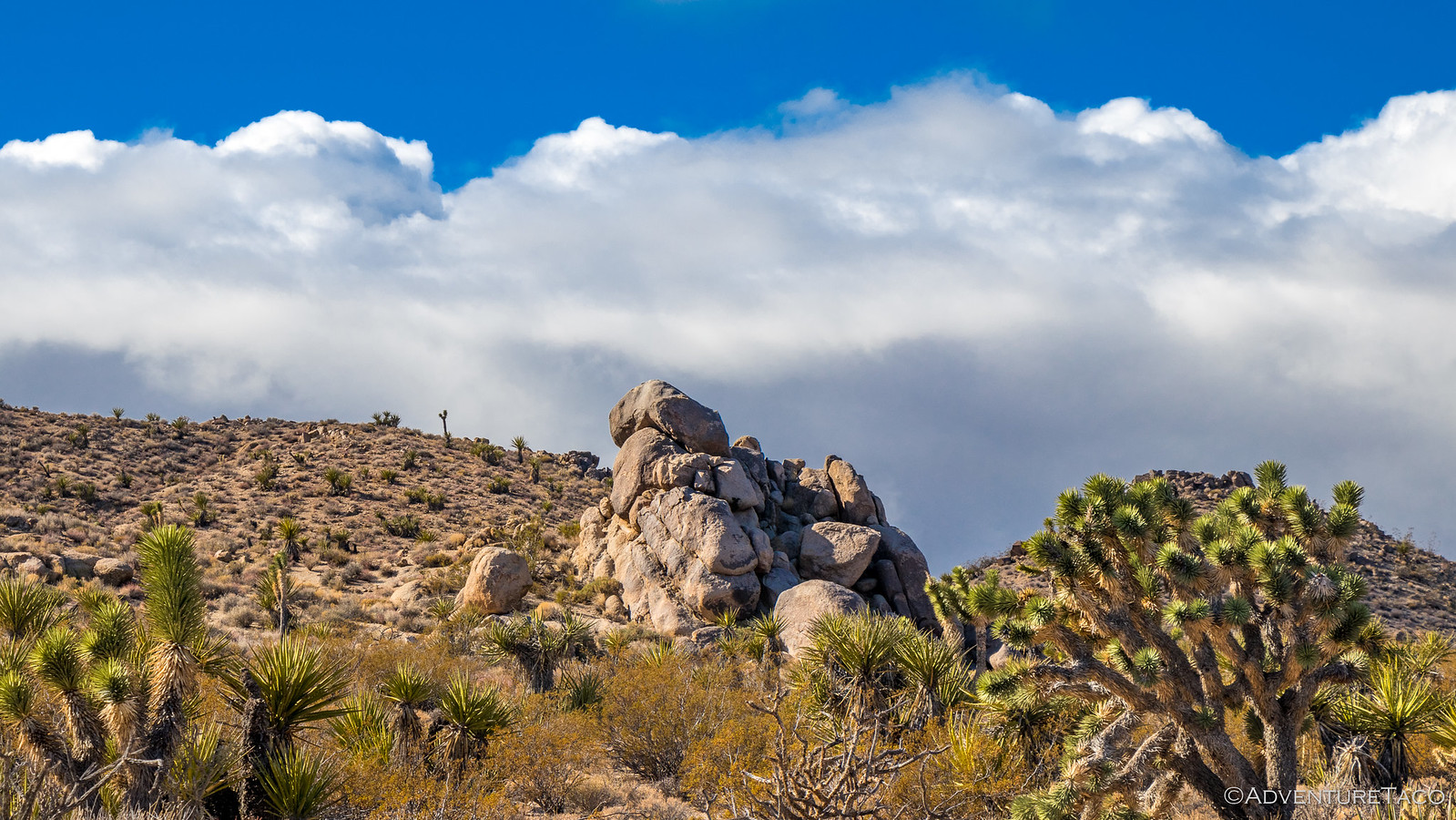
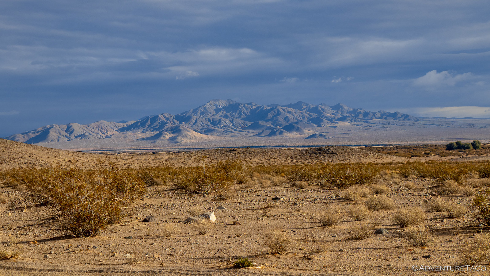
Regardless, as the skies turned blue and the sun broke through, we agreed that the surrounding landscape was the most beautiful we'd see on the trip - the vegetation various yellows, greens, and blues; their crazy shapes dancing against the sky.
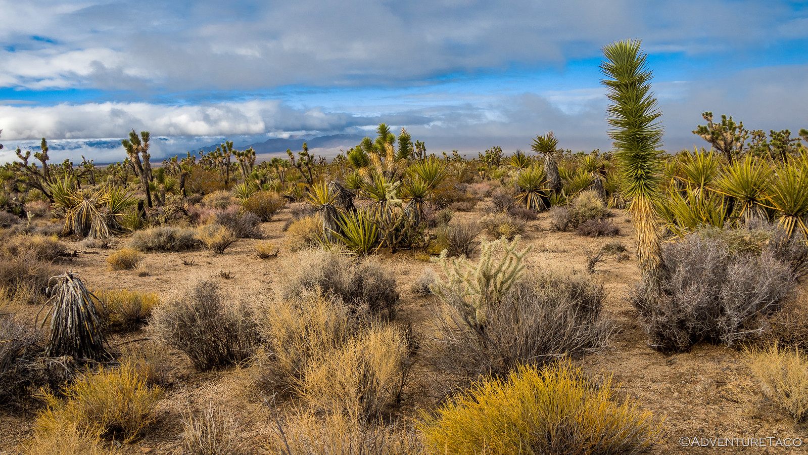
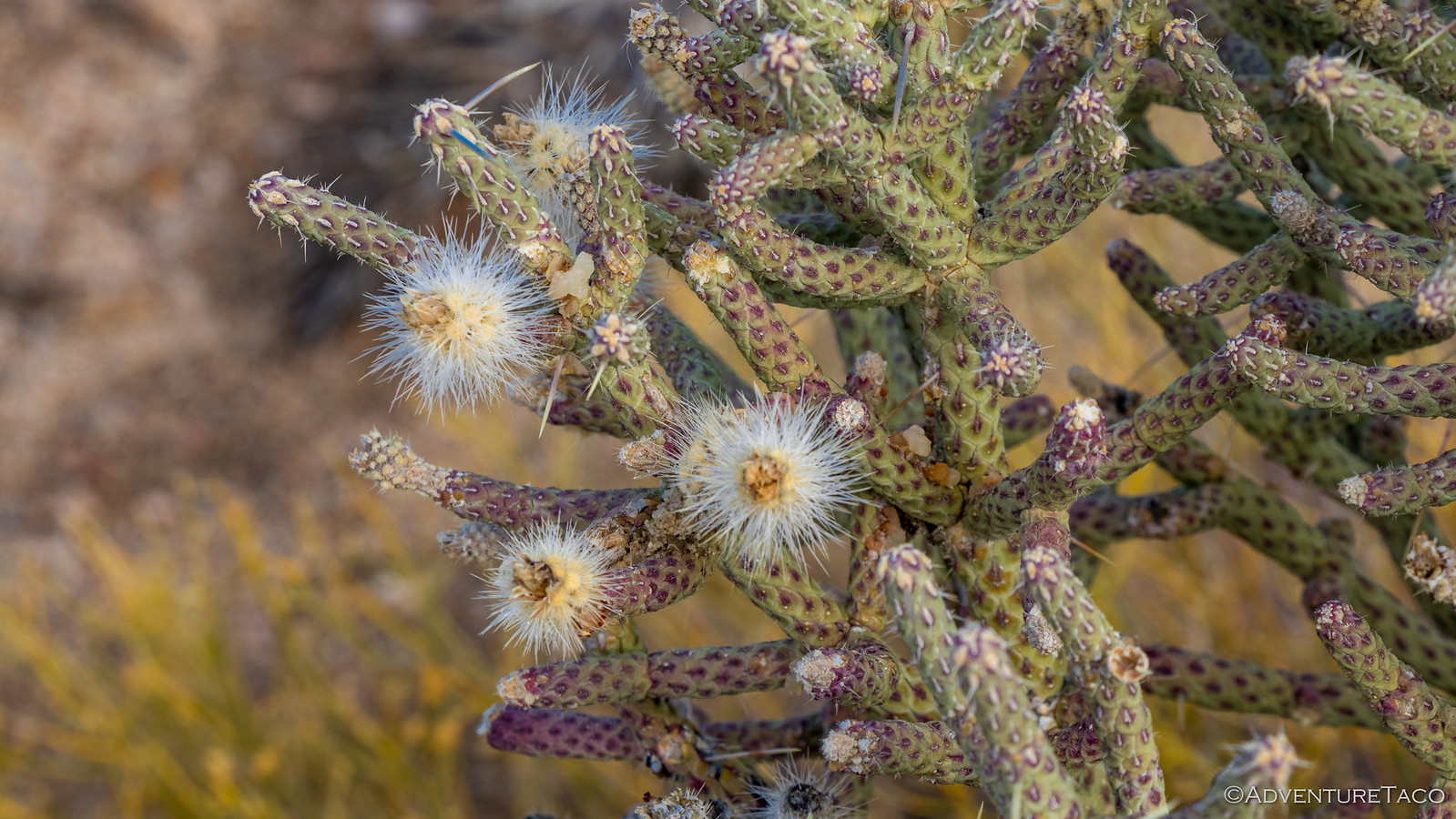
This too was the only place where we'd see three types of chollo cactus growing together - the segmented branches covered with spikes ready to jump out at passers by.


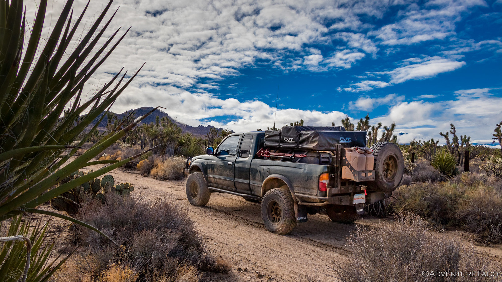
Having skipped breakfast we were getting hungry and decided that once we were back on the Mojave Road, we'd look for a good spot to open up the tent (to dry it out), get our meals for the day prepared, and eat breakfast. And, though we were initially surrounded by a Joshua Tree forest as we turned onto the road, we could see it meander into the distance - giving us confidence that it wouldn't take long to find a suitable spot.
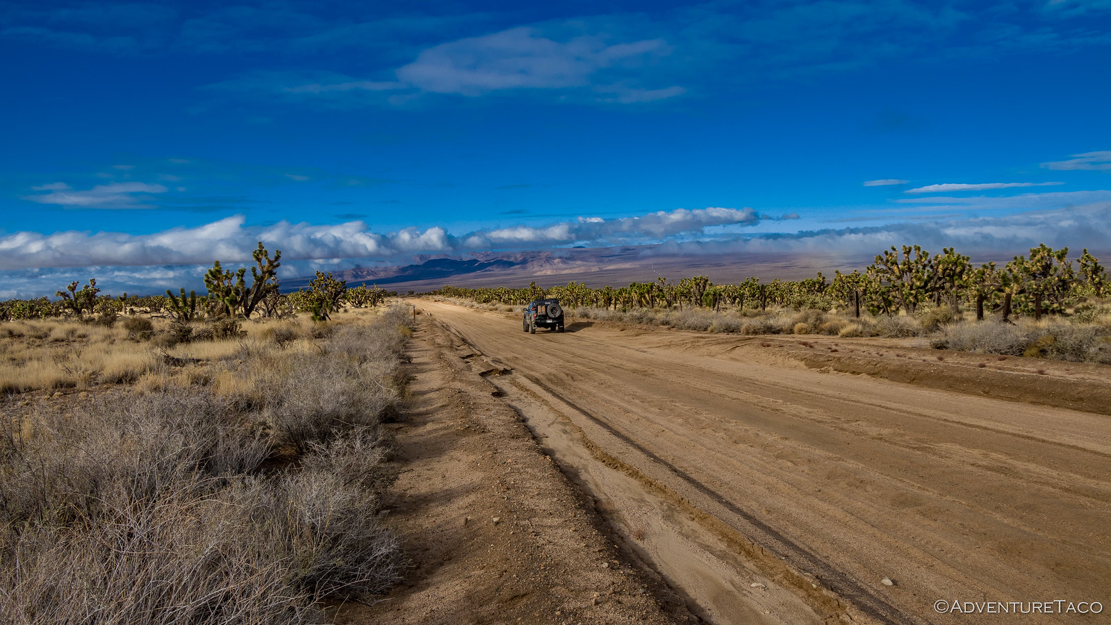
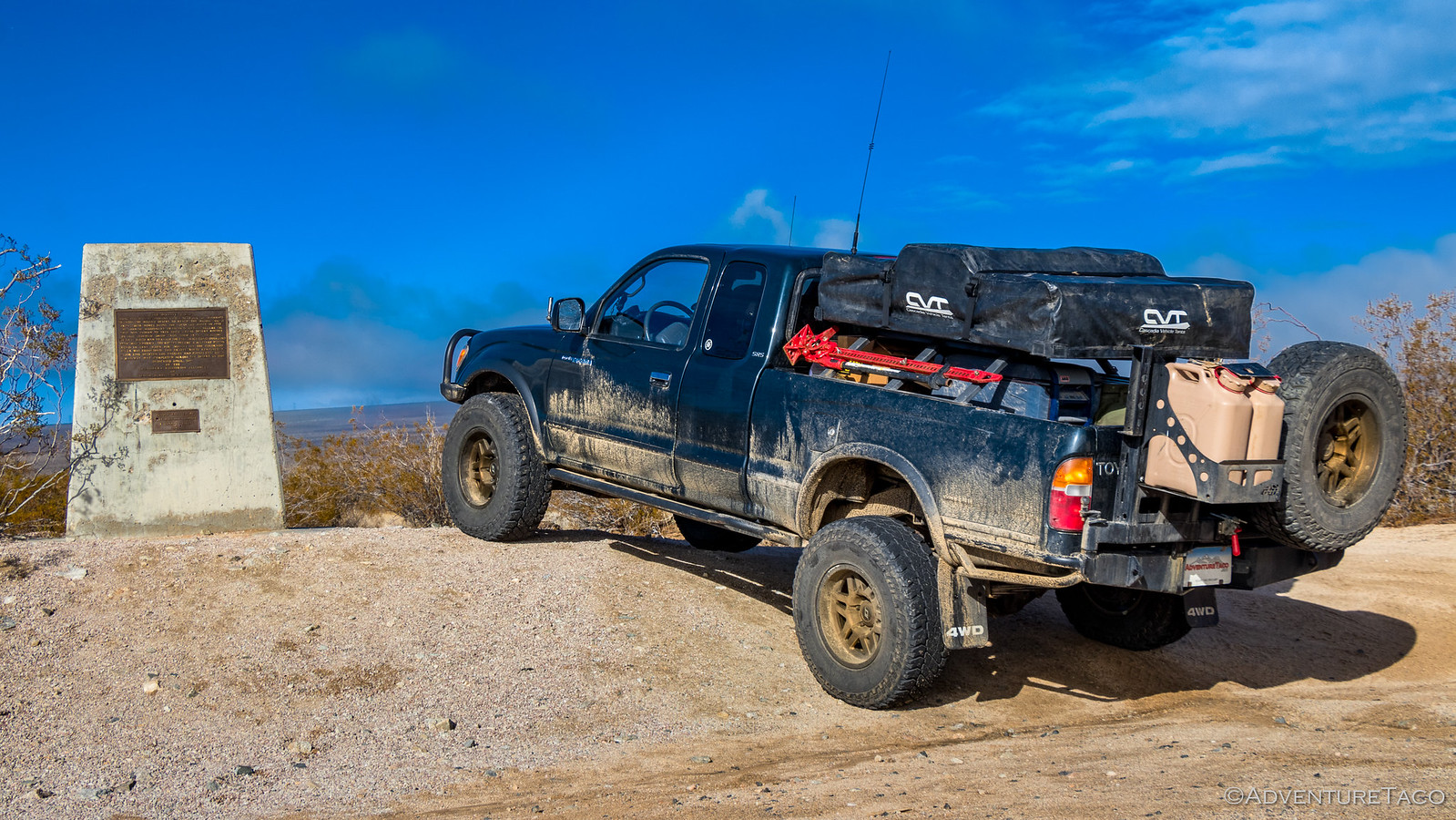
It was just as we crossed the Kelso-Cima Road that we found a good place to pull over. Just past a Mojave Road plaque, the Joshua Trees had thinned dramatically and we had an amazing view of the Beale Mountains in the distance. In direct sun and with a reasonable breeze we couldn't have asked for a much better place to eat a late breakfast!

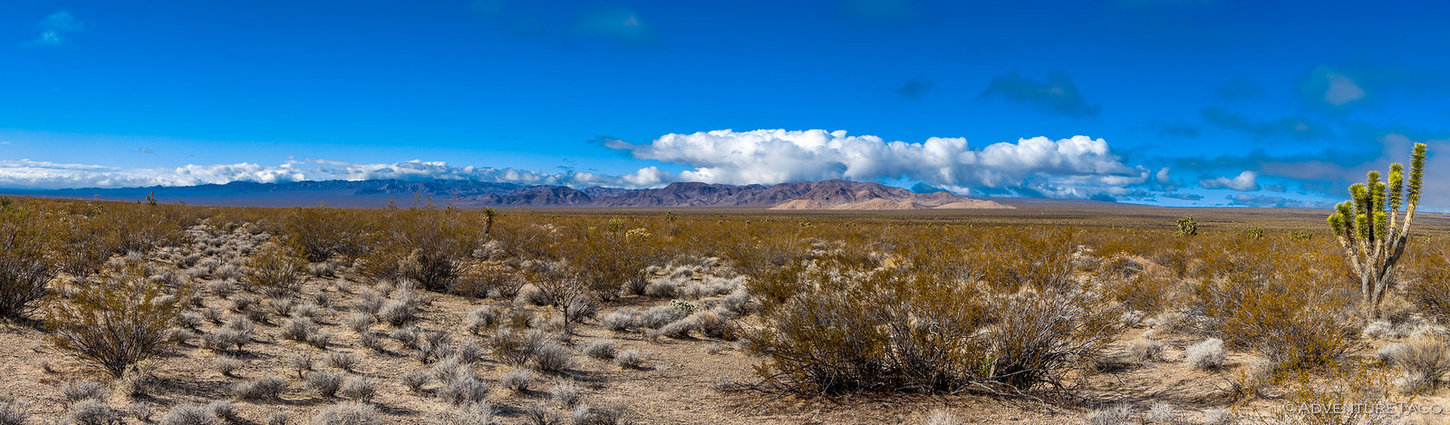
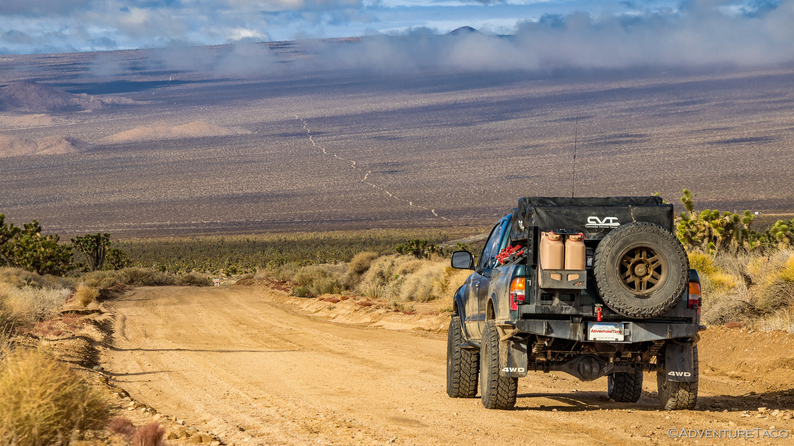
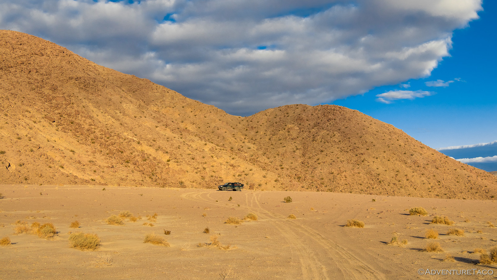
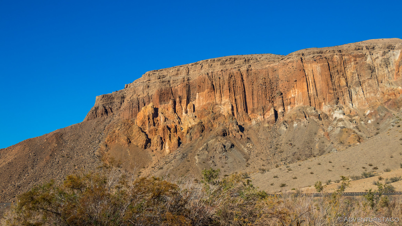
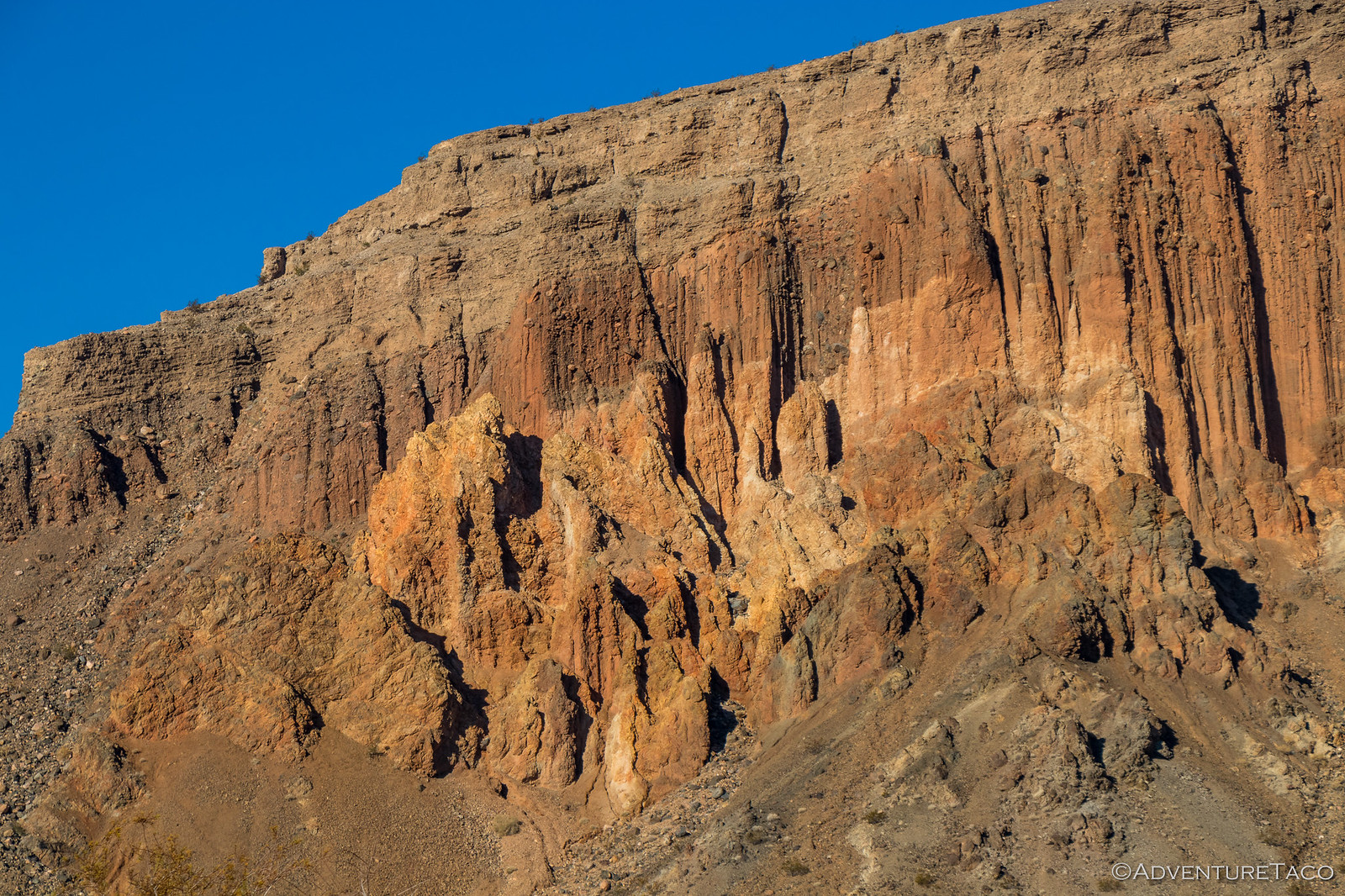
Our bellies no longer grumbling, we continued on towards the Beale Mountains - the road a continuous series of "whoops" that kept our speed low, especially with the rear shock situation. But we eventually reached the Beale Range - it's rocky construction different than the others we'd seen so far.

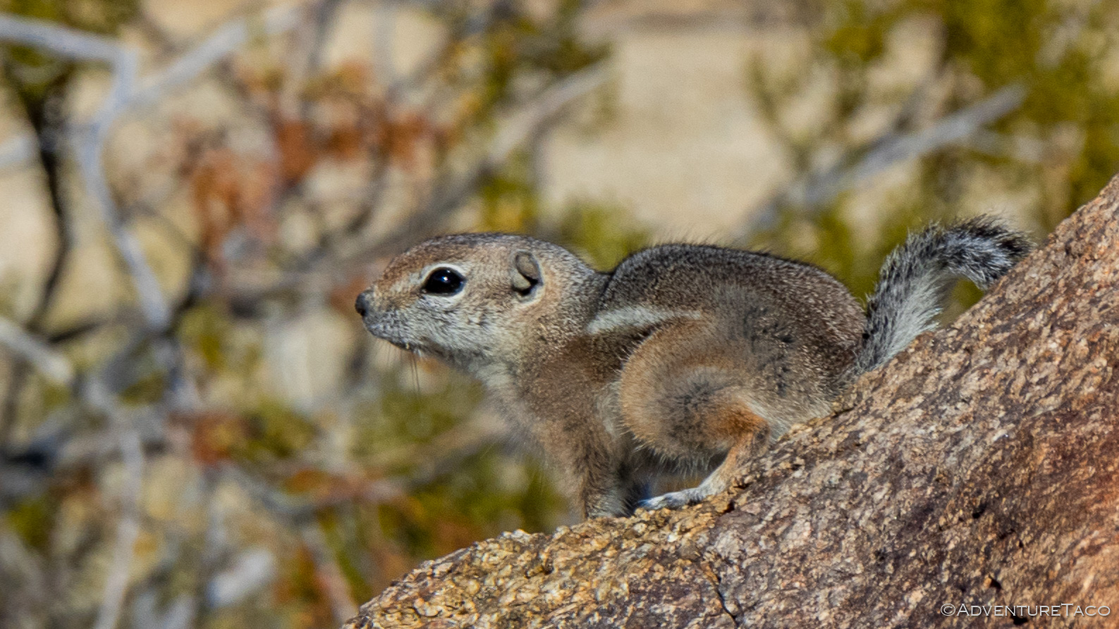
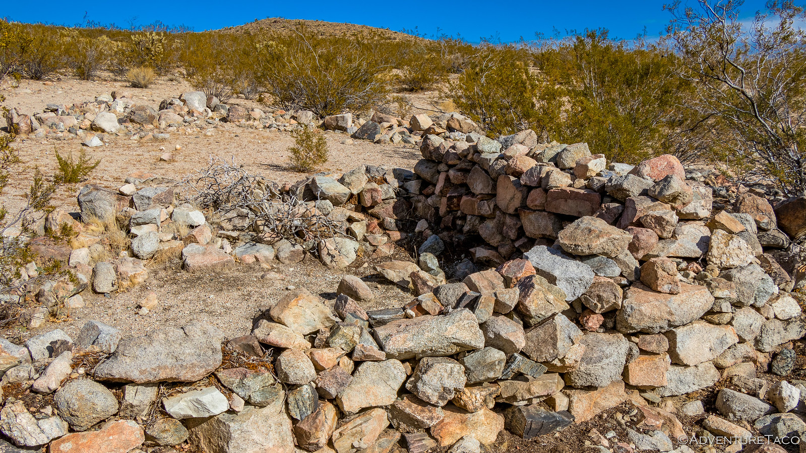
Making note of a few nice looking camp sites we continued on - the road once again full of whoops as we crossed the next valley towards Marl Springs and the Marl Mountains. Perhaps expectantly, any spring in an environment like this is likely to have an attempted civilization around it and Marl Springs was no different. Now just a low stone wall, it was clear that someone had tried to make it here for a time - who and when likely lost to history. A chipmunk now calling this area home.
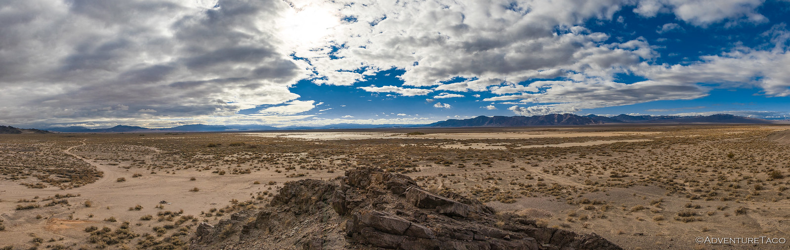
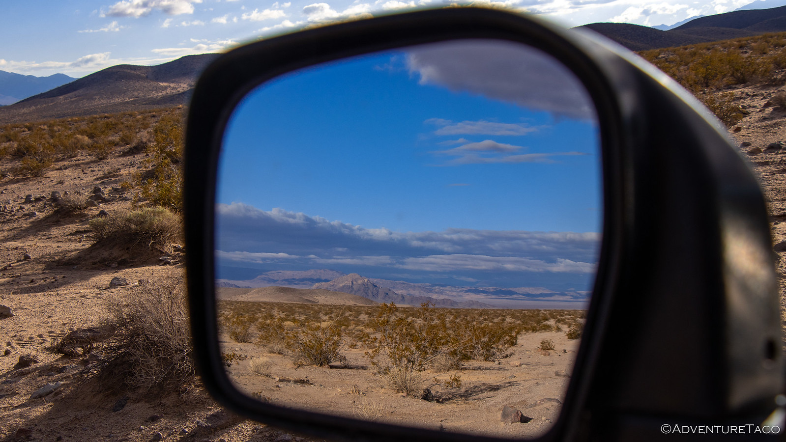
And then, as we crested the Marl Mountains - a dramatic change. The sun we'd so enjoyed was suddenly gone - a huge bank of fog pushed up against the western face of the range. I stopped the truck and tried to capture the transition.

The fog quickly became pea soup and limited visibility of all but the closest objects; though this time - thankfully - it was not accompanied by a heavy mist.
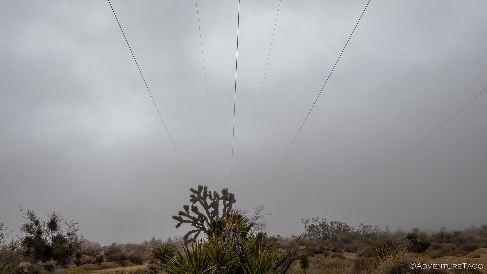
Bummed to be socked in, we continued on - hoping that any moment we'd pop out the "other side" of the fog to dramatic and amazing views of the desert valley in front of us. Alas, as we came upon the Mojave mailbox - something I'd been looking forward to probably more than any other waypoint, it was still foggy and glum - as it was through the cinder cones on the way toward Soda Lake.


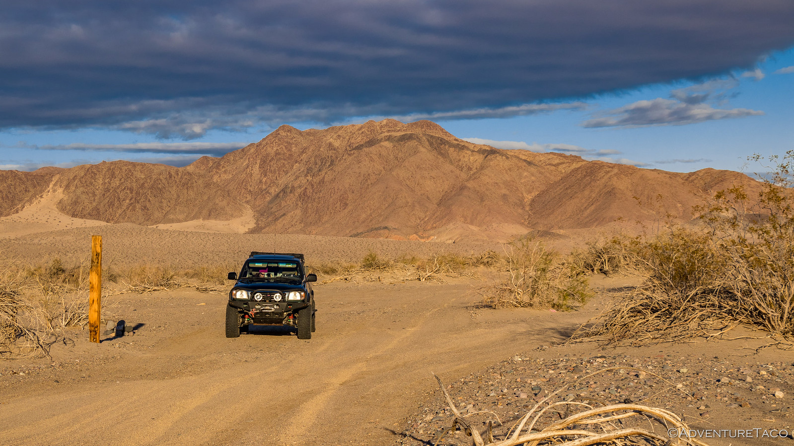
But then, as we put a bit of distance between us and the Marl Mountains, the fog began to lift again and the sky began to clear - the road, once again, stretching into the distance.

It was at this point we had a decision to make. We knew we weren't going to be crossing the Dry Soda Lake bed given the rain that had fallen in the last 72 hours - the surface is muddy and treacherous enough that even in ideal conditions it's best to tackle with two or more vehicles in order to effect a recovery if the lead vehicle should get stuck. But we didn't know if we should take the nicely paved Kelbaker road into Baker or whether we'd find a more fun dirt trail closer to the edge of the lake.
Perhaps predictably, we opted to try the later - after all, even if we didn't find anything suitable, it'd be more fun and we'd get to see Cowhole and Little Cowhole Mountains, the latter of which was largely covered in sand.
Seriously people, you named a mountain "Cowhole" and thought it was a good enough idea that you'd do it again? 
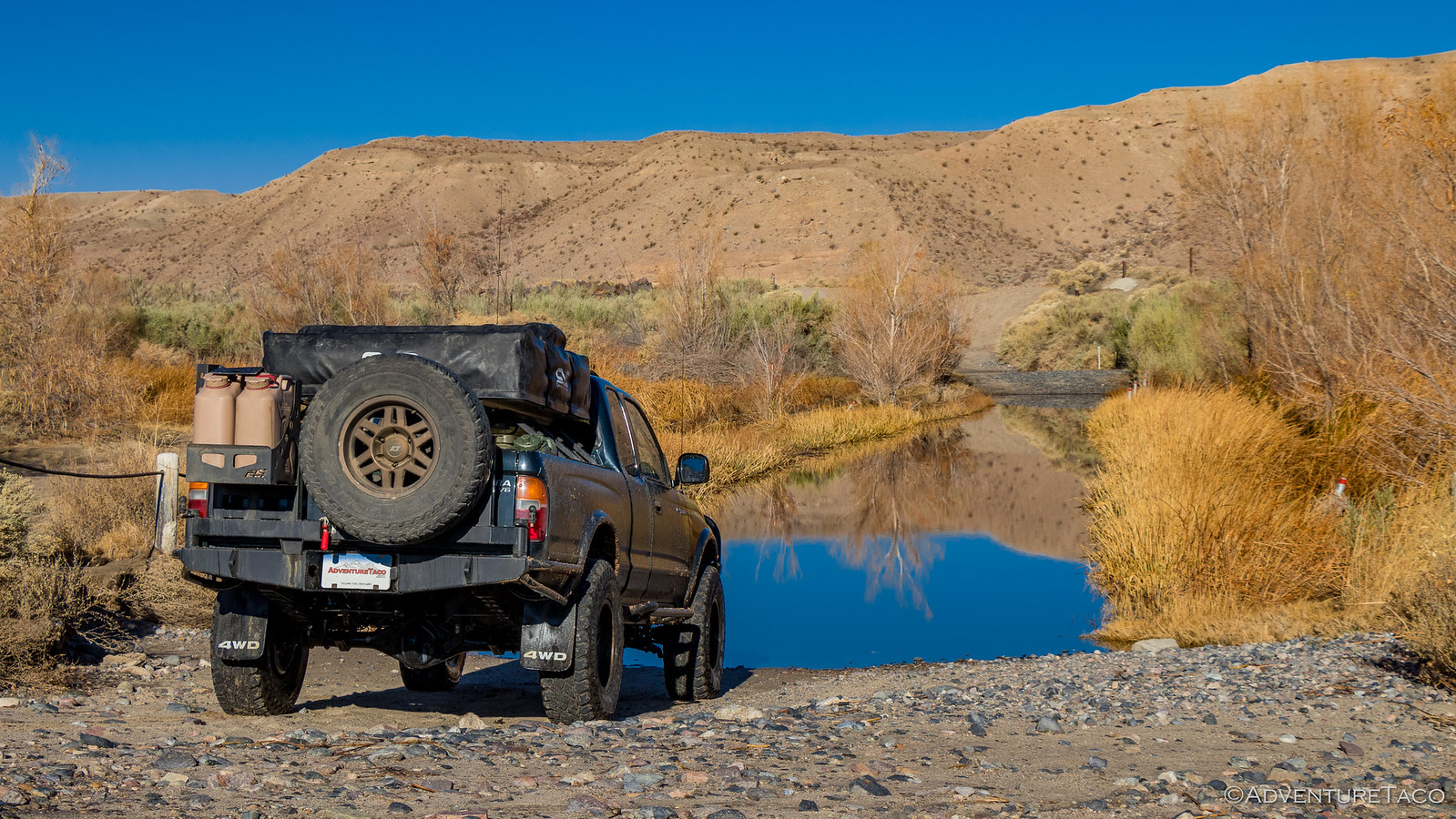
The two Cowhole's were essentially the gateway to the eastern edge of Dry Soda Lake and upon discovering ruins of the Green Rock Mill near the base of Little Cowhole, we decided that this would be a great place for us to eat lunch and get a view of the lake bed to the west.

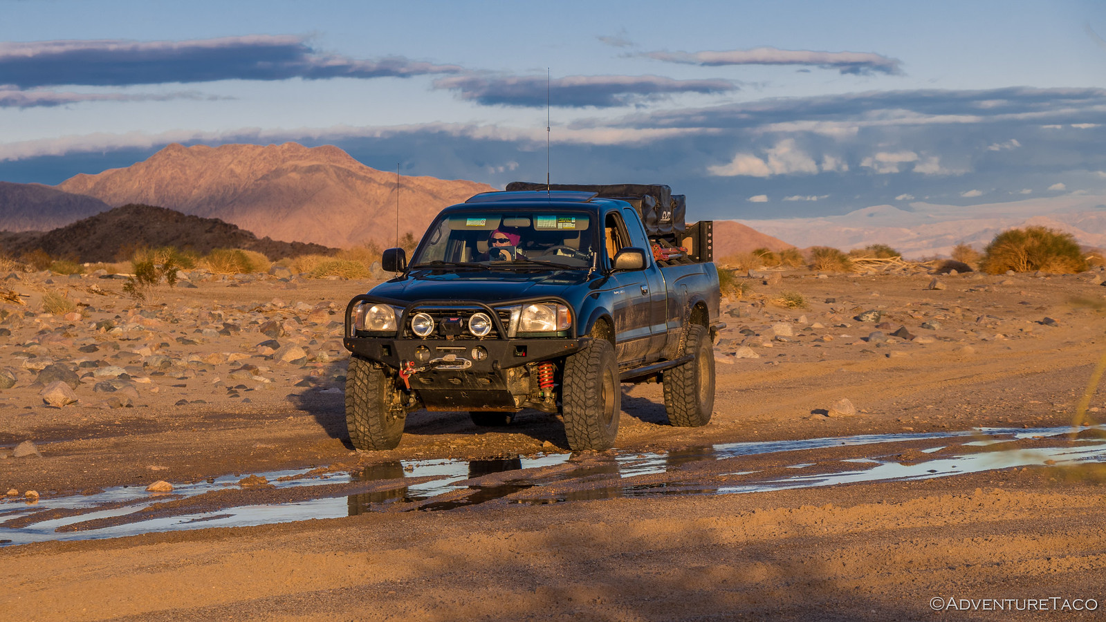
Already nearly 2:00pm, lunch was quick and we headed north on a road that our map suggested skirted the lake - thereby avoiding the muddy danger. Even so, the road did take us perilously onto the eastern edge of the lake bed, and we were careful to maintain speed and investigate especially-wet-looking areas before proceeding.

Of course, you're reading this so everything turned out fine and within half an hour or so we'd made it to Baker, CA and I-15 West, which we traveled for a few minutes to the Rasor Road exit, just past the town with perhaps the coolest name ever: Zzxzy.

Now, Rasor Road it turns out is the entrance to an OHV (Off-Highway Vehicle) park and so as we made our way back to the Mojave Road, it was clear that there was a lot of traffic out here. Roads were 100 feet or more wide, and UTV tracks zipped off into the desert nearly everywhere. But it was still beautiful - Old Dad Mountain rising up in the distance.
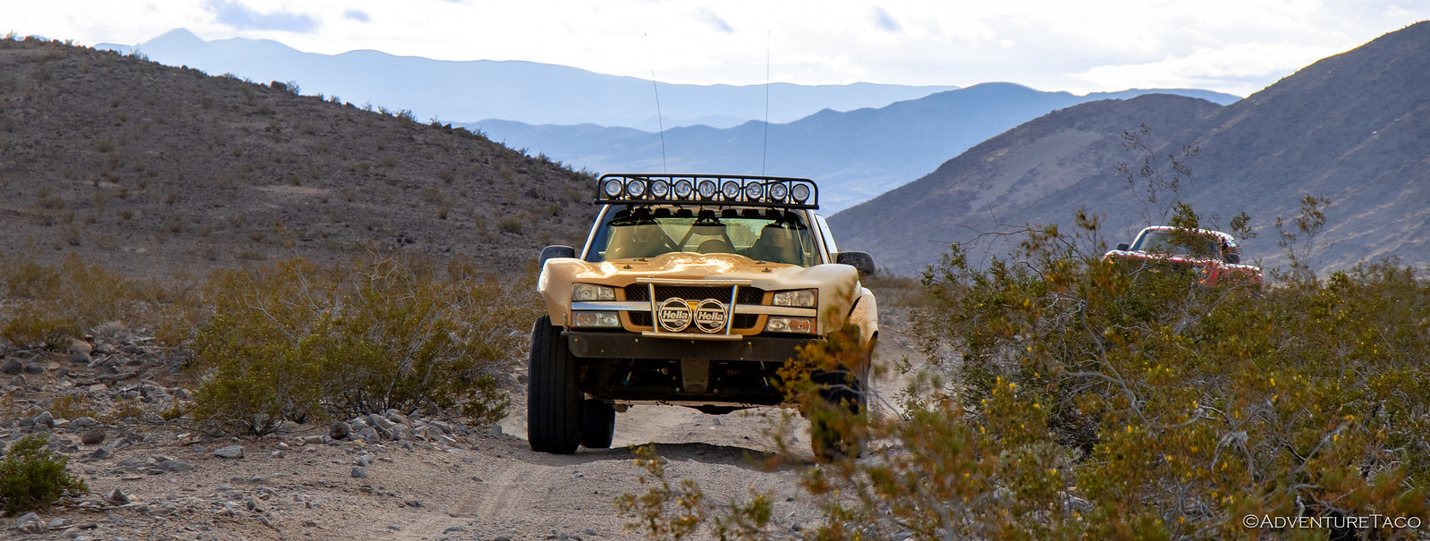
Rasor Road eventually met up with our route and just as we turned west toward Shaw Pass, a group of 10 long-travel Ford and Chevy PreRunner's came barreling towards us. I'd be lying if I said it wasn't pretty cool. Of course I can only imagine what tires like that do to your truck in the mud, so there's still no way that's in my future - my tires are already an inch further out than I'd like!
We were now on the western-most section of trail, and the part that @mrs.turbodb's guidebooks had described as "deep, soft sand," that required "skilled driving" to "not get bogged down." All I can say is that this was the nicest section of road we'd driven all trip. The sand was firm and the driving was easy - no chance at all of bogging down.
Time to update that guidebook.
With all the OHV traffic, the hardest part of this section was finding and staying on the trail as it wound its way up a mile-wide wash towards Afton Canyon. Luckily for us, a group of Jeepers who have adopted the Mojave Road placed cairns and large wooden posts every several hundred feet along the official road - so for the most part we were able to stay on-trail through this section.
As the afternoon turned to evening, we found ourselves at our first crossing of the Mojave River. I'd mentioned to @mrs.turbodb before the trip that there was a somewhat famous water crossing at the end of the trail, and when she saw the state of the river here, she was quick to ask whether we'd even be able to ford it at all.
I hoped that wouldn't come back to bite us.
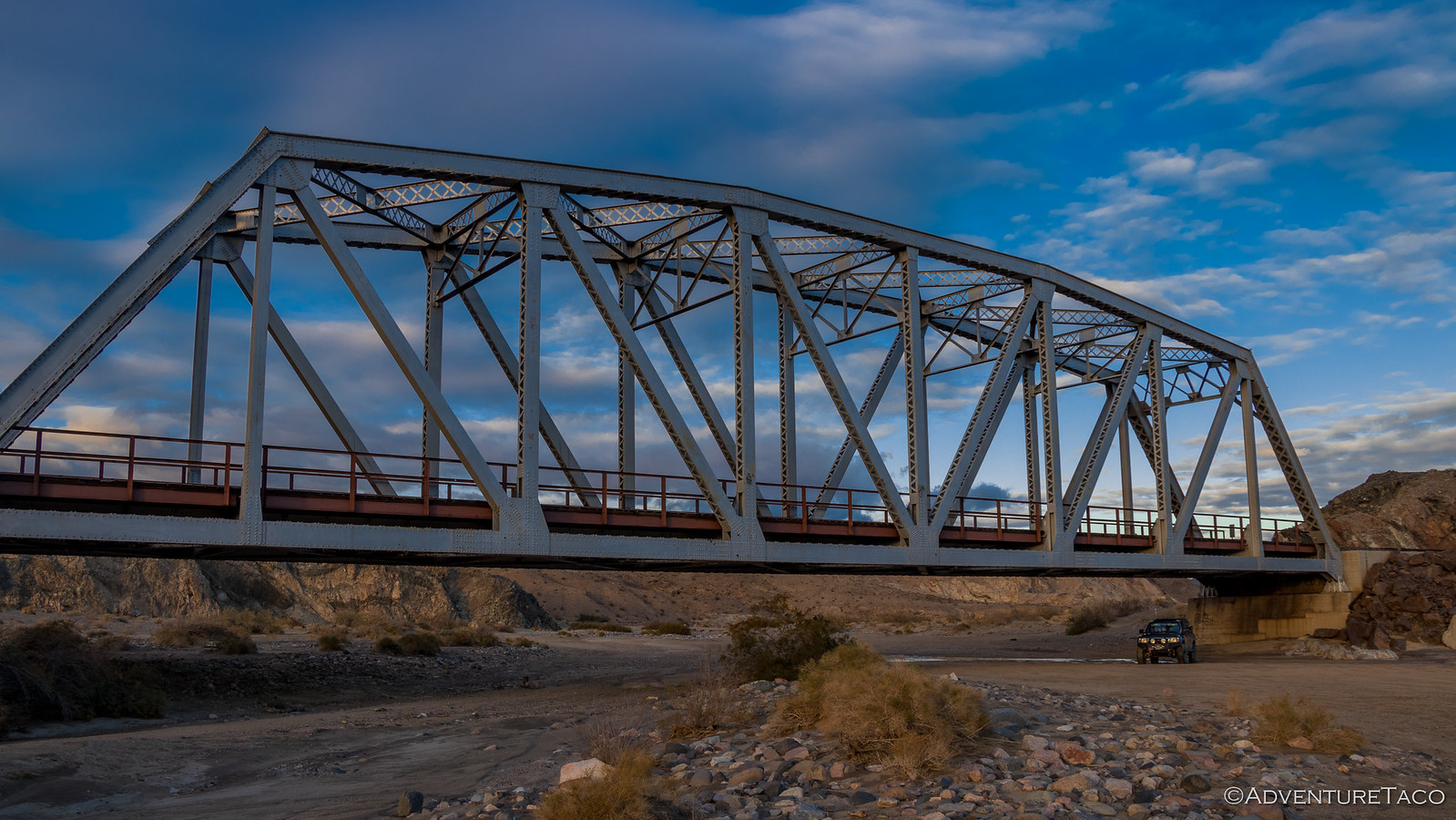
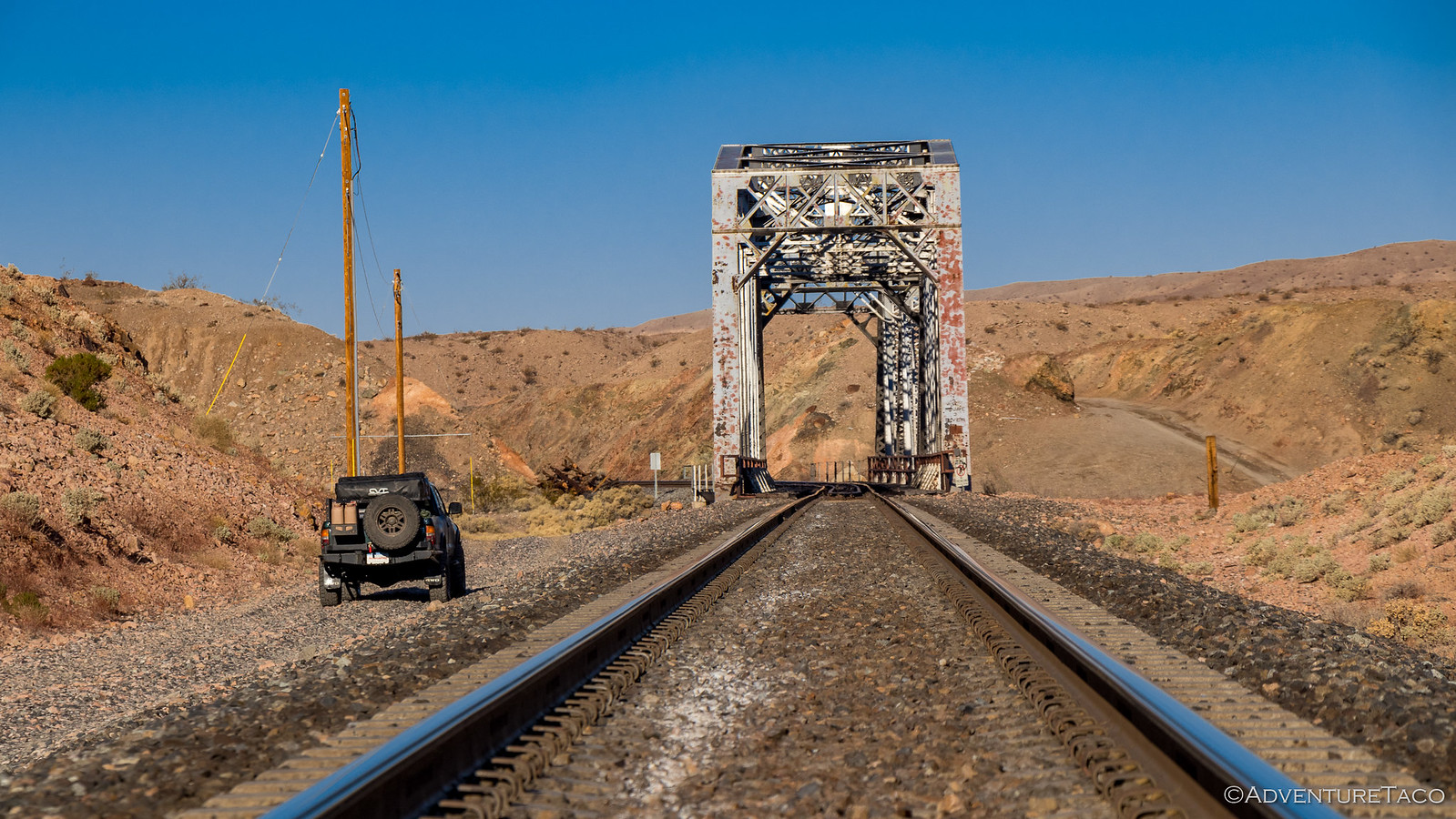
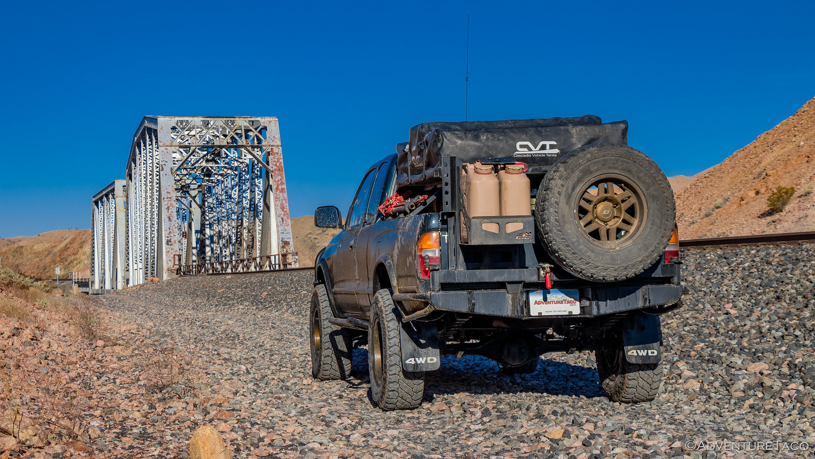
From there it wasn't long before we hit the first train trestle, essentially the entrance to Afton Canyon - the landscape starting to rise up and close in around us, reminding me of some of the geography I'd seen a couple months earlier in the Glen Canyon and Grand Canyon areas of our F.U.Rain trip. It was beautiful, especially as the evening light warmed up the landscape.

It was about this point that I realized we had a decision to make - with approximately 8 miles to go and what I'd heard could be a sketchy water crossing at the end of the trail, we had three options:
- Push forward and try to complete the trail (and water crossing) now, and camp in the primitive Afton Canyon campground - which was just on the other side of the crossing.
- Continue up Afton Canyon and find a place to camp closer to the end of the trail so we'd have less ground to cover in the morning.
- Find a place to camp near the mouth of the canyon, increasing our chances of morning sun to warm us up and dry everything out.
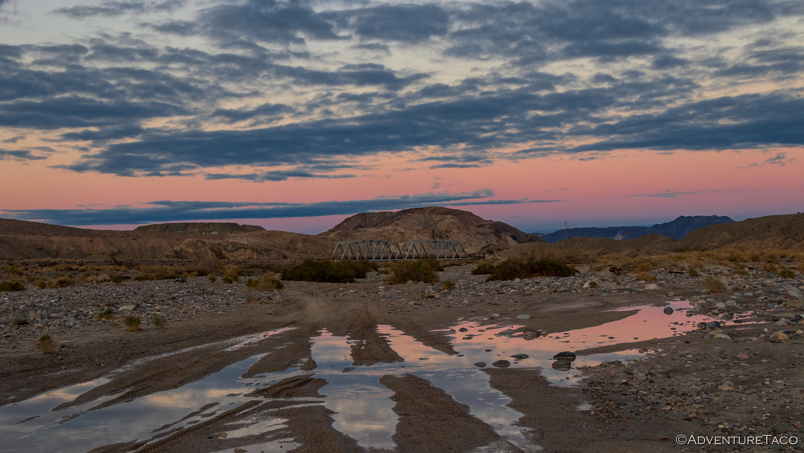
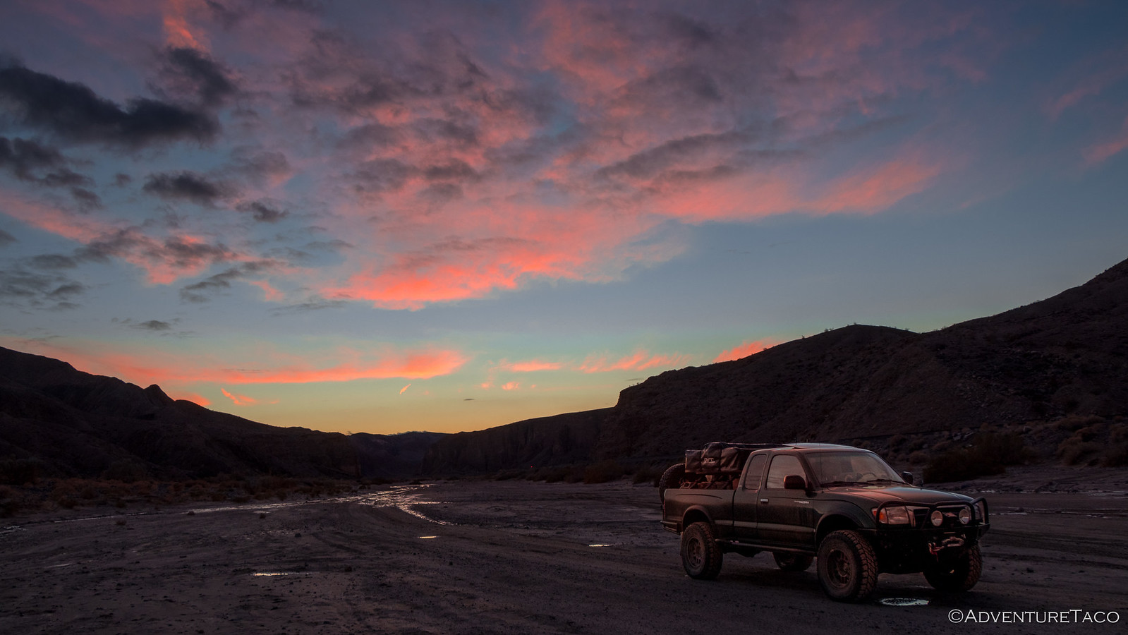
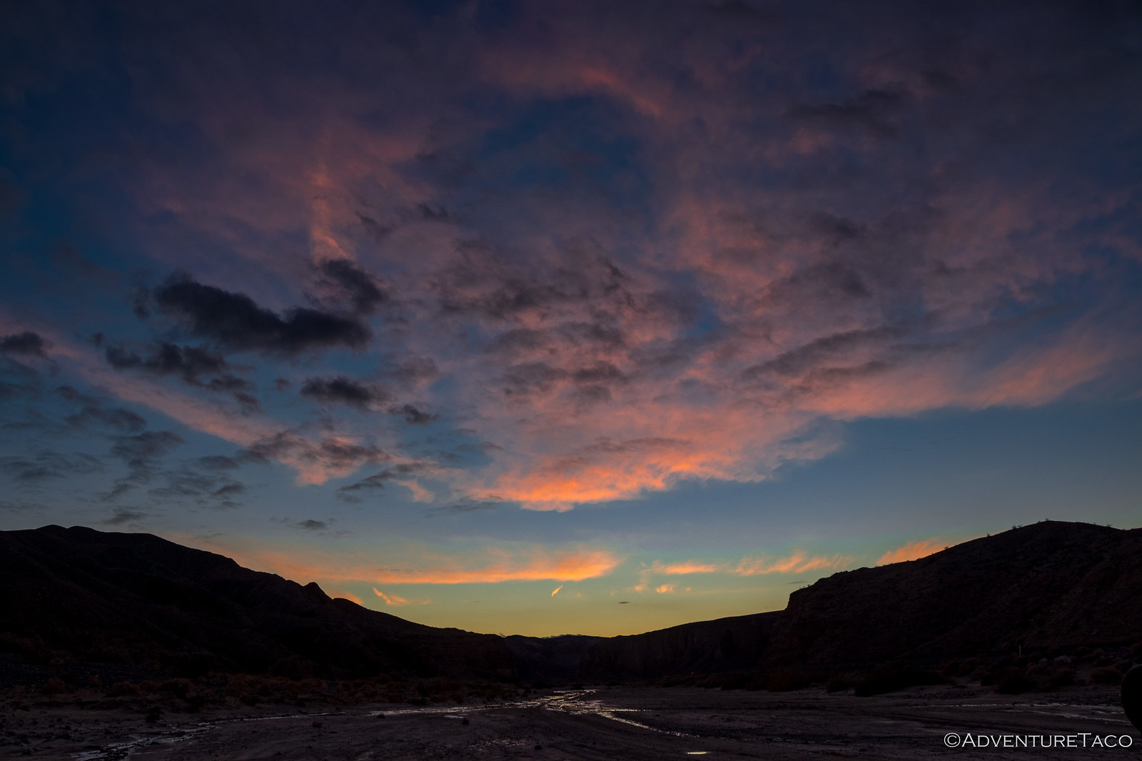
Knowing that I didn't want to attempt the water crossing in the dark, and being a sucker for the light of early morning sun, we decided to go with option #3 - but not before we captured a few sunset shots as the sun fell below the horizon.

It was about this time - as we headed back toward the train trestle and we heard the rumble of an approaching train - that we realized we were going to be camped very near a train that ran quite frequently - once every hour or so. Luckily for us, as the first of many trains powered past, it was relatively quiet - the remote landscape and lack of railroad crossings negating the need for a the horn blasts we're all so familiar with around town.
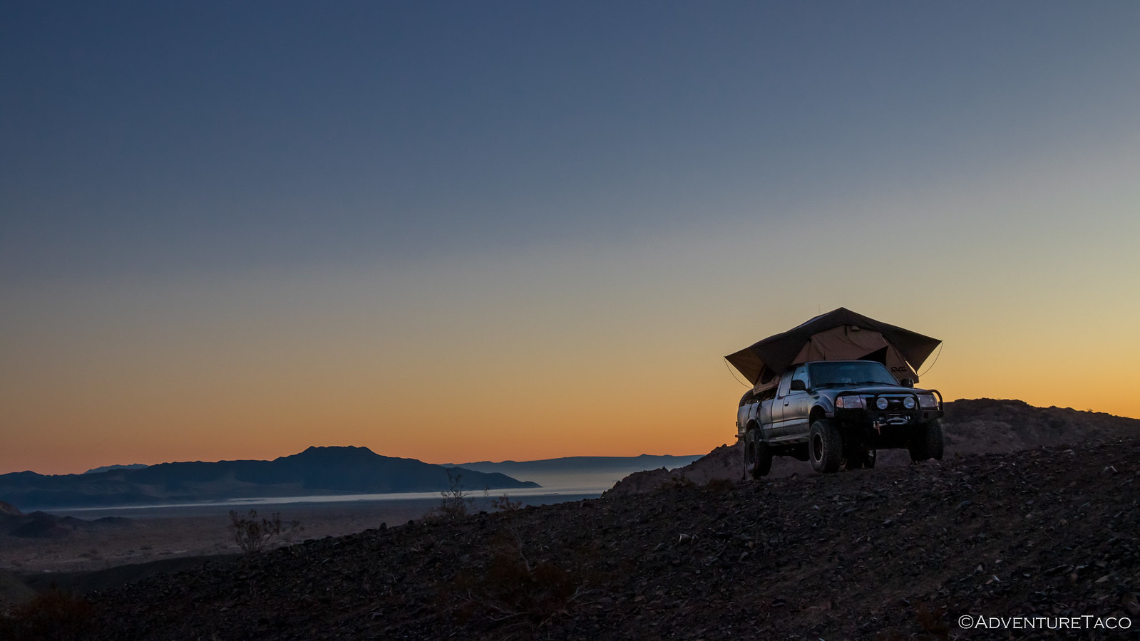
And so it was that as the last rays of purple light played across the sky, we found a spot to camp along the south rim of Afton Canyon, overlooking the western end of the Mojave Road.

As I deployed the tent and @mrs.turbodb readied dinner, we weren't exactly sure what the next day would bring - but we were pretty sure it would start with an exploration around camp (we'd discovered some headstones nearby) and then hopefully a successful completion of the Mojave Road.
- - - - -
We awoke the next morning just as the orange glow along the horizon was coming to its end, the sun nearly peaking out to start the day. To our east, Soda Lake and the Devil's Playground were partly covered in fog, eerie and beautiful at the same time. To our west, Afton Canyon awaited.


And there, on the next knoll over, four grave sites. Likely old train workers we decided, the inscriptions on their graves suggestive of their love for the rails.
| David M Conahey
Feb 1933 - Sep 2011 Much-loved husband, father, |
T-Bone Albright (and wife)
Oklahoma to California in 1933 ?? days 7 hours riding the rail |
Ronald W Humeston
Feb 17, 1926 - Dec 1, 2008 Bitchen ~ Bitchen ~ Bitchen |

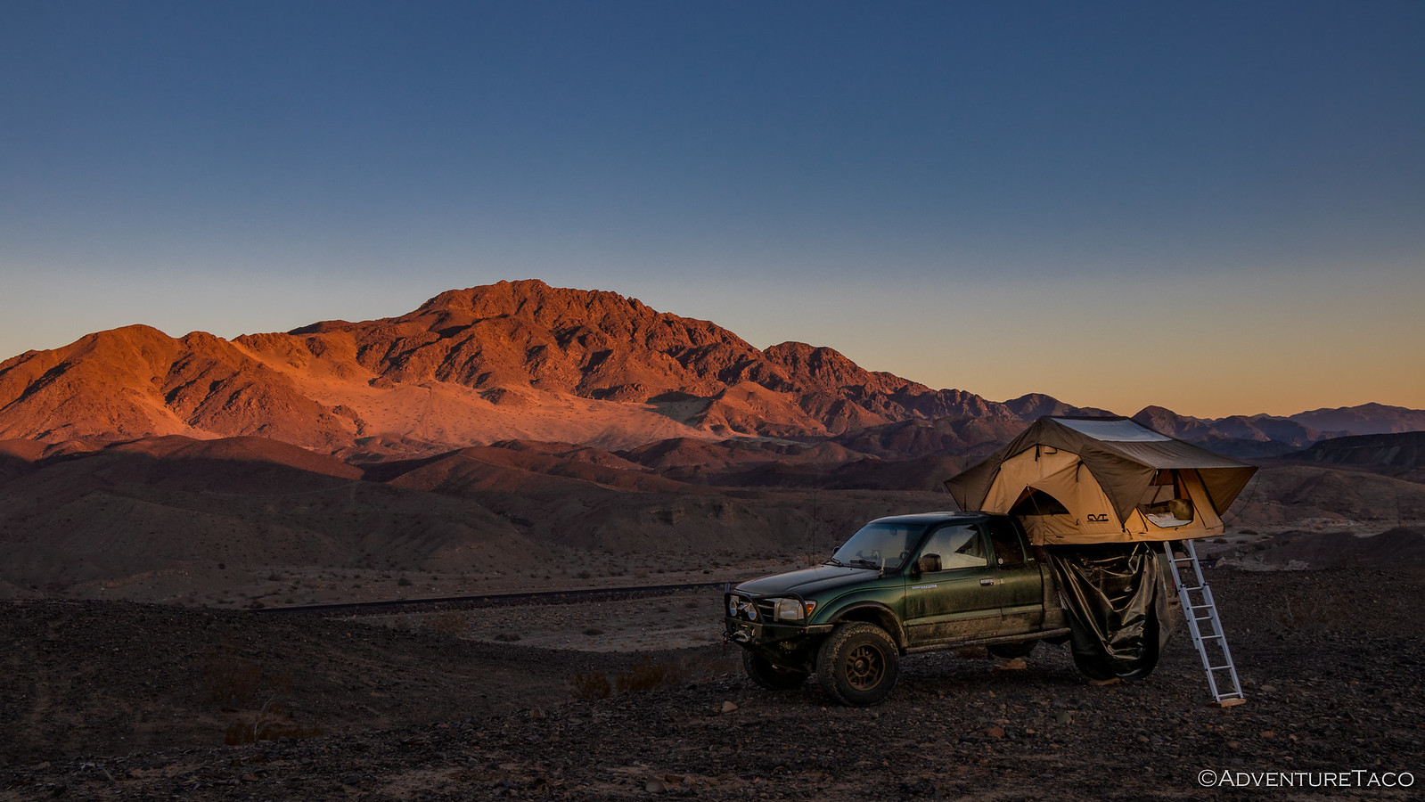
It wasn't long before the sun lit the canyon walls on fire, soon helping to dry our tent as well as we ate breakfast and got ready for the day ahead. In the distance, an ATV - making it's way our direction.
Agile and able to move quickly and obviously familiar with the terrain, the rider was to our camp 5 minutes later - wanting to verify that we weren't out hunting - this area one that he'd drawn a tag for and that he'd been scouting for the better part of six months. His plan - to get a big horn sheep with a bow - would be only the fifth time ever that had been accomplished in California.
We told him our plans for the day and he wished us luck before heading off in the opposite direction; we finished putting away camp a few minutes later and headed up Afton Canyon ourselves - the walls rising above us in the morning sun, the bright orange a confirmation that we'd made the right decision to camp rather than continue in the dark.
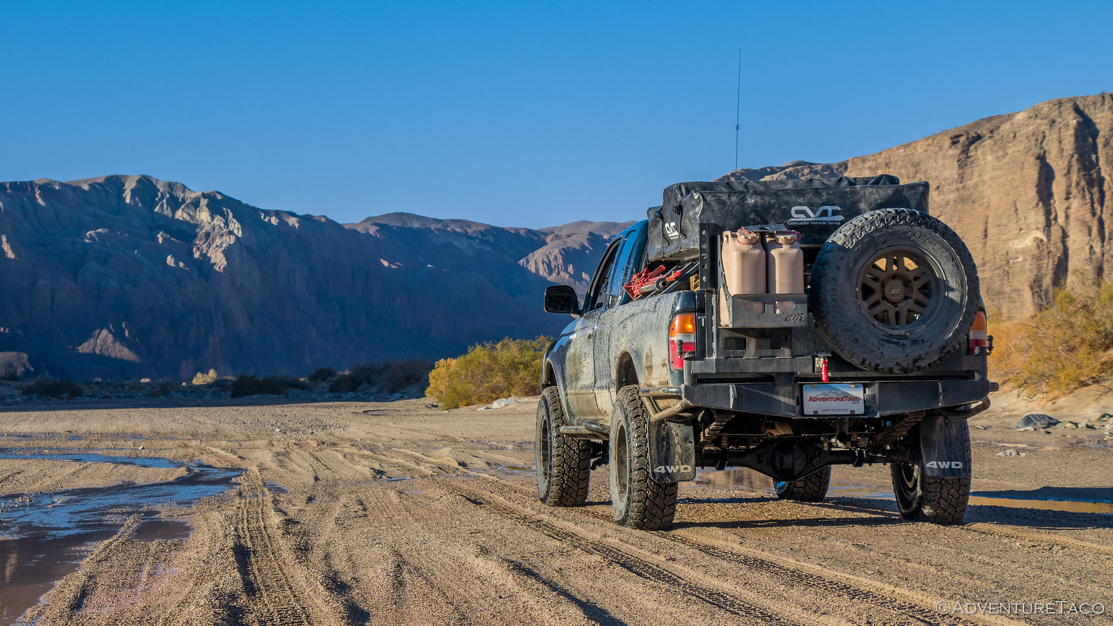
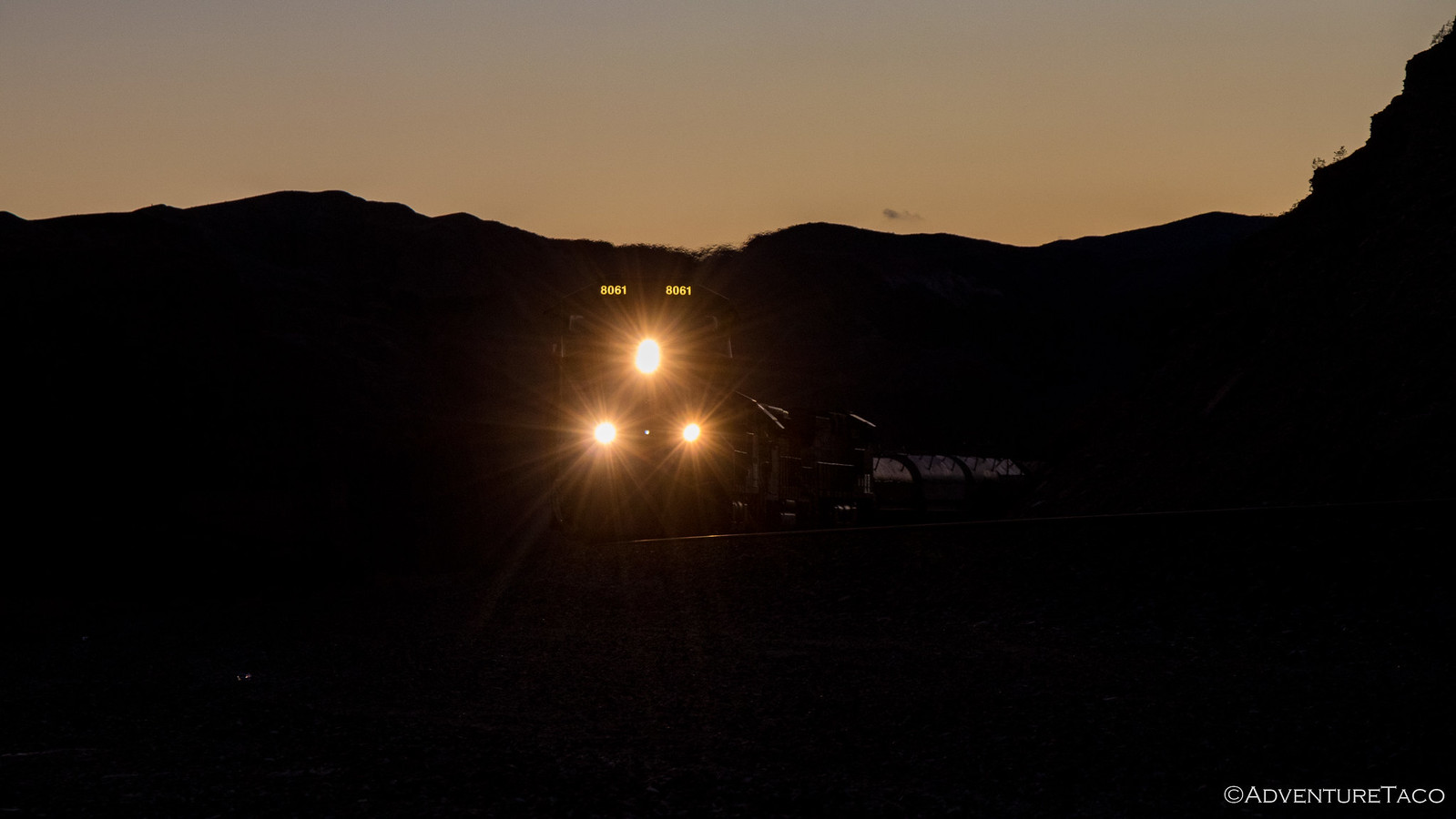
As it turned out, the Mojave Road at this point was in amazingly good shape and we made great time blasting up the trickle that was the Mojave River - perhaps better time than any other section of trail in the last couple days. And then, with a mile or so to go, the road joined up with the rail line just as a train came barreling along!

And then, we came to the crossing of the Mojave River that I'd heard so much about. It's not the river itself that makes the crossing hard - it's the fact that so many vehicles have crossed here over the decades, and so little trail maintenance has been done - that the road has been worn away, leaving a deep trough, 200 feet long through which all vehicles must pass.
I stopped the truck to scout it out.
It was beautiful and scary at the same time, and there was clearly no "sanctioned" way around - the nearby stretches of riverbank roped off, and the drive along the train tracks and over the train trestle obviously illegal.
So I looked at @mrs.turbodb and said something to the affect of "It's either this or go back to Baker, so here goes nothing." As my adrenaline rose, the truck entered the water. 10 feet or so in we were already a foot deep. 30 feet in it was two feet deep and still rising.
I'd put the truck in 4Lo before starting across, knowing that I might need to use the gas to power through any mud and knowing that I needed to keep the revs up - if the engine were to stop, we could be in serious trouble.
At 60 feet in, the water was quite clearly up over the top of the tires and bottom of the doors on the driver side and I could tell it was even deeper on the passenger side - @mrs.turbodb now much more serious about the crossing than she'd been the afternoon before. And we were still getting deeper.
"Hope it levels out." I think I said out loud, "We're getting really close to the intake." My adrenaline at this point was high, but I kept my cool and made sure to keep a good bow wake in front of the truck.
It wasn't until about 80-90-feet in - well past the halfway point - that we finally started to climb out - the water having gotten only a bit deeper in those 20-30 feet.
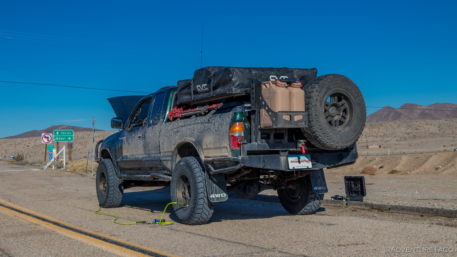
To say I was relieved would be an understatement. As soon as we were up the berm on the far side, I was out of the truck with the hood popped. I wanted to take a good look at the intake to ensure that my air box and filter weren't both full of water. Luckily, while it was clear that a few drops - perhaps a tablespoon or so - had gotten in, it was relatively dry and there was nothing past the air filter.
And it was then that I noticed the water line on the side of the truck.

Tape measure in my adrenaline-hopped-up-hand, I shakily measured the distance from the water line to the ground - 35-37 inches. Holy sh*t!
But we'd made it - and with minimal leakage into the cab - a bit of water on the passenger side all we could find. We soaked that up as much as we could with a towel and counted our blessings before high-fiving and heading out - less than a mile between us and the end of the tail.
As we drove out, two Jeeps - a Grand Cherokee and a Rubicon passed us on their way in and I wondered out loud what they'd decide at the crossing. Turns out my copilot was curious as well, so we stopped and watched to see if they'd plow right in or hesitate before making a decision. While the Rubicon was running 35" tires and would have likely been fine, the Cherokee was on 33's and sat much lower than our Tacoma - so when we saw them hesitate we decided it'd be a good idea to head back and let them know how deep the water was.
They were of course very grateful for this, and as we drove away, I joked with @mrs.turbodb that we'd know what decision they made if they came out past us as we were airing up!  With that, we found ourselves at the head of Afton Canyon road - a sign warning that there was "NO OUTLET."
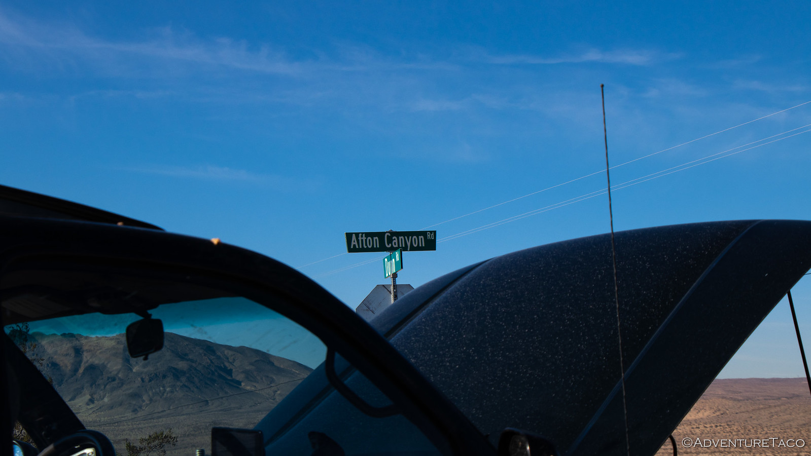

True, I guess, unless you make it through the water crossing and along 150 miles of the Mojave Road.
And then, as we aired up our last tire and got ready to go, we were passed by two Jeeps, headed back to the highway toward Baker.
Thanks for reading! Now get out there and drive the road for yourself, it's amazing!

Nice photos of the trail. no photos of the phone booth though. All alone 20 miles from anything and still works. Enjoyed the pictures. Makes me want to go camping again. first camped there in 1958 with my dad
Roland Humeston.
Thanks!
We were quite a bit further south than the phone booth (we mostly stuck to the Mojave Road). Will be a great place to visit in the future...so many of those places within the Preserve.
You've provided a wonderful account of your travels on the Mojave Road. The "side trips" and stopping to hike or enjoy the other wonders of the desert really emphasize what a trek on the Mojave Road can be. Well written narrative.
Regarding the phone booth. In May 2000 the Mojave phone booth - "the loneliest phone booth" made its final disconnection. In the book "Adventures with the Mojave Phone Booth" by Godfrey "Doc" Daniels (2018), page 207, Daniels cites the NPS announcement that said "...while the phone and its location proved to be a novelty for some in recent months, the increased public traffic had a negative impact on the desert environment in the nation's newest national park."
Thanks John, glad you enjoyed the story. Can't wait to get back down there, and will have the chance to in the next couple of months. So excited! The plan this time is to explore some more of the "off the beaten path" stuff - via hikes, etc. so if you have suggestions, I'm all ears.
Those Carins were placed by the Mojave Desert Heritage & Cultural Association (formerly The Friends of the Mojave Road) yes many drive Jeeps but other 4wd vehicles too. https://mdhca.org/
Awesome, thanks for the additional info! I've run across the MDHCA in a lot of my research, since our first trip (this one) a couple years ago. Seems like a pretty standup organization.
I traveled half the Mojave Road about in July 2018. I'd spent the night at the Afton Canyon campground and headed out early the next morning going from west to east. I know exactly where you met the Mojave River. After spending a few seconds studying it, I didn't bring a life jacket, I decided I'm better off going under the railroad bridge. I've got to admit I didn't I didn't look at much of the sights, careful to stay on the "trail" and not wander off. "Those who wander are not lost." I've done that a few times.
The cairns helped a lot. I came across the dry lake bed with no problem. I'd read about the huge pile of rocks. Off in the distance to the north I saw ZZyzx. It was a good trip, except I didn't do much more than drive. I left Mojave Road near Seventeenmile Point and headed south on Kelbaker Road.
I have two books I'd bought some time ago when I first started going to Mojave National Preserve in 2014. One is the Mojave Road Guide by Dennis Casebier. This book takes the Mojave Road from east to west. The other is Tales of the Mojave Road The Military also by Casebier.
ROAD TRIP!! I really need to pay better attention.
I'm glad you got to run the Mojave Road - it was our first introduction to the Preserve, and we always look forward to going back now - to see things that we missed the first, second, third, (...and so on forever) times! Even in all those times though, we still haven't crossed the lake bed - it's been wet EVERY time! ? (We do generally go in the winter months, so it's our own fault.)
I didn't realize there was another crossing from the Afton Canyon campground under a RR bridge that was easier/shallower - if I'd known about that, we might have opted for that as well!
If you're going to do a road trip to the Mojave, I can't recommend this book enough: Hiking the Mojave Desert. Digonnet describes some amazing places (mostly mines and hikes) and a lot of the history behind them (in addition to how to get to them). He is by far our favorite author, as his descriptions are captivating in themselves. As of a recent trip down there (that I'll start sharing soon), I think we've only got one or two destinations left that we've not been to!