We were up bright and early...
Ha! No we weren't, this was not a trip where early mornings were "a thing," with one exception that I'll get to eventually. In fact, I think I as the first one out of bed - a bit after 8:00am - and only because the sun was streaming in through the door of my tent, blinding, rather than warming me, as it had on previous mornings.

Familiar. Have I been here before?
Our plan for the day was one that I'd been looking forward to for the entire trip - and I know Mike @Digiratus and Monte @Blackdawg had been as well. This was, after-all, the spot we'd camped the night before that fateful day last year - the day the Redhead punched a coilover through the front passenger shock tower on the climb up Mt. Antero. This time, we hoped that by the end of the day, we'd have reached - and this time we'd have summited - Mt. Antero.
First though, we had to get there. Rather than take the route we'd travelled the last time - up and over Cumberland and Hancock Passes, the route we'd take today was new to us all - we'd approach Antero via Slaughterhouse Gulch and Tincup Pass.
We started by following a route that had been a "wrong turn" the previous year, climbing into the hills south of Taylor Park, and then down again into the adjacent valley - the smoke that'd been present the last several days, hazy in the late morning sun.


Through the meadow and making good time, we climbed again as we entered the woods, until we came upon the ruins of an old log cabin. We have no idea - really - what the cabin was for, but Dan @drr commented that if this was the slaughterhouse for which the gulch was named, there was a conspicuous lack of corrals.


The craftsmanship in construction was clear; there's a reason this place has stood for likely over 100 years.
We continued on, cresting another set of hills before dropping down into another, much smaller valley just a few miles from the town of Tincup. Here too, the ruins of what were once inhabited buildings of the old west were present, their locations clearly picked for the commanding - and beautiful - views of their surroundings.


Unlike the previous structure however, those we found here were, in fact, adjacent to old corrals. Could this have been the abattoir for which the area was named? Interestingly, as we explored the area on foot, it appeared that a tack shed next to the corral - and so perhaps the corral itself - was still in use!

From these ruins, it was fewer than two miles to Tincup, which we entered from the south - via the road we'd exited the previous year. A tiny town, this place was originally named Virginia City, located in Tin Cup Gulch - named for the tin cup that prospector Jim Taylor used to carry gold that he'd panned from Willow Creek, back to camp in 1859. It wasn't until 1878 that larger lode deposits were discovered in the area, and by the 1880 census, the town had a population of 1,495. Confusion with Virginia City, Nevada, and Virginia City, Montana, caused the residents to change the name just two years later - the same year that town marshal Harry Rivers died in a gunfight. Tincup it turns out was a violent place - one year later in 1883, marshal Andy Jameson was shot to death in 1883 as well. (Gunnison County)
Today, the town retains many of the old structures, and a good number of residents have moved back in at least during the summer months. The town hall sparkled - even from a distance - as we drove into town, its white paint and turret easily mistaken for a church building.


There are no paved roads in Tincup even today, the many dirt roads leading to various passes in the area. For us, this year, the road we were looking for exited to the east, and within minutes of entering town, we were leaving again as we began our ascent up Tincup pass.
Not far out of town, human traffic dropped precipitously until we reached mirror lake, where several groups were out fishing and having an otherwise great time. Even at nearly noon, the night's cold temperatures were apparent - ice still lining the creek crossings that fed the lake.

As with a couple of the other passes we'd already run on this trip, the climb up Tincup pass was reasonably easy. Sure - there were rocks and bumps in the road, and both 4wd and high-clearance were a plus, but there was nothing of note from a technical perspective, which allowed us to soak in the views as we climbed above the tree line, and ultimately crested yet another ridge along the continental divide.


We reach 12,154 feet above sea level, along the continental divide.
While nice, Tincup wasn't as dramatic as some of the other passes we'd seen, so after a few minutes we headed down the east side, eager to achieve our ultimate destination for the day.


The descent was much as the ascent had been, though perhaps with a bit more traffic than we'd seen out of Tincup.
The road caused the traffic to move slowly, and we leapfrogged our way down the mountain, our suspension setups clearly head-and-shoulders above what most were experiencing on this beautiful day. Mike especially was enjoying this section of trail - the Redhead's new suspension soaking up the whoops and potholes in ways he'd never experienced before; his exclamations of joy over the CB radio bringing a smile to my face.
At some point - earlier in the day than normal - we decided to stop for lunch. And, as we pulled out our chairs and sustenance, talk of truck swaps began. This is somewhat of a tradition on trips like this - though one that I have yet to participate in, much to the chagrin and teasing of my fellow adventurers. Still, it gives each of them the chance to drive each others trucks, pushing them to their limits, at speeds higher than they might drive their own vehicles on the same terrain.
It was during this swap that Monte stepped out of the Redhead - after all the work that had gone into it over the last year, and said
That's almost as good as Frank.
Let me tell you, there wasn't a prouder parent than Mike at that moment, at least as far as the look on his face.
Back in our caravan of four, we quickly wrapped up the bottom of Tincup pass and made our way through the historical town of St. Elmo. Technically classified as a ghost town, it was anything but on the day we rolled through - the streets packed with UTVs and their haulers. We wasted no time getting away from it all and to the turn-off to the highlight of our day: the ascent of Mt. Antero.

This is the spot I nearly hit Mike and Monte last year when my brakes didn't engage. I know Monte still wonders how I kept my truck from flipping over, as I careened past them, my passenger tires high up this hillside on the upper log.
The route up to Mt. Antero can really be thought about in two segments. The first, a climb from 9,400- to 10,800-feet delivers the adventurous explorer to a creek crossing and fork in the road. Straight continues on to several camp sites and the Baldwin Lakes; left heads up the mountain toward the peak.
As we ascended this portion of the trail, CB chatter was high, each of us peppering Mike with questions about exactly when and where the Redhead crapped the bed the last time we were here.


As we reached the end of the first segment, we passed a couple Jeeps on their way down from "the top." According to them, the actual top was unachievable today - the shelf road impassable due to snow at much higher elevations. "You'll have to back up onto the scree field to turn around," they warned - something that made us all wonder if we were just a little crazy.
It was sketchy enough that Mike decided he'd call this spot good for the day, offering to find us a good camp while Dan, Monte, and I continued toward the summit. It was - after all - the thing we'd been talking about for the last week.
In case there was any snow bashing to be done, Dan - with his 35" tires and love of snow - headed up first.


Up we go!
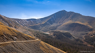
The climb from the transition point is long and steep. From 10,800 feet, the road climbs to 13,774 feet in approximately 4.5 miles, all of it along a shelf road carved into the side of the mountain.


The views - obviously, given that the entire road is above the tree line - are some of the best we'd had on the entire trip, and Monte and I made several stops along the way to take them in. Dan however pushed forward and was the first to reach the snow. Warning us over the CB that it was - in fact - impassable, he advised us to find a spot to park, and then come help him get his truck turned around on the narrow road.
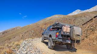
We obliged, finding the perfect spot to leave our Tacomas.

A few folks out having a good time?

Or Toyota commercial?

The view back to Baldwin Lakes from our parking spot was impressive.
A quarter mile up the road, we found Dan and helped him get flipped around - a few perfectly placed turns, and good brake control making quick work of the job. We were - at this point - 2.5 miles from the top, and we had a decision to make: should we hike it?
You're DAMN RIGHT we should hike it, and we set off up the steep road - Devin @MissBlackdawg and her dog Ollie, leading the way.

All of us in better-than-average shape, I was pretty sure that we'd cover those 2.5 miles more slowly than at sea level, but quickly enough that it wouldn't be much of an issue - perhaps taking us a bit more than an hour, rather than 35 minutes. But travel at 13,000 feet is a little different than any of us could have imagined, and our speed averaged only a little more than 1 mph for the entirety of the climb.
Perhaps part of the reason was that we couldn't stop taking pictures. In fact, yeah, that's the reason! 


As we made the final push to the end of the road, we were all breathing heavily.
The taste of victory in our legs as we completed the last switchback, we rounded a corner to see that we'd simply reached the end of the road. The path to the summit was another half mile and 500 vertical feet of elevation gain. Not only that, but from here, it was a narrow path through a scree field, not a nicely graded gravel road.
It was 4:30pm and we had a decision to make.

The summit, just ahead. Note: background compression of a zoom lens is in full effect here.

The summit (left), still half a mile away.
Ultimately, after much back and forth, more sane voices than mine won out - it was late(r) in the afternoon and none of us had brought any water, much less warm clothing or food. If we got caught out on that trail once the sun went down, we could find ourselves in significant trouble - or worse - a truly dangerous situation.
Dan climbed to the top of a local apex, and we took a few final shots of the 14-er that had now eluded us two years running.


Bighorn sheep in the bowl below Mt. Antero.
A little deflated, we retraced our steps back down the road to our vehicles. The going down was much easier - as would be expected - and we made good time, covering the distance in just over 45 minutes. Back at the trucks, we radioed down to Mike that we were on our way, and he relayed that he'd found a great camp site just a little way up the road from where we'd left him.
And sure enough, we found him exactly where we thought we would, our story of defeat relayed immediately upon arriving in camp. Mike too had a story of woe, having attempted to find camp further up the Baldwin Lakes road, only to be turned around by a particularly difficult section of trail that he felt uncomfortable tackling as a single truck.
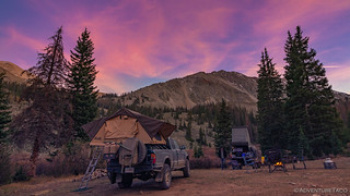
And where we found him was perfect - the view of the mountains a perfect backdrop to settle down for the evening.

In no time, we'd deployed camp.

At nearly 11,000 feet, this was the highest elevation we'd called home on the trip so far, and even at 6:15pm, it was getting a little chilly. We all huddled around the propane fire ring, eating our dinners over the next couple of hours, talk of the day's events, a beautiful sunset, and the plan for tomorrow keeping us occupied until we called it a night.


And a cold night it was - as I climbed into bed, I broke open a pack of Little Hotties hand and foot warmers as well as my wool socks and knit cap. All bundled up, I hunkered down in under two down comforters and on top of my ultra-insulated Exped MegaMat 10.
Hoping it was enough to keep me warm, and the adrenaline of the day finally wearing off, I soon fell asleep. That is, until a noise outside the tent awoke me during the pitch black of night...


