Without a fire, it was another cold night and I was glad for my Little Hotties, their 8-hour life just long enough to keep my toes toasty until it was time to get up. And - at least for me - toasty toes are a key factor to the rest of my body being warm through the night, so I slept soundly as the surface of the beaver pond we'd parked by froze over night.

Of course, as the sun rose to our east - it's warmth streaming down on our camp - we all ventured out of our cocoons to check out camp and start our new day. Mike @Digiratus got started on his coffee, Monte @Blackdawg and I made our usual morning photo rounds, and Brett @Squeaky Penguin got right down to work with his fly rod. It was another fun morning!


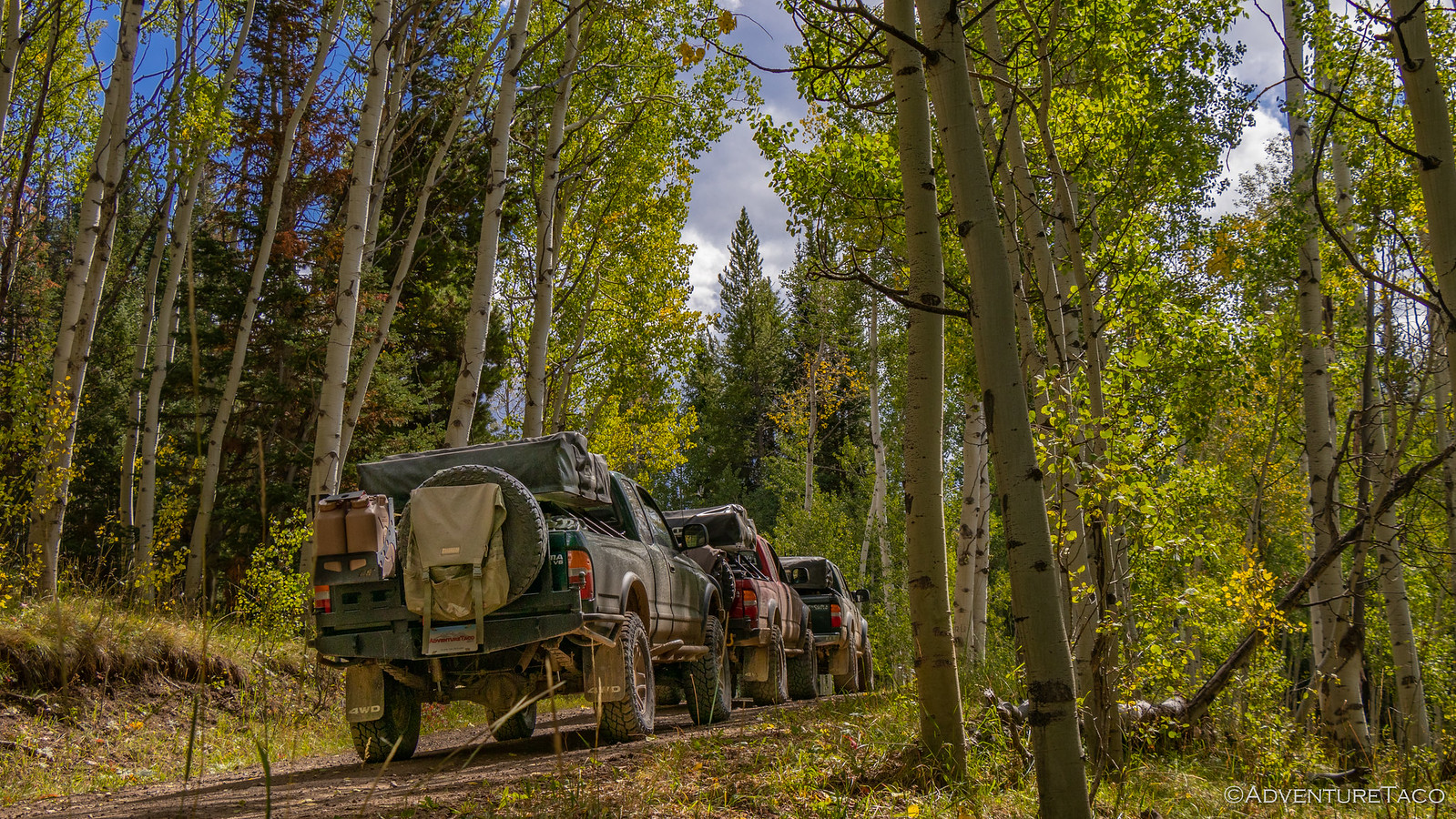
Our plan for the day - though not as ambitious as the last - was going to have us traversing some reasonably cool passes, and hitting up a fancy spot for lunch, we set about breakfast and were ready to get out of camp an hour or so after climbing down our ladders. The cold night had done nothing to reduce the dusty conditions, our liberal use of skinny pedals kicking up the find powder as we sped up the road. We were on our way to Georgia Pass.

One of three passes over the Continental Divide in Summit County, Georgia Pass is well traveled - but not as well traveled as the other two routes. One - Webster Pass - we'd done the day before, and the other - Boreas Pass - was next on our list. It turns out that because Georgia is less difficult than Webster, and more difficult than Boreas, it simply doesn't appeal to either the hard core offroaders or the city slickers, and that meant that as we climbed the pass from the north, we had it mostly to ourselves!


Georgia Pass wasn't always so sparsely traveled. It once served as the primary route into the Swan and Blue river valleys for gold-hungry miners with as many as 200 prospectors a day flooding over the pass - then called Swan River Pass - into the boom towns of Parkville, Swandyke, and Tiger. No trace remains of these once vibrant towns except for a few ruins in Swandyke, since Parkville was buried by river dredges in the 1880s, and Tiger was intentionally burned to the ground by the Forest Service in the 1970s to "rid the area of squatters." By the 1880s, Boreas and Hoosier passes had become easier and more civilized routes and Georgia Pass was all but abandoned.
Today, a sign informing travelers of the Continental Divide decorates the summit - dropping a bit of knowledge on passing visitors.


The trip along - and for us down - the southern flank of Georgia Pass is much easier than the north, and we reached some reasonably high speeds as we slalomed down the well graded gravel road. As we did, Mount Guyot rose in the front of us, it's two-tone ridge striking above the green tress and against the blue sky.

Racing to catch up after a few stops for photos, I finally caught the trailing dust as we approached the tiny town of Como, CO. Formed in 1879,it was the location of a train depot for the Denver, South Park, and Pacific Railroad to reach the silver mines in the area. It was striking as we drove through, how many of the old structures seemed to remain - an old roundhouse - notable among them.

If we'd stopped, we probably could have spent a good chunk of time in Como - several of the houses painted vibrant colors that would have been the subject of our cameras, several other historic buildings worth a look. But that would be left for another day - today we had plenty to keep us busy, and a lunch date to keep in our next "town." Between us and that lunch date was Boreas Pass - the pass an astute reader may recall as the easiest one over the Continental Divide.
Things started off smoothly enough as we climbed Boreas from the south - traffic was light, the road was smooth, and the miles fell away behind us as we climbed toward the tree line.

But then - about halfway up - things changed. First, we caught up to a single vehicle; then two. Before long, we were the last four travelers in a string of cars and trucks nearly 20 strong. And we were going slow. This of course was somewhat understandable - I mean, how fast is a Tesla, really? The bigger problem for us was that - while we wanted to, and could, go faster - everyone else seemed content to make their way slowly along, diving in the dead center of what was clearly a 2 lane road. It was frustrating to say the least, though it did give me time - as the last one in line - to stop and take leisurely photos of our approach. Ultimately we did reach the top, but as soon as we did - and all of the cars pulled over to explore the artifacts there - we pressed our skinny pedals to the floor, trying to jump out in front.

Our strategy worked for about 3 minutes. As you can imagine if you give it just a little bit of though - the parade of vehicles on this road is rather constant. So, while we may have skipped ahead of the 11:00am crowd, we still had the 10:45am folks to contend with as we descended the north side of the pass. And probably the 10:30am and 10:15am groups in front of them. Needless to say, it was slow going, and there may have been some frustrated venting by certain members of our group when the city-folk weren't the most astute drivers in this environment. 
Still in the back of the pack - and frankly hanging back a little extra to stay out of the dust - I continued to stop frequently to try to capture the beauty this place had to offer, even as its crowds frustrated those used to travelling faster. Because it was definitely turning to fall, and the colors were amazing!

Half an hour later, we found ourselves pulling into Breckenridge - the ski slopes bare for the time being, but the town still hopping with summer tourists. Here, we fueled up and then scrambled for free parking so we could enjoy the lunch date we'd decided on the evening before: The Breckenridge Brewery.


Lunch there was about what you'd expect - in my opinion - for a posh, tourist town: just OK. It was however a nice stop with a bunch of good company, a nice break from doing everything for ourselves. I think though, that we were all ready to be back on the trail by the time lunch was over and we'd each paid our checks - our wallets now lighter than our stomachs!
It turned out that Brett had a bit of a surprise in store for us as we pulled out of town, announcing that there were a couple of really cool trails in the area, and that we should go check out one in particular - Crystal Lake. He wasn't sure of the exact turn off from the highway, but we found it easily enough and drove through a reasonably large residential neighborhood before coming to the trailhead. From there, it was stunning how quickly the terrain changed - the graded gravel road almost instantly rocky and high-clearance only. It was great, and we soon found ourselves nearing the treeline again as we flirted with 11,500'!


Not long later, we pulled up to Crystal Lake - 12,000' above sea level and yet still there were the towering peaks of Crystal, Father Dyer, Mt. Hellen, and the aptly named Peak 10, all around us. There was nothing to do but try to fit in.

Bret of course had an ulterior motive with this mid-range side trip - fishing! And for 30 minutes or so he was able to enjoy himself - doing his best to cast into the 20mph winds - as the rest of us enjoyed the views all around us.


We couldn't stay at Crystal Lake forever, and in good time we headed back down and on to our next destination. It was here, I think that Mike really solidified in his mind that he needed to do something about his rear suspension. See, while he's got what I'd consider a totally reasonable setup - nice Fox shocks and a set of Alcan leaf springs - his springs are getting a little old, and his shocks are angled pretty dramatically. And that made it hard for him to keep up with me (somehow I found myself leading) on the way down. Now, when I hear that, I just hear that I need to slow down a bit - you know, to be nicer to my truck. But for Mike, it's really all about going faster. Time will tell where all that balances out, but for now I'm hoping to slow it down. 

Down off of the mountain and on our way to the next, we had 15 miles or so of pavement to pound before our next escape to dirt. Still aired down, that took half an hour or so - and it was a half hour of pain for the trucks. I mean really, it's amazing how unhappy an overloaded truck on 17psi feels on the pavement!  But we all made it, and soon enough we were headed up Mosquito Pass - one of the highest points we'd visited on the trip so far!


Not long after hitting dirt, we spotted what looked like an old mine mill in the valley. Keen to check it out - it appeared to be in even better shape than the Pennsylvania Mine that we'd seen the previous day - we were bummed to see that the road leading to it was gated, with a private property, no trespassing sign. As we continued up the mountain, it became clear that in fact this was likely someone's active property - a new building being constructed just a couple hundred feet away.

Up and up we went - mountains below us as well as above - and before long, Monte called out another cool mine structure over the radio. And this one was right on the road.


It turns out this was part of the North London Mine where in 1874, miners started tunneling into the north side of London Mountain. It took six years, but they eventually found enough gold, silver, and lead to make a handsome profit. Around the same time, mines started on the opposite side of the mountain turned out to be even more profitable, and ultimately the tunnels of the two mines merged via a single tunnel dug beneath the flanks of the towering mountain.
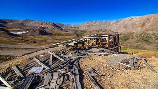
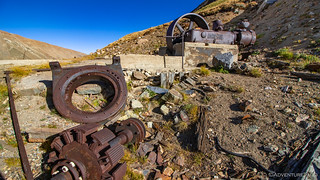
It's not every day that you learn about a mining success story, and it was quite clear that this mine had been a success. Tailings were everywhere, and at some point the mine had been successful enough that electrical power was run all these miles up the mountain - not a cheap job in any era. We also learned via a commemorative plaque that Mosquito Pass was quite a road in-and-of-itself back in the day. As the shortest route between Fairplay and Leadville, it had upwards of 50 wagon passengers per day travel in each direction. Eventually though, the railroad reached Leadville, and the toll road over the pass was all but abandoned.
Which was just fine with us - it meant that we were likely to have it all to ourselves as we continued up through the scree field!


We reached the top - at 13,185 ft above sea level, our highest point to date - without incident where we ran into another 1st gen Tacoma, running the road in the opposite direction. To say he was a little less prepared than we were - with his slide-in camper that was being buffeted by the 30mph winds - would have been an understatement. But we assured him that the trail down was passable if he took it slow and steady and bid him farewell as he started down.
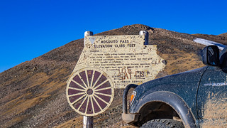
We did the same on the other side - our goal now to find a suitable place to camp that was just a weeeeee bit lower than our current elevation. Still, it was an enjoyable trip down the west side of the pass, the afternoon sun lighting our way with it's long golden rays.


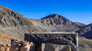
This is where it was nice to have a local guide - even if we didn't realize it at the time. Brett had been here before - naturally - and seemed to recall a camp site down a valley to our north. Birdseye Gulch, as it were. So we headed that way, our elevation dropping quickly. Now, it's at this point that it's worth noting that Brett's idea of "a short easy trail to camp," may not be exactly what other people would consider "short" or "easy." There were several spots where we hit reasonably deep mud; others where we were crawling slowly over skid-plate-hungry rocks; still others where our suspensions were fully flexed out as we eased our trucks forward.
Eventually, we thought to ask Brett how much further it was to this awesome site he remembered. His answer, "I'm pretty sure it's just a mile or so up the fork in the road over there." giving the rest of us a bit of pause. I mean, a mile isn't far, but at our speeds it wasn't short, either. So, Brett suggested that he go check out the location to make sure it was as great as he remembered, while the rest of us waited for him at a small clearing we'd found.
15 minutes later, he piped up over the radio, "I found the site, but there's a pretty big mud pit to get to it...and I'm not sure we'll make it through." Well, that was enough for us, and as Brett made his way back down, we made the call to stay right where we were. Of course, nothing is decided until Mike's tent is deployed, and when Brett got back, he suggested yet another site just a few hundred feet away. In the end, that's where we ended up - a game of rock-paper-scissors the ultimate decision maker.
As we pulled into camp, the sun was dancing it's last on the hillsides to our east, illuminating them a brilliant orange.

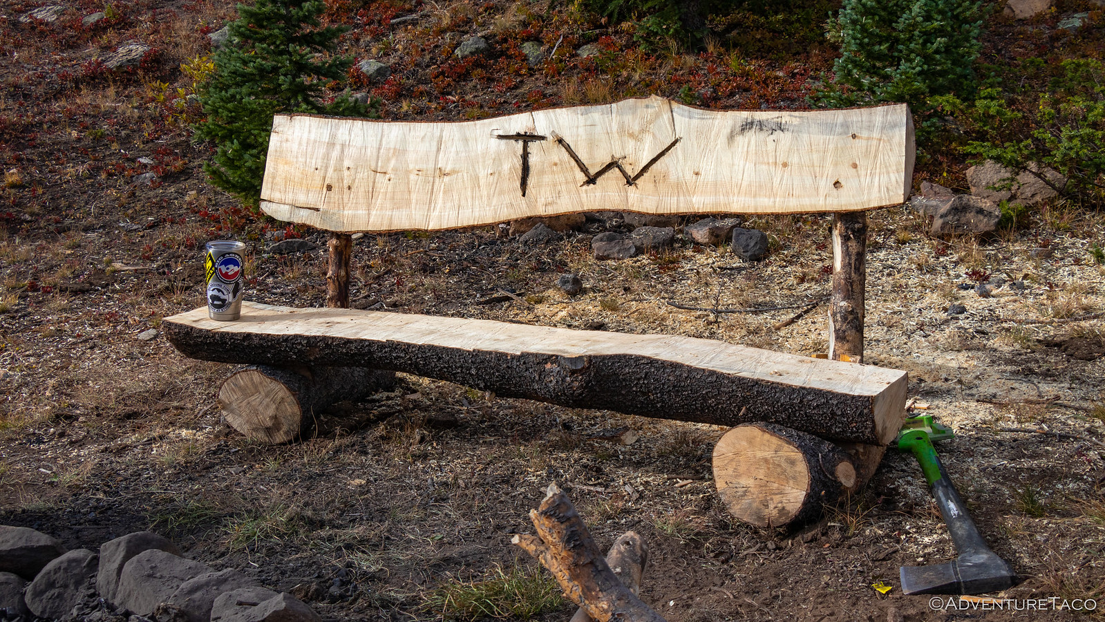
As we all set about our normal evening activities - prepping our tents and getting the fire pit ready - Brett had something else in mind entirely. This was a site worthy of a custom bench. However, unlike many of the locations we'd been, there was relatively little beetle kill here, and so he headed off with his truck to find - and drag back - the trunk of a dead tree. And then, he set to work with the chainsaw.
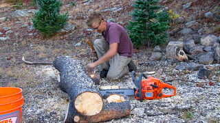


It took a while - I mean, the bench was definitely completed by fire light - but in the end, it was a masterpiece. Using a new technique developed by the group, the seat and back rest were secured by a combination of french cleats and pegs, making it nearly impossible for the bench to come apart without some serious effort. And of course, the TW on the back rest was gravy - reminiscent of the bench I'd found at Sawtooth Lake on the Re-Tour a year before.
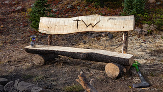
We all gave the bench a good workout that night - the camp fire big and bold, as we were no longer in Summit County and we all missed the heat from the previous nights! Our large fire - a new tradition - kept us up later than we might have normally been, the cold of our 10,930' camp held at bay by the warmth of the fire. Dinner again consisted of a guacamole appetizer, Monte and I spoiled by Mike and inconsiderate of Brett's desire for any of the tasty treat.

It was a great evening, one I think we'll all remember. Morning too would bring revelations about this camp site - for one, we weren't leaving the way any of us expected when we finally went to sleep, and little did we know the games we'd play before we'd leave...
