Having "wrapped up" (and by that I mean, essentially, skipped) Stage 4 of the AZBDR in a little under six hours, it was just after 3:30pm when we set out from Winona in search of open roads. The elevations here were nearly as high as those on the Mogollon Rim, so I was a little worried that we'd soon find ourselves blocked by snow, but @mrs.turbodb was reasonably confident that we'd be just fine.
As usual, she was right.

The snowy San Fransisco Mountains would provide a familiar - and beautiful - backdrop for much of this stage.
For the remainder of the day, we'd find ourselves driving through the San Francisco volcanic field - an area of volcanoes that covers 1,800 square miles of the southern boundary of the Colorado Plateau. Containing more than 600 volcanoes - ranging in age from nearly 6 million years old to less than 1,000 years - Sunset Crater is the youngest and is now protected as part of Sunset Crater National Monument.
This volcanic field formed from a geological hotspot as the North American Plate moved over the hotspot, new volcanoes appeared. With the plate moving westward, this puts the newest volcanoes - most of which are basalt cinder cones - at the east side of the field, through which we'd be travelling!

This view really reminded me of travelling through the cinder cones in Mojave Preserve.

The approach to Merriam Crater.
Knowing that we needed - and by we needed, I mean I needed - to get to the top of one of the cinder cones, we poked around on our digital maps a bit to find one that met all the relevant criteria. Specifically, a road to the top, and a top that was on public - rather than private - land.
Moon Crater seemed to fit the bill, and soon we were slightly off the BDR - not an issue given that we were a full day ahead of schedule at this point - and I was shifting the Tacoma into low gear for the first time on the entire trip as we followed a steep trail up the rim.

Do you see the Tacoma? It's there, really, it is.

A little closer, it helps to find the road 
After spending a bit of time hopelessly trying to improve my droning skills - one of the few things in life that I seem entirely unable to master - I landed the drone by telling it to land itself, and we continued on toward a hike we hoped to do up and around the rim of Sunset Crater.
In 1928, a Hollywood film company - the Famous Players - Lasky Corporation, planned to detonate large quantities of explosives on the side of Sunset Crater in order to create an avalanche for Zane Grey's motion picture Avalanche. Public outcry over this plan led to the proclamation of Sunset Crater Volcano National Monument by President Herbert Hoover in 1930.
wikipedia
Perhaps the strangest National Monument we've visited. I mean, the monument doesn't include any of the surrounding cinder cones, so why not just blow up one of them?
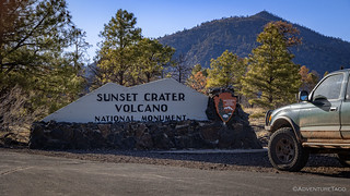
Turns out, however, that the Sunset Crater hike has been closed since 1973 due to excessive erosion caused by hikers, there was little more to do in the monument than snap a quick photo of the entrance sign and head off the opposite direction in search of an early camp.
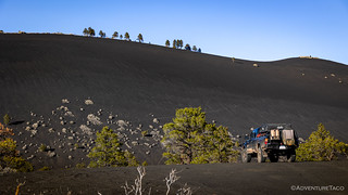
The landscape here was dramatic. Black Mountain (a cinder cone) certainly lived up to its name.

I loved how the trees grew on the ridge line, and the side of the mountain eroded in waves.
It was early - before 6:00pm - that we found camp. Nestled between a rocky outcropping, pine trees, and on a surface of small, black, volcanic pellets, we were camped in the shadow of Darton Dome and O’leary Peak.
As we ate our dinner - an antipasti salad for me and a Spanish tortilla for @mrs.turbodb - we watched as the sky changed colors and the outside temperatures dipped to near freezing. It'd been another strange day on in Arizona, presenting us with sight after sight that we'd never expected to see. Still way ahead of where we thought we'd be, we wondered if the remainder of Stage 5 and the final Stage 6 would finally deliver on some of what we expected from this trip or leave us wondering whether we should have chosen a different BDR altogether.

A colorful sky behind a barren landscape.
Only time would tell, and time has a strange way of getting even. Certainly for us, the following day would end in a way we never expected.
The following morning...
Nestled into the cinder cones, the night ended up being windier than we expected - enough that I climbed out of the tent to tie down the ladder to prevent a stray gust from folding the tent up on us - but earplugs took care of most of the noise, and I was up a few minutes before sunrise to try and get a few photos before shadows began to cover the landscape.

My "before sunrise" didn't account for the increased elevation of O'leary Peak, and by the time I got to the spot I'd scouted for a nice campsite-plus-fire-lookout photo, I was too late!
Too late for photos, I retraced the quarter mile or so to camp and climbed right back into bed for another hour-and-a-half of warmth and cuddling. This was a benefit of being ahead of schedule that I could get used to!
It was 7:45 when we finally decided to get up. Later in the day, this "slow start" would nearly come back to bite us, but at the time, it was easy to convince @mrs.turbodb to wander over to my before-sunrise overlook as we snacked on a couple of mandarins, to admire the views it commanded.

In the morning sun, O'leary Lookout was a tempting side trip. However, since we could tell it was shuttered, we decided to pass.
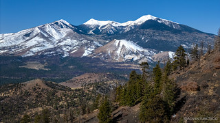
The San Fransisco Mountains were looking chilly in their white dusting.
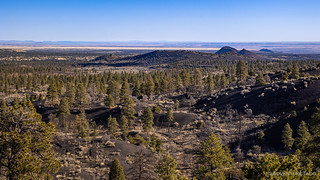
To the east, cinder cones and pine trees covered the land as far as the eye could see.
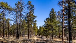
It was nearly 9:00am by the time we finally got going for the day.
Now, the highlight of Stage 5 is - without a doubt - meant to be a visit to the South Rim of the Grand Canyon. Strangely however, the track to one of the greatest geological formations on the planet is labelled as "Stage 5 BONUS - South Rim Grand Canyon," with the main route coming within a few miles of the enormous gash in the earth's crust, but skipping it entirely.
Not only that, but the route also bypasses the Wupatki National Monument, a collection of pueblos created in the early 1100's by the Cohonina, Kayenta, and Sinagua. The main structure - Wupatki - being a multi-story pueblo comprised of more than 100 rooms, a community center, and the northernmost ballcourt ever discovered in North America.
We weren't going to let either of those locations slip through our fingers, and after a quick discussion, we decided to head to Wupatki first.

We were really making the most of our America the Beautiful pass on this BDR!
Our first stop was at the Box Canyon and Lomaki ruins. Situated on the edge of small cracks in the earth's crust, it was remarkable to see how perfectly the structures seemed to nestle into the landscape.

Box Canyon ruins.

Even in the 1100's, it was all about location, location, location.

The Lomaki Pueblo was a significantly larger structure.

Still inhabited! A Great Basin Whiptail (Aspidoscelis tigris tigris)?
Next, we headed to the Wukoki Pueblo. Built on top of a sandstone outcrop, this was the most dramatic of the pueblos, and most definitely the place we'd have wanted to call home if we were to live in a rock-and-dirt shelter some 1000 years ago.
Comprised of seven rooms and a three-story tall tower, it's likely that more than one family lived in this location. A large open area adjacent to the tower, enclosed by a semicircular knee wall, was a plaza used for daily activities, pottery making, basket weaving, and other chores. And the view!

As with the structures in Box Canyon, Wukoki was perfectly situated in the landscape.

Sharp corners and flowing curves complemented each other in this amazing workmanship.

Look, but don't touch.
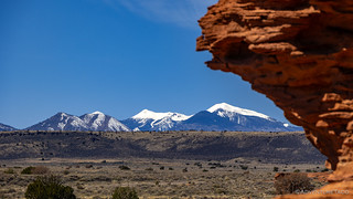
The ever-present San Fransisco Mountains added to the magic of this place.
Our final stop in the Monument was at the Wupatki Pueblo itself. With more than 100 rooms, a community meeting area, and a circular ballcourt, this was not a typical household. Rather, it was an important meeting place with those living here holding leadership or ritual responsibilities within the community.

The scale of Wupatki was entirely different than the other sites we'd visited.

An outlying structure provided even more rooms.
In the end, we spent a couple hours getting to and wandering through Wupatki National Monument. While not as exciting as finding a "natural" or "unpreserved" ruin at the end of a long hike, it was nonetheless impressive and most definitely a place that I'd recommend spending a couple hours if you find yourself in the area.
Now a little after 11:00am, it was finally time for us to start making our way toward the Grand Canyon. Though the roads were smooth for the most part, these 57 miles would end up taking significantly longer than I expected - largely due to my inability to stay in the cab for more than a few minutes without jogging a few hundred feet behind the Tacoma for photos.
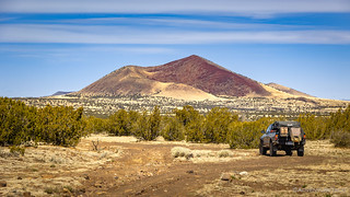
Through the last of the cinder cones.
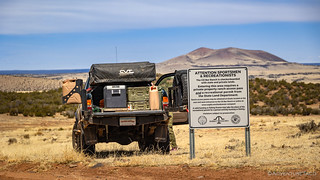
We weren't sure why we needed to pick up an Arizona State Land Recreational Permit until we came across this sign along the route. We decided to take advantage of our we're-here-legally status by eating lunch! 
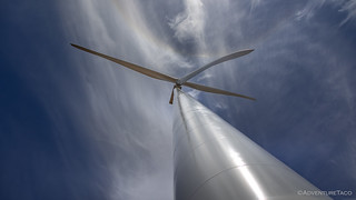
Racing across the tundra, we spotted the windmills and hour before we reached them. Seemingly brand new - given the freshly disturbed soil around their bases and the perfectly graveled roads that led to each one - none were operating, and we took the opportunity to get a real sense of scale of these behemoths.
So big. And so small.
Then, it was back into the Tacoma and onto a track that had obviously seen some moisture not too long before we'd arrived. Likely this was the same storm that dropped rain and snow on us two nights prior, and from the looks of it, someone less fortunate than us had slopped their way through shortly after.
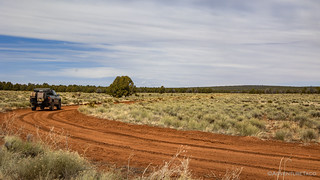
Mostly dry for us, another someone wasn't as lucky.
Entering Grand Canyon National Park on a lightly travelled dirt road, only a small sign urged us to pay our entrance fee at the southern or eastern pay stations before exiting one of the country's most popular parks. A few minutes later, we unexpectedly found ourselves at the Grandview Fire Lookout. No longer in service, it is one of the original tower sites selected when the early Grand Canyon National Monument was planned in 1909. Originally constructed as a simple platform, it was rebuilt by the Forest Service in 1936 as an 81-foot Aermotor tower with 7' x 7' metal cab.
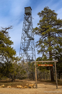

At only 7- by 7-feet, this lookout is tiny in comparison to today's live-in towers. (left) | Up we go! (right)
Unable to enter the lookout room at the top of the tower, we didn't linger long before pushing on to the main attraction just a mile or so to the north. Here, the land dropped away precipitously, the Colorado River having carved a mile-deep chasm through the Earth's crust.
We'd finally reached a somehow optional section of the AZBDR - the Grand Canyon.

The view from Grandview.

A lot of down.

Layers of color.
Even knowing what to expect, the scale of this place really does catch me off guard each time I visit. Photos can't do it justice, though I tried my darndest to pull every last pixel into view. Eventually - with @mrs.turbodb reminding me that we'd be stopping at several other overlooks along the rim - I relented, and we moved east towards the next lot at Moran Point.

Stratified fins.
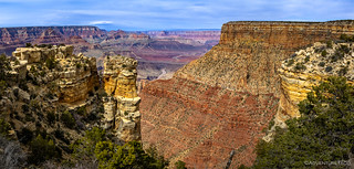
In the distance, the Colorado.
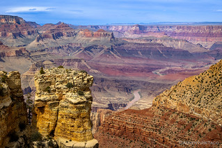
Closer.
Our final stop - at Lipan Point - gave what might have been the most expansive view of them all. Here, no pillars blocked the view, the canyon wall dropping away in a broad, sweeping arc to reveal the layers of color, mesas, and ultimately the muddy Colorado churning its way through the bottom of the complex.

A special place.
It was 3:00pm when we zoomed past the eastern entrance, our America the Beautiful pass safely secured but never needed as we visited one of America's most popular National Parks. From here, we had fewer than 45 miles to complete Stage 5, and we weren't quite sure what would happen once we did.

As we exited the park, we almost immediately turned onto dirt, an action that resulted in some inquisitive looks from the vendors selling jewelry and pottery just across the street!

As we climbed higher, the hidden part of the landscape emerged.

The scale of this place is unbelievable.
It's not that we didn't know where to go, or that any combination of the weather, road conditions, or other "normal" concerns had us wondering. Rather, it was the fact that the final stage traversed a large swath of Navajo Nation land that had the potential to cause problems.
We knew even before starting the AZBDR that we'd need a permit to cross the Navajo Nation, and we knew we could conveniently pick up the permit just outside of Cameron, AZ just prior to entering Navajo land. What we didn't know for sure were the hours of the permit office.
Knowing that we didn't know, we'd tried calling the permit office earlier in the day - just before visiting Waputki National Monument - thinking that we could pick up our permit well before the office closed for the day. However, when no one answered the phone, we called the Monument Valley office to inquire about hours and were told that the Cameron office was only open between 9:00am and 5:00pm, Monday through Friday. Normally this wouldn't have been a problem - we'd planned to be through this area on Tuesday. However, an astute reader will recall that we were way ahead of schedule, and that made for a problem: it was Sunday!
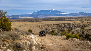
As we worked our way towards Cameron, we discussed a plan for the evening, as the San Fransisco Mountains rose in the distance.
Not wanting to sit around town overnight just waiting for the permit office to open the following morning, I suggested to my copilot that one option would be to leave a note with our contact info and itinerary at the office, alerting them to the fact that we were crossing Navajo Nation and would call as soon as they were open (and we had cell service) to pay the fees. This seemed like a reasonable plan, and before long we found ourselves just south of Cameron - at the little town of Gray Mountain - where @mrs.turbodb wanted to see some of the artwork installed as part of the Painted Desert Project.
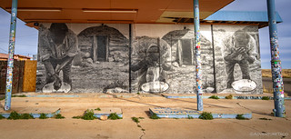
Washing up at an old gas station.
In June of 2009 I started a self-funded, public art project on the Navajo Nation that I called “Big.” I went back through 22 years of negatives and started blowing up photographs to be larger than life and then wheat pasting them onto roadside stands and abandoned buildings. I’m still amazed at the resonance this project had with people on the reservation and amongst travelers passing through.
Shortly after I started wheat pasting I met a fellow street artist based in Prescott, AZ named Yote, and for 2 years after that we collaborated on installations on the Navajo Nation, Tucson and Flagstaff.
In an effort to boost tourism on the reservation, to supplement the incomes of families with roadside stands, and to nurture the creative talent of local youth, I invited a few world-renowned street artists to come to the Navajo Nation to paint murals in 2012, and have continued to invite more as funding allows.
This is the Painted Desert Project.

Rain.
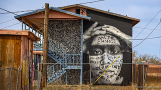
I am the change.
We'd see more work from Thomas as we made our way along the remainder of the BDR - the style recognizable, once you know what to look for - but not all of it was unscathed. As art installed primarily on abandoned buildings, other "artists" have passed through since the Painted Desert Project works were created; in some cases, they've used the surfaces as their own canvas.

You can still see some work from the Painted Desert Project behind this colorful bird.
We wrapped up our quick tour of the artwork in Gray Mountain about five minutes before 5:00pm. From there, we had but seven miles - along Highway 89 - to the end of the stage in Cameron where we'd leave a quick note at the permit office before carrying on to find camp.
At least, that was the plan until we were met, only seven miles down the road, with a big surprise!
 Mexico to Benson - Unusual Encounters | AZBDR Stage 1 - Prologue Running a BDR (Backcountry Discovery Route) this year is going to be a little different for us than it has been in years past, for several reasons. First, we'll be exploring a state that - due to its distance from home, or even Las Vegas where the Tacoma is now stored - we've done very little adventuring through. This should be a great thing, as one of the "problems" with the last couple of BDRs we've explored was that we were already reasonably familiar with what we'd encounter, making the trip less exciting. Second, we'll be running the route…
 Benson to Globe - Kinda Boring | AZBDR Stage 2 - Having wrapped up Stage 1 of the Arizona Backcountry Discovery Route (BDR) more quickly than we'd anticipated, it was early afternoon as we headed north out of Benson, toward Globe. Having just gorged ourselves on Wendy's, we weren't in any position to stop at the shop directly below this tantalizing sign as we left town. While unexpected, we were both glad that things were working out this way. We've found it much more pleasant to end a day halfway through a stage - rather than at the end/beginning of one - in order to find somewhere to setup camp and…
 Globe to Young - Take a Hike | AZBDR Stage 3 - Globe definitely won the "best marketing" award of all the towns we passed through on this trip. It was fantastic to photograph. Rolling out of Globe early on our second day of running the Arizona Backcountry Discovery Route (BDR), we were once again on - you guessed it - pavement! This was quickly getting old - as we sped north at speeds we rarely encounter on our adventures - and by now we were pretty sure that the AZBDR wouldn't be climbing to the top of our "favorite BDR" list unless something changed dramatically, and quickly. AZ-288 (the Globe-Young Highway)…
 Young to Winona - The Mogollon Rim is Closed | AZBDR Stage 4 - As our tires hit pavement in the outskirts of Young, it was time to start thinking about Stage 4. Climbing - and then traversing the Mogollon Rim - this was where satellite imagery, which I'd been watching on a daily basis for several weeks prior to our departure, suggested that 5-19" of snow still blanketed the ground. This didn't look promising. Still, my copilot - having spent the last half hour looking through the road conditions page for the Coconino National Forest - thought we stood a chance, at least in part. Though she confirmed closure of the Forest Service…
 Winona to Cameron - Volcanoes, Pueblos, and a Grand Canyon | AZBDR Stage 5 - Having "wrapped up" (and by that I mean, essentially, skipped) Stage 4 of the AZBDR in a little under six hours, it was just after 3:30pm when we set out from Winona in search of open roads. The elevations here were nearly as high as those on the Mogollon Rim, so I was a little worried that we'd soon find ourselves blocked by snow, but @mrs.turbodb was reasonably confident that we'd be just fine. As usual, she was right. The snowy San Fransisco Mountains would provide a familiar - and beautiful - backdrop for much of this stage. For the…
 Cameron to Utah - The Best for Last | AZBDR Stage 6 - A quick recap... We knew even before starting the AZBDR that we'd need a permit to cross the Navajo Nation, and we knew we could conveniently pick up the permit just outside of Cameron, AZ just prior to entering Navajo land. What we didn't know for sure were the hours of the permit office. Knowing that we didn't know, we'd tried calling the permit office earlier in the day - just before visiting Wupatki National Monument - thinking that we could pick up our permit well before the office closed for the day. However, when no one answered the phone,…
 Underwhelming | AZBDR Epilogue - The Arizona Backcountry Discovery Route (BDR) is the eighth that we've completed in as many years. Through the experience of each one, @mrs.turbodb and I are - as you can imagine - regularly comparing the current BDR to those we've explored in the past and a few years ago I finally started writing some of these comparisons down. Now, naturally, I feel obligated to carry on that tradition into the future. TL;DR - the Arizona BDR is the least technical that we've run, and the vast majority of the route would rank near the bottom of our list of "best…
Love Backcountry Discovery Routes? Check out
BDRs we've run
to find your favorite.







Stunning, spectacular, fabulous, etc... Looks like a marvelous trip, indeed. Loved seeing the Wupatki Ruins in your beautiful photos - haven't been there in 20+ years.
Grand Canyon has been made even more grand with your fine photos.
Thanks so much for the trip down memory lane.
Thanks so much Sherry! As always, it puts a huge smile on my face when folks take the time to share their enjoyment with reading through a story. Those ruins really were something special - and I bet they were even "more" special 20 years ago when there was probably a lot less visitation. And yes, the Grand Canyon always seems to impress - although, I have to admit, we made a stop at the Little Colorado Overlook on the final leg of the trip (stage 6), and I felt like it was even better!
Have been to the Grand Canyon a few times and this is the first time I knew we had our own point there! Moran Point, we're famous, LOL. Yes, it really an amazing view and your great photo showing the flats leading to the canyon is great! I'd like to visit the North Rim also and the surrounding area in Utah but last trip a few years ago the weather wasn't cooperating, bad storm so circumvented the area.
I thought of you as we saw the signs for Moran Point!
The South Rim was nice (obviously), but the North Rim is a lot more special IMO. Perhaps that's because we were there in the fall with all the aspen glowing golden, or because we didn't see another soul for the entire three days that we ventured from point to point overlooking the gash in the ground, but I loved it. Would love to go back again.
Many years ago I drove past the North Rim returning from a Utah trip, as you said, more trees, much nicer but I didn't stop because there was a really strong rain storm and the roads were in bad condition so I didn't want to get stuck and just pushed through to Arizona and home to CA.