Bella Coola is not the most accessible town in British Columbia. Our ten-hour ferry ride aside, there are - technically - roads that lead to this stunning valley, but that hasn't always been the case.
Before the road, the only way in or out of the Valley was by boat, seaplane, foot, or horseback. A trip from Anahim Lake for supplies took three days and nights. Residents kept asking for a road, but the government said the grade was too steep. A road would be too expensive. It couldn't be done.
On September 14, 1952, the Bella Coola Board of Trade took matters into its own hands. With just $250 and a rented bulldozer, they started building the road themselves. They decided not to tell the government until they reached the rim of the Bella Coola Valley, lest they get stopped.
A crew of four used the bulldozer to push through 30 miles of forest and swamp from Anahim Lake to the Valley rim in 42 days. It was then the Board of Trade notified the government of their accomplishment and asked for money to finish the last 10 miles.
Work began in mid-November from the bottom where the steepest grades up to 15% led into the rock face. Work was possible all winter at the lower elevation, but snow and the resulting wet terrain prohibited the eastern crew from returning to work until mid-July.
On September 26, 1953, the two bulldozers met one year and twelve days after starting. The government eventually paid all the outstanding bills - for a total contribution of $58,000. Residents of Bella Coola, Ocean Falls, and Williams Lake donated food, supplies, and $4,000.
The Freedom Road, BC Parks Sign
Today, we'd be taking that road, including a still-dirt section known to the locals as "The Hill." Climbing 4,200 feet in 10.1 miles (16 km), the information signs at each end note grades of 10%, 11%, 12%, 14%, and 15%, with 11 notable curves and switchbacks.
For any who have been, it was a bit reminiscent of Utah's Moki Dugway. Including the fact that it has spectacular views.

It was still reasonably early when we reached the pass, and having already been dusted with a sprinkling of rain on the ascent, the overlook seemed like a great place to stop and eat lunch.
Two minutes out of the Tacoma changed our minds. While we may have left Bella Coola behind, we'd definitely not outrun the mosquitoes. Back in the truck, we pushed on, hoping that one of the towns - we'd roll through two on our way to the trailhead - would offer an insecticide-assisted respite from the swarm.

In fact, not too much later, we found an entirely bug-free elementary-middle-high school parking lot where we enjoyed a leisurely lunch and watched near-constant helicopter traffic from the local airfield. This didn't seem to be fire-related, but rather just a normal means of transportation in these remote reaches of the province.
It was just after 2:00pm when we reached the trailhead. Remarkably, the skies had transitioned from blue to gray and back to blue again, and as we aired down for the climb into the mountains, I was cautiously optimistic that we'd find an afternoon window to eat dinner somewhere along the way.

The first 17 miles saw us weaving our way through the forest. Through greenery, clear-cuts, and burn scars, we slowly but consistently gained elevation, eventually popping out of the trees around 6,500 feet. Up here it was spring, and every clearing along the way seemed to be overflowing with color.

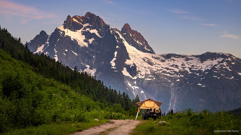
The real magic started when we broke out of the trees. It was about the same place - right at the tree line - where our road would fork, and having planned to camp at the end of the shorter spur, we pointed the Tacoma left, sweeping around the finger of the ridge that separated the two valleys we would ultimately explore.

Over the next 30 minutes, we would make slow progress. This place - like so many spots we explore - was originally opened up for mining. The roads - across the inhospitable terrain - have survived simply because there's nothing up here to destroy them. No trees to fall, no streams to wash them away. Protected by a blanket of snow in winter, even avalanches tend to flow right by.


Turning the corner into the mouth of a fantastic red bowl, it wasn't lost on us how lucky we were to be here. These are the places that are few and far between. The places that not many know exist - not to mention, experience.


Along the north side of the valley is the site of the Briton prospect, an iron deposit located about 1.2 km southeast of the nearby peak. Despite the nearby creek's name, the target here was iron. Specifically, specular hematite - a dense, fine-grained iron oxide.

This hematite occurs in a bed of volcanic tuff between 3 and 9 meters thick, exposed over a fairly large area, and assays from the deposit ranged from about 47.6% to 57.6% iron - high-grade for a hematite deposit. A 1925 Geological Survey of Canada report estimated the deposit held approximately 90,000 tons of hematite in total, though the report noted the continuity of the ore bands was uncertain.
Thirteen claims were staked by Sam Colwell and were sold to Peter Wallace and the Hematite Mining Company in 1913. Development of the mine took place between 1913 and 1920, and consisted of at least 8 open cuts and one 183-metre crosscut adit - all now caved in. The surface cuts contained the best ore with the adit being largely disappointing due to the mostly-poor-grade ore that was encountered. In fact, only a single commercial-grade pocket of hematite was found, a mere 5.5 meters into the tunnel.

No production was ever recorded at the mine, though there was renewed interest in the area - this time for gold - in the late 1960s and again between 2016-2022.
As we hopped around the rusty red rocks, we couldn't help but marvel at the scale of this place. Surrounded by towering ridgelines and gleaming white snowbanks, everything looked so big. And close. And it was big, but it was not close. Curious to see if our little flying buddy could afford us a better view, I powered up its propellers and sent it skyward.


We spent almost an hour poking around at the end of the road. For the first time all trip, there were essentially no bugs, and I found myself wondering if we should count our blessings and call this camp. It was, frankly, almost perfect.
But - as is often the case - the lure of the unknown was too great. Given that, and the fact that we had it on good authority that we'd find a similar situation in the next valley over, we climbed back into the Tacoma just before 5:00pm and began to work our way back down the old mining roads.


We made quick work of the descent, and twenty minutes later we were on our way up again. A little further north, this spur was half as long as the last, and a quick glance at the sky suggested that the all-day rain that'd been predicted - and that we'd experienced a bit of just before lunch - was going to hold off long enough for us to make camp and eat dinner. Talk about lucky!

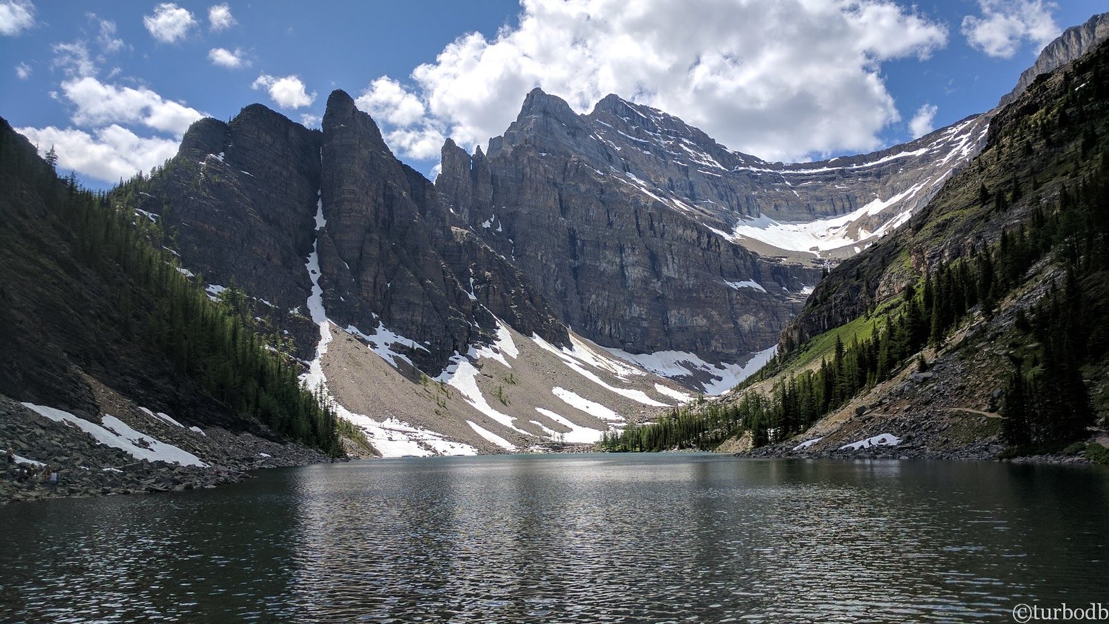
We soon found ourselves in a hanging valley a thousand feet above the one we'd just departed. The landscape here was perhaps slightly less colorful, but no less dramatic. Our campsite - along the shore of a glacial lake - would do just fine in the drama department.


After setting up the tent - and as @mrs.turbodb set about prepping dinner fixings - I gathered my phone and the big lithium battery pack I carry to jump a vehicle in a pinch, and wandered over to a spot along the lake that I thought would be great to capture a timelapse. There, I set about building a 3-foot-tall cairn and carefully aligned the phone for the perfect view.
It was going to be perfect. I'd capture the clouds as they streamed across the sky, the pastel streaks of sunset, and even the stars as they climbed into the sky above our illuminated tent.
Or at least, that was the idea. In reality, I'd confidently hit record without noticing the video mode was set to slo-mo mode. Such a mode is - as you can imagine, a bit like watering a house plant with a firehose, and is a significantly less dramatic way to enjoy a landscape like this. It wouldn't be until hours later - when I went to check on my perfect little cairn-mounted masterpiece - that I would discover the phone had been dutifully recording 240 frames/second for so long it ran out of storage and just... gave up. Great work, me.

Luckily, I was eventually able to delete 99% of the 240 frames-per-second that I'd recorded, at least capturing some of the clouds as they sped by overhead.
After dinner - taco-rritos, enjoyed on the first bug-free evening of our adventure - it seemed only right to skirt the lake to the nearest unmelted snowbank, if only to stretch our legs for a bit. As we did, we were surprised by the terrain - a seeming mix of rock and grassy groundcover. This ground cover. it turned out, was much loamier than we expected, and fully saturated with the glacial melt that was flowing into the bowl from all directions. Choosing our foot placement carefully, we eventually made it through.


Sitting on the far side of the lake, we wondered at the old mining road that climbed even further through the scree. Not knowing if it was passable to a turnaround point, we hadn't investigated it in the truck, and with our planned departure early the next morning, it would remain a reason to return to this spectacular location.
Located roughly 2.5–3 km northeast of the peak, the Mountain Boss - also referred to at various points as the Commodore or Bluebell - was a gold-silver prospect, with a bit of bonus copper thrown in for good measure. This ore occurs in narrow - but locally very high grade - quartz veins and silicified/sheared zones hosting arsenopyrite, pyrite, and chalcopyrite.
Discovered in the mid-1920s, it wasn't until 1935 that F. Crosby, J. Peacock, and J.N. Killas - as the Mountain Boss group - staked a claim and in 1938 drove a 57-meter adit into the mountain.
A sample from the newly driven adit returned 25.4 grams per ton (g/t) of gold and 34 g/t of silver, with underground sampling near the portal returning 564.6 g/t gold and 131.0 g/t silver over 1.8 meters. Still, the remote location and harsh conditions meant that for the next ten years, work would be limited. Even in 1948, when the main ore shoot averaged 14.0 g/t gold and 5.5 g/t silver over a 15.5-meter width, and a separate dump sample assayed 66.3 g/t gold and 17.1 g/t silver - with an estimated total of 30,000 tons of ore - the material was still too hard to extract.
More surveys and exploration were done between 1966 and 1996, at which point the road - that we'd driven - was built, and further adits were installed. Still, there was never enough continuity or proven tonnage to justify building a mill or shipping ore, and by 2019 the Ethos Gold Corp reported that all of the Mountain Boss adits had collapsed.
Wandering back to camp, the dark clouds that'd held off all day finally began to roll in. Not wanting to wait until it was too late - and raining - before brushing our teeth and climbing into bed, we quickly buttoned up our gear and prepped ourselves for a whirlwind pack-up-and-go in the morning. We were reading - and cozy - by the time the pitter-patter of the first raindrops lulled us to sleep.

The following morning...
It rained on and off until 3:00am, at which point the sky was mostly starry as I made a quick run down the ladder to go to the bathroom. Miraculously, the tent was basically dry at that point, the breeze strong enough to evaporate the moisture that'd fallen from the sky.
I'd set my alarm for 5:00am - a few minutes before sunrise - after agreeing that we should get going early if everything was still dry. Naturally, this led to the rain picking up again at 4:52am, and a mad dash to stow the tent before it got too wet. Of course, getting any amount of wet means the entire thing needs to be dried out before being put away for the next adventure, but a mostly-dry tent is more likely to dry as we eat breakfast or lunch, rather than requiring a dedicated session in the sun.
And so, with the sky spitting in our general direction, we pulled out of camp, ready to begin our journey home. It would be a long one - just as long as the odyssey up - but with the promise of showers and fresh veggies - especially the first batch of tomatoes - from our garden, we were both ready for the ride.
And, naturally, having already packed away the tent, the sun came out as we were driving down the mountain. It was beautiful, really, and we stopped several times along the way to enjoy the sunlight as its long rays streamed below the clouds.


Canada is on fire...
The long ride home was mostly uneventful, and definitely smoky. While we'd mumbled a bit about the smoke we'd encountered during our trip, the situation as we headed south was enough for us to be grateful for the still-mostly-blue skies we'd enjoyed every day. Here, further south, not only was the sky not blue, but highways were closed and towns were under evacuation orders.


We'd make it through unscathed and with only minor re-routes, aware that we were the lucky ones, and hoping that the coming rain would assist in the understaffed efforts to extinguish the blazes.
The Whole Story