

Our second visit - in as many days - to Telkwa Pass behind us, we raced down the valley that was shrouded in fog the last time we'd been through. Today, it was anything but, and soon we'd covered half the distance to the trailhead. It was time for a detour. We'd planned on running this trail on our way up the pass, but as we'd climbed out of the fog - and immediately into low clouds - we'd realized there was no point. Though we'd done no research on the availability of views from the top of this trail,…
4 CommentsTag: British Columbia

On our way south from the Salmon Galcier, our spirits were high. There were two reasons for this: first, we were headed to Telkwa Pass, and unlike our first visit with fog and cloudy skies, it was a blue bird day. Second - and I assure you, just as importantly - we'd overridden Google Maps suggestion and found a 4-miles-longer route back to Terrace, BC that was paved; we wouldn't have to suffer through the swiss-cheese-road we'd endured on the way north! We arrived in Terrace at almost the exact minute we'd shown up 24 hours earlier, and pulled into…
12 Comments
We were already halfway through our day, so we hoped to make quick work of the pavement between Terrace, British Columbia and Hyder, Alaska. We would be in the 49th state for only a few minutes - our actual destination was back in maple leaf territory - but it'd be the first time either of us had ever been to the largest state in the Union, so we were both looking forward to the opportunity to visit. First though, we had to get there. And getting there on BC-113 turned out to be more eventful than we'd bargained for! Right…
13 Comments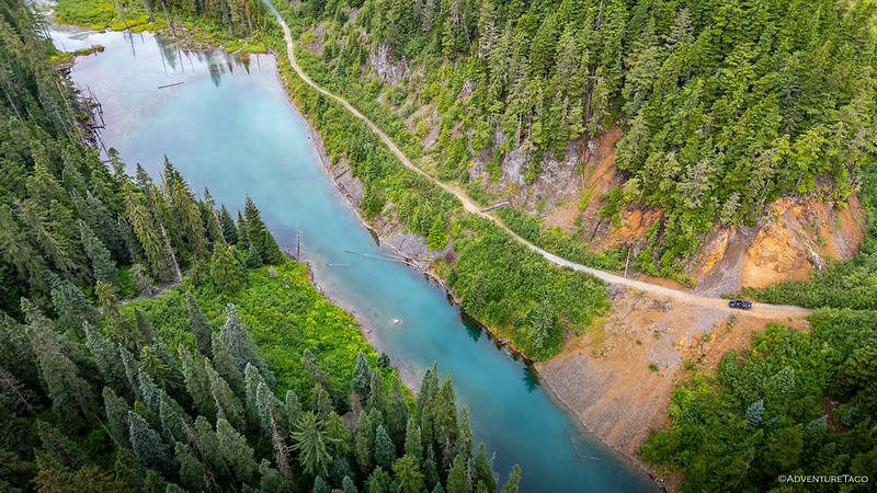
We started from what was, essentially, the furthest north we'd ever been in British Columbia, and it still took us 10 more hours to reach the trailhead for Telkwa Pass. Having left our camp below Perkins Peak a bit before noon, it was dark as we positioned the Tacoma along the banks of the Telkwa River and at the terminus of a dead-end road. We were half a day behind schedule, and while that wouldn't normally be a problem, we'd been shooting for a reasonably small weather window when we'd planned our journey along what was rumored to be one…
10 Comments
2026 in the Pacific Northwest has been a summer of smoke. With fires raging in eastern Washington, all of Oregon, and much of southern British Columbia, all the places we usually enjoy exploring during the summer have suddenly become... unpleasant. In fact, while we'd previously thought that a beginning-of-July timeframe for the Montana BDR was too early, it's now looking like the smartest move we could have made. And our escape to Bella Coola for a few days - while a little hazy from fire - turned out to be genius. And so, itching to explore - while being able…
1 Comment
While on our last trip to British Columbia, we happened to stumble upon a few petroglyphs, created by the First Nations, hundreds or thousands of years ago. They were so different than those that we've seen in the lower 48, and reminded me a bit of the style that found in Hawaii. Upon returning home though, I think it may have been the surfaces - ground-level rocks with petroglyphs on various faces - more than the actual figures, that seemed similar. We arrived at the stie on our way from one place to another. Getting there meant an enjoyable, short…
Leave a Comment
Bella Coola is not the most accessible town in British Columbia. Our ten-hour ferry ride aside, there are - technically - roads that lead to this stunning valley, but that hasn't always been the case. Before the road, the only way in or out of the Valley was by boat, seaplane, foot, or horseback. A trip from Anahim Lake for supplies took three days and nights. Residents kept asking for a road, but the government said the grade was too steep. A road would be too expensive. It couldn't be done. On September 14, 1952, the Bella Coola Board of…
6 Comments
After returning from Purgatory - not a statement one can make on a regular basis - it was time to consider our next move. There were three things that were competing for our attention: The weather. We'd been planning to spend at least three nights in the area, but in the week preceding our departure, the weather guessers suggested that four days of rain would start somewhere in the middle of our visit. Rain wouldn't be the end of the world - dark skies can make for some dramatic photos - but we wanted to get as many "big views"…
5 Comments
Every summer, I look forward to having the truck at home, so we can head north - across the border - to explore some of the most amazing landscapes in the entirety of North America. In all those travels to Canada, the Kootenays - in eastern British Columbia - have continued to capture my attention, with soaring peaks, glaciers, and brilliant lakes that make any hike worth the effort. But this time, I'd gotten wind of another place. Further north and on the other side of the province, the Central Coast seemed to offer some fantastic landscape of its own.…
4 Comments
We had many miles - all on pavement - to cover after descending Redline FSR in British Columbia's Purcell Mountains. You see, it seems that in eastern BC, the highways run almost exclusively north-to-south, with only occasional drifts to the east or west. Since parallel roads never cross, it's only the rare instances where one highway drifts east as another drifts west that one can work their way horizontally across the province. Of course, it's not all bad. It's the spectacular mountains - often topped with glaciers - that prevent the easier east-west movement. Always a treat to wind our…
Leave a Comment
Unlike the previous day when we'd returned from our hike at 6:00pm, we were back in the parking lot for The Lake of the Hanging Glacier a little after 2:00pm. That gave us plenty of time for a quick scrub-down with washcloths before climbing into the Tacoma for what would turn out to be the highlight of our entire trip! After a sunny morning, clouds were rolling in, but the sun still fought its way through to highlight Mt. Scarlett O'Hara from time to time. Our destination wasn't far away - less than ten miles, or however many kilometers that…
7 Comments
We'd gotten up with the sun at the Farnham Emergency Hut and it wasn't yet 7:00am when we departed our 7,300-foot camp site for temporarily lower elevations. It was there - at 4,800 feet - that we'd disembark from our American Hiking Machine (the Tacoma) in favor of our own two legs, regaining all of the elevation we'd lost - and more - as we fought our way through the 10-mile trek to The Lake of the Hanging Glacier. A perfect day on Horsethief Creek. After hiking the Conrad Kain Hut during the afternoon heat of the previous day, temperatures…
12 Comments
We arrived back at the Tacoma completely thrashed after hiking the Conrad Kain Hut in the Bugaboo Mountains. Still, we'd made it down the mountain in good time, giving ourselves a few hours to dash - madly - to the spot we hoped to camp for the night. Farnham. The last time we'd visited Farnham had been full of emotion. We'd made it over the sketchy bridge - adrenaline pumping - and up the narrow shelf road. We'd driven nearly to the edge of the glacier, and - gleefully - tasted a bit of the ancient ice. And - in…
6 Comments
It's been almost a year since we last found ourselves north of the border, in the land of lakes and glaciers. Then, our final night necessitated a painful retreat as thunder and lightning exploded overhead and gale force winds whipped down off the glacial ridge. We were high in the Kootenays, beyond the deteriorating old bridge at Farnham, hoping the tent would remain attached to the Tacoma. Now, we're headed back. We'll work our way along the same road system, to similar elevations, and to the base of some familiar - and some new - glaciers. This time, we'll add…
4 Comments
The rain that'd begun just as we were settling in for our post-sunrise, pre-breakfast nap only ended up lasting for about half an hour, a quarter of the time that our InAccuweather app suggested that water would be falling from the sky. And that meant we could stop - in the middle of the forest - for some sustenance. Breakfast time under nature's umbrella. After picking up a few aluminum cans that were strewn about, we figured that our proximity to Halfmoon Peak - and the fact that we could stay dry in the Tacoma, all the way to the…
6 Comments
After a 12-mile hike through Tetrahedron Provincial Park, we'd planned only a single hike on the following day. That, and I'd also found a couple of extensive looking trail systems on Gaia, and figured that we could end up wasting away much of the day searching for overlooks as we wandered our way through the forest. It was 9:30am as we wound our way through the trees toward Mt. Richardson Provincial Park. Unsurprisingly in a region where logging is king, there were roads on the ground that were not on our maps. Newly graded and covered with bright 3-inch stone…
5 Comments
Having had a successful first day on the Sunshine Coast, we hoped our second day would be one of the most dramatic - at least, from a view perspective - given the effort that was going to be necessary over the next several hours. With the amount of dew on the alders, the Tacoma started out the day with an organic carwash. Arrival at the trailhead. Our plan - a hike to the summit of Mt. Steele in Tetrahedron Provincial Park - entailed a 12+ mile (20km) hike along long-lost mining roads, through temperate rain forest, past a series of…
4 Comments
A few minutes after setting off - just before 5:00am - I realized that we've been doing this whole exploration thing entirely wrong for the last eight years. That's because our first stop was only minutes from home, for half a dozen servings at our favorite healthy breakfast spot - Family Donut. Daily calorie allocation exceeded before sunrise. With a schedule to keep - we had a ferry to catch - we managed to eat only one donut each before climbing back into the Tacoma. And, with a strict "no eating messy food in the truck" policy - of which…
5 Comments
It was 8:40am when we finished airing up at the Rady Creek FSR (Forest Service Road) trailhead. Still reasonably early, we weren't in any rush as far as our daily itinerary was concerned, but I knew that it took about 45 minutes to reach the Galena Bay ferry - departing for Shelter Bay at 9:30am - from our current location, so we zipped along at a good pace on our way toward the terminal. The N52010 Fire smoldered at the base of Mt. Murray in the Lardeau Range as we passed by. Terminal - in the case of Galena Bay…
16 Comments
In all my exploring, there are few places that I've returned to for a third time. Off the top of my head, I can list only a few: a special little spot in the California Sierra where my Dad and I meet each year, the Alvord Playa in southeast Oregon, and Butte Valley in my favorite National Park. I first visited Rady back in September of 2021 after hearing about it from Mike @POSTacoMike and watching a video that Shaun put together about the deactivation of the road that climbed high into the Kootenays of British Columbia. At the time,…
4 Comments