It was still a little before 2:00pm when we started back down the canyon towards the last segment of the Nadeau Trail - the segment that would lead us to the Modoc Mine. This mine was the reason that Remi Nadeau had built this trail - the ore from this area valuable enough to warrant the construction of a road that shaved precious miles off of the previous routes.
In April 1875, a new silver bonanza was set off on the eastern slope of the Argus Range overlooking Panamint Valley. Prospector B. E. Ball discovered there an enormous lode assaying as much as 300 ounces of silver per ton and 50% lead. One of the first investors attracted by his find was Senator George Hearst - his son would later build Hearst Castle - who promptly bought into the claims and formed the Modoc Consolidated Mining Company. The area was so rich that after a few tunnels had been opened, it was incorporated into a new mining district. Inspired by the fine views from the mine, the district was named Lookout - and so was the small camp that grew near the mines. By 1890 the Modoc Mine's production had reached around $1,900,000.Hiking Western Death Valley
But before we visited the Modoc Mine and ghost town of Lookout, we first had to get there - and so we started up the final leg of the Nadeau Trail, passing the remains of ore chutes and mine shafts as we made our way into Stone Canyon.

After about a mile, the road intersected with the Defense Mine Road - named for a mine located in a side canyon to the north of Stone Canyon proper. We would follow this road for a few miles - both to visit the Defense Mine, and also to access the winding road up Lookout Mountain to the Modoc.
The Defense Mine Road was bumpy; rocky, really. As with many roads, it largely followed the canyon wash, but one that has clearly seen more water than others. Still, @mrs.turbodb was sleepy enough that she napped as we jounced our way up through a small but narrow dry fall - one that reminded me of sections of Dedeckera Canyon on the north side of Steel Pass.

It was here too that we had a good indication that we were on the right track - that is, assuming the road went through. 

Continuing up the canyon, we eventually reached a four-way intersection, (is it just me, or are others as sometimes as perplexed as I am when you come to a large intersection in the middle of nowhere?), where we could see the sketchy-looking shelf road leading up to Lookout cutting across the mountain in front of us. For now though, we turned toward the Defense Mine.

If the Defense Mine Road in Stone Canyon had been rocky, the segment of road in the side canyon could only be described as bouldery. With loose rocks between 18- and 24-inches in diameter more common, we slowly navigated our way to the Argus Range Wilderness boundary where we planned to park the truck - to hike final segment of wash to the Defense Mine ruins.
It was just before the boundary where things got a bit...flexy.


The arrangement of rocks and holes here were such that a specific (twisty) line - with tires strategically placed so as to avoid high-centering - was required in order to make it through. I had @mrs.turbodb hop out of the truck to direct me - a task she does just fine at, but does not love doing in case something goes wrong - but even so, one of the hole-to-rock situations was deep enough that we were going to drag the rear diff.
A little rock stacking, and judicious use of the lockers, allowed us to navigate the tractionless material, though situations like this are always a little unsettling - for me - when travelling as a single vehicle.

We'd clearly reached the wilderness boundary at this point, the road becoming more of a hiking suggestion rather than vehicle-passable route, so we got the Tacoma turned around and abandoned it in the side of the wash before continuing up on foot.

It was not far - half a mile or so - from this point, to the impressive ore chute of the Defense Mine. Built in the 1940s to facilitate the movement of the mine's lead-rich ore to a truck loading platform at the end of the road, over $1.3M of lead and silver ore moved through this apparatus during the WWII era.

The hike back to the truck was perhaps even more breathtaking than the hike up the canyon. Even with smoke from California's Creek Fire filling Panamint Valley, and the increasing winds from the west - the late fall light cast a warm glow on our surroundings, their rugged remoteness a critical component to the beauty.

Finally, it was time for us to attempt the location that was the impetus for this entire trip - Lookout and the Modoc Mine. I wasn't sure we could get there, as the roads I'd found when researching the route - both on Google Earth and in written texts - were faint. Were they passable?
The glimpse we'd gotten as we'd driven by on our way to the Defense Mine had not been reassuring. But hey, if you're going to die, it might as well be doing something fun, amiright? 
It turns out that this was one of those times when the road gods were smiling down on us - despite what I'd seen via satellite, and the view from the wash, the shelf road and switchbacks up to Lookout and the Modoc Mine couldn't have been in better shape!
And the views. Oh, my.

Of course, this is still an old, lightly travelled, unmaintained road, so it's to be expected that time will take its toll. Eventually it will be impassable, but for now, the truck-sized rocks that rolled down the cliff to the road bed still allowed enough room for us to wiggle our way through.

And soon enough, we reached the old Lookout townsite. Perched on the eastern face of Lookout Mountain, at least the folks who lived here had a nice view for all their hard work!
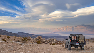

A sign laminated and posted at the sight provided tons of color for this special spot.
Originally called Modoc Camp, Lookout had more than 50 dwellings, and 5 Saloons. In addition, there was a blacksmith and stable, Modoc Mine Company office, two general stores, and a boarding house with a restaurant.
The troublemakers in town were Tom Belmont, Hairy Bill, and Jack McGinnis.
The building this sign is on, is the basement and living quarters of the general store. In 1876, the local miners were having a big celebration and while drunk, they broke into the store and threw two kegs of nails down the stairs into the basement. Then the miners moved down the street to trash all five saloons in town.
Today. his beloved town of Lookout is only rubble. Some visitors have reported to seeing a ghost on Main Street, near the General Store, at various times of the day and evening Could it be Frank Fitzgerald? Hal Fowler, Lookout Historian
We continued to poke around the general store, and made our way down the hillside to investigate several of the other stone foundations - each of them some 4-5' tall, and still in amazingly good condition, the dry-laid rockwork withstanding the harsh environment much better than the wood that once capped these buildings.


Our slow-going in Snow Canyon and to the Defense Mine had eaten up a bunch of time, and as we drove out to an overlook of Panamint Valley, toward the Modoc Mine shafts, we both knew that we'd be camping here for the night - there was just no way we'd be able to explore the rest of the area - and get to our next destination - while there was still light in the sky.
Also, given my propensity for camping on the edge of a cliff overlooking a view, I wasn't about to pass this up.


And it only got better as the sun got lower.

The only problem was the wind. The calm breeze of the previous nights was no longer. Instead, a reasonably constant 10mph was blowing through camp, with gusts up to 25mph every few minutes. To stay warm, we huddled in the truck as we ate dinner, the ham radio tuned to the NOAA weather station to give us an idea of what was coming - as though the tent rocking the truck wasn't an indicator enough.

What was coming - it turns out - was more of the same. Though NOAA seemed to suggest that it would largely be limited to the mountain ranges to our east, the forecast was for a winter weather advisory bring 1-6 inches of snow and gusts up to 50mph!
Still, I was hesitant to leave this location, as I knew the experience in the morning would be splendiferous. So, I suggested that we read our Kindles for a while to see if the wind would die down as sunset passed.
Alas, I'm old, and by 7:00pm I'd already nodded off in the driver's seat - an hour of moonless darkness more than I could handle. Begrudgingly, I admitted to @mrs.turbodb that we should probably find somewhere a little more sheltered. So, we folded up the tent and made our way back along the ridge, its walls shielding us from the worst of the wind, but sleep still fitful as the tent was buffeted to-and-fro.
Our Last Day
I once again set my alarm for "too early," hoping to catch first light and sunrise from up here in the clouds. Or, as it turned out - from up here in the clear sky!
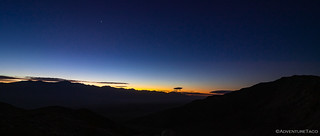
The strong winds had blown the clouds to our east, and the orange glow over the horizon contrasted nicely with the deep blue of the night sky, stars still present in the eastern sky. It was chilly though - a good 25°F cooler than it'd been the day before, and I quickly scurried back under the covers for another hour of coziness, until the sun made it impossible to resist the outdoors.

Our first order of business - after putting the tent away - was to get ourselves into a sunnier position for a little warmth and breakfast. Of course, we knew just the place!


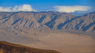
Cereal in hand, we marvelled over Lake Hill - a chunk of the Cottonwood Mountains 3.5 miles to the east. Probably in the late Pliocene or early Pleistocene eras, as a result of repeated earthquakes along a low-angle gravity fault, it slipped down into Panamint Valley - now a stark chunk of Dolomite, seemingly out of place.

And, a little further north, the Panamint Dunes. Hiking these is not easy, but they are on my list of reasons to return.
It wasn't long before we were ready to start our exploration of the Modoc Mine. This was an investigation that we initially undertook in the truck - making our way down the only-possible-because-of-a-rock-retaining-wall road leading along the edge of Lookout Mountain. As we passed one, and then a second uncovered mine shaft plunging dozens of feet down, and immediately next to the road (on the uphill side), I realized that this might be a good section of trail to walk before proceeding.
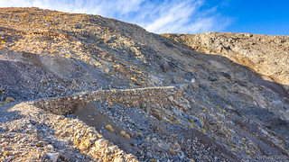
And it's a good thing, too! A little further on, a sink hole - some 20-feet across - plunged 30 feet before bottoming out, the rock retaining wall still standing despite what must have been a dramatic ordeal. With no idea how it happened - perhaps a mine shaft below collapsing? - we knew one thing was certain - we weren't going to be able to drive far enough down the road to get to the turnaround at the end.

We set aside our predicament for the moment and immersed ourselves in the splendor of the Modoc. There were shafts everywhere. Below the road, above the road, immediately next to the road.
We investigated a few, though the obviously unstable ground gave us more pause than at some other mines we've visited, that's for sure!

I think I'm good here.

Cavernous collapse.
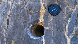
Along with the shafts, much of the hillside was peppered with 3" drill holes - likely used, I believe, for road building, core sampling, and shaft creating.
Eventually, it was time to head back to the truck and get ourselves back down the hill. This turned out to be a bit of a sticky situation - as we had quite a distance to back up, and I hoped that a relatively wide mine shaft opening on the side of the road would allow enough room to back in far enough to turn around.
With @mrs.turbodb ensuring that I didn't run into the mountain, I pulled forward and then backed into the wide spot as far as I could without bashing the truck. Alas, I wasn't even perpendicular with the road, and the angles made it such that there was no way to maneuver farther. With some spotting of the passenger side from @mrs.turbodb, I was going to have to back up the road.
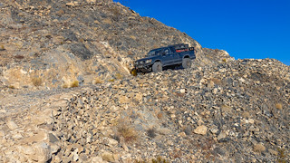
This didn't turn out to be all that terrible - even with a few off-camber sections that always seem worse in reverse - and soon we were back on the ridge and pointed the right direction, the sun brilliantly showing off the colors of the Argus Range.

Down into the wash, we marveled at the power of the earth, layers of sediment turned to rock and then twisted - as we passed through the entrance to Stone Canyon, and back onto the alluvial fan that would carry us north on the Defense Mine road.


And with that, we reached CA-190, completing the Nadeau Trail, plus a little. We hadn't traveled far from a mileage perspective, but we'd seen more than we'd imagined. We'd also used nearly a full tank of gas, so a quick stop at Panamint Springs Resort was in order to fill up.


The truck's thirst for dino-goop sated, we weren't quite done with our Death Valley adventure - there was still that spot I'd hoped to camp the night before. And, given that it was only 10:30am in the morning, we had plenty of time to take the backroads to Darwin, right?
Famous. Last. Words.

We made good time as we turned off CA-190 just west of Panamint Springs Resort - the road was graded, and though it was steep and rough in spots, even a standard clearance vehicle could make it with some careful line choice.
But then, the first of several distractions - mining structures perched high on a mountain to our south caught our eye, and a road leading towards them seemed too good to pass up. This, it turned out was Zinc Mountain, and before long, we were high above the well graded road, the road completely washed out, and the mine still several hundred feet up.
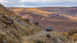

An adventure for another time.
A little pressed for time - we had somewhere to be by sunset  - we'd have to leave the Zinc Mountain mine for a future trip - perhaps the same future trip where we'd explore some of the mines we couldn't reach in the Argus Range the previous day. And so, it was back down to the Old Toll Road to Darwin to press on.
Not 5 minutes later, another too-good-to-pass-by detour caught our attention. A short loop road to some mining ruins above the trail. Sure, the road was steep, but nothing a little 4Lo couldn't handle - right?
Well, it turns out that even with lockers, the 40% grade at the top of the trail was torn up and loose enough to make the going unsafe, and after slipping precariously sideways on the trail, we decided the smart, single truck move, would be to back down the way we'd come and let our adrenaline levels fall a bit as we continued on our way.
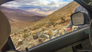
@mrs.turbodb did her best to capture the incline.
Our third distraction was more tame - and the only one of the three that we actually achieved! A couple miles off the main road, ████████████ Spring. Once the site of a mine, the spring now is an improbable cluster of Cottonwoods in the middle of an arid desert.

We were sure there'd be no water at this time of year, but apparently the spring is still active, some colorful and unexpected residents, eager to see us and any delicious tidbits we might bring along.
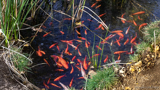
Unexpected residents.
An old tin shed below a dilapidated loading dock and what was once the height of luxury automobiles were the only other remains at this site, a place that obviously sees quite a few visitors due to its proximity to well-graded roads. Remember - places like this in the desert are special. Treat them with respect so that others can enjoy them too!
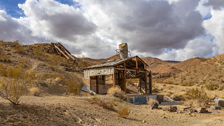

The spring turned out to be our last distraction - at least of the detour-invoking kind - and as the road surface got even smoother, our speeds picked up as we neared Darwin - a few Joshua Trees beginning to dot the landscape at our higher elevation.

Now on the back side of the Argus Range, we could see that the snow we'd heard about the previous evening had in fact made it further inland than predicted, the tops of the mountains dusted with the white powder of winter - a striking view in the middle of the desert.

And then, finally, we arrived at a point I'd placed on my map a little more than a year earlier when Ken @DVExile had posted a photo of the picturesque headframe. Looking back now, it's clear that his composition skills are head and shoulders above mine, it was thrilling nonetheless to travel in his footsteps and capture the dusting of snow in the same frame.

By now it was lunch time, and while we were both hungry, @mrs.turbodb had the brilliant idea to merge the tasks of airing up and lunch, so as to not waste valuable time on our way north to one final treasure hunt that we hoped would yield a highlight of the entire trip. So, we held off on food until we passed through Darwin - the town's artists clearly also comedians - and found ourselves on a pass overlooking an adjacent valley. A storm blowing over the Inyos, we ate tuna and chips and reflected on the fun we'd had!

Darwin is a bit... depressing. Still, if you're into these types of places, check out the documentary.

We initially thought this was an ancient stone alignment. Then we realized where we were, the legs a giveaway.

From here we were headed north - our anticipation high. We knew what we were looking for - it's just that we didn't know exactly where they were - or, if we'd find them!
The Whole Story
Love Death Valley? Check out
the Death Valley Index
for all the amazing places I've been in and around this special place over the years.


Hi, Greg again from Bishop. Great writeup but shame you invested your exploratory time on the Modoc instead of the Defense. Being younger and more stable rock with good venting, it is a spectacular mine to explore!
Guidance is painted on the walls and solid ladders lead to multiple levels to explore.
There is an exit a good 200 feet above the entrance and it is funnest safest mine ive ever encountered! Something for a future visit, but shame youll have to brave the rough road again.
On your way to Lookout City, bet you recall the road arriving at the ridgetop shortly after the 4 way intersection? At the ridge,the toad turns east towards Lookout City. Right there a feint blocked shelf road heads west and slowly makes its way back down into Stone canyon. That is the old stage route that goes over the argus range and eventually to Darwin after traversing a corner of the Navy base which is why its closed.
The stage had to climb up to the ridge to get around the waterfall visinle fown in Stone cyn.
Wonderful hike that reveals amazing rock walls that were the standard before heavy eqpt. built roads. Took me half a day to hike to Argus ridgetop, Darwin view and back, but I think youd love it.
Also bet you noticed that Lookout City built with square nails which really dates it!
Thanks and eagerly await next installment.
Greg
Hey Greg, glad you enjoyed this part of the story! As for exploratory time - as my first time in the area, I pretty much knew I'd be coming back, so I don't consider any of it "wasted." ? Heading back to the Defense Mine is something I'd love to do, and now with confirmation that it's fantastic to explore - well, that just makes me look forward to it more! ?
And, that intersection with the road back into Stone Canyon - well, I want to explore the road you mentioned, as well as Stone Canyon itself!
Thanks again for reading and the tips, they will not be forgotten!
Dan
Wonderful story and excellent photos!!!
Thank you!
Great reading??Makes me want to take my bronco on those roads now
Thanks Dale! Hope you enjoyed all the parts of this Nadeau Trail trip, and maybe some others that can stir up the desire to hit the dirt in that Bronco. It would certainly be able to handle it! Have fun out there!
Thanks for the GREAT photos of my “old country”. The Defense Mine was owned and operated by my family. We lived at Panamint Springs, later Darwin and then Lone Pine. Stone Canyon, the Modoc, Lookout etal hold very dear places in my memory. I treasure my memories of the Defense.
Wow Marilee, that's super cool that you found this story, and thank you so much for reaching out with a comment. It's always surprising to me when those who are infinitely more familiar with a place stumble on my explorations. I have no idea if you'd be up for it - because I know it's a lot of work to write them down - but I would absolutely love to hear some of your favorite stories from growing up in the area. Of the mine, of what it was like to live there, of how you saw it change over the years, whatever.
I also know that sometimes it's hard to share that kind of thing on the internet. If you'd be more comfortable just writing an email to me, you can reply directly to this message (even though it asks you not to/to reply via the link on the web site) and it'll come to my inbox.
Again, very glad you found it, and even happier that you reached out!
Cheers,
Dan