Back in May, we'd attempted to run the northern 40% of the Oregon Backcountry Discovery Route, from Seneca to the Washington border. A day in, we chose a more reasonable goal: Seneca to Unity. And at day three, we called it quits - less than 50 miles from our start point.
So you can imagine that we were excited for a second chance. Redemption as it were.
In the month leading up to the trip, we got ready. Alcan leaf springs, a new HAM radio, and an ARB fridge were going to make us more capable, safer, and well fed.
Our plan was to run Route 5 - from New Pine Creek, California to Walla Walla, Washington - in a week. It would mean approximately 150 miles per day (assuming no major re-routes) which we knew was a lot, but we hoped we could do.
Our daily goals would be:
Day 1, Saturday:
Home to Starting point in New Pine Creek, CA
Day 2, Sunday:
New Pine Creek to Summer Lake - 160 miles
Day 3, Monday:
Summer Lake to Riley - 150 miles
Day 4, Tuesday:
Riley to Seneca - 140 miles
Day 5, Wednesday:
Seneca to Granite - 170 miles
Day 6, Thursday:
Granite to Kamela - 130 miles
Day 7, Friday:
Kamela to Walla Walla - 100 miles
Day 8, Saturday:
Walla Walla to Home
And the route we would take would be based on a route we’d found from 2015:
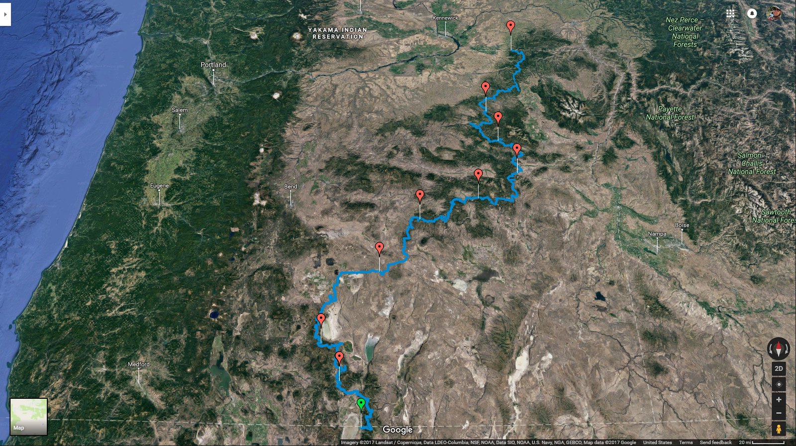
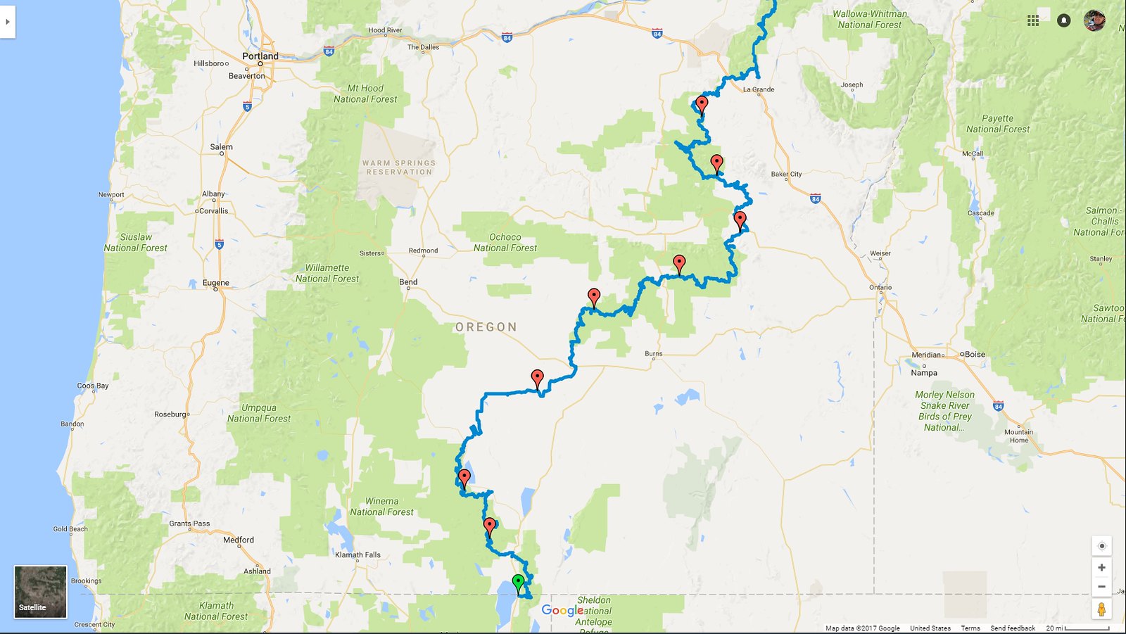
While this route was close to our ultimate path, there were a few deviations - mostly to keep us off of ATV-only tracks, and out of the middle of lakes. Luckily, we recorded everything so that the next time we want to make the run (hahaha, that’ll be a while), we know right where to go!
Return to the OBDR Day 1: Excitement, Adventure, Disaster.
July 29, 2017.
"Damn it." That's what I said when I felt the back of the truck slip a few inches downhill and come to rest on the side of a tree. It was 7pm, I was tired, and it was looking like the whole trip might be a bust.
But we are way ahead of ourselves. And we're just at the beginning.
The morning of day 1 we awoke early, showered, and got on the road. The drive from Seattle to New Pine Creek at the California-Oregon border was a 9-hour drive, and we had a couple of stops in Bend planned to pick up some gear.
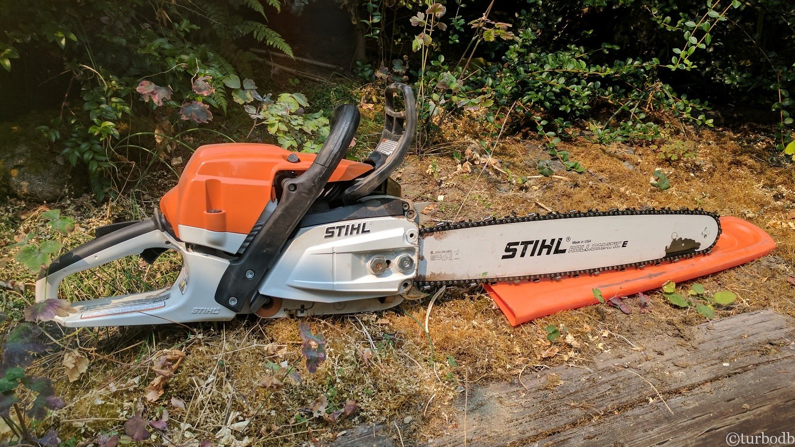
Our first stop was at Stark Street Lawn and Garden, a local Stihl dealer. Having cleared 30+ trees in our last outing, I'd arranged to pick up a little something to help with any downed trees this time - an MS-261 chainsaw with a 20" bar. Boy, were we glad that I did! They good folks at Stark Street were great, and we were in-and-out in less than 20 minutes, the proud owners of this beauty.
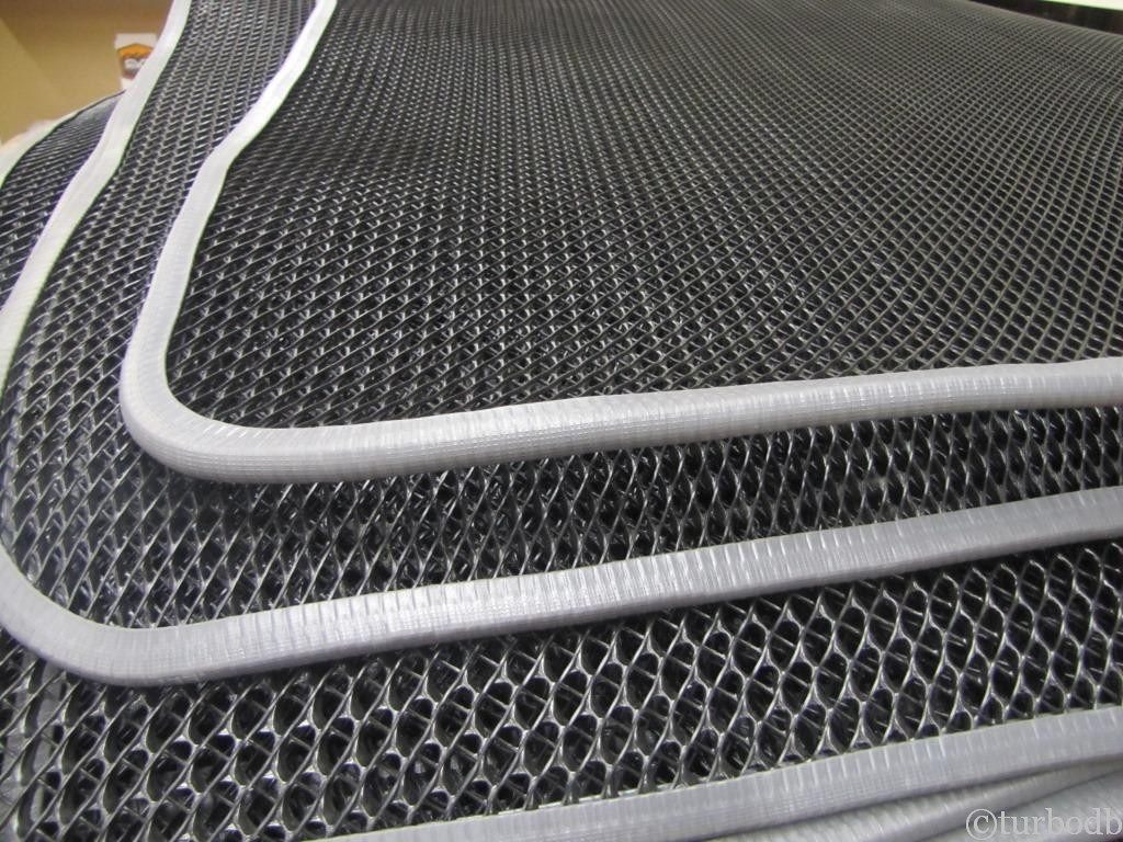
With that, we headed up the street a couple blocks to @Cascadia Tents, where we'd arranged to pick-up an anti-condensation mat for the Mt. Shasta we'd installed for our last trip to Oregon. We'd used the tent for 20 nights of camping already, and it was fantastic, except for the condensation we had to let air out each morning under the mattress.
The new condensation matt fixed all that. Completely. It was like magic.
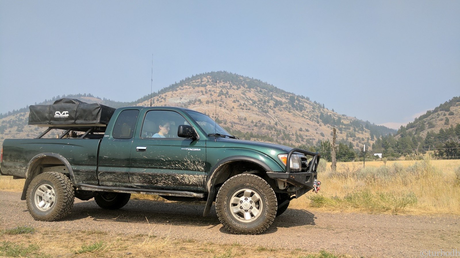
And with that (plus a quick bite to eat), we were back on the road for several more hours until we reached our destination: New Pine City, California - the start of the Oregon Backcountry Discovery Route (OBDR).
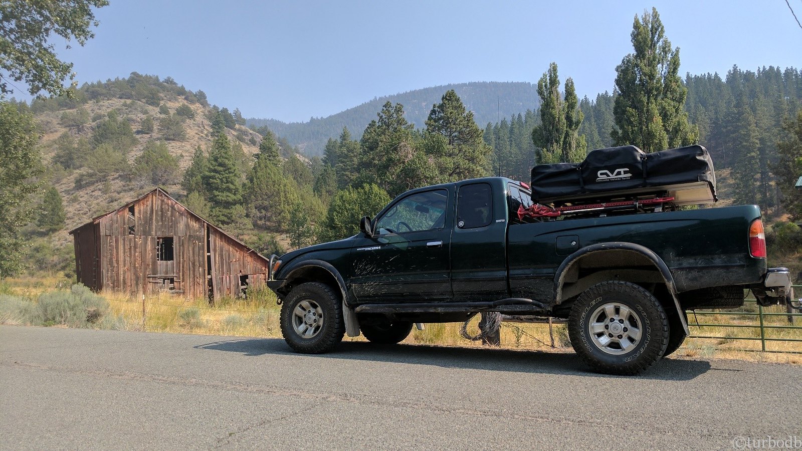
As we pulled off the pavement, we made a quick stop to get our bearings, get the GPS showing the OBDR setup, and get the cameras ready. We decided we'd try to make it a few miles to the Oregon border to find a spot to camp for the night, so we aired down to 18psi (where we'd remain for the next 7 days!) and we got going.
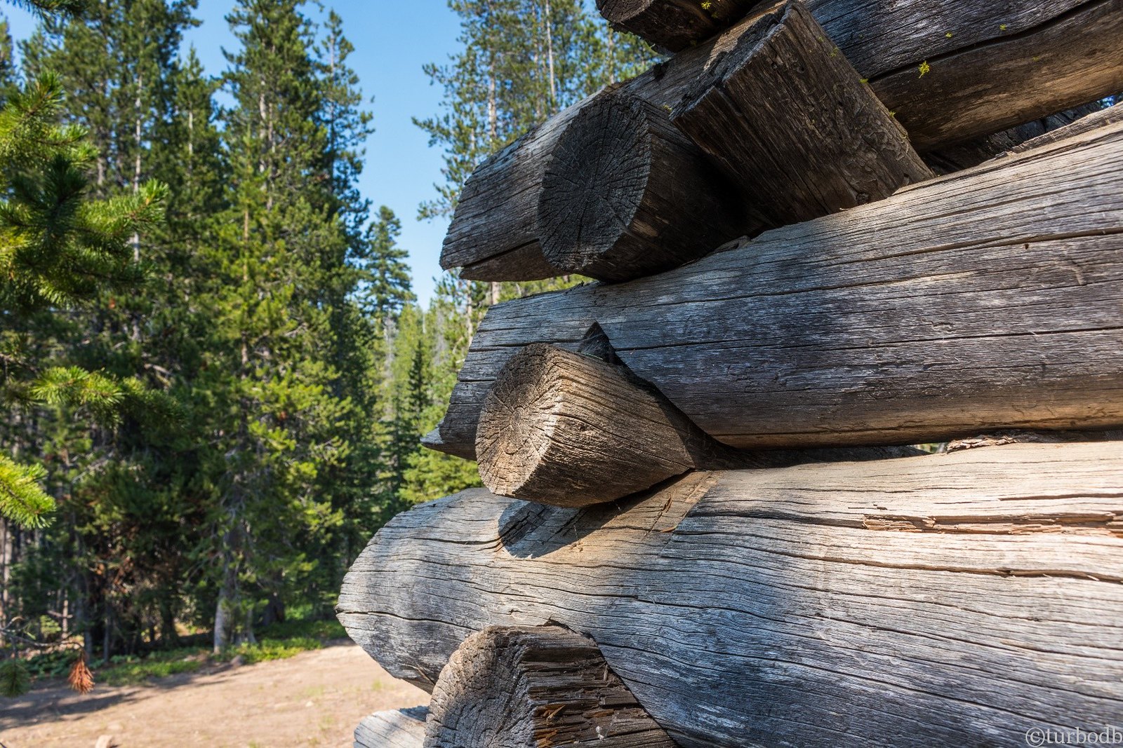
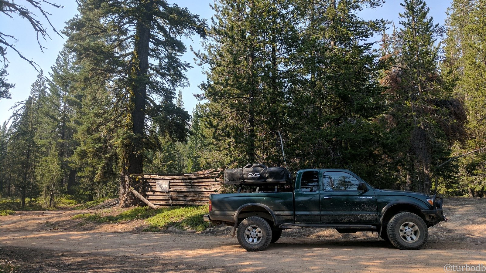
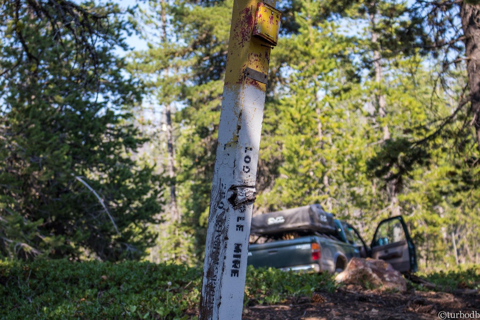
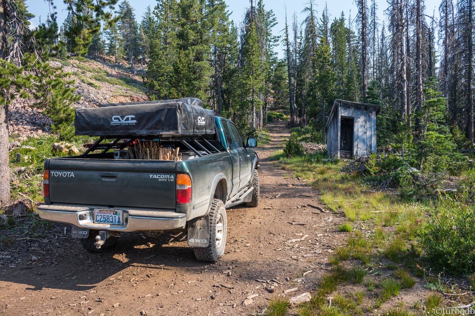
Immediately the trail had points of interest. Lakes and old mine sites proved too alluring to just drive by, so we explored. The Lodge Pole Mine was long abandoned, but the Moonlight Mine had more recent activity.
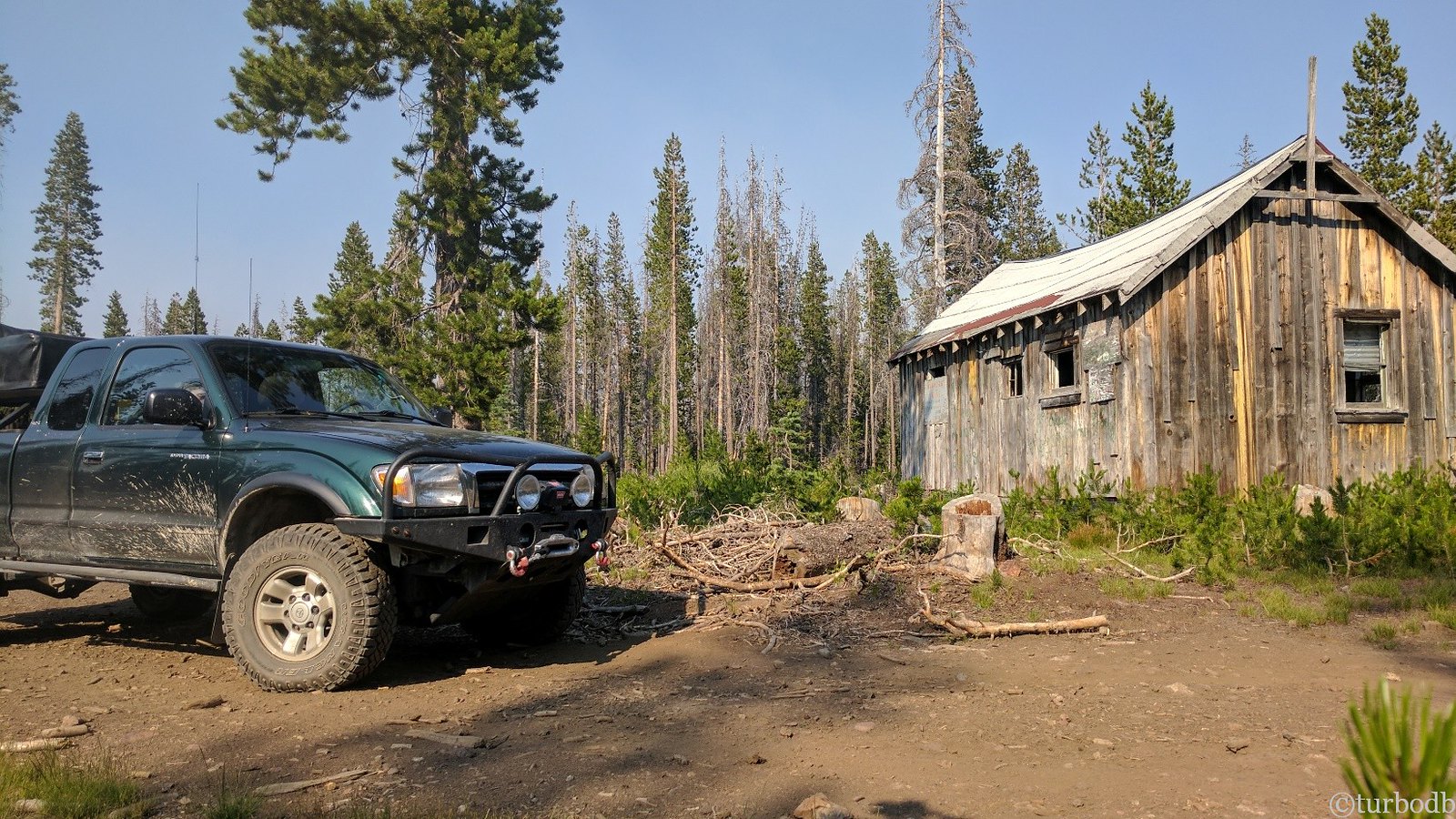
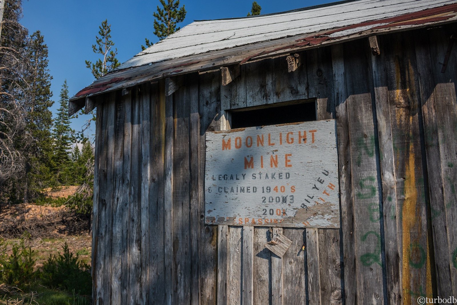
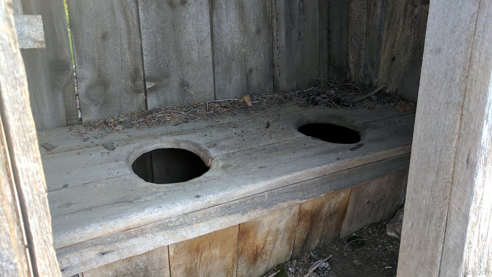
One thing that was a little strange at the Moonlight Mine - the outhouse. You don't generally think of miners using a two-holer. At least, I don't.
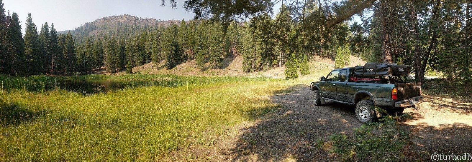
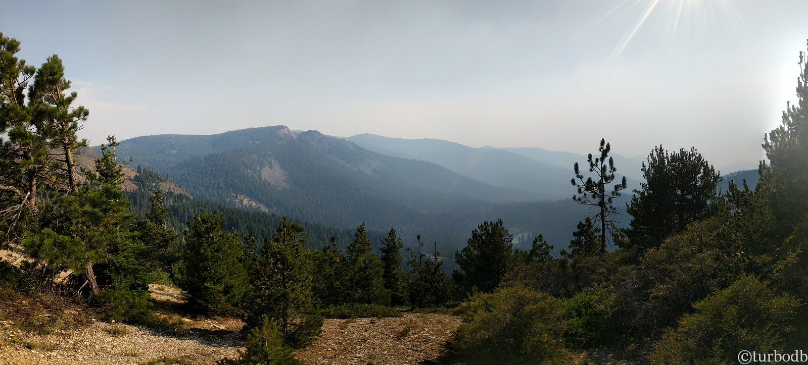
With that exploration behind us, we continued on the trail to the north, following waypoints on the GPS, despite the lack of road on the map. Up on a ridge, we had views to the south, where there were fires burning in California.
That lack of road probably should have been a tip-off, but we continued on until we ran into our first tree on the road. A small one - easily moved.
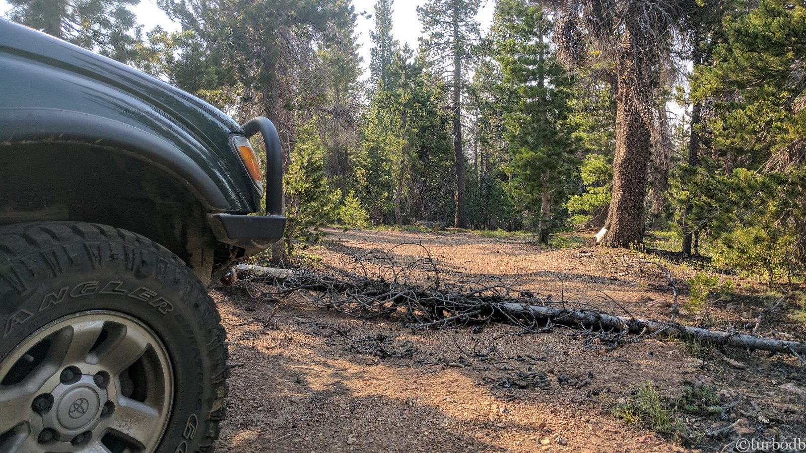
And then, a second tree. Bigger this time. Exciting - the first chance to use the new chainsaw, which made quick work of the obstacle. It would instill a confidence in us that was unwarranted and would shortly get us into trouble.
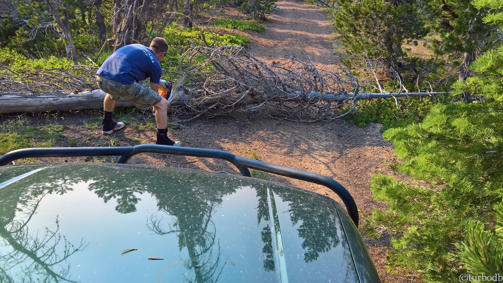
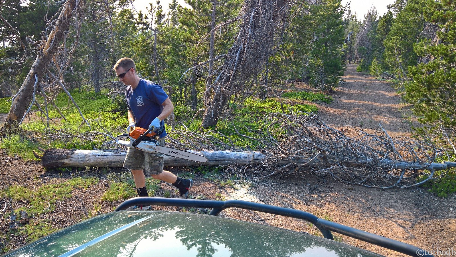
As we proceeded on, the trail got narrower. There were more trees down. And then, a section of trail covered in trees. Probably 30 or so over a half-mile climb to the top of the mountain. So we parked, I got out the saw, and we started clearing - from the top of the trail back down to the truck. Ninety minutes later, we'd cleared 25 trees (and refilled the chainsaw with more gas) and we were ready to go. As we started up the trail, we wondered if the entire trip would be a tree-clearing operation as it had been in May - much easier now that we had the chainsaw - and if all the roads would be this narrow.
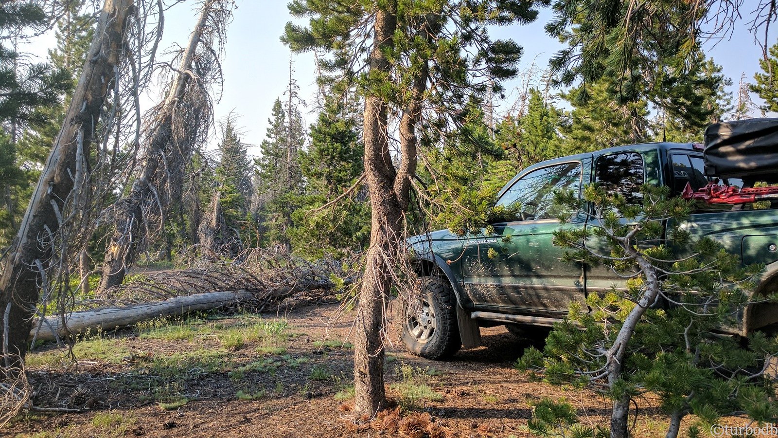
The Tacoma is narrow, but it's no ATV, and there were a few places I'd had to cut down trees because the trail was clearly not wide enough. And then, as I was crawling through one especially narrow section, the back wheels slipped slightly left (when the right slider hit a tree) and the bed of the truck came to rest against another tree.
"Damn it!"
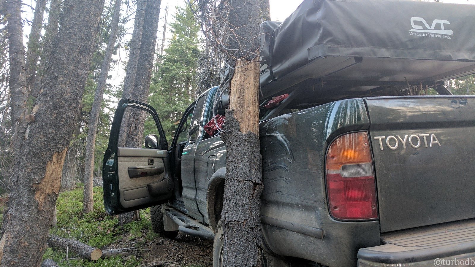
I got out an assessed the situation. Pulling forward or back would just do more damage. The only solution was to cut down the tree.
Of course, it was leaning slightly over the truck, and there was another tree that would keep it from falling away from the truck, so they both had to come down, and we were going to have to be careful! Luckily they were dead, so we'd be able to pull them away from the truck with a rope as we notched and then back-cut them.
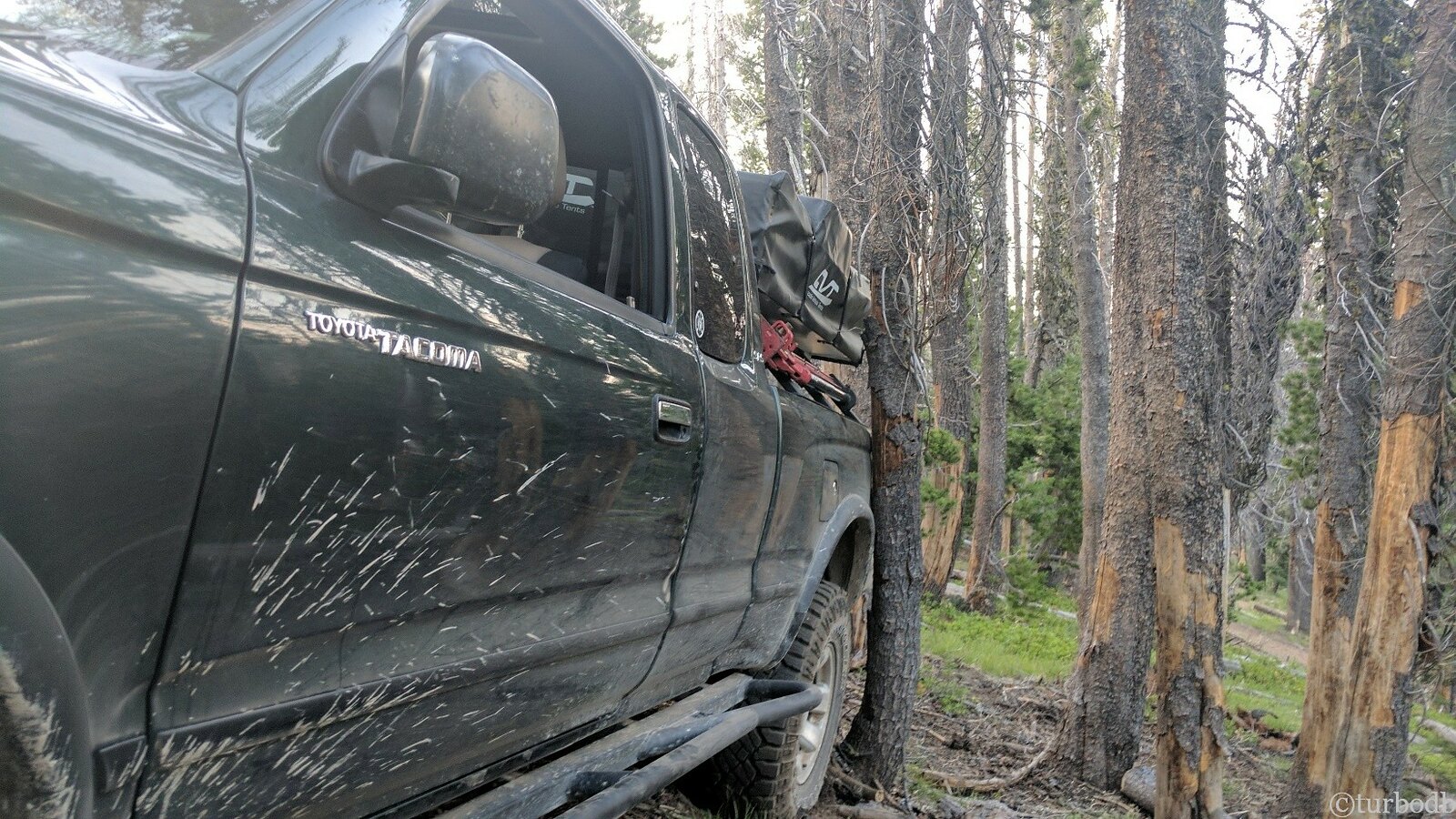
So I got out the saw and gave it a pull. Nothing. After 10 minutes trying to get it started, it was clear that it was flooded. Definitely my day. "Damn it."
I broke out the 10" pull saw and got to work manually. After notching the tree away from the truck, and starting the back-cut, I got @mrs.turbodb setup to complete the cut as I pulled the trees away from the truck. We got them both out successfully with no further damage.
But still, I was not a happy camper.
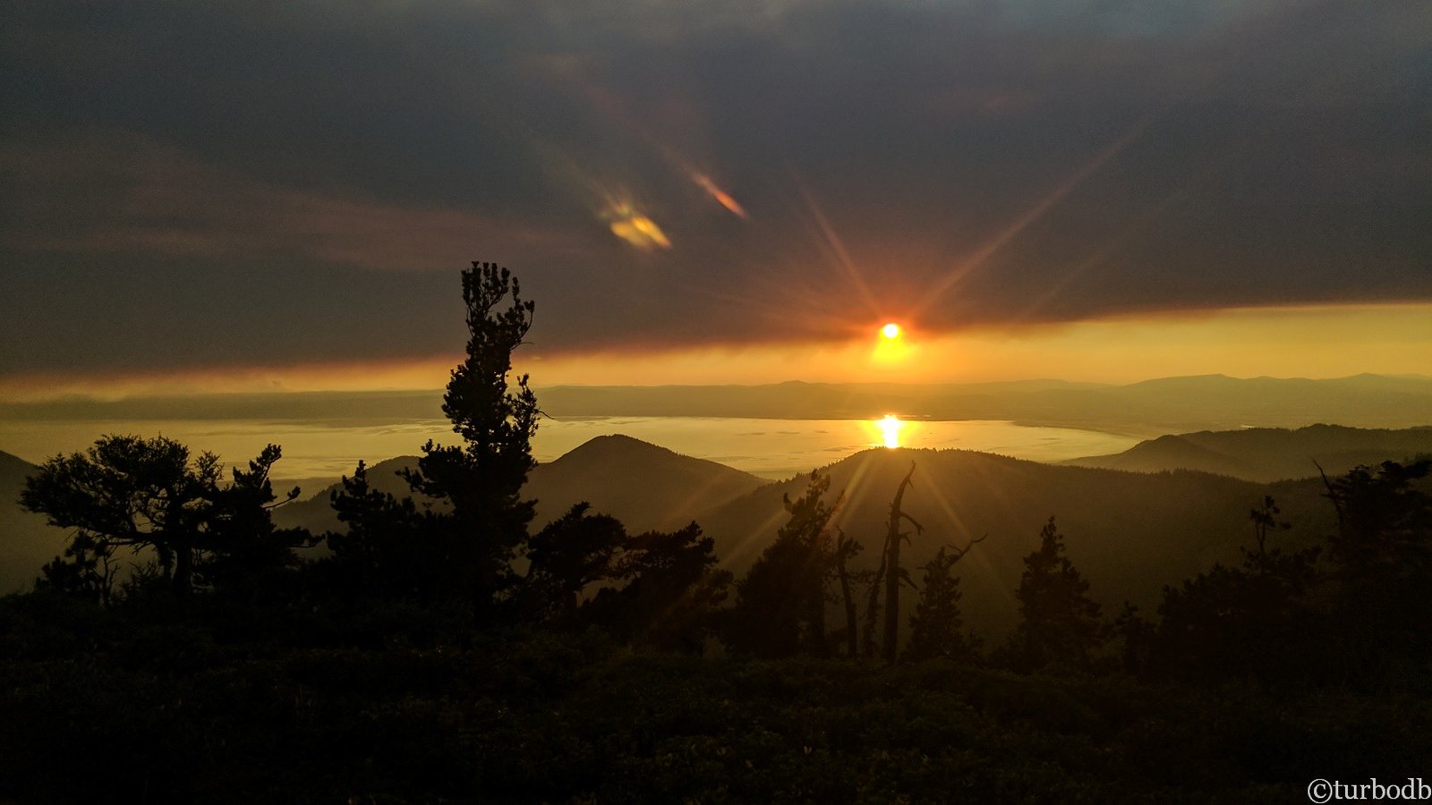
At the top of the hill, we took in the sunset and re-evaluated. The trail was getting even worse, and it was clear that I'd be cutting down trees just to continue forward. This was clearly a motorcycle/ATV trail, and not something meant for trucks - even compact ones.
Less than three hours into our adventure, with the sun setting to the west under smokey skies, we decided to turn around.
We headed back to the Moonlight Mine, and ate PB&J sandwiches for dinner in the dark. Tired and defeated, we crawled into the CVT knowing that tomorrow would be a new day - a day that we'd have some choices to make if we were going to complete our mission of conquering the Oregon Backcountry Discovery Route.


Enjoyed the trip report! I’m looking at doing this route on my adventure motorcycle this summer. Do you happen to have the GPX files you’d be willing to share? Thanks!
Hey Adam, glad you enjoyed the trip report - it was one of the first that I put together and a fun time-warp for me to go back and read when your message popped in. ? As far as the route goes, you can see my approach to sharing those files generally, here: Do you have a GPX for that? Especially with a route like the OBDR, where a private organization has gone to all the effort to build a route, maintain the viability of the route, map bypasses each year, etc., it would be a real bummer if one person were to buy the maps and then completely undermine all that hard work. So, with my trip report and the Index of Places, Trails, and Hikes, you could probably sleuth it out, but my recommendation would be to support the good work of the OOHVA and grab a set of OBDR Route 5 maps from them!
Stolen out of my driveway in 2004.
I’d still be driving it today if it hadn’t been stolen.
Bummer!