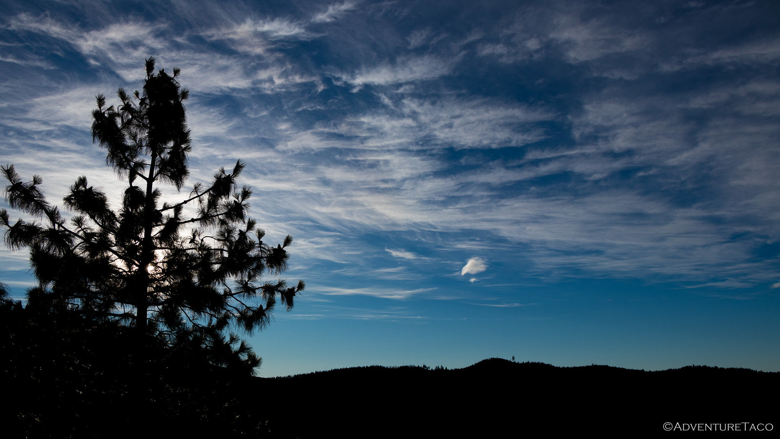
Our campsite above Lake Chelan worked out well through the night, the small bluff sheltering us from the wind until it died down in the early morning hours, and no traffic on the nearby road. In fact, the site worked so well that none of us woke before sunrise, instead the warm sun hitting the tent was what finally roused us from our sleep.
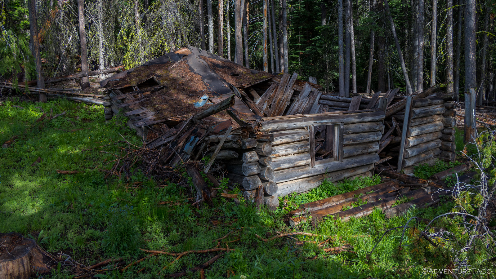
As usual, we spent a bit of time exploring the area with @mini.turbodb and stumbled upon a fenced-off area that appeared to contain some sort of well. We never figured out exactly what it was, or how it was used, but it was clear that it had been abandoned long ago - perhaps even before it was finished - many of the fence poles completely rotten, and piles of rusty old nails strewn about.
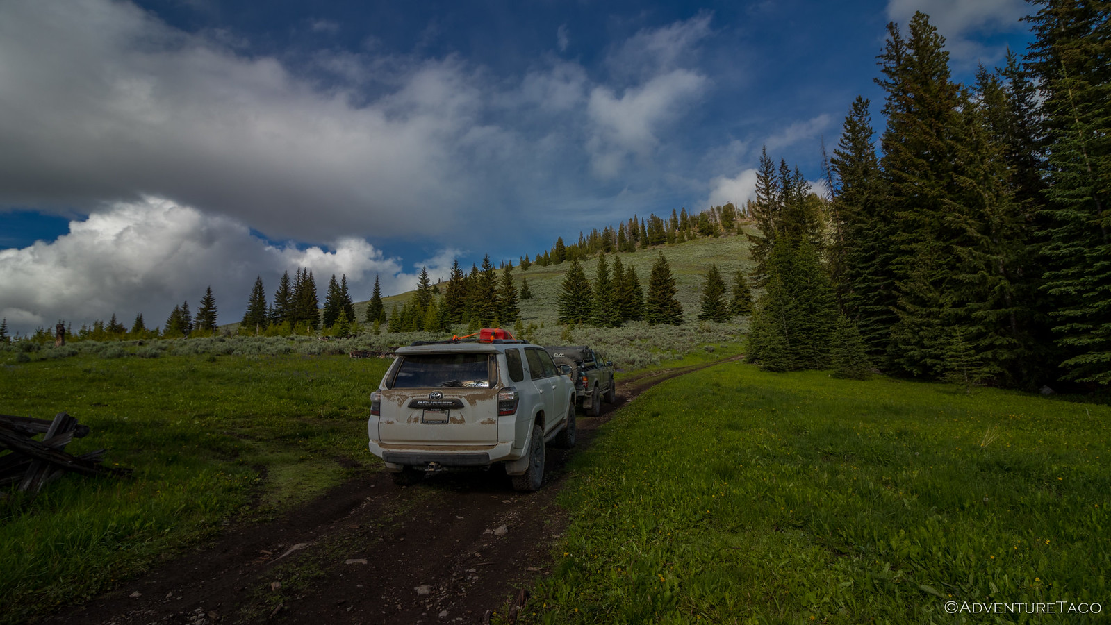
Breakfast (cereal with blueberries from our garden) and camp tear-down were speedy, having become second nature over the course of the week and it wasn't long before we were back on the road, climbing further up the hill where we'd found camp the night before.
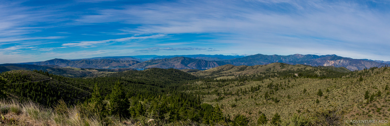
As we crested the top, my emotions were mixed: on the one hand - there was this absolutely amazing view; on the other, just across the road was a large, flat, sheltered camp site with a well-established fire ring! Oh well - you never know what's "just one more mile up the road," and we'd had a great evening so I couldn't really complain!
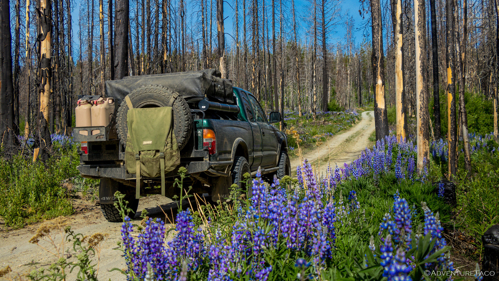
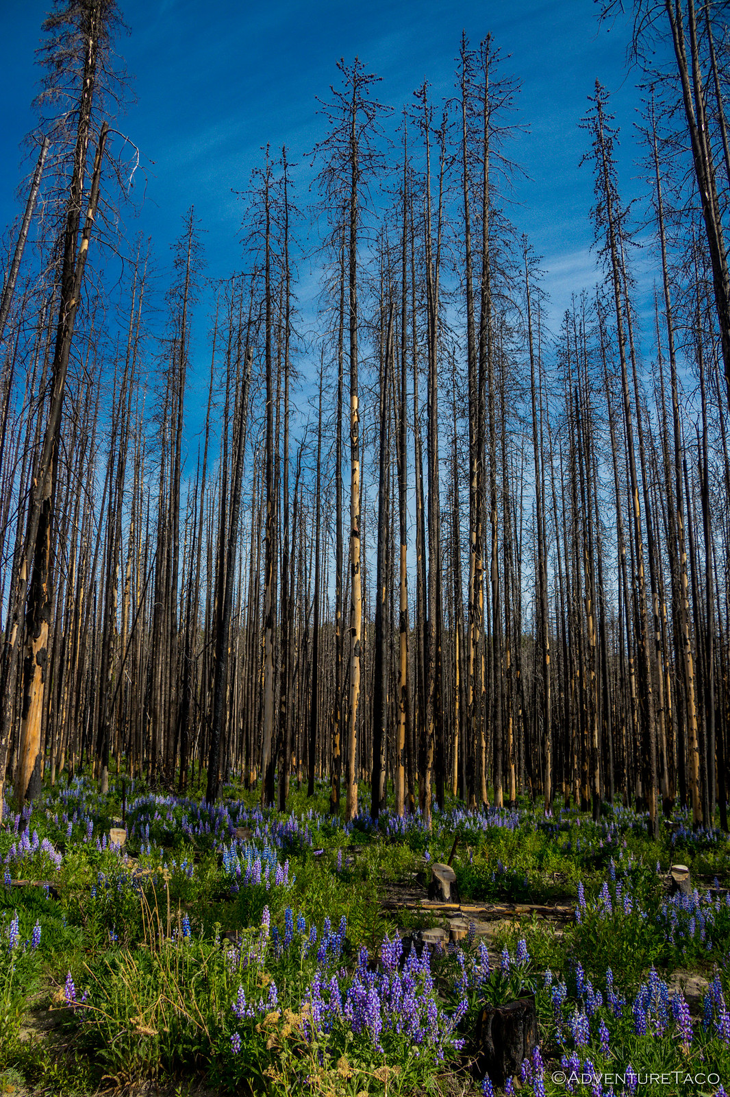
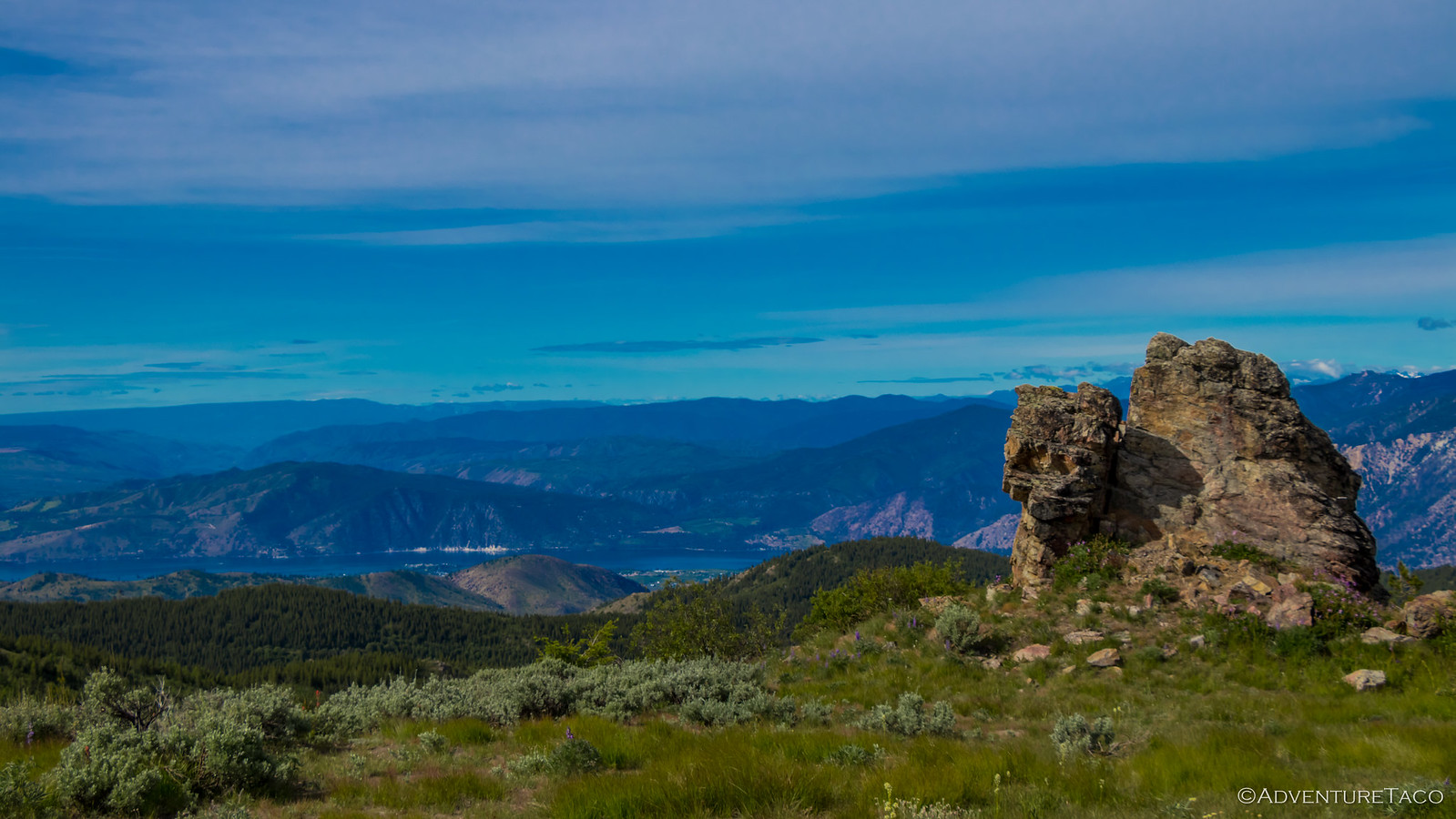
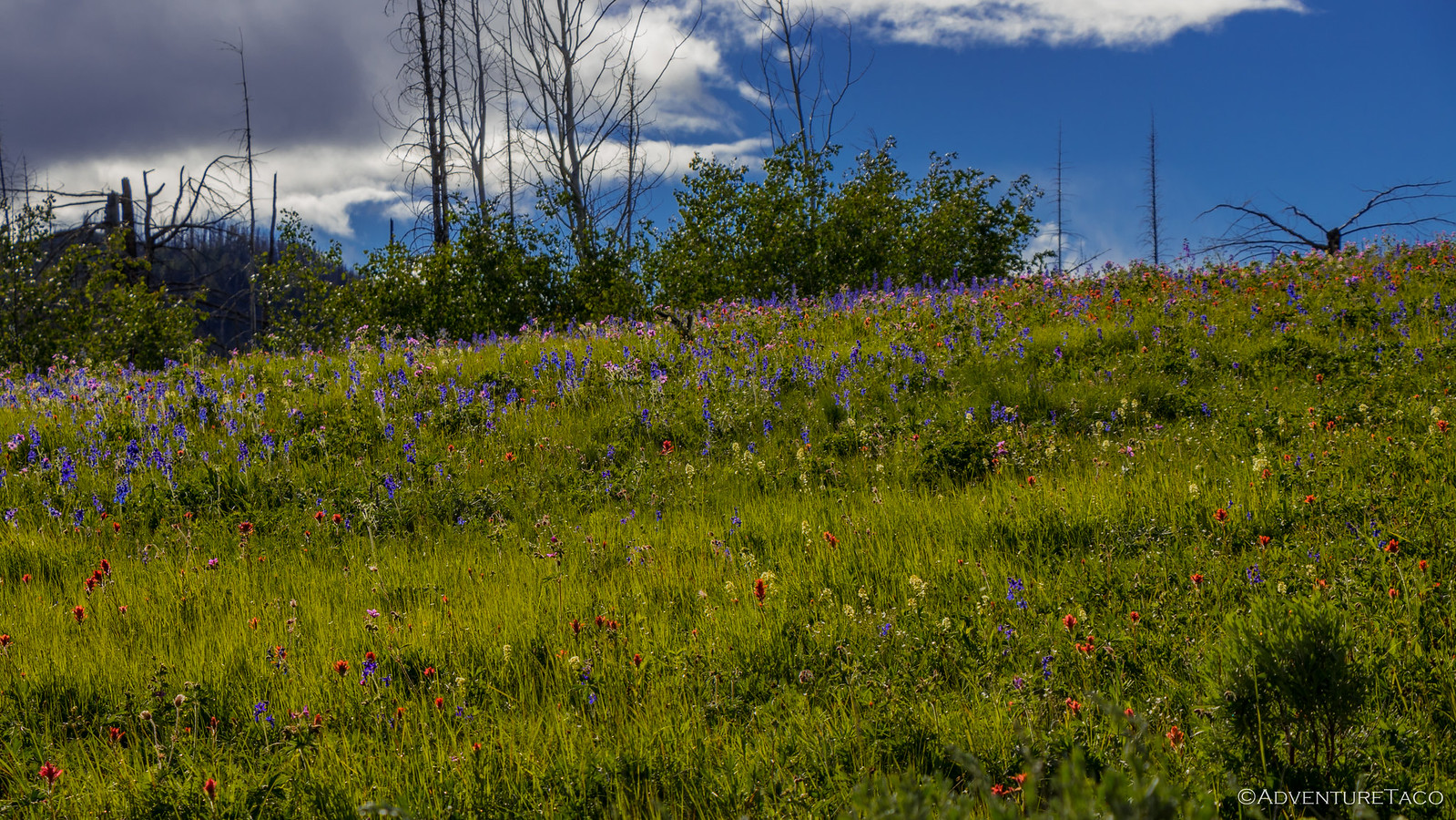
On the road, it wasn't long before we approached Cooper Mountain Summit, once again through an area recently burned by fire - the 2015 Chelan Complex fires in this case. While the forest is not on it's way back yet, the lupines were on full display - a vibrant green and purple blanket under the starkly burned trunks.
The lupines smelled amazing, and so I thoughtfully picked a couple for my two girls in the car - a surprise they loved until @mrs.turbodb looked down at her lap and let out a yelp - she was covered in dozens of tiny black bugs! Apparently the same smell that had attracted me had attracted them - so as quickly as the flowers had entered the truck, they exited and everyone brushed off. Bummer!
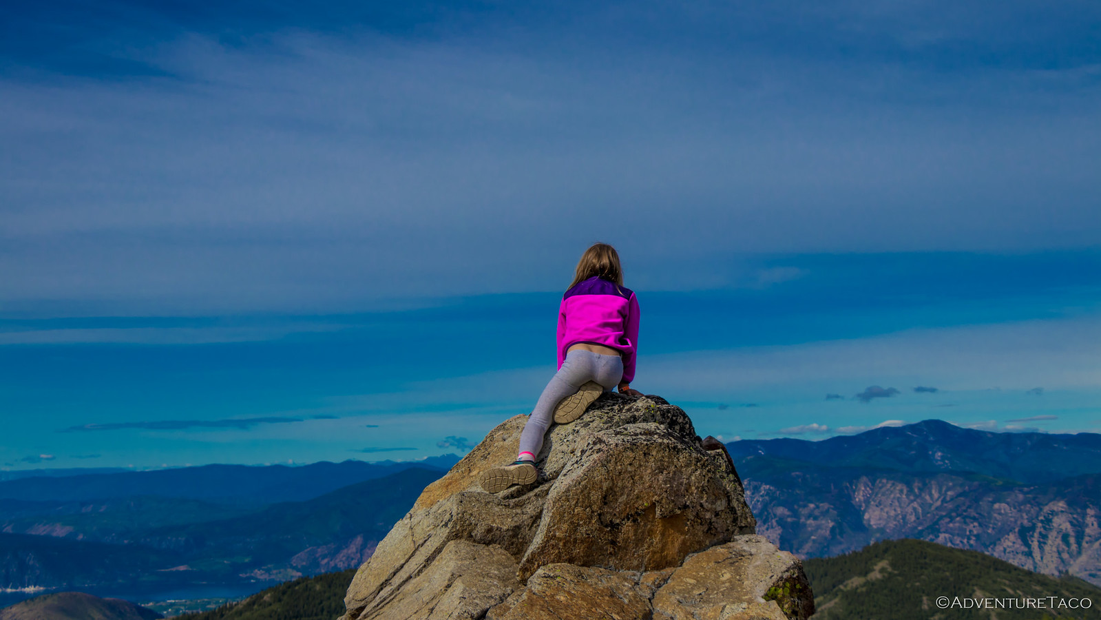
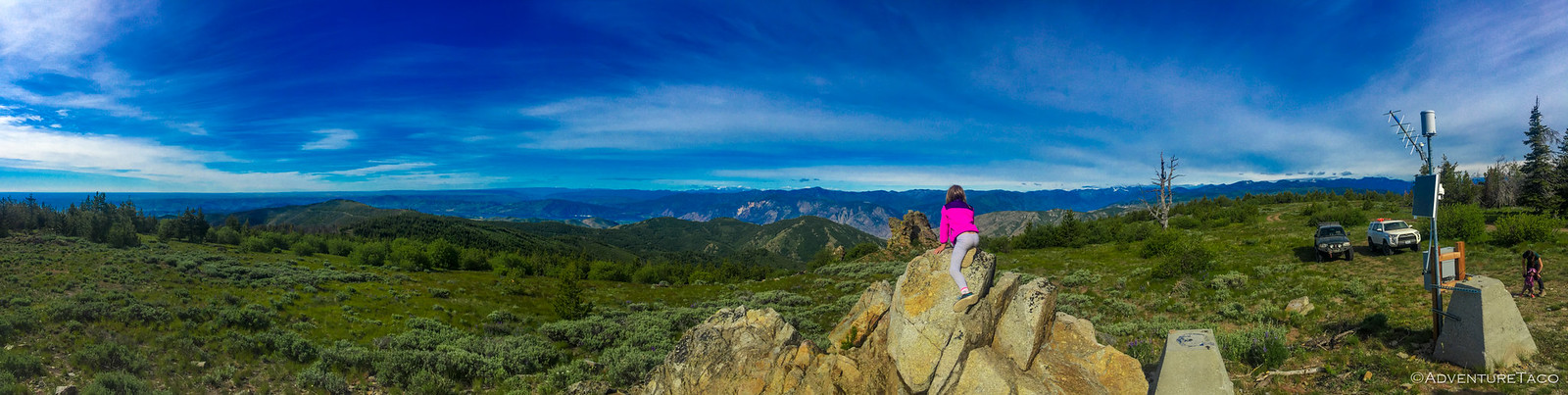
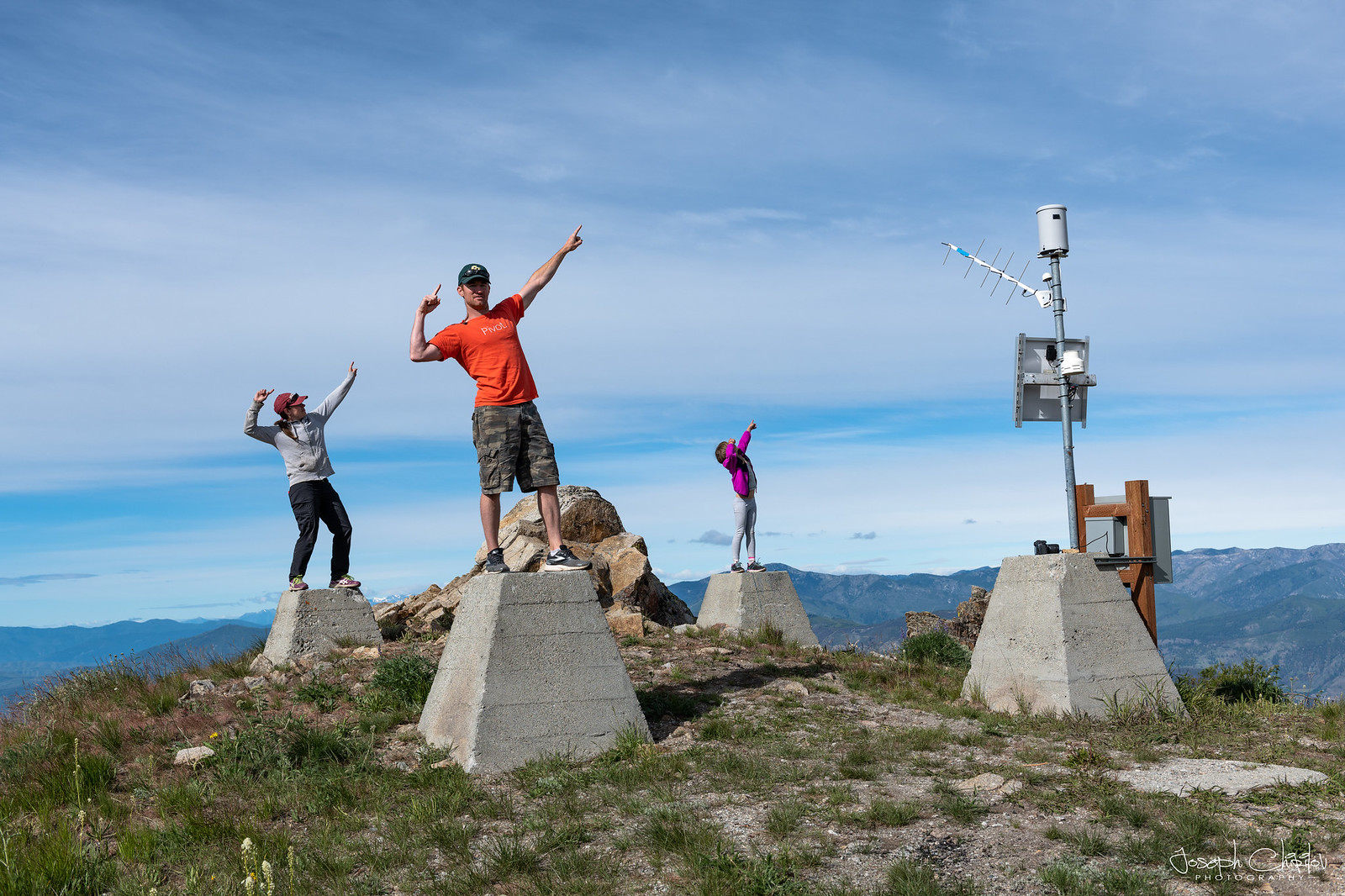
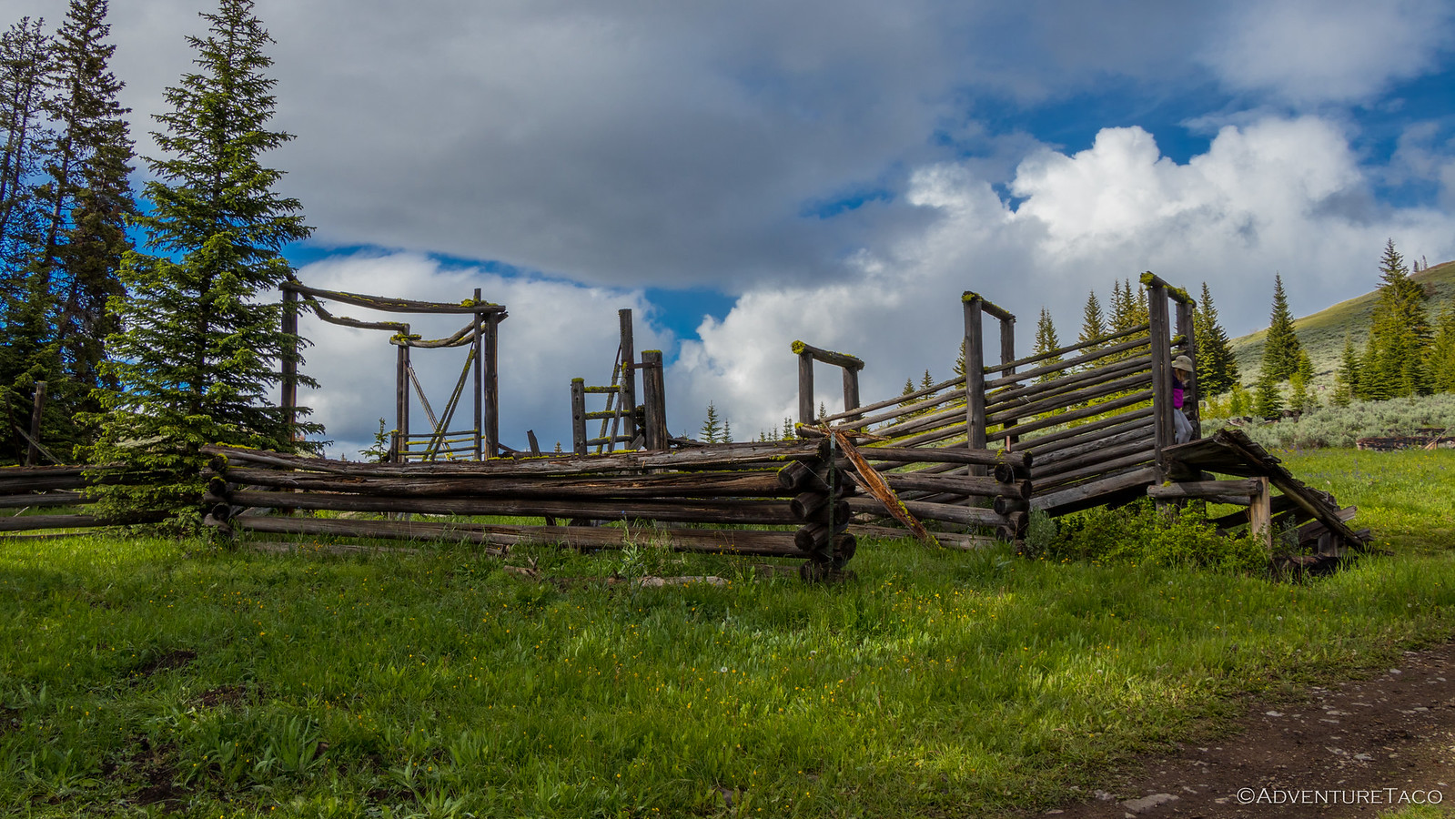
Cooper Mountain Summit has had a tough history from a lookout perspective. Established in 1920 with a crow's nest, the original lookout burned in a 1927 forest fire and wasn't replaced until 1932, when a new log cabin and accompanying 45-foot wooden tower with 7x7-foot cab were built. Later, in 1939 a 53-foot treated timber tower was constructed and staffed into the 1960's, but the tower was once again destroyed in 1968 by fire. Today, all the remains are the concrete footings, and a modern weather station.
Still, we had a great time exploring - lots to climb on and great views all around.
Perhaps we over-did this one.
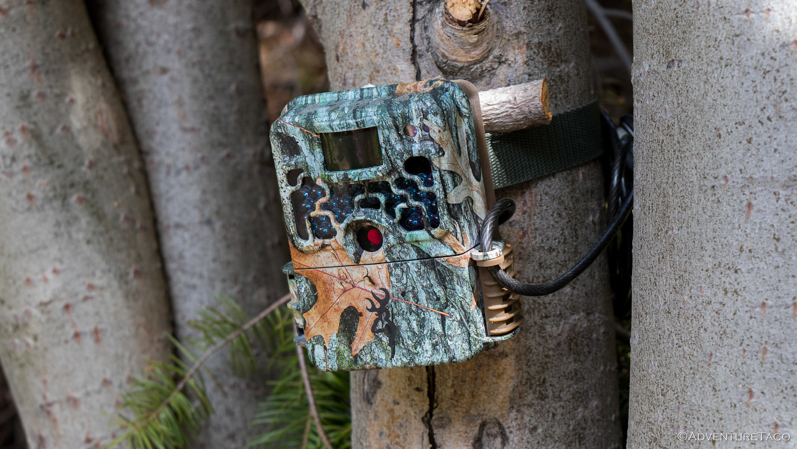
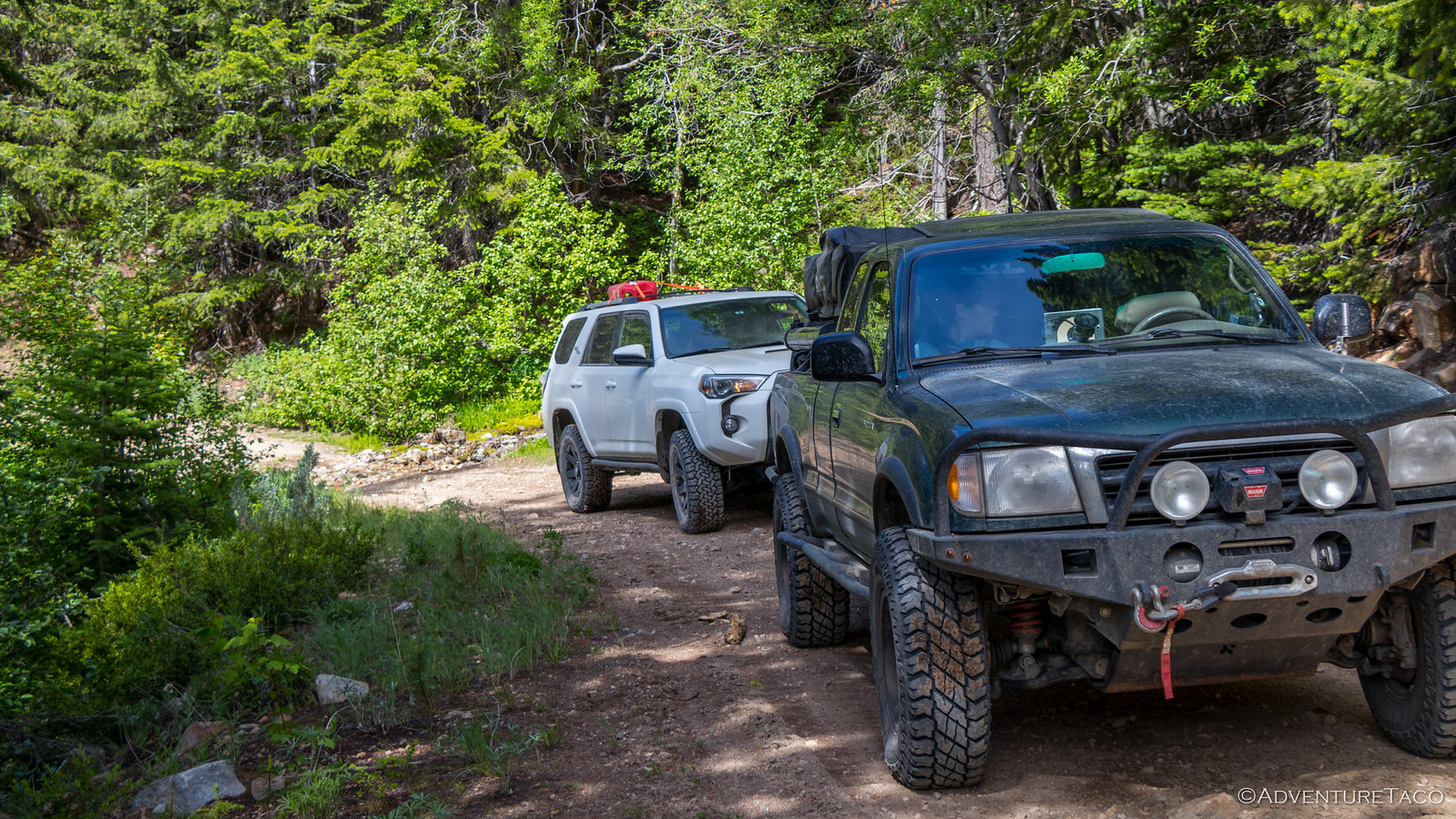
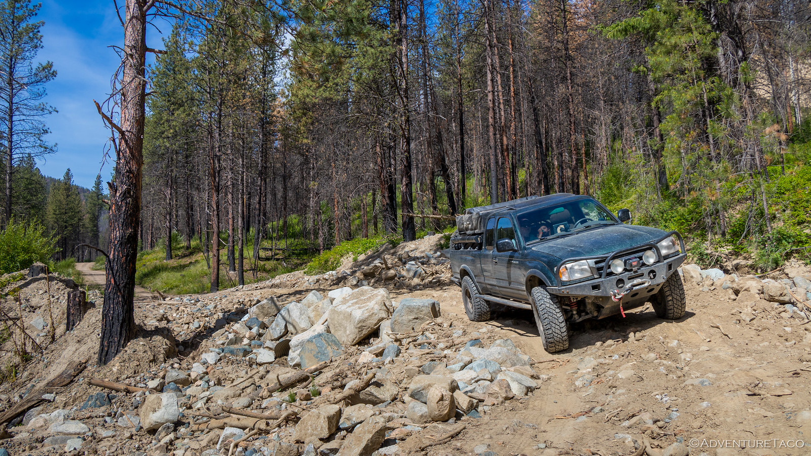
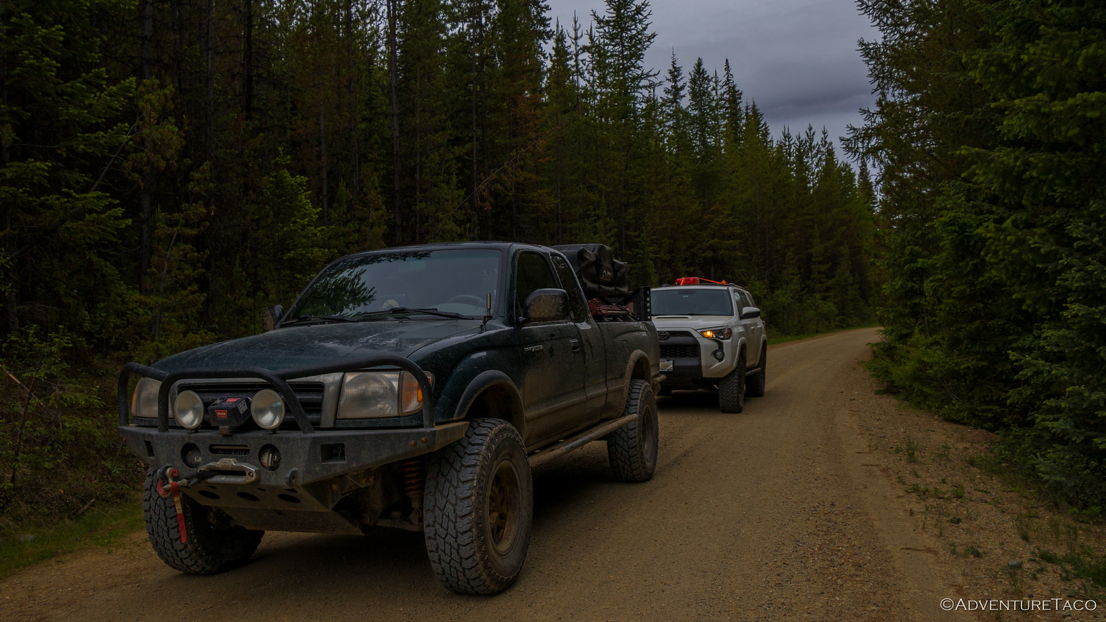
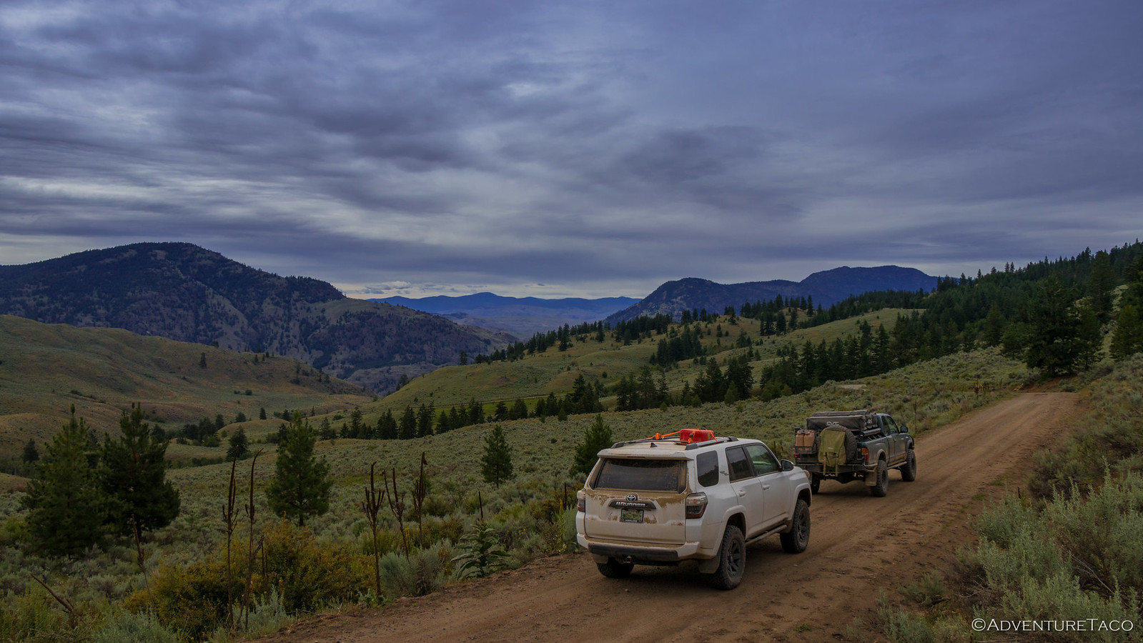
We made great time the rest of the morning - the majority of which was on well-graded forest service roads, through tree tunnels. And then, from the back seat, @mini.turbodb spotted something as we were rounding a bend - what she (and we all) originally thought was a geocache. And boy, does she love a good geocache...well, except for the part where you have to leave something to take something!
Excited, we all popped out of the truck to take a look. Turns out, it was definitely not a geocache.
But hey, we got to have an educational conversation with the little one about why there might be a camera out in the middle of the woods after piling back into the trucks and continuing on.
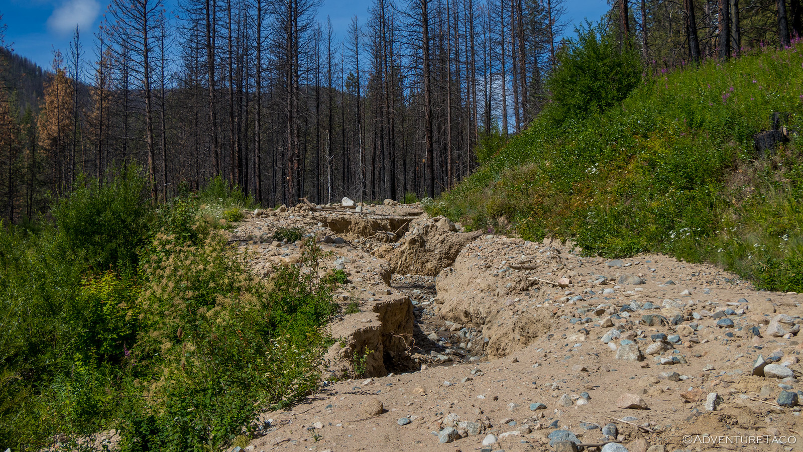
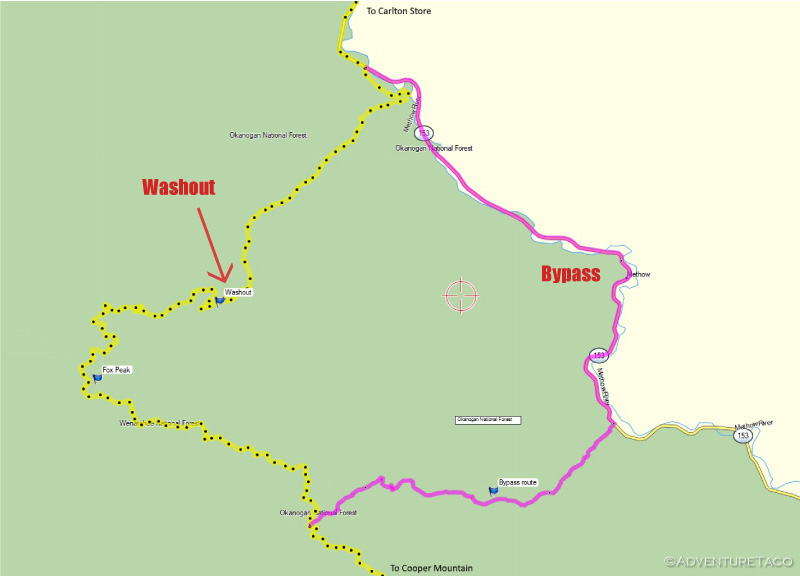
Not long after, we came to a pretty big washout - apparently new for 2018 and not covered by any of the trip reports to date. Several feet deep, there was no way we'd be able to navigate the washout itself.
A relatively major road, it seems this washout has since been reported and is now being repaired and a re-route exists:
There is a washout on the WABDR in Section 5 (Chelan/Conconully) going north past Cooper Mountain on the way to Fox Peak and the Carlton Store. Washout coordinates - N48.12024 W120.17921.
Big bikes are warned to avoid this washout as it is challenging to get through and construction teams working on repairs might block passage anyway.
The alternate route for now would be to descend the ridge well before reaching Fox Peak. The best route we see is via Black Canyon Creek on Forest Road 4010. This will put riders on Highway 153 farther east of Carlton.ridebdr.com
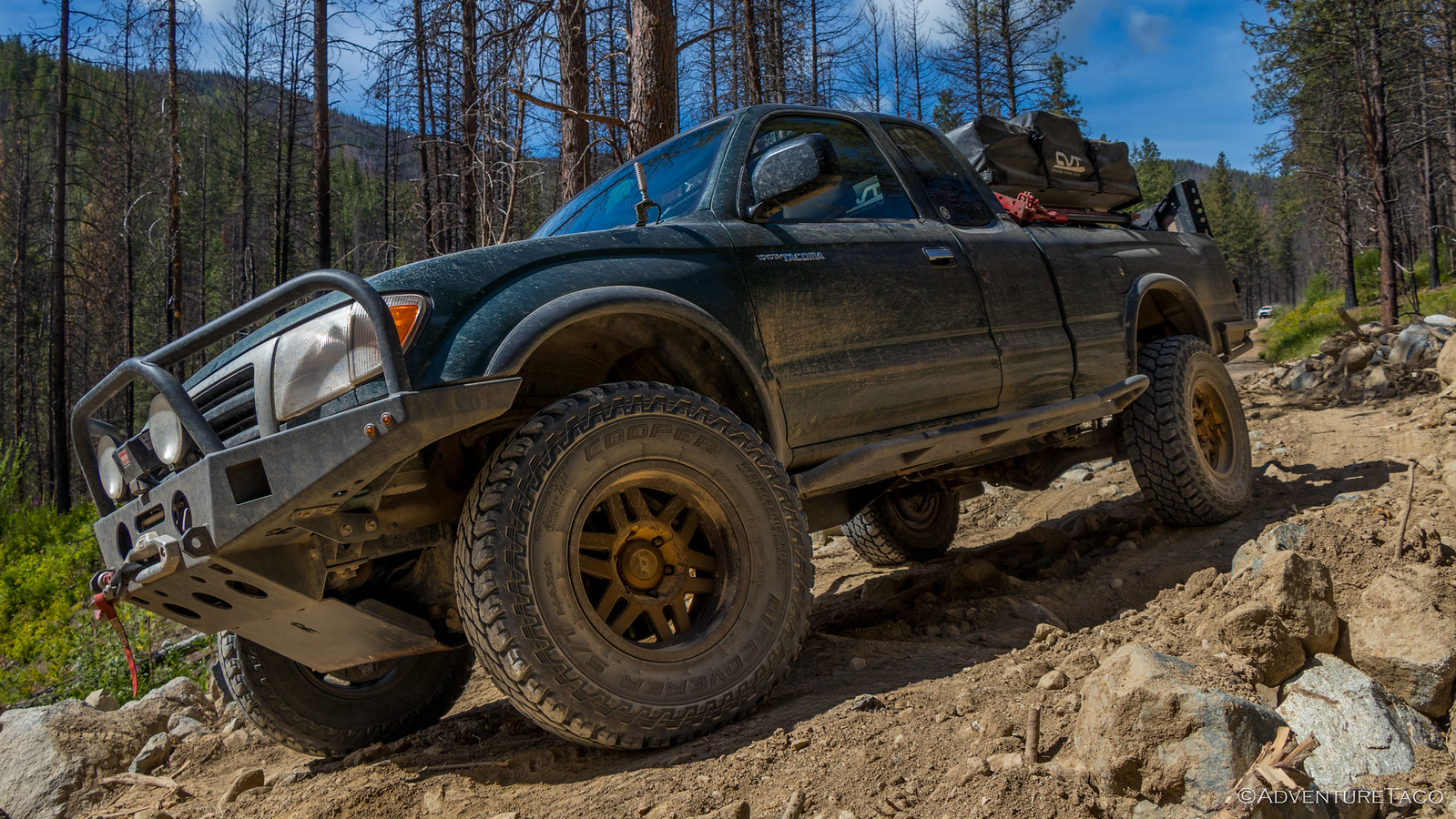
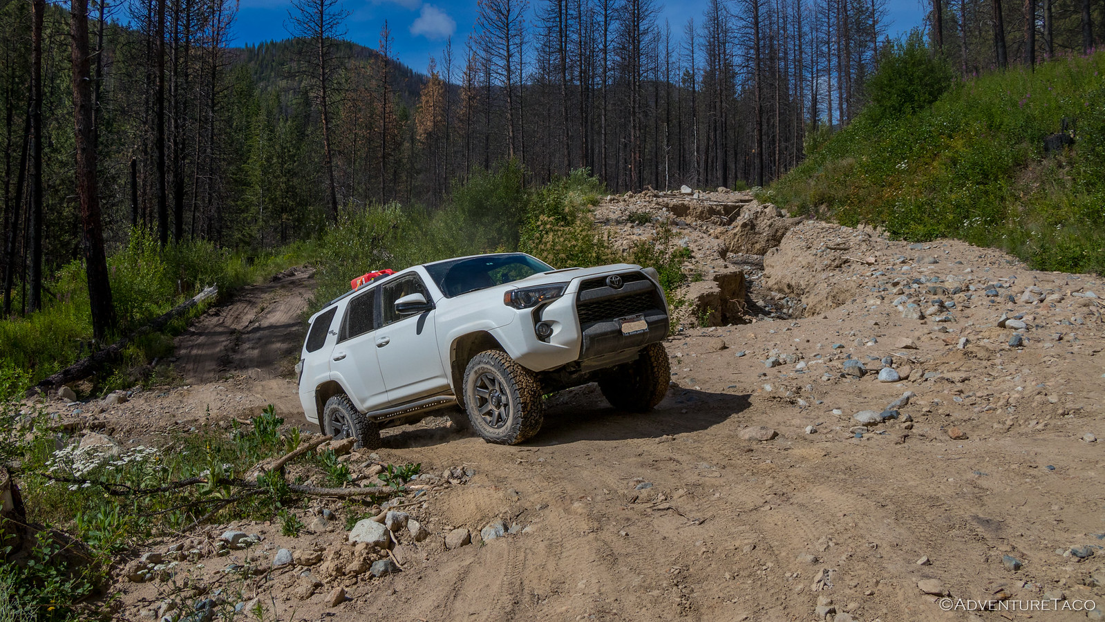
Luckily, we didn't have to turn around to re-route on pavement. It was abundantly clear that though the washout was relatively new, several folks had traversed below the washout and back onto the road a few hundred feet ahead. I radioed back to Joe to let him know that we were going to do the same, and that his 4Runner would do just fine - just take it slow.
And then I was off.
Through the bypass, I popped out to spot Joe through, this being the "knarliest" bit of road he'd been on to date (but not for long) and he made it through like a champ.
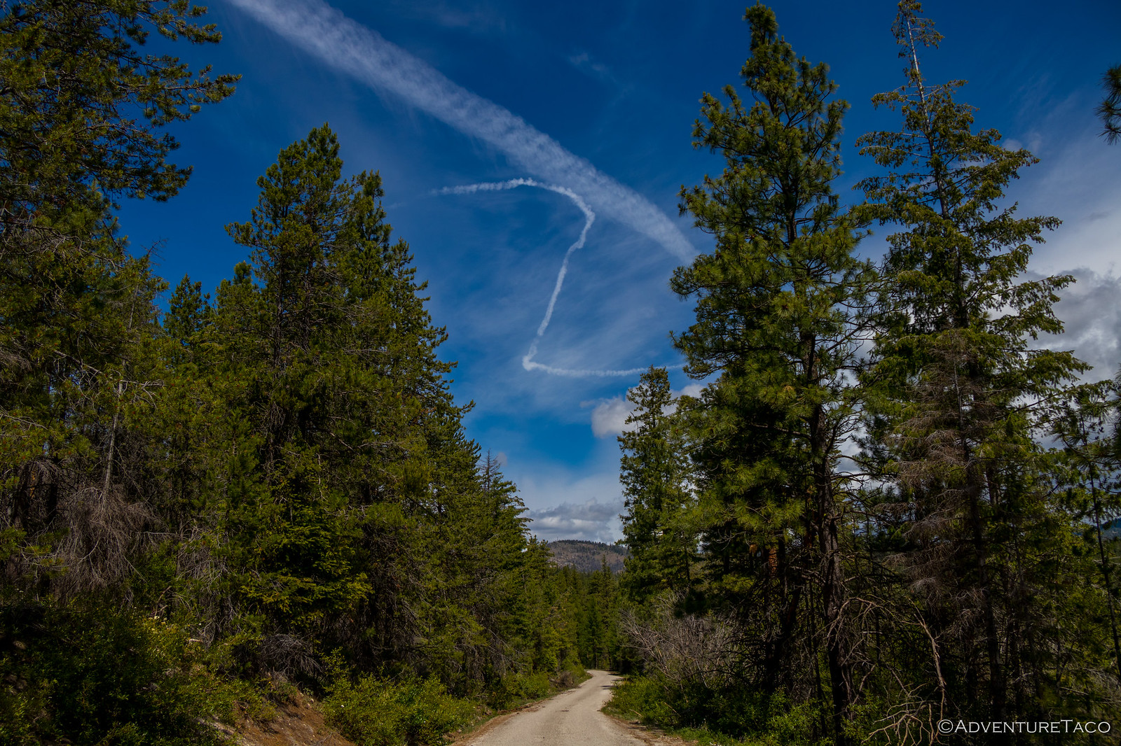
Making good time - but with a lot more to go for the day - we ate a quick lunch at Leader Lake, spoiled by the picnic table we found along the lake's edge. It was about this time that we also saw the craziest contrail I've ever seen. Wonder what was going on in that pilot's mind? Some sort of evasive maneuvers, obviously.
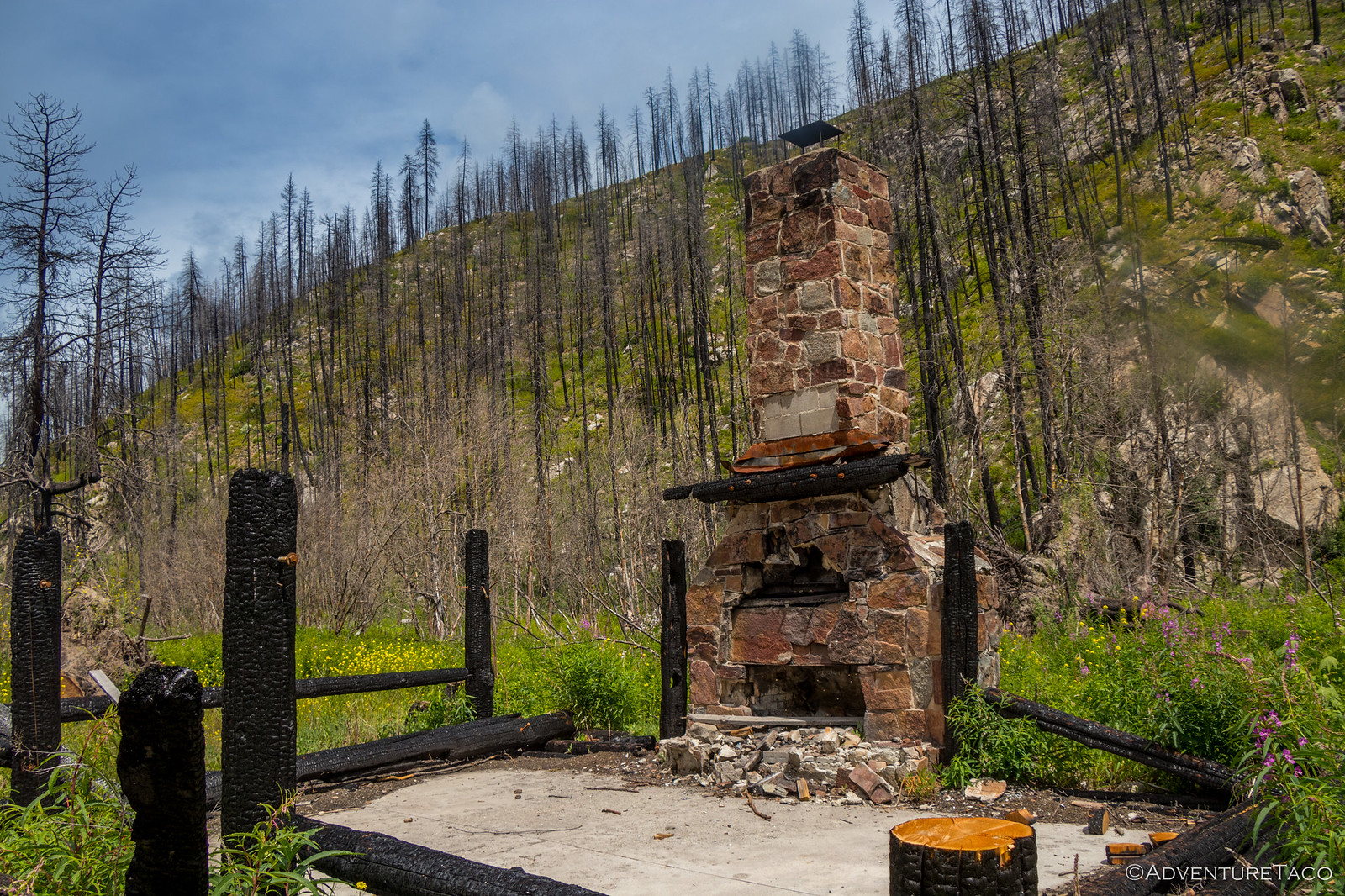
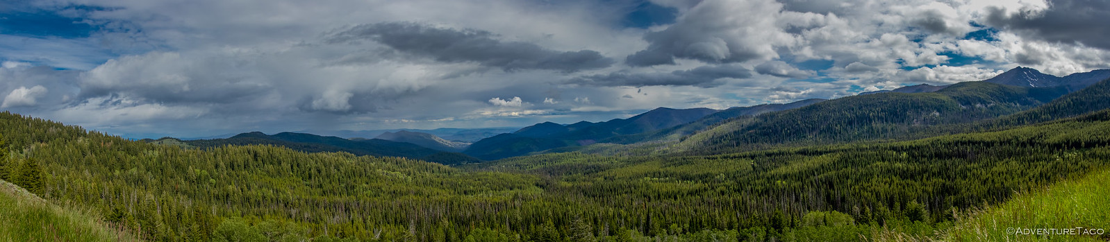
Our bodies refueled, and the kiddos with a chance to run around a bit, it was back into the vehicles and back onto dirt through Loup Loup State Park and Rock Creek campground. Once again, this section of the route had burned in the Beaver Lake fire of 2015 and the campground was closed, only concrete bathrooms left standing.
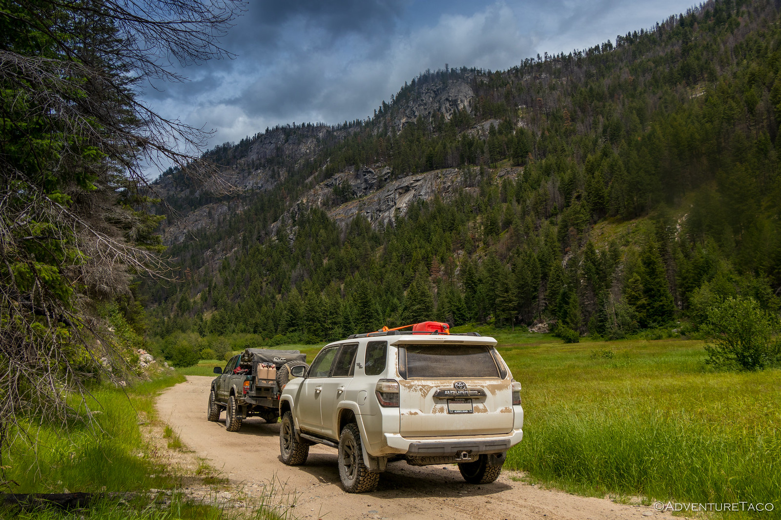
Still, many of the valley meadows and a few of the surrounding hillsides had survived - either unscathed or recovered - and the whole area was a brilliant green as the sun tried to break through the clouds. Criss-crossed by shallow creeks, high speeds made this section of road great fun.
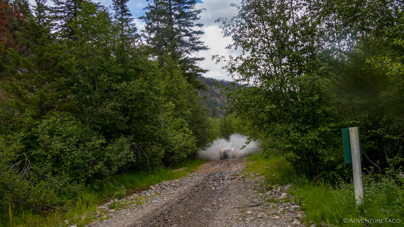
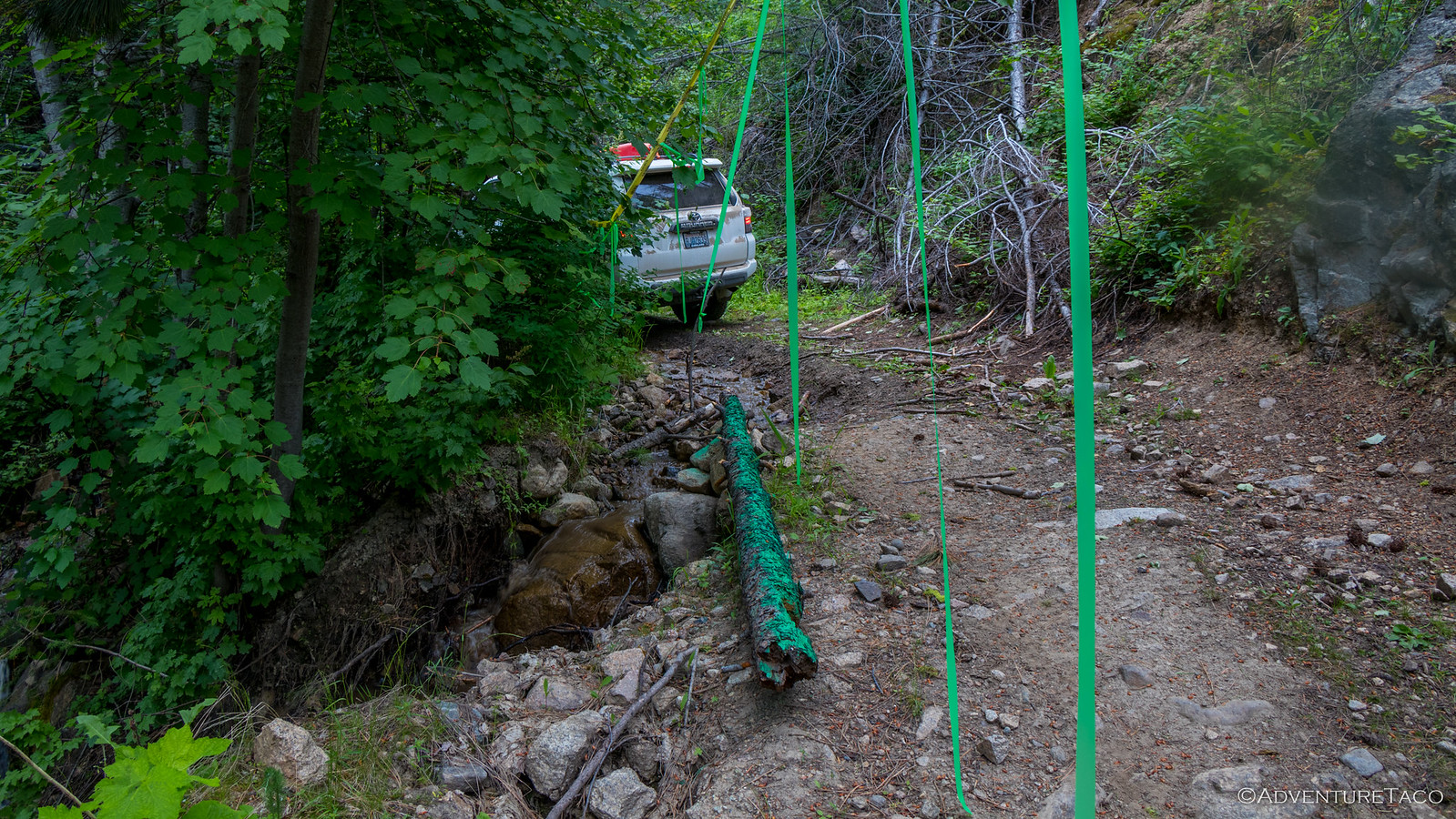
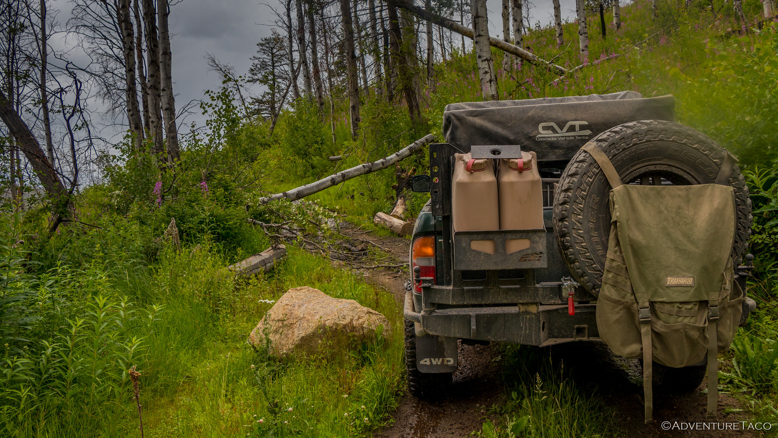
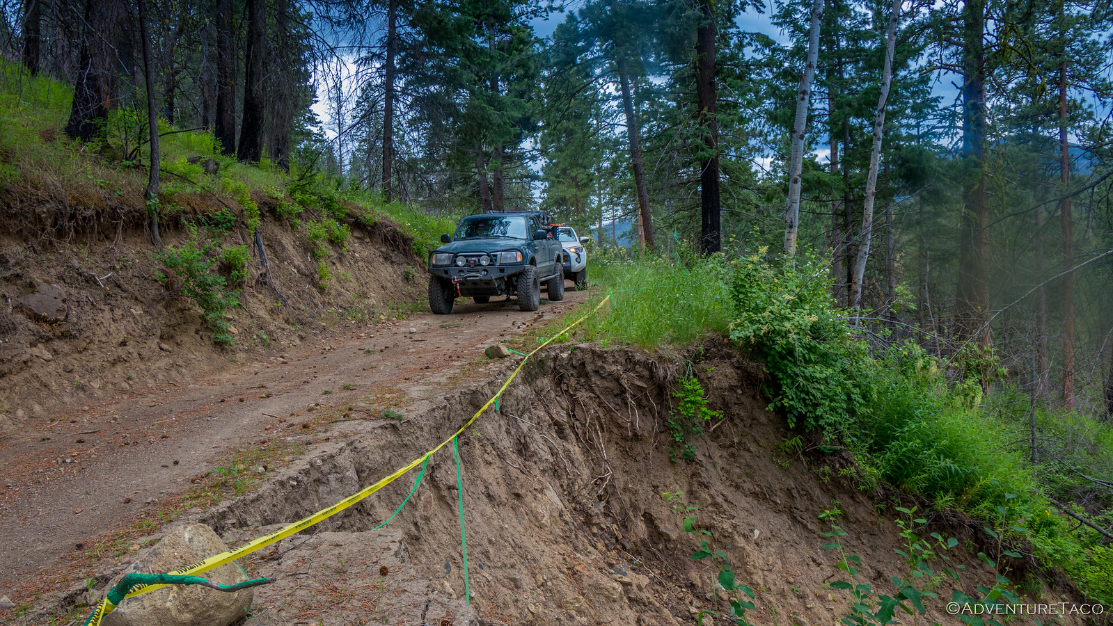
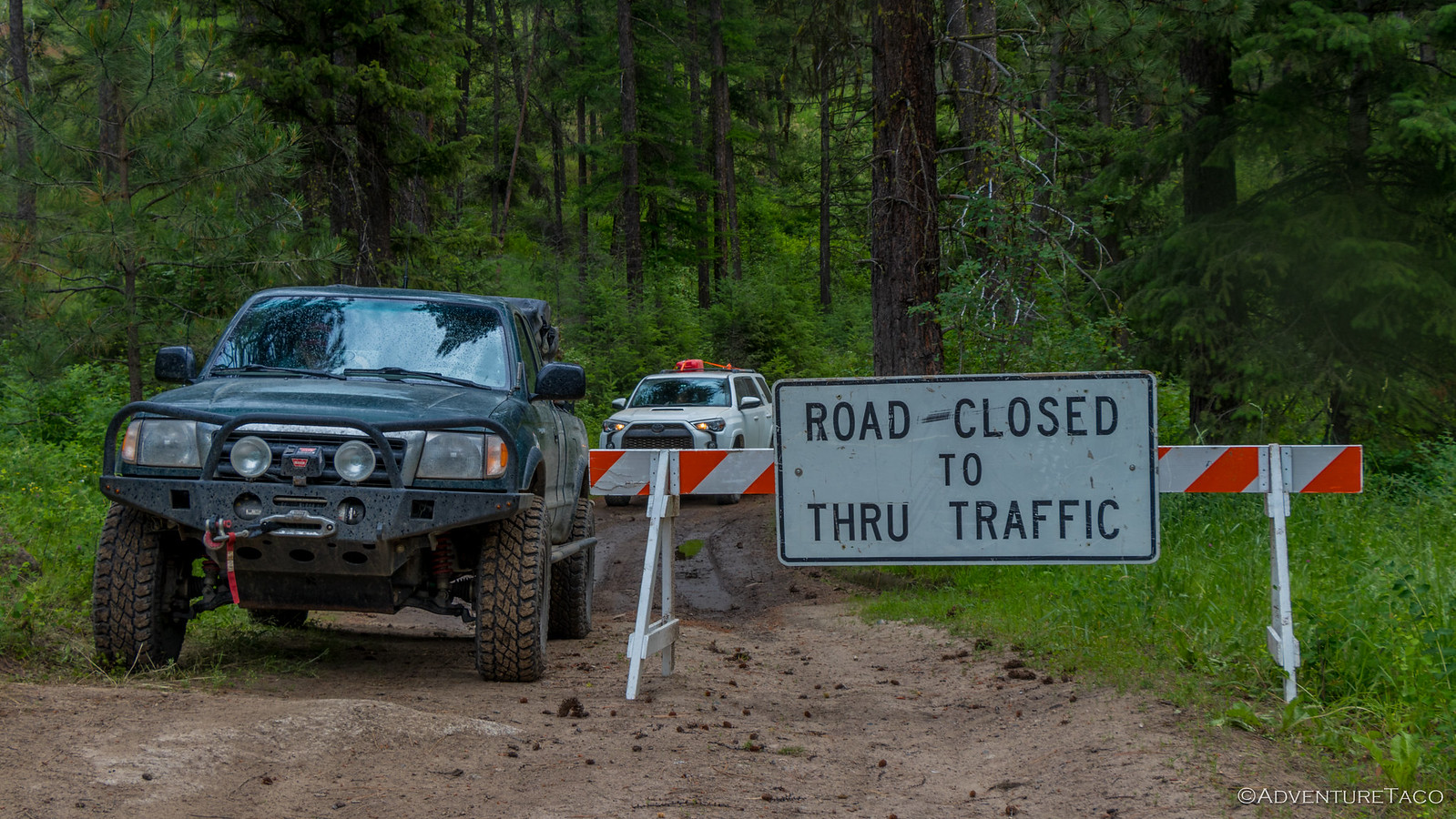
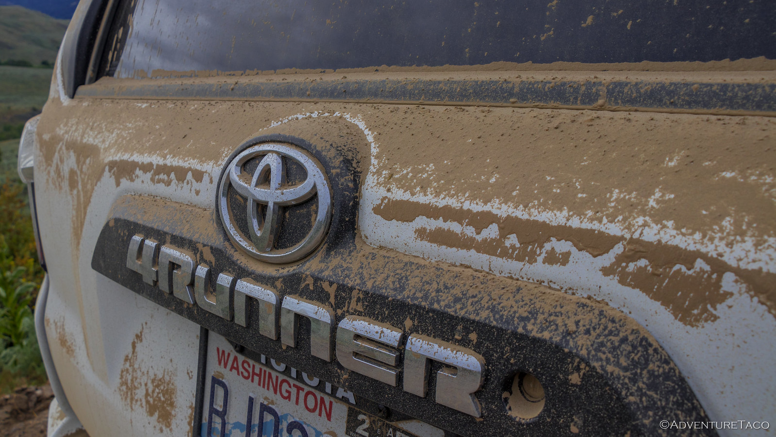
And then, a side trip! We had no idea when we started up the road to China Wall and the Arlington Mine that we were in for a bit of a nail biter, but the next two hours would be the only really technical of our week-long adventure. A light rain and muddy shelf roads made the going slow - especially as we'd squeeze the wider 4Runner past large washouts on the downhill side.
As the underbrush squeezed the road more and more, it was clear that Joe and Daisy weren't quite sure that this was what they'd signed up for - but they did great continuing up the trail.
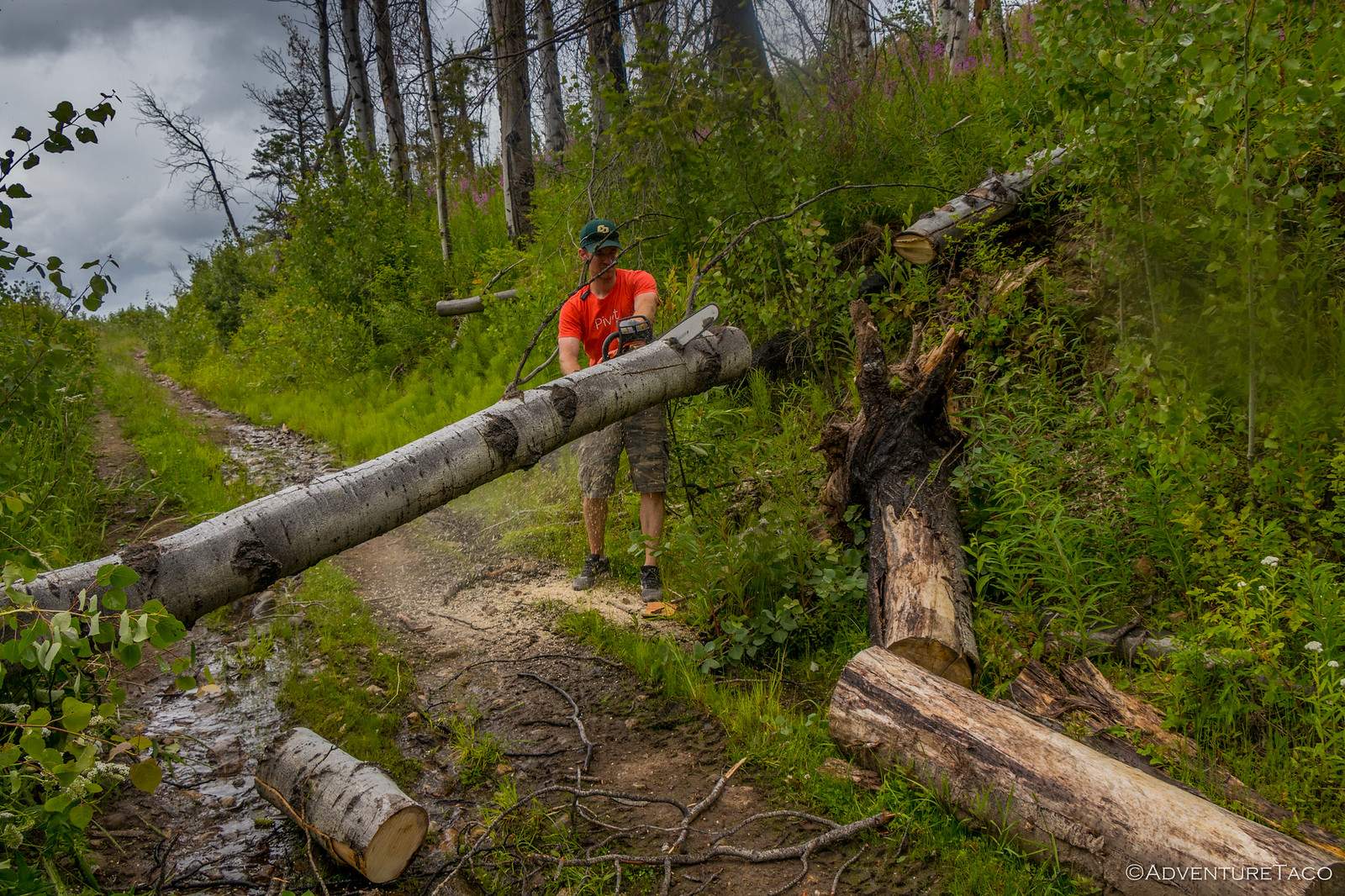
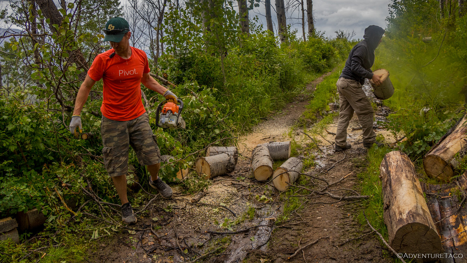
And then - a tree! A new fall, the 12-inch birch was blocking our path and there was nowhere to turn around. Not that we ever considered turning around. Out came the chainsaw, and I cut up the trunk into manageable sections that Joe and @mrs.turbodb could clear off the road.
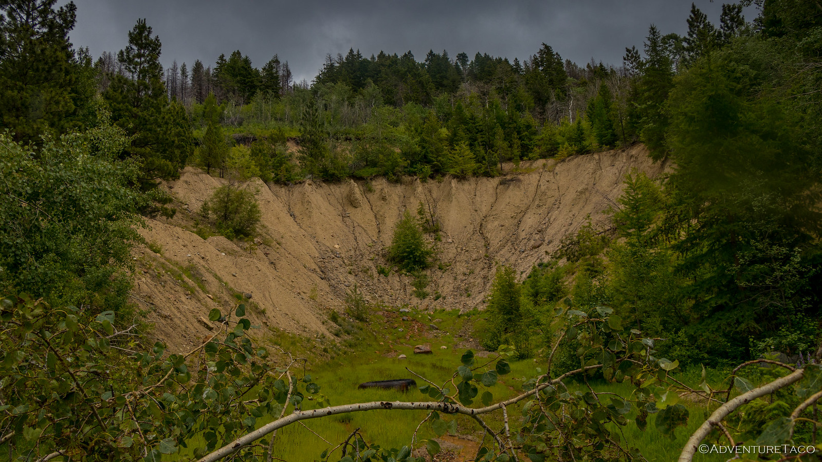
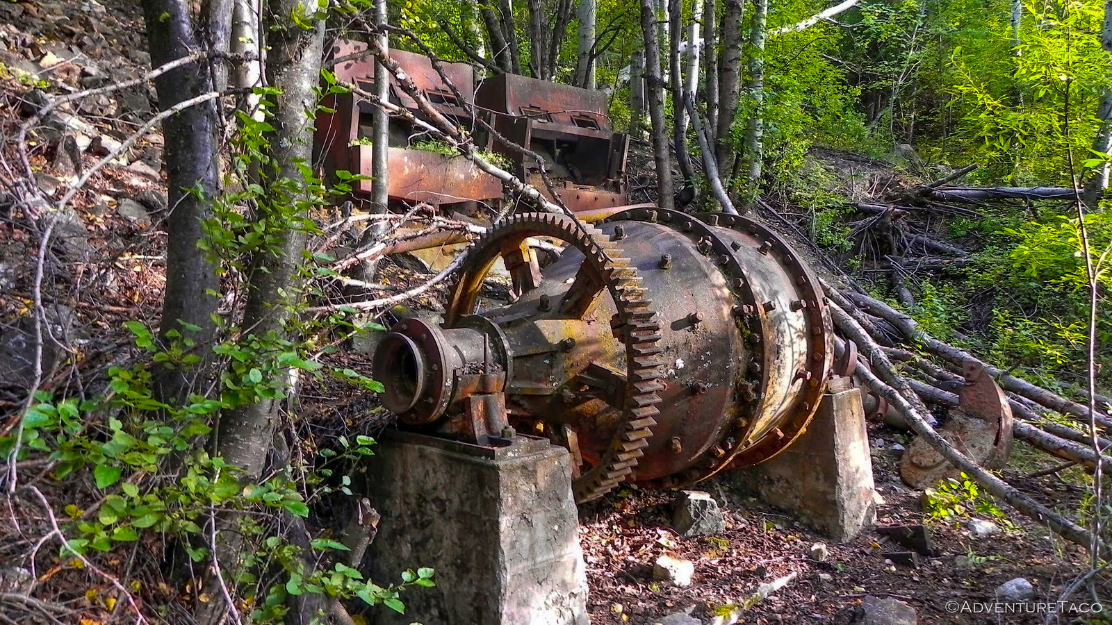
From that point, it was only another quarter mile to the Arlington Mine site - located near Ruby, WA in 1887. Active until 1893, it produced 1000 tons of silver ore, worth only $25,000 until it eventually re-opened in 1905. It's second wind lasted until 1940 when it closed after processing 5700 tons.
Today, the lower pit and ball mill are still visible on the hillside.
The rain picking up a bit and the mosquitoes thick at the mine, we didn't linger - in fact, we never found China Wall (bummer!) - we were back in the trucks and heading down the hill - via another route (to Joe's relief, I think). The road was much better on the way down, but it wasn't without it's troubles as well - the spring rain obviously wreaking havoc on the hillside.
And, when we reached the main road... well, let's just say we weren't surprised. But at the same time, I was glad we'd accessed the road from the other side where there was no sign - it was fun!
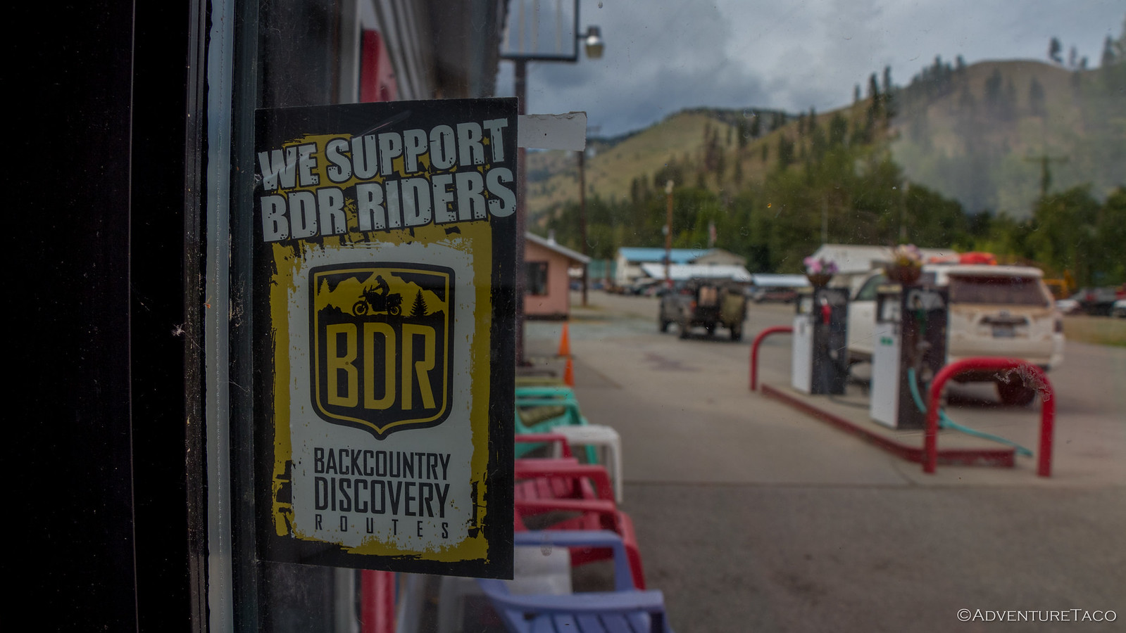
Our little side trip having taken much longer than we'd expected, we made a be-line for Conconully and our last fuel stop before the Canadian border. A little summer vacation spot, Conconully was hopping and it was hard to resist buying an ice cream as we waited in line to fuel up.
In fact, it was impossible to resist- especially when we saw their support for WABDR riders - much to @mini.turbodb's delight.
As we wrapped up our snack and the clouds seemed to be thinning overhead, we discussed our plan for camp that night. It'd been a stressful day already - what with the washout and the road up to Arlington Mine - so the 4Runner family was looking forward to settling down. We decided that we'd shoot for something just an hour or so ahead - near the Skull and Crossbones Cabin - assuming it wasn't haunted!
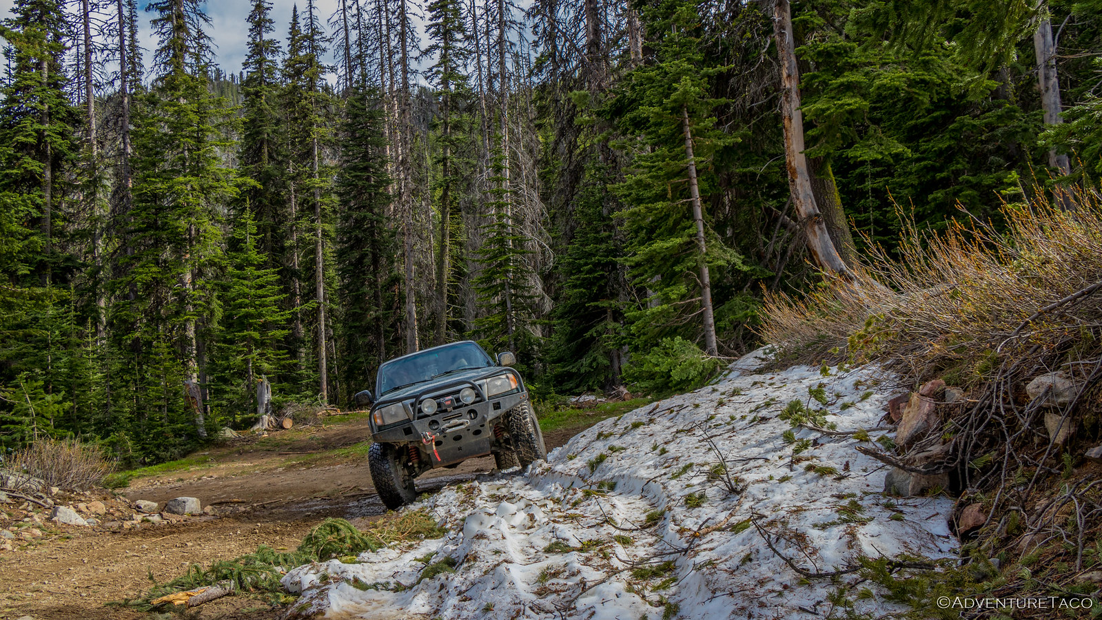
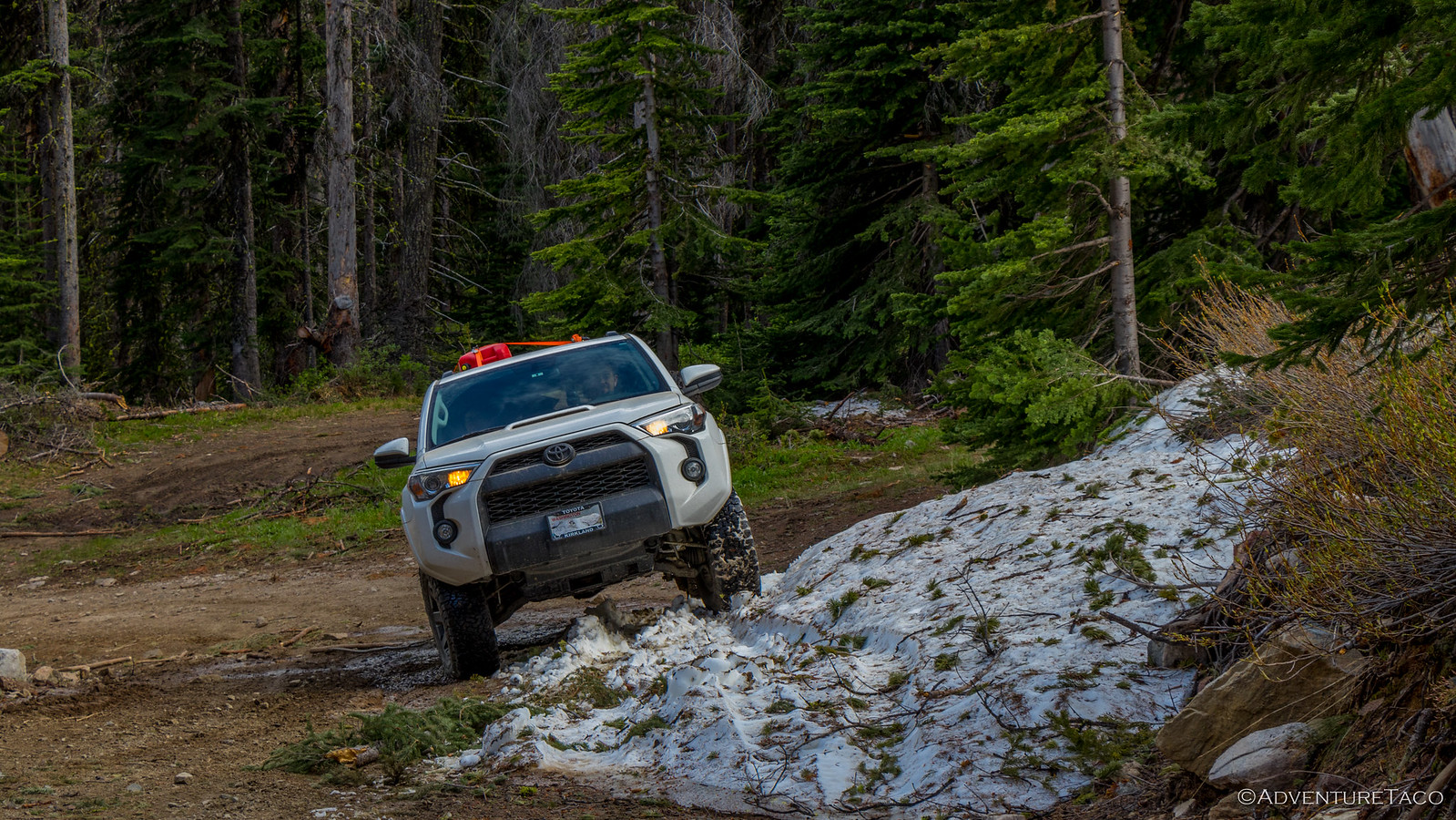
Pavement in Conconully was minimal, and we were soon climbing back into the mountains on dirt. Oh, and we were poser-ing on the little bit of snow we found still on the trail! 😀
We pulled into the mountain meadow containing the Skull and Crossbones Cabin and Corral around 5:00pm. Exploration ensued. Camp setup did not - a very wet meadow and thousands of mosquitoes quickly convincing us that we should push on, for something better.
Still, the cabin and corral allowed for some fresh air and scary stories around their naming. Unfortunately, we never found the skull and crossbones that marked the burial site of the original owner... lol.
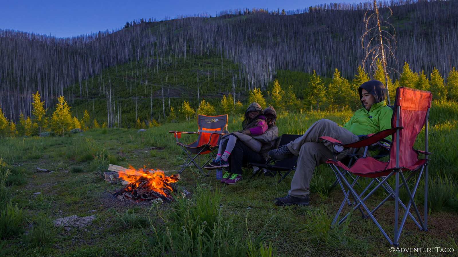
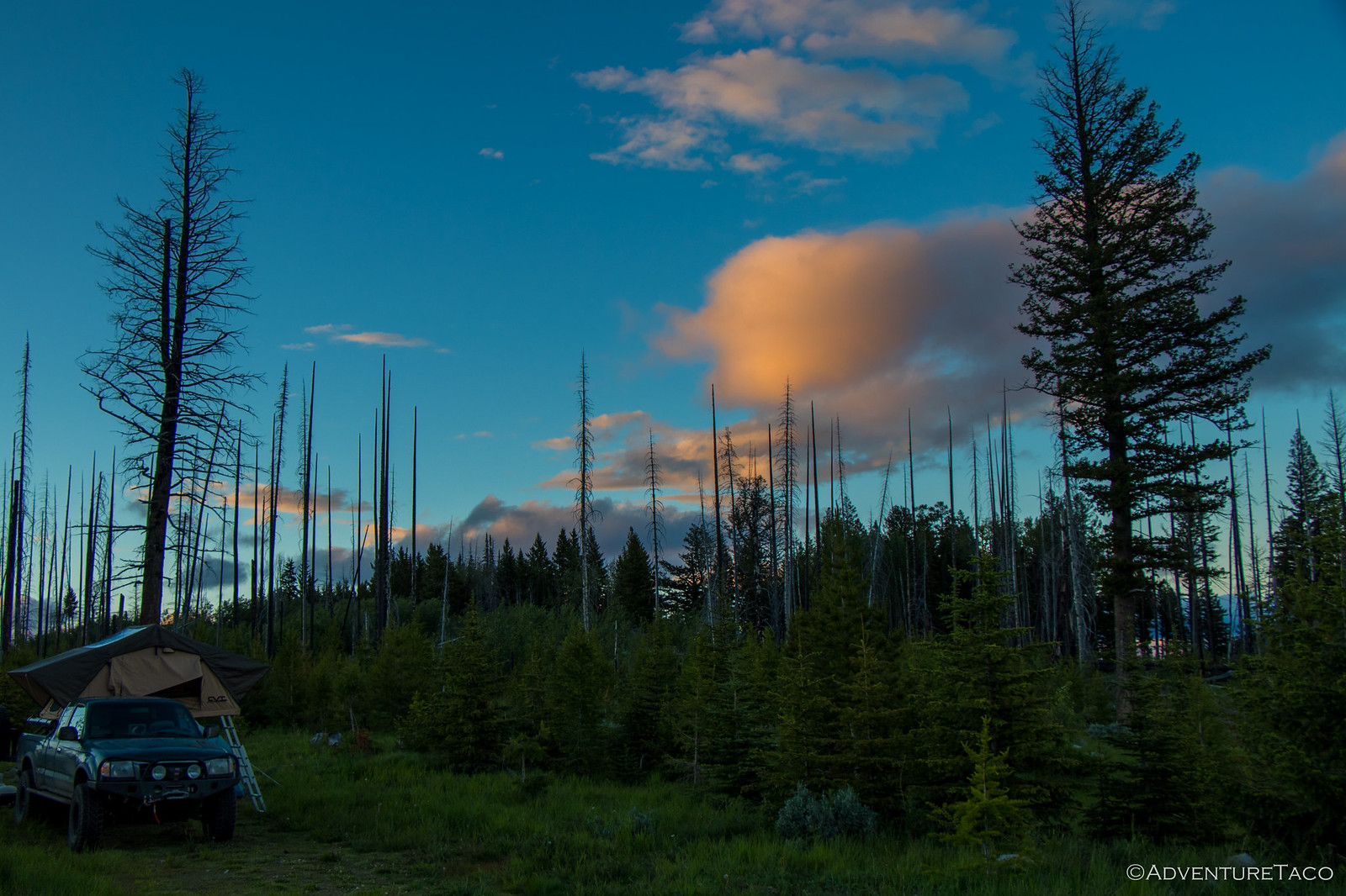
Up over the next pass and down the other side, the moisture change was dramatic. The surroundings were still very green, but a lack of surface water meant that we'd made a great decision as far as mosquitoes were concerned. Within 20 minutes or so, we'd found a great spot in the saddle of the ridge, and we were setting up camp and enjoying the wild flowers that were all around.
Once again surrounded by a burned forest, the still-standing trees were the perfect, dry, fuel for a crackling fire. Quick work with the chainsaw and a hatchet and we had a nice log fire ready to go - the perfect place to enjoy dinner and marshmallows - which of course, we did.
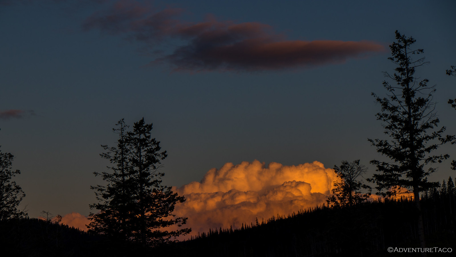
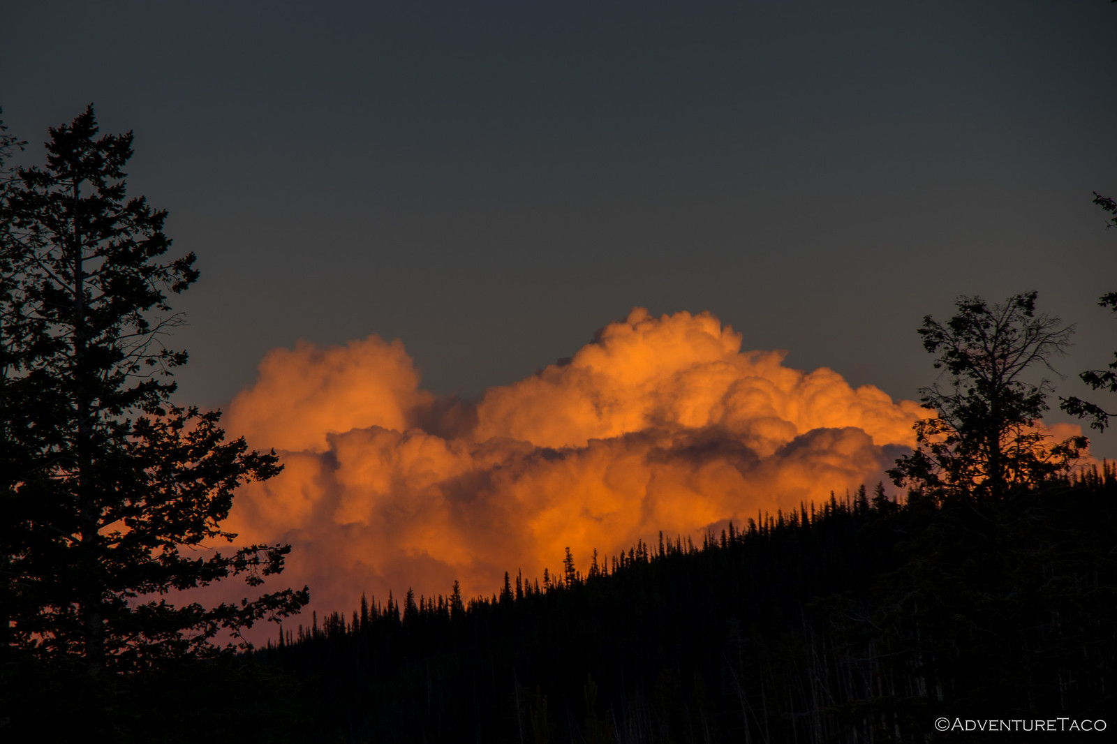
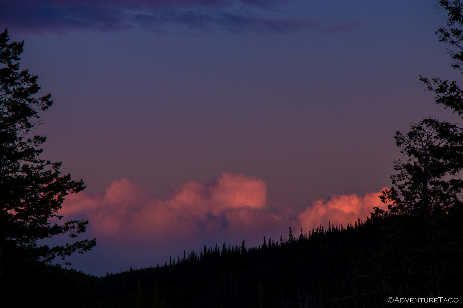
With an entire tree to burn, we enjoyed an extra-long fire as we unwound and the sun set. Clouds clearing, but still in the sky, we were treated to a great light show - orange in the fire and clouds seemingly competing for our attention. This is definitely one of my favorite times of any trip - discussing the day's adventure with friends while nature puts on a show!
Eventually though, the show came to a purple end, and the fire started dying down - a signal to us all that we'd had a long day and were ready for some shut-eye. So we gathered our chairs and headed to our tents, full of delicious dinner and memories of the most exciting day so far.
Of course, we also looked forward to the next day - our plan to reach the Canadian border!
- - - - -
June 29, 2018.
By the next morning, the clouds had moved back in - but there'd been no rain, so we were all happy as we ate breakfast and packed up camp, half a day of travel in front of us to the Canadian border. One of our earliest mornings, we were out of camp and on our way by 8:30am.
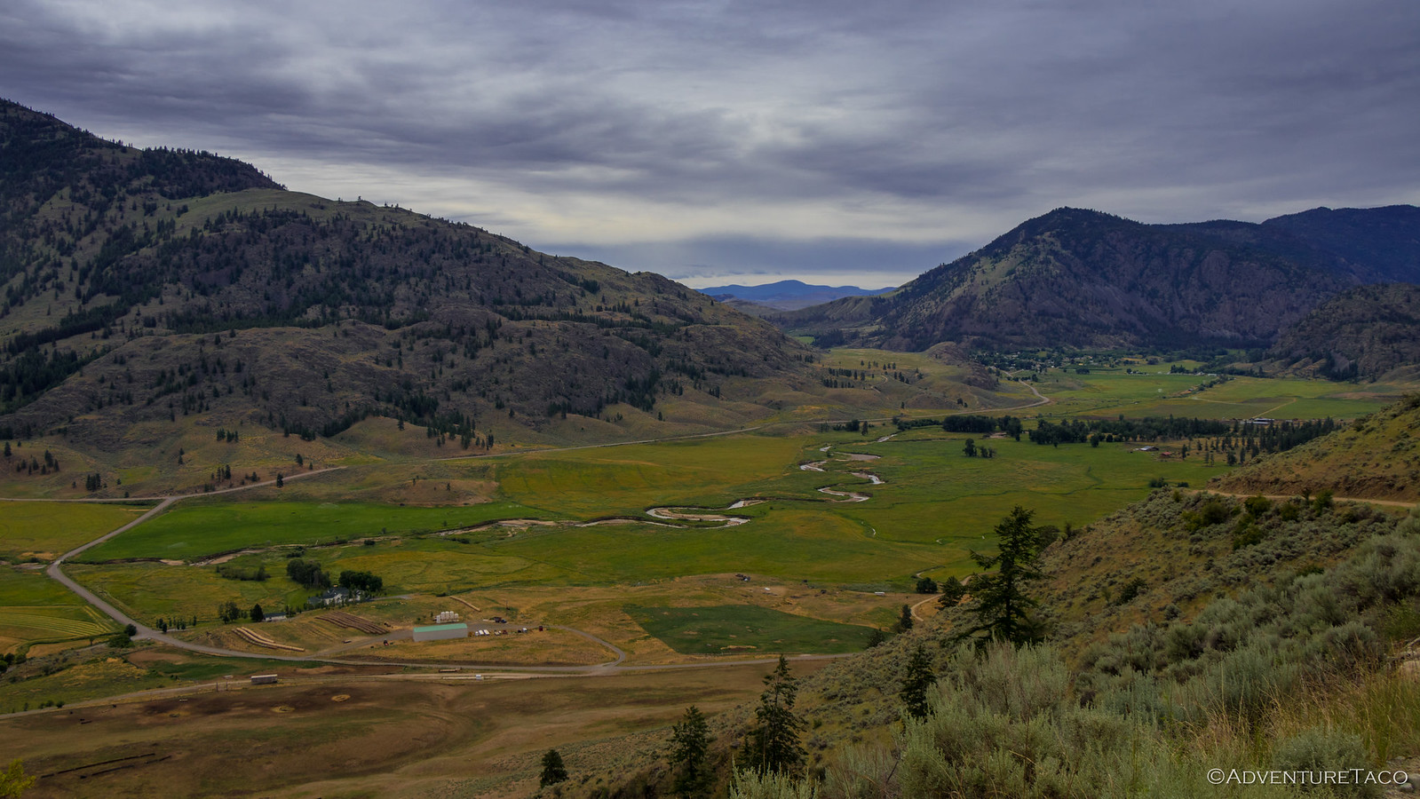
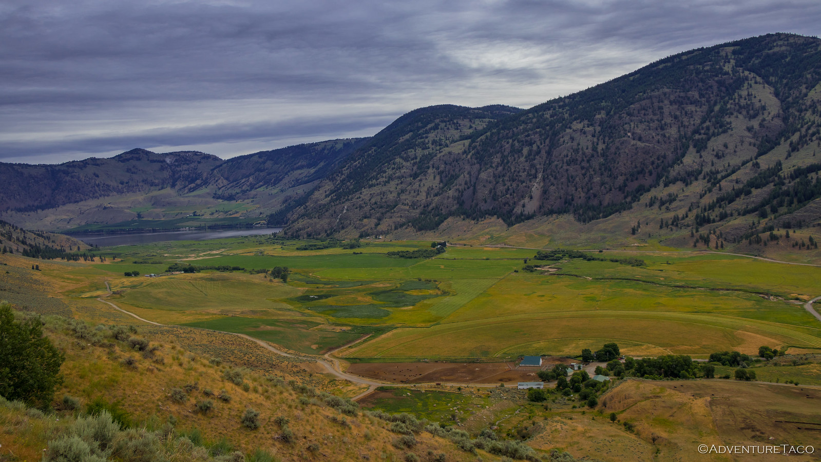
As we wound our way out of the mountains towards Loomis, the dust rising behind us, we stopped a few times for photos, and for shenanigans.
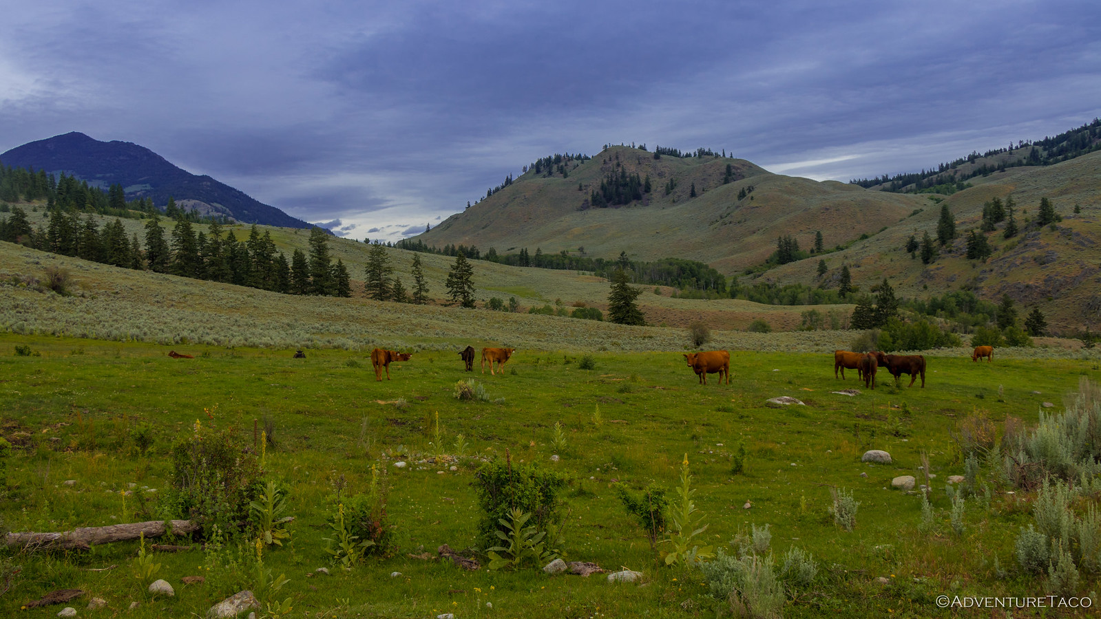
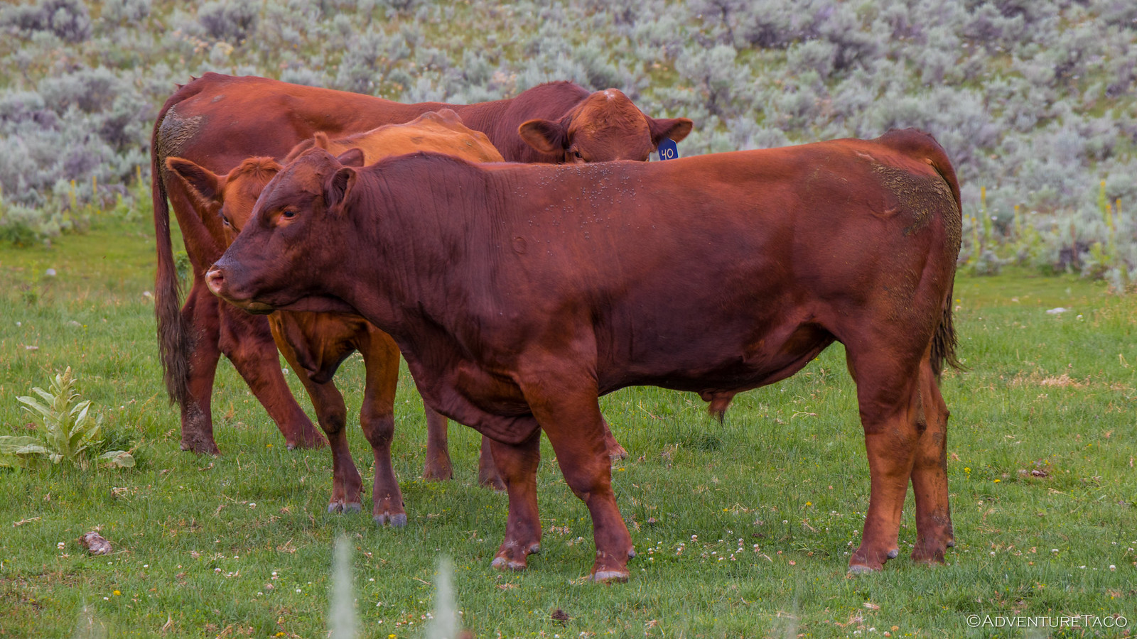
And then, cows - the first we'd seen on the trip! It was great - nearly the entire route, cow-free - so different than the Oregon Backcountry Discovery Route (OBDR), where we'd seen cows daily if not hourly.
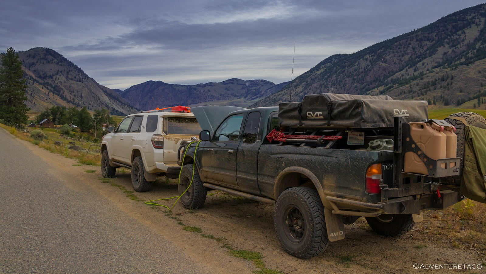
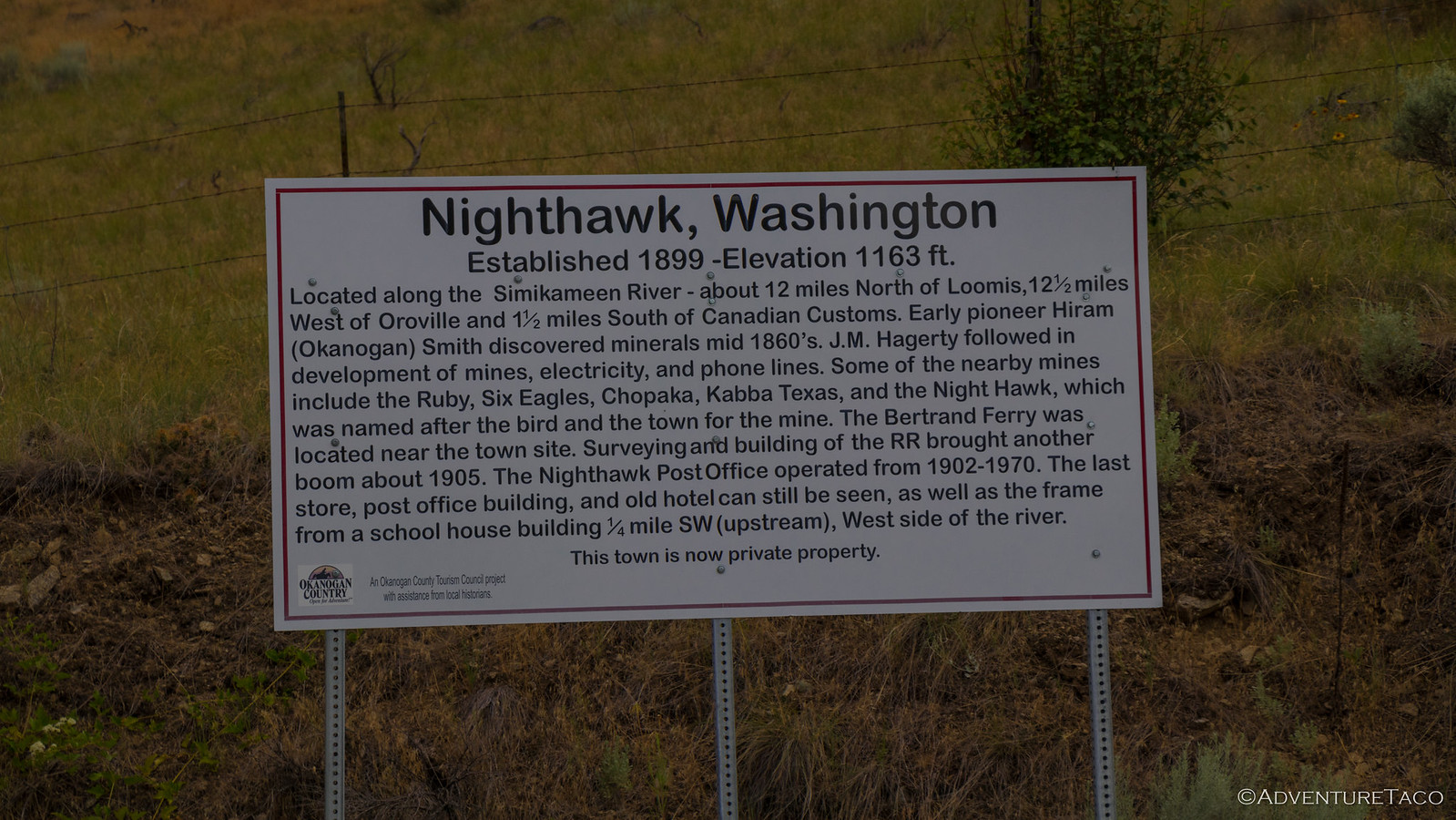
And then we arrived above Loomis, and the end of dirt for the WABDR. That meant it was time to air up for the push to Nighthawk ghost town, and then the Canadian border.
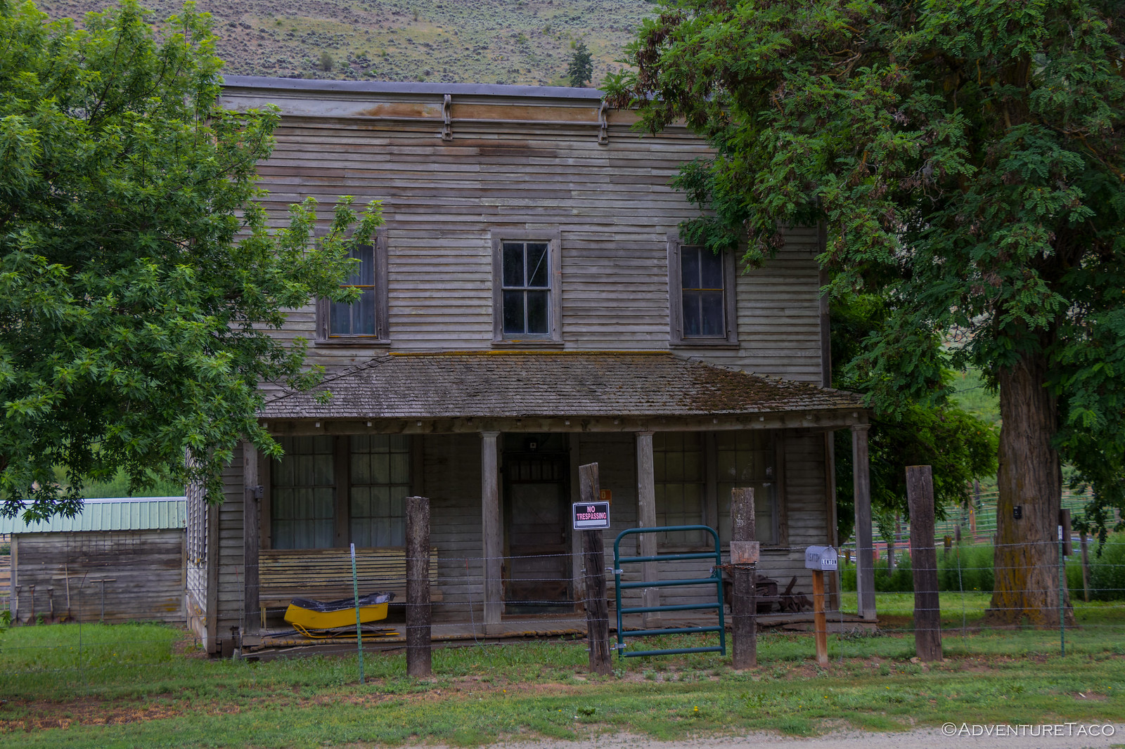
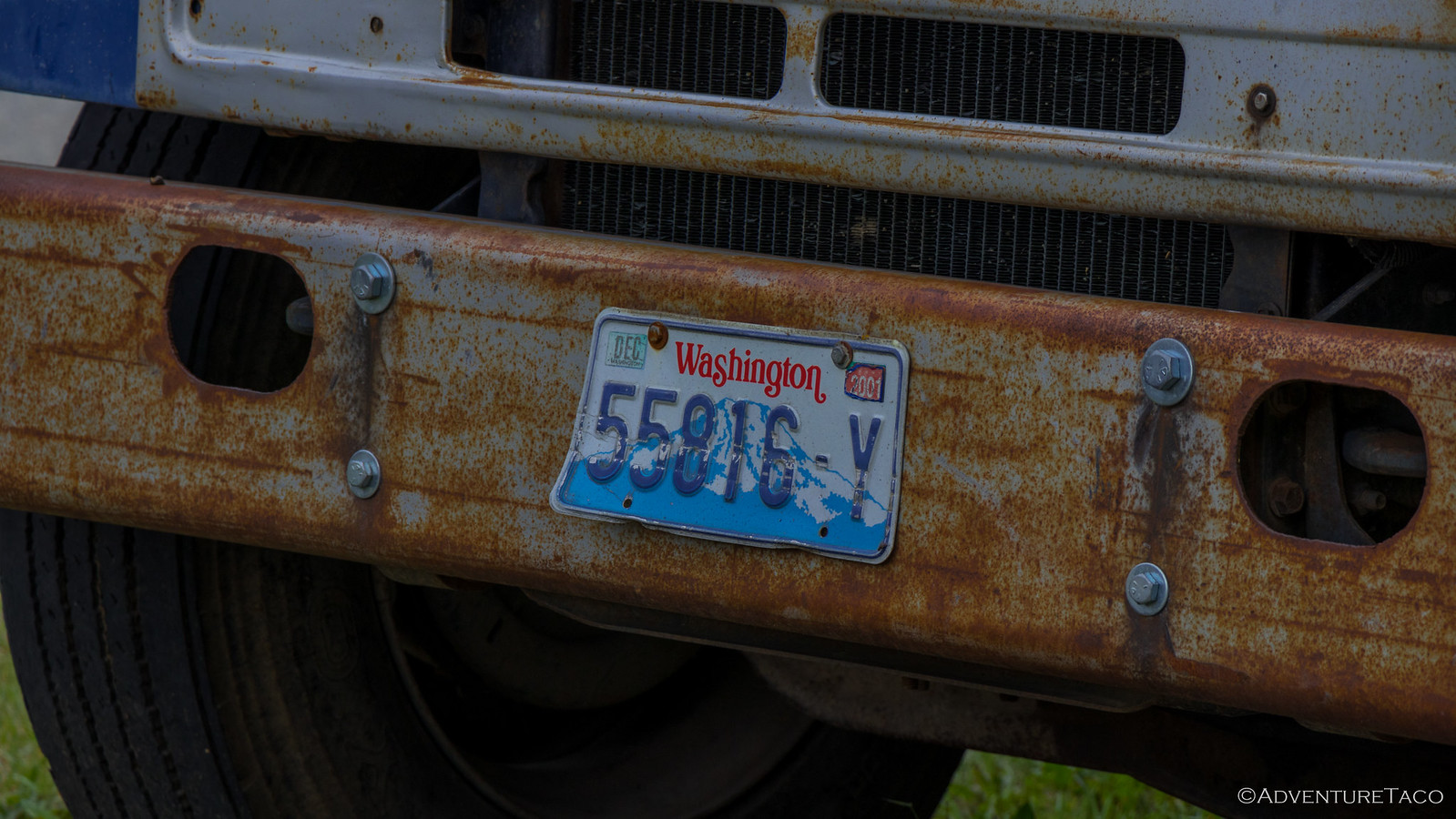
Nighthawk was a bit of a letdown - a ghost town sort-of, it was still relatively populated, though not as heavily in it's heyday, and is now private property so - not easily explorable. The old hotel was perhaps the coolest building, but my favorite thing there was an old Washington plate.
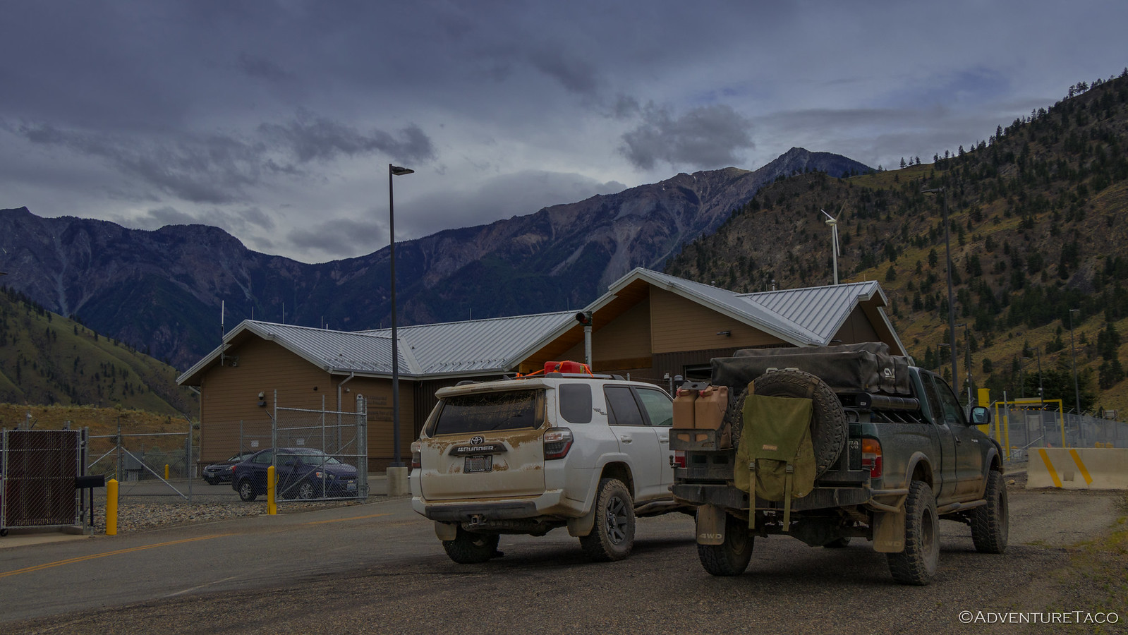
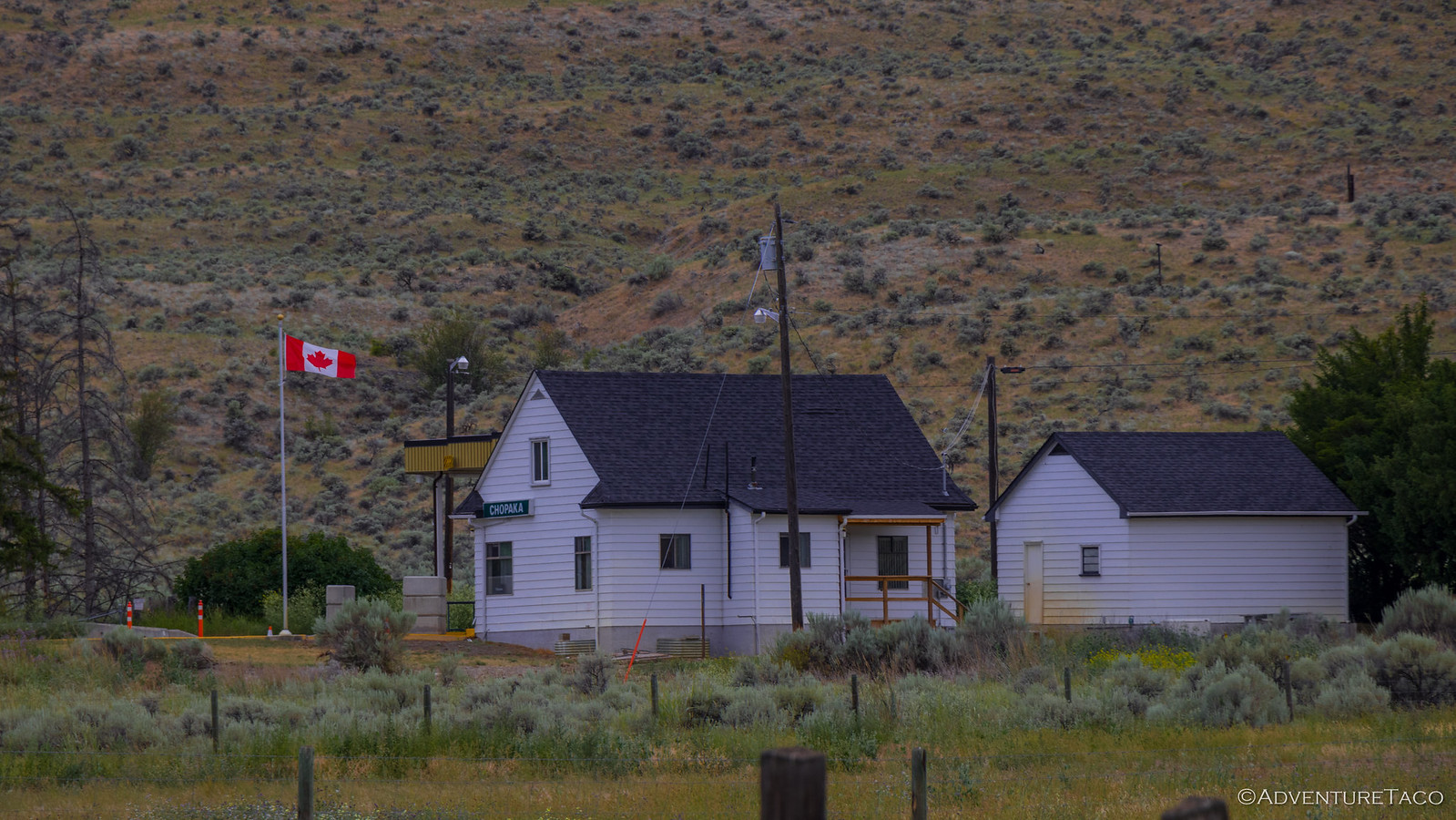
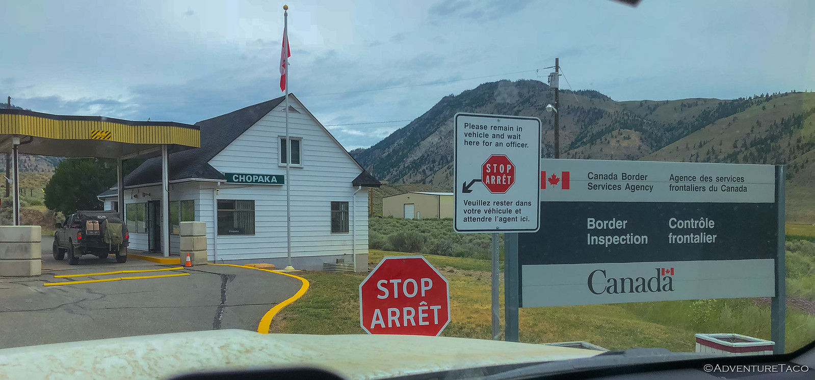
From Nighthawk, it's a relatively straight shot - all pavement - to the border. As we pulled up to U.S. Customs, we knew we were close - the cute Canadian customs office just across a painted white line.
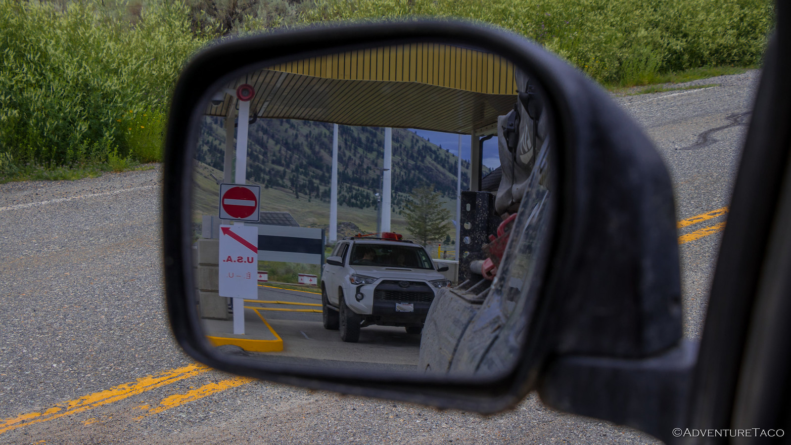
Paperwork in order, we headed across after a grilling by the U.S. Customs agents (who clearly didn't see all that much action, given the scrutiny they showed us). And that's where things went a little south... as I approached the "line in the asphalt" as it were, I thought it would be a great place to get a photo of the truck just about to enter Canada - completing the WABDR.
"Back in the truck sir!" The Canadian agent yelled from his hut, waving his arms, "Get back in the truck, this is a no-photo-zone!"
Now, I've never heard of a "no-photo-zone," and I'm not sure that a Canadian Customs agent could really tell me not to take a photo of Canada from U.S. soil, but I figured that I'd probably save some time at the border hut if I just followed directions.
Luckily, Joe was quick with his phone and captured the moment for posterity...from the safety of his 4Runner.
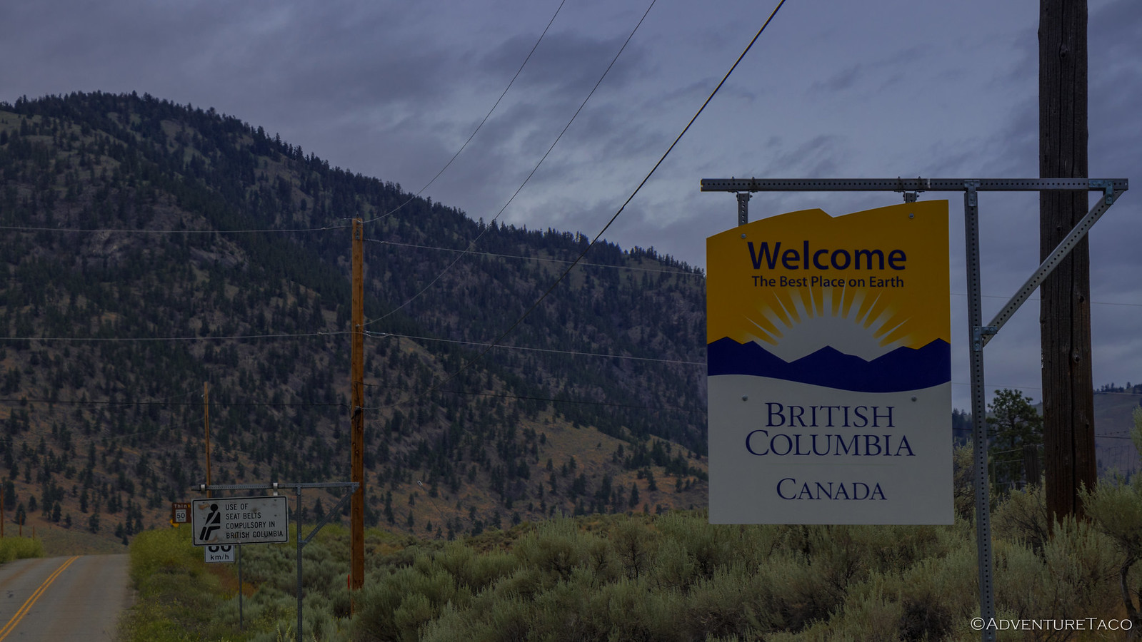
So, it was back in the truck and then 20 questions - pretty much all variants of "Do you have any weapons?" - and a quick passport check from the disgruntled Canadian (probably the only one - definitely the only one I've ever known), and we were into Canada. A few minutes later, so was Joe - also captured in the "no camera zone."
We'd done it!
It'd taken us about 6 days from start to finish and we'd had a blast. Given the relatively easy roads, it was a great first trip for Joe, Daisy and their daughter, and it felt great to get another BDR under our belt.
But we weren't done with adventures - not by a long shot. As we headed back home, the discussion focused on the next two weeks - two weeks that were already booked, with two more trips; Idaho and California!
Wow, what an amazing adventure. And, as always, beautiful scenery throughout. Glad to read about it!
Question: Why IS there a camera in the woods?!
turbodbJuly 27, 2018
Thanks!
If you click the link in the post above, you'll see what that camera is... definitely not a geocache. LOL.
Melssa&RossJanuary 8, 2021
That was a great trip. Enjoyed every minute. It was an easy trip for a newbie. You did an excellent job of putting it together. My other half and I are new to Washington. We have a family of Off-road vehicles. 94 Runner and a 87 Runner. Plus a 1999 Ford F-350 dually with a Bigfoot camper. We are looking for back country trips. Thanks for sharing.
turbodbJanuary 8, 2021
Glad you enjoyed! I'm not clear if you guys actually took a trip on the WABDR, or if you just read through the story and enjoyed that :). Sounds like you've got all the right vehicles for this kind of thing regardless. Have a great time out there. I've got all my trips categorized by state, if you're looking for something nearby or farther away... 👍 Trips by State
Melissa & RossJanuary 8, 2021
Thank you for the fast reply. Greatly appreciated. We enjoyed it through your online narrrative. Looking to start exploring soon. We enjoyed your trip to Death Valley also. Will definitely enjoy the rest of your filmings hope to get out and do them in person soon. We are 65 and 63 yrs young. Looking to explore. Stay safe.
turbodbJanuary 8, 2021
Gotcha. Boy, I hope I'm going strong like you two when I reach your age. Have a great time and safe travels!
Jodi BigelowJanuary 17, 2023
I absolutely loved reading your day to day adventures. Your pictures are breathtaking. I’m looking forward to my fist WABDR this July 2023 with my boyfriend and our motorcycles.
turbodbJanuary 17, 2023
Thanks Jodi, always great to hear when people like the stories and photos! The WABDR on motorcyles will be amazing. What do you two ride? I had a CBR600 for many years - obviously not something for the BDR, but fun around town!
Jodi BigelowJanuary 18, 2023
Oh yeah!!! Riding the bike will be super fun. Between the two of us we have a Kawolski z650, a Versus, KLR and a KTM.
Definitely taking the last two. Gonna pack them full with our gear and head out for 9 days.
The way you shared was very well written. We a definitely excited to go and hopefully the weather will be perfect.


Wow, what an amazing adventure. And, as always, beautiful scenery throughout. Glad to read about it!
Question: Why IS there a camera in the woods?!
Thanks!
If you click the link in the post above, you'll see what that camera is... definitely not a geocache. LOL.
That was a great trip. Enjoyed every minute. It was an easy trip for a newbie. You did an excellent job of putting it together. My other half and I are new to Washington. We have a family of Off-road vehicles. 94 Runner and a 87 Runner. Plus a 1999 Ford F-350 dually with a Bigfoot camper. We are looking for back country trips. Thanks for sharing.
Glad you enjoyed! I'm not clear if you guys actually took a trip on the WABDR, or if you just read through the story and enjoyed that :). Sounds like you've got all the right vehicles for this kind of thing regardless. Have a great time out there. I've got all my trips categorized by state, if you're looking for something nearby or farther away... 👍 Trips by State
Thank you for the fast reply. Greatly appreciated. We enjoyed it through your online narrrative. Looking to start exploring soon. We enjoyed your trip to Death Valley also. Will definitely enjoy the rest of your filmings hope to get out and do them in person soon. We are 65 and 63 yrs young. Looking to explore. Stay safe.
Gotcha. Boy, I hope I'm going strong like you two when I reach your age. Have a great time and safe travels!
I absolutely loved reading your day to day adventures. Your pictures are breathtaking. I’m looking forward to my fist WABDR this July 2023 with my boyfriend and our motorcycles.
Thanks Jodi, always great to hear when people like the stories and photos! The WABDR on motorcyles will be amazing. What do you two ride? I had a CBR600 for many years - obviously not something for the BDR, but fun around town!
Oh yeah!!! Riding the bike will be super fun. Between the two of us we have a Kawolski z650, a Versus, KLR and a KTM.
Definitely taking the last two. Gonna pack them full with our gear and head out for 9 days.
The way you shared was very well written. We a definitely excited to go and hopefully the weather will be perfect.
Thank you for your response.