

I'm one lucky dude. Having just gotten back from two trips to Death Valley - (Lowest Peak in the Park) (Highest Peak in the Park) - over a three-week period, I'm now headed back for my third trip in a month!

But, frequency isn't the only reason I'm excited. Every year, a few buddies get together for an annual outing - usually in early fall - to explore and hang out. For me, it all started when I tagged along on my first major trip - The De-Tour - and I've been hooked ever since. This year, truck problems and smoky conditions cancelled our trip - a huge bummer - until now!
Finally, I get to play tour-guide for a spot I've come to love. It will be the first visit to Death Valley - in more than 10 years of exploration - for a couple of the guys, and our route will take us to lots of iconic places. With a little luck, I'll get them hooked on the desert too, and before long, we'll all be Back for More.
Where are we going? Just a few places - you know, Titus Canyon, Ubehebe Crater, Teakettle Junction, Racetrack Playa, Hidden Valley, the Lost Burro Mine, Lippincott Pass, Ballarat, Pleasant Valley, Gohler Wash, Mengal Pass, the Barker Ranch, Butte Valley, Warm Springs Rd, Saratoga Springs and the Ibex Dunes, Badwater Basin, Devils Playground, Zabrinski Point, Echo Canyon and the Inyo Mine, Crankshaft Junction, Eureka Valley and Dunes, Dedeckera Canyon, Steel Pass, and finally Saline Valley and its Warm Springs.
Well, that was the plan anyway. We had a great time, but it surely didn't go all to plan.  And as usual, I'm getting ahead of myself.
Day 1
It all started with us meeting after dark just outside of Beatty, Nevada. I'd been driving for nearly 20 hours by the time I pulled into camp to greet Mike @Digiratus and Zane @Speedytech7 who'd arrived a few hours earlier. As we all climbed into our tents, Monte @Blackdawg texted that he was going to drive through the night and show up the following morning!

Day 2
We were up at the crack of late morning - something around 8:00am - a couple hours after sunrise, and certainly later than we'd need to get going for the remainder of the trip. Being December, we had fewer than 10 hours of light each day, and our itinerary meant that we were going to need to make the most of it.
Still, Monte wasn't due for a few more hours, so we each placed our bet on how late he'd be as we got camp packed up and headed into Beatty to top off our fuel tanks. With guesses between 11:30am and 1:00pm, I suggested that we check out the Goldwell Open Air Museum while we waited.

Just outside the early 1900s ghost town of Rhyolite, the museum is a funky - but perhaps expected - find in the desert. Created by Albert Szukalski and a group of Belgian artists, it is a self-described "art situation," consisting of several outdoor sculptures that seem both out of place and right at home in the desert.


We spend 45 minutes or so looking around before we were all ready to go, and hoping that it was nearly time for Monte to show up. A quick text and we learned that he had a little over 90 minutes to go - so we headed up the hill to Rhyolite for a bit more looking around.

Of the two legitimate mining towns that sprung up in Death Valley during the early 1900s, Rhyolite had only Skidoo to compete with from a size perspective. With a population of over 10,000 at one time, Rhyolite - founded in 1904 - was the larger of the two towns and sported a train station, school, and at least four banks. But, like many towns of its day, Rhyolite was a prime example of "counting your chickens before they're hatched" The rich strike of gold by Eddie Cross and a "Shorty" Harris in 1904 was enough to get the town going, but not enough to sustain it through the financial panic of 1907 when businesses started to shut down. By 1916 the power and light company had shut down and the people had moved on.


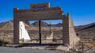
Finally, we visited the bottle house. This one - unlike the other ruins we'd visited - isn't original as it's been restored/rebuilt twice, but it's still a cool structure to check out. In the last several years, a fence has been constructed around it in order to preserve it for future generations, so unlike my first visit, we weren't able to peer in the few windows that exist.


Our exploration of Rhyolite complete, I texted Monte as we drove the final few miles to our first trailhead. It was there - just east of the entrance to Death Valley National Park - that we would air down and wait. It was there - at the Titus Canyon trailhead - where our real journey would begin.


Monte showed up right on time, for him. Actually, at only 45 minutes late, he was technically early! Having not seen each other for more than a year, we all shared warm greetings and chatted for a few minutes before I shushed everyone into their trucks so we could get a move on - it was nearly noon, and I wanted to get us to a spot where I knew we'd have fantastic views before settling down for lunch.

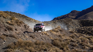
Having run Titus Canyon a few times, I think of it as having two distinct sections. The first is a desert traverse that winds up into the Grapevine Mountains and terminates at Red Pass. This section - while not the namesake of the trail - might be my favorite. Certainly, the experience of reaching Red Pass and seeing the canyon open up below - that is my favorite part of the trail.


 , j/k)
We spent a good hour at Red Pass, with the entire place to ourselves - surprisingly, not a single vehicle passing while we ate lunch - as we caught each other up on recent happenings, truck maintenance, and all the things we'd somehow forgotten to mention to each other over the course of more than 10,000 posts on TacomaWorld. It was fantastic.

It's the second half of the Titus Canyon trail that is the highlight for nearly everyone who takes this route into Death Valley. Personally, I think it's the second-best route in from the east - after the much more difficult Echo Canyon - but it's definitely the route I'd recommend taking on anyone's first visit to the park.
Four miles long and hundreds of feet deep, Titus Canyon's narrows are as tight as 15 feet and rank among the longest and deepest - sometimes rising 500' to the rim - in the park. Filled with bulging walls, overhangs, undercuts, and colorful mosaics, they are a glorious introduction to the wonderous geology of the region, and I have yet to see the visitor who passes through unfazed. This time was no exception.


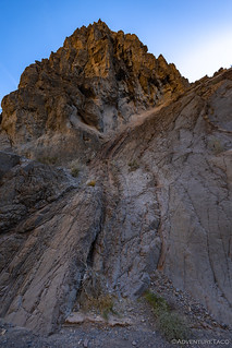

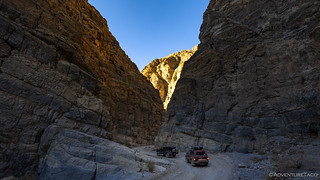
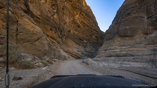
As we neared the end of the narrows, there's a section of wall that I'm sure I've seen before, but that really caught my attention this time through - both sides of the canyon decorated with giant polished mosaics.

These are breccia made of large, dark, and angular blocks of limestone - some several feet across - cemented by white calcite. The limestone probably shattered into blocks thousands of feet underground, where hot water dissolved some of it and redeposited it as calcite in the gaps between blocks. The blocks were displaced very little with respect to each other after shattering, as shown by the matching orientation of cracks in adjacent blocks. (Hiking Death Valley)


It was 2:15pm when I exited the mouth of Titus Canyon and started down the alluvial fan that leads to the floor of Death Valley. Like the canyon itself, this entrance - into the wide-open space that shares the same name as the entire park - is dramatic, and I fired up the CB radio, "Welcome to Death Valley, boys!"
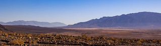
Having all spent many hours driving to get here, I hadn't planned much for this first day of our trip. In fact, we had only a couple more spots before we'd be finding camp - and the first was a few miles to the north on Scotty's Castle Road: Ubehebe Crater.
Ubehebe Crater is the largest of more than a dozen craters clustered within a single square mile at the northern end of Death Valley. Although some of these craters emitted lava, all of them are maars: they erupted when magma encountered an aquifer and/or surface water, creating a pressurized head of superheated steam that blew up the ground above it. A column - consisting of water droplets, ash, and pulverized rock - was blasted high into the atmosphere, before collapsing downward to the ground. This collapse caused a ring-shaped cloud to spread radially outward at high velocity, blanketing the surrounding terrain and filling every drainage with volcanic tuff.

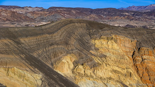
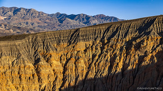
As I knew would be the case, we didn't spend long at Ubehebe Crater. There are hikes here - to narrow canyons, to the base of the crater, to desiccated playas, and through petrified ash dunes - for anyone wanting to spend a day exploring; I highly recommend it.

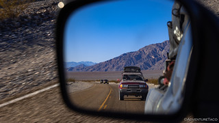
From Ubehebe Crater, we headed south on Racetrack Valley Road in search of camp. With just over an hour until sunset, we kept the skinny pedals pressed firmly down - hoping to cover the 30 miles or so as quickly as possible, so we'd reach camp with a bit of daylight still remaining.

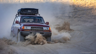
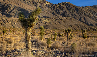
As we made our way south, Joshua Trees began to dot the landscape. This trip was Monte's introduction to the strange Seussian shapes, and I couldn't wait to show him the larger specimens I knew were coming later in the trip.


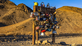
After half an hour, we'd nearly reached the location I planned to find camp, and we stopped for a few minutes to admire the current collection at Teakettle Junction. A strange - yet somehow appropriate in the desert - place, we each poked around, pointing out this kettle or that one, noting the dates - the oldest of which was less than three weeks old - and laughing at some of the stickers.

Our path the following day would take us further down Racetrack Valley Road, but this evening we were turning left and heading into Hidden Valley via Lost Burro Gap. It was there - away from the hustle and bustle of the much more popular playa - that I knew we could find a nice, sheltered camp site. A place where we could all enjoy a nice campfire before turning in for a good night sleep.

A few minutes later, off the side of the road, we were settled. For a while, our own routines kept us busy - deploying tents, setting up camp - though the conversation continued through it all. Eventually, Mike got to a point where his propane fire ring was ready to be set up, and I grabbed my 20lb bottle of propane to fire it up.
Then, I wandered off. Having been in this area before, I knew that not far away was the Lost Burro Mine. I wouldn't have much time to explore it this evening, but I hoped to catch it as sunset lit the sky around the hillsides it inhabited. And - as it turns out, and perhaps surprisingly - that's exactly what happened!

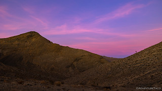
With light fading fast, I made my way back down through the hills and along the road to camp. The fire was burning bright as I arrived - the time now just after 5:00pm - as it would for the next 5 hours as we sat around catching up on the last 14 months. Even though we were all tired - some of us with less than 4 hours sleep in the prior 48 hours - none of us really wanted to go to bed. There was too much to say, too many jokes to tell, too much fun to be had.
But eventually it was time. Luckily for us, this was just the beginning. The beginning of a trip that would end unexpectedly... but not before more memories would be made.
The Whole Story


A spectacular trip with friends always makes it a grand time. I love the tea kettle junction, how appropriate.
There are a couple fun places like that in the desert - some in Death Valley (Crankshaft Junction is another one) and some in the Mojave Preserve (the Mojave Mailbox comes to mind). Always fun to stumble upon!
#EPIC pictures and story telling
Glad to hear you enjoyed it Gerard! Lots more coming, and well... I shouldn't give too much away. Needless to say, there were ups and downs - and not just through the valleys in the park ? ?.
Definitely agree.
Outstanding scenery. Who knew the desert could be so beautiful. Titus Canyon looks amazing. Would love to take my jeep here one day. Love the colors in the sunset.