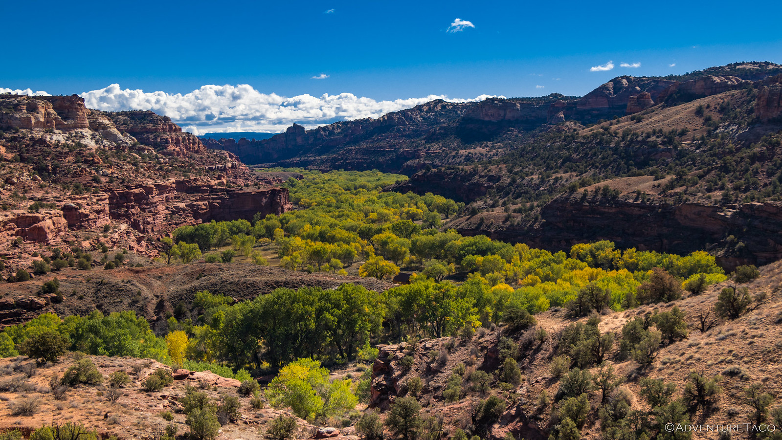
In perhaps the most uneventful morning of the entire trip - a good thing! - it was 8:45am before I woke up and climbed out of the tent, our perch at the mouth of Escalante Canyon beautiful under clear blue skies.
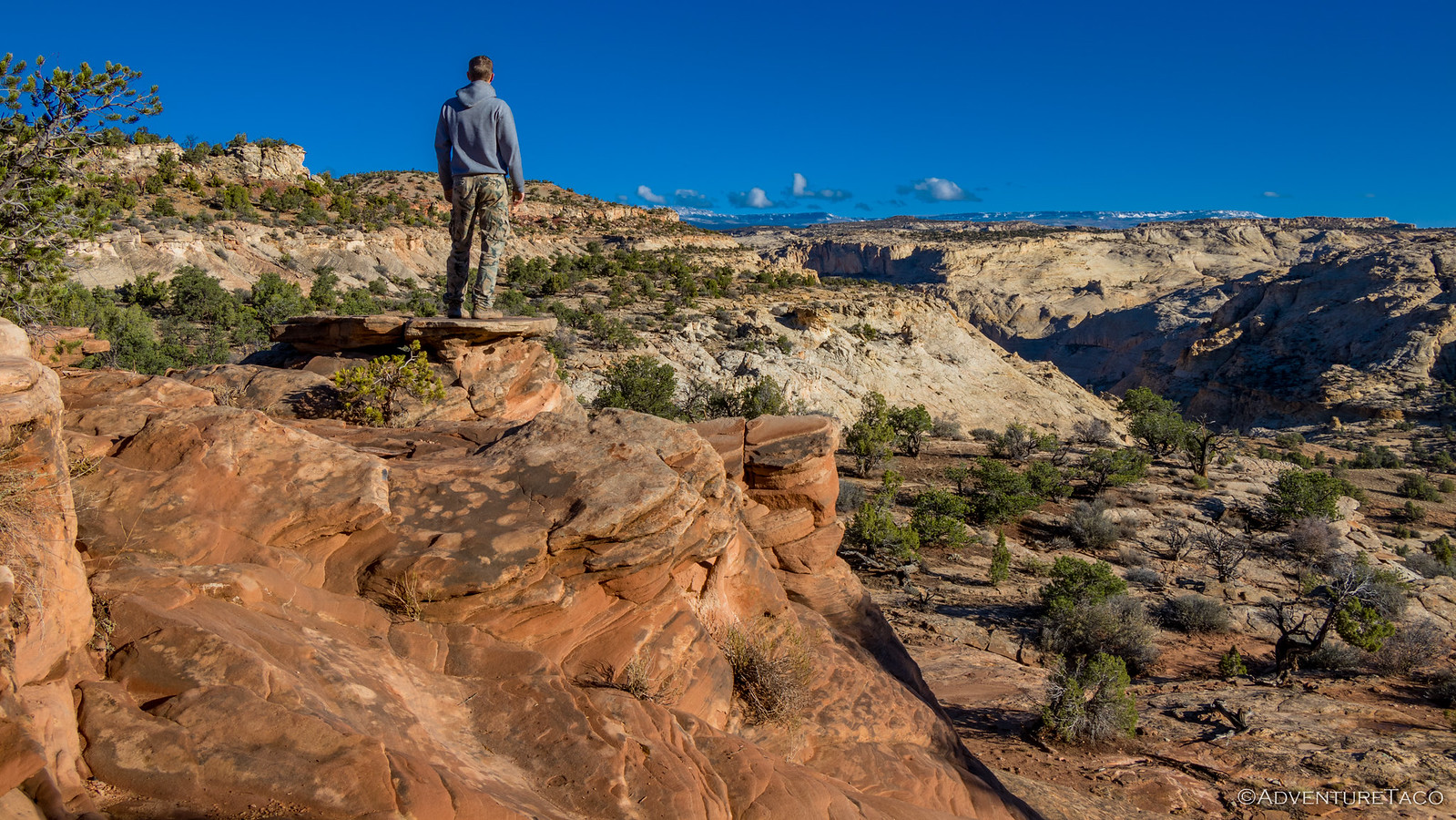
I wandered around a bit exploring the edge of the canyon, torn between wishing that I'd gotten up early to go explore the canyon itself, and the 8-hours of uninterrupted sleep I'd gotten. I suppose that, given the canyons we'd seen so far, the sleep was likely the better option, even if I hadn't made it purposefully  . And so, I headed back to camp to see what I could do about accelerating the drying of my tent (already happening in the sun, but it never hurts to speed that up).
As I was toweling off the stargazer windows on the top of the tent, Mike @Digiratus and Monte @Blackdawg ventured out into the day - likely awoken by the ruckus I was making, but the reward far outpacing the pain of getting up. Like me, Monte wanted to see the canyon up close, and so headed out immediately as Mike and I got going on our morning breakfast rituals, the tents continuing to dry off.
But the canyon was pretty far away - probably a good ¾-mile or so - and it was with a tinge of the same regret I'd felt that Monte returned to camp to get everything packed away and ready for another day on the road. A beautiful day.
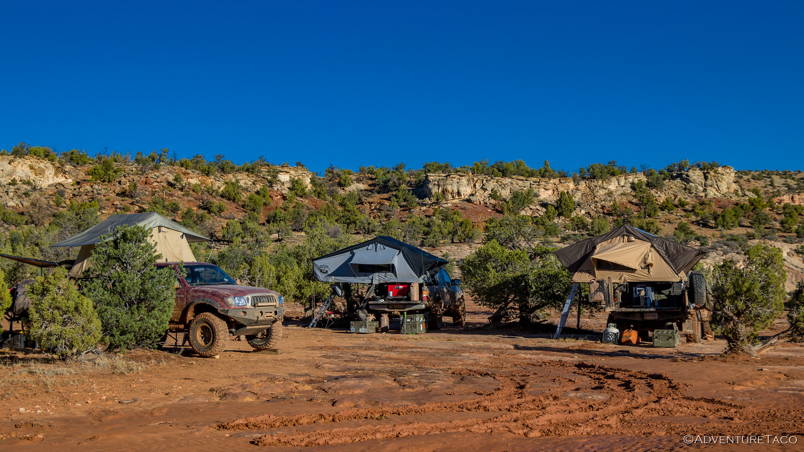
We were out of camp by 10:30am, our tents mostly dry (dang the shady side!), and definitely drier than they'd been the previous couple days - a win in our book. Today, we were headed northeast - through the town of Boulder, UT and then to the Burr Trail, which would take us through the colorful, varied landscape of Grand Staircase-Escalante National Monument, Capitol Reef National Park, and finally to the base of the Henry Mountains.
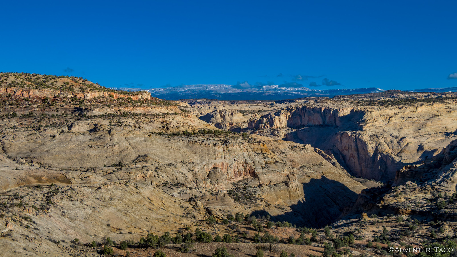
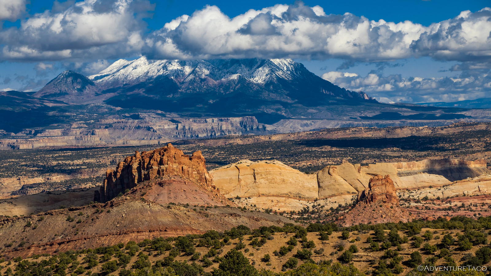
Our first stop was just before we reached Boulder at Head of the Rocks Overlook. This viewpoint on highway 12 provides amazing views out over the Escalante Canyons, one that allowed us to see our entire route for the day - the Henry Mountains far to the north.
Excited, we headed back to the trucks - eager to get off the highway and back onto dirt. More eager perhaps, than we should have been, it turned out! We made our way up the canyon to Boulder, where we stopped briefly to top off our gas tanks and pick up a few things at the attached surprisingly-well-stocked store. I forget exactly what all we picked up, but the store's selection of Newman's Own products was extensive - and Monte couldn't resist a few vanilla Oreo-style cookies.
The Burr Trail splits off of highway 12 in Boulder - so after our quick pit stop, we were officially on our way - a sign alerting us to a 72-mile dirt road ahead. Score!
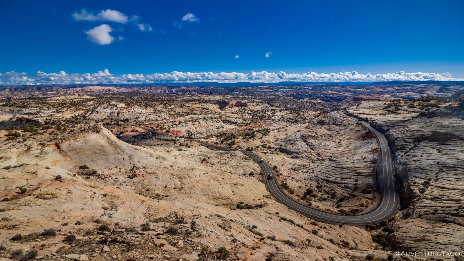
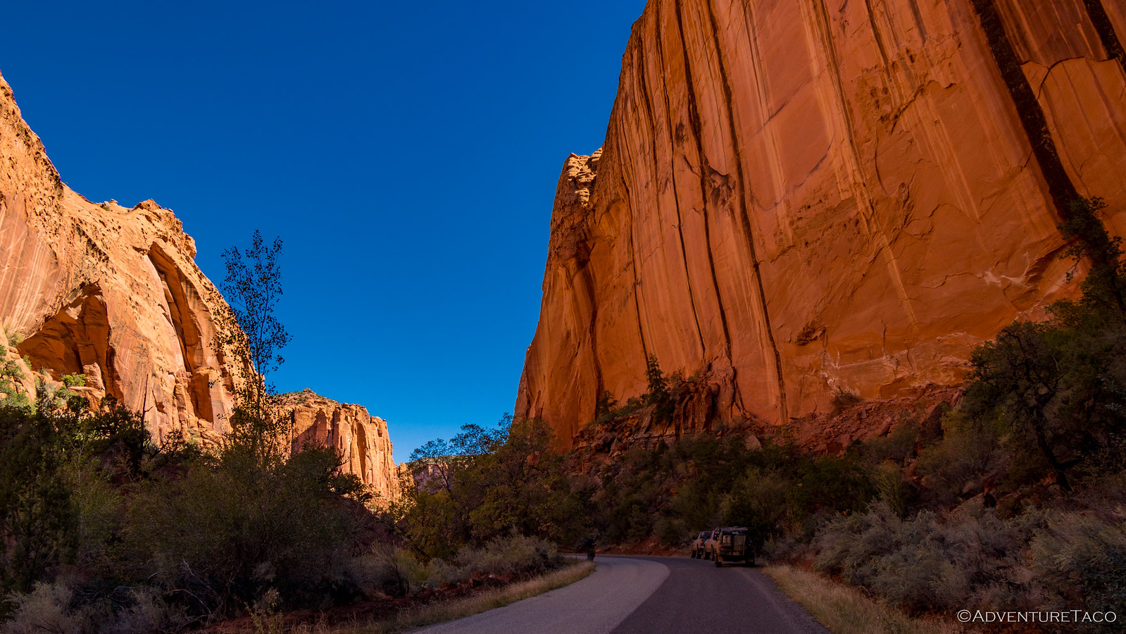
But then, as we continued on, pavement. Lots of pavement. I joked over the CB, "Perhaps the sign meant 72 miles to the dirt." There was no laughing. Of course, pavement is just a road covering and though not our favorite covering, it didn't do anything to detract from what we'd consider the main attraction - the views down into Long Canyon beckoning us in.
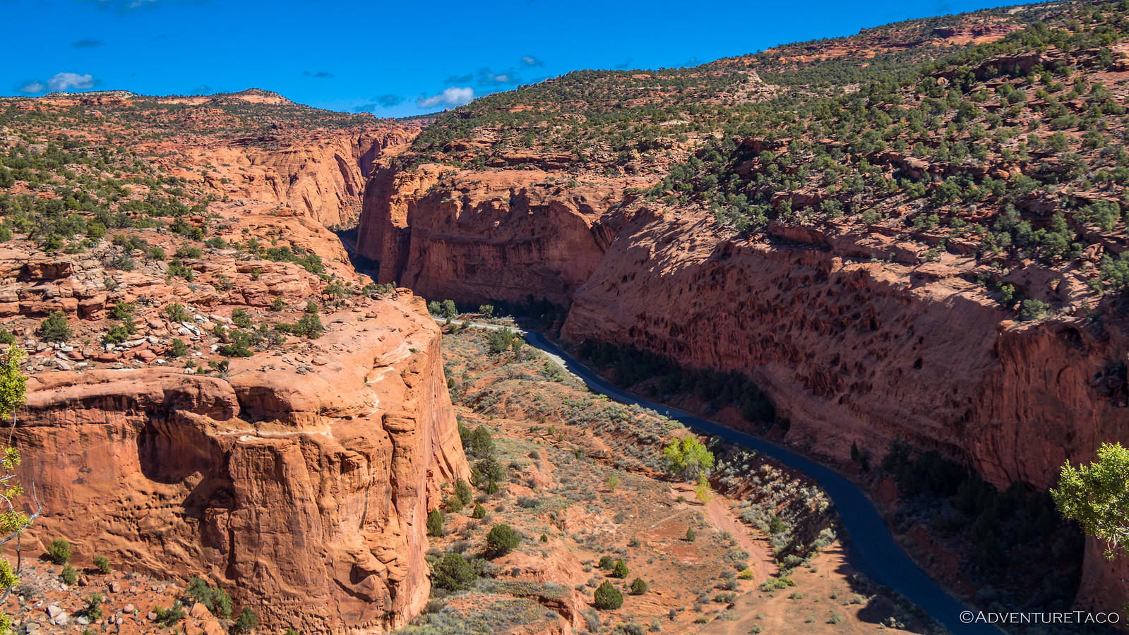
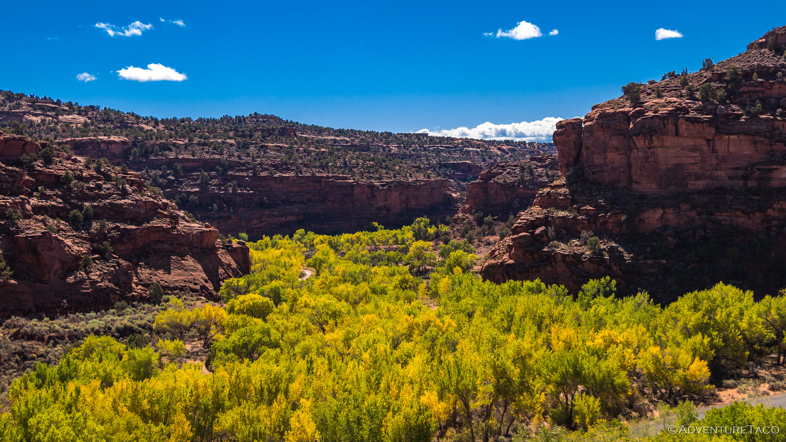
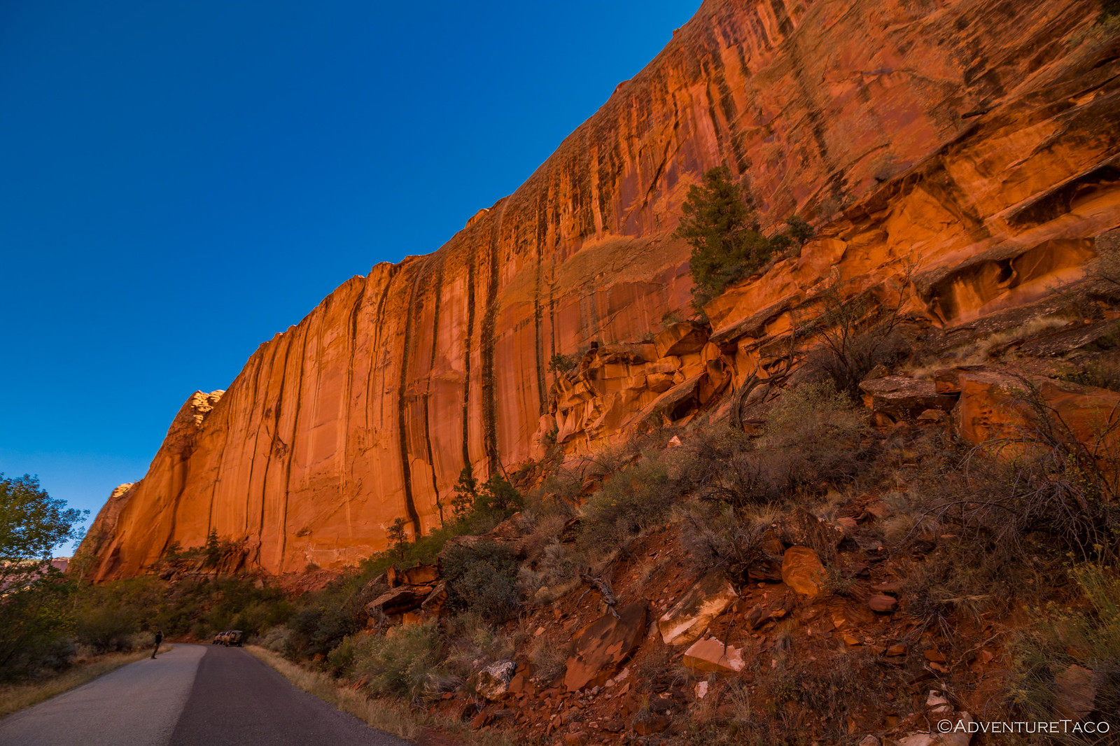
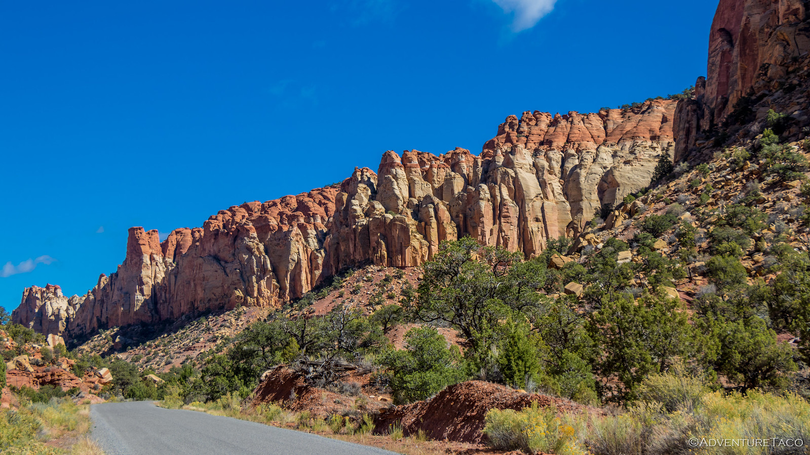
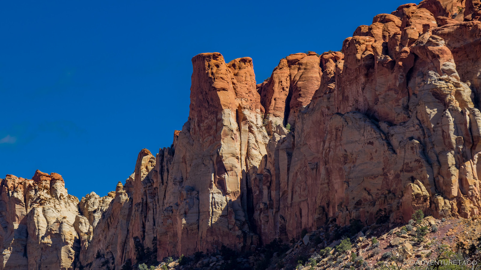
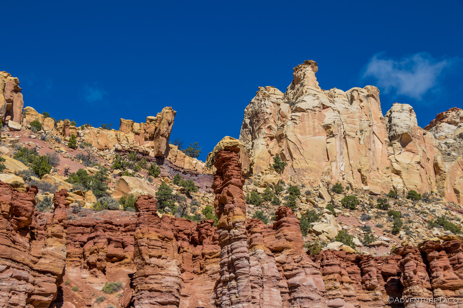
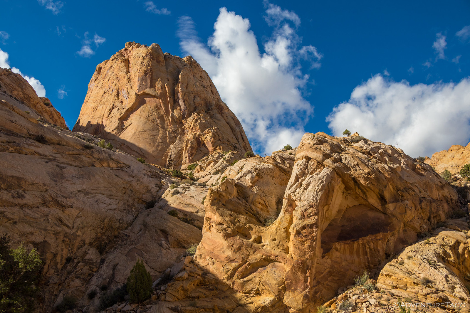
Long Canyon is a special place to say the least. It's dramatic walls rise high over the roadway, the reddish-orange sandstone brilliantly reflecting the sun into the canyon, casting a warm glow on everything around. Contrasted with the deep blue of the sky, it felt like we'd stepped into a different world, the rules of color different than our own.
From towering walls, the road continued to wind up the canyon - the walls turning to needles and hoodoos, reminiscent of those we've experienced elsewhere in Utah, most recently for me in The Maze, and reminding me that a trip to the Needles District in Canyonlands National Park needs to happen in the near future.
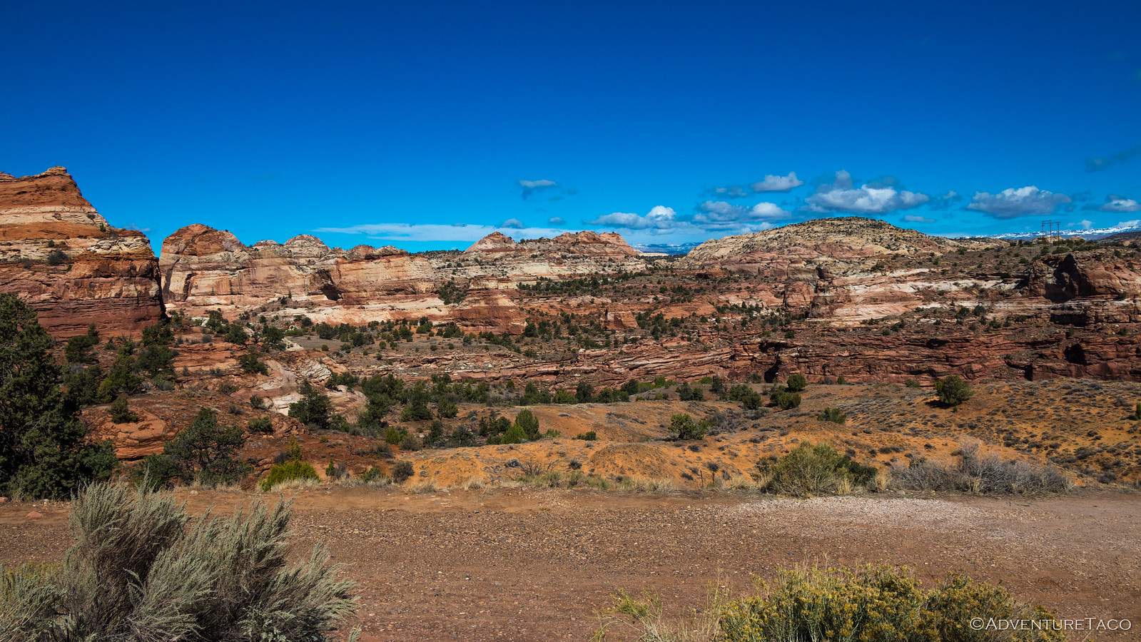
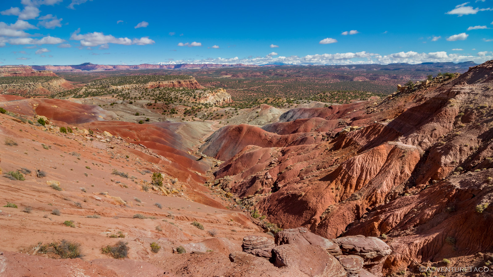
Our progress through this wonderland slow (as usual), it was already early afternoon, we were still on pavement, and we hadn't eaten lunch - so when we came to a pass at the top of the canyon, it was the perfect place to stop and enjoy a sandwich, overlooking Capitol Reef National Park stretching across the landscape, our destination - the Henry Mountains - still far off on the horizon.
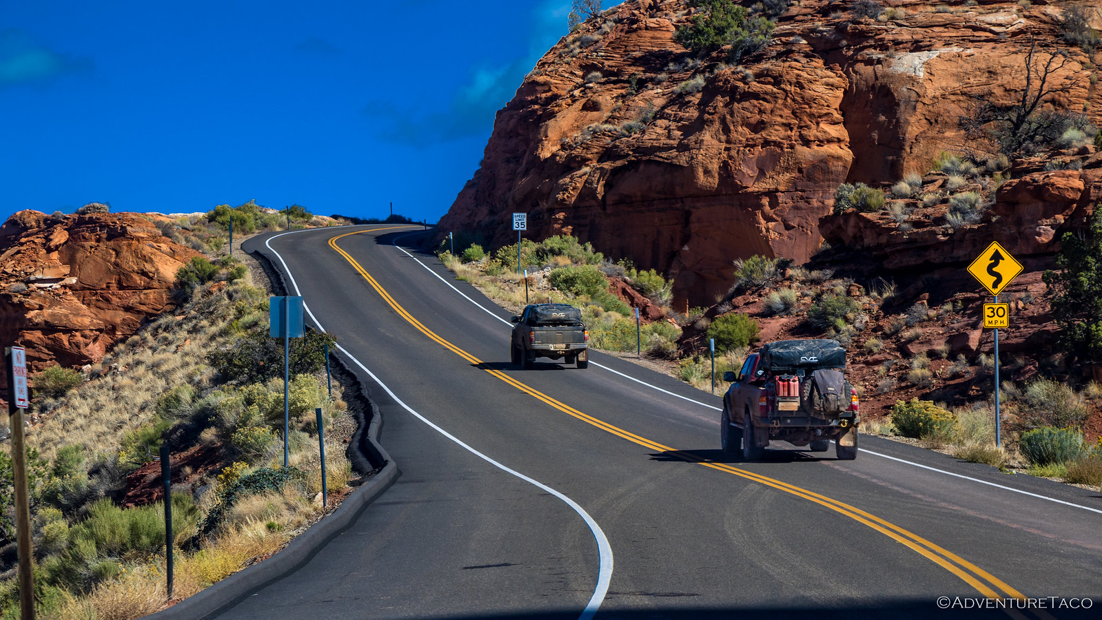
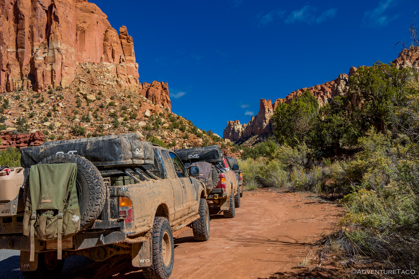
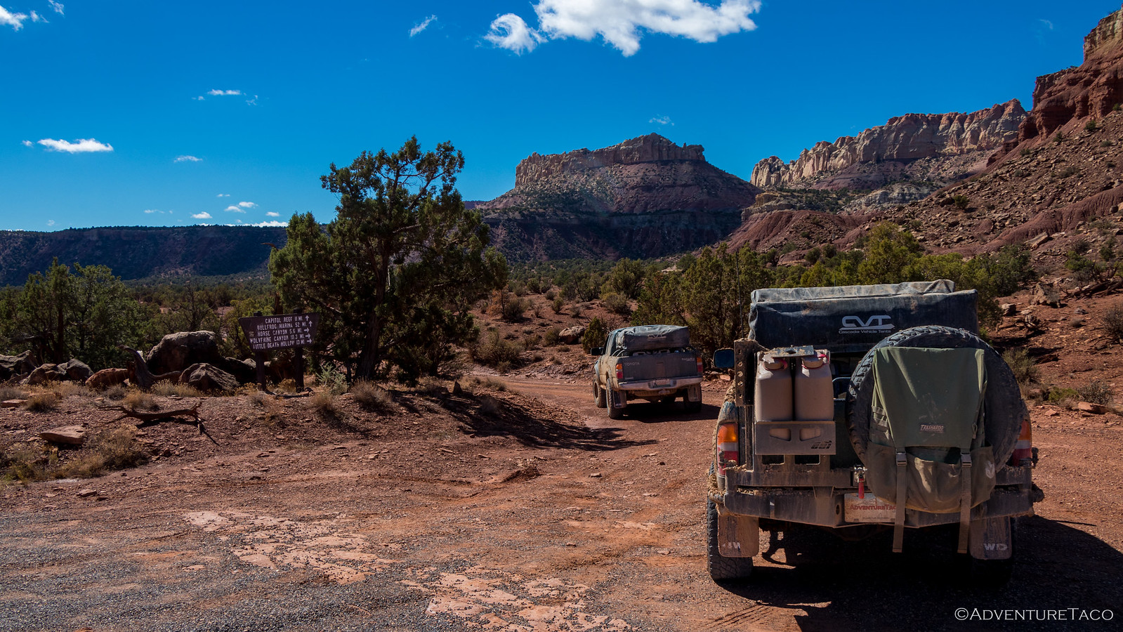
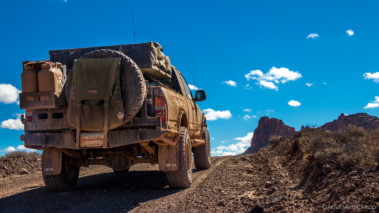
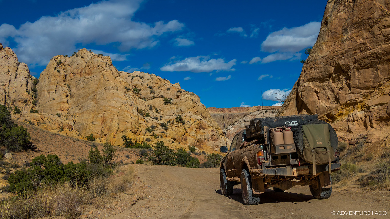
With lunch complete and our bellies satisfied, it was time to get some serious miles behind us. Headed down the pass, we finally got what we'd been craving since heading out on the Burr Trail - dirt, and a sign telling us we had 12 miles to Capitol Reef and some 50 miles to our destination. Not too bad, if we could keep the wheels spinning. Already aired down, we were ready to go!
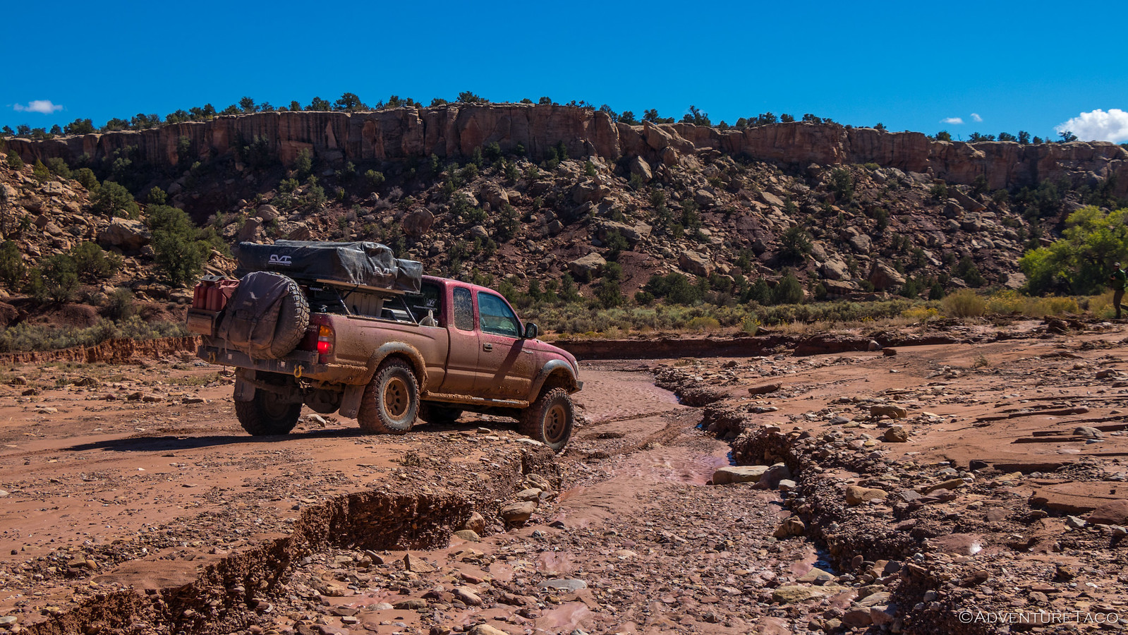
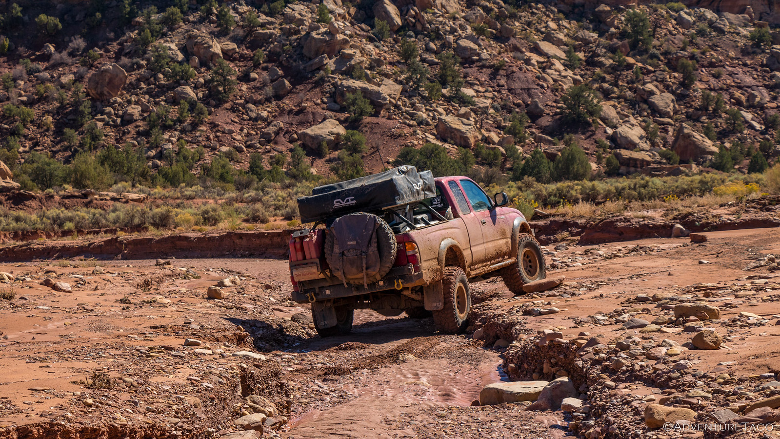
The roads on this section of trail were in relatively good shape, with a few exceptions. Actually, it was really just one exception - the wash that wound its way back and forth across the road. Of course, that was just fine with us - getting flexy one of the things we endlessly enjoy.
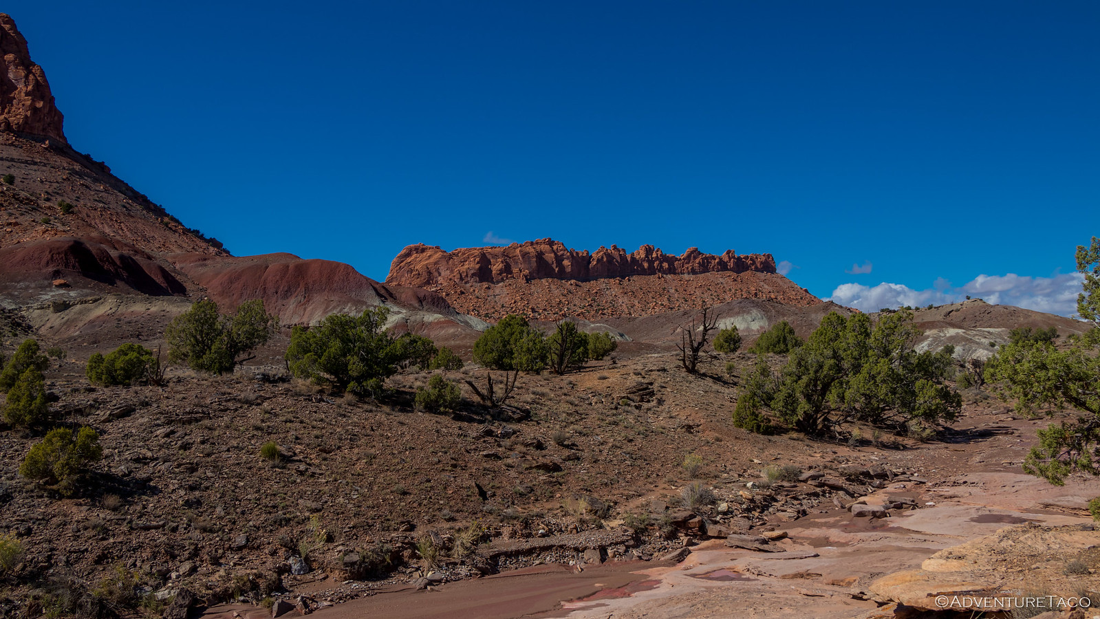
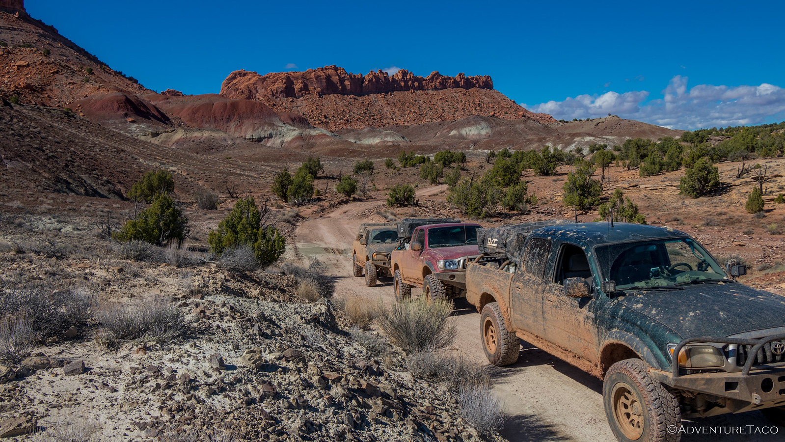
We continued on, making our way to Capitol Reef National Park - the borders of the park undefined all these miles away from civilization, us the only adventurers making our way across the landscape.
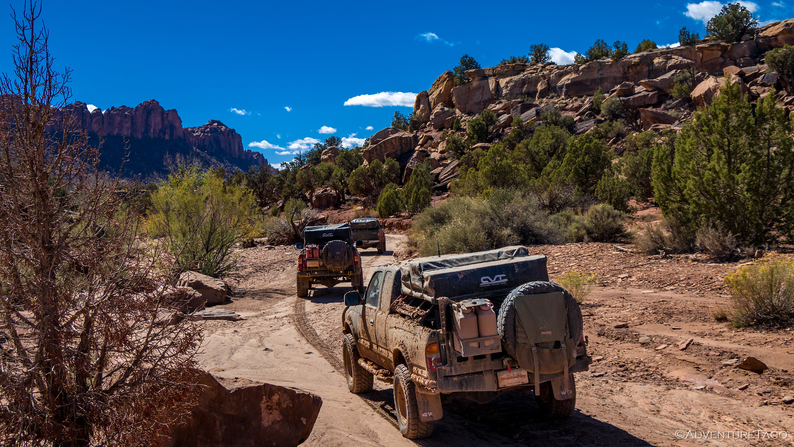

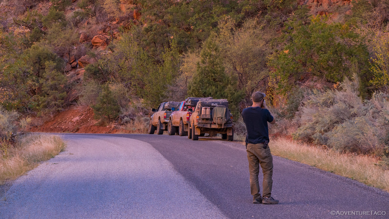
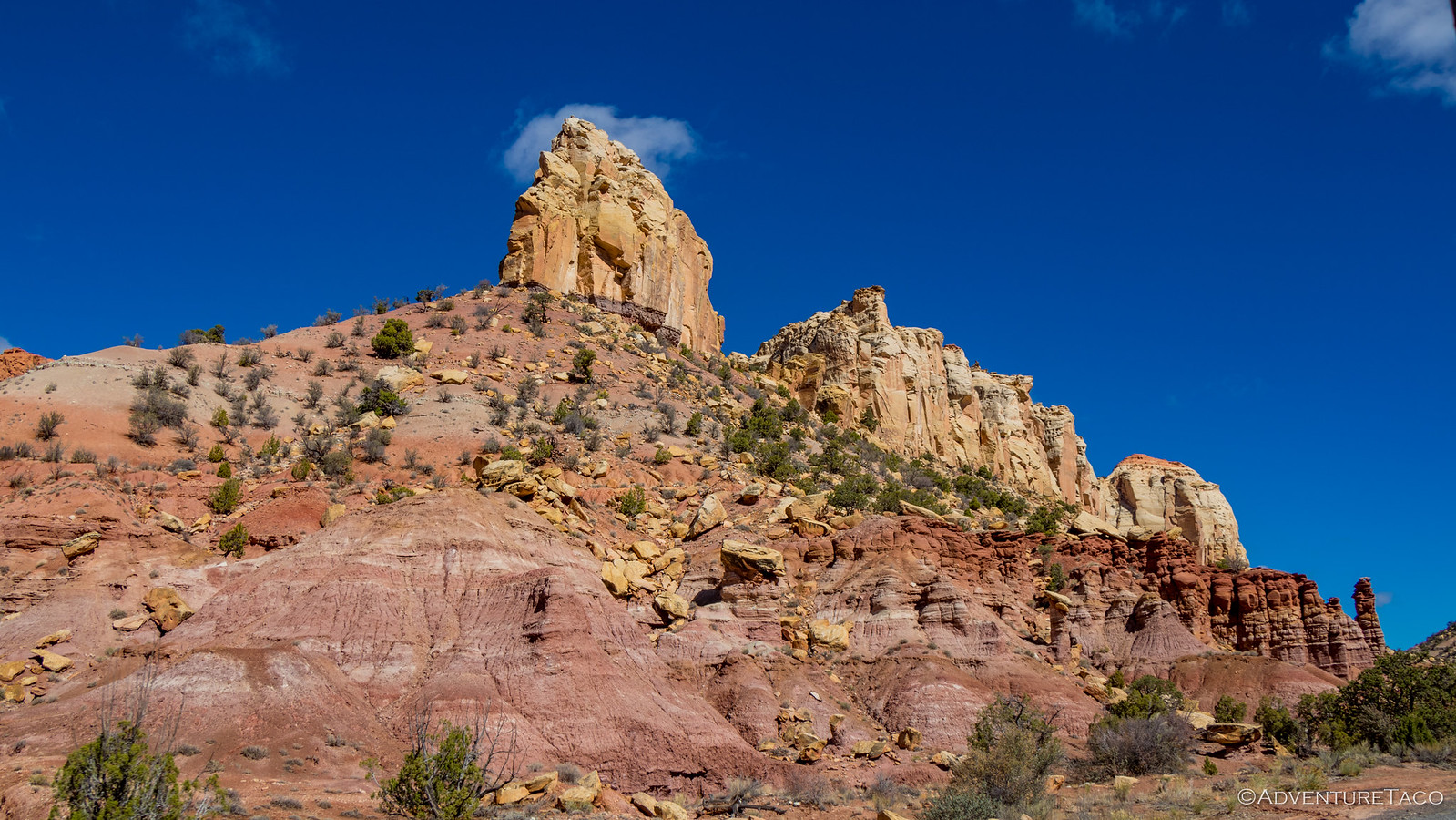
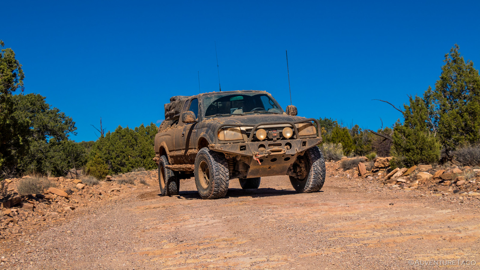
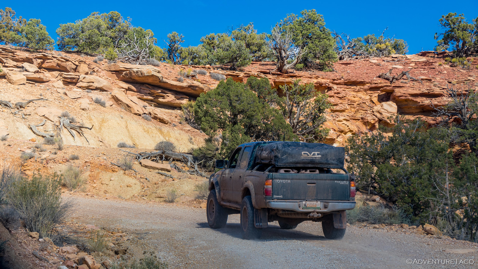
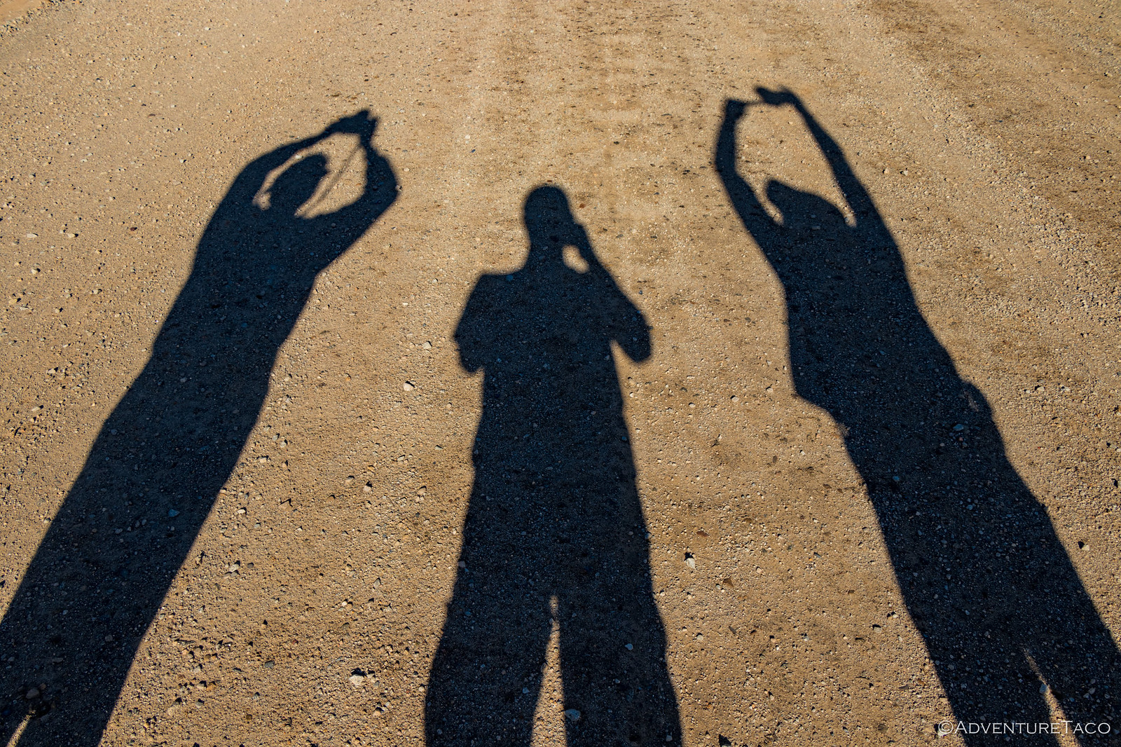
Around the mesas we traveled, each view seemingly more dramatic than the last. We stopped often, but none of us more frequently than Monte - the blazing sun and bright landscape resulting in plenty of opportunities to practice his nearly-patented photo pivot.
Pivot complete and photo captured, Monte would speed off again - another opportunity surely just around the next bend.
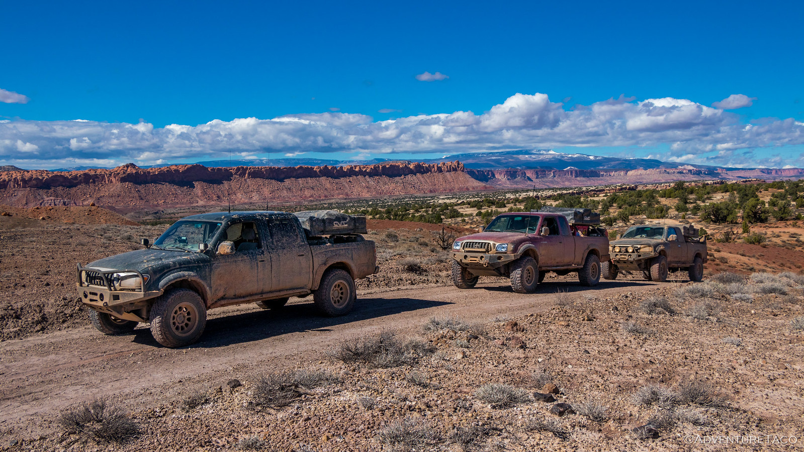
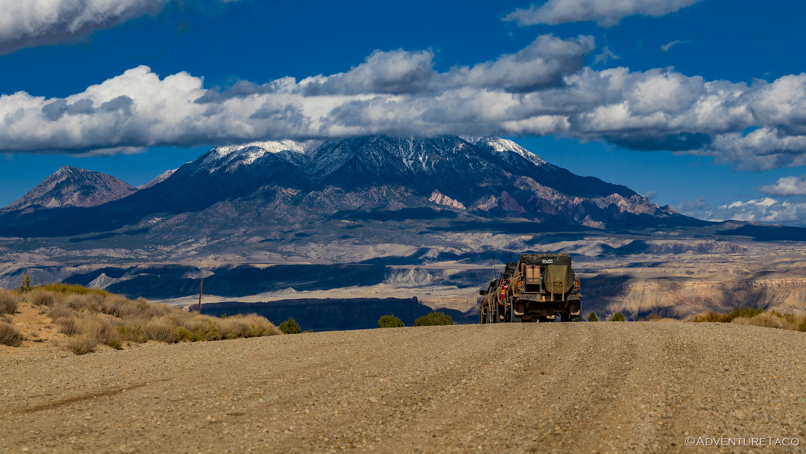
By mid-afternoon, many of the miles we'd wanted to travel were somehow behind us - a testament to Mike who kept us moving despite our best efforts to essentially walk the trail, cameras in hand. It's not that we'd reached the Henry Mountains per-se, but they were definitely closer, and they framed a varied landscape that was nothing short of splendiferous.

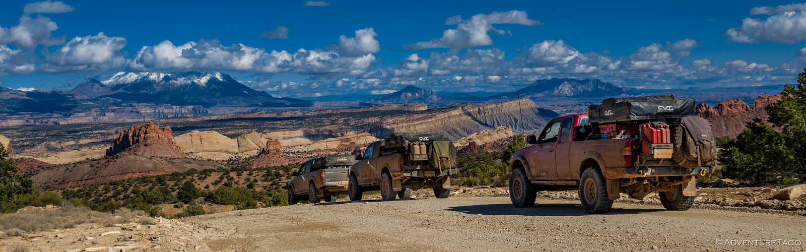
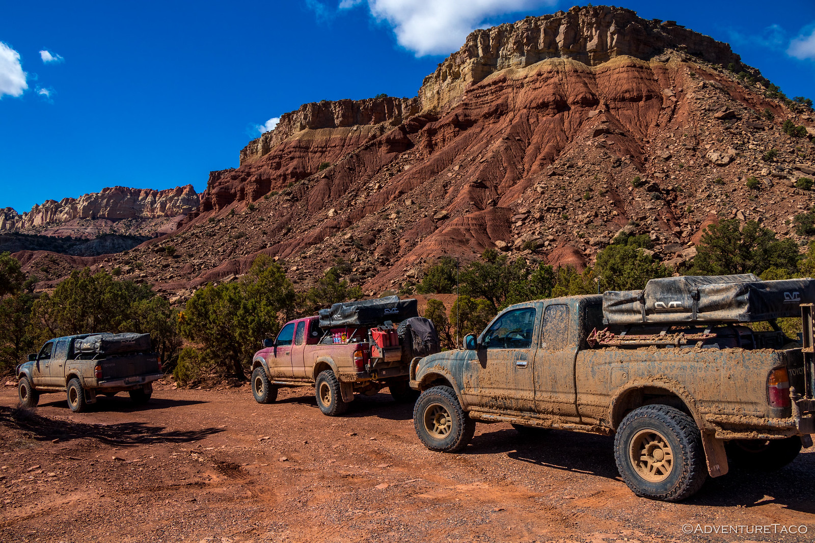
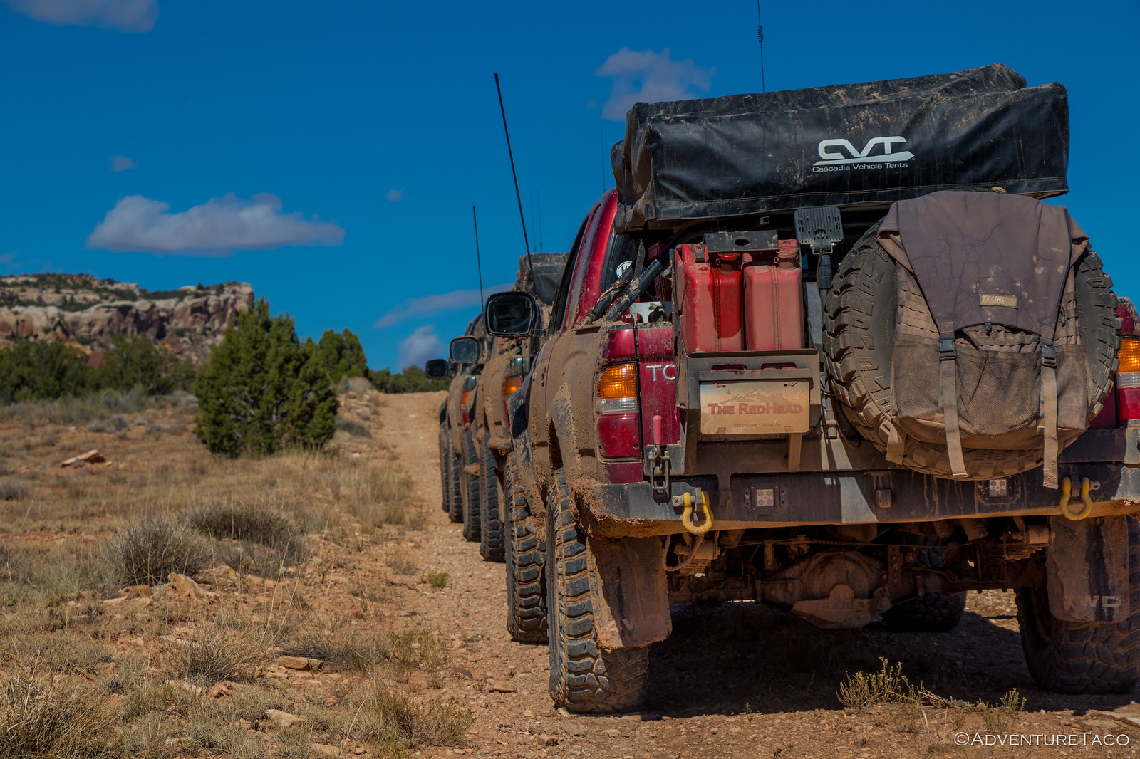
Usually good about staying to the side of the road when we were out and about, it was more than we could resist in this instance and we lined up for a shot - no better sight really than three first gen Tacoma's lined up in a row.

As one might suspect, the one time we did this the entire trip, a Jeep approached us from the oncoming direction, so we quickly scattered to unblock the road. As Monte and Mike continued on, I had a quick chat - the Jeeper curious about our tents, apparently his son working in Bend, OR - for @cascadia tents, perhaps?
Before long, we hit a stretch of the Burr Trail that I'd been looking forward to all day - the switchbacks. Hot off a couple recent adventures featuring some steep and narrow switchbacks, I was hoping for more of the same as we descended these - the route looking promising on he map.
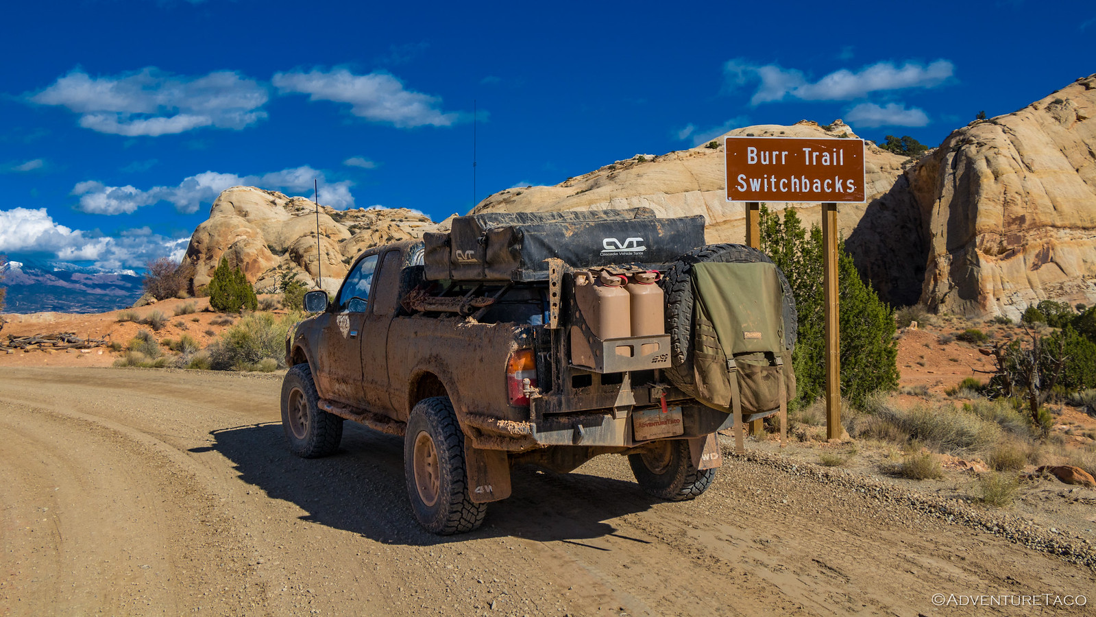
As we crested the top of the hill, the switchbacks unfolded before us. The road was wide and well-graded, these switchbacks nothing like what we'd built up in our minds; there was no adrenaline rush here. Of course, they were still a dramatic feature of the landscape, as the trail wound its way down the rocky mountainside - dropping 700 feet in a little over a mile. I can only imagine how difficult this route must have been for its original travelers - late 19th century cattlemen moving their herds between winter and summer ranges.
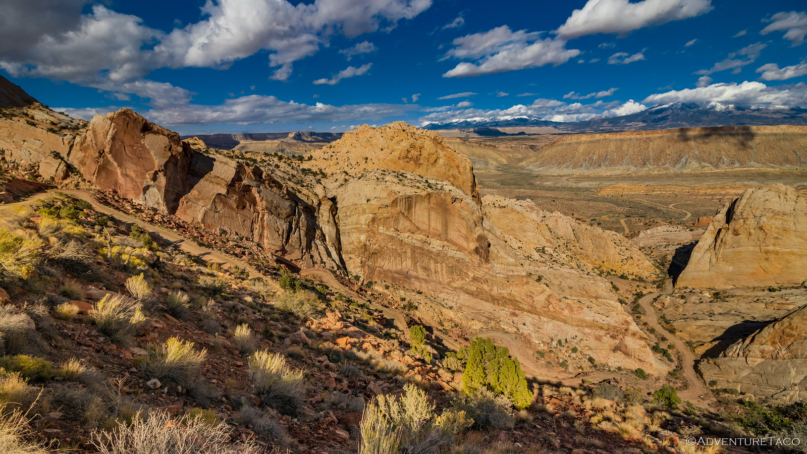
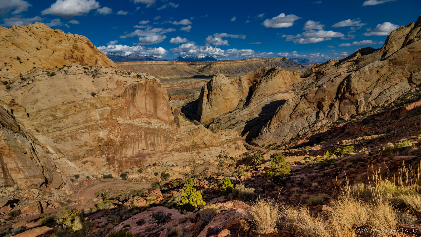

The going easy, we enjoyed ourselves down the mountain, stopping frequently to capture the looming rock formations - oranges and yellows once again captured in a sea of blue.
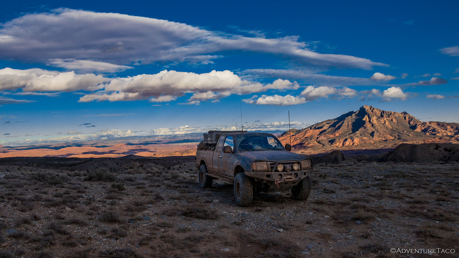
And then, a change of scenery. The Burr Trail continued south at this point to Bullfrog, a town we'd visit later on the trip - but we were headed east, towards the Henry Mountains - now seemingly so close we could touch them.
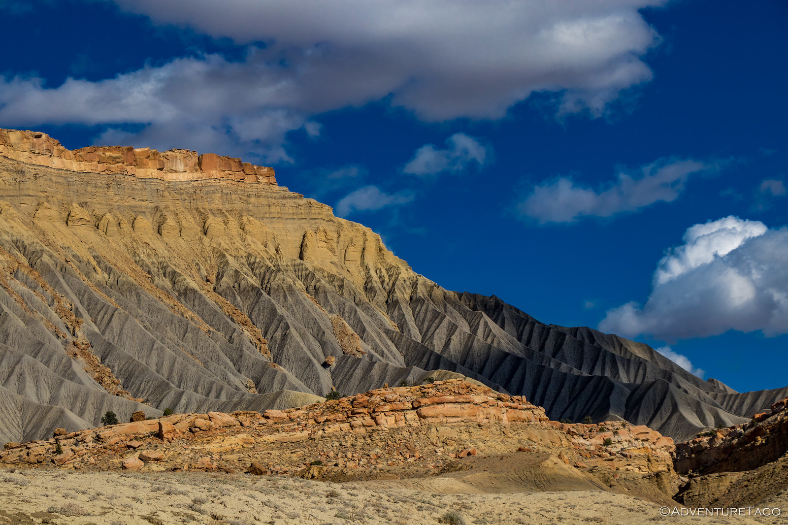
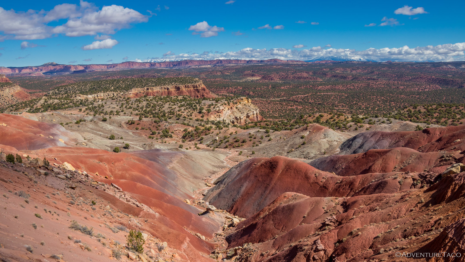
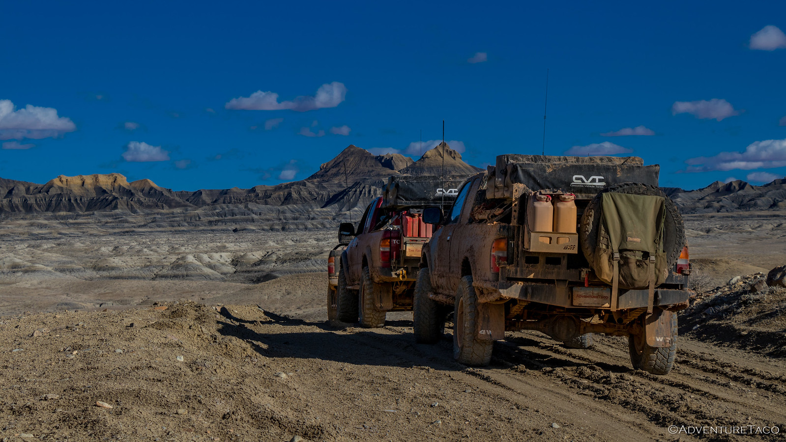
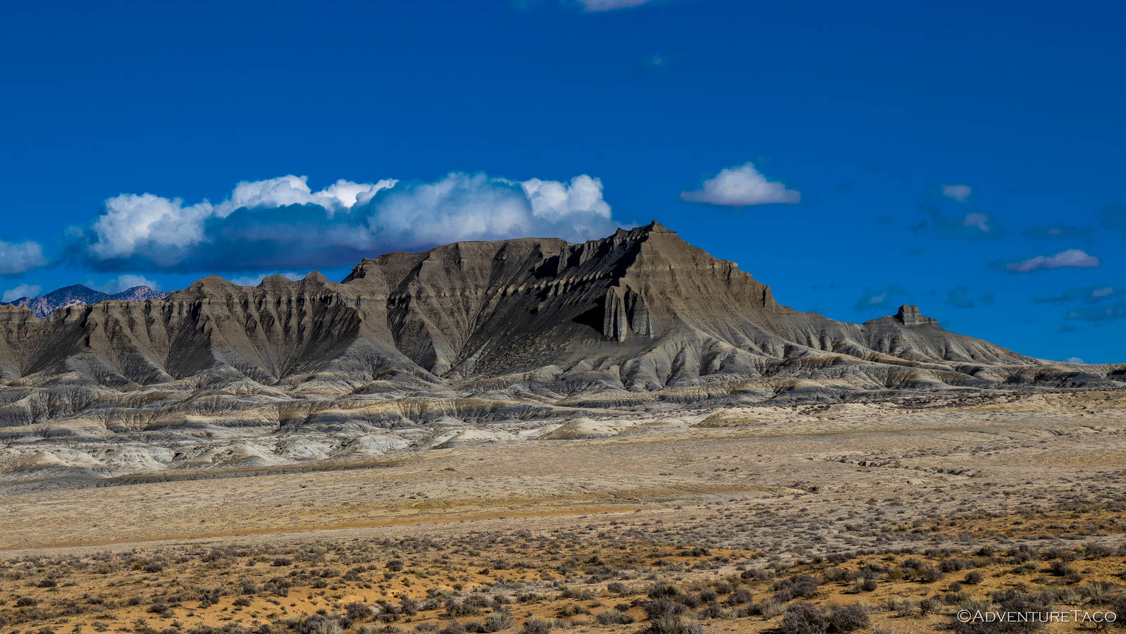
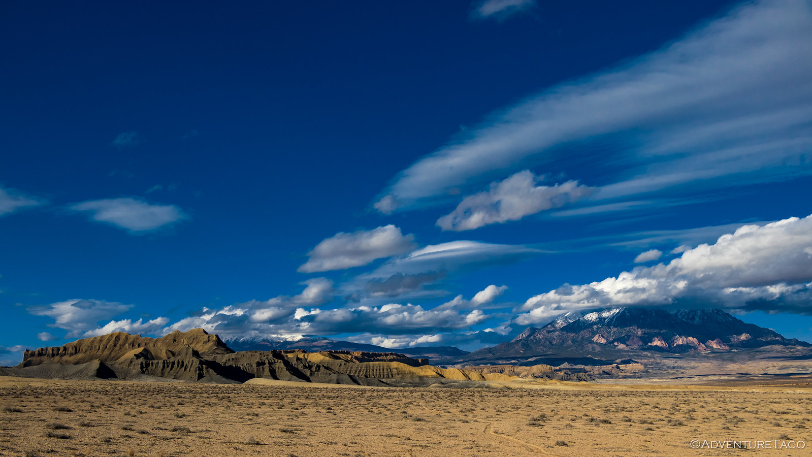
Our path to the Henry's was dramatic to say the least. From a distance, the badlands looked like a barren wasteland - not a piece of vegetation around, the layers of land eroding into a rainbow of rock.
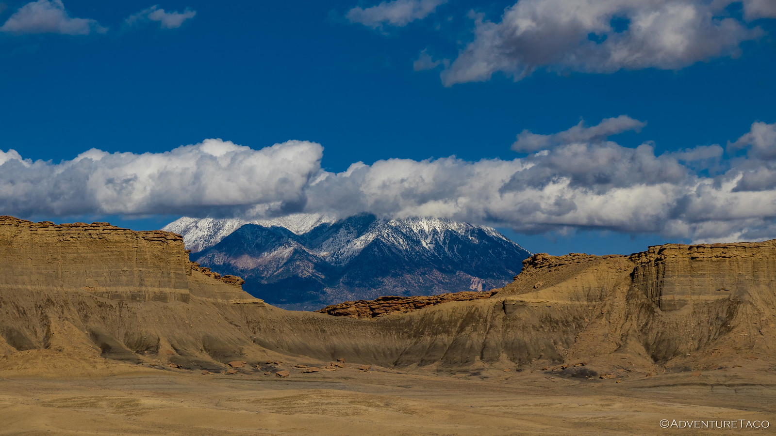
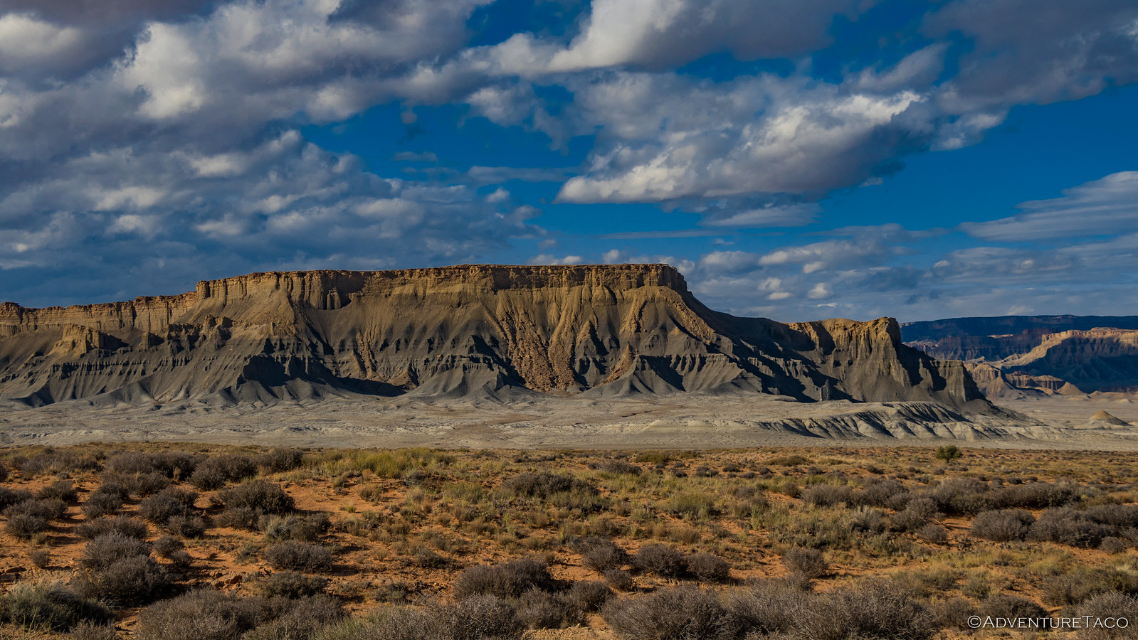
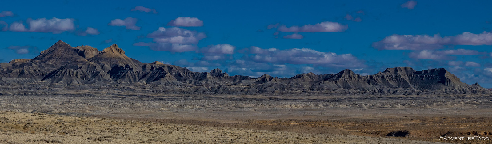
These mountains, with their eroding ridges, stretched across the landscape - rearing up out of the badlands only to be washed down around their edges by time. Each one different than the next, perhaps the most striking to me was one that was almost entirely black - the orange and yellow top having eroded into history.
As we took in the sights, our shadows lengthened - the sun began it's nightly retreat in the west, nature's hint that we needed to find a place we could call home for the evening.
Keen to find a place that would provide a good view and less mud than the badlands in the case of rain, we were glad to see that the last of the badland ridges were passing to our rear, and we could see the road head up the southern most edge of the Henry Mountains, an area sure to provide a bit more shelter.
Just before the ascent, Monte came over the CB radio, "Ouch! That was deeper than I thought." and his door opened. We'd been through many washes over the course of the trip, but this one had caught him off-guard. Underwater, hard to see, and after a long day of driving, his bumper was on the ground and his passenger front was going nowhere.
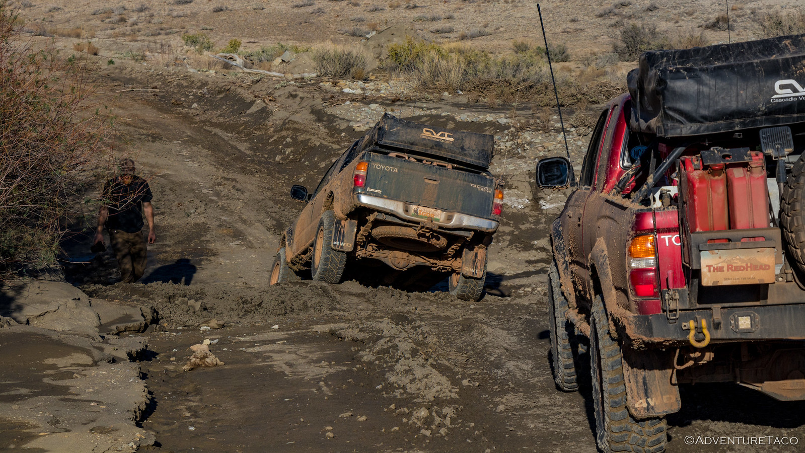
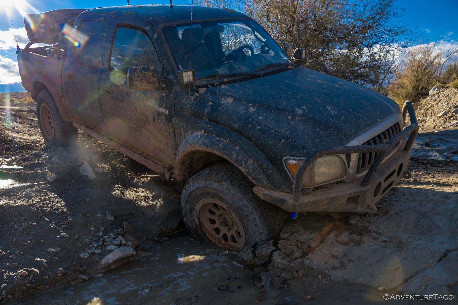
Nothing was broken - he'd been going slow - and traction on the other three tires was good, so it was a simple matter to back out and pick a new line... but it's a good reminder that anything can happen at any time on one of these trips - staying alert to conditions our best defense.
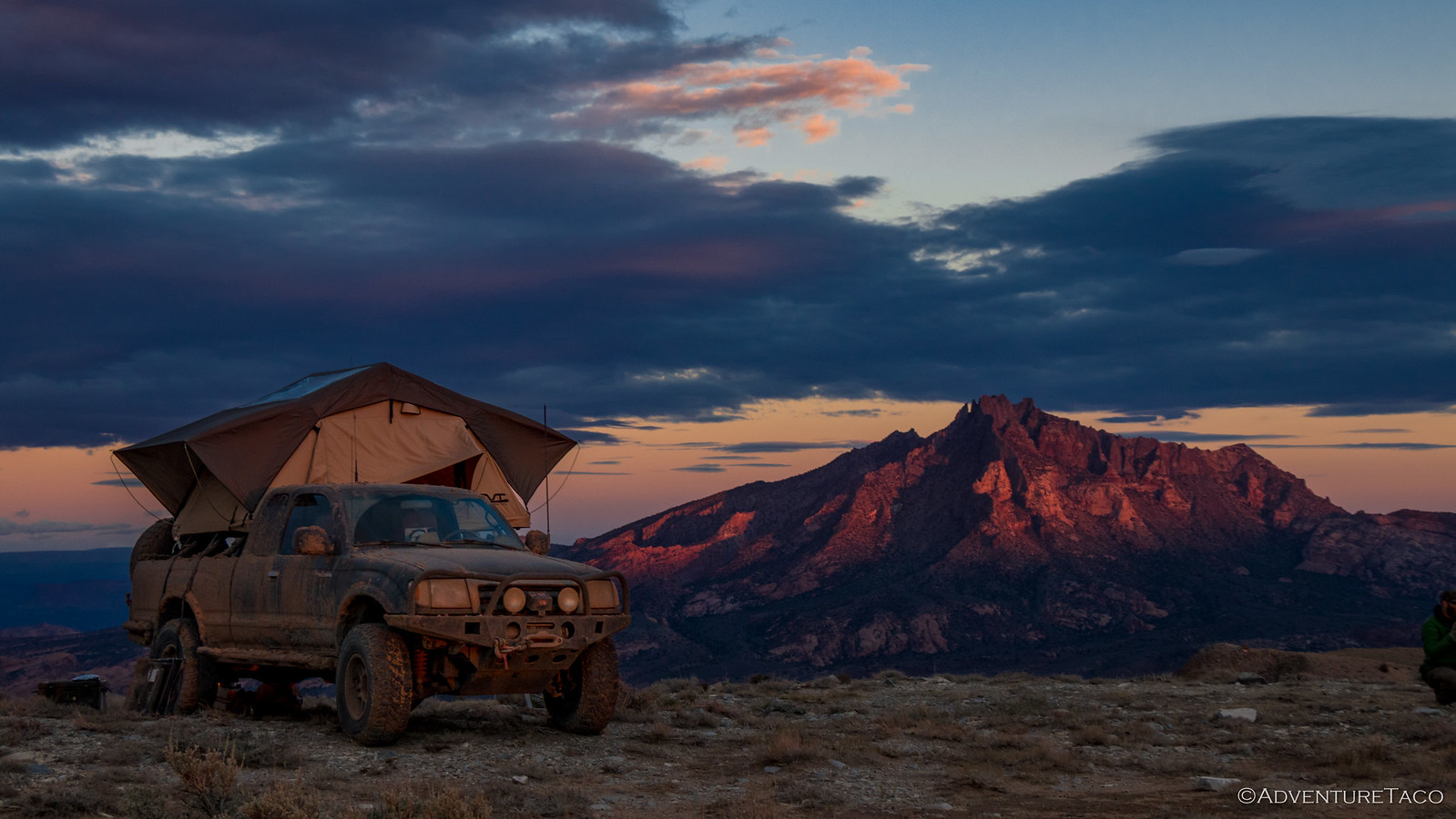
Minutes later we arrived at what we'd call camp for the night - a saddle between the Henry Mountains to the north and the Little Rockies to the south.

We passed by initially - Mike with a feeling that we might be too exposed in this spot. However, the views were amazing in all directions and our search for something nearby that was less exposed was unsuccessful, so we headed back to choose our positions in camp - after-all we thought - a little breeze will just help to keep the tents dry.
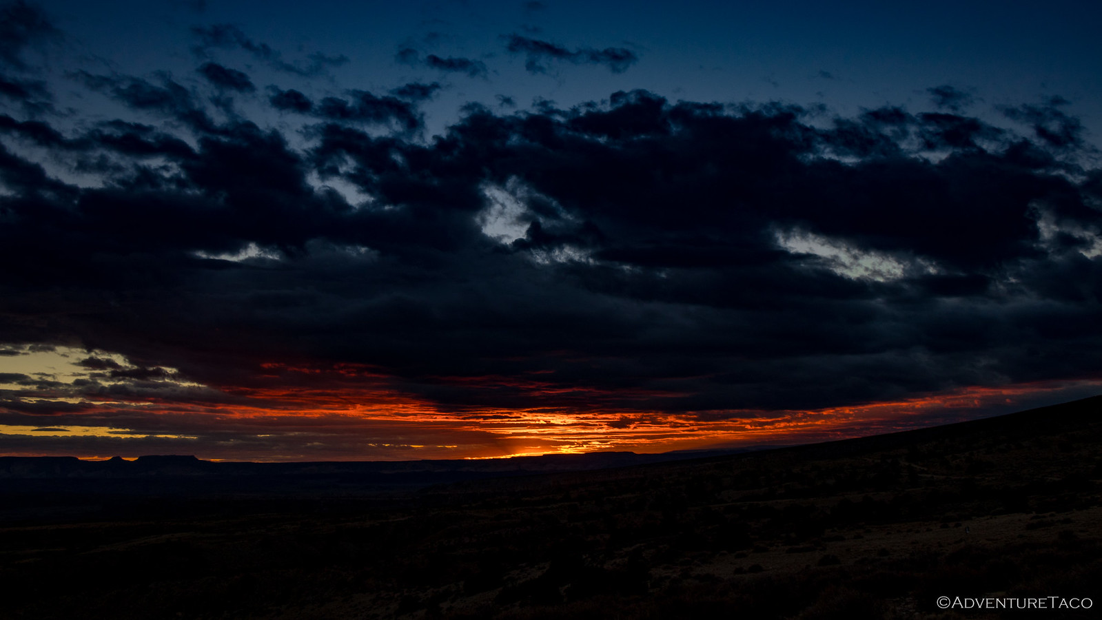
Even before we could start deploying the tents, the long rays of the evening sun started their magic dance across the landscape; different camera exposures capturing individual aspects of the dance, but none able to capture it in it's entirety.
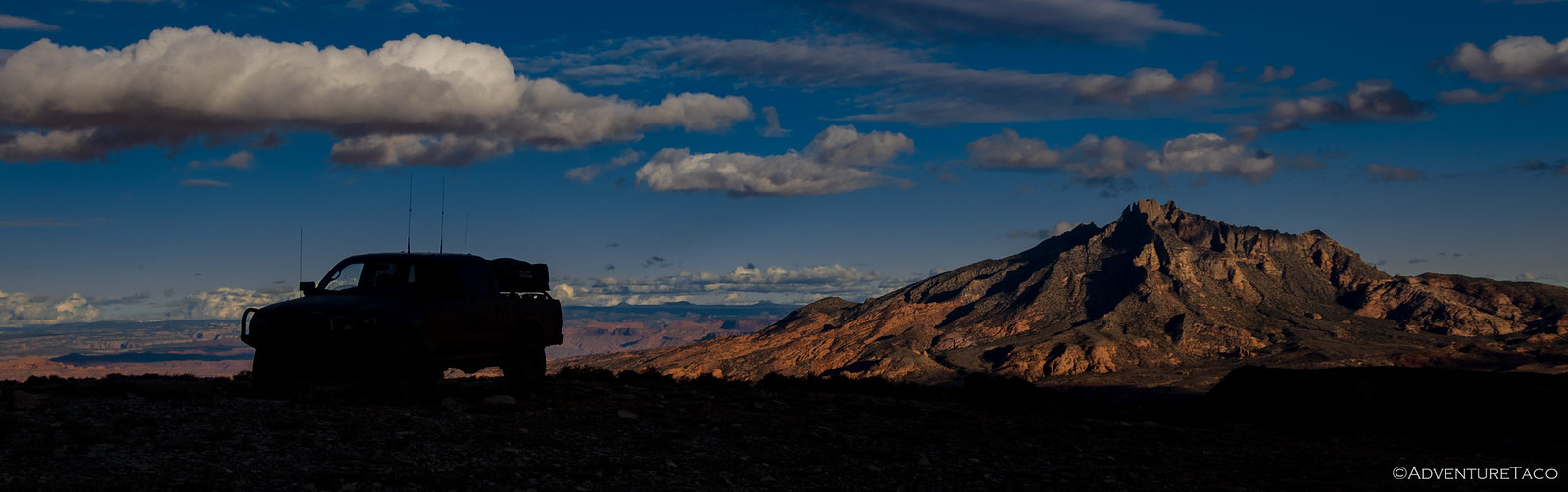

Knowing that the next half hour could be special, we put down our cameras and quickly setup the tents - both so we could capture them in the moment and because we'd learned that daylight setup while not strictly necessary is definitely more convenient. The wind was starting to pick up at this point, and so measures were also taken to secure tents more firmly to the ground.
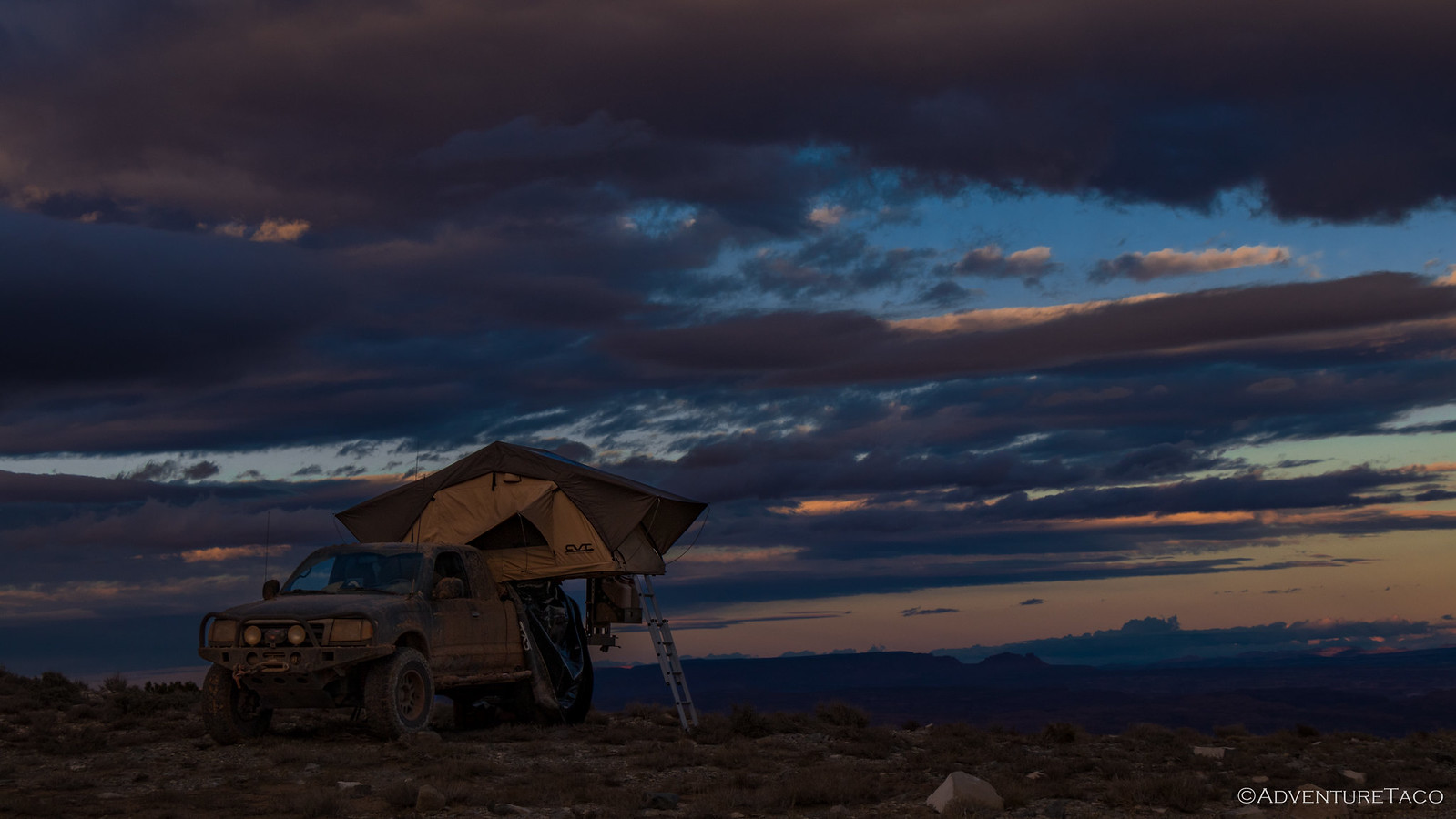
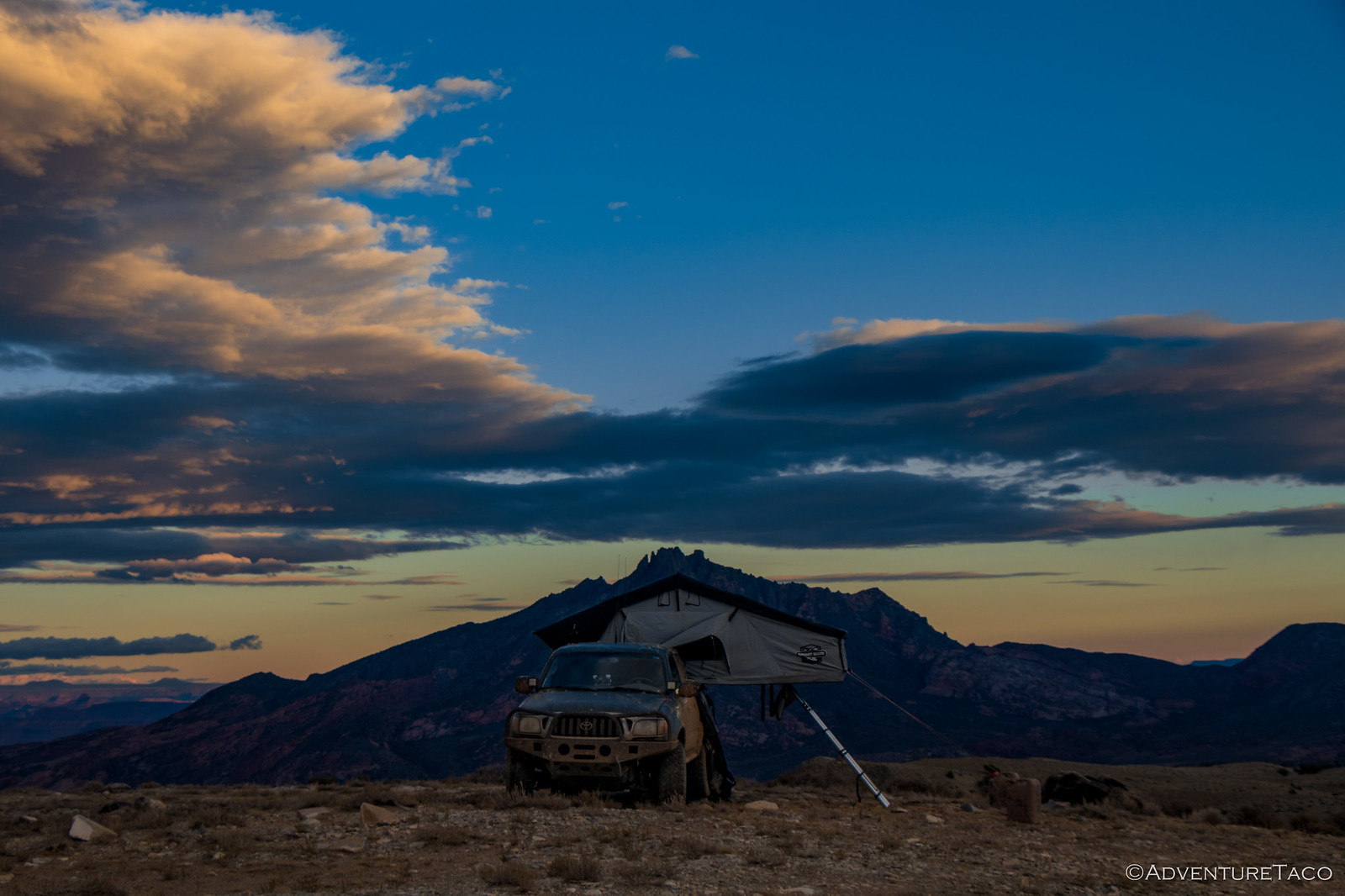

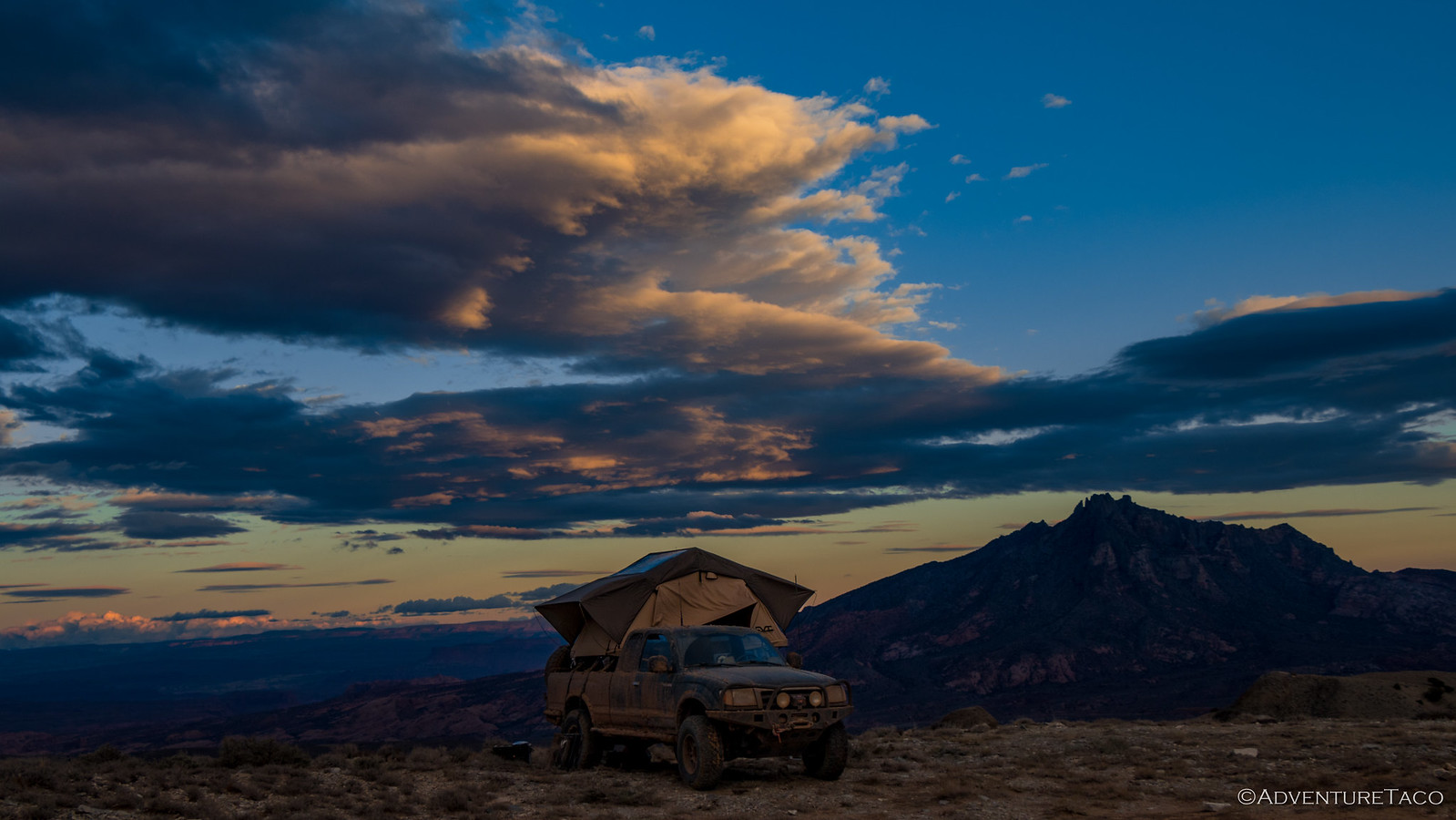
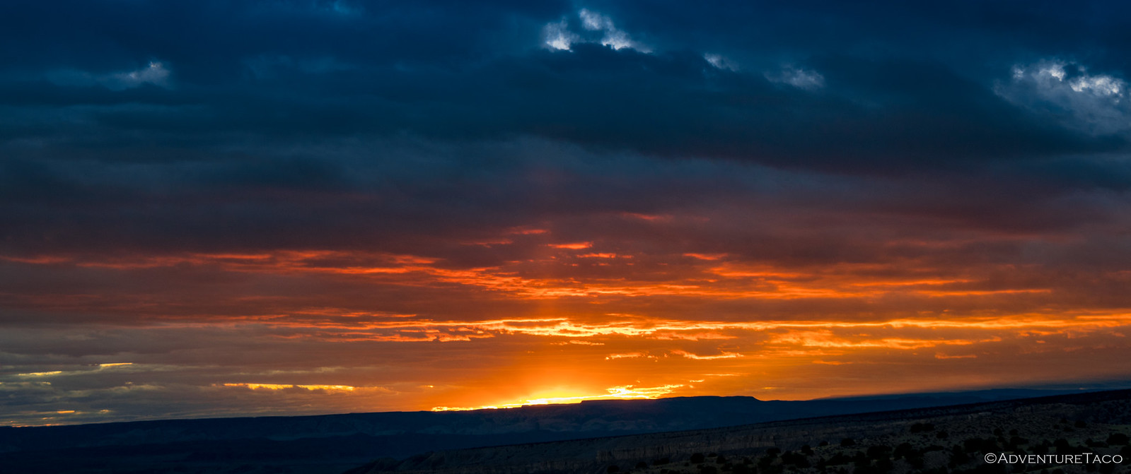
And then, finally, the sun poked under the clouds on the horizon. That special moment we'd been waiting for was here - but only for a few seconds. The blues in the sky turned to pinks and purples; the trucks, then mountains, then clouds basking in the last of the evening's light.
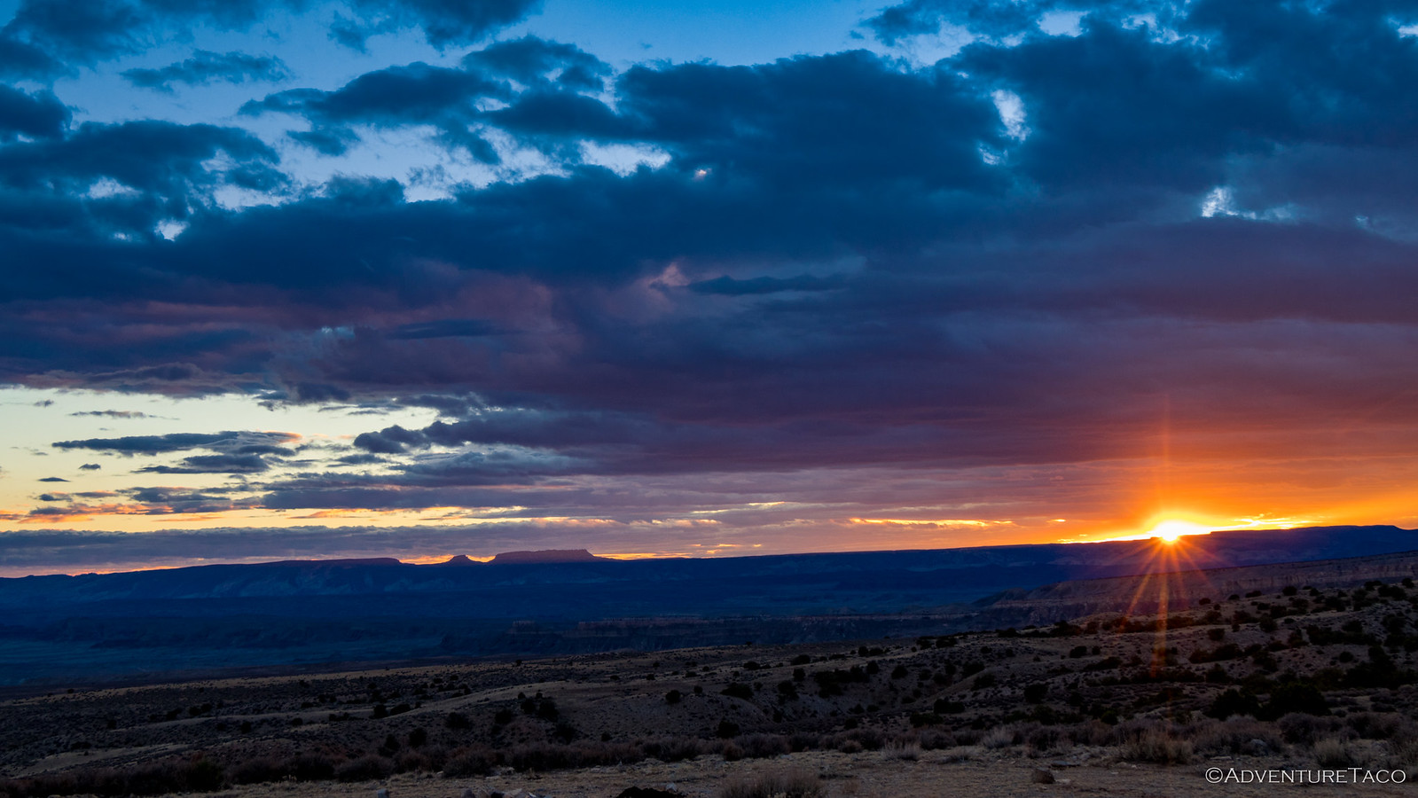

Would we - could we - capture the moment?
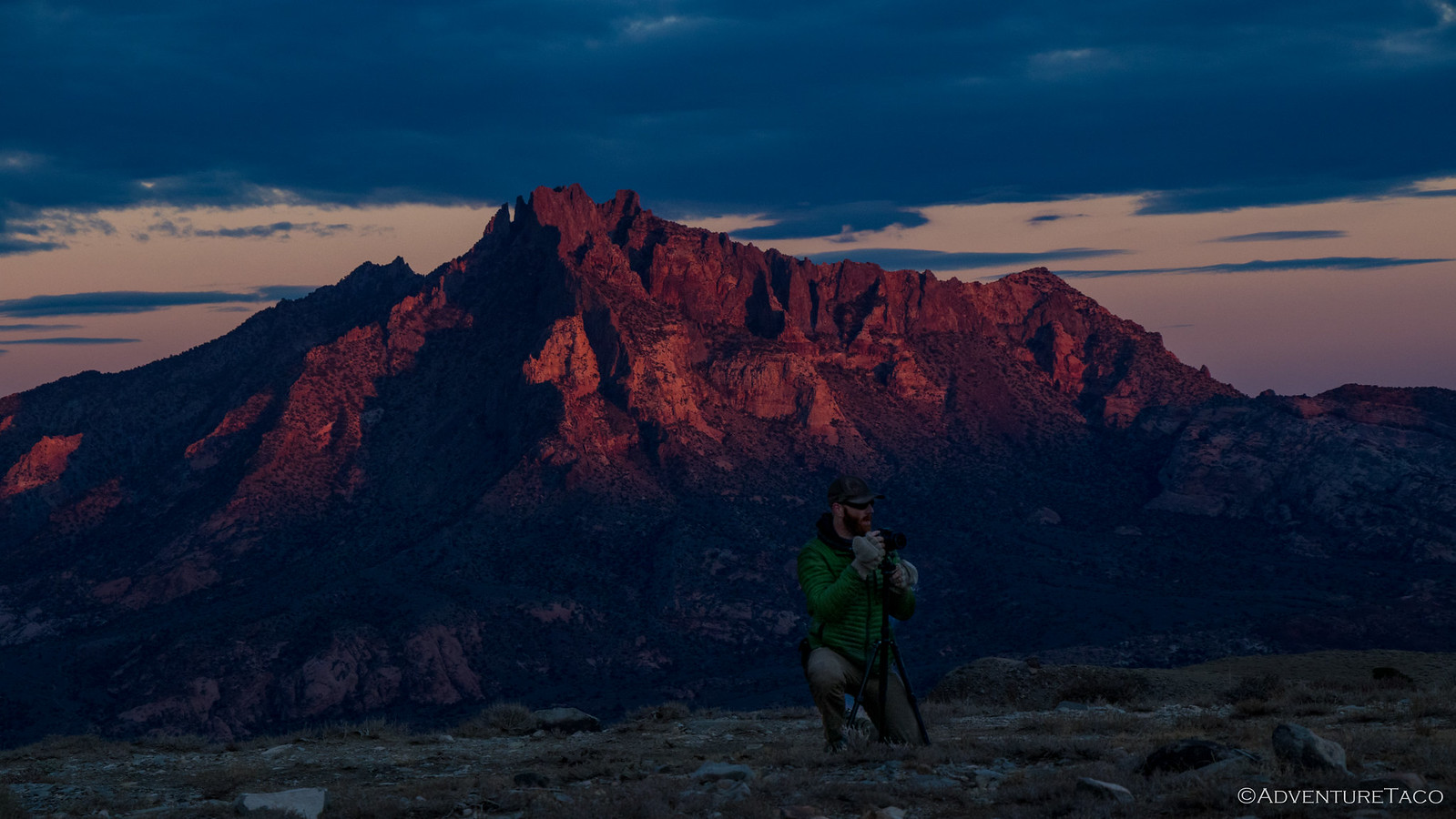
In the end, I'm sure we got some but not all of the beauty bestowed upon us that evening. For sure, we all enjoyed it - and in the end, I think we all put our cameras down - we'd captured what we could and we just wanted to soak the rest in.

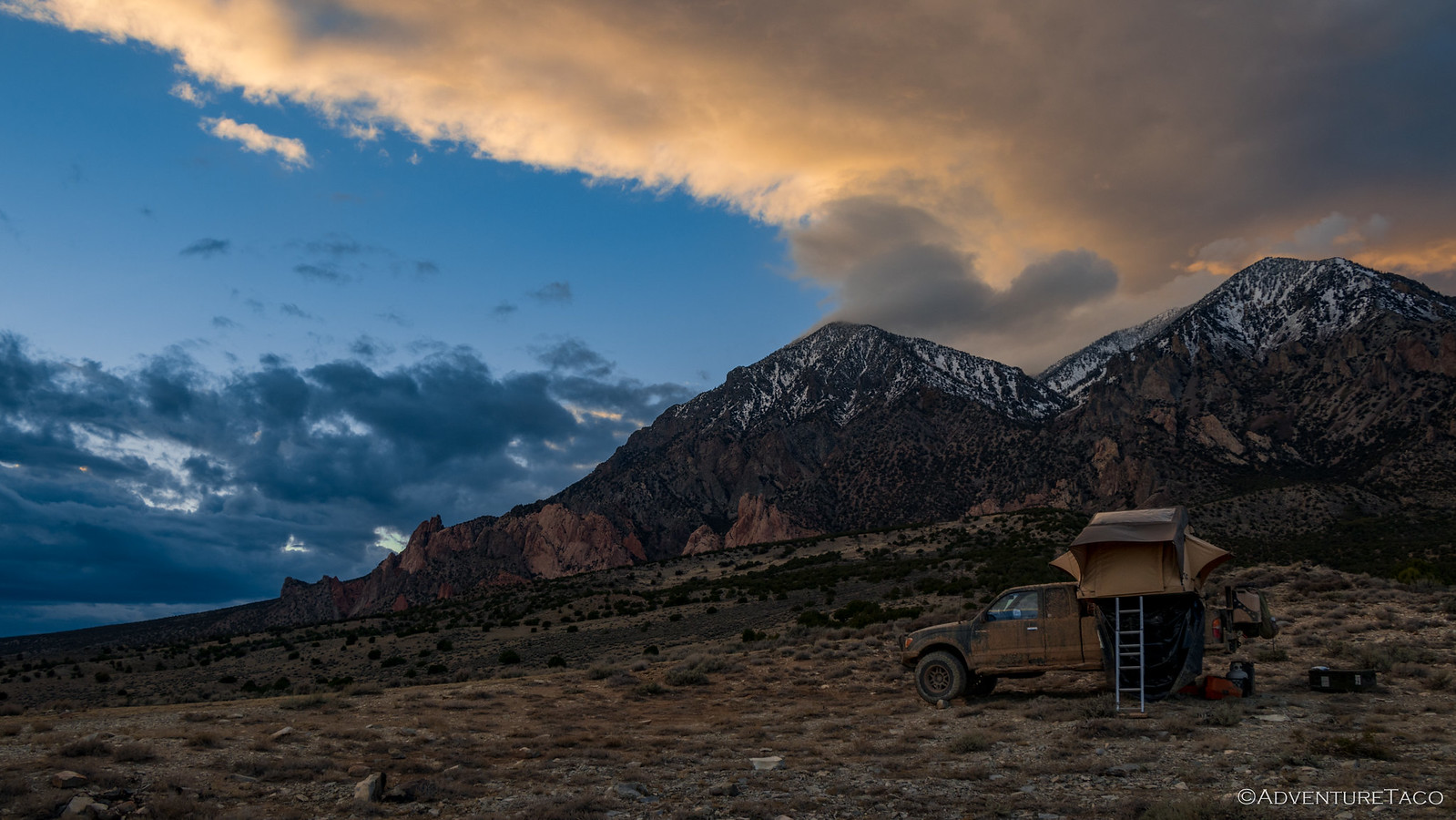
As we gathered around the camp fire, we huddled close - the wind no longer a breeze through our camp but cold gusts unconstrained by any windbreak, funneled through the saddle that was our camp. A warm dinner and Newman's Own cookies of course helped our spirits, but by 10:30pm we were once again chilled to the bone and retreated to our tents.
Before climbing up, I got on the ham radio - our position one I could tell would have good range to faraway repeaters - and messaged @mrs.turbodb using APRS (which can send/receive text message over ham radio frequencies) and we had a fun chat for a while before I finally decided to call it a night.
As I climbed into the tent, the fabric buffeting around me, little did I know what was in store over the next 8 hours. If I had known - in fact, if any of us had known - I'm not sure we'd have decided to stay in that camp through the night.
But as it was, we stayed...


October in Southern Utah can be a good to visit, until its not. Amazing places you covered, many I have been fortunate to visit. The weather caught us in Oct 2015 on Notum Rd a few hundred yards north of the Burr Trail, it was not pretty. Took the road crew's large loader to lift and pull us out. Had to replace some diff seals as mud ground them up. Your team has true grit to powering through all that.