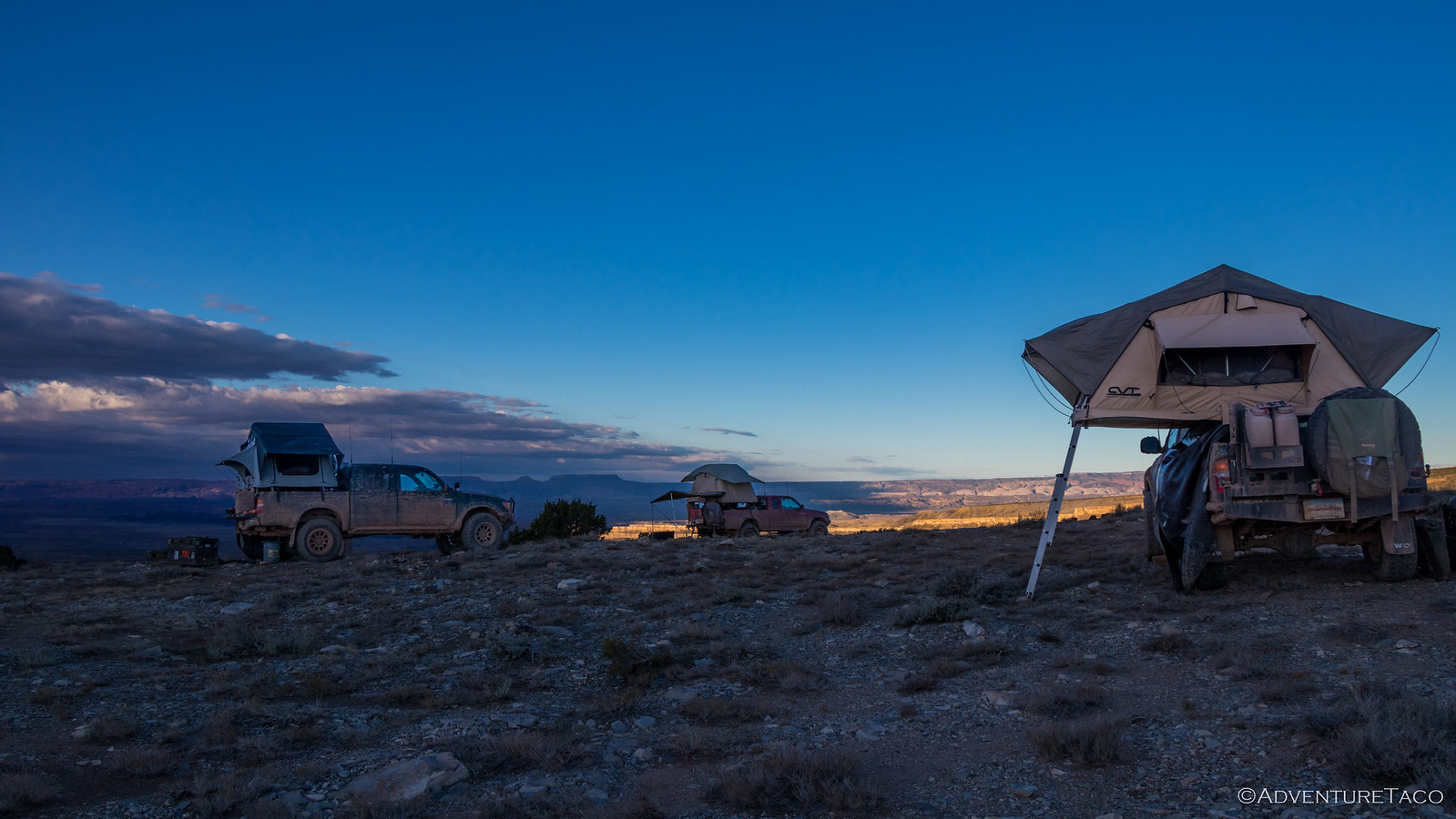
I'd gone to sleep with all the tent windows and doors tightly zipped closed and earplugs in - to protect me from the wind raging through our camp. I've been in windy conditions before - in fact, our night at Point Sublime just a week before was a pretty windy affair - so I wasn't all that concerned - in fact, the wind rocked me to sleep a bit as the tent and truck flexed under its force.
But then, at 3:30am I was awoken by a whole new sensation - my tent was trying to kill me. I quickly realized that the wind was the real culprit - so strong that it had lifted the fold-out portion of the tent off the ground, even as I lay on it, attempting to close it up with me inside. And then it did it again.
This couldn't be good for my tent I thought as I put on my clothes - convinced that the right thing to do was to close everything up and spend the rest of the night in the cab. As I unzipped the door, a blast of wet wind tore into the tent - that's right, it was so windy I couldn't hear that it was also raining!
That put a quick end to my previous idea, and instead I hurried back under the covers and spent the next several minutes evaluating the structure of the tent as it flexed wildly in the wind. Though it sounded terrible, it looked OK - a testament to CVT's (@cascadia tents) quality so I eventually put my earplugs back in and tried to go back to sleep - the truck now bucking haphazardly rather than rocking gently on its suspension.
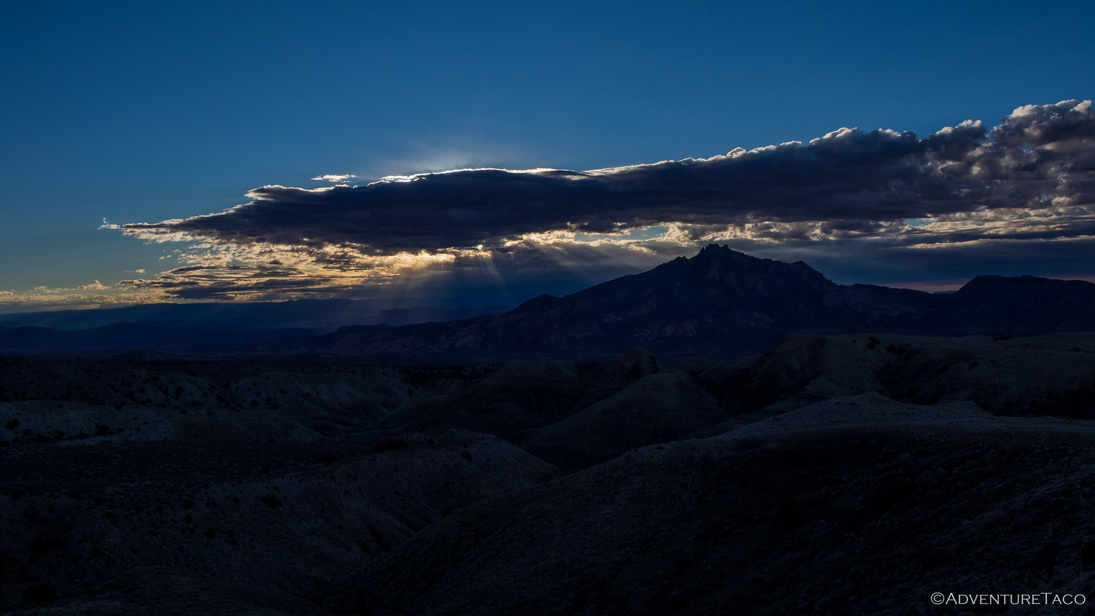
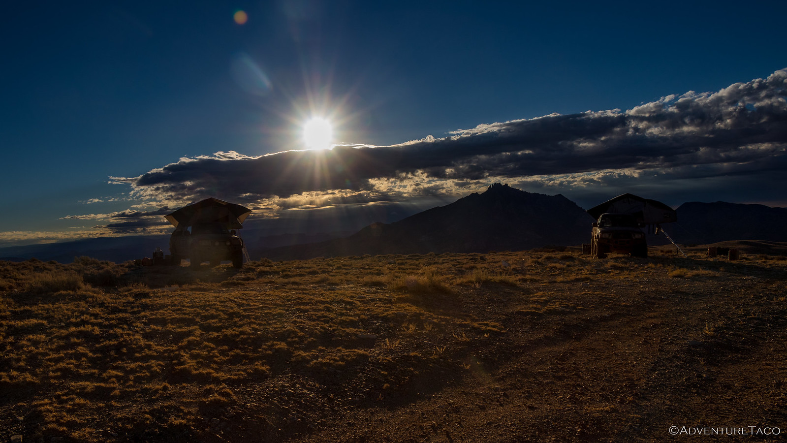
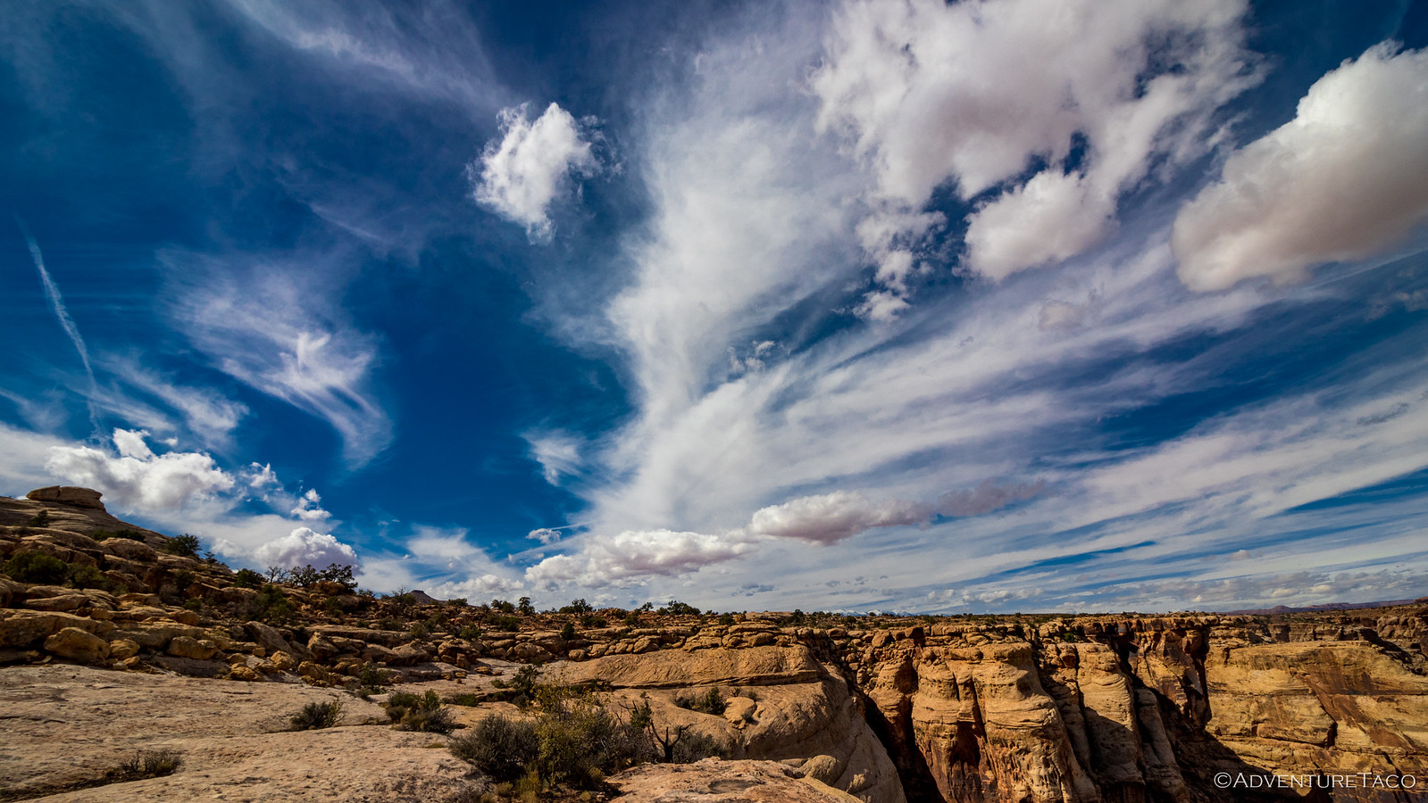
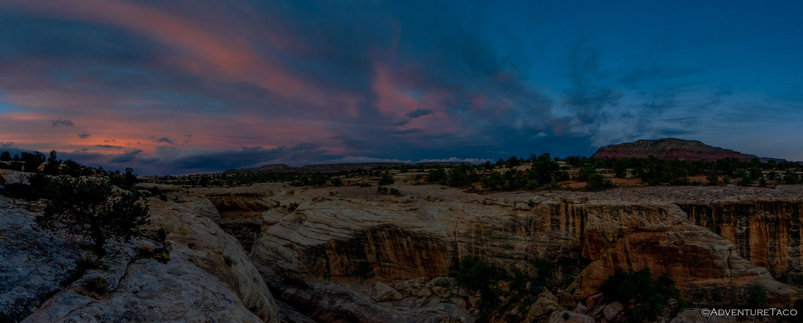
Eventually the rain must have stopped, but the wind never did. I'd set my alarm for sunrise in the hope that the wind would clear out any cloud cover, and sure enough it mostly had! It was a beautiful morning, the last remaining clouds already past us and moving further south.
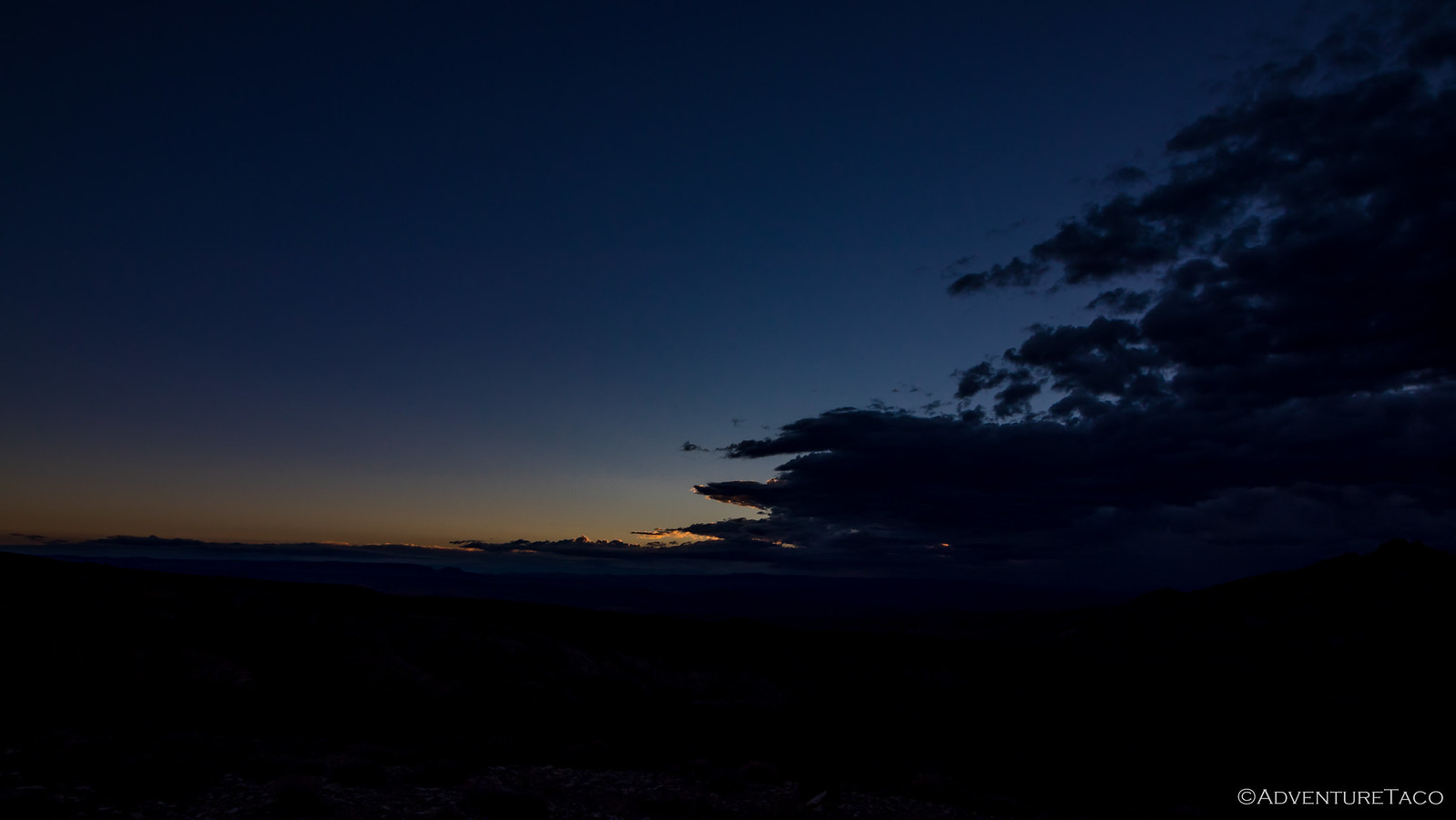
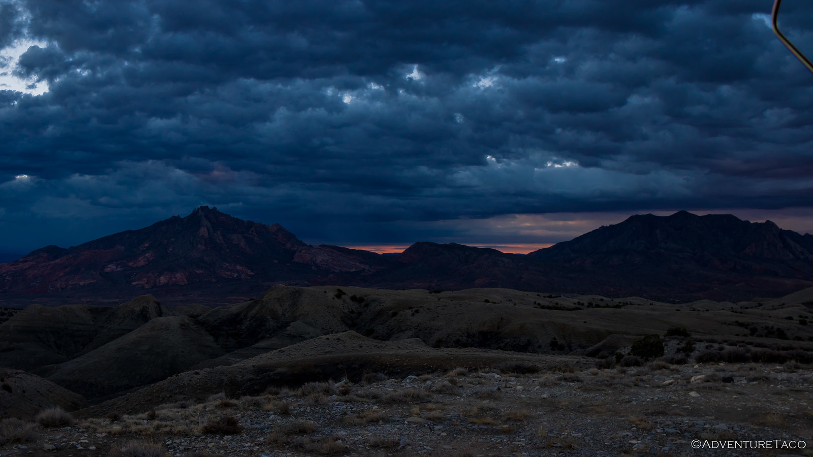
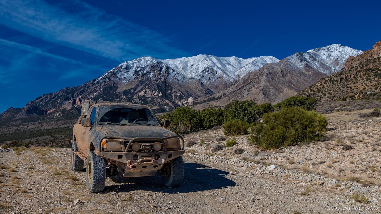
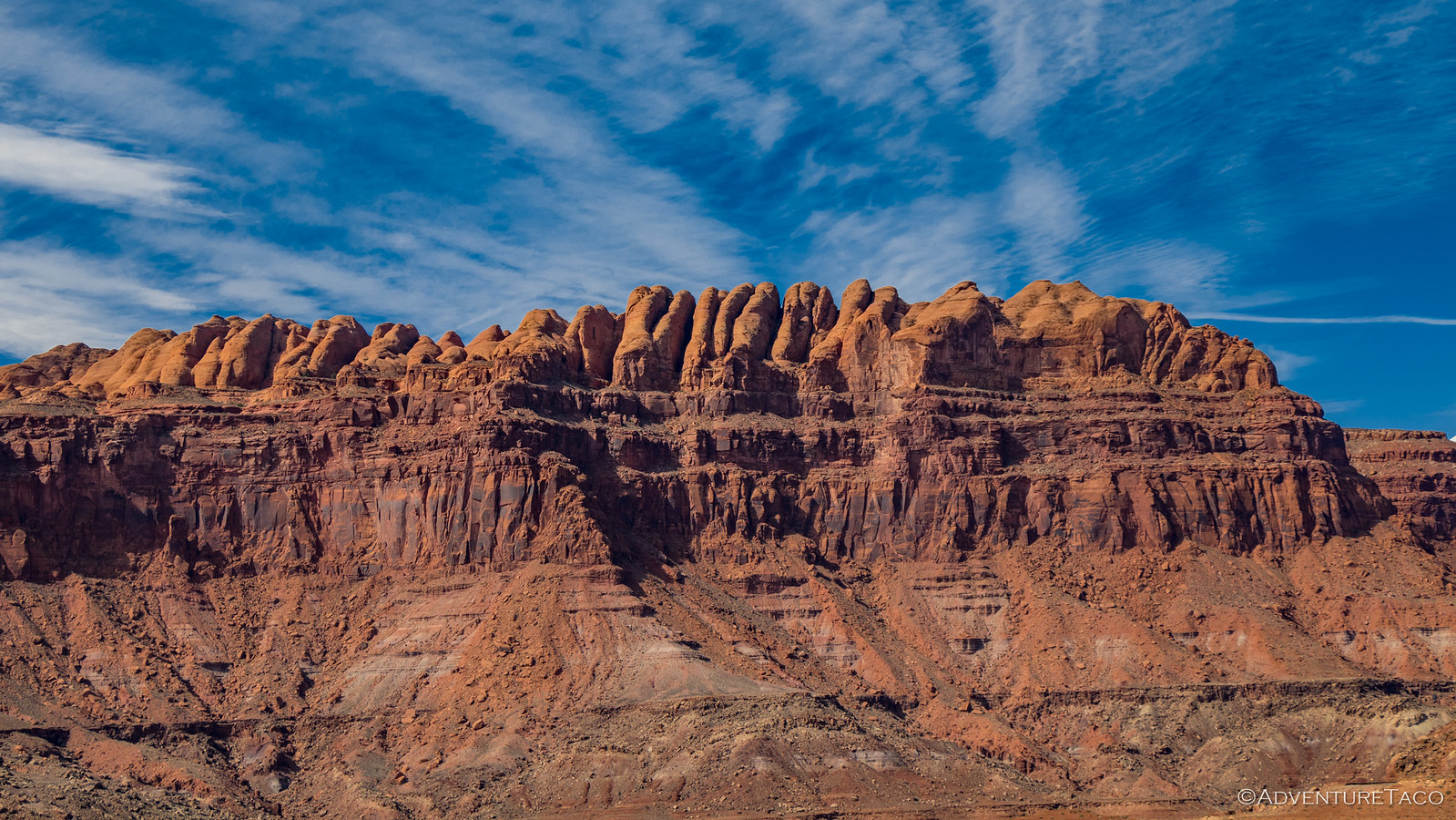
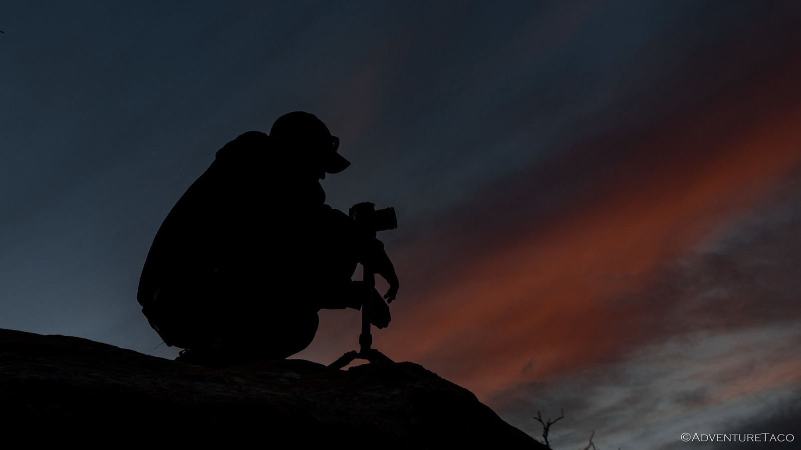
After a few photos and a bit of procrastination under the warm comforter, I finally pulled myself out into the wind just as the sun was peaking over the horizon and lighting the Henry Mountains behind camp. We might have had a rough night, but we definitely knew how to pick dramatic sites!
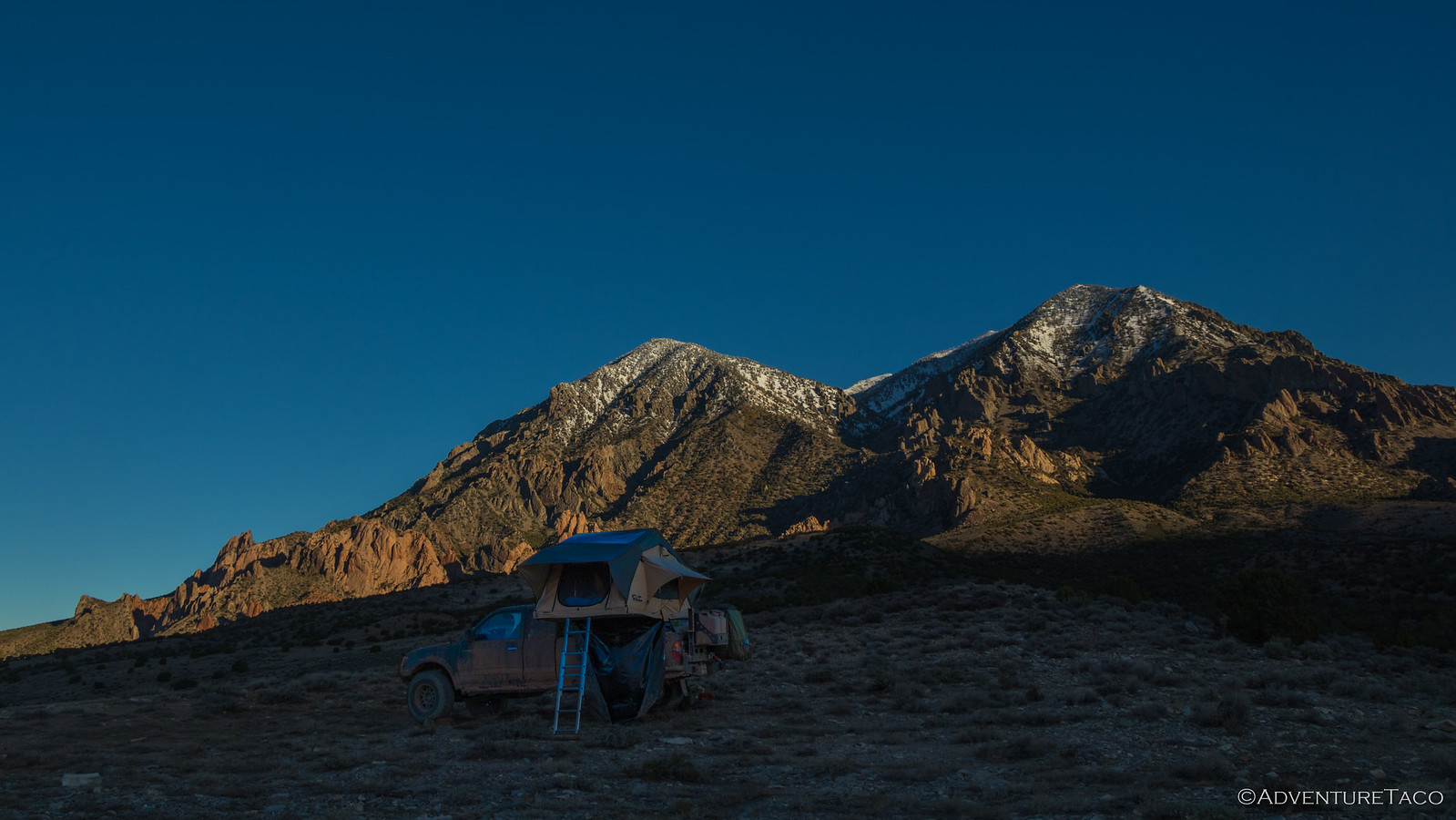
For the next little bit, the sun climbed higher in the sky and I enjoyed every minute of it. Eventually, it was up and over the remaining clouds, and camp was fully illuminated.

And that's when I noticed that I hadn't had the worst night of the group. Mike @Digiratus had. Or at least, his tent had - one of the poles blown out of it's anchor and haphazardly wedged under his rain fly.

By this time, Mike and Monte @Blackdawg were getting up as well and as we fixed the pole in Mike's tent, we all had a good - dare I say nervous - laugh about the weather we'd experienced the night before. Needless to say, we were all keen to find a place a little more sheltered for the remainder of the trip.
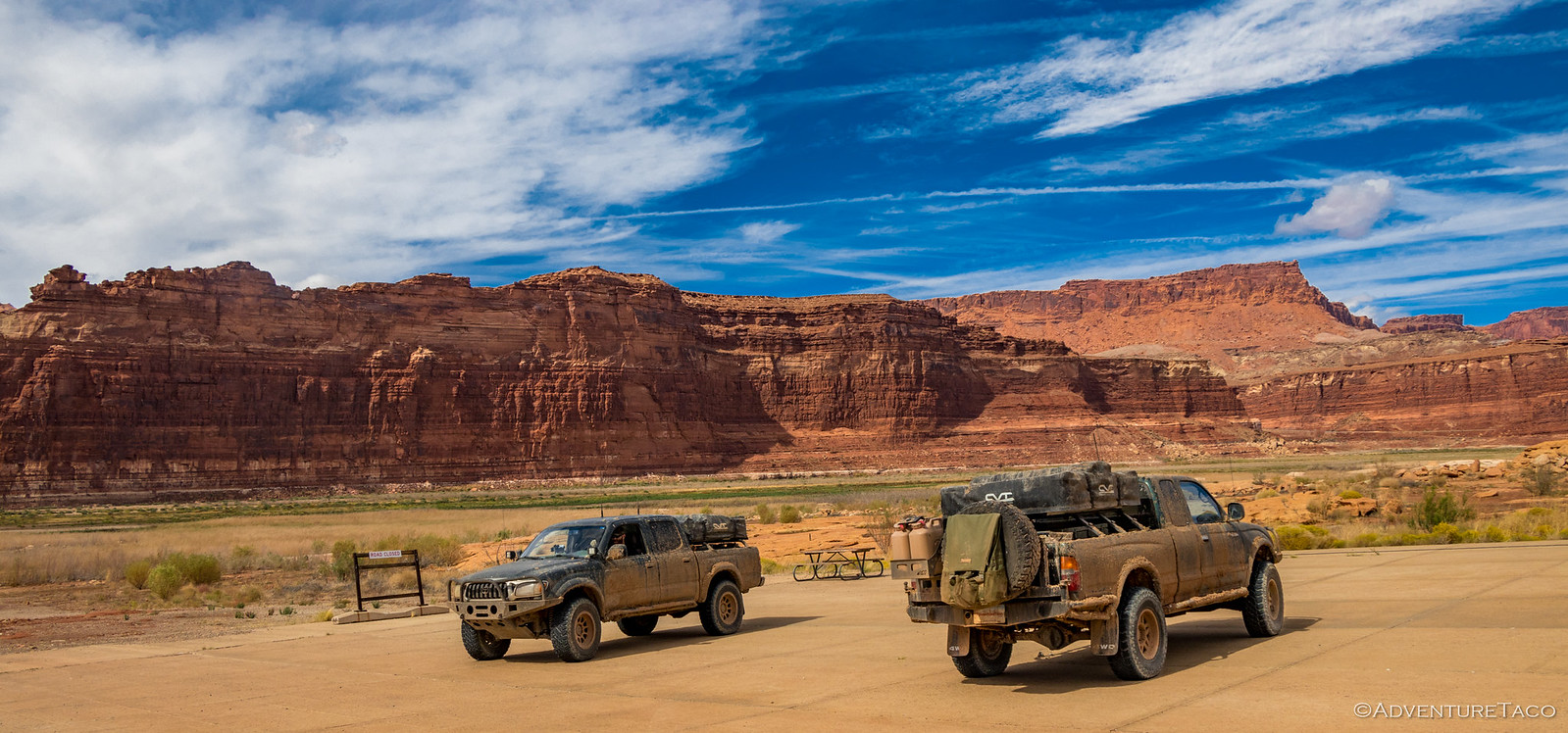
But everything was OK, the tents were dry, and the sun was out - so we enthusiastically completed our morning routines and got on the road just after 10:15am as we watched a second gen Tacoma drive by, headed west - like us.
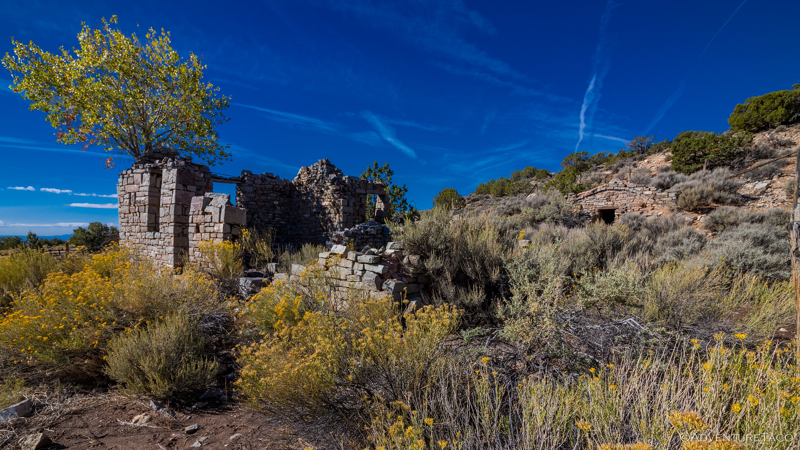
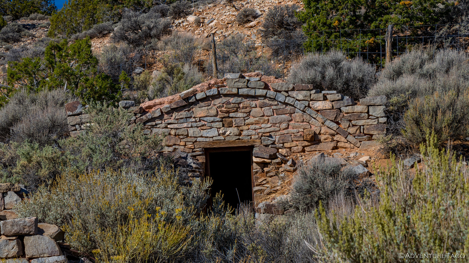
We didn't get far before encountering the remains of the Starr Ranch. Selected as the headquarters for his mining operations in the 1880's, Al Starr hired a builder to construct the home and cellar. Neither was completed however - drought and loco weed killing most of Starr's horses before any ore was produced.

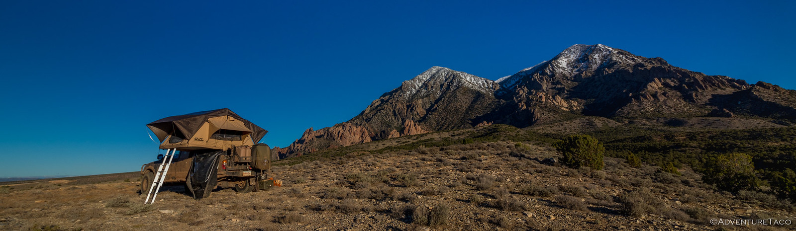
Surprised the second gen Tacoma hadn't stopped as well, we figured we weren't going to see it all day as we pulled back onto the trail towards Utah 95 and Hite, the snow-capped Henry Mountains still dramatic as we skirted around their base.
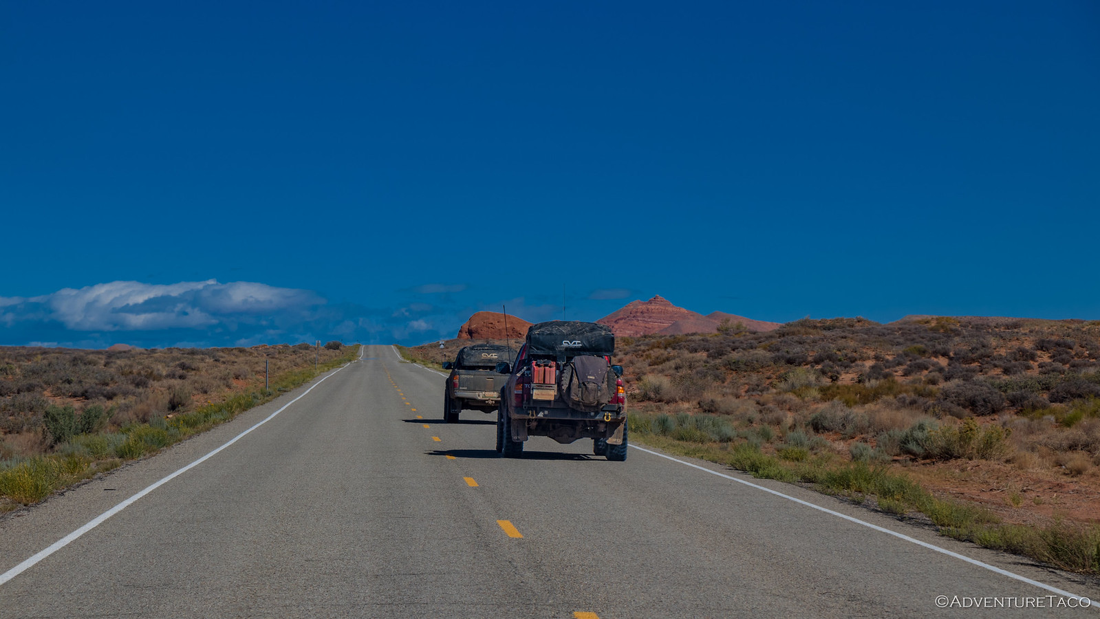
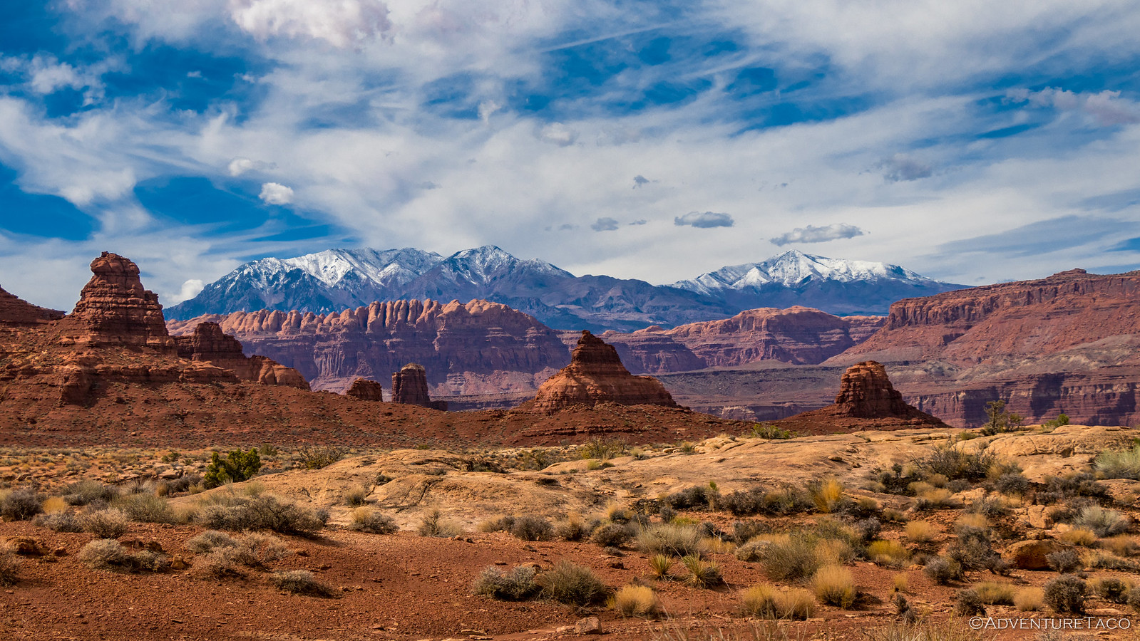
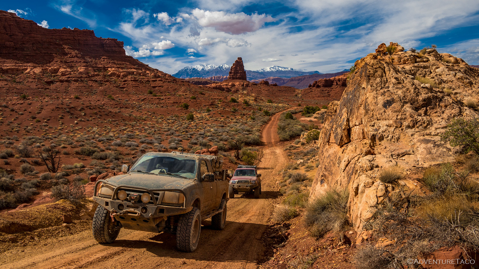
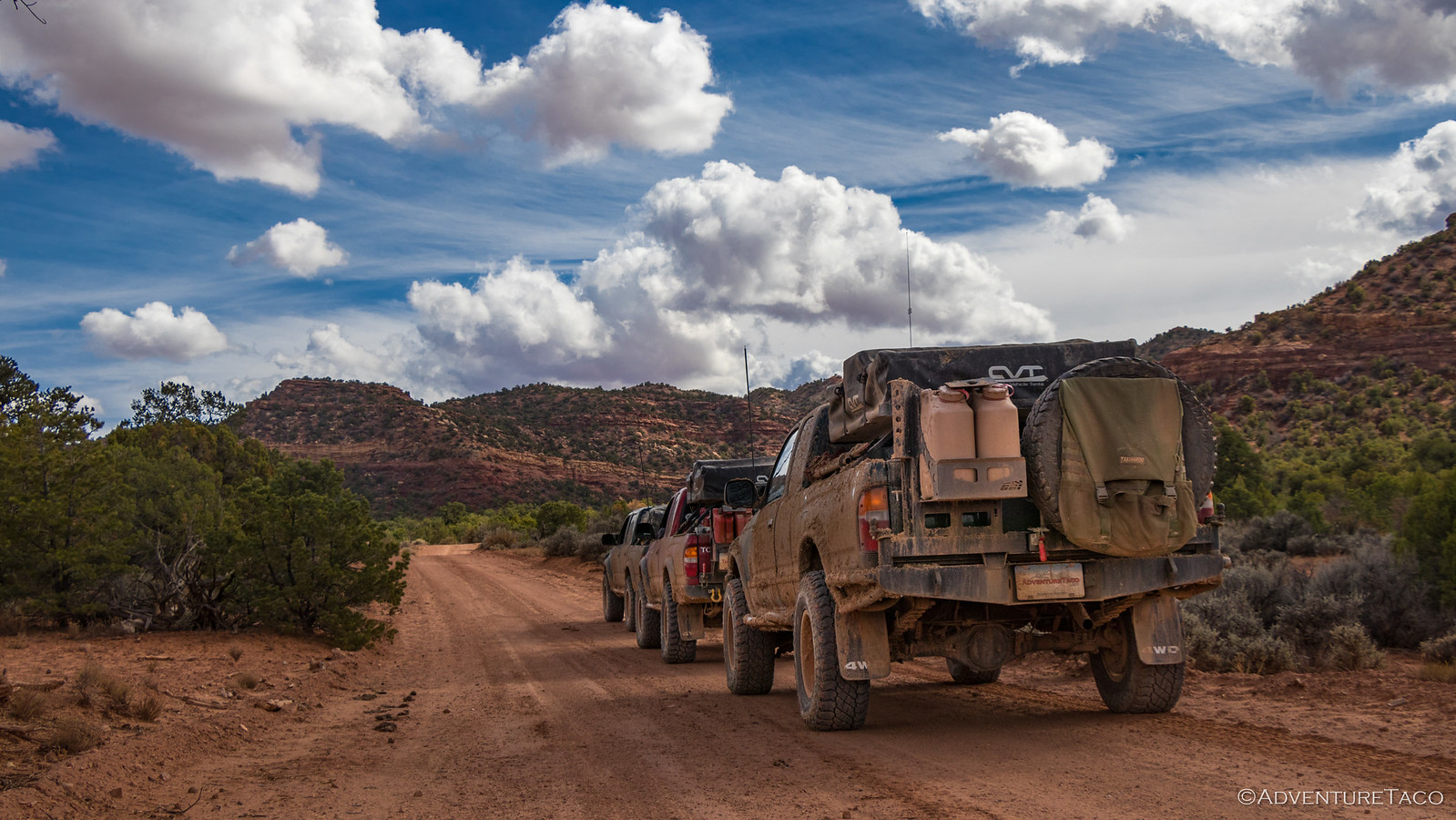
Enjoying ourselves in the beautiful morning, it wasn't long before we hit one of the prettiest stretches of Utah 95 that I've driven. West of Canyonlands National Park, and south of the Poison Springs Road trail that I'd run with Ben @m3bassman and Zane @Speedytech7 earlier in the year, it cascaded down through the canyon towards Hite, UT. Still aired down, we struck a leisurely pace.
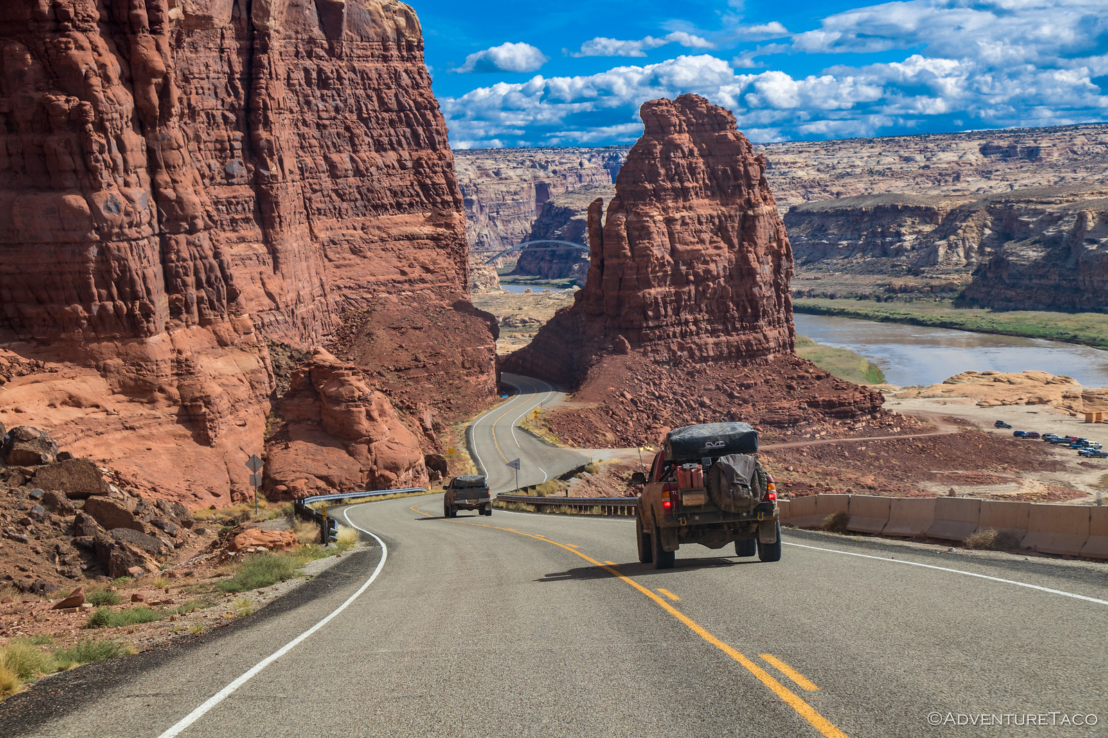
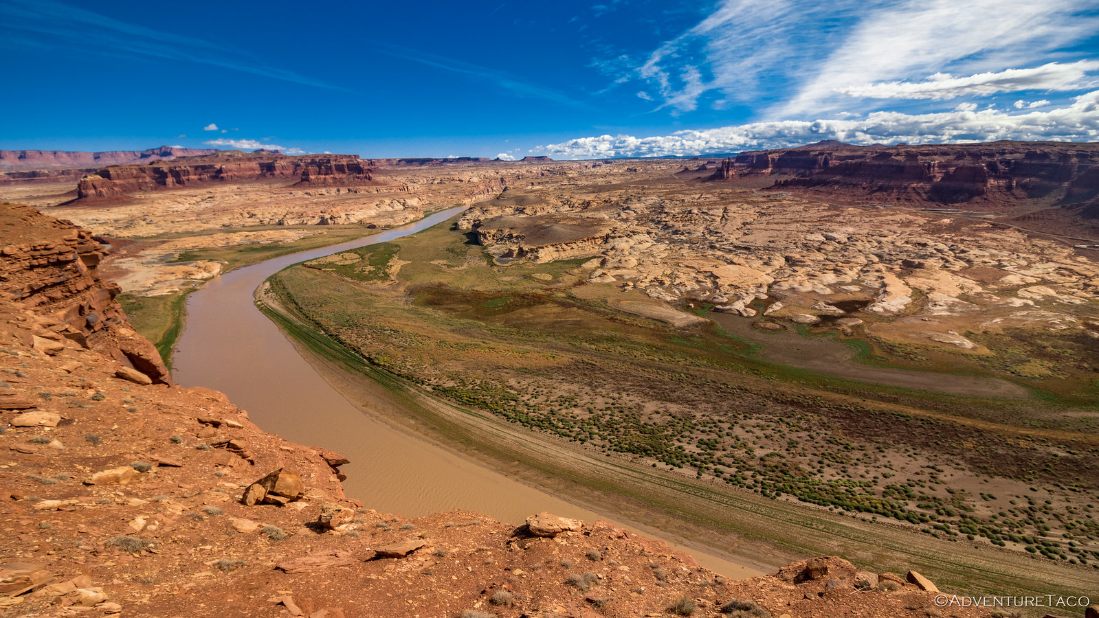
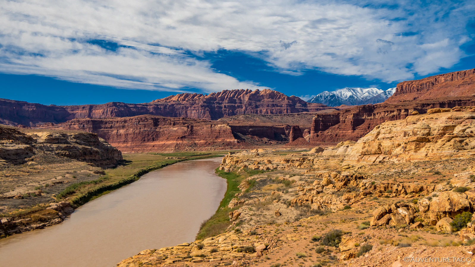
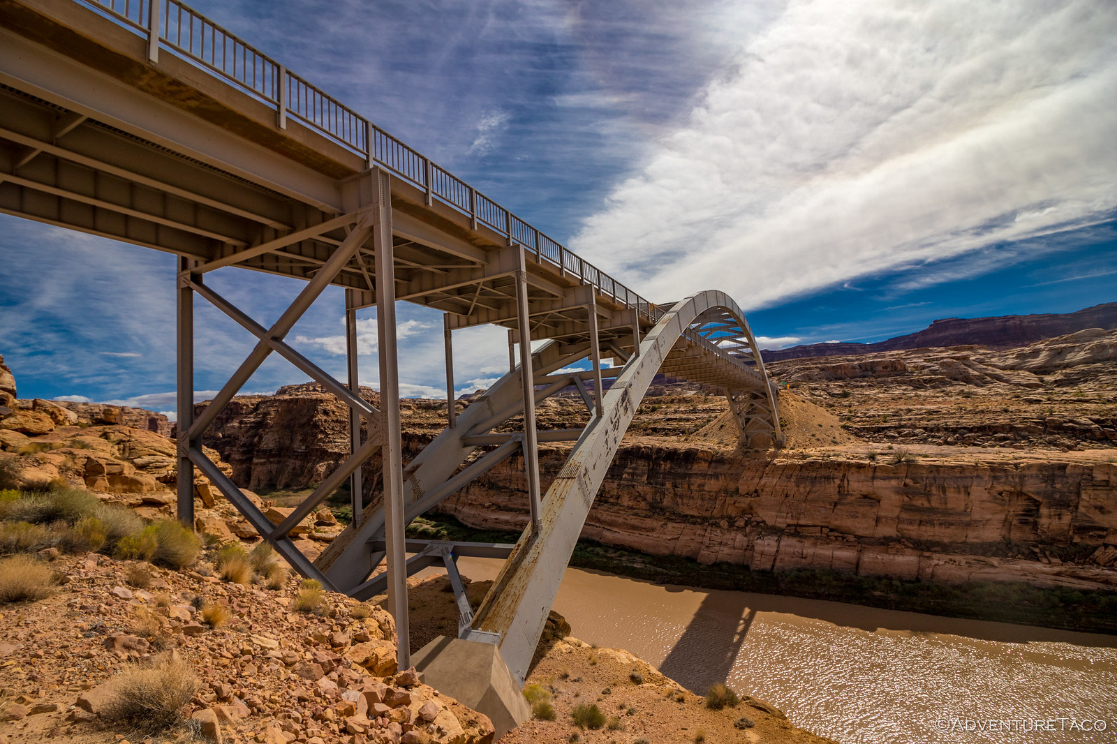
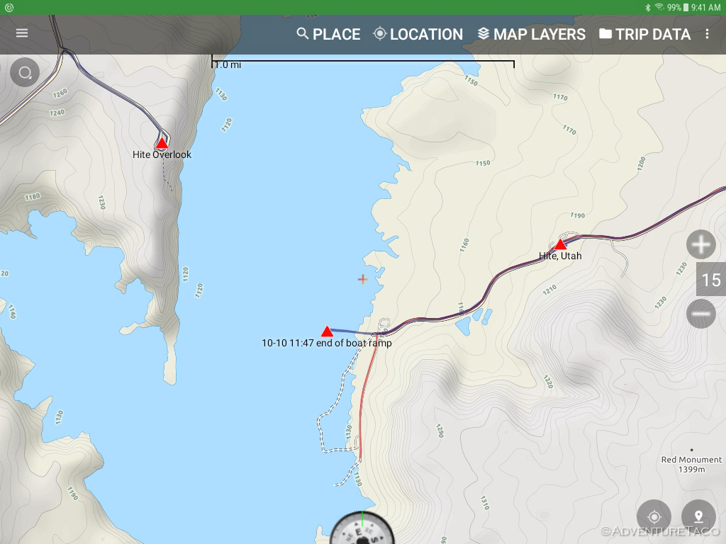
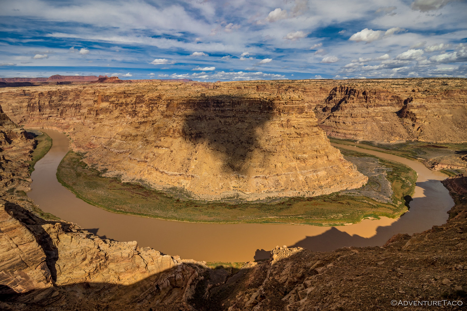
We eventually found ourselves at the Hite Overlook where we opted for the short stroll from the parking lot to the overlook proper. As we did, the Colorado River peaked out far below - the water level some 70 feet lower than it's been in the past, rendering the Hite boat launch unusable.
The views though, were as usable as ever.

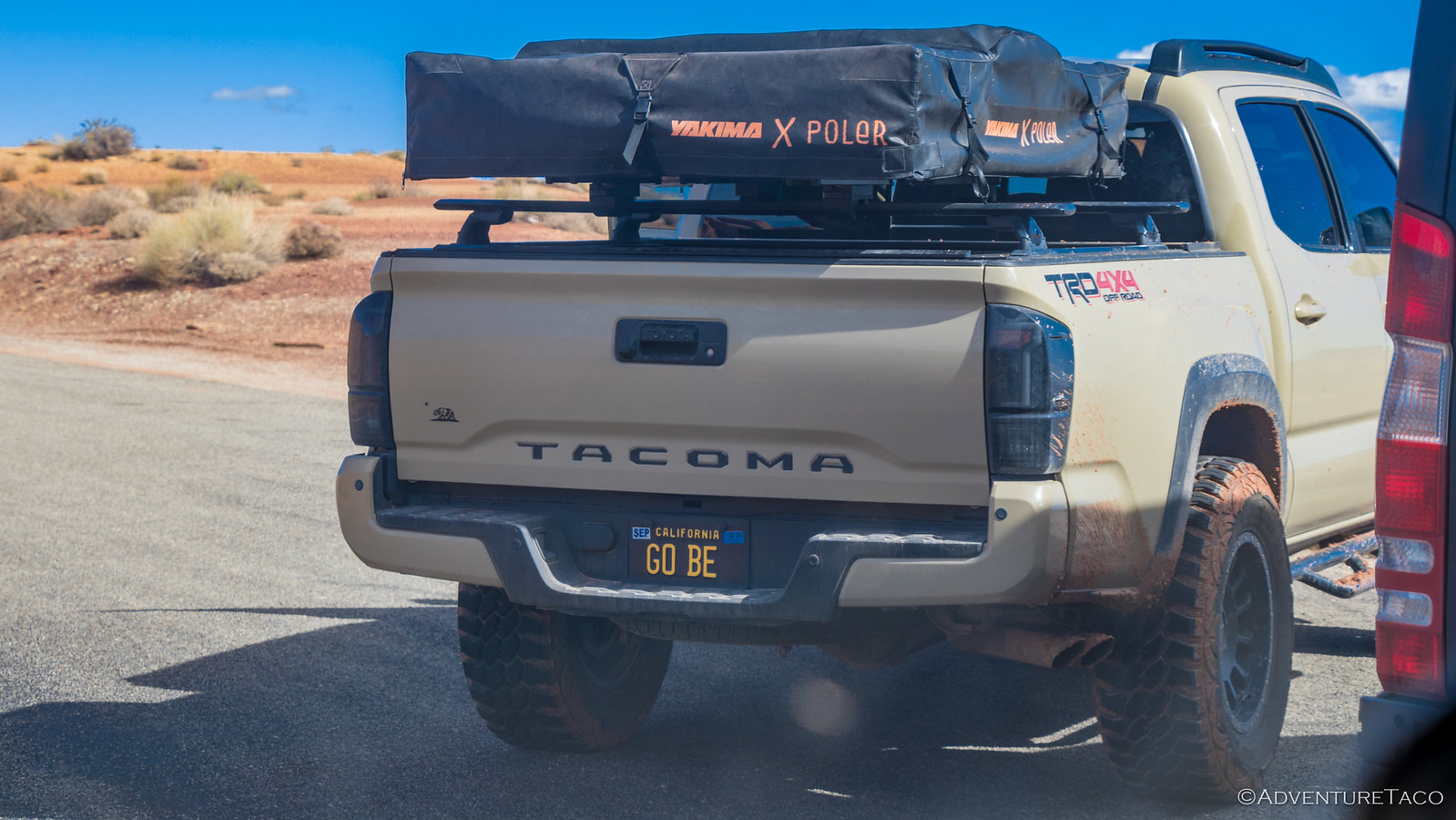
We headed out as a 3rd gen Tacoma pulled in, ready for the Ultimate Expo Adventure™, his custom plate, Yakima tent, and nerf bars up for the worst nature could throw at him.
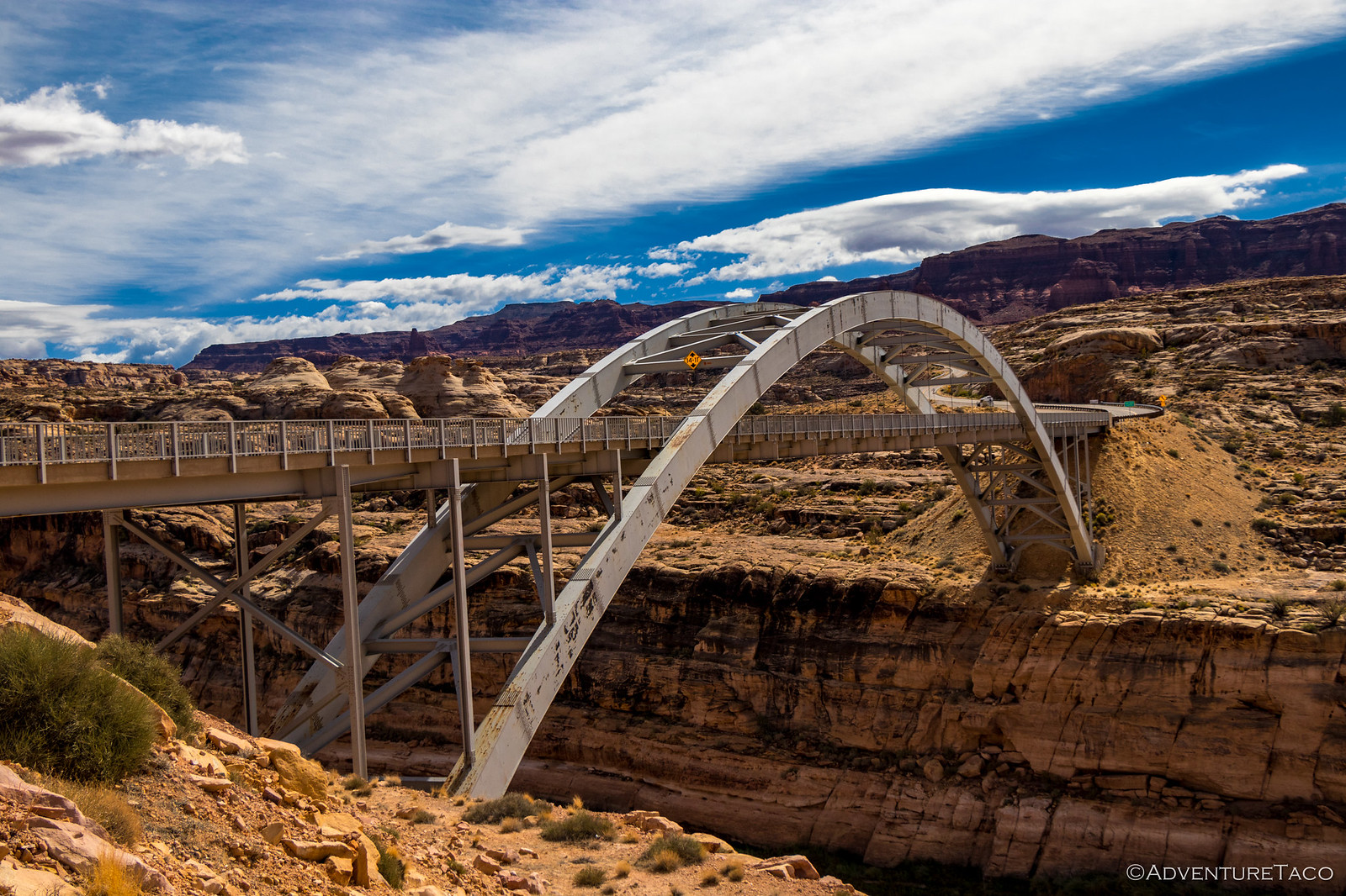
As we descended from the overlook towards the Hite Crossing Bridge, we made one last pit stop - a bathroom break for Mike, and an opportunity to explore the landing strip for Monte and I. This had to be quite the runway to use for take-offs and landings - the runway itself narrow and wavy. Not to mention the 1000-foot sheer wall at one end, and the 1000-foot drop at the other.

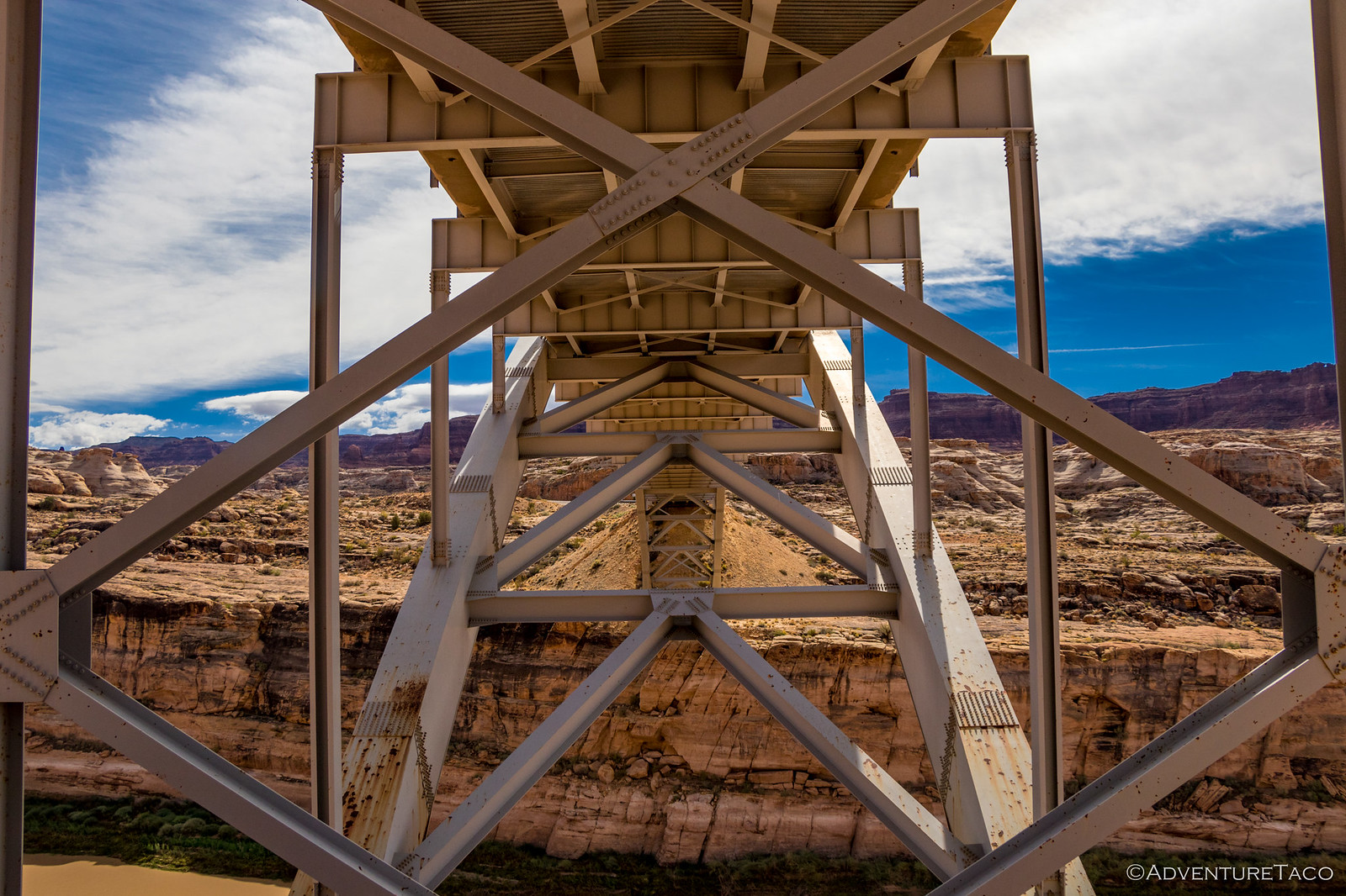
Wondering how often it was used, we climbed back into the trucks for the last quarter-mile to the bridge where we'd meet up with Mike for the final few miles into Hite. Of course, at the bridge we spent a bit of time exploring as well - the metal I-beams beckoning, rocks begging to be thrown into the abyss - a long 8 seconds down to the Colorado River below.
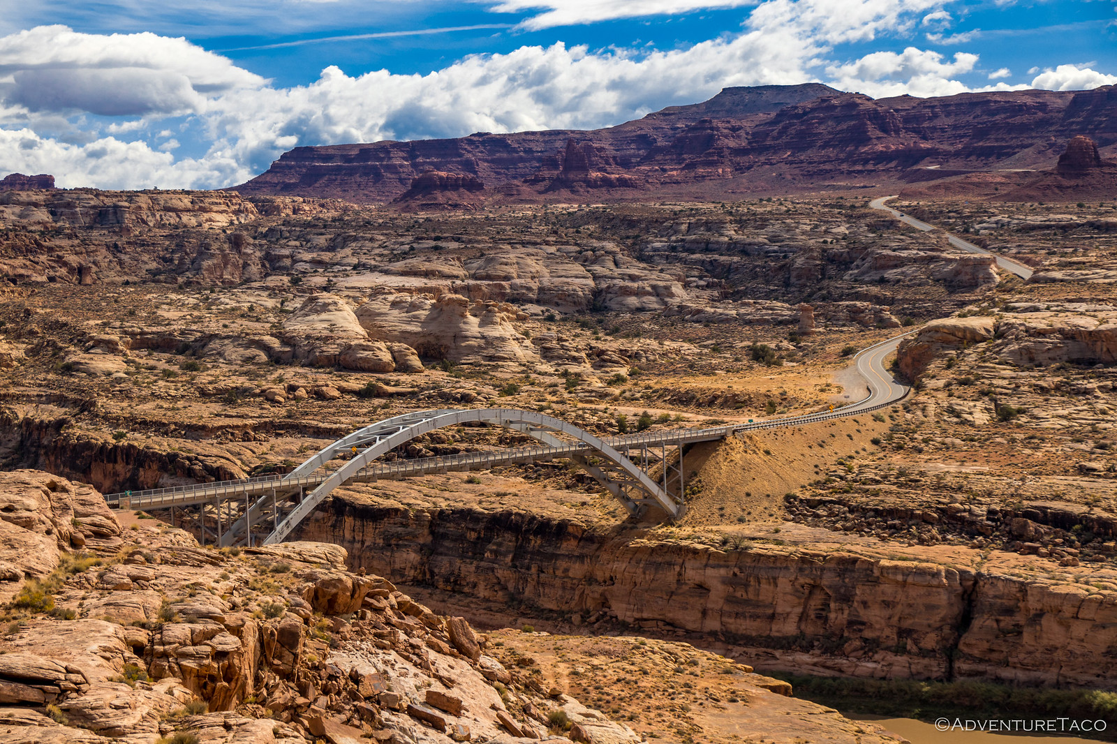
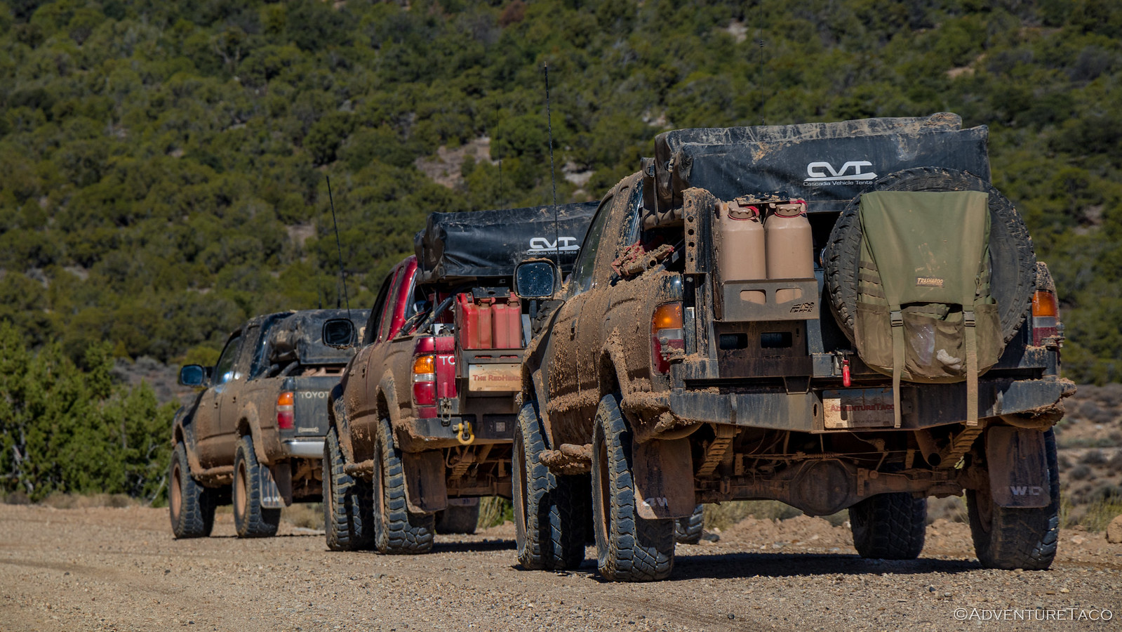
Ready for lunch, we crossed the bridge wishing - as we had many times earlier in the trip - that we had a drone in follow-mode to catch our caravan. We were quite the sight, I'm sure - three bad-ass rigs in the noon-day sun, headed to the end of the road in Hite.
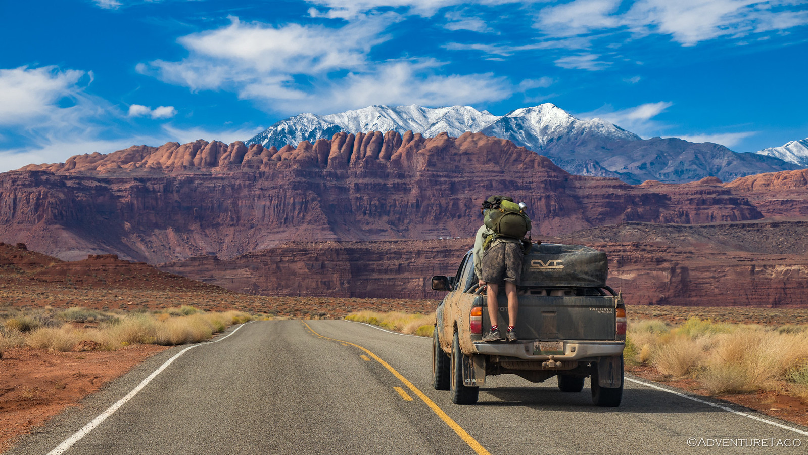
And so it was that as we made our way the last mile or two, we noticed a hitchhiker on the side of the road, headed the same direction. Our cabs full, we still wanted to give him a lift, so Monte told him to hop on to his rear bumper and hang on!
Dude was totally cool with that, and had a blast. Thumbs up and hang loose gestures frequent as we drove into town.
Gas anyone? Still probably a better deal than the 12 oz, 3-year-old mayo that Monte bought for $5.95. 

At Hite, we enjoyed our lunch on a picnic table at the tail end of the boat launch ramp; the sun shining down as though it hadn't rained in months. Oh, and according to our maps, we were enjoying our lunch in Lake Powell.
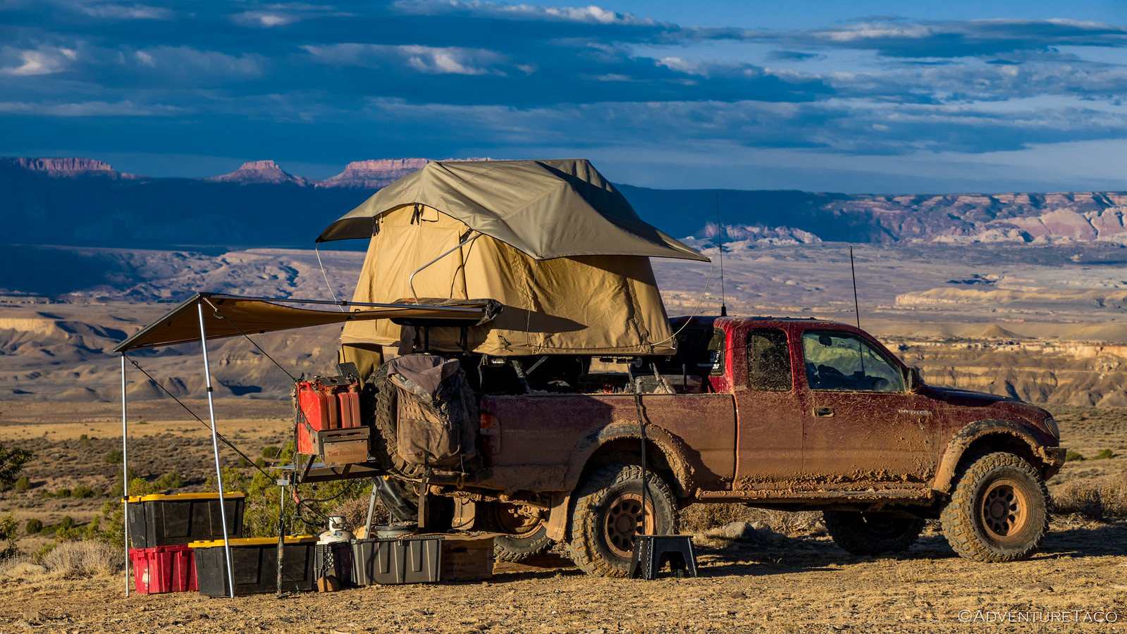
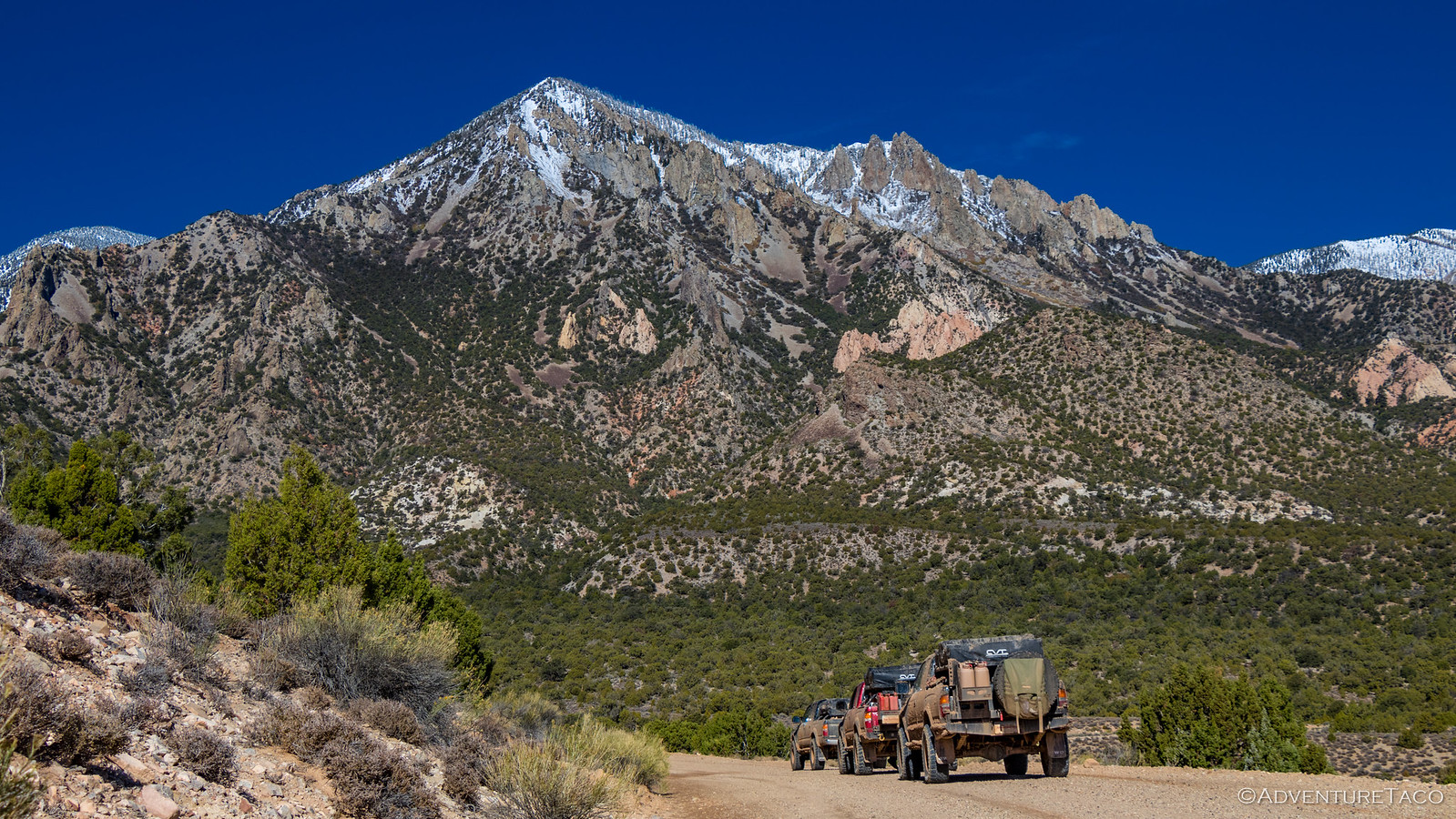
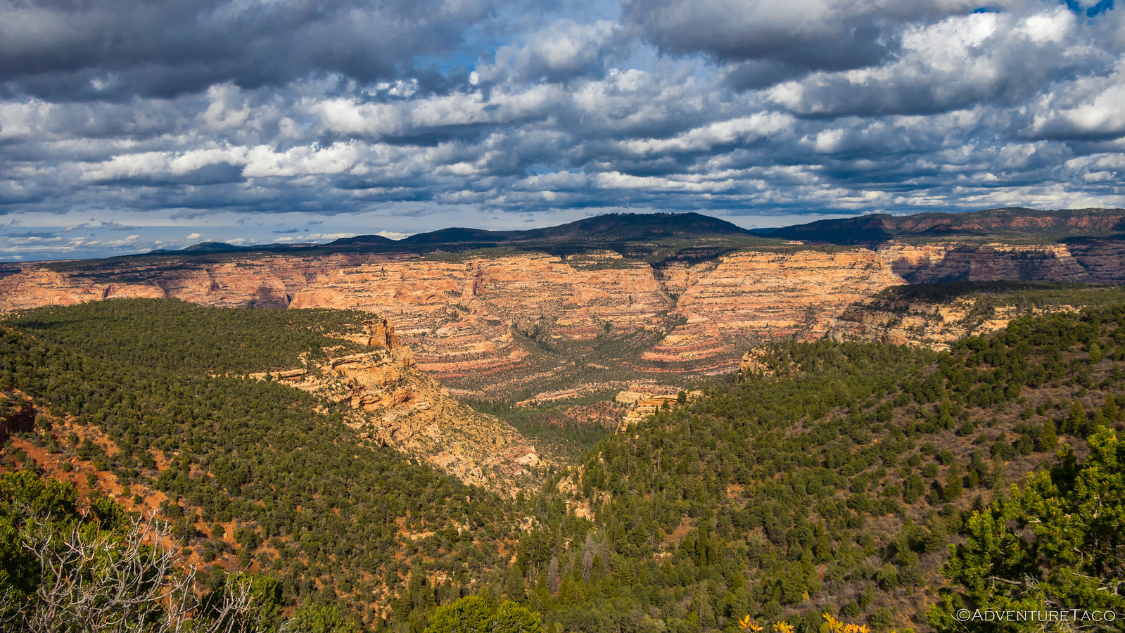
A leisurely lunch behind us, we headed back up the boat ramp - our trucks having performed flawlessly under the 50-feet of water indicated on our tablets. That was good, because they had an important place to take us - Bears Ears National Monument - a location we wanted to visit in its current form, before any reductions have time to affect the land (Wikipedia). From Hite we were almost immediately on dirt, the Henry Mountains still a reminder in the distance.
Along our route, Monte had noticed a horseshoe bend in the Colorado River and marked it on our maps. We had no idea if there'd be an access road or not, so we were excited when one presented itself, even if there was a half-mile hike at the end in order to see the large meander - Mike taking in the sight from the top of the butte behind us.

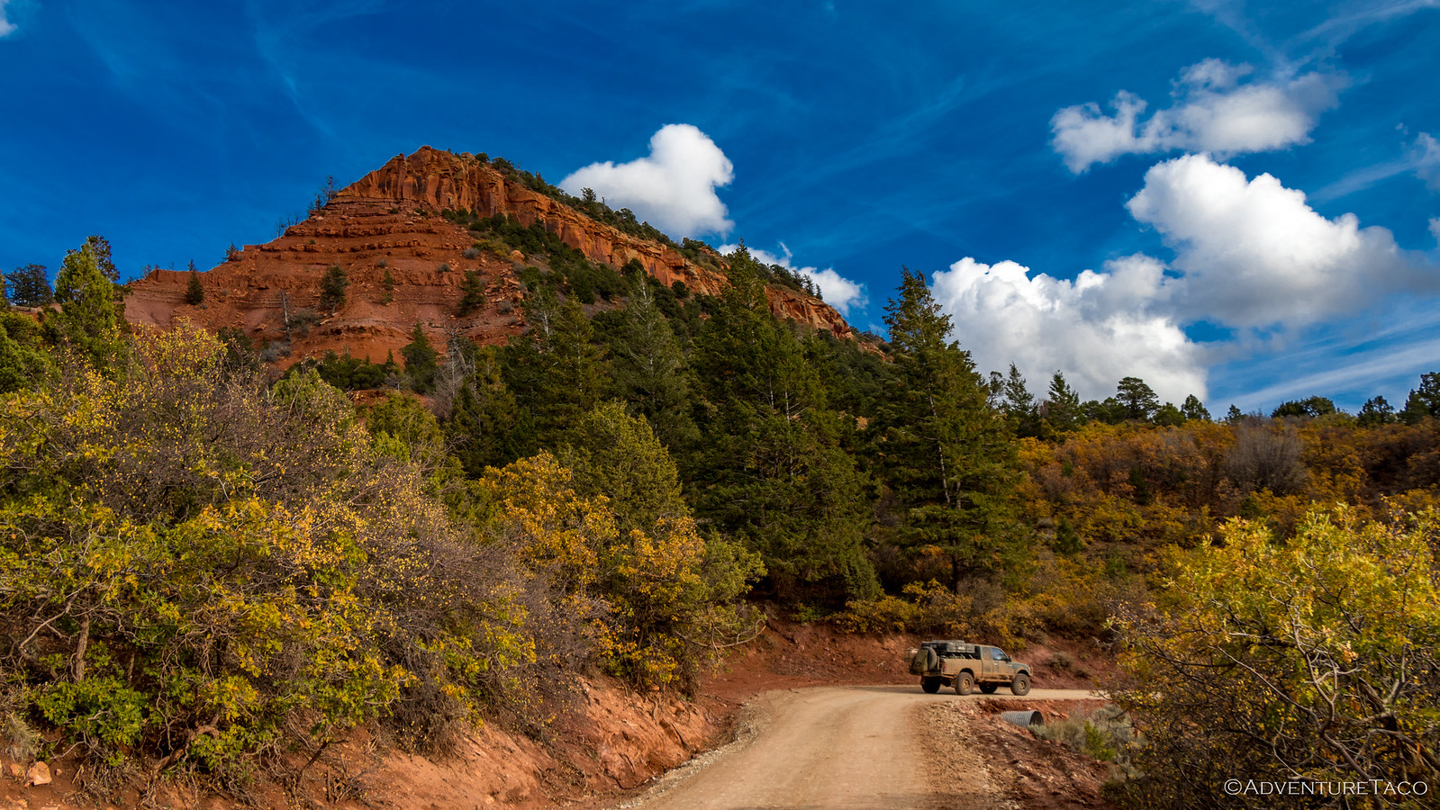
Side excursion complete, nothing stood between us and Bears Ears at that point, and we made good time on dry, well graded roads. We could tell however that they hadn't been dry for long, and that they'd have been a royal pain in our rear if we'd hit them on a muddy day.

And then, completely unexpectedly, we ran into trouble. It wasn't our own trouble, but someone else's. And it'd happened three days before, when the roads weren't dry and the traction had been bad. P-rated (passenger vehicle) road tires hadn't helped. This Chevy Colorado had definitely seen better days.
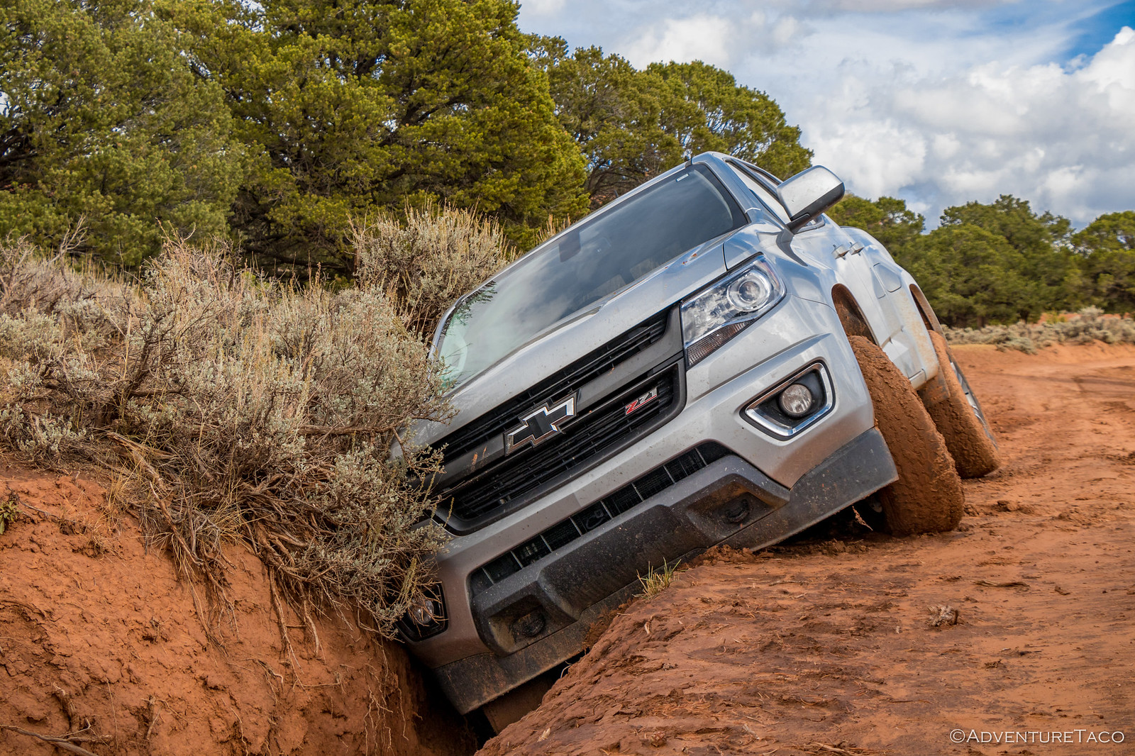
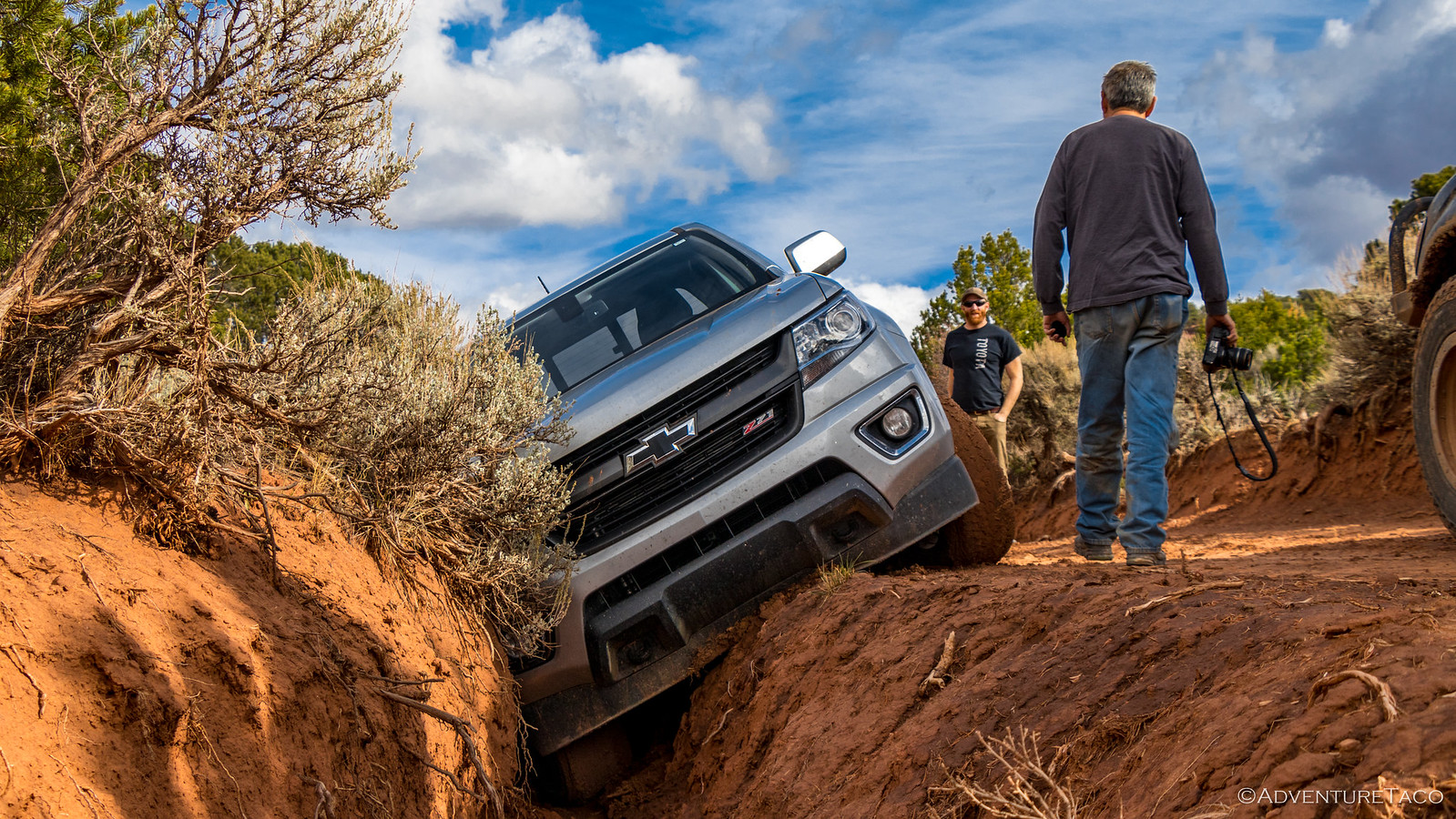
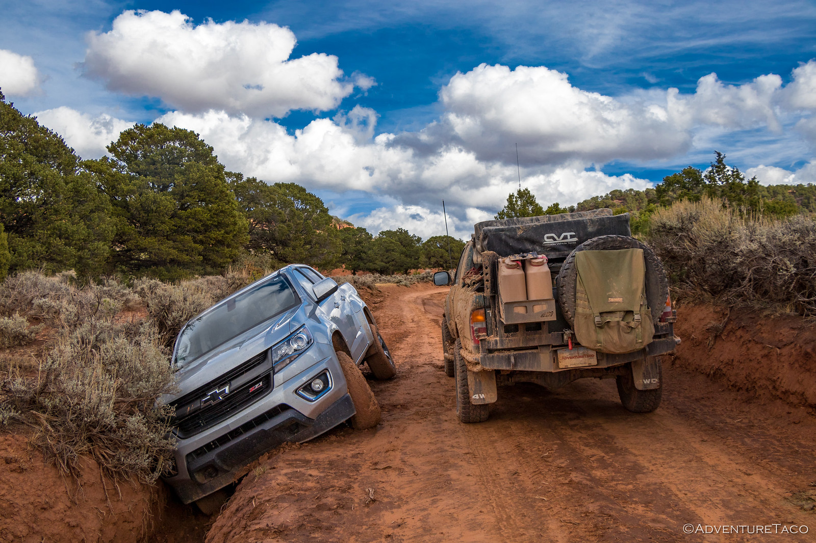
We wished the owner had been around - it would have been a quick job for us to winch the Colorado out, but the three day old note that "this car is not abandoned" made it unlikely that we'd pass them on the road to offer help. Instead, we carried on - up into the mountains, leaving the canyon below.
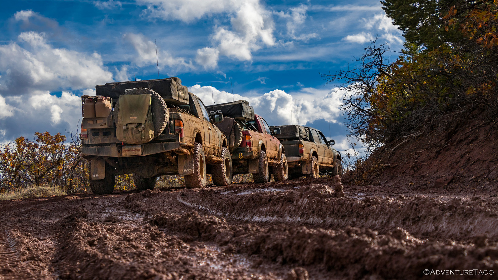
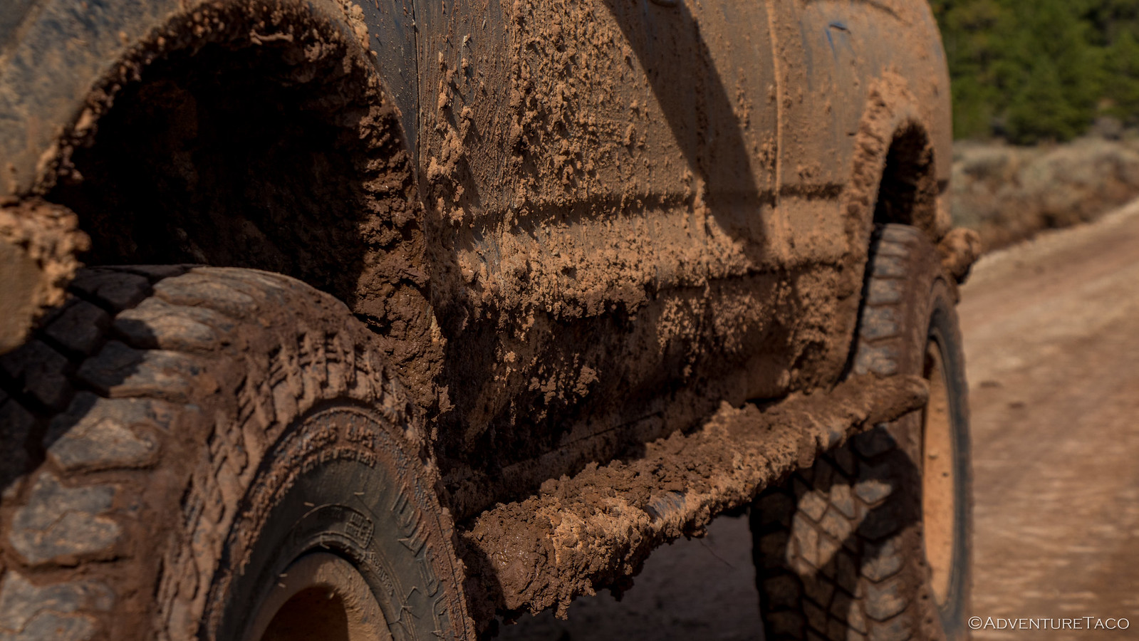
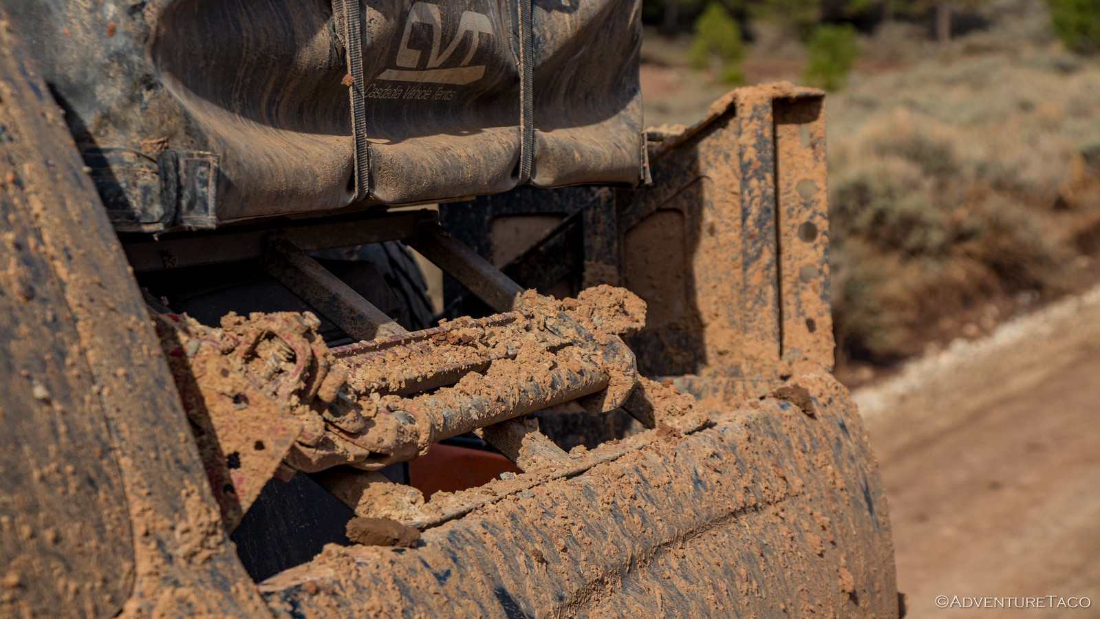
And as we gained elevation, we got a taste of what the Colorado had experienced just those few days before. It was wet and muddy and sticky. Even for us, it wasn't all that fun - the mud caking our trucks from tip to tail.
Say it with me now, "F*ck you rain."
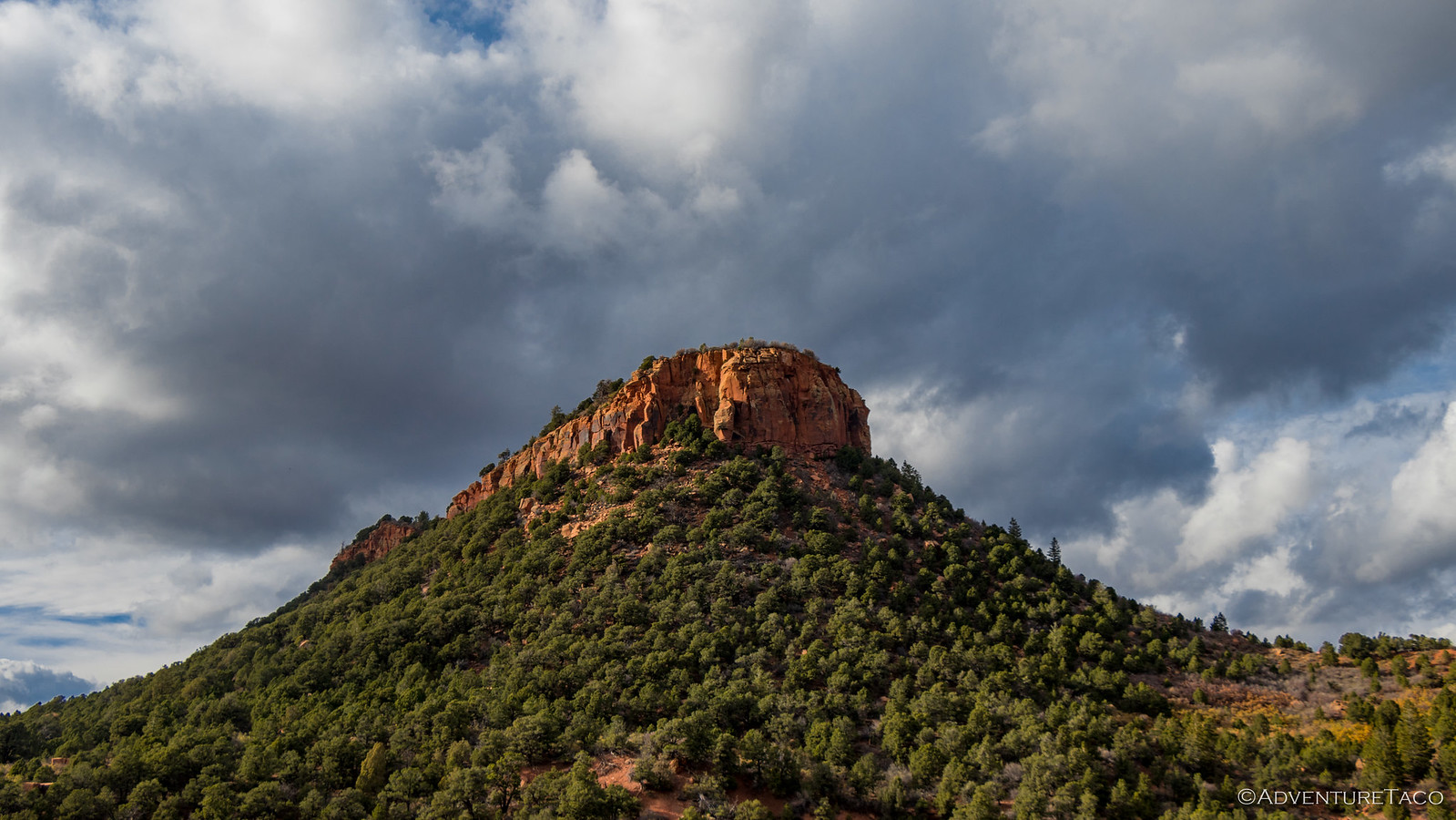
But the elevation and mud meant we were nearing the summit of our trip, and as we turned a corner we stumbled upon a sign alerting us to our location - much more unassuming than we'd have expected.
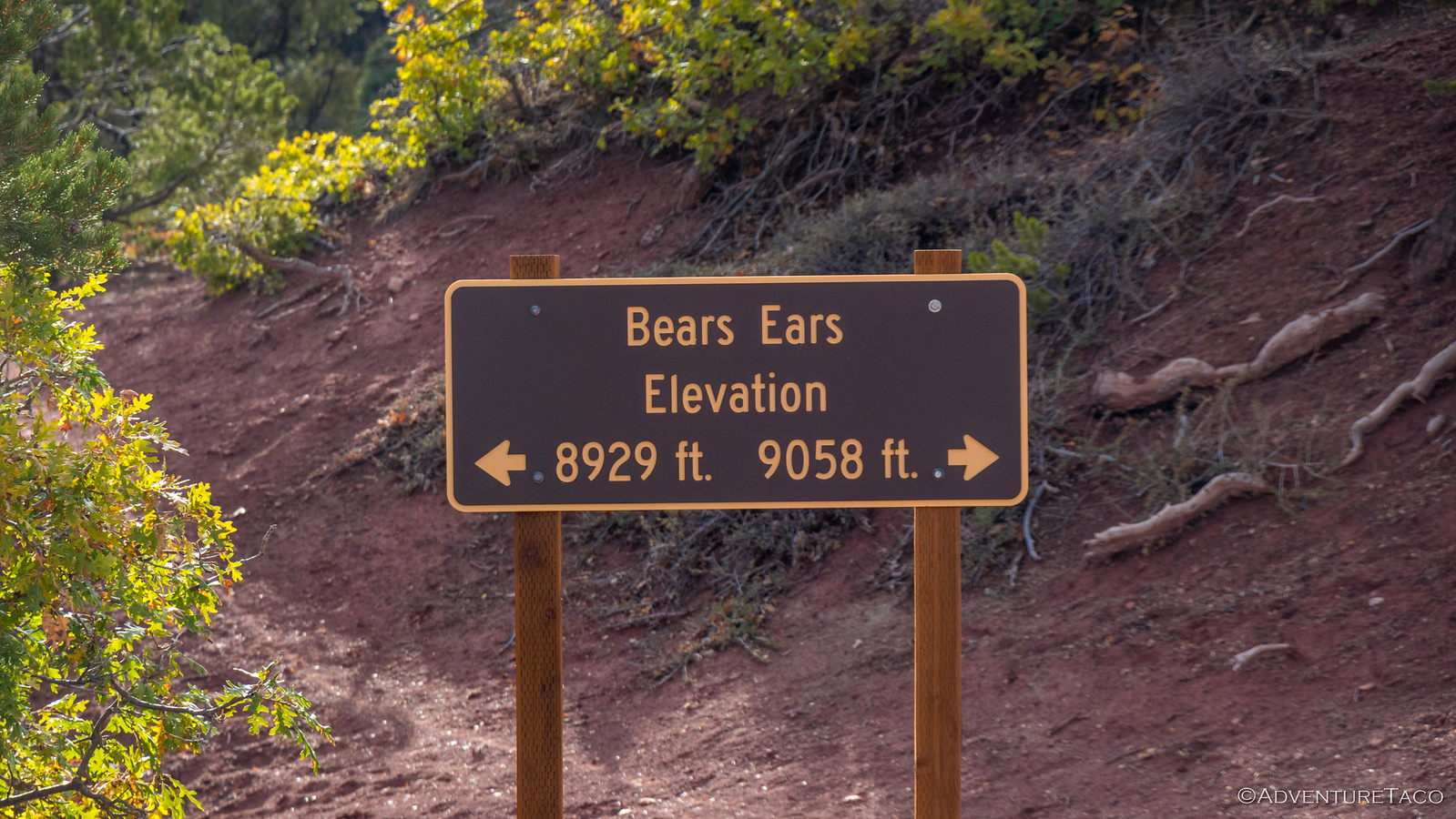
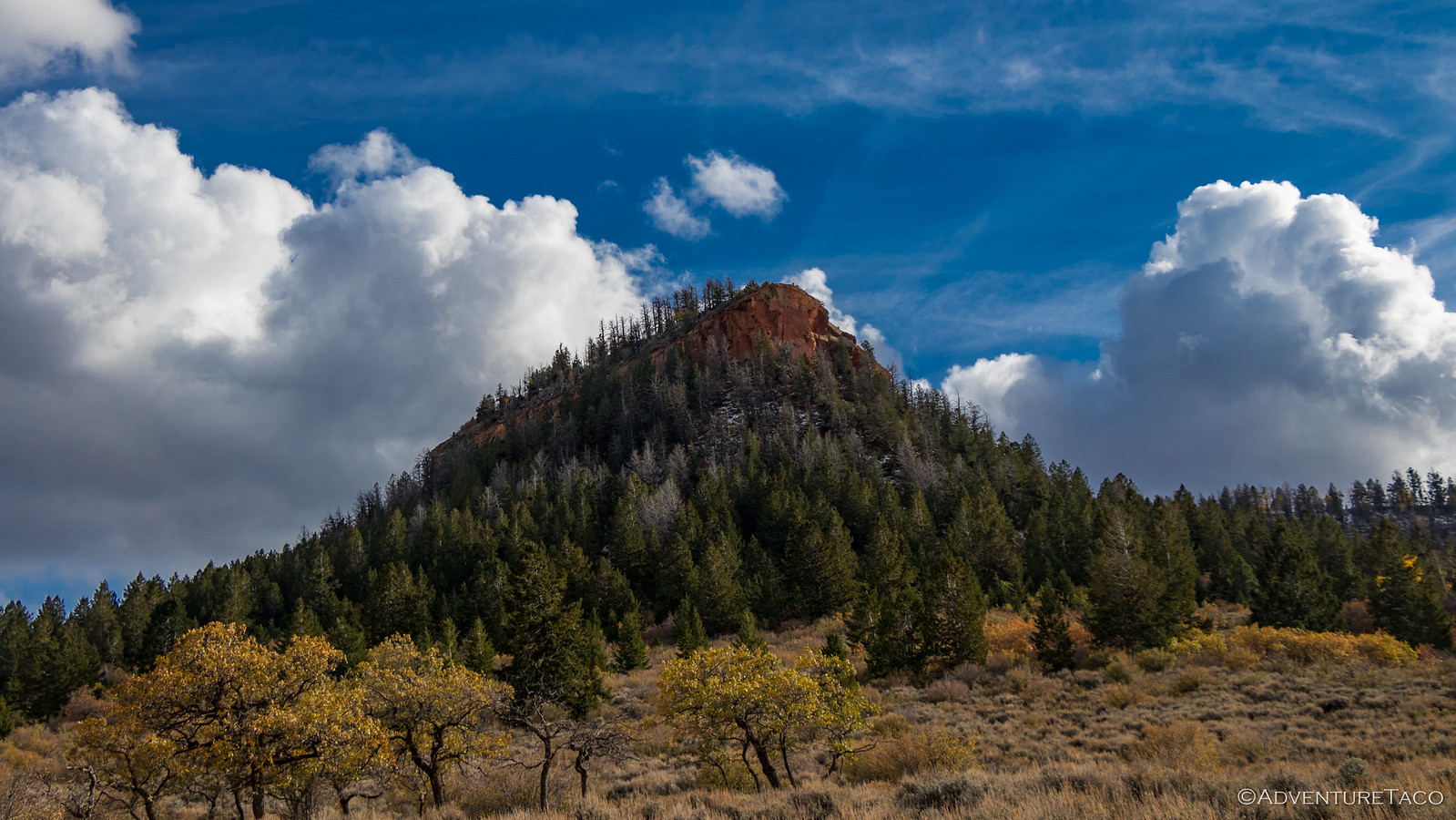
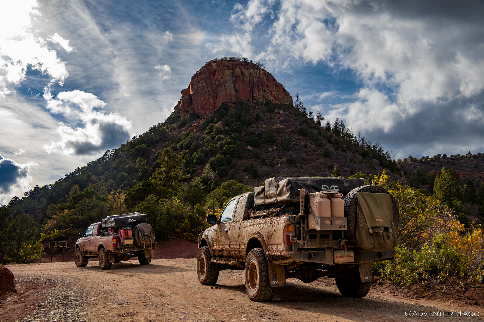
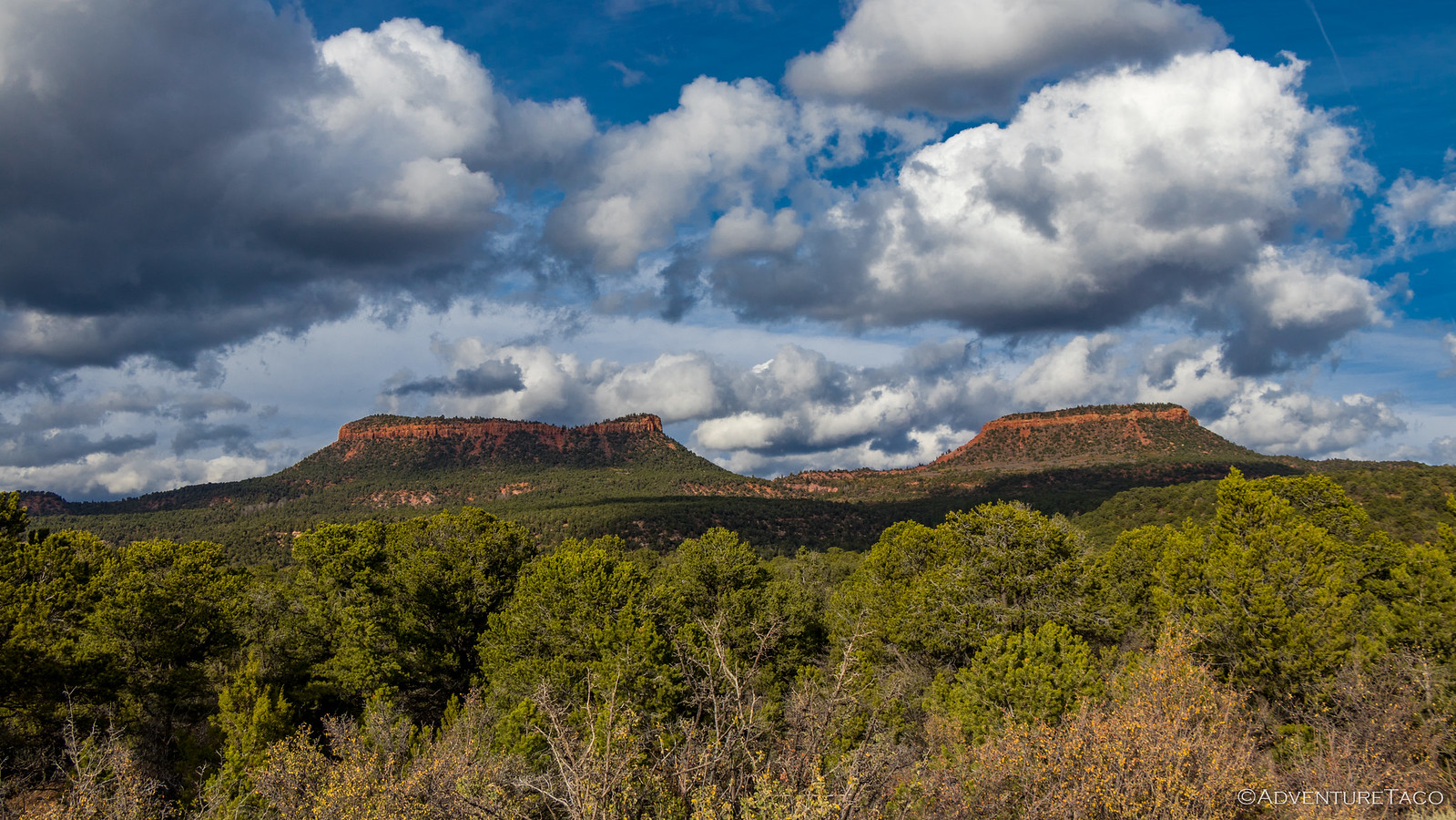
From our current location, the Bears Ears buttes for which the monument was named weren't really all that dramatic, "underwhelming" Mike would later say (though we were all happy to have visited). So we continued on, snapping a few photos as we pulled away - eventually getting to a point where we could see the two ears in a single shot.
And it was then that a decision to make - we could either look for camp, or we could make a push to see Natural Bridges National Monument, just 20 minutes or so away. It was nearing 5:00pm by that time, so as you might imagine, one of us wanted to get to camp and the other two were keen to have a look.
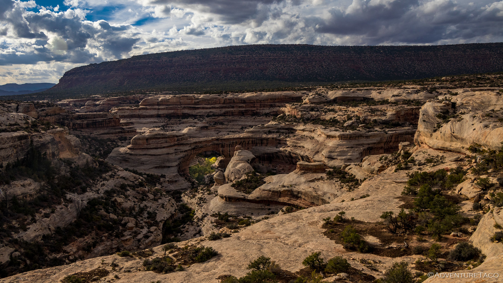
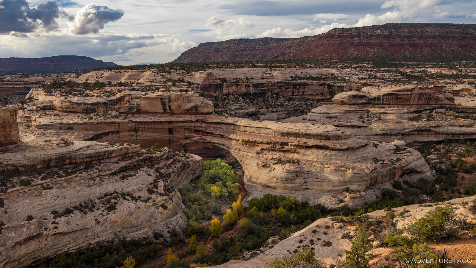
Somewhat reluctantly (and he was probably right), Mike gave in and we headed over to the nearby monument. We didn't really have enough time to do it justice - no hikes to the bridges, and no real exploration of the area - so it's a place still on our "we need to come back" lists.
Still, even from a distance the Natural Bridges were cool - by far the largest I'd ever seen at over 268 feet wide and 220 feet tall.
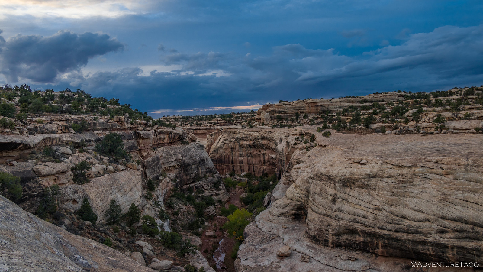
Light clearly waning at this point, we pressed our skinny pedals looking for a camp site. We knew there was rain coming overnight so we wanted something that would keep us from getting too muddy and would protect us from any wind a bit more than the saddle we'd found ourselves at the night before.
Eventually we found ourselves winding up the edge of a small rocky canyon off of Utah 95 - obviously part of the same formation that made up Natural Bridges. That was good in our minds, since the rocky ground would shed water rather than turning to mud. Plus, who can complain about a canyon out the tent window?
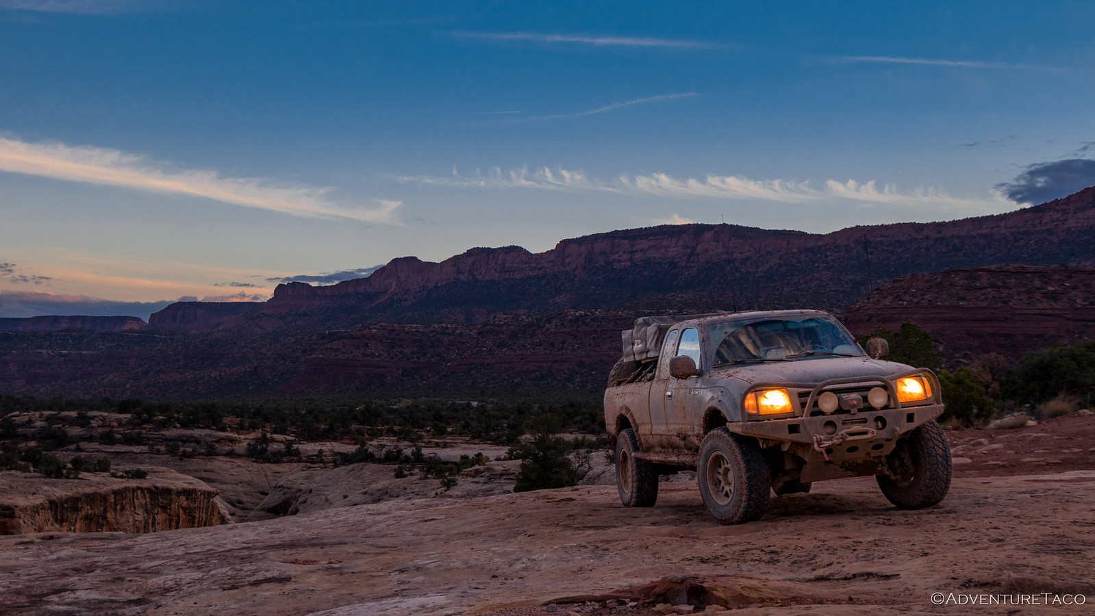
We all settled our trucks, tent ladders and tailgates strategically positioned on the rocks and set about our evening routines - camp setup, photos, campfire - now well-oiled into our bodies after nearly two weeks on the trail.
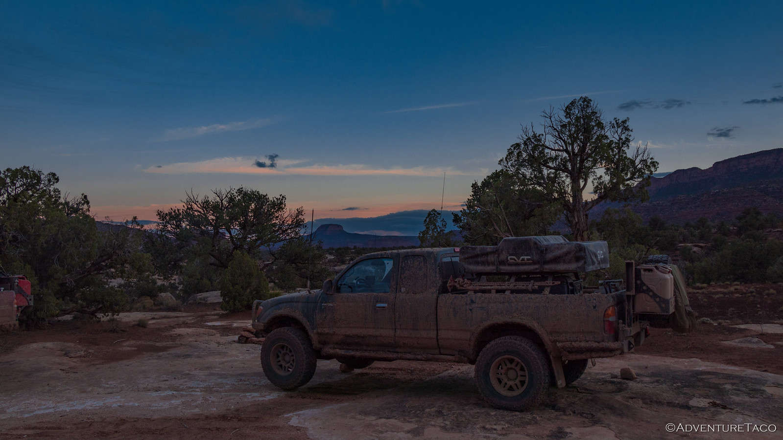
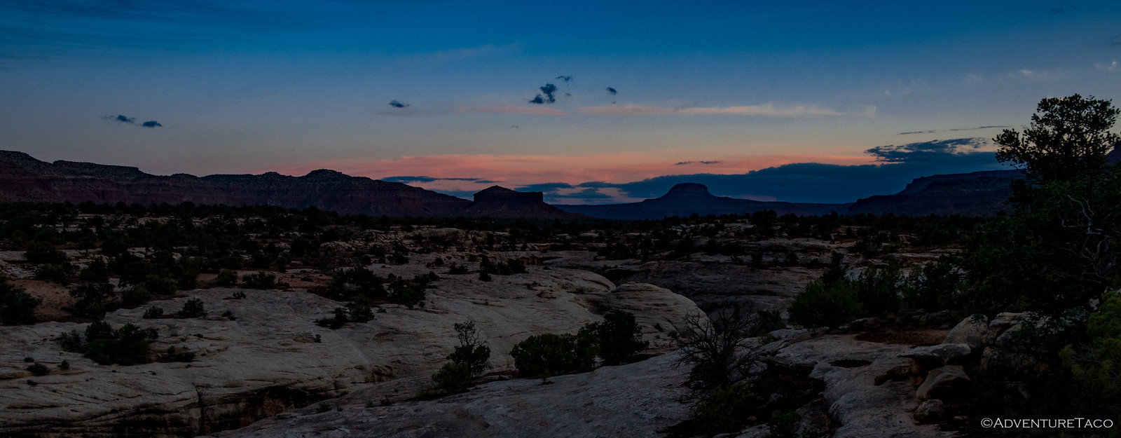
The sun already below the horizon, the clouds started to move in, highlighted by the last rays of light; broad brush strokes across the previously clear sky. A bit of chill was also in the air, the season clearly changing to late fall throughout our trip.
On the dinner menu that evening was cheese tortellini with a sausage meat sauce, eaten around the fire to keep warm. We chatted into the night about what we'd seen that day - so much ground covered really - and what our plan for the next day would be. With rain in the forecast we knew that it could be a slog if we attempted something similar to our 10-hour, 35-mile run from the Grand Bench to Left Hand Collet Canyon, but at the same time we had a desire for dirt and the cool sights to which it would lead.
In the end - brought on by the start of the rain at 11:00pm - we decided that we'd wait and see what the weather had in store for us overnight. In the morning, we'd re-evaluate and hopefully aim for some dirt if the mud situation was manageable.
As we climbed into our tents to the pitter-patter of drops on the tops of our tents, we were all glad for our rock islands, but the general consensus was still, for good reason, "F*ck you, rain."


