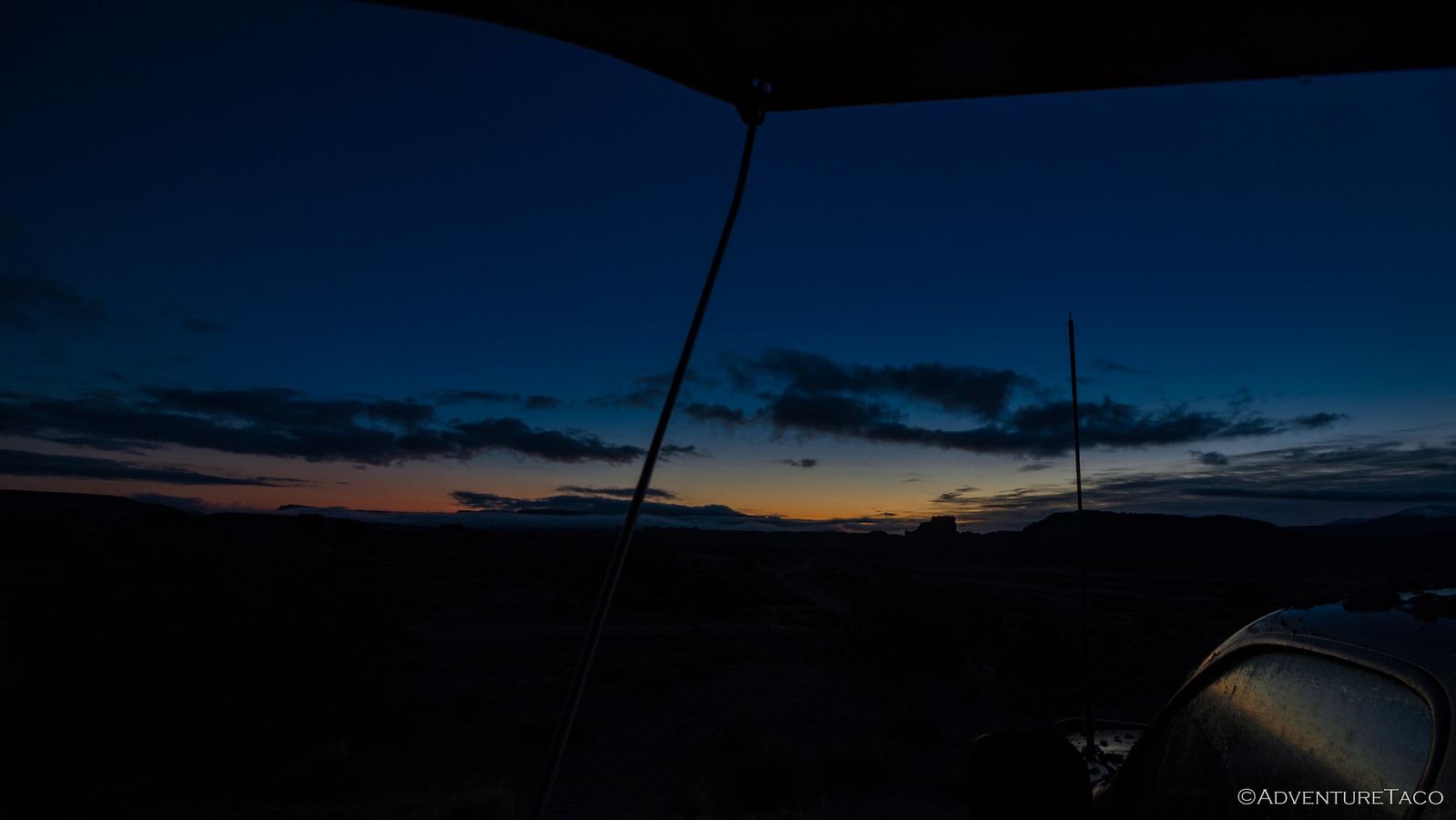
I woke up on the last real day of our two-week adventure having slept well through the night. The rain stopped a couple hours after we went to bed, and as I looked out the tent window at an orange sunrise, I could see that most of the clouds had been blown away as well - it was going to be a beautiful day.
With no rain to worry about, my first order of business was to sleep for another couple hours - the tent warming up and mostly drying off in that time. Perfect.
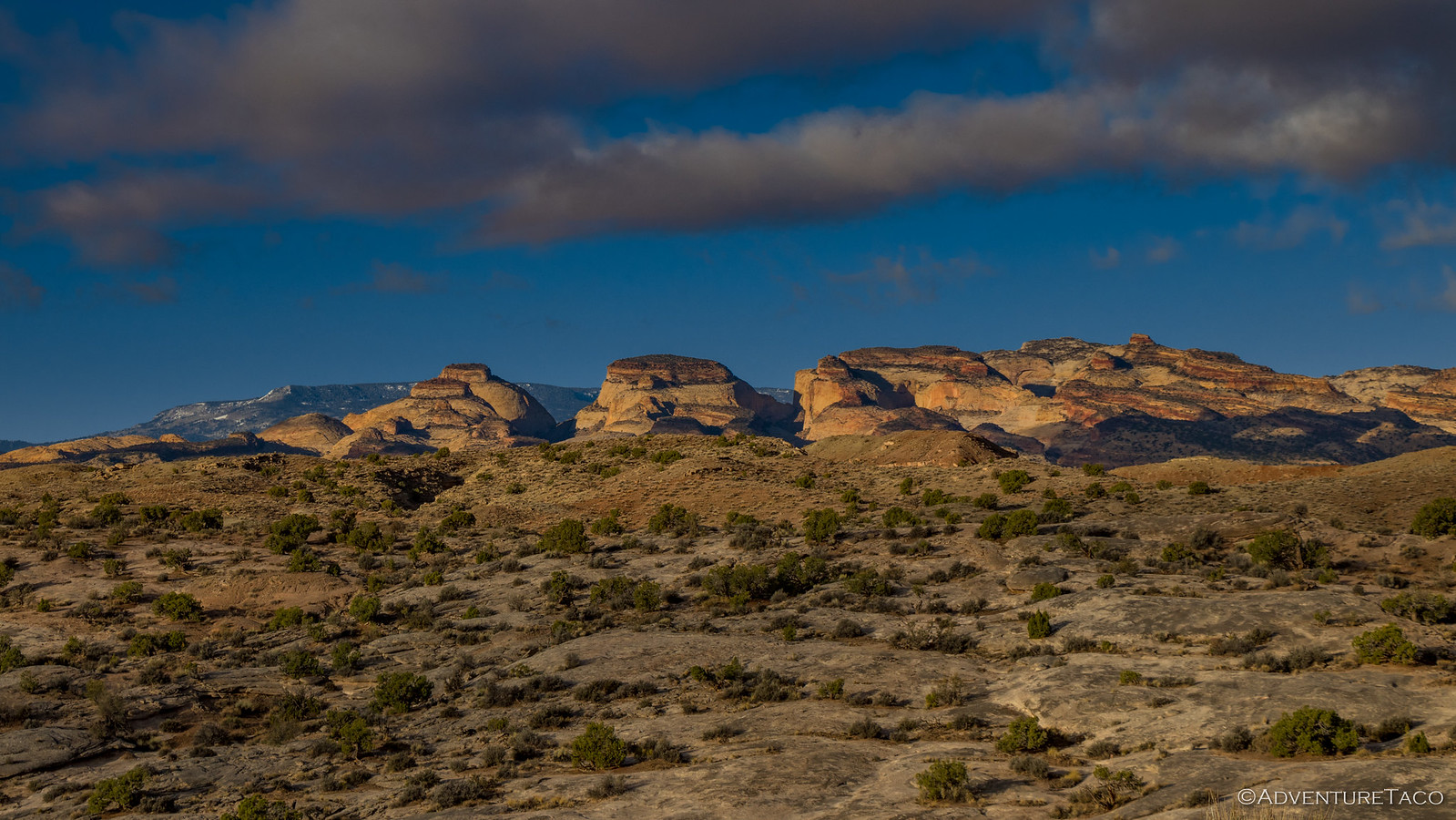
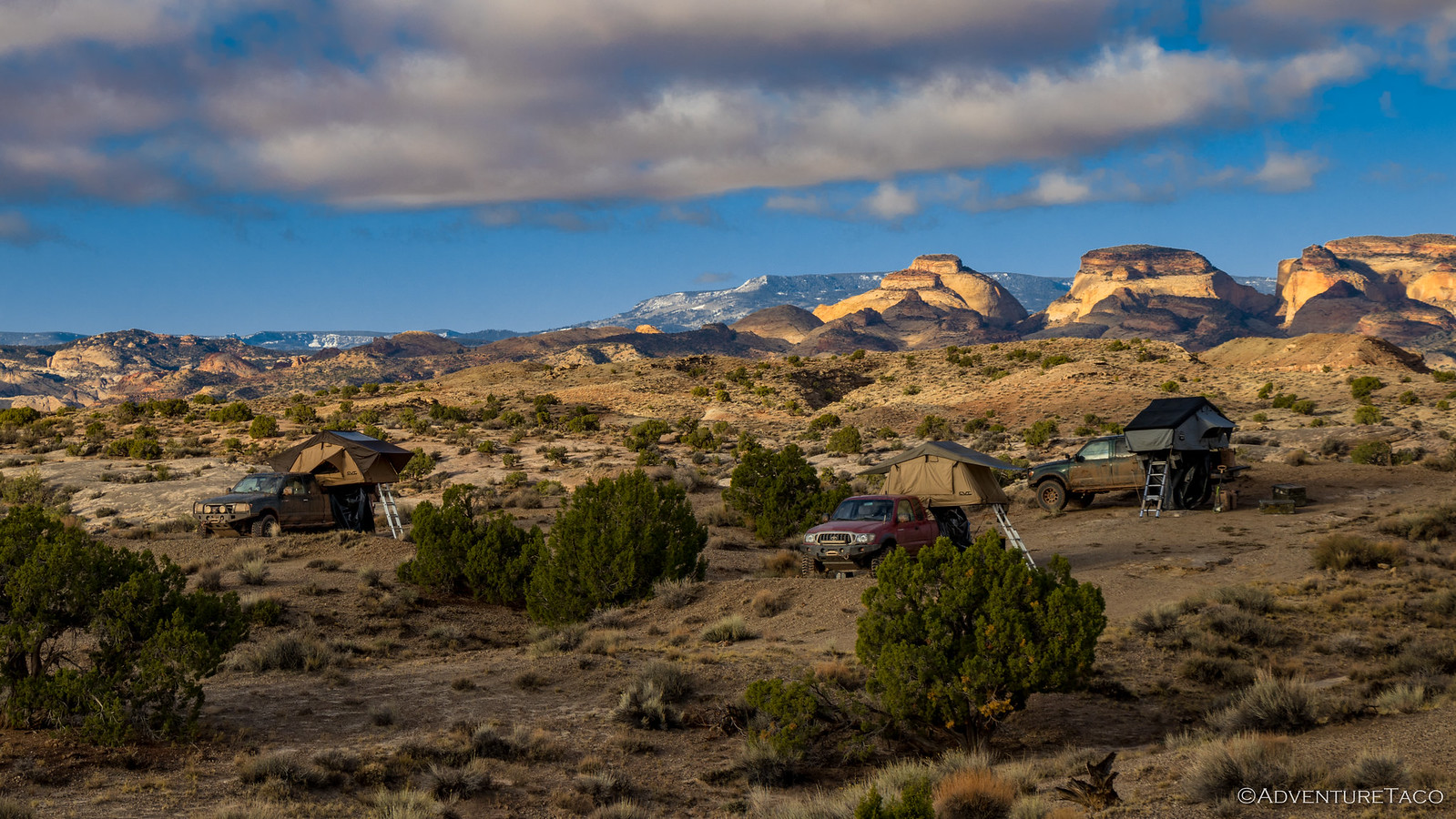
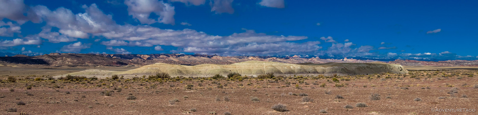
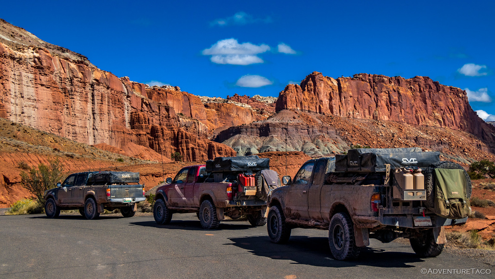
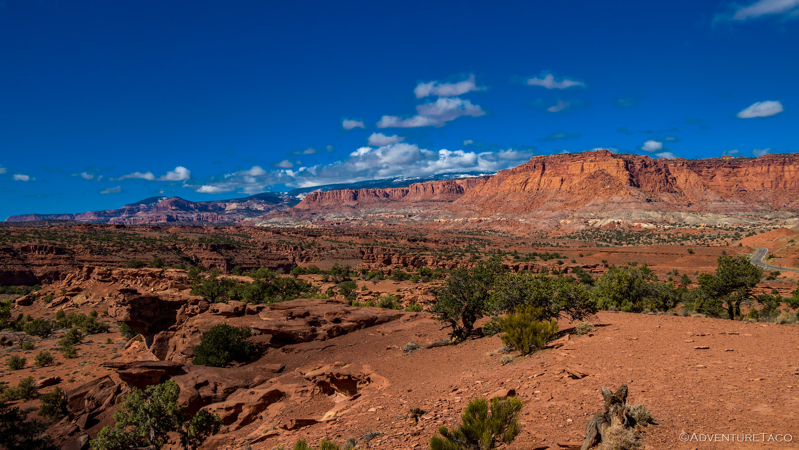
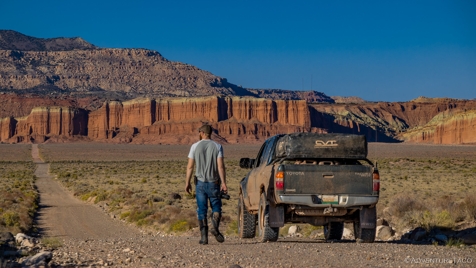
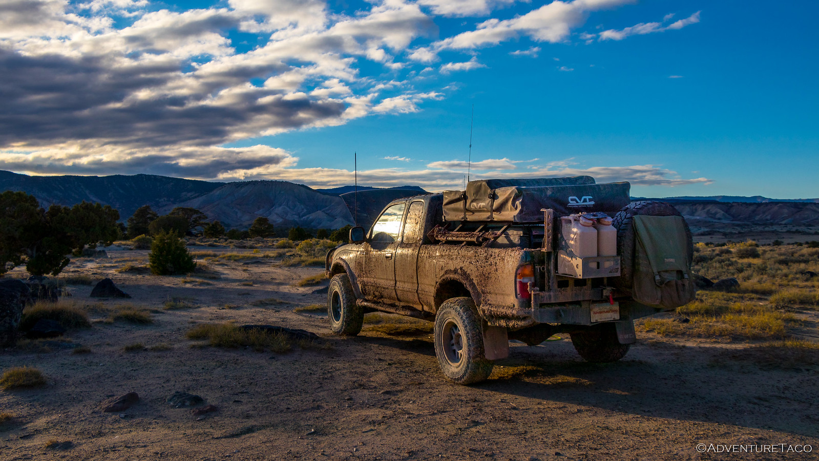
I couldn't hole up all morning though, and with the sun up over the Henry Mountains to the east, I pulled myself out of the warmth and ventured out around camp. It was our first real opportunity to see the landscape around us - most of it obscured by clouds the evening before - and it was great, Capitol Reef's Golden Throne a bright backdrop to our trucks.

Unlike previous mornings, as I walked back to camp neither Mike @Digiratus nor Monte @Blackdawg were stirring. That was just fine with me - I pulled out my Kindle and started in on a new book, my back warmed by the morning sun. And so we were until 10:00am when the heat in the tents must have gotten overwhelming, driving Mike and Monte out of bed.
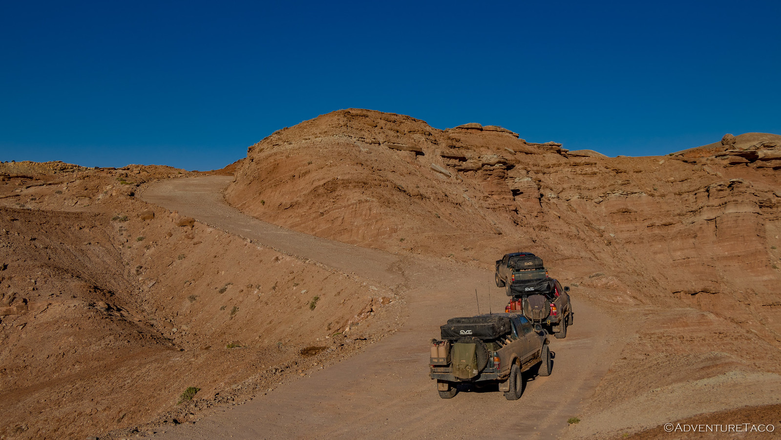
It was 11:15am when we finally rolled out of camp - one of our latest mornings onto the trail, but also one of our most pleasant. Our goal for today was to complete the northward trek through Capitol Reef National Park to UT 70, where we'd spend one last night before parting ways.
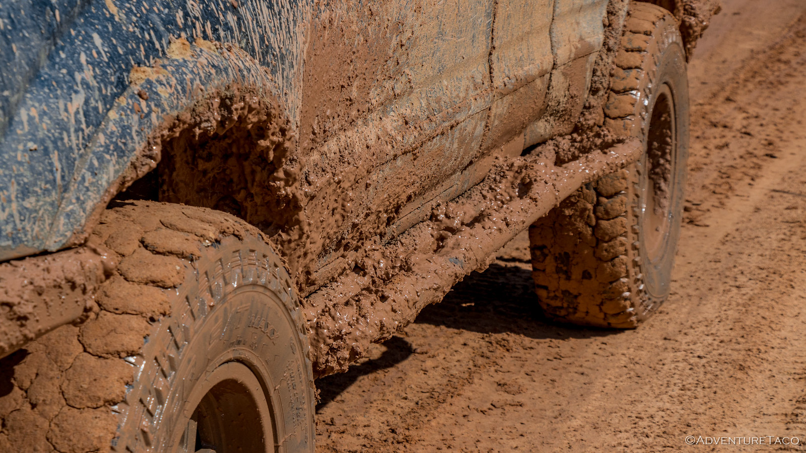
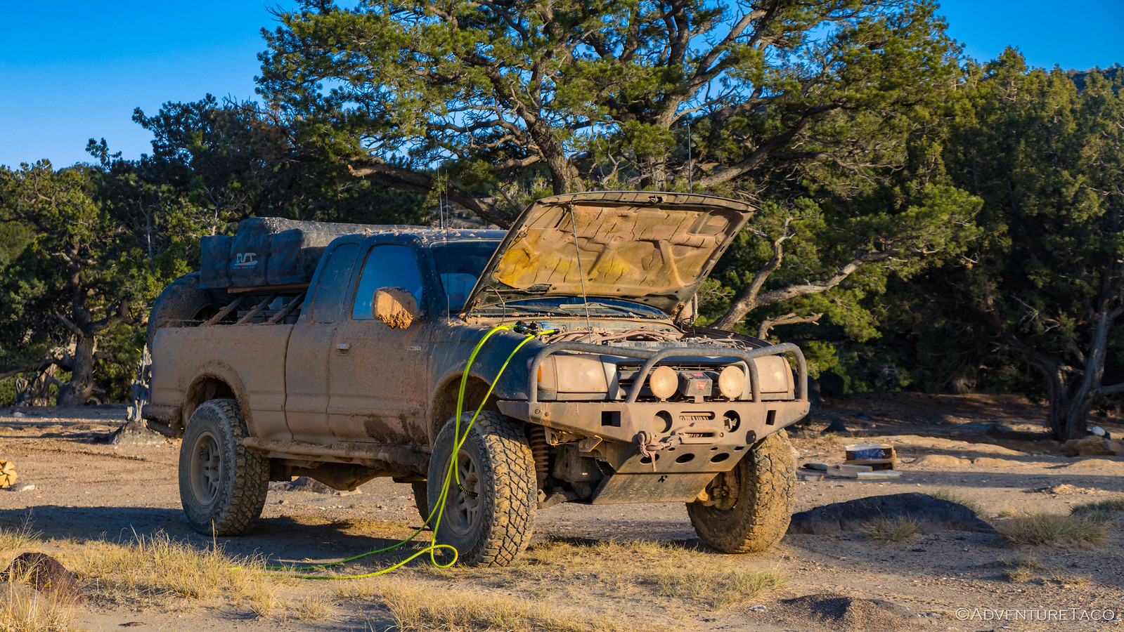
Almost immediately we were reminded how lucky we were for such a nice last day in the wild. The mud was thick; the pit holding it long.
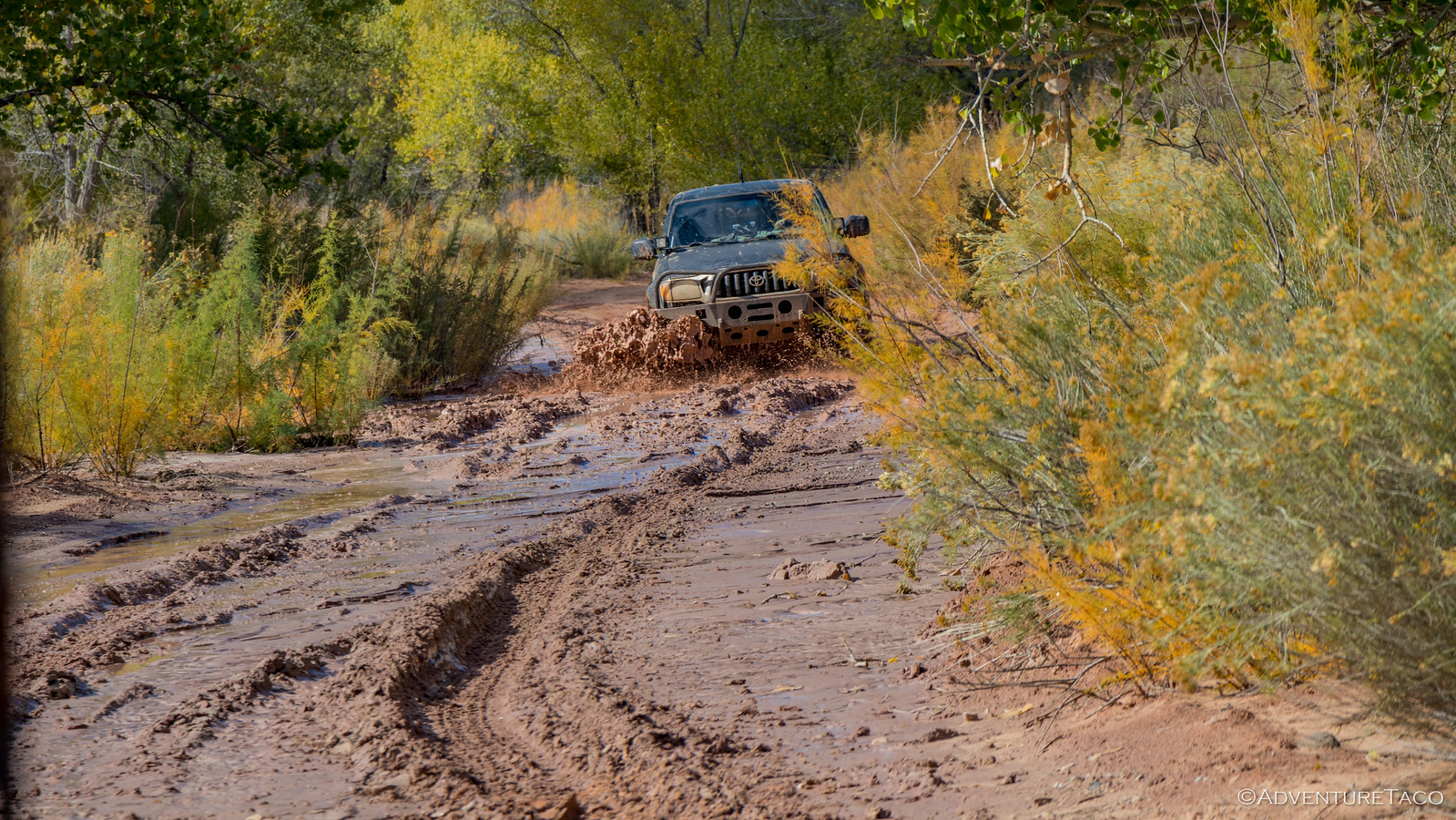

It got everywhere. Again.
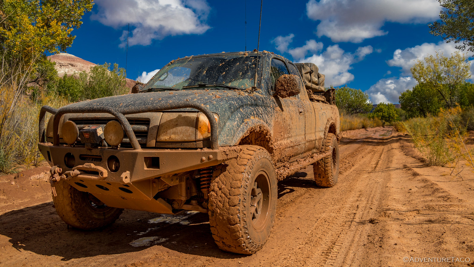
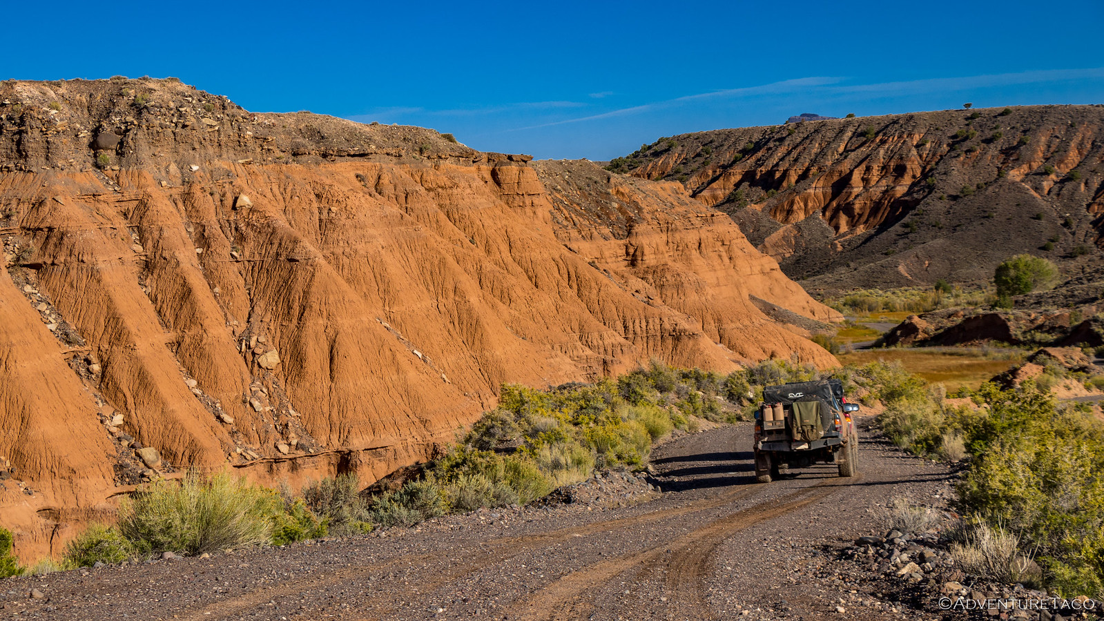
Hoping the entire trail wouldn't be this way, we continued onward - pretty quickly coming to drier ground as we moved north. the sites in Capitol Reef continued to be some of the most striking of the trip in my opinion, the layers of the rock so bright and colorful. Some formations - like a long, narrow, white sand dune - alien in their own surroundings.
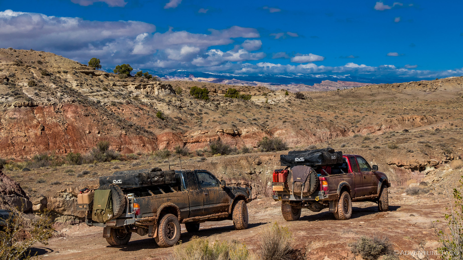
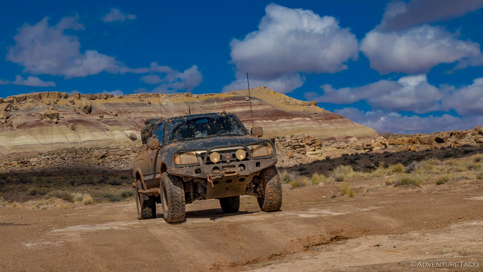
We continued on - through muddy patches, through washes (muddy but no longer running), and over small ledges - for several miles until - as we rounded a corner, we saw two trucks approaching from the opposite direction. As they neared, they were the same two Nissan Xterra's we'd seen the day before. They were covered in mud and gesturing for us to stop.

"The road is impassable up there, you might as well turn around here." they said. "We were flinging mud everywhere and made it up the first climb, but there was no way we were going to make it up the second - it's a lot steeper."
Well, we weren't sure these were the right guys to believe that the road was impassable, but we were sure that we didn't want another day of 6-inch deep mud - especially our last day on the trail. So after a quick pow-wow on our next move, we decided that we'd head back to the highway and then north to Torrey and Loa, and then over the mountains to Solomons Temple and the Last Chance Desert.
Even travelling west on UT 24 through the national park, there was nothing to complain about - the views were still amazing, the sun was still shining. It was a great day, even if we were on pavement for the next 40 miles.

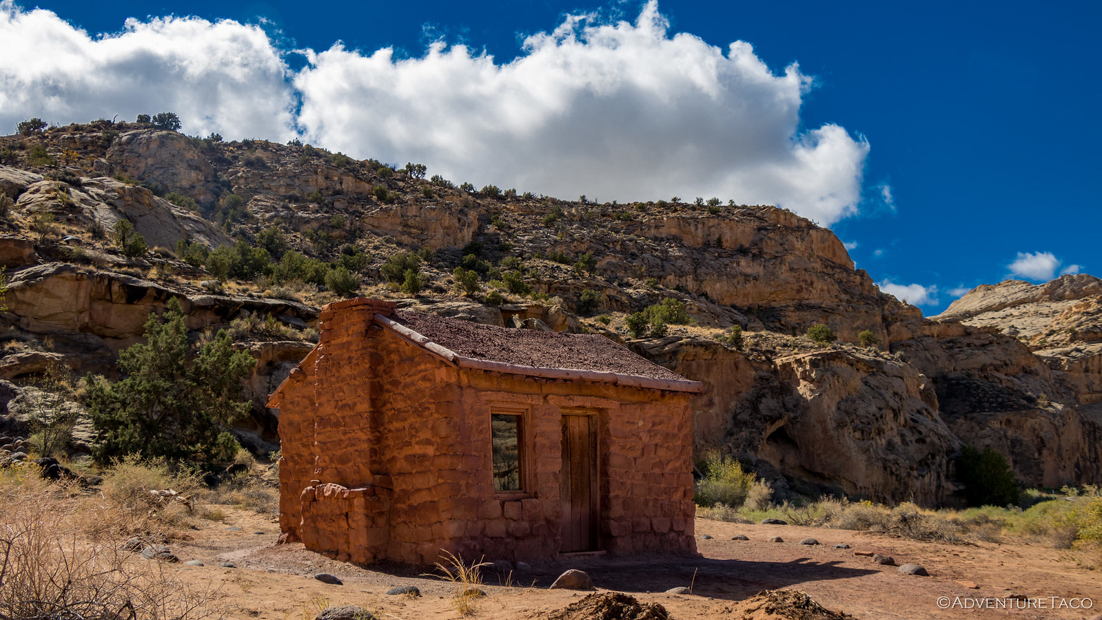
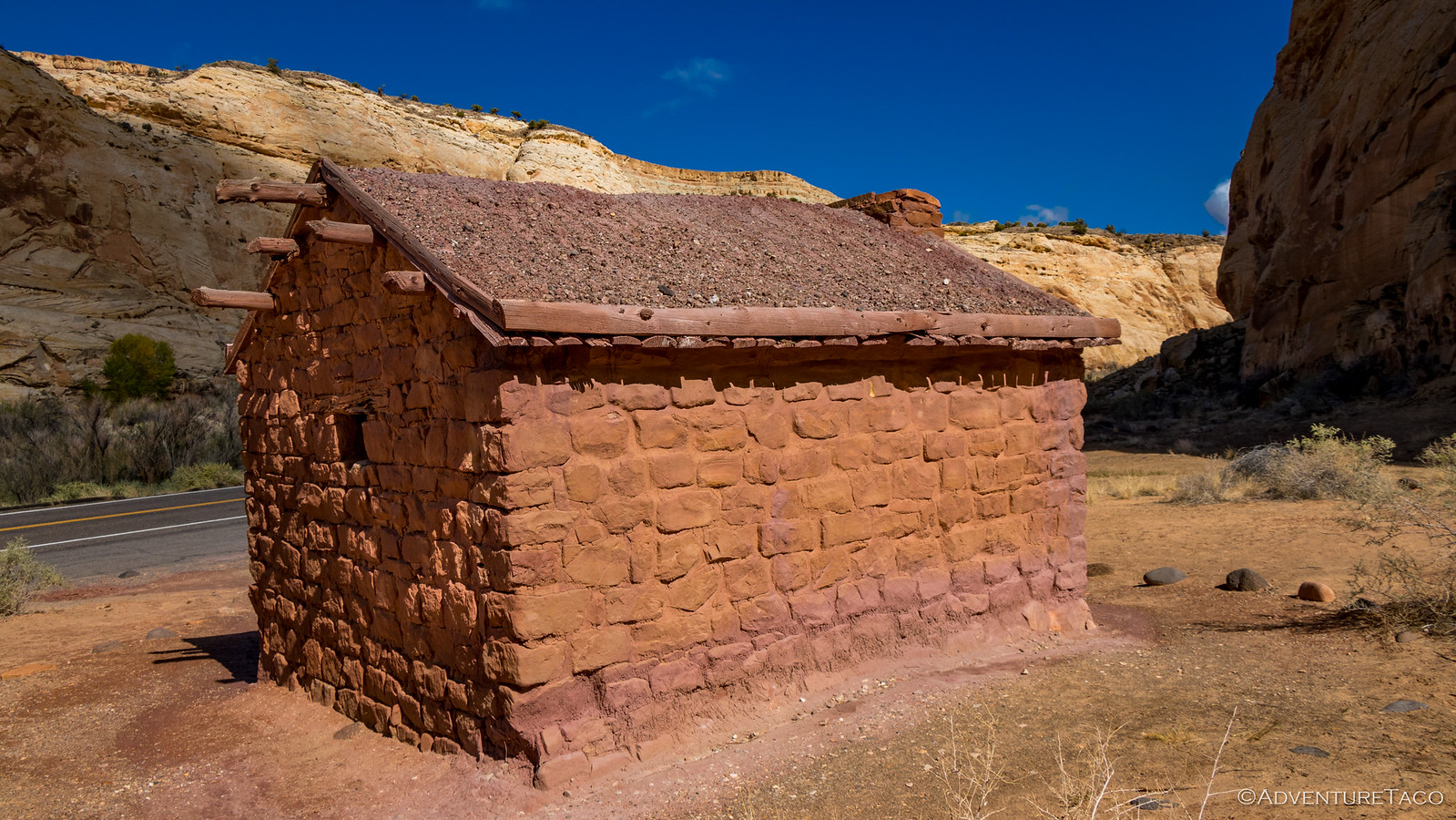
On the main route, we played tourist a bit as well. On the side of the road, the old Behunin Cabin. Built in 1882, Elijah Behunin and his family (a wife and 13 kids!) were some of the first to settle in the Capitol Reef area. Within a year, the family moved away to higher ground near Fruita - repeated floods of the Fremont River ruining their irrigation system and washing out their crops in this unforgiving landscape.
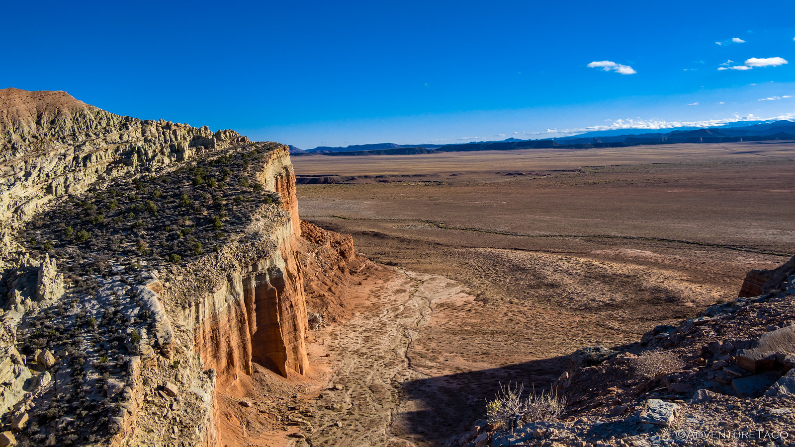
From there we continued on to an overlook dubbed "Panorama Point." That's perhaps the most promising way to describe an overlook for the three of us, and so we buttoned up the trucks in the packed parking lot and set out on foot - a 500 foot stroll to the point. The views there were reasonable - nice even - but nothing like some of the panoramic vistas we'd seen so far - so spoiled we'd been on our own.
Continuing on, we soon found ourselves in Torrey, UT - our bellies hungry and Slacker's Burger Joint beckoning. We drove past at first, but a quick chat on the CB confirmed we were all thinking the same thing - a burger and shake sounded delicious. So we spun around and lined up the trucks outside.
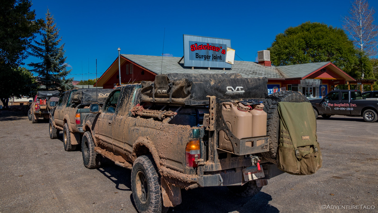
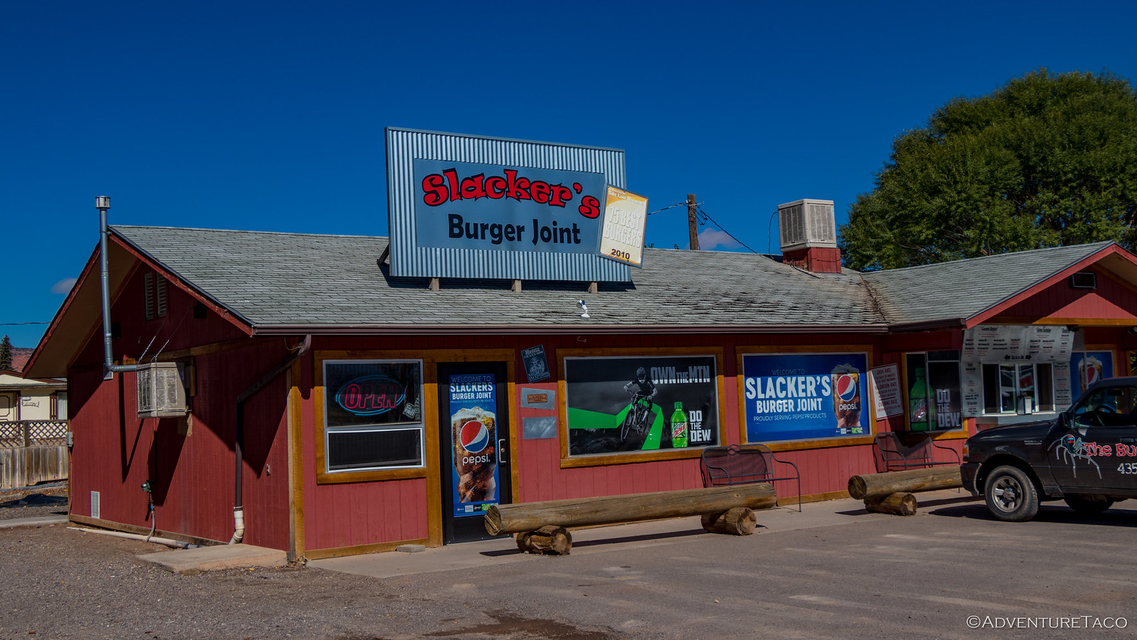
Burgers were ordered and thoroughly enjoyed. "Seems like we're easing ourselves back into normal life." I mentioned as we sat back after eating - no apparent rush to get back on the trail. We couldn't stay forever of course, and eventually we were back on the road and headed up towards Hens Hole Peak - snow clearly in our future, hopefully without too much associated mud.
But almost as soon as we started, we were stopped in our tracks again - the road closed ahead of us. Turns out there was a fire fighter training exercise going on sometime between July and October, and the good folks of the BLM didn't want to expose the public to any unnecessary danger.
Luckily, we found an alternate route and after a quick re-route, we were back on track!
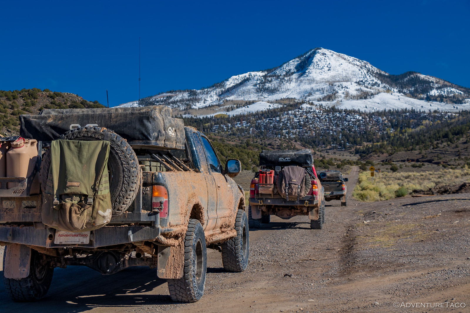
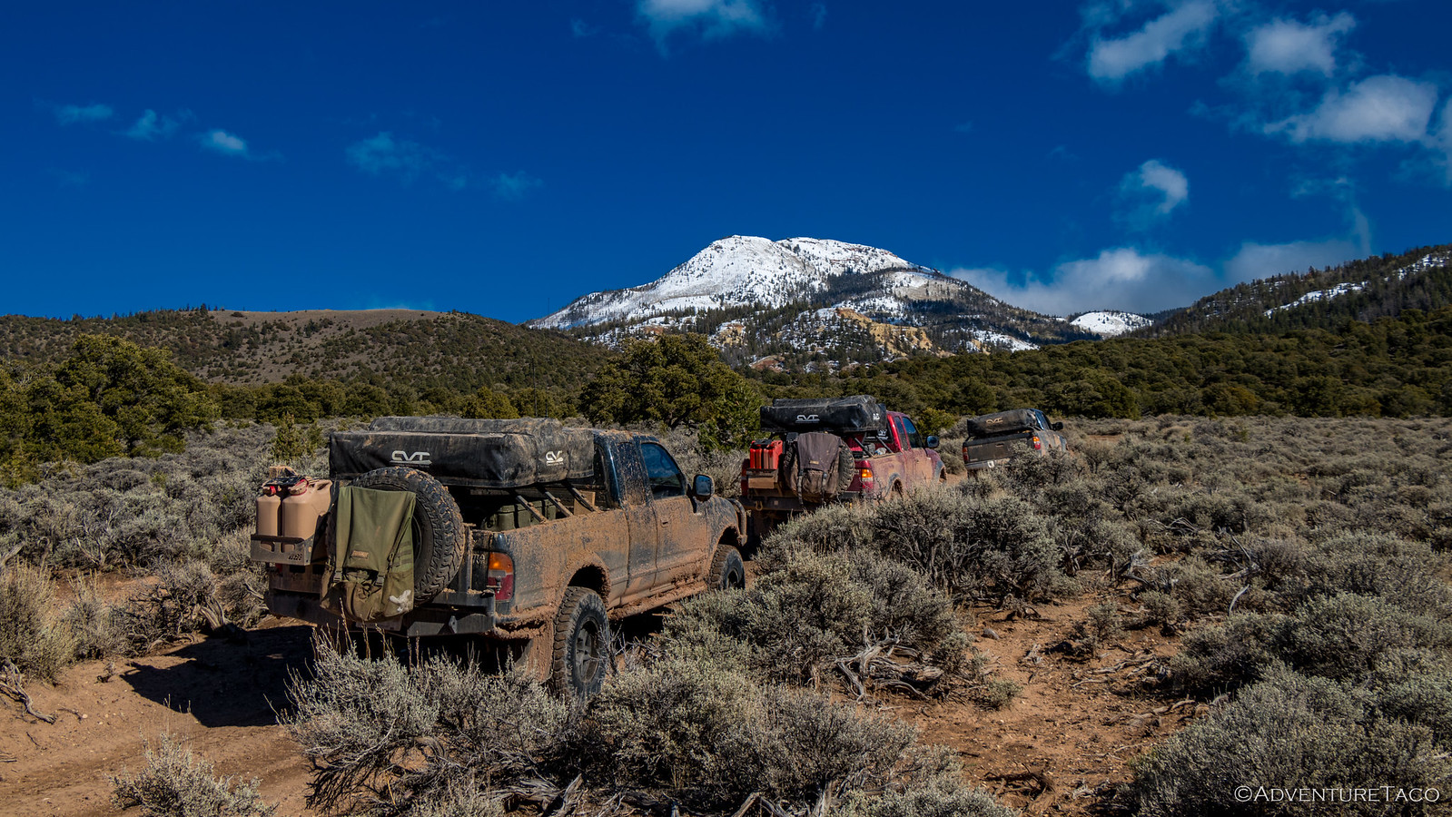
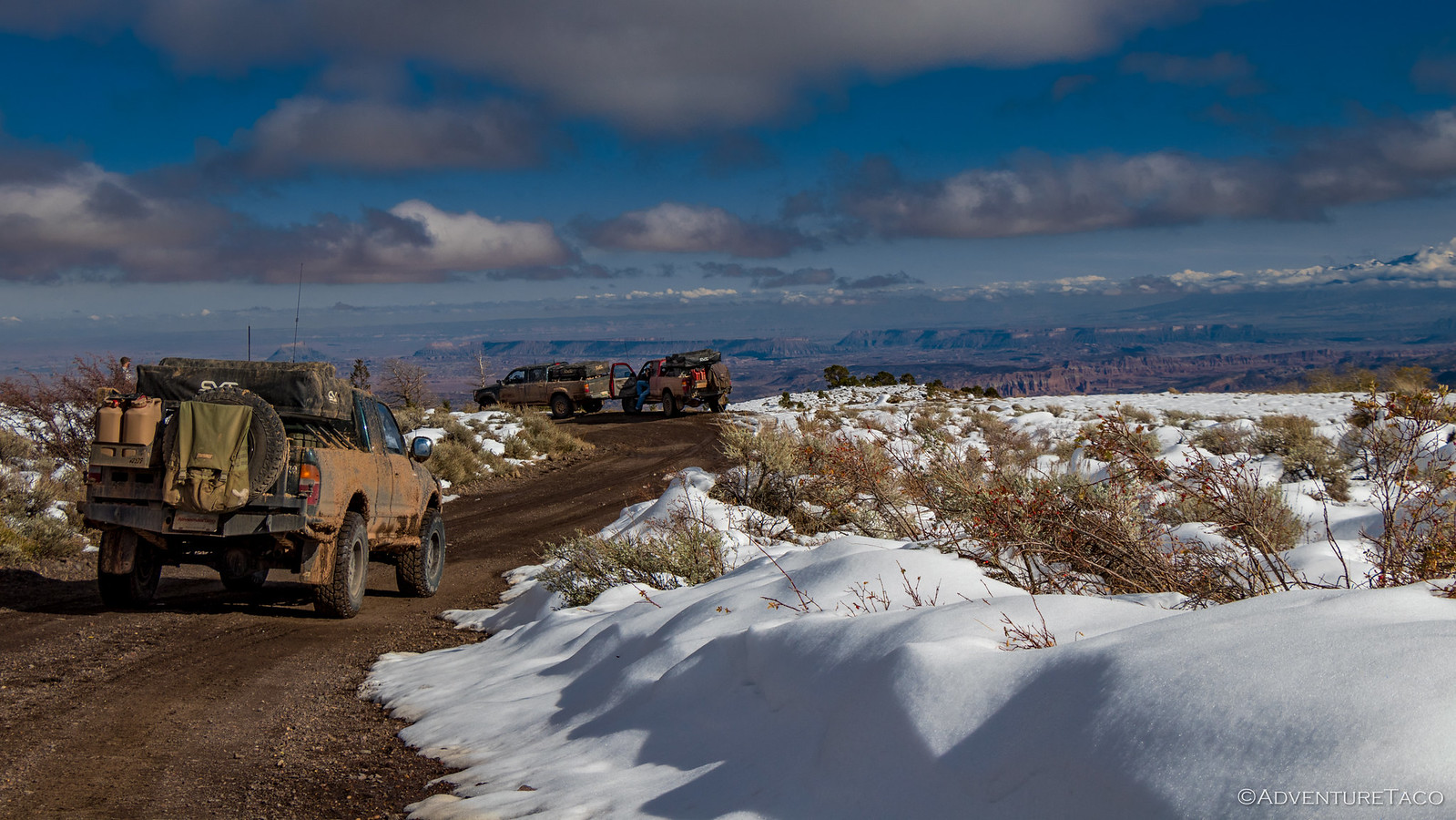
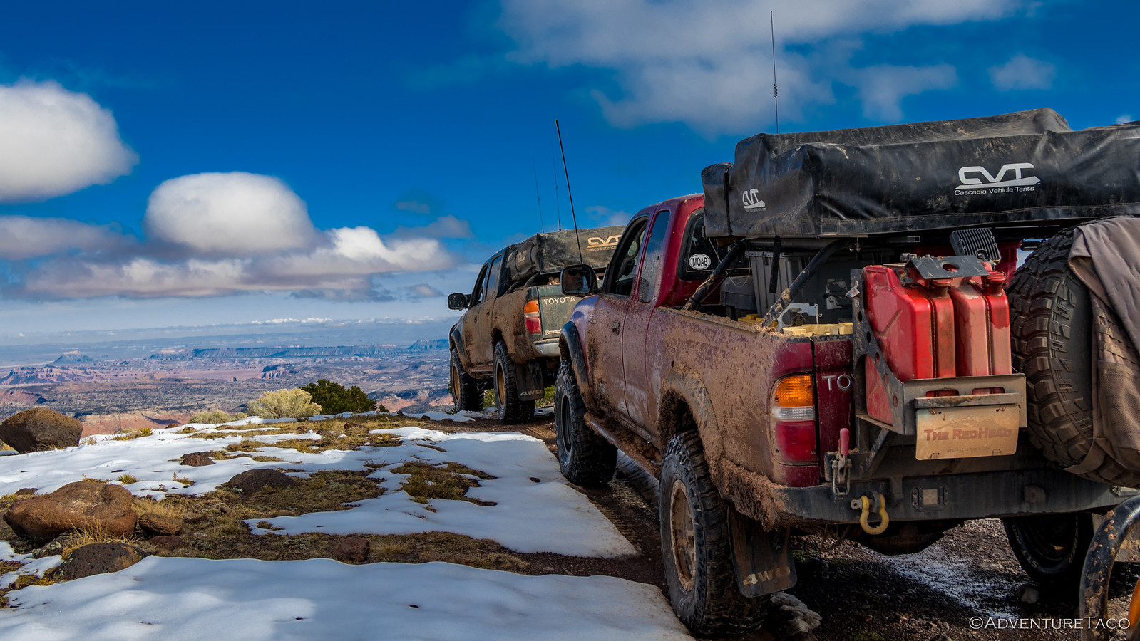
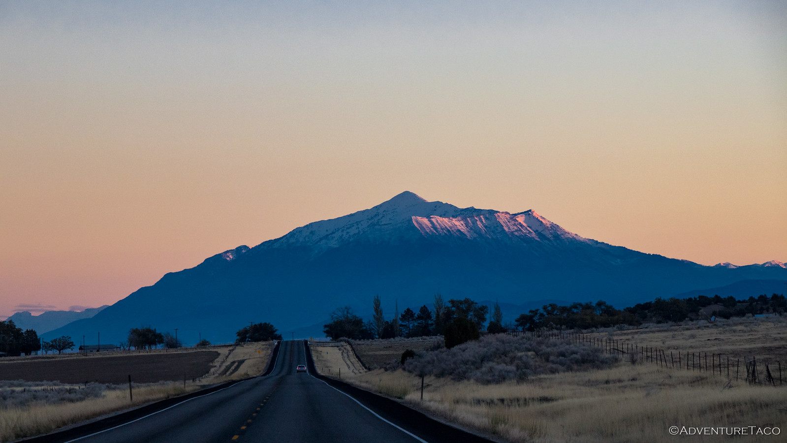
As we reached the pass, we got our first taste of snow - and it was great. The sun shining and the sky blue, this was a whole different snow experience than we'd had on previous trips, and we soaked it all in - Monte especially happy for the cooler temps.
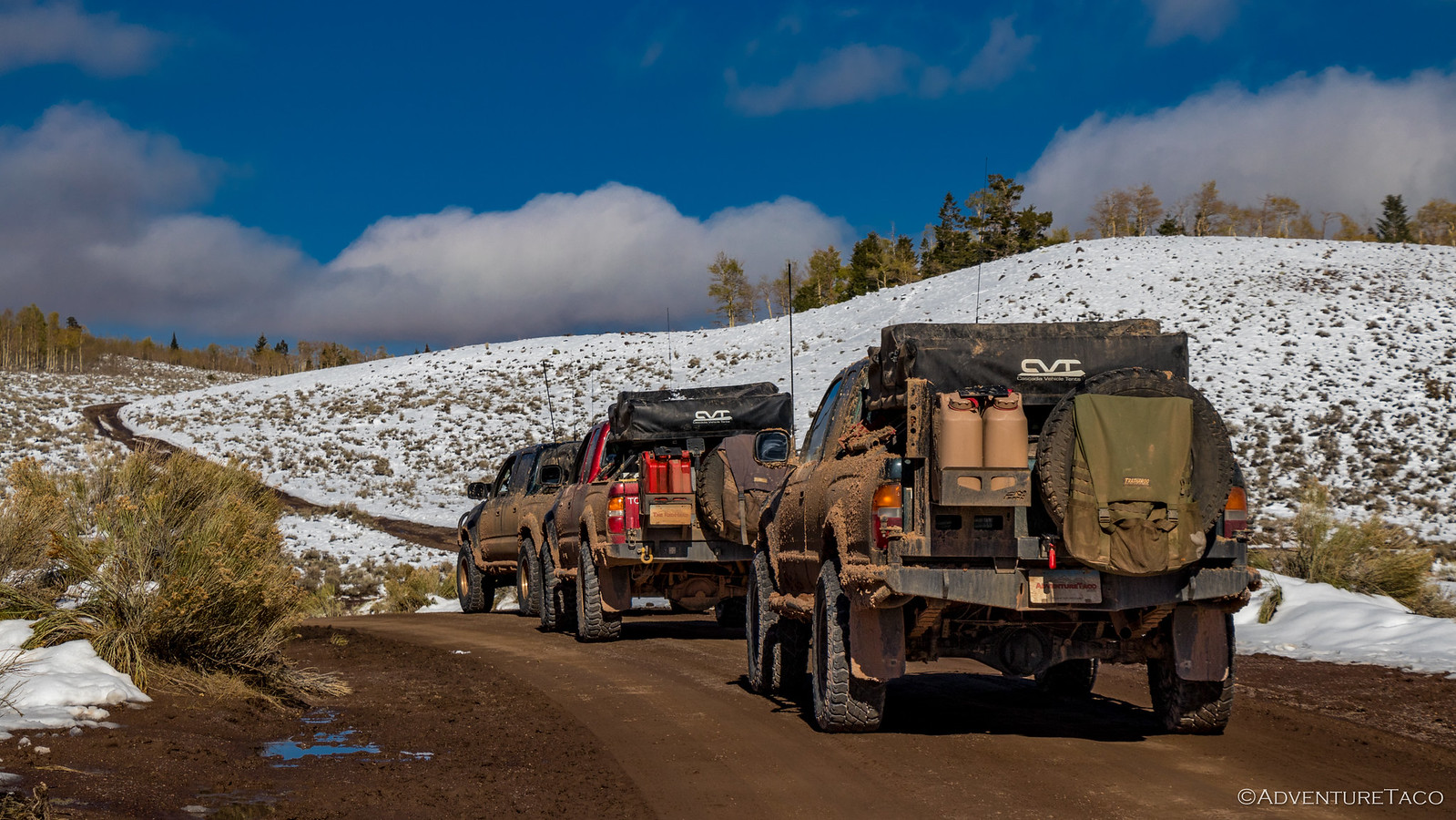


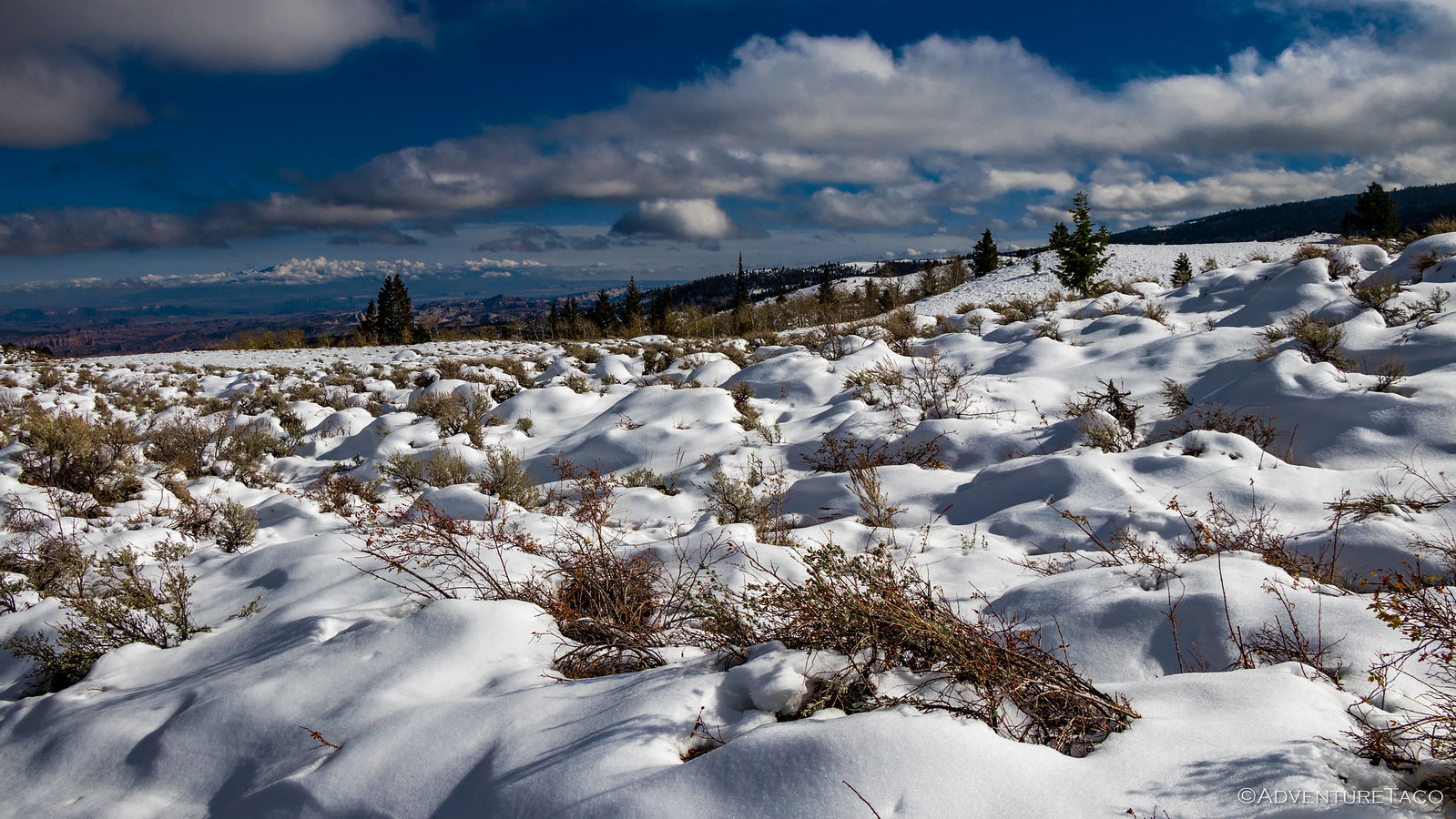
From viewpoint to viewpoint we continued to stop - each one unique in it's own way, the three of us happy to experience them all. And, as we started dropping down the other side, the warm, red Cathedral Valley sprawled out in front of us - quite a site to behold from the snow-capped mountains we now found ourselves on.
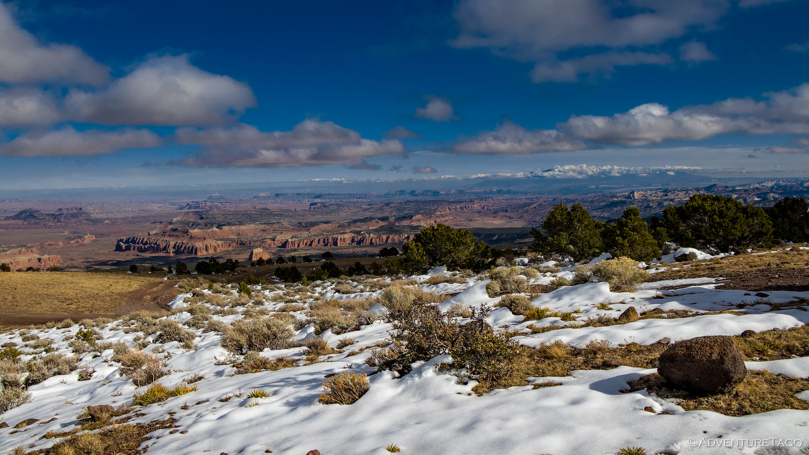

As we descended towards Last Chance Desert, the formations of Cathedral Valley loomed in the distance. In front of us, Solomons Temple; beside us, sandstone mesas - some slowing eroding into the valley, others standing tall beside it. And on the road - 2-3 day old tire tracks - Goodyear Duratracs, from our Xterra friends.
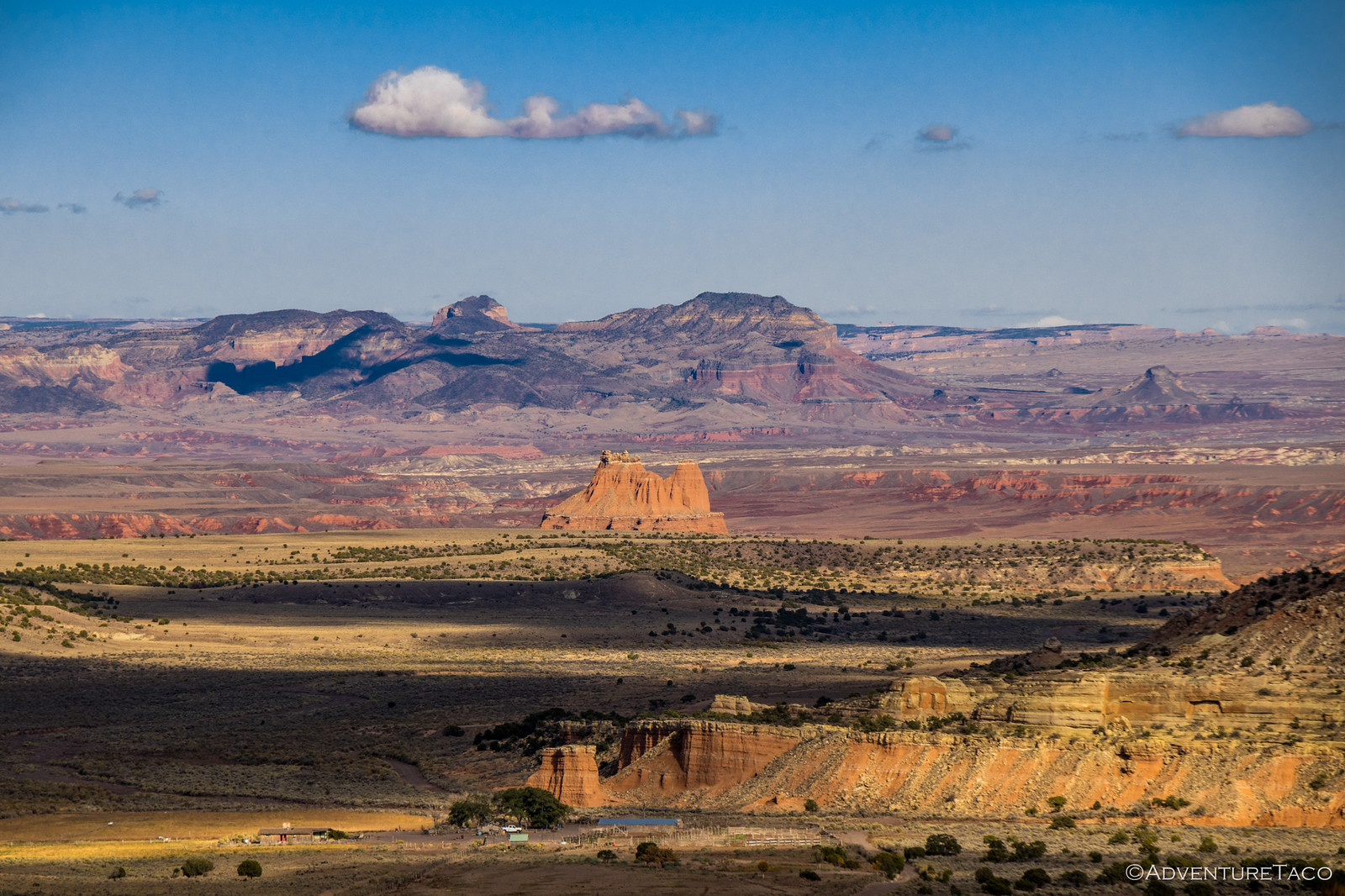
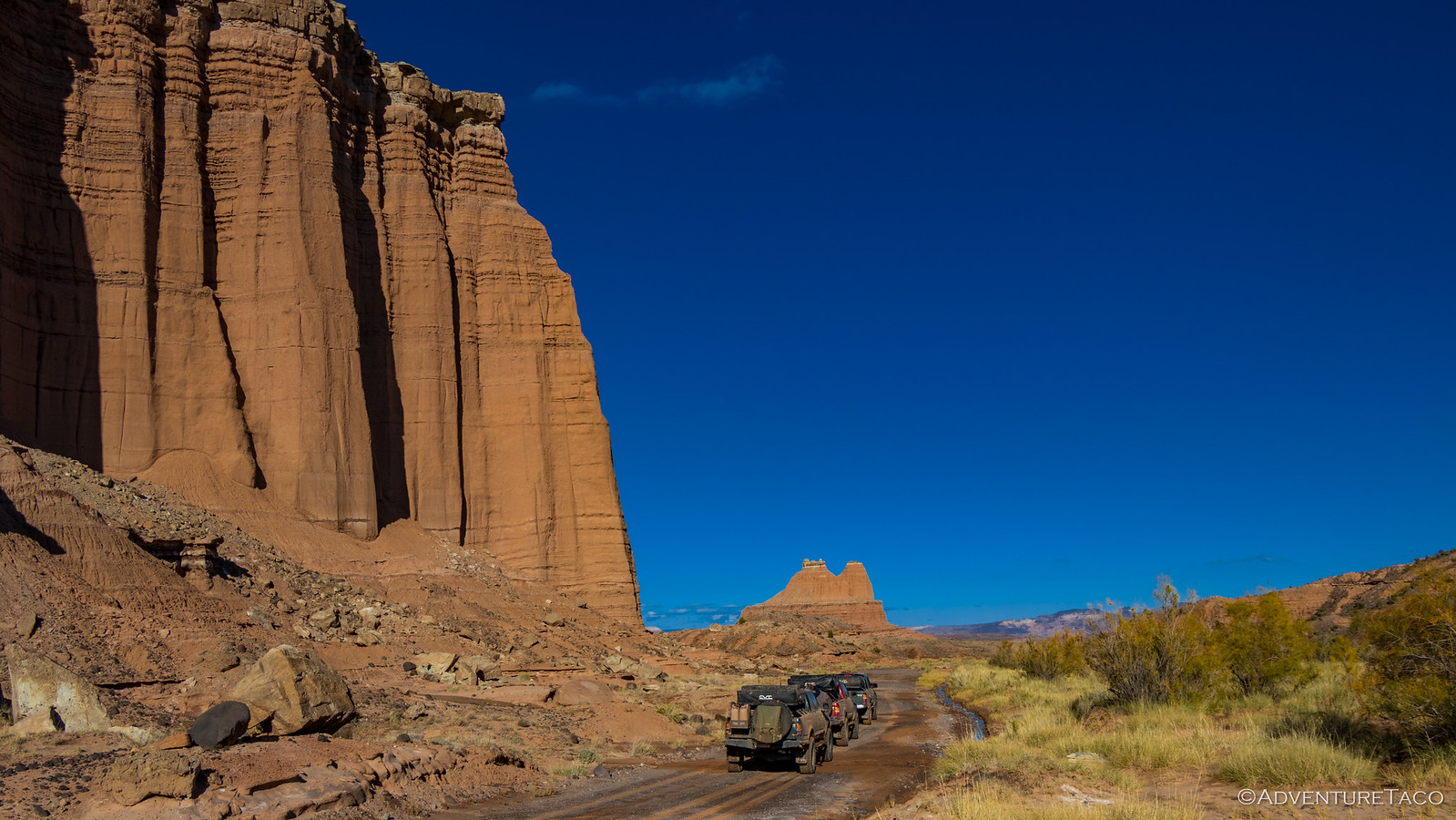
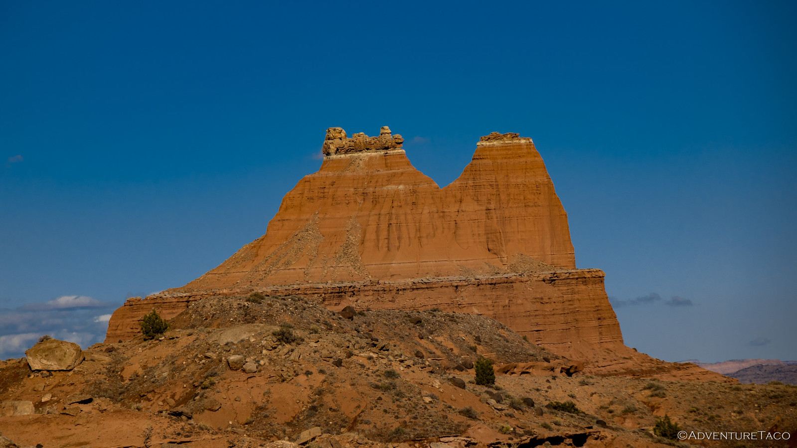
We eventually passed Solomons Temple - it's peaks some 350-feet above the desert floor, the top decorated by a white band of sandstone and a decorative cap of rocks. This peak is hikable - but not by us, and especially not on this trip - the summit guarded by sheer cliffs on all sides.
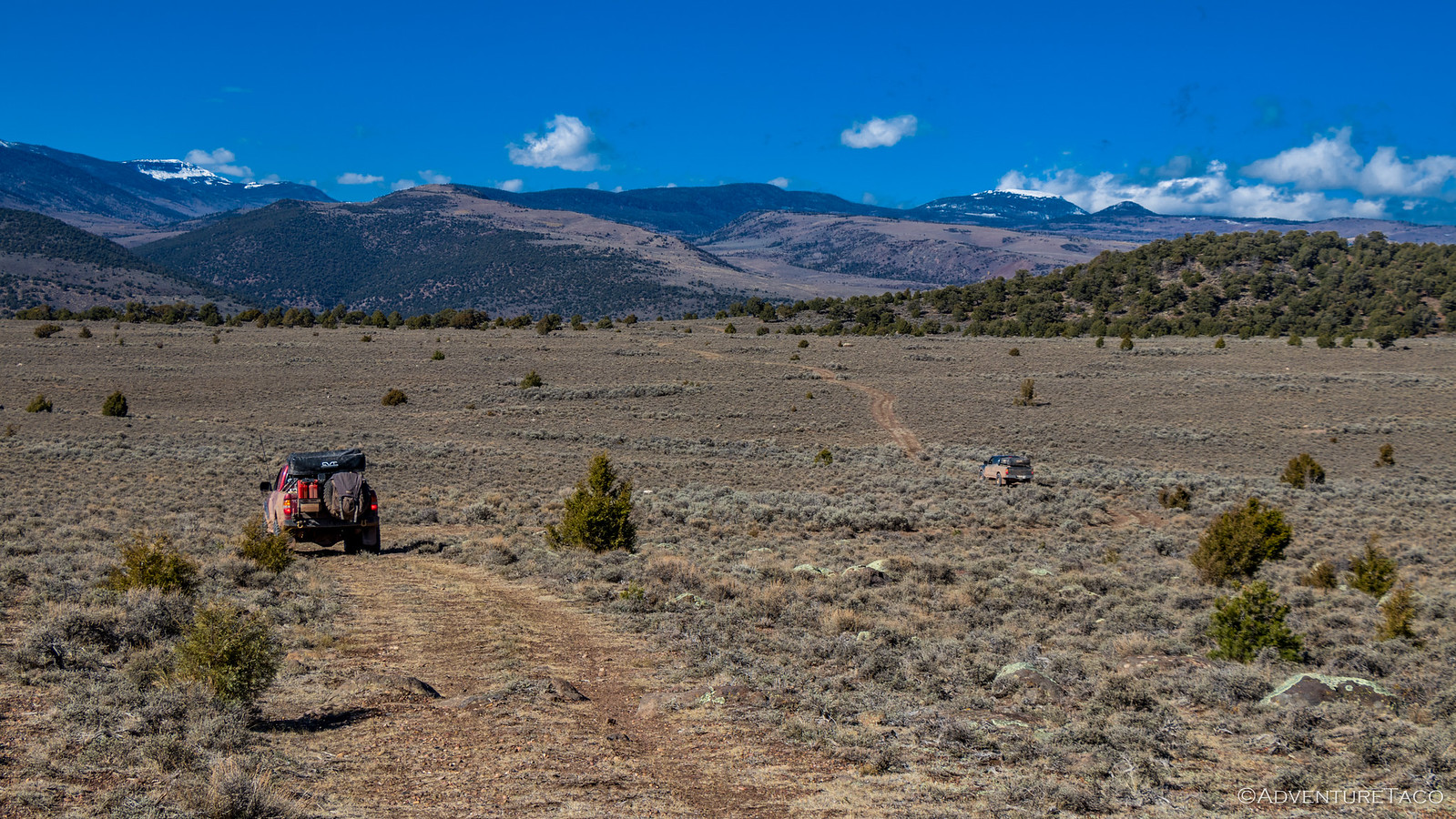
It was about this time that we started keeping an eye out for a camp site for the evening, the sun starting to drop in the sky to our west, our shadows getting longer. Still, we couldn't help but stop as the views just kept coming - Utah's super power.

As we made our way up and over our last dirt pass of the trip, a rock slide. Nothing major - the boulders were all easily manageable by Monte and I while Mike looked on. Well, not just looked on - egged us on for delaying the inevitable - our last camp. Perhaps he was right - a bit of delay distracting us from the inevitable end of an amazing trip.

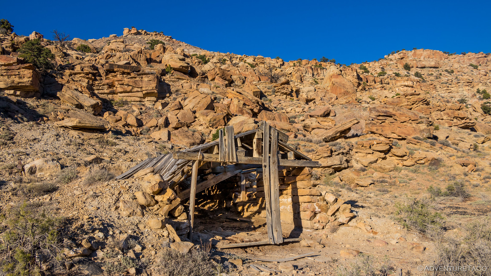
The rocks cleared, we moved on again - eventually stopping for what would be our last time - as we found an old, dilapidated cellar of some sort, built into the hillside on the side of the road. We were of course unsure what it'd been used for, but on closer inspection it appeared to have been built (or repaired) more recently than it might appear - some of the boards dimensional lumber; some of the nails round wire nails instead of square cut nails.
And then, just as we emerged from the pass, Mike spotted a promising offshoot that led east into what little tree cover existed out here along the edge of Last Chance Desert. "I think this looks pretty good. Come take a look." he called out over the CB.
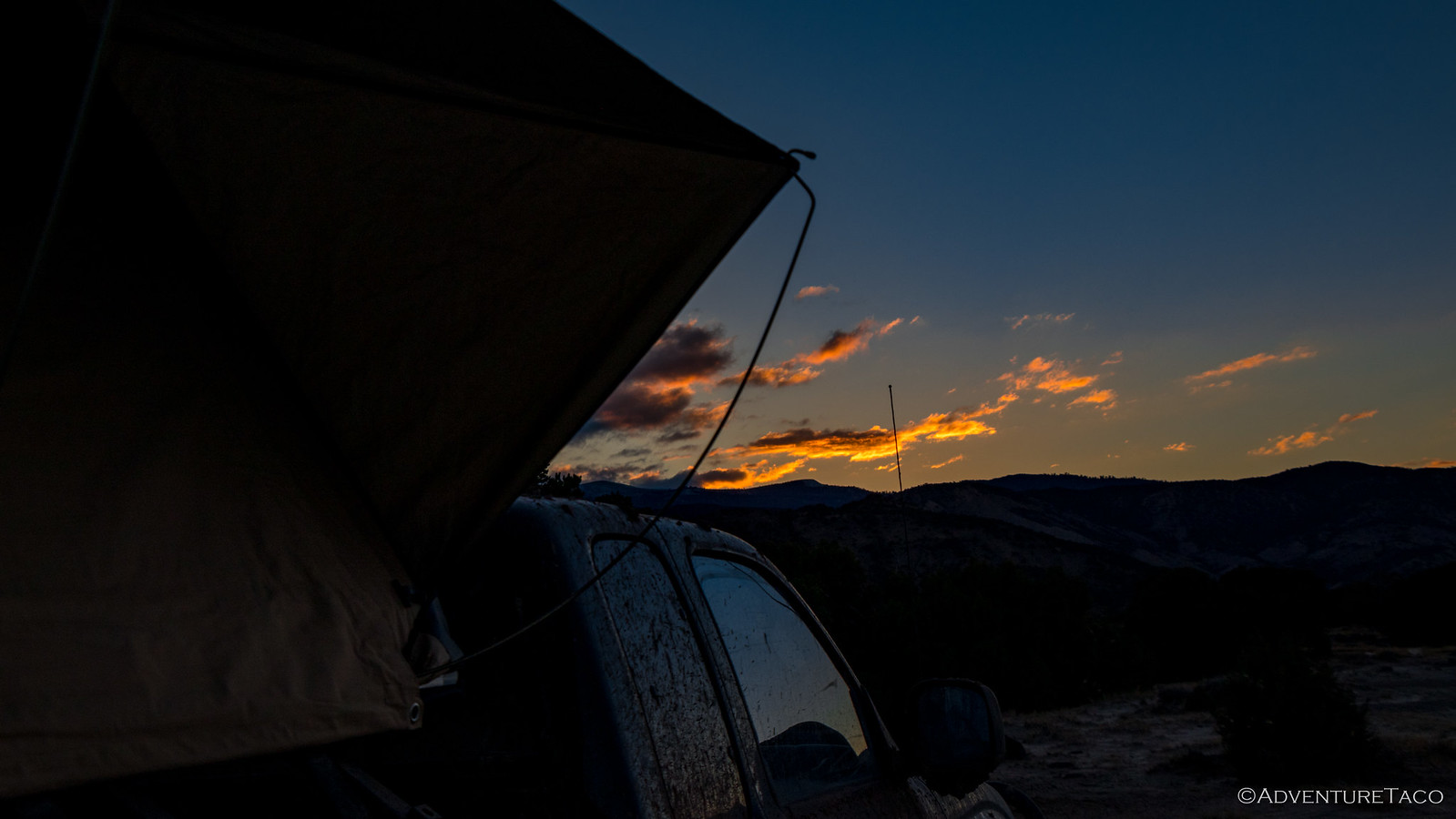
We did, and it was. We'd found our last camp. We each got ourselves leveled out, the evening light warming the landscape.
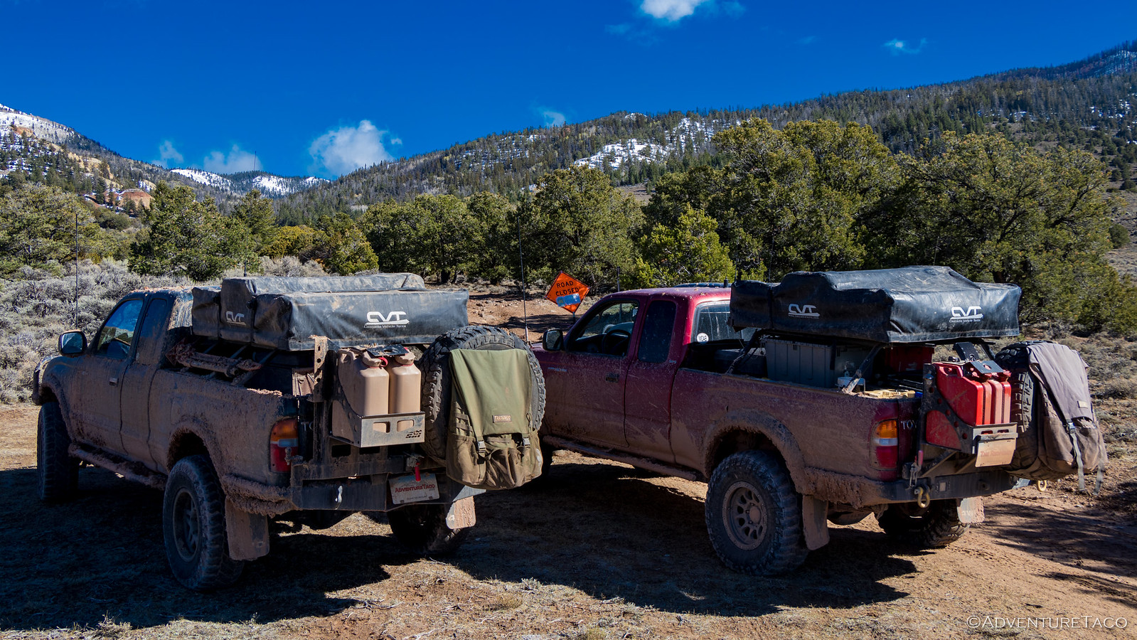
Setup this evening was a bit different than normal. All keen to get a bit of an early start the next morning, I was going to leave especially early - 5:30am - and try to make it all the way home in a single push. But we all wanted to be ready to go, and so before deploying tents, the first order of business was to air up our tires for what was only the third time in over 1,400 miles - a good 1,100+ of dirt.
And then as the sun set, we went about our business getting tents deployed and dinner made. We'd decided earlier in the day that we'd combine forces for dinner - Mike cooking up some of my potatoes and making guacamole for the last time, me cooking some of Monte's eggs, and Monte frying up the last pound of bacon.
Breakfast-for-dinner around the camp fire and under clear skies, with the last few cookies I'd made for dessert. Tasty.

Our campfire that night was one of our best of the trip. With two bundles of wood, we kept it burning hot - the heat helping to cut the chill of what was clearly going to be a clear, cold night. As we had the night before, talk was of our favorite parts of the trip and places to which we wanted to return - either to re-explore or see in more depth - the list long enough for several more trips!
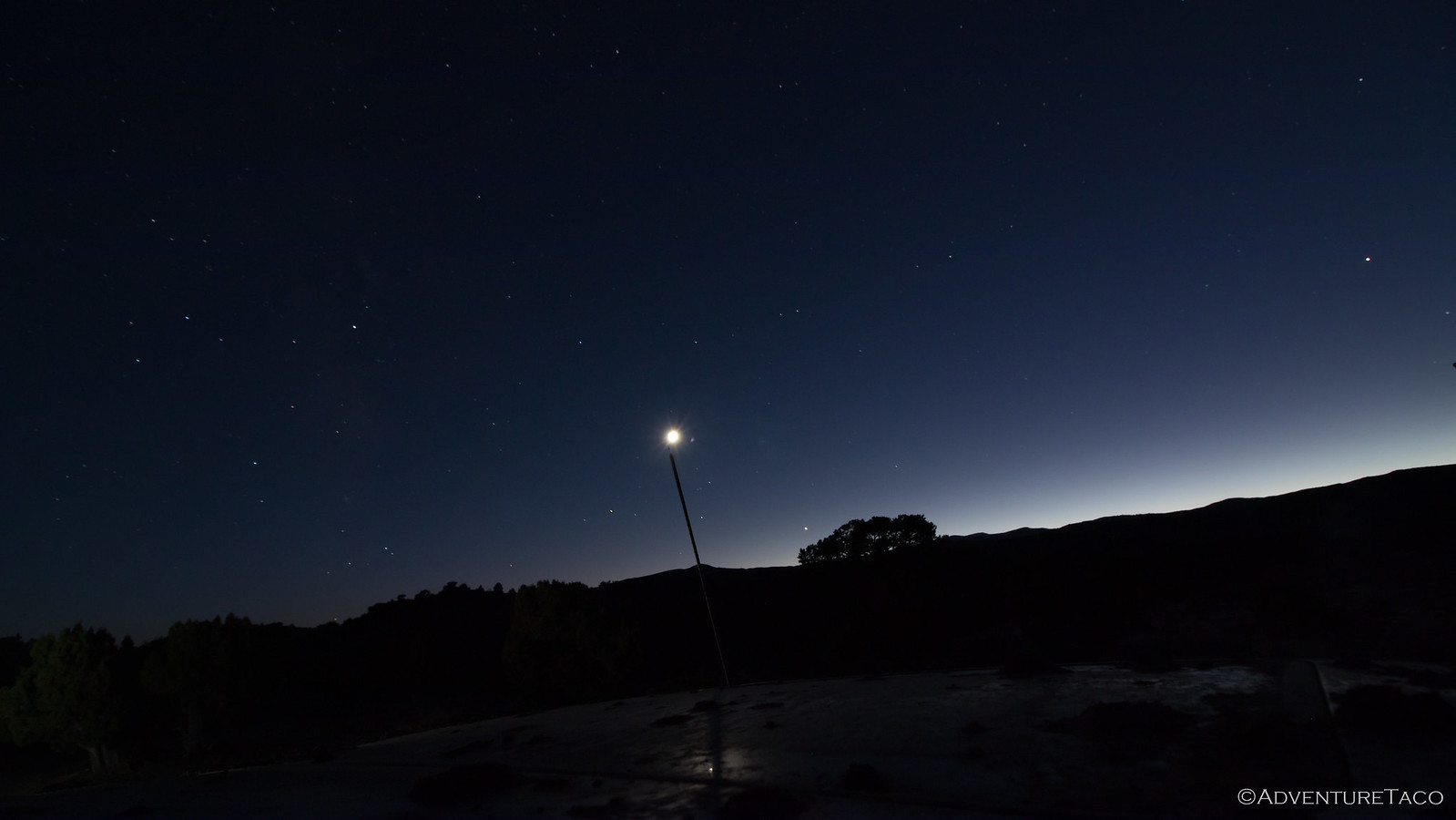
As we did, my camera clicked away on Monte's tripod in the background - his attempt at the only star photo of the trip - the sky finally clear of clouds. We'd find out after several hours that the night chill had fogged up the lens early on - only an hour or so of photos salvageable.
Despite our best efforts, the wood supply seemed endless. With an early morning and a long drive, we decided to call it an evening just before midnight, a couple wedges still unburned. And so it was that it was time for a round of "good trips" and "safe travels" - my departure time much too early for those in the morning - that we climbed into our tents, moon and stars in the sky.
- - - - - -
October 13, 2018.
I woke early with the help of my alarm. 5:00am, it was by far the earliest I'd been up all trip and not only was it dark, it was cold. Freezing cold, literally. The clear cold night had left a heavy dew on everything and the tent was completely covered in a relatively thick layer of ice crystals. Nothing I could really do about that - so I pulled on my gloves got to work putting it away, the sides like cardboard as I folded it up.
As I pulled away at 5:30am I was both glad to be on the road toward home, and sad that that the trip was over. It'd been another amazing adventure through our beautiful lands - some places that few in the world ever see.
Within a few miles I reached the highway and headed north, the sun rising as I neared Salt Lake City, UT, and setting as I passed through the familiar state of Oregon.
Through it all, the truck performed flawlessly, even after two weeks of abuse - and after 18 hours, my 970-mile trip home would be complete, much of it driven into a 12mph headwind. A "brutal" headwind is how Mike described it, having followed the same route several hours later.
But, we were home - safe and with amazing memories. And eager for our next adventure.


What a fantastic adventure....thanks mucho for the great job recording the trip and for the great photos all the way through. FANTASTIC! UJ
Glad you enjoyed it, was a fun one for sure! Would be great to get one in with you and pops this year :).
Thanks for sharing this awesome trip with us. the write up and photography was great and has inspired me to plan some trips in these areas.
It is the first trip report by you that I have read, but I'll be reading a lot more for sure. What blog software are you using for your site?
Hi Keith,
So glad you enjoyed the trip! You can always sign up for emails when new reports are posted - https://adventuretaco.com/subscribe. The software I'm using is WordPress.
Wow rad trip apprecaite you taking the time to post these adventures. I def have some spots Ill be visiting. What dates were you in the grand canyon cause i must go see the aspens this fall.
Thanks,
Keith
Hi Keith,
Glad you enjoyed it! We were there at the beginning of October (first week or so) and the whole trip was the first half of October. Of course, every year is a little different, so make sure you check weather and road conditions, etc. before you go.
Also - Grand Canyon requires permits for backcountry camping, so that's something to keep in mind as well. We tried to stay outside the park boundaries as much as possible just to save money (...though, I think it wasn't that expensive - maybe $30-60/night for 3 vehicles).
Have fun, and share the trip report if you go!
This trip is bringing back a lot of memories! Excellent write-up and pics. I am curious how low you normally air down to, and if you have to air up for a stretch, how high do you go?
Although it might vary lower if doing a lot of sand or technical crawling, I usually aired down to about 18-20psi. If there was a bit of pavement I would normally just roll as is, not going too fast for too long. For better or worse, I just tried to avoid airing up and down a lot.
Hey Chris - cool to hear that there are some memories being jogged for you. Did you run the same (or a similar) route to us, or just in the same general area? (And when?)
For airing down, it sounds like we're pretty similar. I generally try to get to 17psi, though it seems to vary between about 15 and 19 depending on how closely I'm monitoring the deflators as they do their thing. For pavement, I generally try to make a call based on distance. When aired down, I keep the speeds to 50mph or slower, so if I'm going more than about 60 miles, I'll usually try to air up, just to save time (airing up takes about 10 minutes for me, so at 60 miles, it becomes more advantageous to air up).
Hope you enjoy other stories as well! And reach out any time, I love hearing from folks when they read the stories. ?
For me -because most of my trips were only 4 or 5 nights- your travels covers a multitude of trips into those areas between 2009 and 2018. Most of those very same roads were taken at some point, the big one I never did was Grand Bench... we came down past the coal seams on Smokey Mountain Rd. Trust me when I say you can do another trip into Northern AZ and Southern Utah and see MANY more things (and possibly revisit a couple if desired). One of my favorite aspects of overlanding is the trip planning, so if you ever want ideas or suggestions let me know!
Nice. Most of my trips are also of the 4-5 night (or really, 3-5 night) variety, but there are a few each year that are "bigger," like this one.
As for exploring the area - I'm 100% sure you're right - I bet I could do dozens of trips for many years to the area and still have more to see. That's the great thing about the west, really - there's just so much out there! In fact, ppeaking of southern Utah, you might enjoy a couple trips I did down there last year:
Oh man, just reading through those a bit get's me all excited to get back down there now that my Death Valley season is coming to an end for the spring, hahaha.
And I'm always interested in suggestions. I too love the trip planning, so if you have places you think I'd enjoy, I'm all ears. I also understand that some of them might be better shared via email rather than here, which you're more than welcome to do. (and thanks!)
Hah, guess I spoke too soon... so I did a deeper dive into your site so I don't embarrass myself again! (hopefully) More great trips indeed. I'll tell you what, that area around and north of Bluff with the north-south ridges and Cedar Mesa is just great. Maybe not as recognized as some areas, but SO much to explore.
I highly recommend doing the Moab area, if you haven't. If you're like me, doing 4x4 for the sake of 4x4 isn't the goal, but there are still some really fun moderate "moab" trails to do that have great views and other points of interest, and/or link you to other areas. But it's mostly about the amazing trails in and around the Needles and Island of the Sky districts on Canyonlands NP. World class stuff.
On the GSC/Escalante side, if you haven't completed Hole in the Rock road and the Cottonwood Canyon area to include Bryce, those are certainly areas to check. This isn't exactly secret stuff and I'm sure you already have some sort of future plans into those common regions.... but like I said, hit me up on email before you go and I just might have some tips or suggestions with pics/maps.
Now worries Chris - there's a lot of content here, and I certainly don't expect that you've read through it all - though you're welcome to! I try to make it easy to consume just what you're interested in, so you might find the trips organized by state or by destination to be interesting starting points.
I'll definitely shoot you an email - thanks for that offer. My first trip down to southern Utah will likely be in April sometime, and I'd love to get some pointers on where to go. I'm definitely more of a Cedar Mesa guy than a Moab guy (I'd much prefer a drive to a nice hike than a trail for the sake of 4x4 and a parade of people to boot!)