
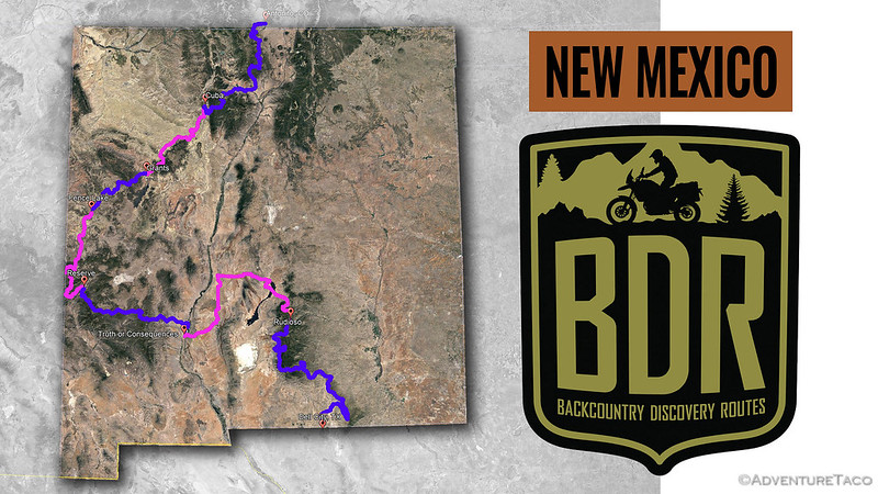
Stage 2 of the New Mexico Backcountry Discovery Route - Ruidoso to Truth or Consequences.
We pulled out of Ruidoso a little after 6:30pm. This time of year, we weren't at any risk of not having enough light to find camp - the sun didn't set until 8:15pm - but we'd already had a long day and were looking forward to a good night rest.
One of the things I do before going on any BDR is research the route a bit to find side trips that might offer a spectacular view, or an interesting attraction. One of our favorite detours - especially after some great experiences on the Idaho BDR - are fire lookouts.
The best of these are manned by USFS personnel who are almost always happy to chat with us about the nuances of their lookout and about our adventure. As outdoorsy people, they find us just as intriguing as we find the job of a lookout! And, in the rare situation that we happen to be near a lookout in the evening, they can be a great place to camp - with permission of course - given the 360 degree views that they afford.
As luck would have it, I'd discovered a lookout - the Monjeau Lookout - just a few miles outside of Ruidoso, and as we were pulling out of town, I realized that I should do a quick check online to see if it was open. The first review on TripAdvisor wasn't promising.
Locked gate. ★★☆☆☆
My poor rating is not due to the Lookout but due to road being closed about 1 mile from the Lookout. No warning until you get to the lock gate. If you can there, it’s a great place!
Still, it was only 10 miles or so to the lookout, so we figured it was worth the risk. And, if couldn't get to the top, maybe we could camp below the lookout and hike up before sunset or in the morning before breaking camp.

Just as we turned off of pavement, I spotted a black bear along the side of the road. Naturally, it spotted us at the same time, and lumbered away. Brazen as ever, I stopped the truck and hopped out with the camera, letting @mrs.turbodb know that I'd "be right back." She wasn't thrilled - and of course I don't recommend this for anyone else - but I planned to keep my distance and my head on a swivel as I followed the bear over reasonably sparse terrain, so I figured I'd make out OK.

"Me, heading into town for some dumpster diving? No, I've just been sitting here on this log all evening."
My stooopid quota met for the day, I pushed the skinny pedal in the Tacoma and pointed it uphill. Gaining altitude quickly, we could soon make out the lookout perched high above the burned forest around it.

Why is it that most lookouts seem to be in the middle of a burn area?
We passed one, then two unlocked gates! Pretty soon, we were rounding the final bend in the road - we were going to reach the lookout!

What a beauty!
Made almost entirely of stone, Monjeau was a grand lookout to be sure. At 9,641 feet, it was also high enough to make the outside temps rather pleasant, something I think we were both happy about. This lookout is the second on this spot, constructed in 1940 and considered the most unique in the southwest due to the rustic construction. Listed in the National Register of Historic Places in 1988, it turns out that this lookout is no longer staffed, but is heavily visited by hikers and those on the hunt for great views of the area.

Standing bright against a cloudy sky.

A lookout or a fortress?

A commanding view from the middle level (of three).
With the sun peeking out from under the clouds, we wasted no time in finding a nice spot to setup the tent and make dinner. Tonight, dinner preparation consisted of pulling some pre-prepared containers from the fridge - antipasto salad for me and Spanish tortilla for the lady - and finding a nice spot to sit on the rocks for the light show.

My kind of campsite.

Rays of light.

Not your typical sunset.
With no cooking or cleanup beyond licking off our forks, we wrapped up dinner and climbed into the tent with light still in the sky. It'd been a full day, but I dare say we ended it on a high note.
The Following Morning...
Having looked out the tent door half-an-hour before sunrise, I opted to stay in bed for 30 minutes rather than snap photos of a cloudless sunrise. Our position high on the mountain though, it wasn't long before the full force of the sun was bearing down on the tent, warming it and reminding us that we still had nearly a thousand miles of road in front of us, and that we should get going.

Good morning sunshine.

Is it just me, or is it a bit clearer than it was yesterday?
At such an early hour, we decided to hold off on breakfast until a more reasonable time, and got the tent put away and the truck rolling in about twenty minutes.

Down we go.

Some nice views of the Capitan and White Mountain wilderness to the north. Guess who is headed that direction?! 
With well graded roads, downhill is almost always faster than up, and we covered the miles back to Ruidoso - then on some pavement - and finally back onto dirt in no time. We lost 2000' in the process, and boy were we reminded of how lucky were to have been at elevation for a cool night sleep.
Our first attraction of the day was Bonito Lake, which was signed as closed about a quarter mile from the southern boundary. As we approached the razor-wire fence surrounding it, we both wondered what could possibly be going on. And then we saw it.

Bonito Lake is closed. There is no more Bonito Lake.
With nothing to see, we continued on, the road once again winding its way through woods - not at all what we were expecting for New Mexico.
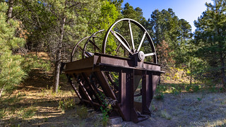
Some sort of hopper for mining in Tanbark Canyon.

An escaped bus from the International Car Forest.

Rusty boilers for a nearby mill; now just concrete footings.
Up and down, in and out of the trees, we made good time on what might have been our first "through the woods" trail of the trip. It was refreshing to finally be off of pavement and gravel roads, but the feeling wouldn't last long.

Are we in New Mexico or California? (Lincoln NF)
Just before wrapping up our before-breakfast-time in the Lincoln National Forest, we stumbled upon this beauty. At first we thought it was a bronze statue, but closer inspection - as I tried to find some angle to take a photo in the harsh light - revealed it to be concrete and paint. Still, not something you see every day along the side of a dirt road in the middle of nowhere.

Bronze Baby (based on size) Buffalo. Baby Bronzalo.
Twenty miles of pavement later, we found ourselves approaching Valley of Fires State Park. For me at least, the name stirred up memories of Nevada's Valley of Fire State Park, a fantastic array of brightly colored rock. You can imagine then, my surprise - and perhaps a bit of disappointment - to discover that this Valley of Fires was actually a volcanic wasteland, much more akin to Oregon's Jordan Craters in the Oregon's Owyhee Canyonlands.
Still, it was time for breakfast, and we're always curious to see volcanic activity so we pulled in for a short stop. Almost immediately we were attacked by swarms of several hundred gnats. Needless to say, we ate as quickly as we could, moving around the entire time!

Land of the devil gnats.
44 miles long and only a few miles wide, the lava (1,500 - 1,000 years old) represents several long, thin overlapping flows. The surface still exhibits many of its original features: a rumpled, ropy, shiny surface formed from lava the consistency of taffy; caves and tubes; pressure ridges where thickening lava pushed up through breaks in hardened crust; domes, blisters, and bubble like vesicles; and many deep fissures resulting from shrinkage of the basalt as it cooled. (Roadside Geology of New Mexico) Most interesting to us was how much more vegetation there was on the relatively young flow. Only twice the age of the still barren Jordan Craters, it was clear that New Mexico's desert environment meant that cactus and yucca were pre-adapted to grow in the nooks, crannies, and shallow depressions of sand that gathered on the lava. It was, the perfect desert habitat.
I think we were done with breakfast in under five minutes, and despite the 90+ degree temps, we had the windows open as we turned off the pavement, just to clear the cab of the dastardly little gnats.
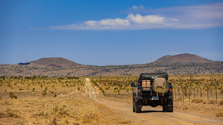
Through the desert, toward Broken Back Crater.

This guy was keeping an eye on things before we disturbed his peaceful morning.

The well graded roads sure made for easy (and fast) travel.

Just like human kiddos, this guy was a little timid as mom came over for a sniff and a pet.
Our route through the ranchland around Broken Back Crater proved to be a couple-dozen mile loop that brought us back to the same highway we'd been travelling north on as we passed through Valley of Fires. The highway had turned, and was now making its way west, the Oscura Mountains rising up in the distance.

More pavement.
By the time we turned south - now heading away from Colorado, another twenty miles had ticked off the odometer. The reason was clear soon enough - we'd looped around the White Sands Missile Range, and were now hugging its western edge as we sped along a soft sandy road toward the end of the stage at Truth or Consequences.

WARNING: WE MIGHT BLOW YOU UP IF YOU COME OVER HERE.

One of us was hoping to see an F-35 streak overhead, loosening an array of explosives on some unsuspecting plot of desert.

To our west, cows and Sand Mountain.
White Sands Missile Range - at least the portion we skirted - was more than 50 miles long, and pretty soon, things got boring. Despite my hopes, @mrs.turbodb's wishes won the day and we were not used for targeting. We did however stumble on an old tanker truck that was either used to help build the road, or was spared destruction by poor shooting.

An old relic.
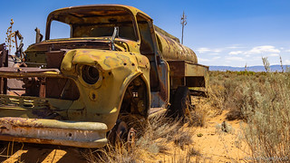
All the glass was mysteriously missing.

Waiting patiently in the desert.

Seems obvious, but better safe than sorry I suppose.
Nearly half an hour and no movement of the steering wheel later, the only other interesting thing we saw along the missile range came into view. On the wrong side of the fence, we didn't know what it was at first, and I suggested to @mrs.turbodb that it was a bunker where guys sat to watch the show. "We should hop the fence and knock on the door, to say 'hi,'" I said. She was not amused.

Turned out to be a generator for some nearby video cameras.
With no one to greet - or be arrested by - we continued on. At one point, we passed through a gate, and I mentioned that the race was now on - could we get through the range before we were targeted? It would take expert driving for sure, and we should keep our eyes to the sky.
She was not amused.
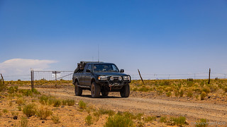
Time for a little excitement!
Note to Keyboard Commandos of the Internet: this gate was to a ranch, not to the WSMR.
At this point, we started to veer west again, the end of the stage now less than an hour away at the little town of Truth or Consequences. As we were speeding along, I was still joking that we might be under attack, when my story was suddenly backed up by an old missile stuck in the ground on the side of the road.

A lot less dramatic, once you notice the erosion. And the construction with household building materials. 

This is the White Sands Missile Range's own little Mojave Megaphone. Still a fun little piece of art.
Approaching Truth or Consequences, we noticed a huge rain cell in the distance, passing directly over town. Sheets of rain were streaming down, and though we were too far away to hear the thunder, lightning flashed overhead. I didn't say anything at the time, but I hoped that whatever roads we were taking out of town would still be passable once the storm blew through.

The clouds were looking nice - or ominous - depending on your perspective.
The trip along the missile range had taken us quite a while - no doubt due to my frequent stops to check out this or that little thing along the road. Still, we'd really only just started this started this stage when we'd woken up this morning, and by 2:00pm we were only a few miles from the end. And we were hungry. Our late breakfast had held us over for a bit, but a complete lack of shade as we'd raced through the desert had kept us on the move as noon-time came and went. But then we got lucky.

We were ecstatic to find a nice shady area along the Rio Grande River, just below the Elephant Butte Dam.

A spectacular sight, and a popular place to park your party boat. The Lake Powell of New Mexico.
Lunch in the shade was pleasant - if still a bit warm with air temps in the high 90s °F - and having finished the cherries we'd picked up the afternoon before, we packed up the Tacoma, sipped a bit more warm water (gross!) and drove the final five miles into town.
As we did, the full force and effect of the thunderstorm rained down on us - a strange experience given the temperature - but only for about three minutes or so. Everything was thoroughly soaked, and the drainage ditches on the side of the road were overflowing at times. We were getting a little taste of the monsoon season we'd heard so much about.

We'd reached T-or-C!
T-or-C got its name from an NBC game show. Featured on both the radio and on TV, it was called (you guessed it) Truth or Consequences, running on-and-off through the 1940s and 50s. Looking for a 10th anniversary shtick, the show announced a contest in 1950 where the hosts announced that they would record the show from the first town to rename itself after the show. Hot Springs, Mew Mexico bit, officially changing its name on March 31, 1950, and the program was broadcast from there the following evening.
Stage 2 was now in the books. But rather than celebrate our success, the real question on our minds - as we filled up with fuel - was whether the roads in front of us would be passable. Only time would tell.
The Whole Story
Love Backcountry Discovery Routes? Check out the
BDR Index
for all the routes I've run - they are fabulous!






Bitchin lookout, of all the lookouts I have seen this is the first one built by stonemasons, makes me wonder if this was built by the CCC. With more beautiful views of the American West, we are blessed to live in this part of the US.
I am looking forward to some more exploring here in Idaho after the weather cools down a bit. Keep up the exploring and traveling and for sharing your photos and stories with us.
Thanks Kenny! That was a very cool lookout, and as you suspect, built by the CCC in 1940. Have fun there in your neck of the woods, I'm headed that direction soon for some high-mountain exploration. Haven't been to ID in nearly a year, so it'll be great to get back!
Good posts, but PLEASE use correct spelling when talking about our landmarks and destinations. No, I am not a grammar nazi but if you take the time to write about something, maybe do a little more research (or spellcheck?) It's BONITO Lake, not BONITA... and because of a terrible fire, they have been dredging the lake and rebuilding it for a few years now. Yes the lake is closed, but you can still camp out in and around that area, which is absolutely gorgeous... And PLEASE don't encourage or advertise that you are petting a wild horse. I've seen people kicked and bitten because they wanted to touch a wild animal or take a stupid selfie with it. THEY ARE WILD FOR A REASON...
Also, Valley of Fires is not a "wasteland" as you so eloquently described but is actually a sacred place to the natives of the area and is a very important piece of history (if only you had done some actual research?...) That statement shows your extreme lack of respect to the land and the people who live here....
Thank goodness we were only a pit-stop and that you moved on.. ✌?
Anna - I'm sorry to hear what you took away from the story, and I hope you can read it (and other stories) in a more positive light in the future. If you are at all familiar with my adventures and writing, you'll know two things: First, that I absolutely love getting out there and seeing the beautiful land in which we are fortunate to live; second, that I am always as respectful as possible and looking to learn. I'll try to address each of your points, however, since it seems that you felt otherwise, at least on your first reading: