It was nearing 9:00am when we pulled out of our sheltered camp spot on the southern edge of the Jordan Craters lava flow. As we started back on the windy road to the south, @mrs.turbodb suggested an addition to the day's itinerary - a visit to a small ghost town in the Idaho uplands: Silver City. It'd mean adding a few hours to our day, but with our only plan being the southernly drive to Three Forks Hot Springs, I figured it was totally achievable.
So, instead of south, we headed east - back into the Owyhee Uplands, though along a different route than we'd traversed the day before.

The road - in the beginning - was amazing. Much like the Owyhee Uplands Backcountry Byway, it was wide and well graded. We easily maintained speeds of 40mph - except as deer crossed our path - and had yet to air down on the trip.

As we drove, @mrs.turbodb read a bit out of Roadside History of Idaho - as we find that, when possible, it's always nice to know a little bit of the story behind the places we visit.
Silver City began in 1863 when Michael Jordan and a part of prospectors from the Boise Basin headed for the Owyhees. They struck pay dirt on Jordan Creek. When word of the new diggings leaked out, some 2,500 men poured out of Boise overnight and tramped the sage brush trail to Owyhee... The new town stretched out along Jordan Creek and up the mountainside, thriving on rich veins of ore deep within the earth... The most prominent mines became famous, their romantic names - the Ida Elmore, Golden Chariot, Morning Star - rolled off tongues all the way from San Francisco to London.
Today, it is a ghost town of its former self, yet not entirely a relic of the past. People summer here and continue to patch up the old place, so it teeters on the brink of coming alive again... It's a far cry from the old days... The old schoolhouse has become a museum housing Silver City relics, and the picturesque little Catholic church (originally Episcopalian) holds services occasionally. The sagging Idaho Hotel still stands, a faded dowager now. Roadside History of Idaho

Now, the beautiful road didn't last forever. In fact, it became clear at one of the forks, that the "beauty" was for the Delamar Mine - one of the last active mines (now an open pit mine) in the area - a bit south of our destination. Our road - the one that continued on to Silver City - was signed as "Closed for season. Recovery from this point at owners expense."
Other recent tracks and the knowledge that the closure was a seasonal one, we continued on - our hope that we could make it through buoyed with each mile we put behind us. Winding our way up Jordan Creek, the scenery was pleasant and it was nice to be in a proper woods - at least as compared to the desert we'd traversed for the previous couple of days.
Then, as we rounded a bend - an old cabin perched on the hillside - in what seemed to be amazingly good shape. We pulled over to take a closer look.
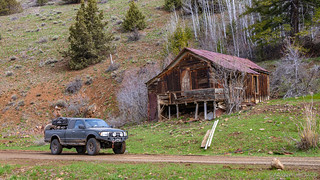
Not much further up the road, some old mining equipment (some sort of shaker), more cabins (though most of them completely dilapidated), and a collapsed headframe dotted the hillsides. We'd discovered - or rather, stumbled upon - the ghost town of Delamar.

A shaker, used to wash and separate ore.

Water sprays from the horizontal pipes, washing gold and silver rich material down through the grate and into the sluices.
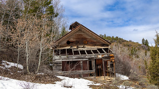
An old workshop near the collapsed headframe.

A headframe and storage tanks of the (old) Delamar mine.
More curvy road led up and through the valleys leading to Silver City. Traffic was clearly lighter this high up - we were now nearing 6500 feet of elevation, but we could still see that a tracked vehicle had travelled the road before us, giving us hope that the last couple miles were going to be passable.
The first couple of drifts on the road turned out to be just that - passable - until we hit the third drift. This one - being in the northern shadow of the mountain it ascended - was much longer, and over a foot deep. We could see where the tracked vehicle had continued - actually riding on top of the compacted snow - up and around what were some reasonably off-camber sections of trail.
As a single vehicle - and without tracks - we would not be attempting the same. Did make me think about getting some chains though - I think we could have made it with chains.
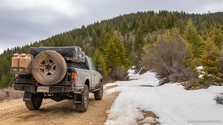

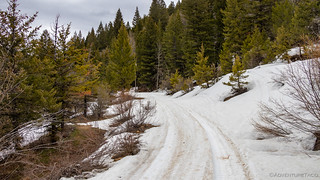
A little bummed, but having half-expected to get stopped by snow even earlier than we had, we got turned around and headed back down. Along the way we decided to cross Jordan Creek to investigate a concrete structure we'd noticed on the way up.

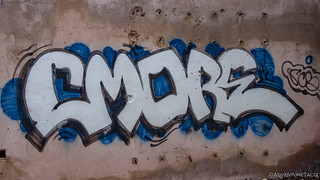
It's unclear exactly what this structure was - perhaps a mining buff can leave something in the comments below. A rectangular building, the only thing noticeable about it was that there were channels in the floor - some 18" deep and 24" wide - that must have had some sort of material moving through them - though I don't really know. The building had recently been vandalized - something I feel like we're seeing more and more on our adventures these days. I guess that really just comes with time. How unfortunate.


Exploration complete, we headed back across the river, taking the opportunity to rinse off all the mud that had collected on the interior of the wheels and undercarriage of the truck - hopefully meaning we wouldn't have any wonky balance issues when we were back on the highway, and making for overall less cleaning work work once we got home.
Well, except for all the mud we still had to get back down the road. One can hope though!

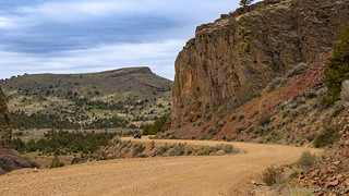
The way back down was uneventful, save for what seemed like quite a few people on their way up. We did make one stop at a hole in the canyon wall, clearly a location that water had bust through sometime in the distant past.


And then, we were back into Jordan Valley, where we fueled up and washed our windows - as was becoming a tradition - before heading west, towards Rome, Oregon where we'd turn south - the way we'd originally planned.
As often happens, we were once again distracted on our way to Rome, when we noticed a sign on the side of the freeway for a "Historical Marker - ½ mile." Curious, we slowed half a mile further, where a second sign read "Charbonneau Memorial - 3 miles." On the one hand, that felt a bit misleading - I mean, to say that there is a historical marker in half a mile, only to find a sign there that sends you six times further seems a bit...wonky. I suppose I could erect a sign on our street - "historical marker, 100 feet" and then a bit further down, place something like "Charbonneau Memorial - southeast, 632 miles." On the other hand, we were intrigued. Mike @Digiratus had actually asked me about this memorial just a week or two earlier, and having never been myself, I'd had nothing to tell him.
As it was 11:30am, we decided it would be the perfect place for lunch and a bit of history.


Our bellies full, we finally made it to Rome a little after 1:00pm - what would turn out to be perfect timing for our leisurely ~3 hour drive out to Three Forks. We turned south on Skull Creek Road and crossed our fingers that we wouldn't run into flooded desert as we had in the Alvord the previous year.

Finally aired down, 70% of the way through our trip.
In no real rush, and enjoying the cushiness of the softer tires, we ended up making several detours along our route - primarily to overlook the Owyhee Canyon. The first of these was reasonably near the mouth of the canyon as it approaches Rome and provided a spectacular perch from which campers like ourselves might just decide to setup camp and enjoy the solitude - especially in the spring as the canyon walls green up with the little bit of rain they receive each year.


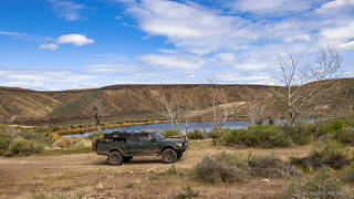
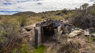
As we made our way back to Skull Creek Road after this first little adventure, we came upon what I'm sure is actually a cow pond/reservoir, but which was once clearly some sort of homestead. Complete with a picnic table, flat spot to camp, and several old buildings (including a dugout in reasonably good shape), it was a fun place to get out and look around - wondering what its original resident was thinking when they setup out here in the middle of nowhere.
We pressed onwards, through a few rolling hills, and then onto the high desert plateau where we found a second spur that turned towards the canyon.


A grand canyon is there... if you know where to look.
Further from town, this spur was significantly less travelled, and by the time we got to the canyon edge, there was little but two faint tracks in the grass. An old fire ring at the end suggested that this too was a camp site for desert explorers - little other reason for it to exist, really.

Someone found it.

Continuing to follow Skull Creek Road south as the canyon migrated southeast, we soon found ourselves a couple miles from its eastern edge, the tundra unfolding before us - its vastness a reminder of just how far we were from civilization.

Every now and then though, we'd get a reminder - even here, in one of the most remote areas of Oregon, ranchers rule the roost - fences and cattle guards delineating property lines and pastures.

We'd never seen a hydraulic cattle guard before - it collapses as it's driven over, and then rebounds slowly once we've passed.
At a little after 4:00pm in the afternoon we reached the terminus of our trip on Skull Creek Road. Counting ourselves lucky for not having run into a muddy mess by this point, we crossed our fingers as we turned towards the descent down into the canyon. Our hope now was that the descent was passable - something we'd come out here knowing might turn us around.
Note: After returning from this trip, another traveler mentioned to me he believes that this road down into the canyon is technically closed, but that hunters often remove the signage denoting it as such. With no first-hand knowledge, I'd suggest that (a) if there is a road closed sign there, it must be honored, and (b) even if there isn't a sign, if you're asked to leave at any time, do so immediately and without fuss. I do have first-hand knowledge that the Three Forks springs area is private land, and so we should all be respectful of the landowner's wishes at any time.

As we made our way down - through several rock ledges and gardens, I casually mentioned to @mrs.turbodb that it was good that it hadn't rained in the last 24 hours, and that if it did start raining, we should probably head back right away so we weren't stuck down here for a prolonged period of time!
The views though - as we made our way down what turned out to be a side canyon that joined the Owyhee at the hot springs - was fabtastic.

Both anxious to get to the springs, we neglected to take many photos of the journey down. Not to worry of course - we'd be retracing our steps the following day, plenty of opportunities to document a bit of the surroundings.
As we pulled up to the final fork, we had a decision to make - we could head right, down to the river - or we could head left, over to the hot springs. It wasn't much of a choice, really. We went left.

Hot springs > Cold river.
As we drove along the ridge, we were completely exposed to road and camp sites along the east side of the river - the same location we'd visited four years earlier - now packed with campers who we could tell were wondering, "How'd they get over there?" And, "How can we get over there?" Of the several groups looking our way, one had clearly visited before. They'd brought an inflatable kayak, and used it to paddle over to the hot springs as we found a perfect little place to setup camp a few hundred feet above the springs.

As we watched the dad and his two kids paddle back after having had their fill of the springs, we knew it was our turn - and that our turn would last for as long as we wanted - no one else equipped to make the journey across the raging North Fork Owyhee River.
And with views like this, we were glad to have it to ourselves for the evening!
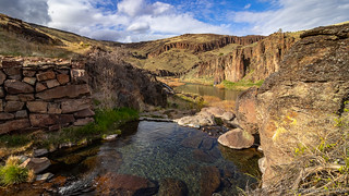

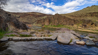
We hung out in the warm water - probably in the 102°F range - for half an hour or so, the pool large enough and deep enough for us to swim around and find the warmest pockets... while never really getting cold in the coolest. It'd been three days since our last shower, a nice way to clean up on a trip, if you can get it!
The sun was setting as we headed back up to camp - its long rays streaming below a cloud cover that was blowing in from the west. The buttes - their rocky outcroppings poking above the soon-to-be-green spring grass - glowed in appreciation.

Dinner on this splendid evening - overlooking the river, hot springs, and activity on the east side - was hot dogs. Not just any hot dogs - genuine Costco hot dogs, long enough to fill two normal-sized hot dog buns. Perhaps not the healthiest of meals, but delicioso nonetheless!

The light show continued as we were eating, the buttes on the east bank of the river lighting up even brighter than those on the west.
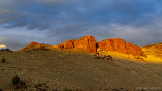
Hoping to catch a colorful sunset given all the clouds, we held off climbing into the tent for another hour or so. Unfortunately, the clouds must have extended to the horizon - something we couldn't tell from our position - because no color ever crossed the sky. Even with the delay, it wasn't late when we climbed into the tent - and that was just fine with us. It'd been another full day and we were ready for some shut eye.
As we pulled out our Kindle Paperwhites and snuggled down in the comforters, I looked at @mrs.turbodb and mentioned to her that if the cloud cover brought rain during the night, we should probably get ourselves out of bed and make a run for the plateau - so we weren't stuck here should the road become impassable.
We dozed off around 8:30pm and slept soundly until 12:04am - when the pitter-patter of rain on the tent awoke me from my sleep...


I imagine the area would be pretty hot from June to Oct? We’re there a lot of people on the track that you took to Three Forks or are they all on the other side of the river?
Yes, it gets warm there in the summer. But hey, once you get there, you can swim in the North Fork Owyhee, so.. 🙂 ?. Most folks are on the other side of the river, which to be honest, has a lot of benefits as well. There are more springs over there, more flat ground, easier to get to, etc. Still, I think we like this route better.
Love the article and the pics! I’m a single dad with 3 young sons, we love exploring and finding new spots off the beaten path, I’d love to take them here but I had a few questions if you don’t mind. Looking at the maps it seems like skull creek road turns into Indian fort creek road, did you turn off before this transition? Where do you enter the canyon and where exactly are the hot springs? I sure appreciate the article and any help.
Hey Louis, glad you enjoyed the story, and it sounds like your boys are lucky to get out with ya! As far as specific locations, I don't generally give those out since following the stories usually has enough "mentioned" waypoints, etc. as you read the story and follow along on a map (i.e. there aren't generally all that many roads to the places I go). For this story in particular, the next chapter may help give you a bit more "context" so stay tuned for that. You can get an email when I post it if you sign up here.
Also - for a bit more about how I do route planning (which will also give insight into how to find the roads, etc. in this report), check out my Route Planning series.
If all that fails, shoot me an email using the contact link at the top of every page.
Hohum...so lovely
Thank you for this. Beautiful pictures and prose. I'm planning on heading this way next week and this was great intel.
Glad you enjoyed it Tom! I'm hoping to head that way in the near future as well! Do you have an itinerary in mind?