
We wrapped up the four-trail loop - from Devil's Racetrack to Coal Wash to Fixit Pass and finally along Nielsen Dugway (see More Than We Bargained For - Swell #3) - right around 3:45pm. With sunset slated for just before 8:00pm - oh, how I do enjoy the longer summer days - I figured we at least had enough time to head south towards our next destination. Depending on the roads, I hoped we also had time for another short hike or two!
And so, we passed back under I-70 from the Head of Sinbad, and rejoined Temple Mountain Road - the exit we'd taken earlier in the day. A well-graded gravel thoroughfare, we were back in the land of high desert, the mesas, pillars, and slickrock we'd enjoyed earlier in the day, now in our mirrors.

With some 30 miles to cover, @mrs.turbodb took full advantage of the smooth ride for a late afternoon snooze - a reasonable thing to do given the combination of dust kicked up by high winds and clouds overhead, reducing visibility to a few miles anyway. I stopped a few times along the way, but by 4:25, we were nearing our destination, and boy, did the landscape change again!


Though I'd planned the drive on Temple Mountain Road, I hadn't really thought much about Temple Mountain itself. Looking back now, that was an obvious oversight - not so much for rock art, since the name of the mountain comes from its resemblance to modern-day temples in Salt Lake City - but because there are numerous mine workings in the area that would be fun to explore.
Mining claims were staked here as early as 1898, but no significant quantity of ore was produced until 1914 when mining for radium, vanadium, and uranium began and continued intermittently into the 1920s. The Temple Mountain mines were major uranium producers on the Colorado Plateau in the late 1940s and early 1950s. From 1948 through 1956, the Temple Mountain area produced approximately 1,287,000 pounds of Triuranium octoxide, also known as yellowcake, and 3.8 million pounds of Vanadium pentoxide. During the uranium mining boom as a result of the escalation of the Cold War, a shanty town known as Temple City temporarily sprang up here.Wikipedia
On the flip side, given Temple Mountain's close proximity to UT-24, Goblin Valley, and several campgrounds in the immediate area, it was perhaps unsurprising that the area was seriously crowded with the RV/toy hauler/UTV crowd as we rolled by on a Saturday afternoon.
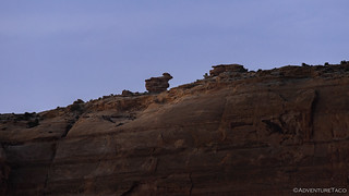
Our destination was a bit further south, along South Temple Wash - where we planned to camp for the evening - but we did make a quick stop along the south side of the mountain to check out an interesting rock art panel along Temple Mountain Wash.

The largest image is, at present, fully about 6-feet tall. It could easily have been 8 feet or more when it was originally created, and more than 100 feet long. The sizes of these images seem to suggest that the creators wanted them to be easily seen and to demonstrate that they were of exceptional significance.
A large part of the panel has broken off from the cliff face. This is spalling and it occurs principally because salt crystals grow from mineral-laden water that has penetrated into the stone from above. As the water evaporates near the surface, the crystals grow larger and eventually fracture off the front layer of sandstone.
There are two ages of petroglyphs present in this panel. The concentric circles and horned figure anthropomorphic figure (a stylized human) on the far left is are Fremont, painted between AD 100 to AD 1300. The other figures are Barrier Canyon Style, perhaps from the Archaic period, which began between 8000 to 6500 BC and ended approximately 2000 years ago, though some Barrier Canyon Style art may have been created as late as 1100 AD.
The Fremont figures are placed far to the left because it is likely that the rest of the cliff face was covered with Barrier Canyon Style figures before spalling caused their destruction.Steve Manning, Utah Rock Art Research Association


As we pulled away from the panel, I found myself hoping - or perhaps more accurately, worried - that the incessant drone of UTVs and RV generators would extend towards our planned stopping point for the night. And, as we pulled up to the trailhead, my worries proved themselves out - while there wasn't a human in sight - they were all huddled away in their RVs as the 50mph winds howled by, the entire bluff above the wash as packed with RVs and UTVs, their generators droning away.
Clearly, we were going to need to find another plan for the evening.
After a quick conversation about what to do about camp - and no decision made - we decided to proceed with our planned hike to the Ochre Alcove since we still had a couple hours of daylight left.
This, it turns out, was a great decision! Despite all the people in the area, we saw no one - and very few footprints - as we crossed South Temple Wash and entered the sandstone slot canyon that led to the alcove. In fact, we'd see no one on the entire hike - a wonderful surprise given the number of people in the vacinity.


Eventually the narrows widened and we found ourselves in a beautiful gorge surrounded by towering walls of sandstone. To the east, the Ochre Alcove sat high on the cliff; to the west, the sun just peeked out over the edge.

After a bit of scrambling and route-finding we made our way up to the alcove, the slickrock providing ample traction even on the steep terrain.

Often referred to as the Transformation Panel, the pictographs here are a fantastic - one of the best, really - examples of Barrier Canyon Style images that we would see. We spent a bunch of time checking out the detail of all the figures, each section of the panel holding hidden treasures as we looked more closely.


Even with only a single panel, we probably spent a good 20 minutes in the alcove, enjoying ourselves. Eventually though, it was time to return the way we'd come, and figure out our plan for the evening, since there was no way we were going to camp in a sea of RVs at the mouth of the canyon.


Upon climbing in the truck, I suggested that we only really had two options: we could continue along our route - retracing a few miles up past Temple Mountain, toward the following day's destination - or we could suck it up and suffer through the situation we current found ourselves in the middle of. It wasn't a choice, really, as neither of us were keen to make dinner in a blowing sandstorm, or sleep through a night of generator noise. And so, we set off in search of something better.
To both our surprise - I think - it didn't take us long to find what turned out to be a fabulous spot. With the westerly wind, we were in search of something that'd be sheltered from that direction, and of course be relatively private as well. I'd assumed that we'd have to travel a good hour or so to find something that fit that description - given the crowding around Temple Mountain - but within 15 minutes we spotted a spur road into a side canyon and decided to give it a look-see.

With no wind - and bellies suggesting that we should have eaten more at lunch - dinner was a quick affair. Assembled and consumed by 7:45pm, that gave me time to scramble up the hillside to our west to enjoy the final rays of light as they spread across the landscape.

As seems to happen with some frequency, the winds died down significantly as the sun set. This, combined with our location, made for a very pleasant sleep, both of us dozing off by 9:00pm after reading just a few pages of on our Kindles.
The Following Morning...
Nestled low in a canyon, I knew there was no way I was going to catch sunrise, but I was up early anyway, hoping that another scramble might present some nice light on the surrounding hills. And, while some thin, high clouds blocked any orange-ing of the sky as the sun crested the horizon, they did allow for a nice purple hue to spread across the land, which was nice.


As usual, I waited until a few minutes after the official sunrise to whistle down to @mrs.turbodb that it was "getting up time," and within minutes, she had herself and the inside of the tent squared away so that I could do the teardown and stowage as she got started on breakfast. Efficient as ever, we were out of camp before 8:00am, both of us looking forward to the itinerary for the day.

For the last several months - from November to March - we'd really only visited our winter haunt: Death Valley National Park. Neither of us would complain about that - well, except for the drive down and back - because there's always so much to do, see, and hike in that wonderful location. But, as we hopped from pictograph to petroglyph here in the Swell, I think we both missed - to an extent - finding and exploring a thing that seems extremely common on our trips to Death Valley: mine sites.
Today though, we were going to change that - we were headed to the Dirty Devil Uranium mine (amongst others, it would turn out) - and that had us both excited for something different.

Of course, as usual, I'm getting ahead of myself - our exploration of McKay Flat and Red Canyon will have to wait for the next story!


Wonderful, as usual! I do love Utah, so many parks and so little time. We've hiked some of the parks and visited most but on our big cross Utah trek some years ago weren't able to squeeze in Canyonlands so that will be a future goal. We had a choice of Arches OR Canyonlands and decided on Arches. Can't wait to get back to Utah but also want to see more of AZ & NM. As for mines, looking forward to the uranium mine. I guess out here in the Mojave we get spoiled as mines are everywhere. I've even visited (many times) mines in the Angeles Forest on my hikes there. As always, looking forward to your next post!
Thanks for sharing!
Thanks John! Utah really is a great place - a jewel of the west, really. And the entire west is really the jewel of the continent (in my biased opinion ?)! I hope you have a chance to get back to see the bits you want to see. I noticed that they closed the Lincoln National Forest in NM today due to extreme fire danger, so hopefully we get some rain down there so we can all enjoy the southwest more.
I was down in the Swell last week. Always a treat. If you had taken the “Behind the Reef” trail. You could have found some secluded campsites. I’m not surprised that you were alone on your hike. ATV’s, Quads, OTV,s all come with glue on the seats so you never have to leave the safety of your precious ride.
I’d post a pic of the “Lone Warrior” but this site won’t let me.
Thanks for the tip on "Behind the Reef" Greg, I've heard of it, but will look into it a bit more for future trips! And I have seen the lone warrior - in fact, I had it as a possiblity for this trip, but we ended up skipping it due to time. Just a good excuse for a future trip of course!
(and sorry for the slow reply, I just found a bunch of comments that were incorrectly marked as spam, so I'll need to dig into the guts of the site to figure out what's going on)
Yep, I have friends in the high country in Arizona and they have had quite a few fires in the last year, same with New Mexico. The upside on some of these fires (including here in CA) is that, if allowed, will burn up some the brush, dead wood, and other things that are clogging the forests to make room for new growth and lessen the chance of future fires.