We slept well through the night, our location mostly sheltered from the strong winds. What little wind made it to the tent was easily quieted by ear plugs, making for a peaceful night sleep. Most of the night passed uneventfully - a fact we were happy for given the weather report we'd seen the day before. We were right on the edge of a weather system - areas to the west expecting rain all day, areas to the east predicted to be dry.
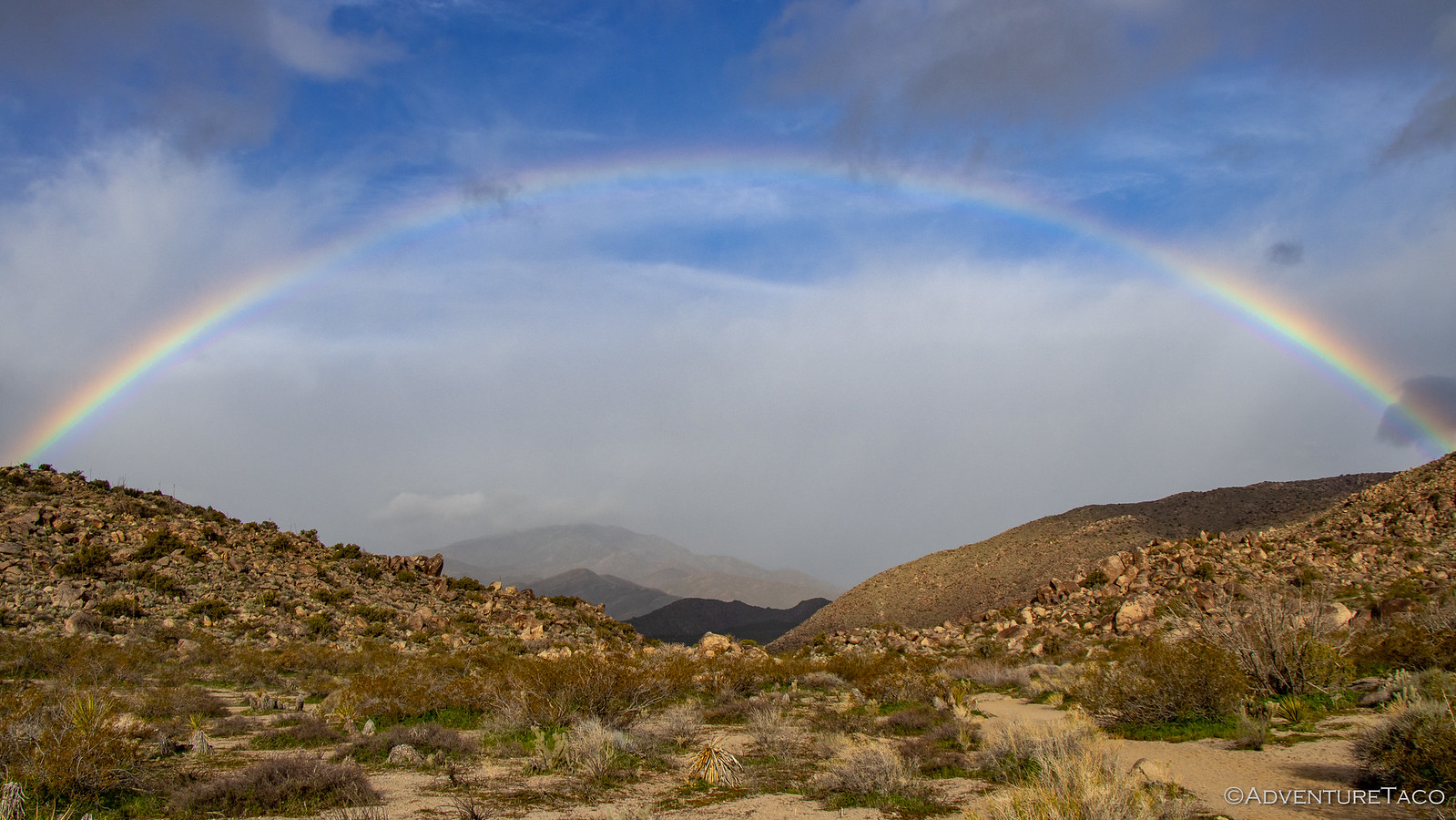
But then, around 5:00am, a pitter-patter on the rain fly - we hadn't escaped the rain fully. Of course that pitter-patter also meant that there was no need to get up early for sunrise - the clouds in the sky limiting the color we'd have otherwise seen. So, it wasn't until 7:30am - when there was a break in the rain - that we rolled out of bed to take a look around.
Low and behold, the sun was sure trying - there was a rainbow over camp.

Our plan for the day was to start with a hike to the nearby pictographs, but with the break in the rain and no idea what was in store on that front, we decided to partially dry off and put away the tent before setting out. This turned out to be a bit of a wash as the rain sprinkled off-and-on for the rest of our time in Little Blair Valley, and we were going to have to fully dry out the tent later anyway.
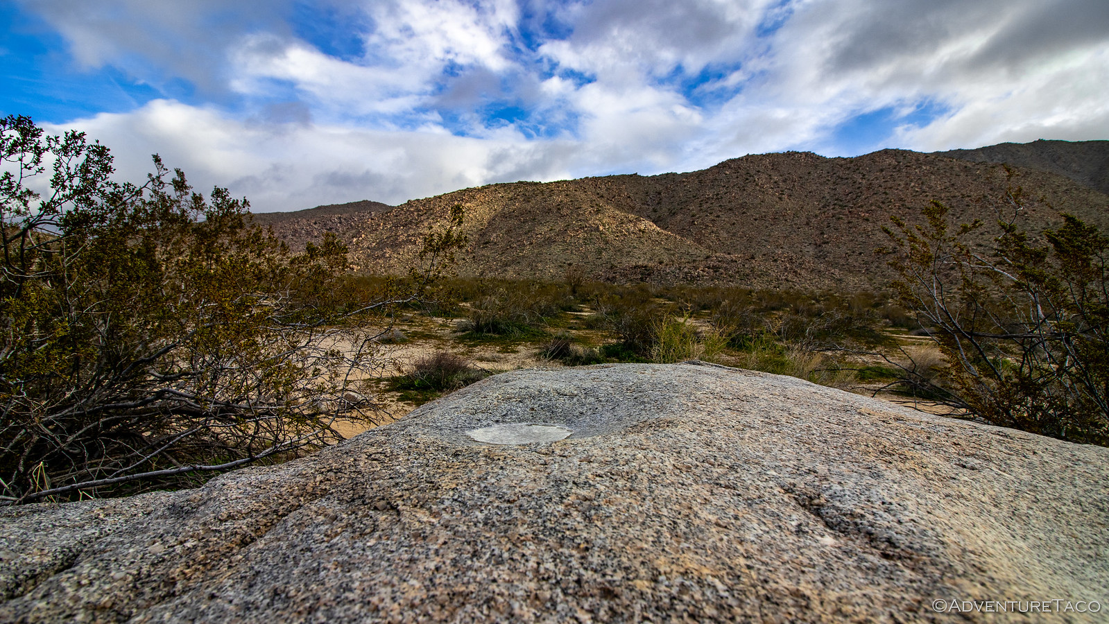
With the tent away, we headed up the trail toward the pictographs. It really was a beautiful morning, the rainbow coming and going as the sun streamed over the horizon but under the clouds.
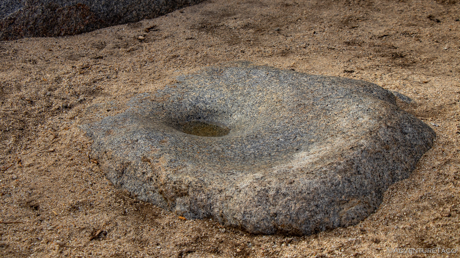
It wasn't long until we reached our destination - a rock along the valley edge where over 2000 years ago, Kumeyaay Indians had stopped to camp, leaving behind a bit of rock art and a few morteros - bowls carved into large boulders used to grind pigments as well as various grains and food stuffs.

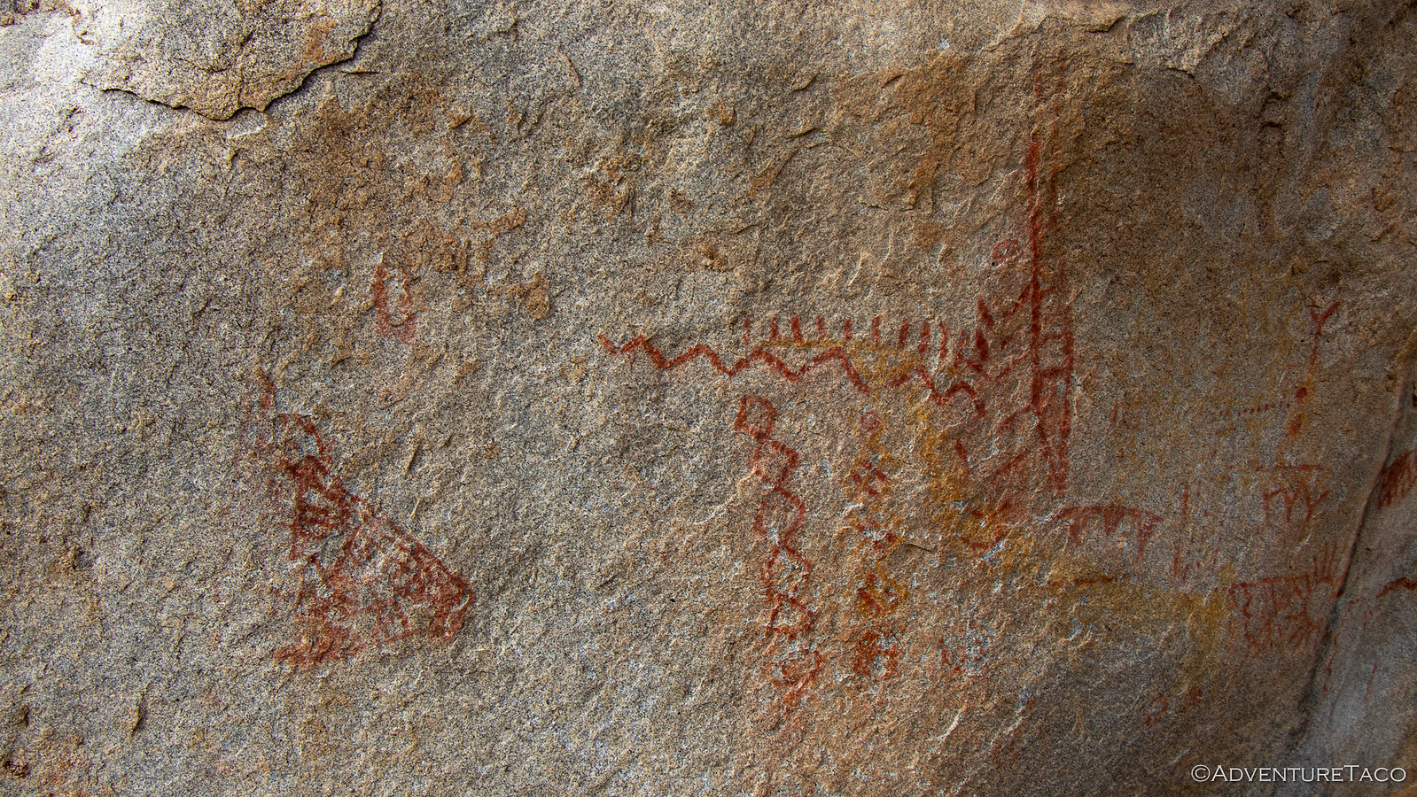
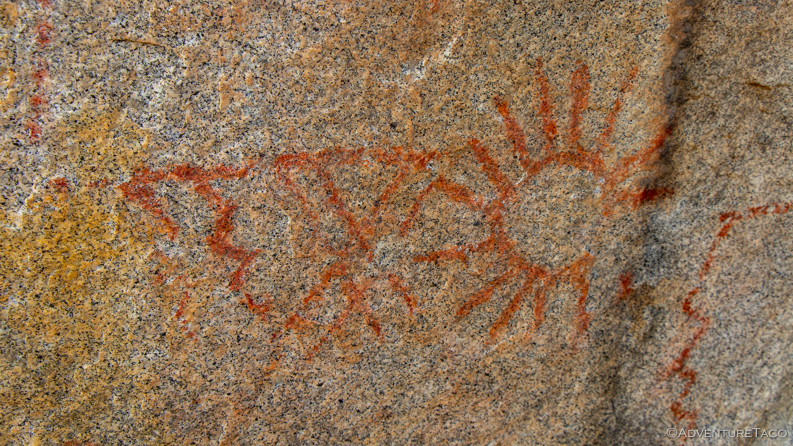
An interesting bit of knowledge that @mrs.turbodb shared while we were there was that pictographs are images painted on rocks using some sort of pigment and that petroglyphs are images carved into the rock. Additionally - at least in the Anza-Borrego area - you never find rock art with both geometric shapes and human/animal images in the same area. Weird, but there you go - perhaps it's because the ancient people were respectful of each other's work.
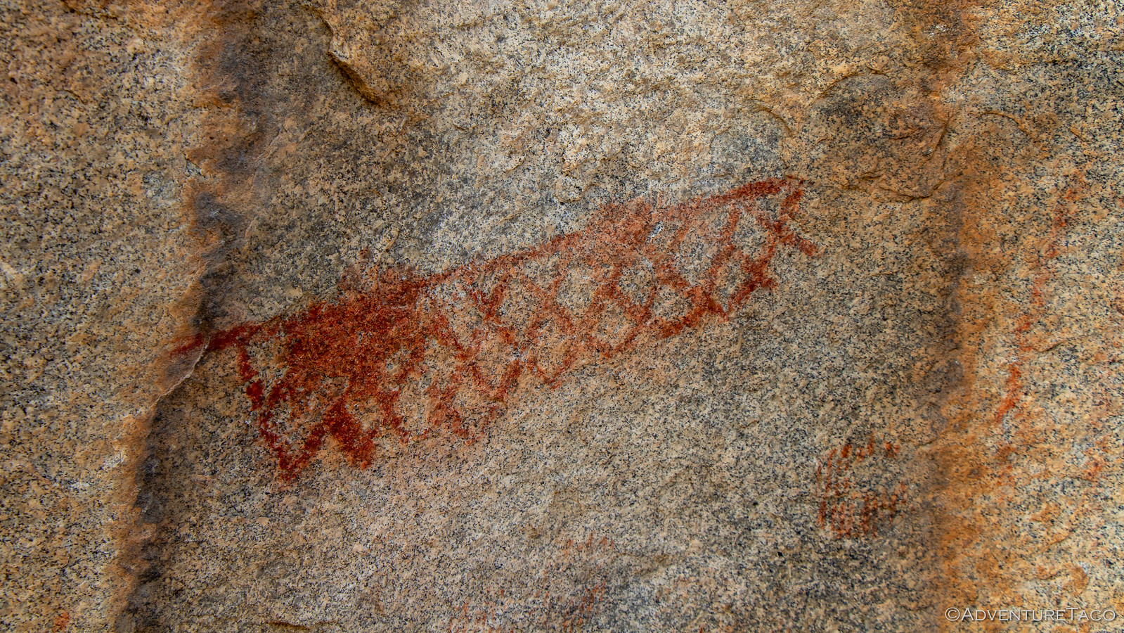
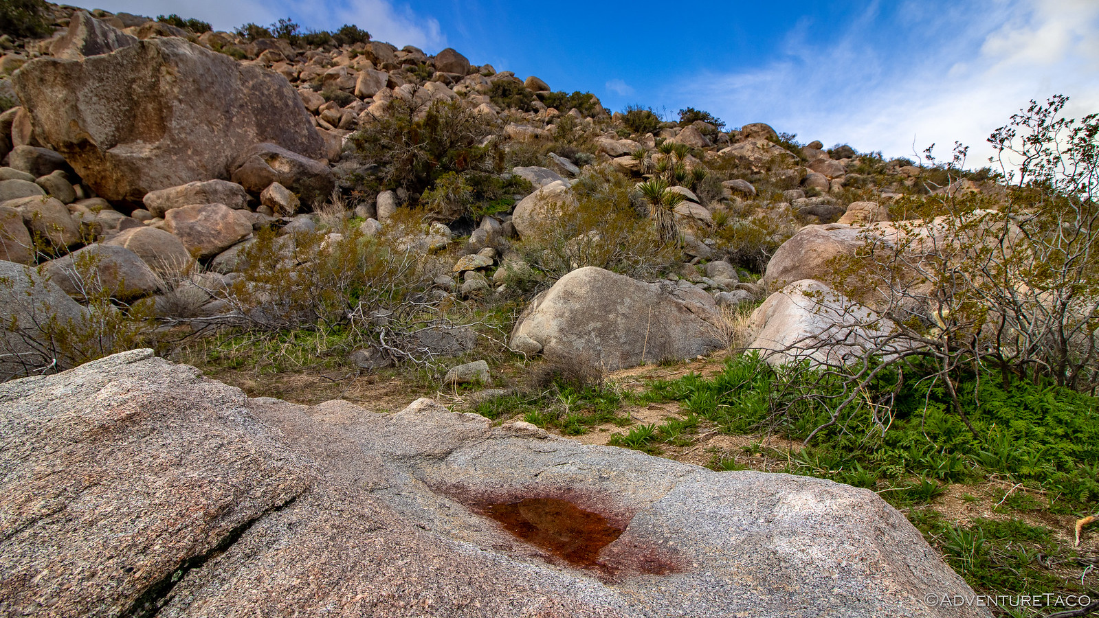
We enjoyed the pictographs a while longer before deciding to head back to camp and get on the road - breakfast-less - towards our first trail of the day and drier weather. And, as we started back, we noticed what I think was a special rock - one with the top stained a dark crimson - the same color crimson as the pictographs. My guess, is that this is where Kumeyaay Indians ground the various pigments that they used for the pictographs. A cool find if you ask me.
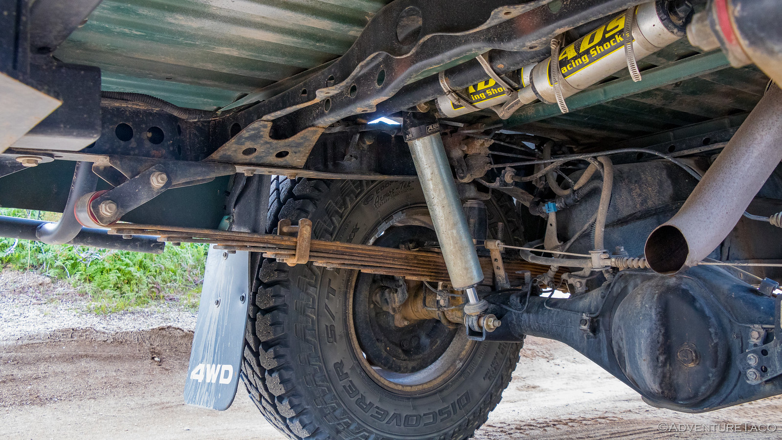
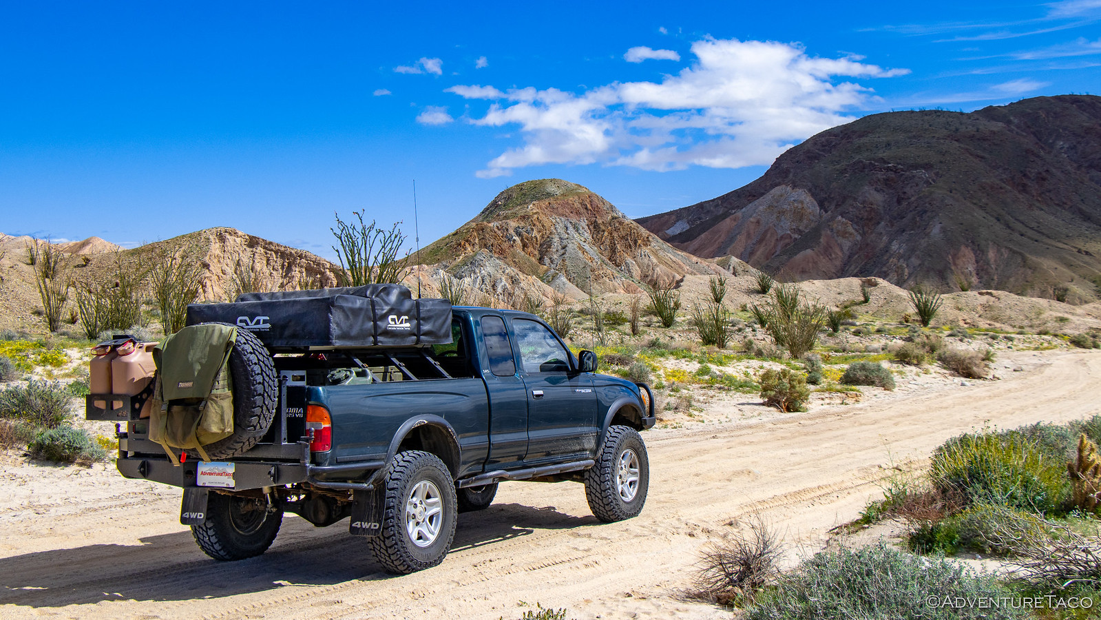
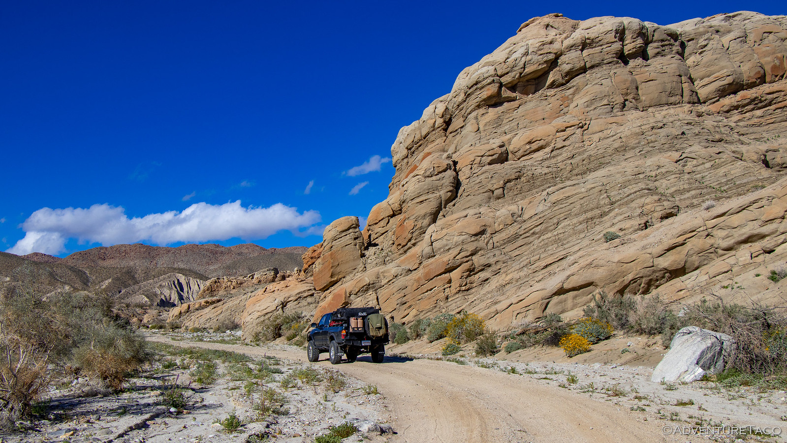
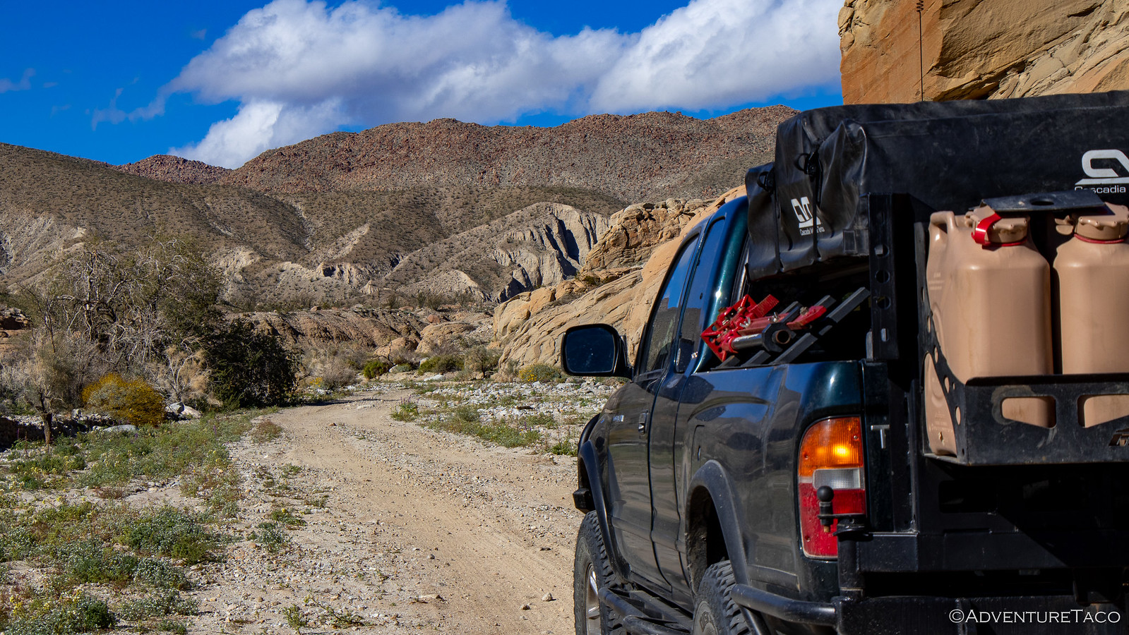
The trails in and out of Blair Valley were some of the nicest I've ever driven. A passenger car would have been fine on all of them, and we made great time - stopping only twice. The first was in a small diagonal washout so I could check on the travel of the rear suspension. Everything looked good - the bump stop was nearly touching the frame and I still had a bit of travel on the shock, the leaf was mostly flexed, but still had a little way to go, and the shackle seemed to be doing it's job as well. Nice! (And whew!)

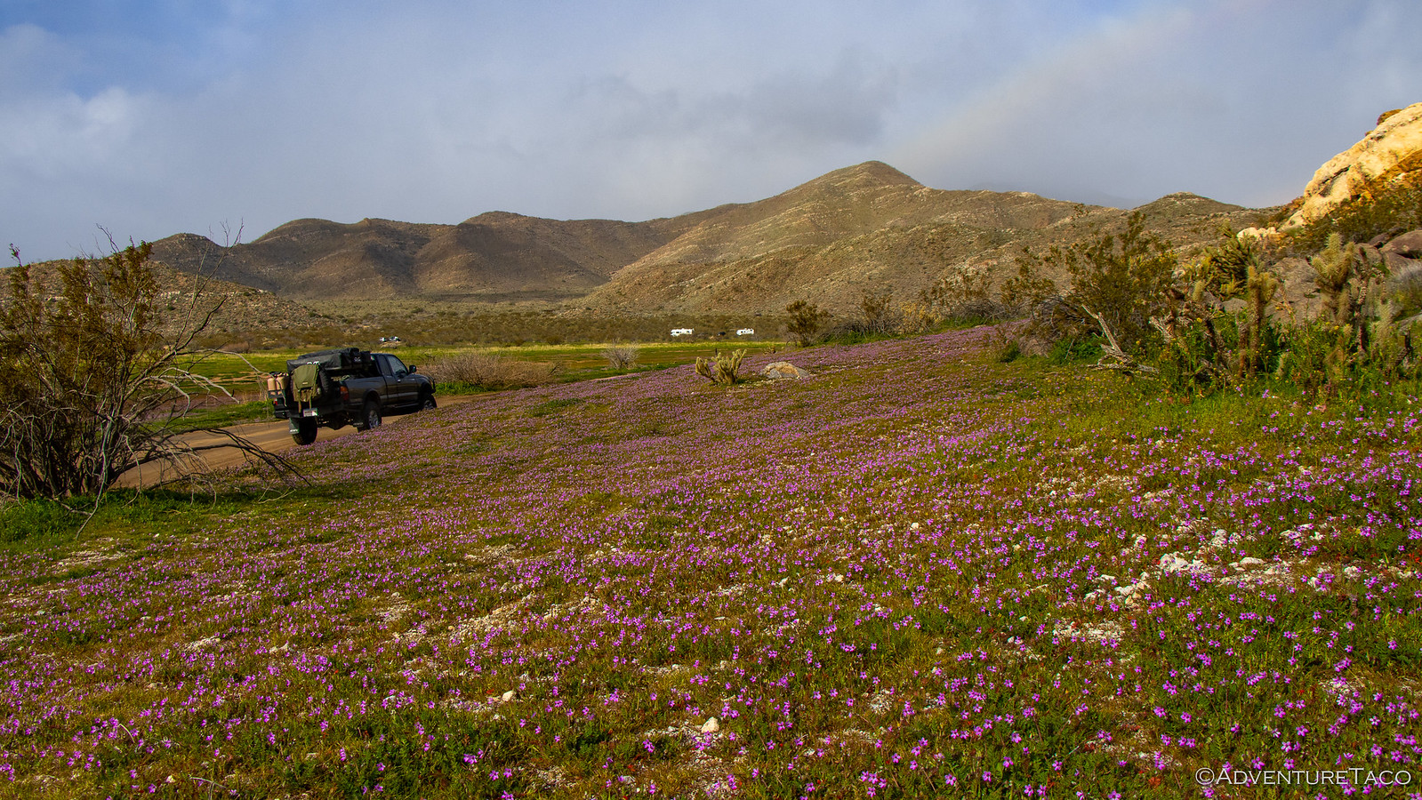
The second stop was very close to the end of the trail, just before we got back on the freeway. Like the yellow blanket we'd seen covering the floor of Little Blair Valley the day before, today we were treated to a purple display along the base of the hills in Blair Valley - making us extra glad that we took a different route out than we'd taken in the previous evening.
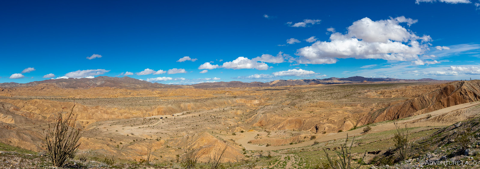
At this point, we had about an hour of driving to get to the maze of washes that we'd take north over the next two days. As we made our way east, we drove in and out of rain showers, the mountains keeping them mostly at bay to our south and west.
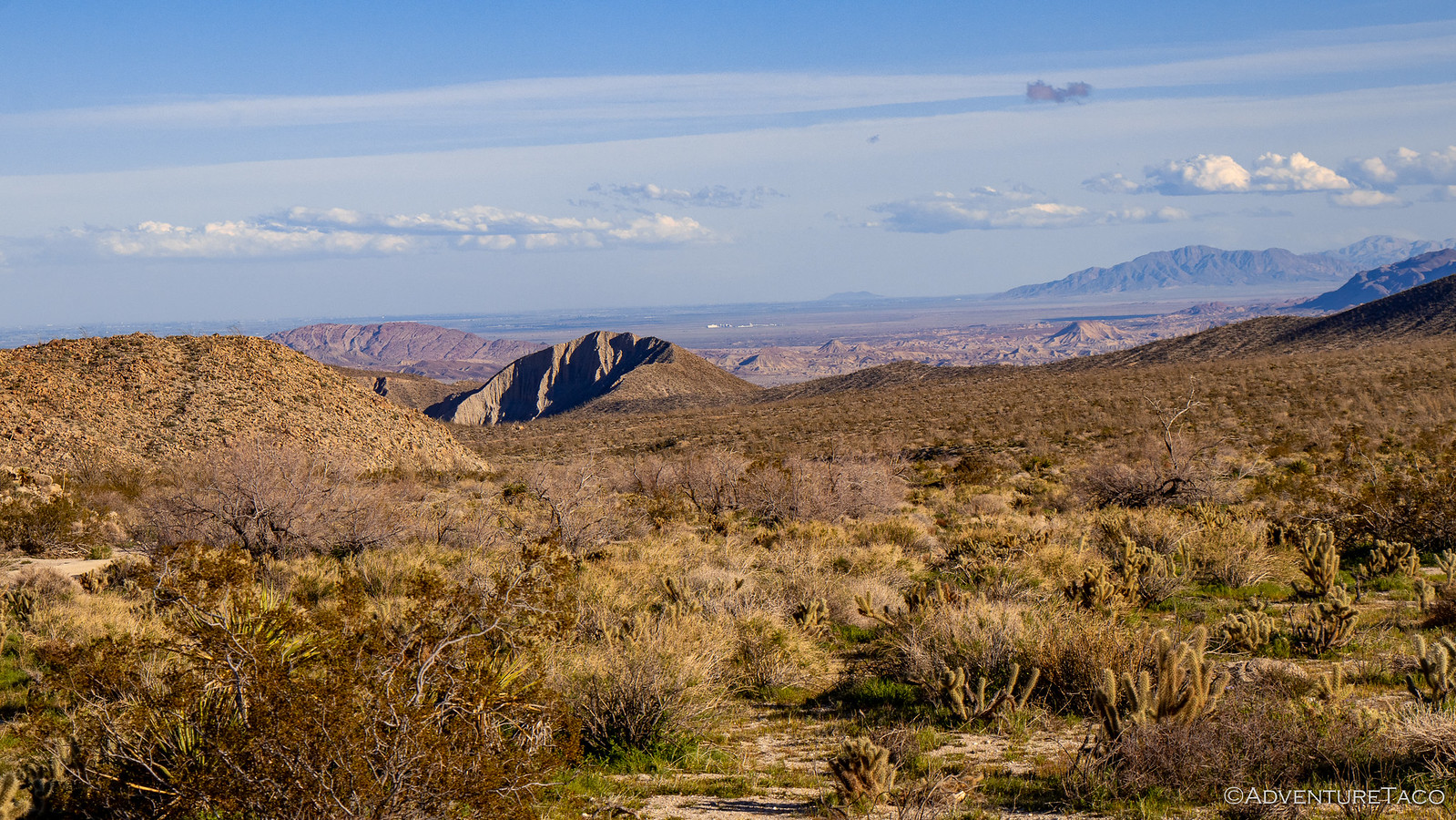
By the time we arrived at the Carrizo Badlands overlook - where we planned to have breakfast before heading into Canyon sin Nombre - the sky was mostly clear and it only looked better in the direction we were headed. I set about taking some photos of the spring bloom while @mrs.turbodb prepped our breakfast.
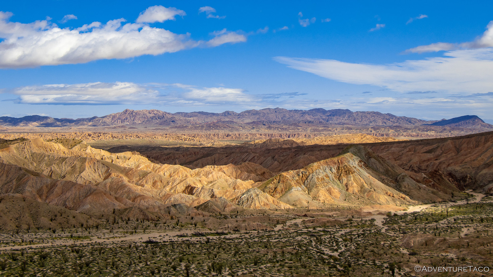


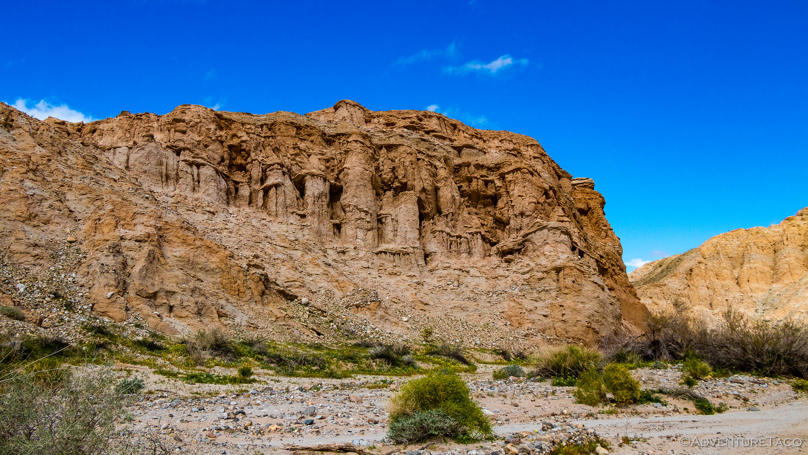
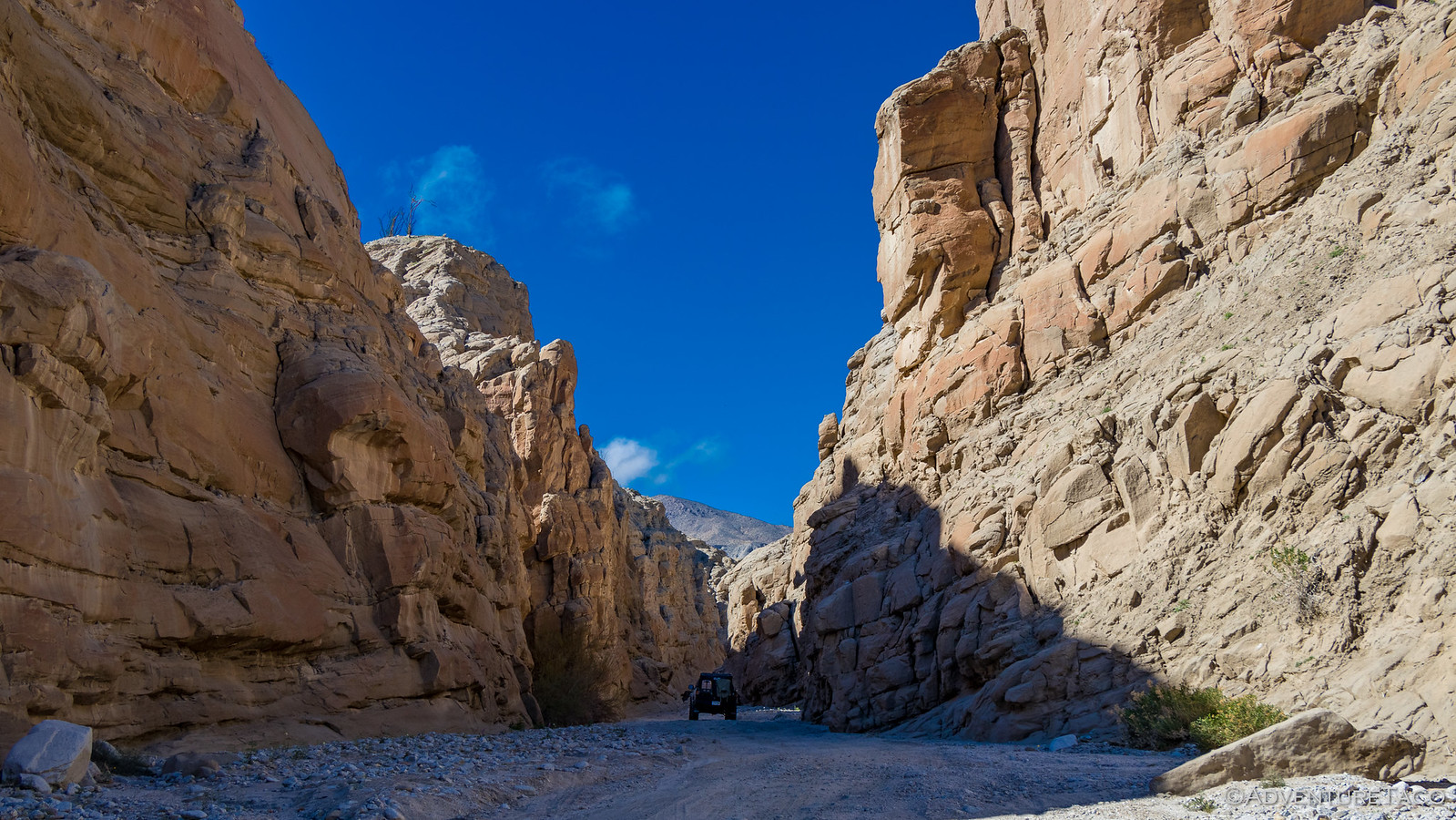
And then we were off - a short drop from the viewpoint down into the canyon and we were almost immediately in what I think was the most breathtaking canyon of the trip (at least so far).
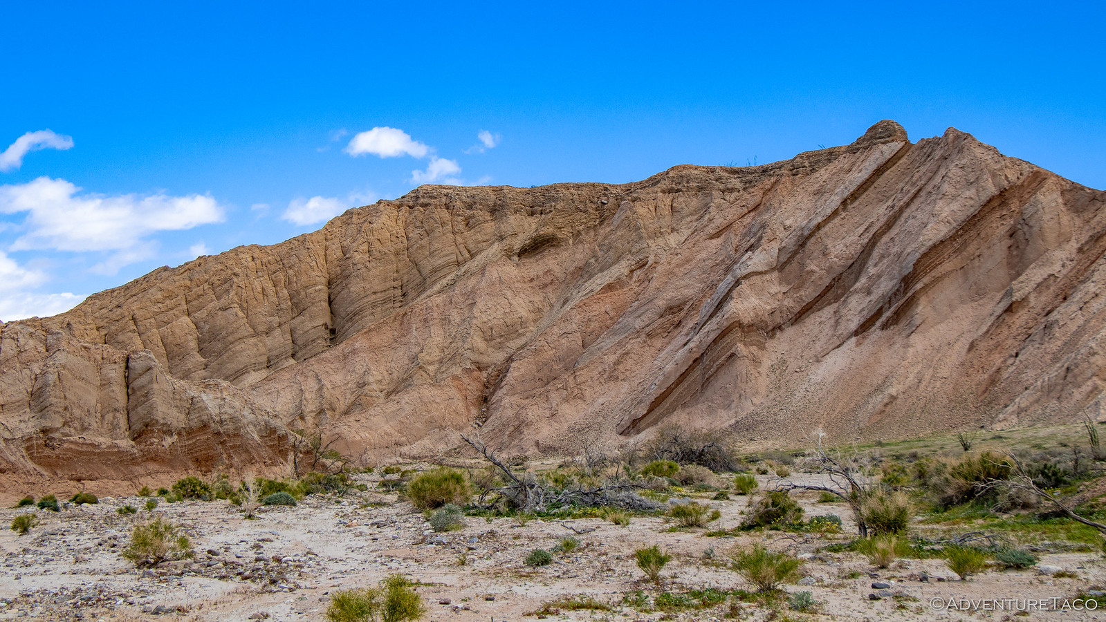
Not only were the colors amazing, but so was the geology. The entire area had been uplifted in giant synclines and anticlines, and then crushed and folded into amazing shapes. I wasn't the only one who wanted to stop and get out for a closer look - we were both hopping out of the truck on a regular basis at this point.

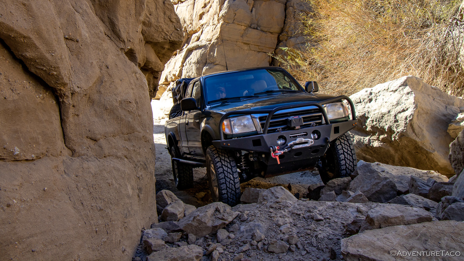
Not really knowing what to expect, we took our time making our way through the canyon, enjoying each turn and view as we proceeded down the wash. A couple miles in, we saw three metal posts blocking off a side canyon - an invitation to investigate if there ever was one!

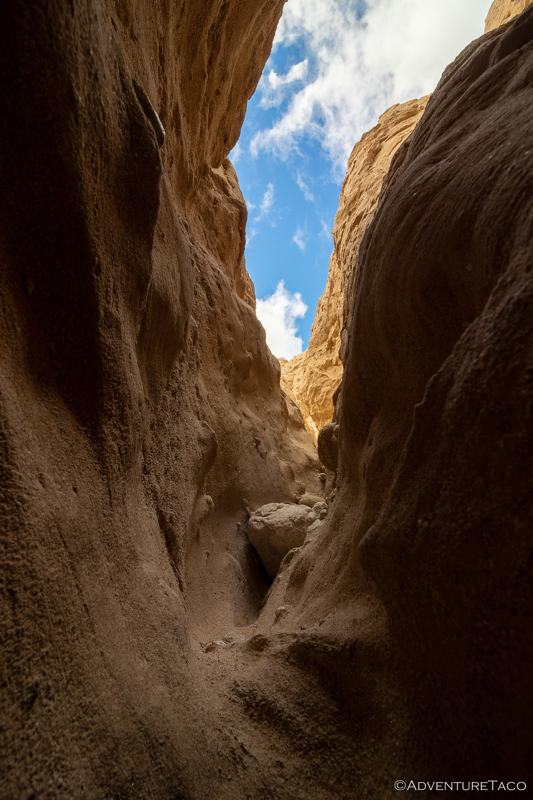
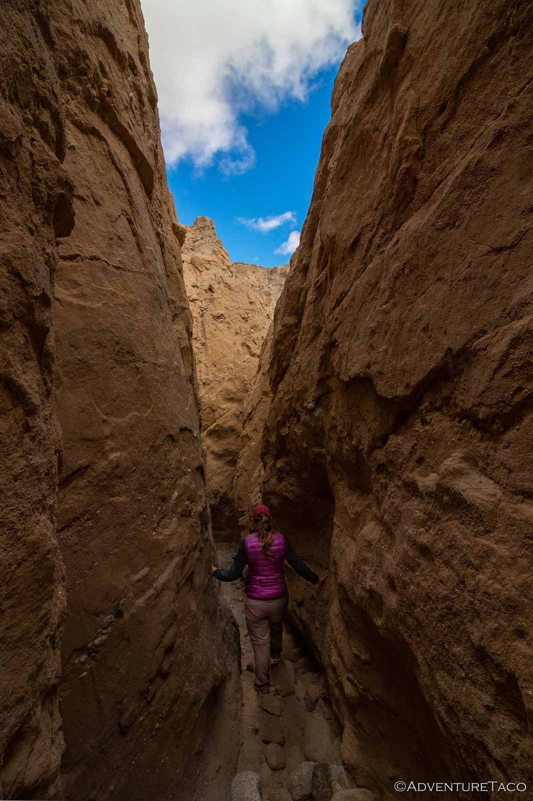
This turned out to be the entrance to not one, but two spectacular slot canyons, and we made our way through one - climbing up and and through various crevices until we came to dry falls that would require more equipment than we'd brought with us today. We left the other for a future trip - unsure what the rest of the day had in store from a time perspective.
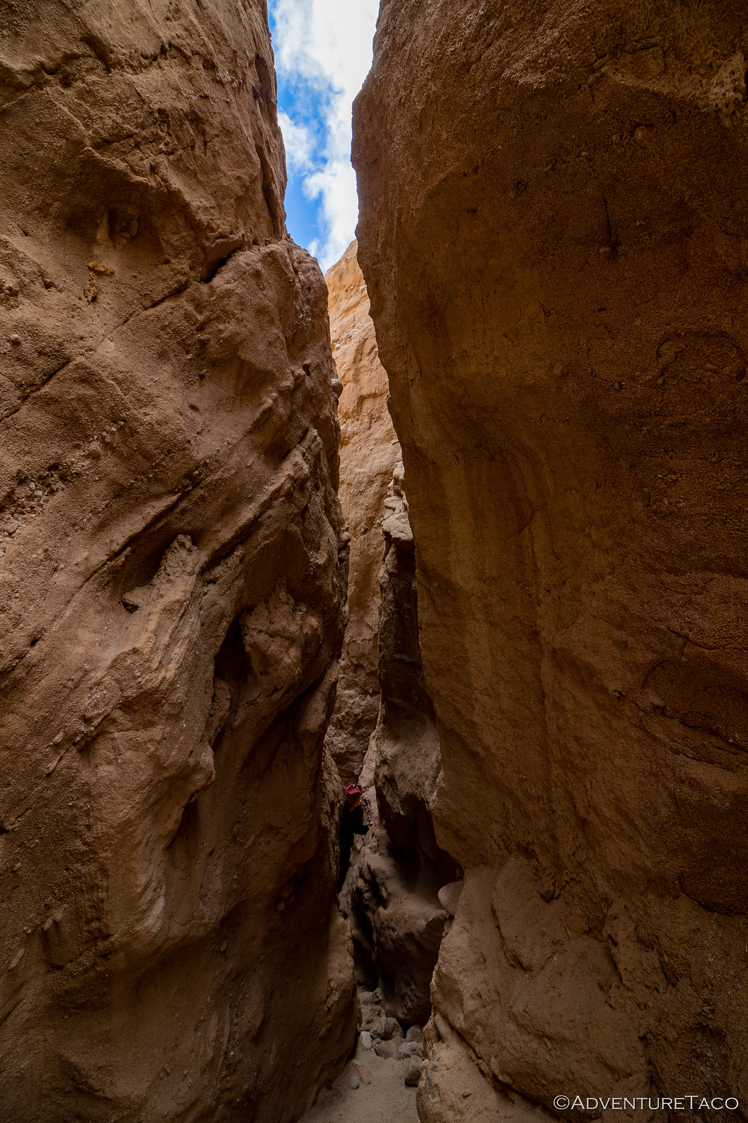
We made our way back to the truck, and pulled away from the canyon entrance just as some hikers walking down the canyon arrived. Initially, it looked as though they were going to skip this amazing side trip entirely - but at the last moment they turned in, probably one of the best decisions they'd make all day! 
The main wash continued to be a delightful display of geography, our heads on pivots, fingers pointing out details of each of the formations as they'd come into sight.
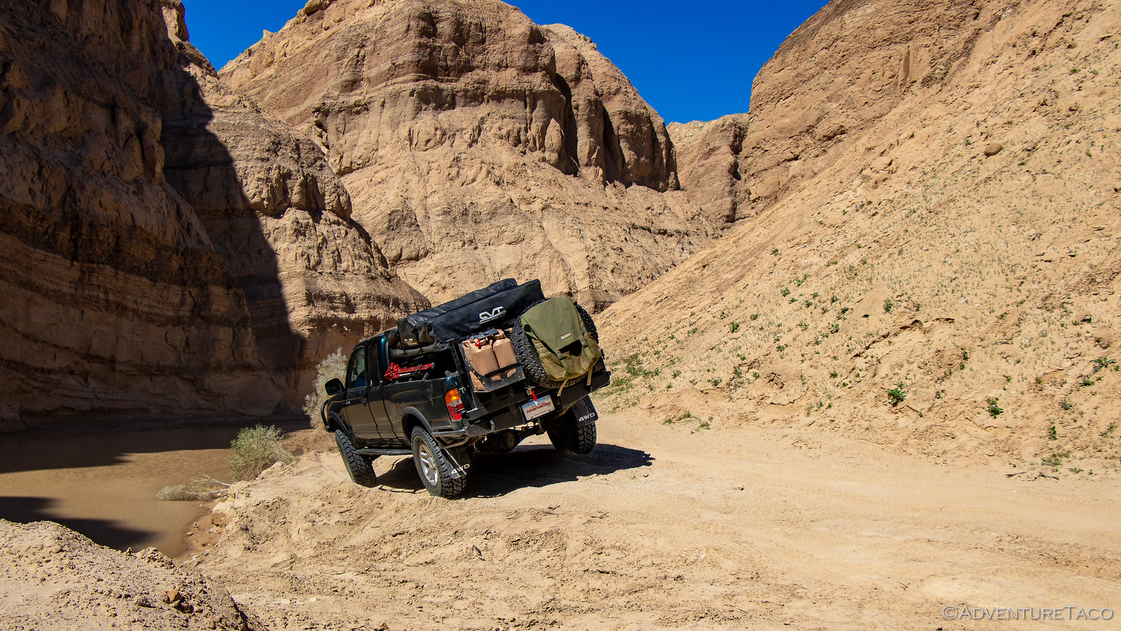
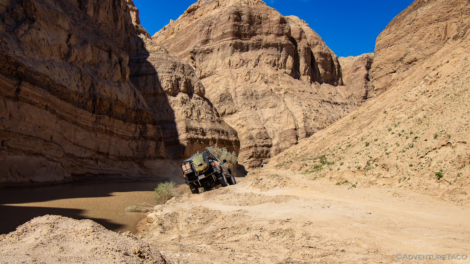
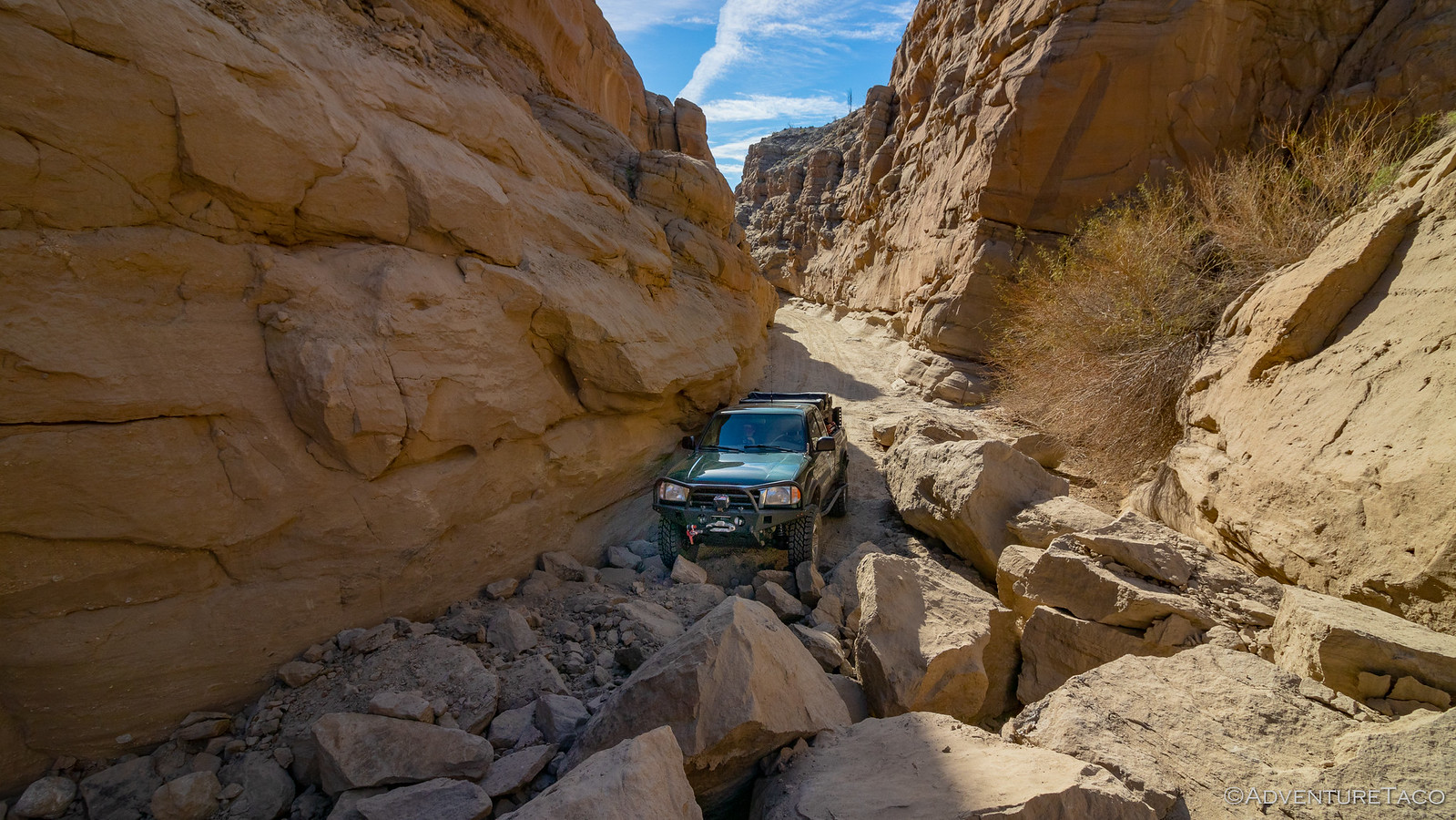
Too soon, we exited the canyon to a four way intersection with Arroyo Seco del Diablo, Carrizo Creek, and Vallecito Wash - so much to explore and so little time to do so. For now, we were headed north on Arroyo Seco del Diablo, on our way to Diablo's Drop.
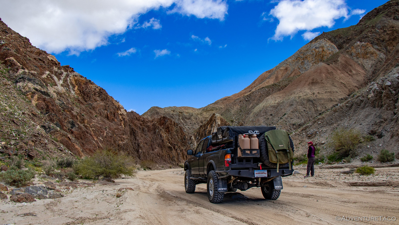
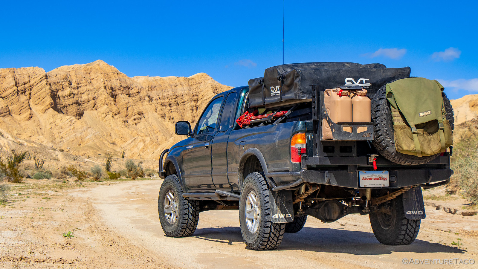
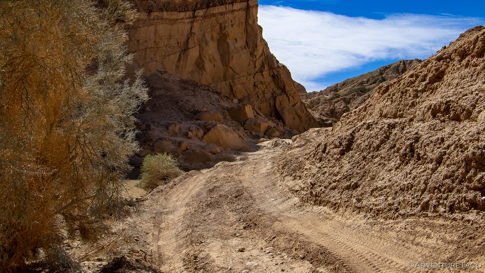
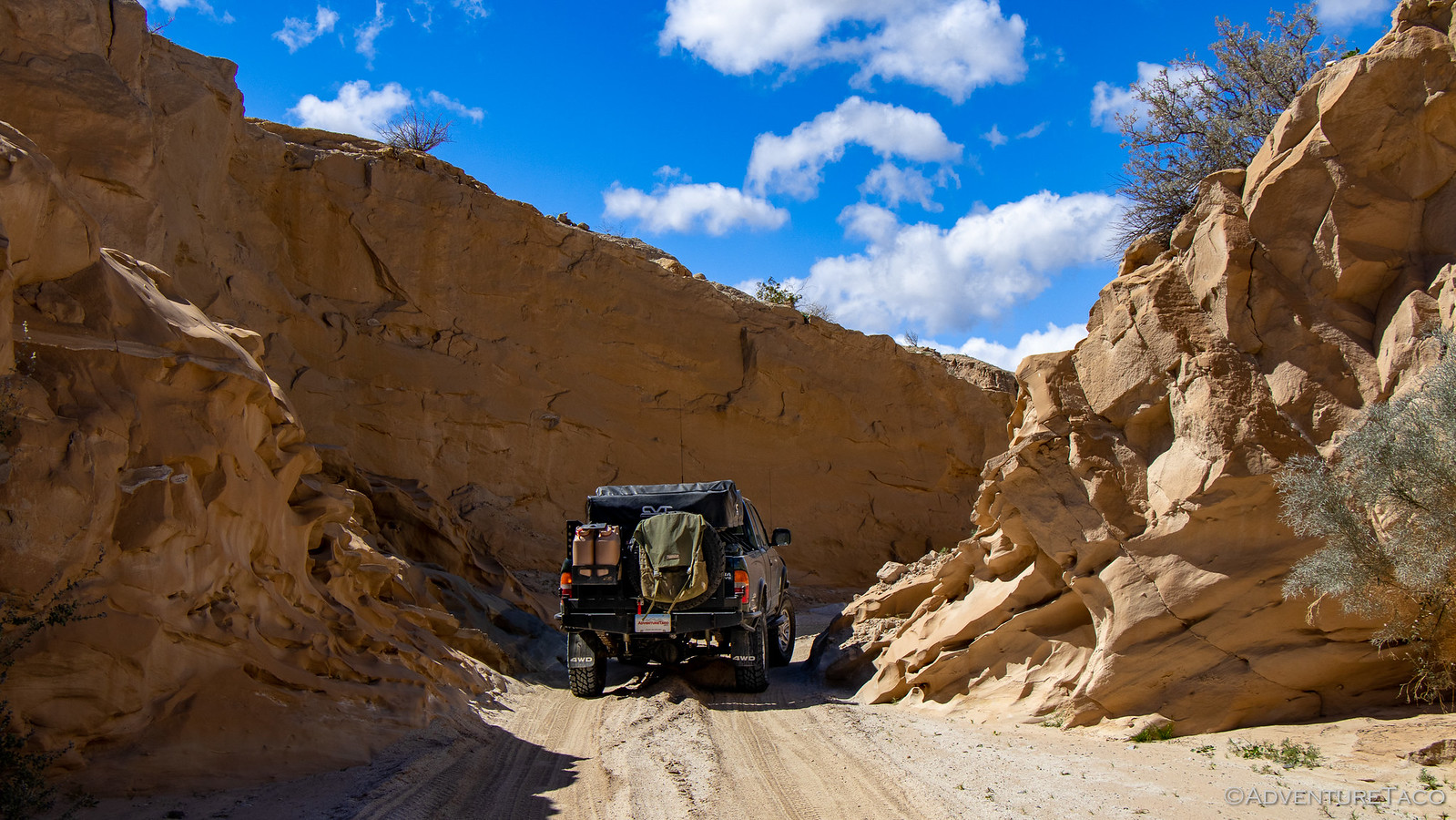
Once again, we were impressed. This really is a great route through the park, with lots of variation in the canyon walls - and it's a bonus to be driving north, since everything is well lit by the sun to the south.
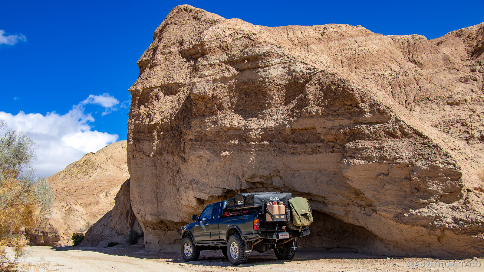
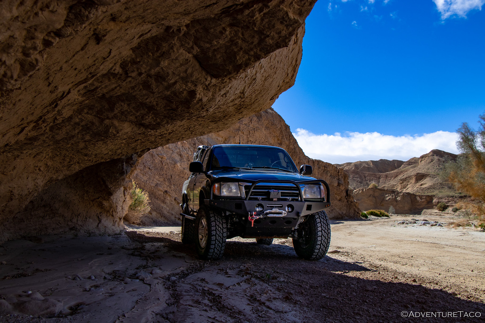
At one point, we found an overhang in the wash wall that had been carved out by what must have been millions of cubic yards of water rushing by and I relayed to @mrs.turbodb a warning I'd read somewhere before the trip. It's perhaps obvious, but it was a warning that these sandstone cliffs are always eroding - chunks randomly breaking off every year throughout the park, sometimes blocking trails or at least adding interesting obstacles. The warning of course - try to minimize your time right next to these cliffs.
So having just relayed the story, I parked under the overhang. As one does.
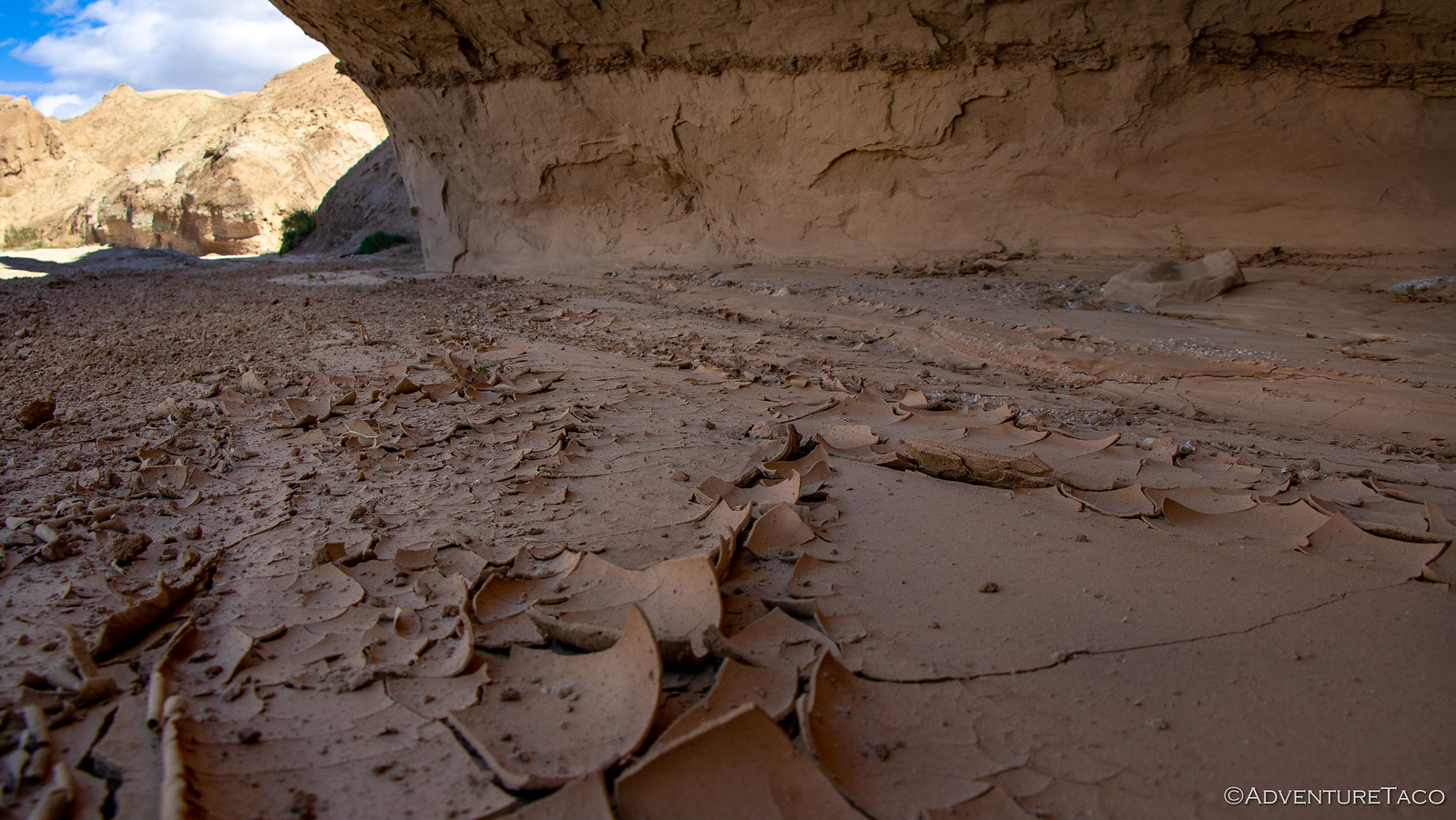
Suddenly, as I was taking pictures, @mrs.turbodb comes bolting out of the truck. See, it turns out that the reasonably strong winds were blowing small chunks of sand and debris off the top or side of the wall above the truck, and they'd land on the roof with little clink-clink sounds.  She was having none of that. Out of the truck, she did discover some cool dried mud however, which we admired briefly before moving on.
It wasn't much later that - as we continued up-wash - that we ran into the remnants of one of the collapses we'd been talking about moments before. A huge chunk of wall had fallen down over the road - enough that it had blocked the water in the wash entirely and a new trail had been created around one side of the fall (away from the wall). That new trail was way off camber, and as we pulled up there were three vehicles in front of us scoping out the situation - ultimately deciding to proceed as many others had before them.
I pulled up as they zoomed away.
At this point, I suggested that perhaps @mrs.turbodb would prefer to sit this one out and take some photos - something she was more than happy to do. And, it was the right call for sure - the camber here crazy enough that a roll-into-the-water felt all but certain. Definitely got the adrenaline going.
And then, as my heart rate was returning to normal and we were getting back into the truck to continue on, we were shown an alternate line to the obstacle by a 4Runner that had caught up to us on the trail. Whether he had previous experience or just lucked out, this was clearly the right line to take!

If Canyon sin Nombre's super-power was it's geographic beauty, Arroyo Seco del Diablo's was the sheer number of slot canyons that branched off of the main wash. We counted a dozen or more slots, knowing that we could spend a day or more on a future trip, exploring all these narrow wonders. For now though, we bypassed them all, opting instead to push on - several trails in store before we'd call it a day.

Seven miles or so in, we turned east onto the Diablo Drop Off. Apparently this trail can sometimes be quite tricky, dropping at a nearly 45º angle in a couple of places. It's also technically one-way, though apparently when it's in better condition, the signs get removed and then the road gets torn up as the #trueoverlanders prove how cool they are by driving back up. That's how it was when we were there, the 57th annual desert safari for Tierra Del Sol (San Diego’s Four Wheel Drive Club) making this popular trail even more crowded than normal.
We did our best to ignore it and instead took in the expansive view before heading down the drop. At least today, it's reputation was definitely #instaoverrated.

Now in Fish Creek wash, we were getting close to one of the trails I'd had at the top of my list for our Anza-Borrego visit: Sandstone Canyon. With some more technical sections, I thought this would be a fun trail, and I knew that the further we got, the fewer people we'd see - always a positive in my book. But, before we hit the turn off, I happened to glance over and notice something at the base of Fish Creek's tall walls - pumpkins!
Not real pumpkins of course - but pumpkins like the ones we'd seen in the Pumpkin Patch the day before - only this time, they were still partially encased in the sedimentary layers of the mountains that had formed around them - some of them sheared off, so we could see the initial "seed" that created the pumpkin. This means - I believe - that the hundreds of pumpkins in the patch were - many millions of years ago - similarly encased in mountains of dirt that slowly eroded around them, eventually leaving them lying on the hard(er) ground layer that we see today. Super cool.


As we were admiring the pumpkins, a couple of women hiking up the canyon in full backpacking gear happened by, and ever the nerds, we were quick to alert them to this amazing find. Needless to say, that confirmed our nerdiness, as after a pause of no more than 3 seconds, the women were on their way.
So were we - now at the mouth of Sandstone Canyon, where we figured we'd drive up a way and then find a nice sheltered, shady place to enjoy some more turkey sandwiches and chips. But then, not 5 minutes into the canyon, a group of reasonably well outfitted Jeeps passed us going the opposite direction, motioning to us to roll down our window.
Hey man, you're going to want to turn around, there's a new rock fall up ahead and I got high-centered. With your wheelbase, it's going to be even worse.Jeeper 1
As he pulled away, his buddy behind him pulled up, his window also down.
He was a total wuss. You can make it. Just give it some gas.Jeeper 2
Well, we weren't going to turn around just yet - we figured we'd check it out and make the call ourselves once we got a good look at the situation. So up the canyon we continued, it's walls towering high above us on both sides.
It wasn't long before we came to the rock fall area, and it was definitely more than we were going to tackle. We posed a few photos and then watched as a group of Jeeps on 40" tires who had made it through, came back the other way - only one of them making it through without damage, the rest scraping body panels and one blowing a tire. Three had to be pulled through after high-centering.
Our hope - a big fingers-crossed sort of hope - is that in the two weeks between this first trip and our second down to Anza-Borrego, enough folks try to run this trail that the rocks get broken down and/or stacked in such a way that we can make it through next time. For now, it was time for lunch, no better setting than in the middle of the wash in Sandstone Canyon.

By the time our leisurely lunch was complete, it was getting on 2:30pm in the afternoon, and we knew that we weren't going to complete even the relatively short set of trails I'd planned for the day. Not a problem of course when you're not really on a schedule and enjoying yourself in the outdoors! It did however mean that - upon deciding to continue up to the end of Fish Creek and Hapaha Flat - that we were on the lookout for a reasonable place to spend the night.
We enjoyed the sights and made good time - arriving at the end of the road just before 4:00pm. Now, technically this would better be described as the "end of two roads" since it's also the end of the one-way Pinyon Mountain Road - apparently the most difficult road in the park, with a obstacle known as "The Squeeze" - just wide enough for a JK, and a drop known as "Heart Attack Hill." We wouldn't be running that trail ourselves - especially the wrong direction - but a group of six Jeeps showed up just as we were starting back along Hapaha Flat - clearly having a great time. We let them zoom by before continuing on our merry way.
We'd spotted a couple places that looked like they could make reasonably sheltered camp sites on our way up the trail, and as we were heading back we ran into a park ranger. Driving a 2nd gen Tacoma, she was out exploring and generally making sure everything was OK in some of the more remote parts of the park, "I've got the only vehicle in our fleet that can really make it out here." But we were blocking the road so we didn't chat long - each of us continuing on our - for now - opposite directions.
36 hours later, we find out that the same park ranger had talked to my dad earlier in the day to let him know that a great area to bird in the park was a place called McCain Spring. And as if talking to the same ranger wasn't coincidence enough, it also turns out that 30-minutes after talking to her, having not even touched on the subject, we pulled into McCain Spring and decided to call it camp for the night!
The view back into Hapaha Flat, from McCain Spring.
Arriving to camp earlier than normal, I quickly setup the tent since we'd put it away wet this morning, and we decided to do a bit of exploring before dinner. McCain Spring was named after a rancher who lived in the area years ago, having piped water from a spring back up in the mountains to a watering trough he'd installed in Hapaha Flat. The old cistern and pipe still exist, so we thought it'd be fun to follow the pipe to the source.
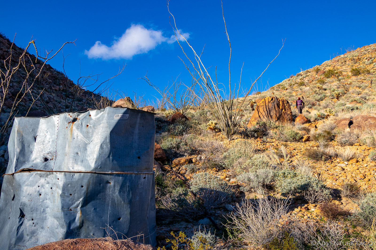
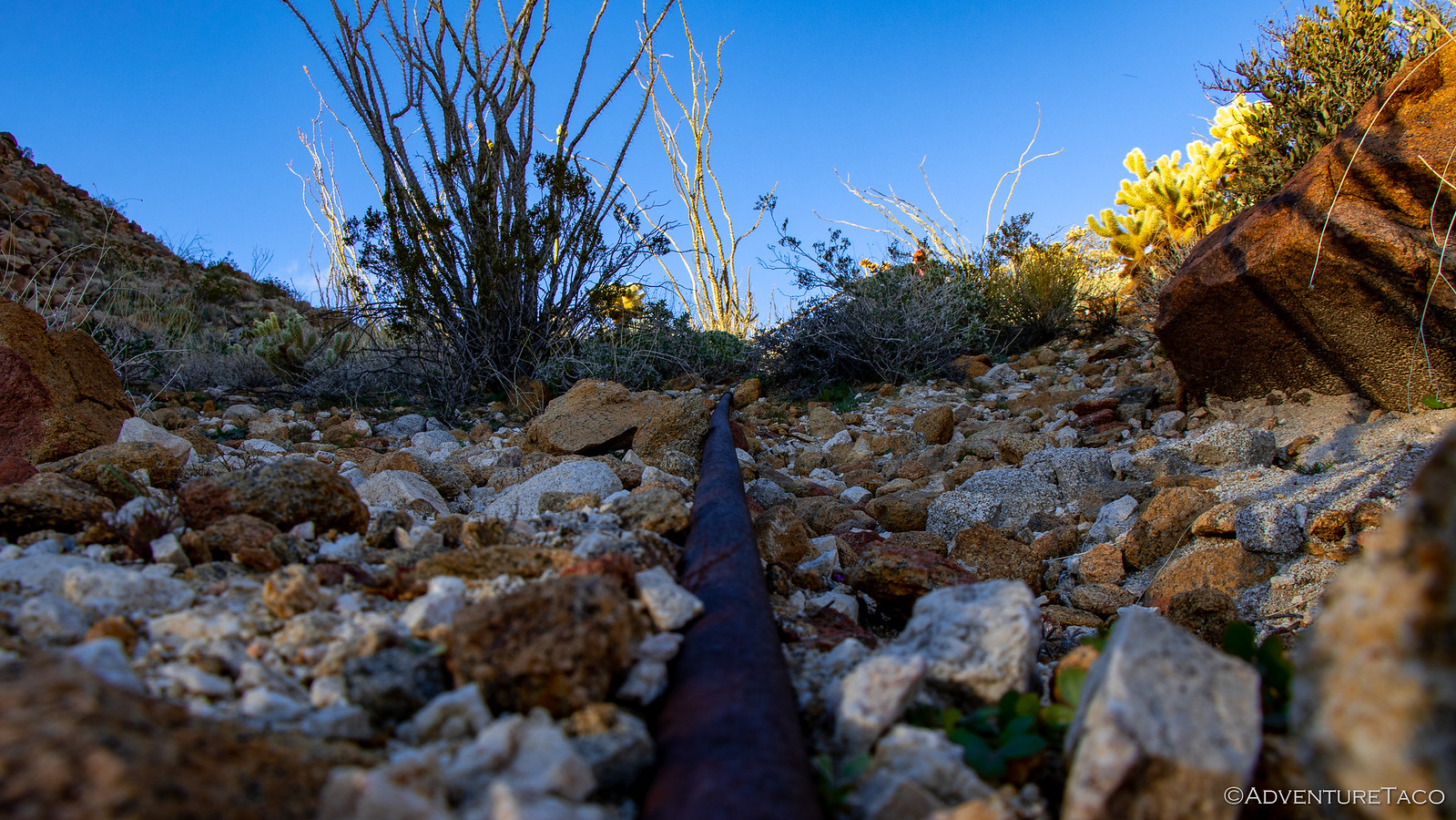
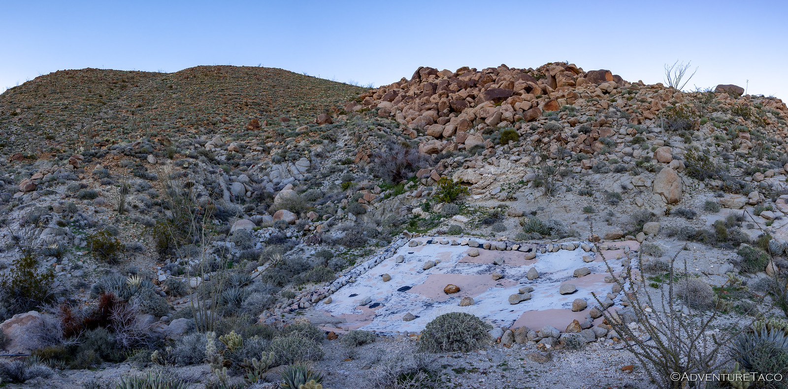
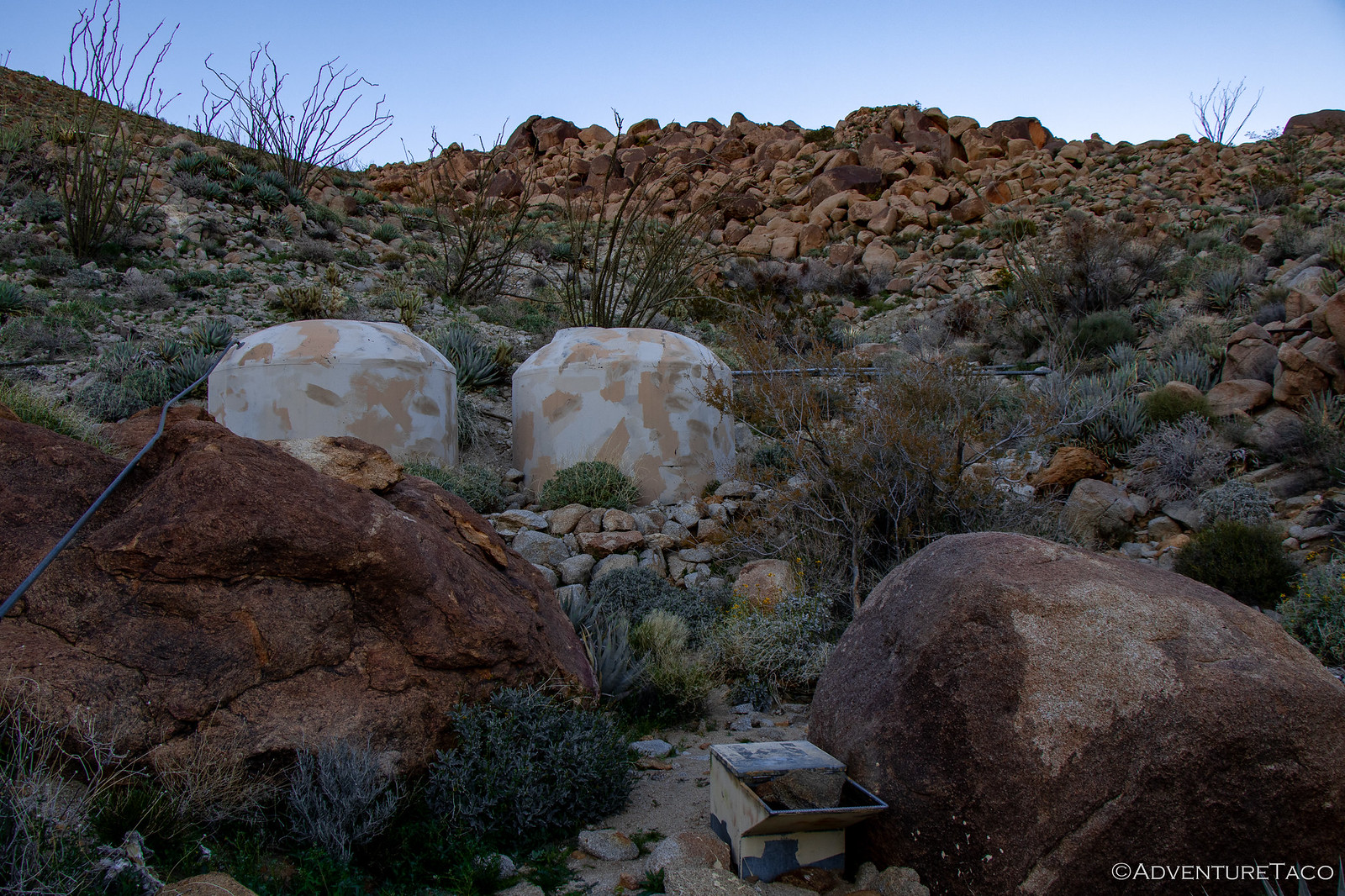
The spring has long since dried up, but to our surprise, where the spring used to be, there is now a large tarp covering the ground, draining into two large plastic cisterns, which in turn feed water into a small trough. The idea, naturally, being that for years animals in this area utilized the spring as a rare water source - and now they can once again, thanks to the ingenuity of the park service.
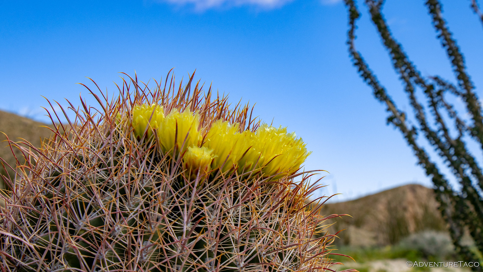
By now the sun was setting as we made our way back to camp. I scrambled up the rocky hills to snap a few sunset shots as @mrs.turbodb snapped photos of the various flowering cacti in the area.


Eventually we made it back to camp, the wind buffeting us the whole way. We'd selected our camp spot for the fact that it was sheltered on three sides, hoping it'd protect us from the 20mph winds and 50mph gusts, but were disappointed to find that in fact no, that wasn't the case at all - due to the strength of the wind, it was windy everywhere and we were in for a noisy night.
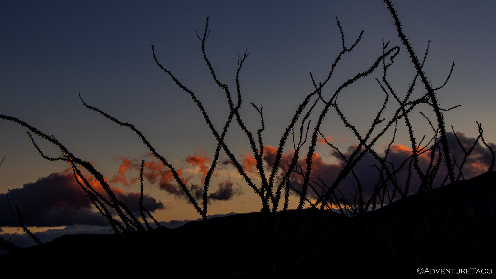
Hoping the wind would abate a bit as the sun set and temperatures evened out, we read our Kindles in the truck for an hour or two, the last of the light fading from the sky, the ocotillo silhouetted against the orange highlights.
But rather than abate, the wind seemed to pick up into the evening, the tent bucking wildly in the wind. In fact, it was so wild that I pulled all of the metal poles out of the window and door awnings, reducing surface area as much as possible and buttoning up everything as tight as I could.
We held out until 8:00pm or so hoping that things would calm down enough to get out and make dinner - another round of delicious turkey sandwiches - but it never happened. Luckily - having eaten a late lunch - neither of us was all that hungry, and so we decided the best course of action would be to climb into bed and let the wind rock us to sleep, hoping that in a few hours things would settle down.
Boy, were we in for something else entirely.


Not as brave as you two, but what a blast I had on your adventure, reading your post and looking at absolutely incredible pix. Thank you for doing the hard work for me. My husband and I go to Anza Borrego every Feb-Mar, so we know the winds all too well. We don't have 4wd, so we enjoy the calmer side of the desert. Your trip was wonderful!
Glad to hear you enjoyed the adventure, hope you had a chance to read the entire thing (both of the trips)! Such a cool place down there, wish we were closer so we could explore more, and for longer :).