

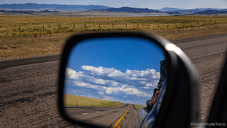
Heading out of Alcova, we were driving into the sun. I'm never a huge fan of this, since it makes it harder to enjoy the landscape into which we are adventuring, and I hoped that we'd find somewhere to camp quickly, or that we'd turn north so that the sun would at least be to the side. Not that I'd looked at the route and known that neither of those things were in the cards. 
Before we could find camp, our first order of business was to visit a rock that wanderers of the west have been visiting for centuries - Independence Rock. We had high expectations of this short side-trip off of the main route, hoping it'd be similar to El Morro, which we'd visited on the New Mexico BDR the previous summer.

[Independence Rock] was a landmark for explorers, fur trappers, emigrants, Forty-Niners, cavalry, stage coaches, and Pony Express riders. It has been called the "Great Register of the Desert" because of the many names carved in its granite surface. The following quote is from a passerby, William Marshall Anderson, in 1834;
We have breakfasted this morning at the base of Rock Independence. There are few places better known or more interesting to the mountaineer than this huge boulder On the side of the rock names, dates and messages, written in buffalo grease and powder, are read and re-read with as much eagerness as if they were letters… from long absent friends ... being a place of advertisement, or a kind of trapper's post office . . It is a large, egg-shaped mass of granite, entirely separate and apart from all ... ranges of hills. One mile in circumference, about six or seven hundred feet high, without a particle of vegetation...
Various stories surround the origin of the name Independence Rock. The mountain man "Broken-Hand" Fitzpatrick may have named it on July 4th, 1824, when his buffalo hide "bull-boat" capsized near the rock. General Ashley camped here on July 4th, 1825 and may have named it. Others say that Captain Bonneville named it in 1832 because it stands alone and "independent" on the prairie. Pioneers on the Oregon Trail needed to make it to the rock by July 4th to complete their journey west before winter, and therefore called it Independence Rock.
A one-mile trail exists around the rock, and despite having recently removed the sweat from our bodies, we decided that we'd brave the still-in-the-low-90s °F temps to check out some of the signatures.


In the end, I don't think either of us were all that impressed by what we found at Independence Rock - compared, at least, to what we'd seen at El Morro National Monument. Looking back, this is likely more a reflection on the fantastic nature of El Morro than anything - it really is a place to check out if you're ever in the area.
Our trek completed - and our bodies now slightly sweatier than when we'd started - we traced a few miles back to the BDR route in search of a place to call home for the evening. By this point we'd both admitted to having looked at the map and acknowledged that our best bet - to escape the heat - was going to be finding something in the shade of a mountain, as we wouldn't be gaining any elevation for quite some time.

Having eaten only taco-rittoes for dinner to this point in our journey, we decided that this would be a nice night to switch things up a little bit. Before leaving, I'd made a cold pasta salad, and @mrs.turbodb had prepared a Spanish tortilla and some roast cauliflower, so we pulled those out of the fridge and set about stuffing our faces.

Besides still being very warm after dinner, the mosquitoes decided it was time to eat, so we had no choice but to retreat to the tent. Luckily, with all the windows and doors screened over, we had some nice airflow and the little bloodsuckers were kept at bay.
Reading of Kindles - and a bit of photo processing to clear up space on the camera - were all that stood between us and some shut eye. Another great day on the BDR.
The Following Morning...
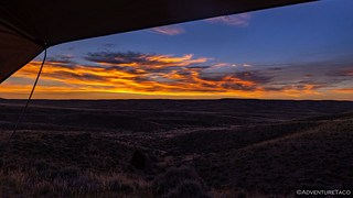
Up early - about 15 minutes or so before the sun broke the horizon - we decided to get an early start to the day in order to take advantage of the cooler temperatures while we could. It wasn't cold by any stretch of the imagination - it was still more than 75°F - but it was a heck of a lot better than what we'd gone to sleep to the previous evening.


By 6:15am we were already on the road, the long rays of the morning sun beginning the process of warming the air around us. Elements of the landscape reminded us of Alabama Hills in California or Idaho's City of Rocks, the stacked granite boulders rising from the surrounding desert.


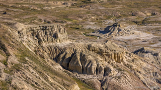
Soon, we found ourselves on Beaver Rim, our view of the badlands to the north, spectacular. We'd stop several times as we made our way along the undulating two-track as it followed the fence line, each time sure that the view couldn't get any better. Each time, proving ourselves wrong.



Along the way - as we'd experienced along the entire route so far, and would until the end - the primary hoofed inhabitants were pronghorn. Far outnumbering deer and even cows, this guy decided that he'd escort us for a mile or so at 30mph. It was a fun couple of minutes, for both of us!

Besides the view over the edge, the up-and-down nature of the plateau we were on meant that we could see the twists and turns of the road before as it wound its way through the green grass and sage. Up one rise and down another, we slalomed across the hillsides, the morning air still cool enough for our windows to be open.

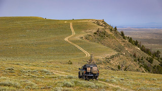


Eventually the road turned away from Beaver Rim as we passed the halfway point of this stage and turned southeast towards the town of Atlantic City. Only one of us remembers this part of the route, as the curvy nature of the road and sweet smell of wildflowers pushing into the cab was apparently just right for rocking a passenger to sleep.


It was here - as we were perhaps 15 miles away from Atlantic City - that we noticed a BLM sign along the side of the road, marking one of the many offshoots from the BDR route: Gillespie Place. No distance nor direction beyond the sign was mentioned, but a line recommending a high clearance 4x4 was enough to get our attention. A quick look at our GPS showed that - even if we never found the Gillespie Place - we'd meet up with the Oregon Trail if we took the detour, so I turned the front wheels and we set off in a new direction.
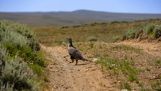
As we stopped to photograph the grouse (?), I happened to spot a roof nestled behind a rise a little to our left. Not knowing for sure, but suspecting that it could be what we were after, I stealthily navigated us in that direction, despite direction from my copilot that, "The Oregon Trail is to the right [the other way]."


Apparently - through this section of the west - the Oregon Trail is also the Mormon Pioneer Trail and Overland Trail, and we followed markers for a few miles to the ghost town of Lewiston, where several old ruins and a single new(er) cabin dotted the landscape.
In the spring of 1876 Martin Lewis discovered placer gold on Strawberry Creek 13 miles east of South Pass City, WY. Upon following up on the placer find a claim is struck to be known as the Bullion Lode. The miners began by sinking a shaft & running a drift under the creek, discovering a small fortune. The Bullion Mine reportedly yielded 21,000 ounces of gold in its heyday. Families such as the Nickersons and Gustins flourished here as well. In 1879, with the discovery of the Burr Mine, the camp of Lewiston opened up.
In the late 1870's and early 1880's a Montana man by the name of A.T. Burr makes his way to Lewiston with a soldier from the nearby Fort Washakie. On a suggestion from an old friend, Sam Springer, a particular spring from a nearby gulch is panned. During their second pan a nugget valued at $6 is found. Upon filling several pouches with gold & returning to the fort, news of the strike spreads like wildfire and a mini rush is on.Informational Sign


Not wanting to stray too far from the primary BDR route, we took a quick look at the GPS to ensure that our next couple of turns would dump us back out onto the trail. From there, it was only a few miles to Atlantic City, a "ghost town" that is anything but.

Atlantic City was bustling - to say the least - its claim of 57 residents a stretch for just the main town square. ATVs, side-by-sides, and street legal vehicles of all kinds clogged the streets. We'd been hoping to find a place to stop for lunch - a nice shady spot like the one we'd run across in Medicine Bow - but one thing was for certain: we weren't going to find that here. We needed to push on.
Luckily for us - we thought - the ghost town of South Pass was only a few miles down the road. We'd planned to stop there to explore some of the old mines and buildings, so we figured we might was well eat lunch there as well.
Yeah, right.
The Whole Story


Love Backcountry Discovery Routes? Check out
BDRs we've run
to find your favorite.




Yep! Atlantic City. The haven of atv’s and Side by sides. If you happen to be there at or near lunch time the wait is about two hours. Some of the unfriendliest people on the whole CDT except for the old man in the MAGA hat in Colorado. But just wait for Pinedale and the Upper Green and Union Pass. The absolute best.
Great story. Great trip. Thanks
Nice photos and always enjoy the text also, especially since I'm sure we don't get up that way again during this lifetime. Thanks, much!