
From Rainbow Canyon, I'd planned to drive a couple hours east - through the darkness - to a fantastic petroglyph site that I could enjoy when the sun crested the horizon the following morning. But, as is often the case, I was easily distracted as I set up the navigation system and noticed that my route would take me right by Cathedral Gorge State Park.
We'd briefly stopped at Cathedral Gorge for breakfast on a previous trip south to explore the eastern Mojave, but we hadn't spent much time there and I knew that what we'd seen at Miller's Point was just the tip of the iceberg. Plus, rather than a two-hour drive east, I had just a 20-minute drive to a little slice of BLM land just outside the park boundary - no need to pay the $35/night fee in the campground - before I could settle in for what I assumed would be a chilly-but-dry night.

Chilly - yes. Dry - apparently not.
Finding the entire tent - both inside and out - covered in a thick layer of frost when my alarm went off about an hour before sunrise, I wondered what my best course of action would be. I'd purposefully gotten up early so I could enjoy sunrise at Cathedral Gorge, but I didn't want to put the tent away in this condition, either.
Ultimately - with enough frost on the outside that it looked like snow - I decided that I'd better pull all my bedding out of the tent, close it up wet, and then - hopefully - dry it out in the sun while I poked into the muddy slot canyons just a few minutes away.
Cathedral Gorge
I pulled into the park to pay my day use fee just as the sun was cresting the horizon. This was slightly later than I'd hoped, but turned out to be a blessing in disguise as it meant that I could more easily find a location to park that would be in full sun. Even with temperatures in the mid-20s °F, I hoped that a few hours would be enough to sublimate off all of the moisture.
With the tent oriented optimally towards the sun, I headed to the Moon Caves to start what would be one of the most surreal experiences of the entire trip!
Given the tall, narrow nature of these narrow slot canyons, lots of the photos here are in portrait mode. For those of you on phones, enjoy; for those on computers, apologies!

Ghosts of Cathedral Gorge.

There was nice, reflected light in the first slot canyon I hiked into.


Darkness to light.

A hint of green.


Narrow passages.

Curvaceous walls.

Towering pillars.

A natural bridge!

Shadows and light.
With the light streaming in at a low angle, and the Moon Caves more elaborate than I'd expected, I ended up spending more than an hour wandering through the narrow passageways before pulling myself onward to the Canyon Caves - mere steps to the north.

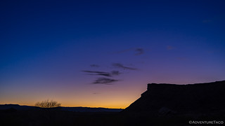
Frosty morning.

Sliver of light.


Textured walls.
Knowing that I had more to do during this day than simply exploring one fascinating mud slot canyon after another, I pulled myself away from the Canyon Caves more quickly than I'd been able to at the Moon brethren. I still had one more set to investigate - the Cathedral Caves - but first I wanted to check out an old Civilian Conservation Corps (CCC) water tower that was built in the early 1930s. Alongside a picnic area and restroom, these allowed visitors to one of Nevada's first four state parks to enjoy the area in much the same way I was enjoying it today!

Texture and light.

Water tower sunstar.

Looking up from inside the Cathedral.
While I had no misconceptions that this would be a quick stop on my way to the first petroglyphs of the day, the slot canyons were so much more interesting than I'd expected that I spent nearly twice as long exploring this area than I thought I would. It was worth every minute. I highly recommend stopping to enjoy this little park just after sunrise or just before sunset to wander through these gorges, craning your neck to the sky.
Parowan Gap
After a fantastic morning at Cathedral Gorge, I packed up the - now dry - tent and had a quick breakfast before heading east to the petroglyph site I'd thought was going to be my first stop for the day - Parowan Gap.

"A little chilly" seemed to be a theme for this trip.
Arriving a little after noon, I was surprised to find myself alone at what I knew to be some amazing rock art - perhaps an indicator that 12-year-old @mini.turbodb is right: I'm not normal.
Whatever the reason, after parking in the nearby lot, I made a beeline for the gap, and one glyph in particular.

The zipper glyph.

A migration story.
Of course, there is plenty more to see here, and after admiring the zipper glyph, I continued through the gap - down one side and up the other - to soak in the hundreds of petroglyphs that line this narrow channel carved by an ancient river.


Snake glyph and Bug Man.

Snake man, or Mouse man with a snake?
Many of the petroglyphs at the gap appear to depict wildlife. On the boulder before you, for example, four cross shaped images angle up the rock face. Might they be bird tracks? Or birds in flight? This landscape is filled with birds that could have inspired such carvings. Golden eagles regularly nest in the cliffs around you. Many other birds of prey including peregrine falcon, prairie falcon, red-tailed hawk, and great-horned owl live here as well. What other wildlife images do you see among the petroglyphs? (BLM information sign)
Parowan Gap boulder.


High on the wall, I spotted these designs.
In 1849, the Legislative Assembly in Salt Lake City commissioned Parley P. Pratt to lead the Southern Exploring Expedition and scout for new Mormon settlement sites. Expedition members recorded Parowan Gap in their journals, several members noting that the Ute leader, Chief Wakara, referred to it as "God's own house." (BLM information sign)
Inscriptions made by early settlers have become, in a sense, part of this site's historic record. But now that people understand just how remarkable and irreplaceable the petroglyphs are, this site protects that heritage. Any writing on the rocks today is vandalism, punishable by law.


South alcove petroglyphs.

These angular patterns reminded me of the petroglyphs we'd seen just outside of Las Vegas.


Two more fascinating panels.

Native Americans say that petroglyphs are their written language based on the Indian sign language which was universal among all tribes and can be read by any tribe throughout North America. This is why you see many symbol similarities throughout Utah and the southwest.
I'd considered eating lunch at the gap, but with a brisk breeze and plenty left to do in the daylight I had remaining, I decided to push on. My next stop wasn't far away - less than a mile - where I hoped to check out my first set of fossilized dinosaur tracks for the day!

My first order of business upon arriving at the dino track site was to help this mom and her three kids out of a sticky situation they'd gotten themselves into! I think the kids - who loved every minute of it - tried to livestream it to their social medias.

Unfortunately, someone broke off the middle toe of this dino track sometime between 2010 and 2011. This is why we can't have nice things.
Probably an UTVer. (j/k ... OrAmI?)
Wrapping Up My Day in Warner Valley
From Parowan Gap, it was time to head south. I'd spend the rest of my trip popping back and forth across the Utah-Arizona border, checking out a few spots in the Arizona Strip that I'd been meaning to visit for quite some time. First though, I had a couple hours of driving in front of me, and that meant I was going to be cutting it close as the sun raced towards the horizon.

UTVs on public roads? I must be in Utah.

Making my way along the base of red cliffs towards my first destination.
It's not every day that you get to visit two dinosaur track sites, but today was one of those days for me. Whereas the first had been a series of molds - essentially, the sediments that once filled the tracks and later turned to stone - the second set was the actual tracks themselves!

Megapnosaurus. 6-8 ft. long; 3 ft. high at the hips; 50 lbs.

Dilophosaurus. 20 ft. long; 6-7 ft. high at the hips; 1,000 lbs.
Anyone who knows me, knows I love a good lizard chase (and catch). Obviously I wasn't going to be catching any of these, but that didn't stop me from tracking around, snapping photos from various angles and generally looking way too interested in a few dimpled rocks. Luckily, no one else was around to give me any grief.
By the time I'd had my fill, it was nearly 4:00pm; only an hour of daylight remaining for my final excursion of the day. Nearby, the trailhead of the 5-mile hike would lead me down the Fort Pearce Wash to the site of the Red Man Pictograph... assuming I could find it before it was too late (literally).
Knowing I was cutting it close, I opted to postpone my exploration of Fort Pearce itself until I returned. Instead, I grabbed my small, ultra-bright flashlight and hoped that I could at least make the trek to the Red Man before the sun went down. After all - I figured - I could always hike back in the moonlight!

Along the way, some old pioneer signatures. Goates was through more than once, apparently!

1757 seems a little early for these folks to have visited.

William needs to work on his "S"s, and on finding his own rock, rather than carving over petroglyphs. Shame on you William.
As I proceeded down the wash, I made reasonably good time. I'd been worried that I'd find myself bushwacking through more of the thorny the Catclaw Acacia (Senegalia greggii) that I'd encountered in Arrow Canyon a couple days earlier, but luckily the I faced no such obstacles and soon the trail opened up into a much broader wash.

Fort Pearce Wash boulder.

High on the cliffs, I didn't have time to climb to the panels that ruled over the landscape. Luckily, I'd brought along my 240mm "climbing lens."

The sun nearing the horizon, shadows got longer and colors more vibrant. I was nearly jogging at this point, since I still had half a mile to go.
With only a few minutes until sunset, I glanced up in the general direction I hoped to see the Red Man, and to my delight - or dumb luck - I spotted it high on the cliff. There was no way that I was going to let my climbing lens get all the glory, so after snapping a quick photo, I began clawing my way over the jumble of boulders that stood between me and this man-sized work of art.

I see you Red Man, you can't hide from me!

Easily distracted by tafoni.

Back on track.

Success!
As I stood there, admiring one of the largest pictographs I've seen - it reminded me of this Shaman - I basked in the pink glow that spilled across the valley. It'd taken me only an hour to cover the 2.5 miles, and at much lower elevations than I'd experienced the rest of the trip, temperatures were still pleasant as I slowed down to soak in the sunset.

Layers.
Time to head back.
With the moon lighting my way, it was just after 6:00pm when I arrived at the trailhead. Figuring that I'd spend an hour or so transferring photos from my camera to my laptop and then go take a couple night photos of Fort Pearce, I got everything setup and inserted my microSD card.
And then, boom! Adobe Lightroom decided that it hadn't communicated with its authentication servers recently enough for me to use the product that I pay a significant amount of money for every single month. Having worked on subscription software myself (that gets the auth bit right), this really irks me. I'd been connected to the internet less than 24 hours earlier - was there really no way that Adobe could say... cache the fact that I had a valid subscription for a couple days? Or maybe give a warning that I'd need to connect and verify the subscription in the next few days in order to prevent the software from going into lockdown mode? Seriously, just locking down immediately - that's just dumb.
Unable to waste time with technology - perhaps this was a blessing in disguise - I donned my headlamp and set about making dinner. I wasn't sure this would take long enough the light on the horizon to fade enough for a night shot, but I figured that a belly full of taco-rritoes would at least put me in a slightly better mood. Because I do love guacamole.
After dinner, I headed out to try my hand at a bit of foreground lighting.

Fort Pearce and some weird stripe in the sky.
The small structure at the Fort Pearce Historic Site is one of only three remaining stone guard posts built during Utah’s Black Hawk War. This “war” was actually period of intermittent raiding between 1865 and 1870, during which the Ute Tribe, led by Chief Black Hawk (Antonga), and other Native Americans allies attempted to drive the Mormons from the Ute traditional homelands. Mounted Ute raiding parties, often joined by Navajos, stole Mormon livestock, attacked outlying ranches and settlements, and killed settlers who interfered with the raids. More than 100 Native Americans and at least 70 Mormons were killed during the raiding.
To protect their herds and homes, local Mormon militia constructed a series of protected guard or sentry posts, called ‘forts’, along major trails and travel corridors in central and southern Utah. Four to six armed men with horses were stationed at each post, to attack and delay the Indian raiding parties, while a rider raced to the nearest settlements with a warning. Horses were stabled at night in the guard posts, to ensure that the early warning ride could be made without delay.
Fort Pearce Wash was one of the primary routes along which Ute-Navajo horsemen traveled to raid the livestock herds and settlements of the St. George Basin. A site was selected in the spring of 1866, on a high bluff overlooking a narrow, steep-sided canyon, just above the only natural spring for miles, for a guard post along Fort Pearce Wash. A small number of armed men could easily defend this location and water from the spring would support the defenders and their stock.
A work party of 20 men began construction on that guard post on December 4, 1866, working for nearly a month to quarry enough local sandstone to construct the dry-laid or mud-mortared defensive structure and a stock corral. No armed conflicts are known to have taken place at Fort Pearce, but the guard post was manned, at least intermittently, from 1866 until 1873, when peace negotiations and U.S. Army actions ended the raiding that was known in Utah as the Black Hawk War.Bureau of Land Management
I'd also bypassed a few petroglyphs that were in impossible-to-photograph light when I'd initially set out for the Red Man pictograph, so I hiked back down the trail a touch in order to capture the slab under the moonlight.

Fort Pearce Petroglyphs.

A closer look at the petroglyphs on the slanted boulder.
As with the previous night, I'd used up every last minute of daylight. As I walked back to the Tacoma, I decided that I'd spend another 90 minutes or so driving through the dark to the Little Black Mountain petroglyph site. Having already poked around in Nevada and Utah, jumping over the border and into the Arizona Strip would mean that I'd have covered three states in a single day!
Of course, I'd have to wait till morning to resume my search for some fo the most unique rock art I've ever encountered. Hopefully, this time, with less frost to clean off my tent!


Another amazing adventure, thanks very much for sharing. These are some places that we might be able to visit in the spring. In any case the photos are excellent and the areas are pretty amazing!
Thanks John! These are - with the exception of the Red Man pictograph - places that are all easily accessible (mostly by paved or well-graded dirt roads) so I'd totally recommend going! For Cathedral Gorge - I'd try to make it an early morning (just after sunrise) or evening (just before sunset) visit, even if that means camping overnight as the light at those times of day really accentuates the canyon walls. They can get washed out a bit in the middle of the day. Hope you get to check them out! ?
Just thinking of those folks sitting there creating graphs like that so long ago....and you get to see them. Your pictures preserve them before human or nature erases them.
I can only imagine how long it took to create all that rock art so many years ago. Pretty cool that it persists through history and that we get to enjoy it today (or at least, what is left of it, as you mention)! I suppose that with computers and internet, everything we are creating these days will be preserved... I wonder if that will make it less interesting/special in the future?