

2026 in the Pacific Northwest has been a summer of smoke. With fires raging in eastern Washington, all of Oregon, and much of southern British Columbia, all the places we usually enjoy exploring during the summer have suddenly become... unpleasant.
In fact, while we'd previously thought that a beginning-of-July timeframe for the Montana BDR was too early, it's now looking like the smartest move we could have made. And our escape to Bella Coola for a few days - while a little hazy from fire - turned out to be genius.
And so, itching to explore - while being able to see what we're exploring - we're pushing even further north. Into regions of British Columbia that I mapped with little expectation of ever paying a visit. Into Alaska.
- - - - -
It used to be that long drives were a winter ordeal. A way to trade the gray skies for the vastness of the desert. But now the tides have turned. Flights to Las Vegas have made winter trips easy and enjoyable. This year, the long drives are taking place in the summer; an attempt to trade the orange skies for blue.
Out of the house at 6:00am, there was no way we'd reach our main destination - Telkwa Pass, in Northern British Columbia - before sundown. With smoke covering the province between the border and Williams Lake, I suggested to @mrs.turbodb that we return to a site we'd enjoyed on our last adventure in the Pantheon Range. It was three hours - each direction - out of our way, but the views were some of the best we've seen, and we hadn't had a chance to hike to the summit the last time we were there.
With no obviously better option as we approached the turn, we headed west as podcast after podcast earned the played label in our feed.
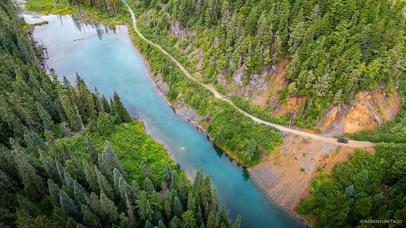
It was a little after 7:00pm when we pulled off the pavement and drained enough air from our tires to make the race past Miner Lake as comfortable as it could be. With two hours until sunset - and having already eaten dinner on the road - we were in good shape to reach camp before dark, and ready to be done driving.

The plan, therefore - since we'd experienced this road only two weeks before - was no stopping for pictures. It was an impossibility, of course, but hopefully our concerted effort to efficiently reach our destination would be - at least - less...slow.
Five minutes in, the entire plan was thrown to the wolves. Or the cats, as it were.

I'd spotted the bobcat bounding across the road as we'd rounded a bend, and as quickly as I could, I grabbed the camera and hoped it would be as curious as we were as I rolled to a stop. After snapping a couple quick shots, I swapped in my long lens and set off into the woods, unsure whether I was the hunter or hunted.
By then, the feline was either long gone or well-hidden, and after a few minutes of gingerly stepping through the dry twigs and low brush, I headed back to the Tacoma so we could continue on our way.


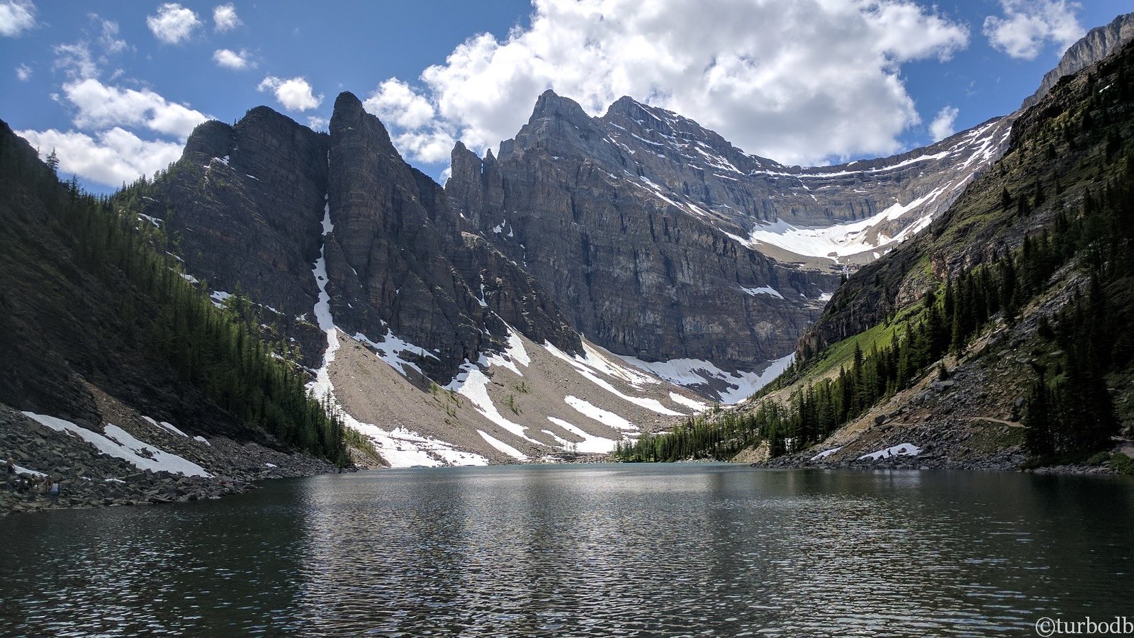
The last time we'd camped under the watchful eye of this Peak, we'd taken up residence on the waterfront. This time, I wanted to climb - as far as we could - an old shelf road that switch backed up the ridge and through the scree, positioning us as high as possible for a trek to the summit.


Our next trick was finding a spot to camp. On the one hand, we wanted to reduce our climb to the summit the following morning; on the other, it was a bit breezy and with rain in the forecast, a spot sheltered from the worst of the wind would provide less a less blustery, blow-us-off-the-mountain night.
Having experienced the worst storm we'd ever weathered in a similar location high in the Kootenay Mountains of British Columbia, we were soon nestled into the carveout of a switchback on the leeward side of the mountain.


It'd been a long drive, and after a few minutes getting settled, we brushed out teeth and climbed into the tent. As we did, the first drops of rain pelted the fly, neither of us sure how long or wet the storm would be. Not that it'd have made any difference to us; sheltered from the brunt of the wind, the rhythmic rain provided a calming pitter-patter that quickly knocked us out for the night.
The following morning...
Despite the fact that we'd driven more than twelve hours to reach this most magnificent camp site, we still had another ten hours of seat time before we'd find ourselves at the trailhead to Telkwa Pass. For most, this would point to an early start of the day, a couple meals on the road, and rolling into camp sometime around dinner. But we are not most. We are crazy.
Our plan was to sneak in a 6-mile hike with 2,500 feet of elevation gain - most of it without a trail - before getting on the road. @mrs.turbodb has learned that this is standard stuff when I'm planning a trip, and while she's not the biggest fan of pre-sunrise alarms, they have proven to allow for a bit more adventure every day.

From below, the hike up to the summit looked easy. We'd follow the old mining road to its apex, traverse a mostly flat ridge, and finally push up a not-terribly-steep-slope to the summit. The thing was that, the looks were deceiving. The distances and grades - once enroute - were much more significant than we'd projected. But I am - as usual - getting ahead of myself.

Reaching the ridge as the sun raced skyward, the situation we'd gotten ourselves into suddenly became clear. There was no trail here, and after a night of rain, the scree-covered slopes were slippery to say the least. The distance - which looked like perhaps a quarter mile from our vantage point at the lake - was closer to a mile-and-a-half.
And the up at the end - into a cloud-covered summit - looked daunting.

Hoping that the clouds would clear by the time we reached the top, we decided to push on. After all, I was sporting a new pair of shoes on a recommendation from Matt @theesotericone, and we were both having our first-ever go at hiking poles; it was no time to turn around!


The increased stability we achieved with the hiking poles allowed us to make surprisingly quick work of the traverse along the ridge, and before we knew it, we were at the base of the final climb. The final three-quarters of a mile would require a 1,300-foot ascent. If we were going to turn around, now was the time to do it.
We were not going to turn around.


It was just after 8:30am when we reached the summit. Completely socked in, we could only imagine the never-ending views that stretched in every direction. I settled in to reading the (new in 2026) summit log, adding an entry for our early morning climb.

And then, just as I was stowing the log back into its weather-proof vessel, the clouds cooperated. The sky didn't clear - not by a longshot - but for a few seconds, the mist dissipated and the mountains made an appearance. It was glorious!

As quickly as I could, I launched our little buddy into the sky. These were perhaps not the safest of conditions for it to be cruising - gusty winds and a lack of visibility meant I was battling a constant barrage of warning indicators - but with any luck I'd capture the two of us at 9,318 feet, on the top of the world.

Hoping for a repeat performance, I negotiated an eight-minute delay with my hiking companion before we'd begin our descent. Naturally, eight became more, but with no clearing in sight - not that we could see much of anything - we were soon working our way back down the talus slopes of ███████ Peak toward the rest of our day.
Now and then, one band of clouds would give way to the next, a short period of blue separating the trains. In these moments, we'd get a taste of what might have been, had our trip started a day earlier - or later - than it had. Still, we were grateful for this second chance so soon after our last visit, and enjoyed every sunlit view that presented itself.


The summit would make an appearance only once - and then, for less than five minutes - during the ninety minutes that it took us to return to the Tacoma. The show, it turned out, was to the north, where clouds raced above the ridgelines, their fluffy forms creating a never-ending light show below.


It was just after 11:00am when we climbed into the Tacoma for the race back to pavement and our continued trek north. What I'd thought would be only a short side trip had turned into a twelve-hour detour; one that meant we'd arrive at our next trailhead more than an hour after dark.
We'd be a half day behind schedule, and - while we wouldn't know it until more than two full days later - it'd be a blessing in disguise.
The Whole Story


Love it, Thank you!
Rick