
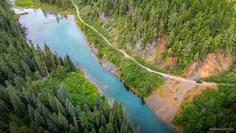
We started from what was, essentially, the furthest north we'd ever been in British Columbia, and it still took us 10 more hours to reach the trailhead for Telkwa Pass. Having left our camp below Perkins Peak a bit before noon, it was dark as we positioned the Tacoma along the banks of the Telkwa River and at the terminus of a dead-end road.
We were half a day behind schedule, and while that wouldn't normally be a problem, we'd been shooting for a reasonably small weather window when we'd planned our journey along what was rumored to be one of the more beautiful FSRs (Forest Service Roads) in Northern BC.
Of course, we'd left our flux capacitor at home, so with no way to turn back time, we climbed into the tent and hoped for the best.
The following morning...
With the weather guessers suggesting rain at 7:00am, I'd set my alarm for 5:45am. This would give us plenty of time to stow the tent and eat a quick breakfast, even if the rain started a half hour early.
What it didn't give us was enough time to do the same when the rain began at 5:49am, four minutes into the best "I'll just hit snooze once" sleep of the morning.
Pulling on our pants and slipping into our shirts, we were out of the tent in a flash, @mrs.turbodb tossing our things into the cab as I quickly folded up our now-damp digs before the rain really started coming down in droves. There was no time for breakfast. Not yet.
Hoping the weather would clear by the time we worked our way deeper into the mountains, we were off.

Under the right conditions, overcast skies and recent rain can lend a wonderfully dramatic ambiance to an adventure. The moody light and ominous clouds create a sense of foreboding; colors pop, the dust washed away by a summer showers. But those same wet conditions can also render the nearby world invisible, moisture in the air turning to fog. Expansive views lost in the mist.
It was yet to be determined how this day would pan out.


Providing an almost direct east-west route through the Coast Mountains between Telkwa and Terrace, the Telkwa Pass Trail is used primarily as a powerline and pipeline corridor between the interior and the coastal areas of B.C. By road and rail, the 125 km route through Telkwa Pass is 90 km shorter than the 215 km Highway 16 route that follows the Bulkley and Skeena Rivers.
The middle 23 km of trail - accessible by active logging roads at both ends - is used for Horseback Riding, Mountain Biking, Hiking, and Outdoor Recreation Vehicles such as Quads, Side by Sides and Dirt Bikes. There are also handy Recreation sites and Trails Branch campsites near each end of the trail; with the Harvey Recreation Site located to the west on the Zymoetz (Copper) River, and Jonas Creek Recreation Site on the eastern side.Rec Sites and Trails BC Info Sign
Calling out every odd kilometer as we raced up the first 15 km, it was becoming patently obvious that views would be few and far between for at least the first half of the day.

More than missing out on the scenery, I was also concerned that we'd mis-timed the entire trail. There is - at the top of the pass - a camp site on a lake that I understood to be one of the more dramatic places to spend the night. Had we gotten started a half-day earlier, we would have arrived just in time to call it home for the night, but as it was, we'd arrive sometime before lunch, much too early to call it quits for the day.
And so, I proposed something audacious: postpone the trail until the following afternoon, heading even further north while the skies were gray, hoping to outrun the clouds by the time we reached Alaska!
It seemed like such a good plan that we we'd already turned around - and covered a couple of kilometers - when I applied the brakes and looked to my right. "What if we do it twice?" I said.
After a few more minutes of discussion, we decided that there weren't really any drawbacks to giving ourselves two chances at the lake, and without further ado, I executed a flawless 7-point turn so we could retrace the same stretch of road for the third time in ten minutes.

Beyond the transition from Telkwa FSR to Telkwa Pass Trail, the road steadily transitioned from thoroughfare to two-track. Steep loose grades, water crossings, and entire trail segments that doubled as creek bed were the order of the day.

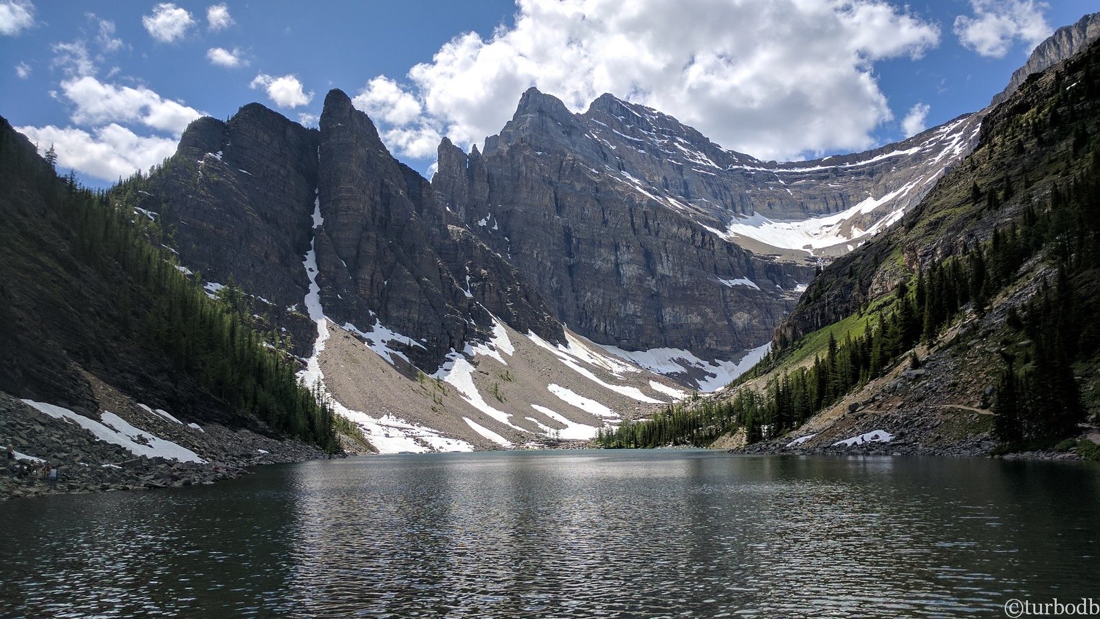
It wasn't even 10:00am when we reached Top Lake. A brilliant blue, we reveled in its clarity, its glassy surface reflecting the clouds that raced across the sky above.


A few minutes later - after plowing through more creek-road - we popped out onto the gravel bar that is the most glorious campsite to be had. Even in the mid-morning gray, it was obvious that this was a place we needed to camp. The stream flowing mere inches from our tent, the lake lapping at our tires, and sheets of water spilling from the glaciers above, this had to be one spectacular place on a blue bird day.
For now though, it was a good spot for breakfast!


Knowing that we had to come back - but also that we had a long way still to go - we were back on the road after a 30-minute meal, pushing our way through the back half of the trail toward Terrace. Picking our way through tire-sized rocks and along willow-choked trails, we bounced along as quickly as we could, knowing that once we reached the end of dirt, there were still hours of pavement between us and Alaska!

Unsurprisingly, we moved significantly faster when I wasn't stopping every couple of kilometers to snap a photo or send our little buddy screaming into the sky. In fact, where the climb to the pass had taken the better part of three hours, we made it back down the other side in just under two.


Rolling into Terrace a few minutes after noon, we quickly fueled up the tank and pumped air into the tires for the long drive north. On our way we'd - momentarily - leave Canada behind, spend our first few minutes in Alaska, and spot our first bear!
But that was nothing compared to the spot we'd call home for the night.
The Whole Story


Awesome photos, great eye, great route. "The road is the river video" who is driving? who is flying the drone? Seems crazy to think you were doing both.

Thanks!
The drone has a "follow that vehicle" mode that might be barely better than me trying to do it myself. You can see how jerky the video is as the drone tries to position itself to keep the Tacoma "in the right spot in the frame." Really makes me appreciate all the folks who make videos that look super professional. Definitely not a skill in my toolbox!
I think the follow mode was distracted by the forest, in other of your videos where it is following in open country it seems a lot better.
mrs.turbodb have any interest in off-road driving? My wife has on her list to learn "just in case", but we haven't crossed that bridge yet. However expect she would do better than she thinks, having seen so much.
In other "follow" videos, it hasn't been follow mode.
I’ve been thinking about driving this road. I’m just wondering if my vehicle is capable. I have a Chevy Tahoe with a 3 inch lift and some 33 inch KO2 tires.  We also have a 5th gen 4runner with a 3 inch lift n the same.
The Tahoe might be a little wide in sections. The 4Runner will be just fine as long as you don't mind a little striping.
AdventureTaco wide meaning it will be brushing up a lot on the foliage?
It'll be in the foliage, and there are (only a couple) narrow bits of trail. Really, it'll probably be fine, but I always like having the narrow Taco.
I think I missed you by a day on the pass, I grew up in that area and was home for a trip to Haida Gwaii. If you're ever in the area again it's a worth while place to check out!
Bummer, would have been cool to run into ya! Love running into folks on the trail.
And, you're the second person to suggest Haida Gwaii to me after this trip, so I'm definitely going to have to check it out next summer! Thanks!