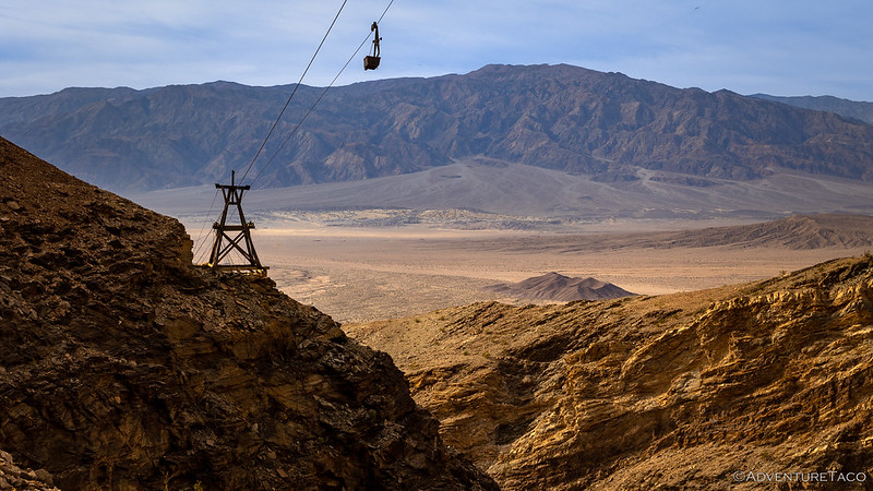
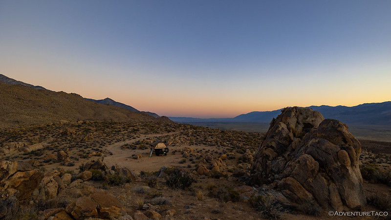
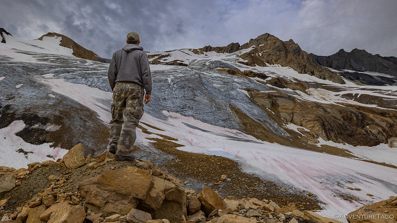
There are several places that I've wanted to check out in Death Valley for quite some time, but that haven't fit into the route or schedule for previous trips. Hoping to knock off a bunch of those places that I've "left behind," I set about planning a route that would take us along West Side Road and the eastern escarpment of the Panamint Mountains. From there, we'd repeatedly climb into the canyons, exploring the mines, narrow passages, and vistas that each had to share. It would - I thought - be a lot like our trip along the Nadeau Trail,…
8 CommentsTag: 4wd
It was 2:00am when the light pitter patter of rain woke both @mrs.turbodb and me from our cozy sleep in the mouth of canyon on the eastern escarpment of the Inyo Mountains. "Guess I waited too long to go pee," she said. "Me too," I replied. It was the first time - in more than 80 nights in the park - I've ever experienced rain at night in Death Valley. Of course, while the whole bathroom thing was inconvenient, my biggest hope was that the rain would tail off reasonably quickly, allowing the tent to dry off before we had…
15 CommentsNestled into the mouth of an unnamed canyon of the eastern Inyo Mountains, sleep came quickly after climbing into the tent a little after 8:00pm. For five hours, everything was great - temperatures were perfect, in the low 40s °F, a gentle breeze cascaded down the canyon, and clear skies eliminated any anxiety about putting the tent away wet in the morning. Then, as if to remind us that conditions should never be taken for granted in the desert, the wind picked up. As though a switch had been flipped, gusts up to 40mph seemed to appear out of nowhere.…
7 CommentsWe wrapped up our long drive south as we turned onto CA-168 from Big Pine. My plan - crazy as it seems now - had been to get all the way to our first trailhead prior to calling it a day, but given that it was already 3:00am and the trip over North Pass and into Saline Valley would take another 90 minutes, it seemed prudent to find camp rather than risk needing to do so in the much colder elevations should the pass be... impassable. There was no getting up at sunrise. Nestled in a small side canyon and…
23 CommentsIt was shortly after 2:00pm when I arrived at the trailhead for my next destination. Literally parked along the shoulder of CA-190, anyone driving by might surely wonder, "why is a person parked here?" I know I was wondering why a white Tacoma was parked in the same spot, almost exactly one year earlier. Like the time of day, to the casual observer, there's nothing remotely remarkable about this place - though with a little knowledge, both the time and place become noteworthy. The time, because I had only a little over two hours - before sunset - to complete…
6 CommentsDoing our best to put the failure of the tent zipper behind us, we left the Glass House in the rear view mirror and set off on our exploration for the day - to visit several old homesteads I'd found on satellite maps around Hart Mountain, just to get a better sense of the terrain in a place we've not previously been. It was looking a little ominous to the south, with plenty of snow on the Warner Mountains. The first structure I'd discovered wasn't very far away, but I was surprised when - less than 15 minutes into our…
11 CommentsOne of the things about the high desert is that it just looks boring. Miles and miles of - generally boring - flat terrain. Millions of the same - boring - sagebrush arrayed out over the sandy soil. And colors that - for most of the year - are just drab and boring. There's a lot of this land in the western United States, and one of the great things about it - in my opinion - is that everyone else thinks it's boring. The secret, however, is that these desert areas are great at preserving whatever ends up within…
20 CommentsEver since our first visit to the Owyhee, the high desert of southeast Oregon has delivered trip after trip full of wonderful discoveries and surprises. Still - all these years later and having visited nearly a dozen times - I'm sure we've only scratched the surface. In fact, while we did once find a dirt route between Fields Station and the Hart Mountain National Antelope Refuge, we've rarely explored west of Steens Mountain at the edge of the Alvord Desert. And so, finally, it's time. Having uncovered a few interesting destinations near Hart Mountain over the last couple of years -…
7 CommentsWe arrived at the Laurel Lakes trailhead just after 9:15am on a Sunday morning. Aware that this was a reasonably well-known destination, we were a little worried that the trail - and lakes themselves - would be crowded. On the flip side, I knew that portions of it were considered rough, and the trail had been - at least temporarily - closed for a washout several months earlier, so we could always hope. Unsure if it was good or bad, there were two SUVs parked at the bottom of the trail, and a single F150 parked about half a mile…
12 CommentsWe awoke on the third morning of our trip, full of anticipation. Or at least, full of something that starts with an "a." Perhaps apprehension. Whatever it was, we knew we needed to get an early start on our day, and so were down the ladder before the sun rose above the horizon. Solar panels don't do much before sunrise, buddy. (windshield) We'd gotten a good night sleep, and as @mrs.turbodb set about assembling tuna sandwiches and other lunch fixings, I stowed the tent in case there were others who visited the trailhead during the day. No need to air…
14 CommentsOur night below the The Hunchback couldn't have been more pleasant. Though we were at 10,500-feet, temperatures never dropped below the mid-40s °F, and even getting up for a bathroom break and some less-than-mediocre star photos was an enjoyable few minutes. Unlike the previous morning when I hadn't set my alarm, I made sure I was out of the tent a little before sunrise to capture that magical time when the sky is transitioning from dark to light and the earth's surface is shadowless. Here, with views of the Sierra all around, it was spectacular. Before the sun rises, its…
5 CommentsThe Eastern Sierra. I don't know if they are less well known, harder to get to, or I was just oblivious, but while I've driven past the majestic peaks numerous times - on my way to and from Death Valley - I've never really taken the time to explore the mountain range that boasts the tallest peak (Mt. Whitney, at 14,505 feet) in the contiguous United States. But, over the last few years - as I've ventured into the Volcanic Tablelands, and here and there within the Owens Valley - I've reveled in the rocky faces and snowy peaks. Now,…
36 CommentsI have to say, it was so pleasant sleeping next to the Hoh River, as it quietly rippled by through the night, bringing cooler temperatures along for the ride. Those temperatures - along with the fact that we were parked in a valley - meant that sunrise wasn't on the agenda, and it was nearly 8:00am when we finally climbed down the ladder to get our day underway. I'm usually a fan of cliff-side camp spots, but this one turned out to be great. Note: I'm kicking myself a little bit that we didn't camp *in* the river, which was so…
8 CommentsWanting to get an early start, we were up before 7:00am - right along with the sun as it crested the ridges to the east. Climbing out of the tent, we were pleasantly surprised to find the rain fly completely dry, having expected that it'd be dripping wet after a night in the rainforest. Nestled off the road, we'd slept well, undisturbed all night. As with a couple of our recent trips, we decided to skip official breakfasts on this adventure, opting instead for snacking on trail mix and blueberries - something that allows us to get out of camp…
4 CommentsIt was a little strange to be heading back to the Olympic Peninsula only a few days after having bailed on a trip to the same location, but such is life sometimes. This time - not wanting to retrace our steps through the same terrain to kick off the trip - we decided to pick up the loop around the peninsula at the five-o'clock position, near Skokomish. From there, we'd run the loop clockwise, the opposite direction of our previous attempt. This meant that rather than take a ferry to kick off the trip, we drove down and around the…
3 CommentsIn all of our exploration, we've done relatively little in our home state of Washington. Partly, this is because the weather window here is relatively short each year; partly, it's due to our desire to explore lands further afield; and partly it's due to the landscape. Western Washington is so wet that finding a route that is more than simply a tunnel through trees can be challenging. Roads are quickly overrun with brush, structures rot away in the blink of an eye, and with much of the land owned or leased by logging companies - the roads are gated and…
12 CommentsHaving returned to Radium Hot Springs from our run up a glacier that was Hallowed Ground, Mike @Digiratus and I put a bit of fuel in our tanks. Prices had dropped 7 cents/liter in just two days, but I still used gas from my Scepter jerry cans, since I wanted to be sure to use up my cheaper "USA gasoline" before buying more than I needed in Canada, where prices were about $1.50 USD higher per gallon. Filling our tanks didn't take long, and after a few more minutes of internet connectivity to ensure that everything was still OK on…
4 CommentsEven before we entered Canada, I knew that our run on "the glacier trail" was going to be a highlight. This was a trail that Mike @Digiratus added to our itinerary, having discovered - and run - it several years earlier with Monte @Blackdog and Ben @m3bassman. There was more that made this a special place, but I'm already getting ahead of myself. First, we had to get there. As with many of the routes so far, this one started in a valley, granite peaks soaring high above. Horsethief Creek wasn't bursting at its seams, but there was no shortage…
15 CommentsAll aired up, Mike @Digiratus and I were about to spend the rest of our day on pavement. Well, pavement or its equivalent at any rate, since there are a good many highways - like BC-31 - that are gravel, but are so well groomed that we could easily achieve pavement speeds. Like the state of Nevada, southeastern British Columbia is comprised of a series of ranges that run north-south, separated by valleys and lakes. And, while the trails we wanted to run - out of the Radium Hot Springs area - were only one range east, and less than…
12 CommentsIt was nearly 4:00pm when we turned onto the Rady Creek Forest Service Road and popped out of our trucks to air down our tires. I'd thoroughly enjoyed this trail when I'd rushed to Canada nearly a year earlier - worried that it was about to be deactivated (closed) forever - and from our conversations prior to departure, I knew that Mike @Digiratus was really looking forward to seeing this place as well. I didn't choose the best spot to air down - I was both blocking the trail and in the sun! As with our run up Mt. Buchanan,…
3 Comments


